Life-Threatening Flash Flooding in South Central Texas; Heat Continues from the Northern Plains to the Mid-Atlantic
Life-threatening and locally catastrophic flash and urban flooding is expected across portions of south-central Texas through early Friday, with significant river flooding and rapid rises on small streams, arroyos, and typically dry washes expected. A significant heat wave continues for the Rockies, Northern Plains, and Great Lakes into the Mid-Atlantic, peaking in intensity through midweek.
Read More >
The information in this statement is preliminary and subject to change pending final review of the event(s) and publication in NWSStorm Data.
Summary
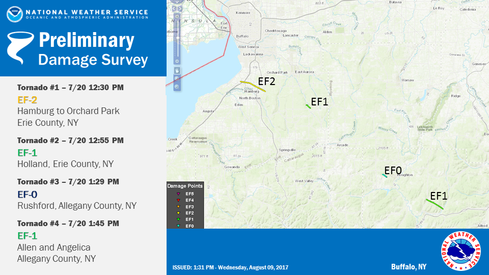
The National Weather Service in Buffalo NY has confirmed that thunderstorms moving across western New York on July 20 2017 produced four tornadoes.
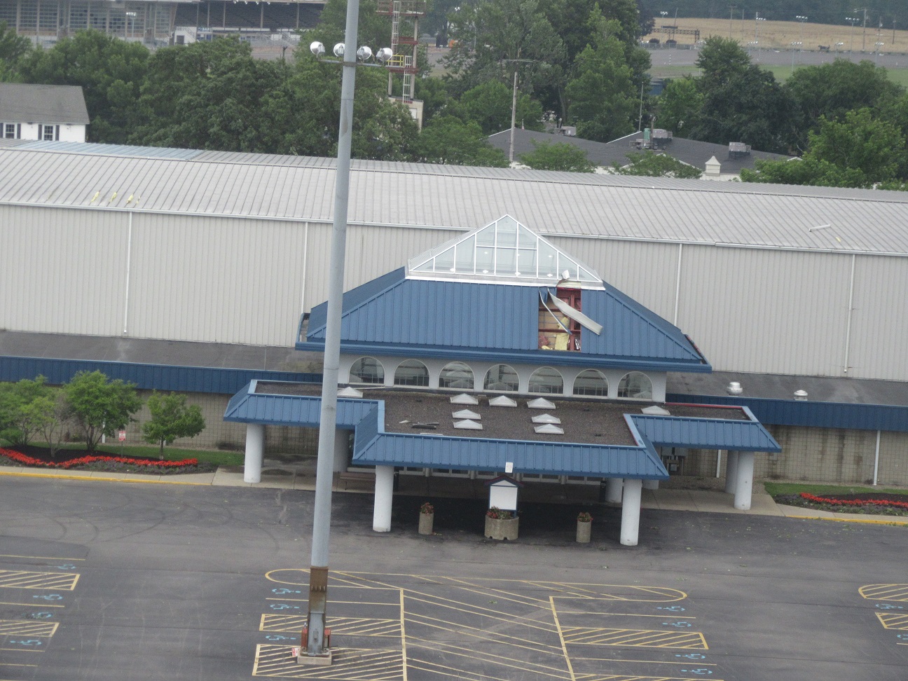
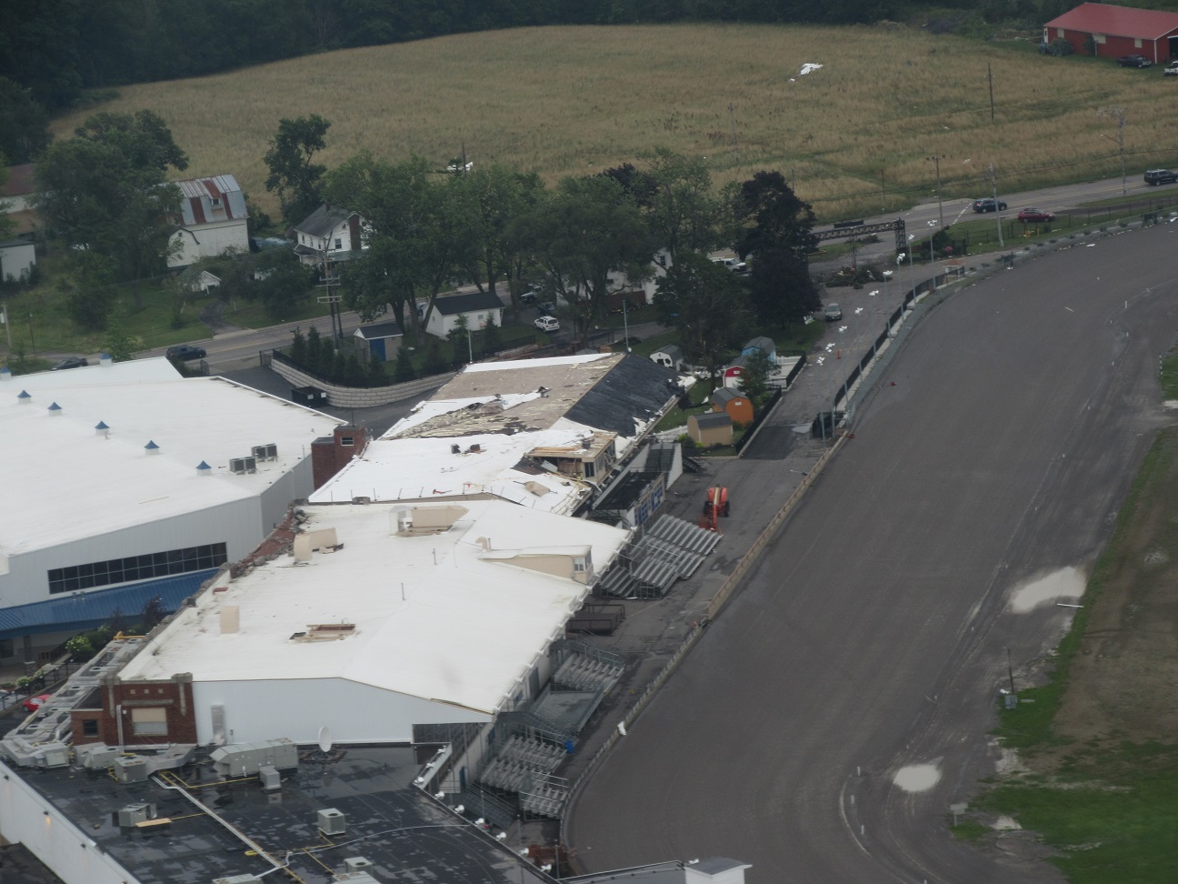
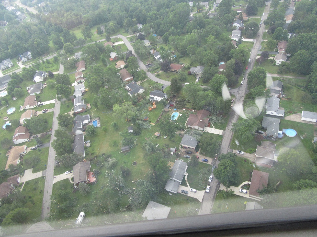
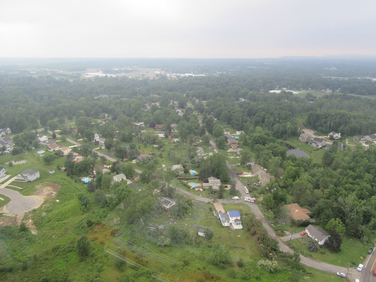
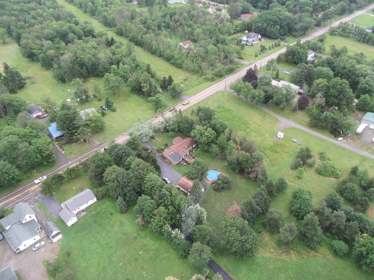
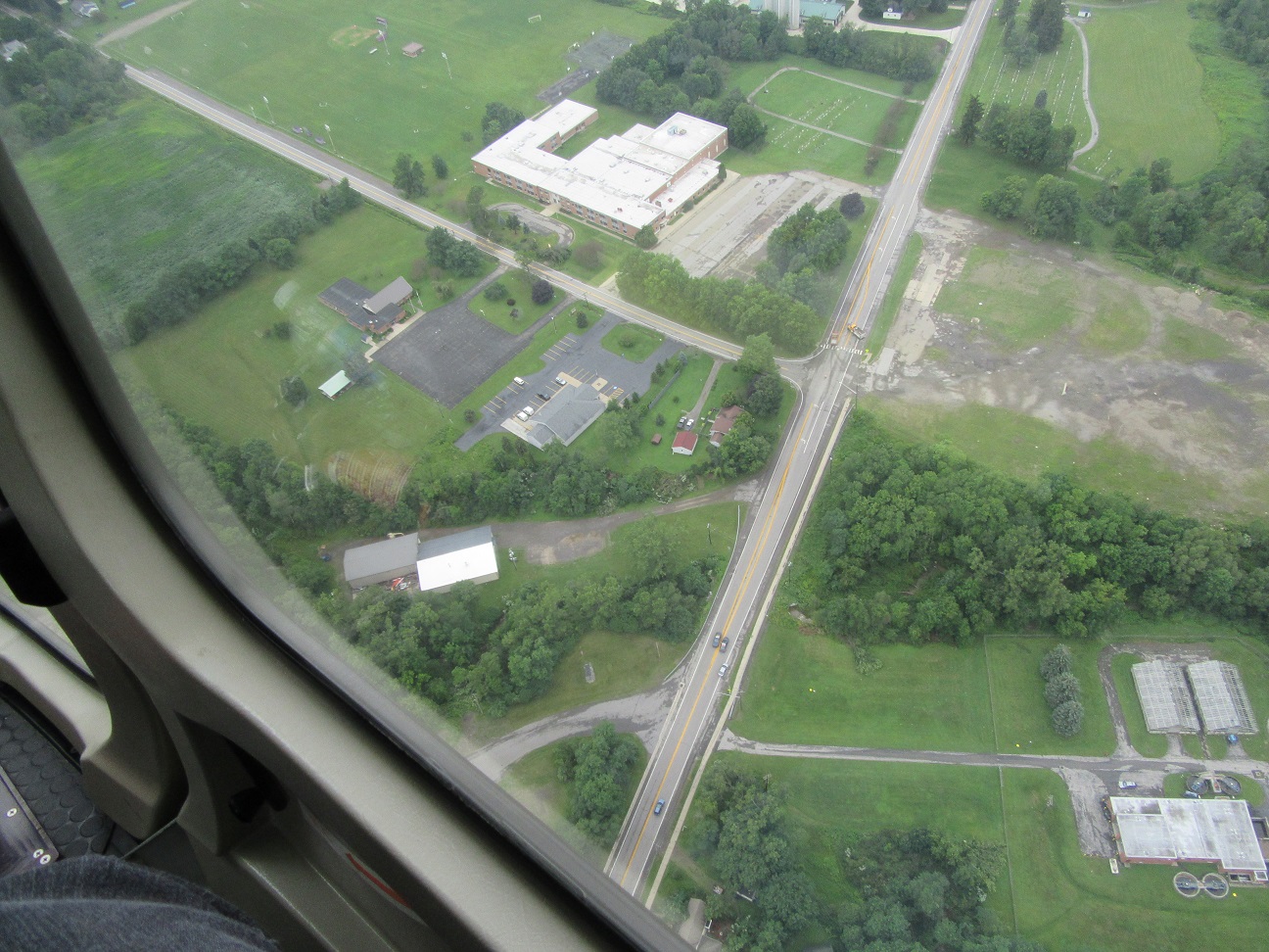
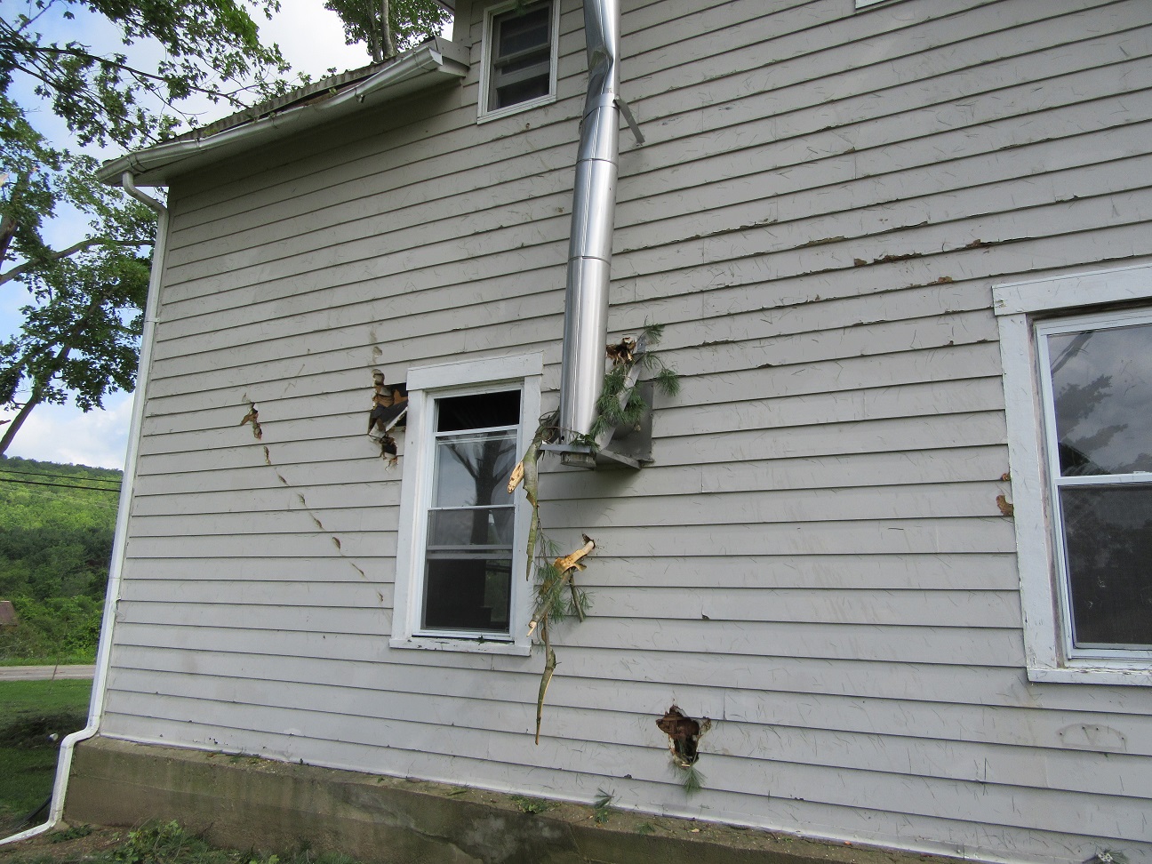
The storms moved onshore from Lake Erie with damage beginning in Hamburg before moving across Orchard Park. Windows of hundreds of car windows were blown out at the Hamburg Fairgrounds where trees were downed and several buildings including the Grandstand sustained damage. The tornado continued across the Chestnut Ridge Park and the Town of Orchard Park causing more structural and tree damage.
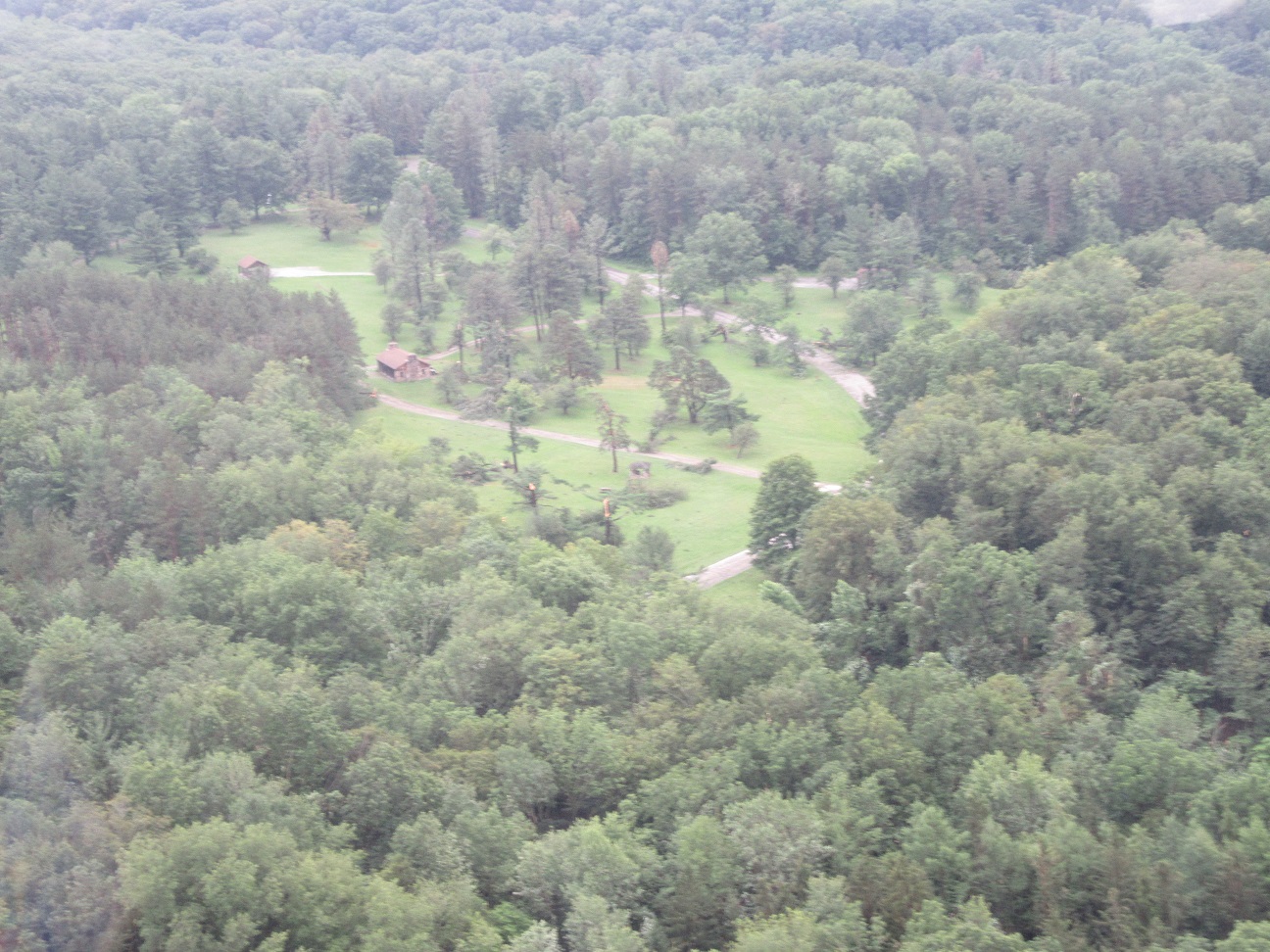
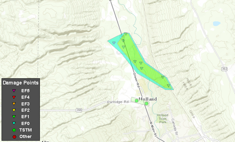
About ten miles further down along the thunderstorm`s path, a second tornado touched down in the Town of Holland. Several structures were damaged with a significant amount of tree damage. Roads were blocked and wires were downed. Tracks of the Norfolk Southern Railway were blocked in several places by large downed trees.
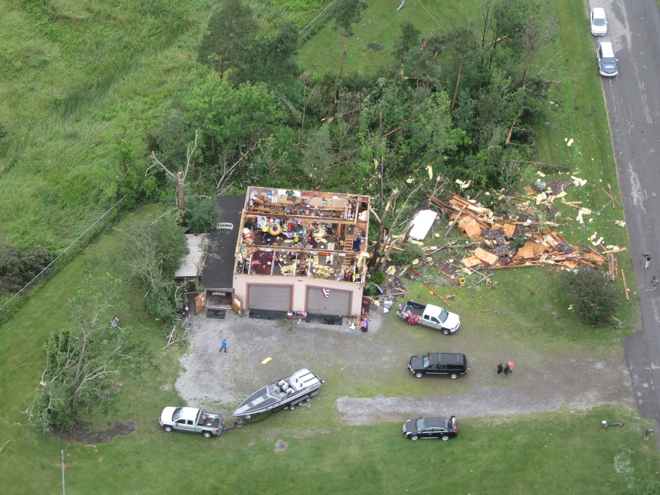
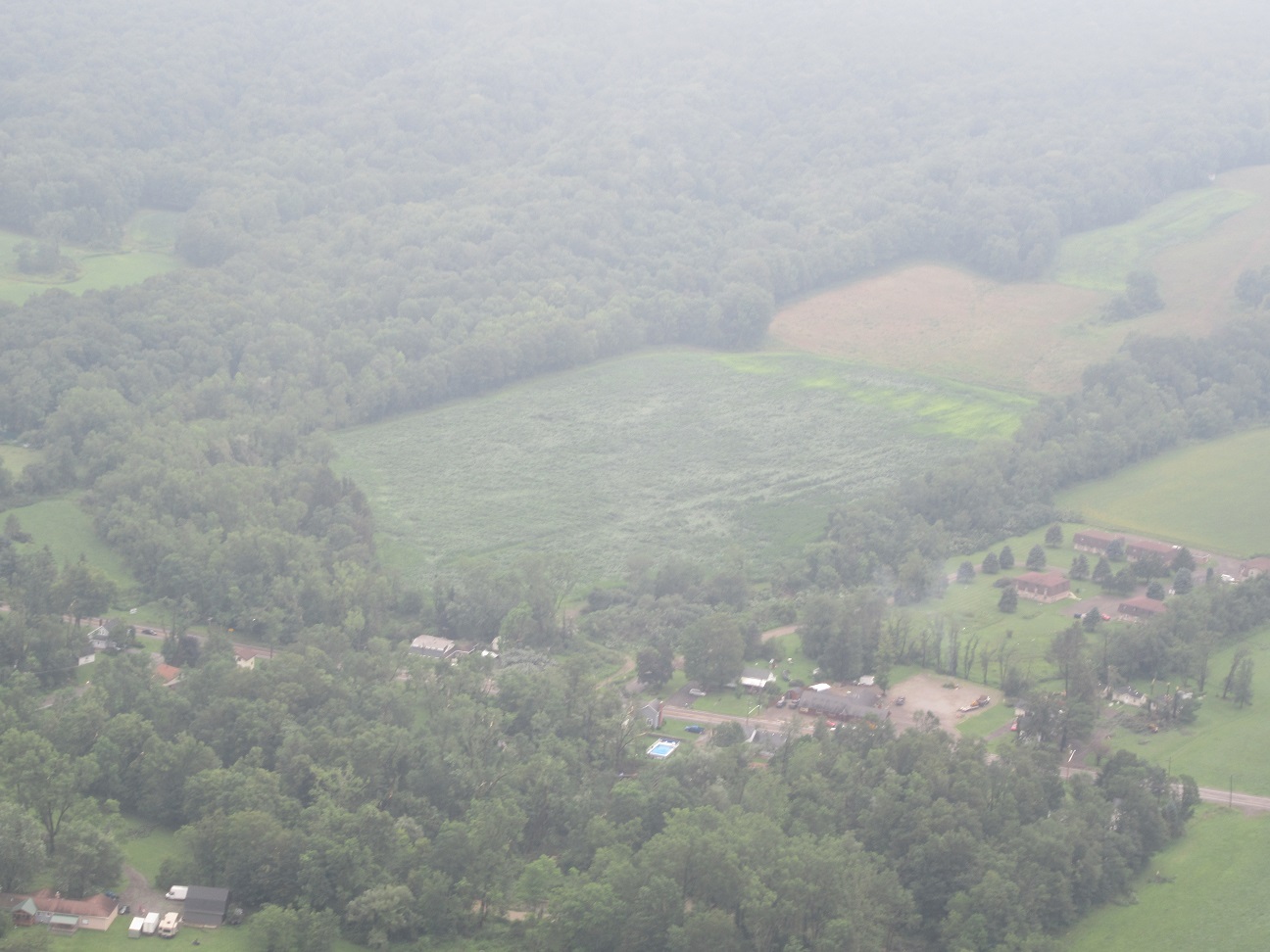
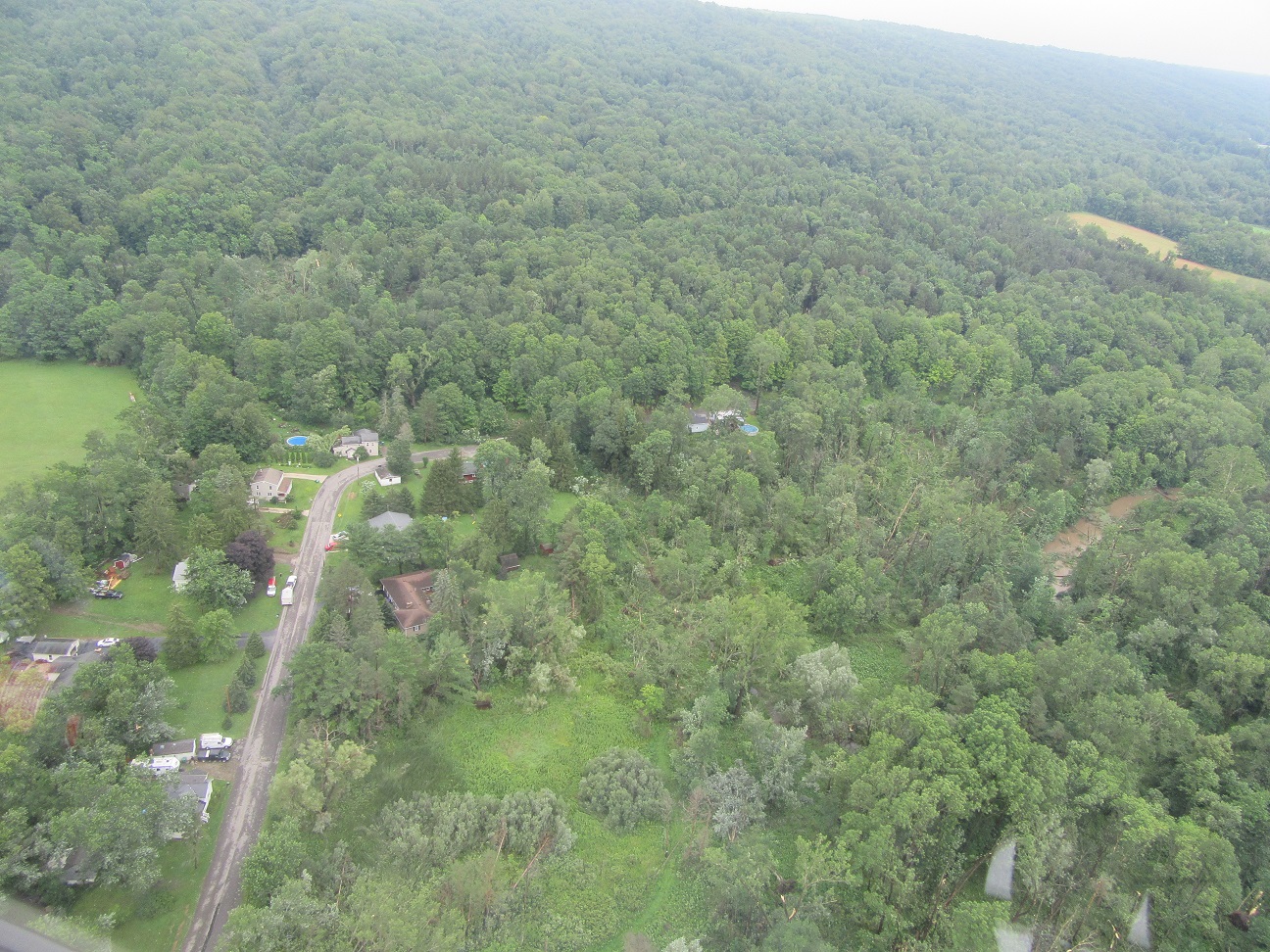
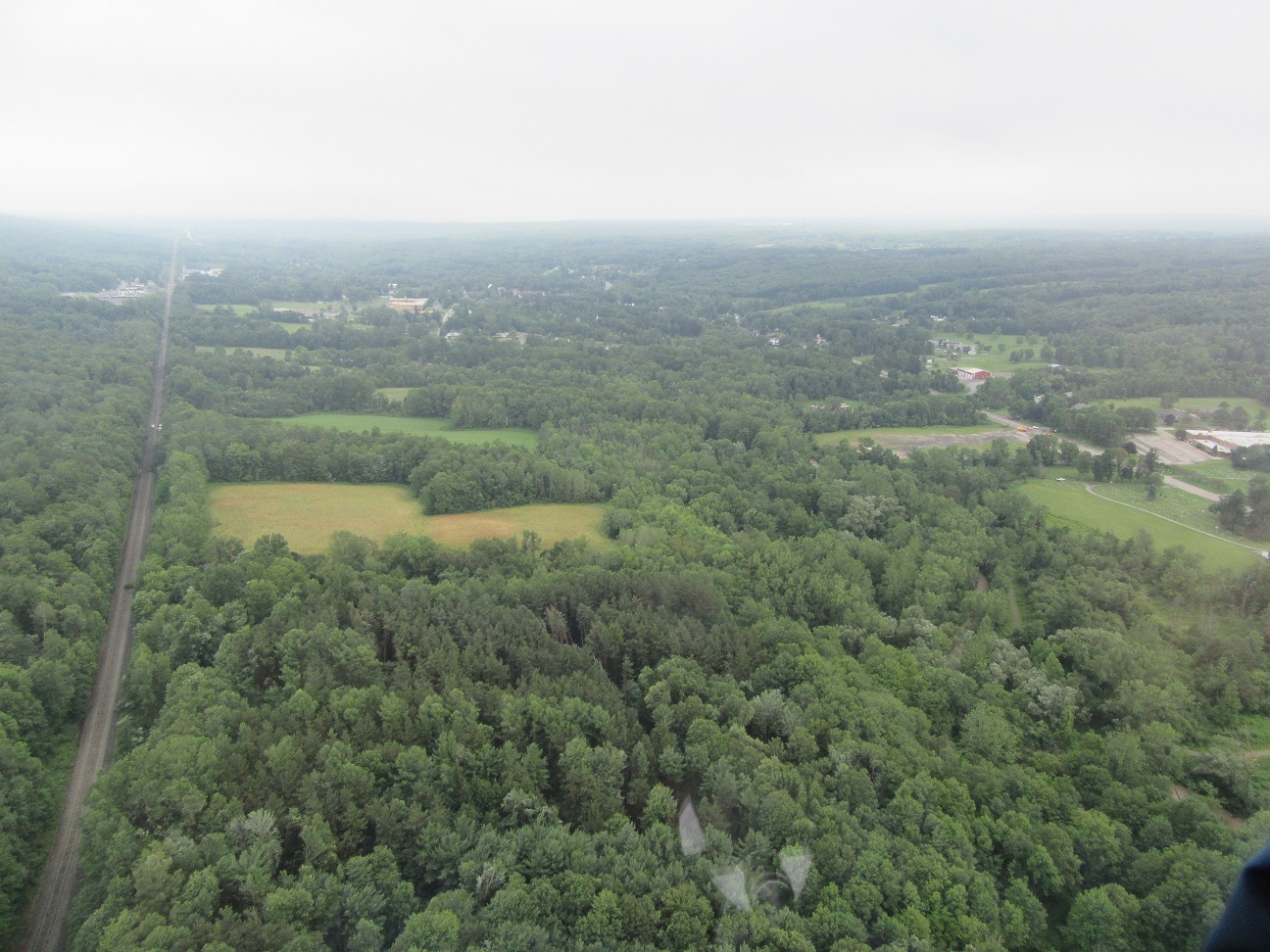
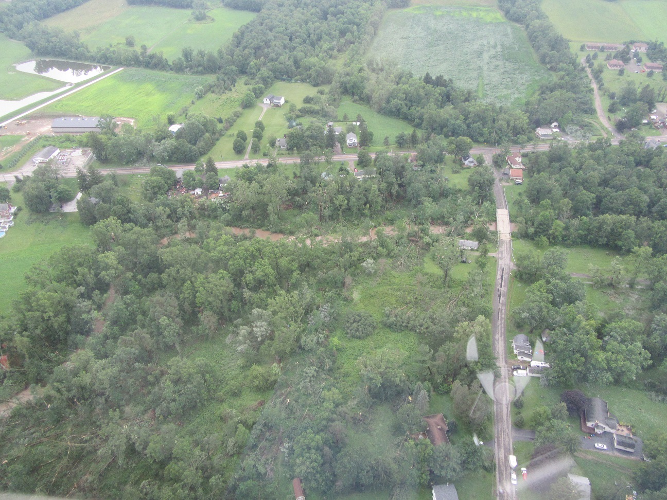
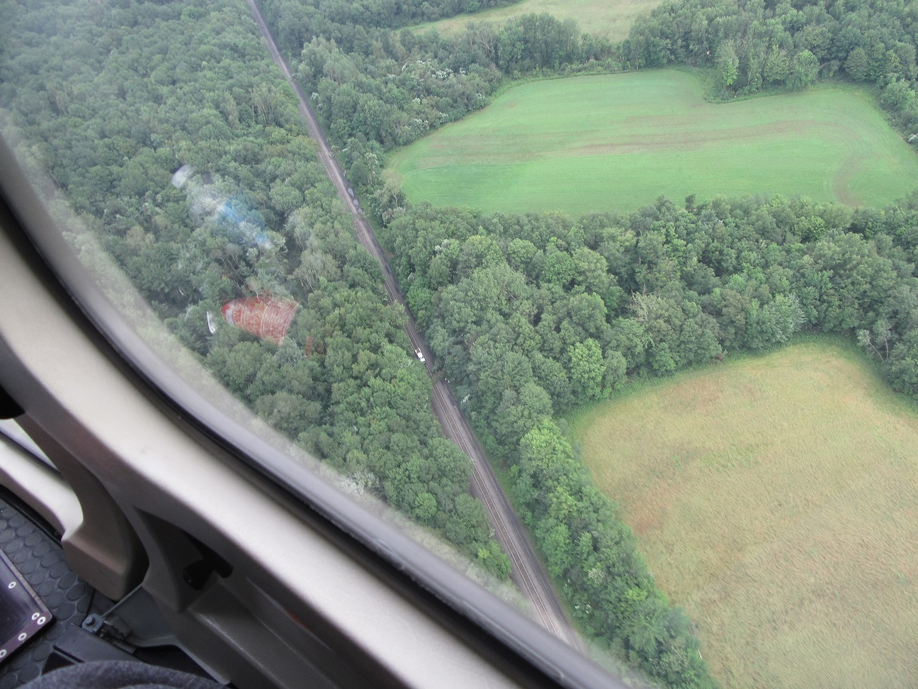
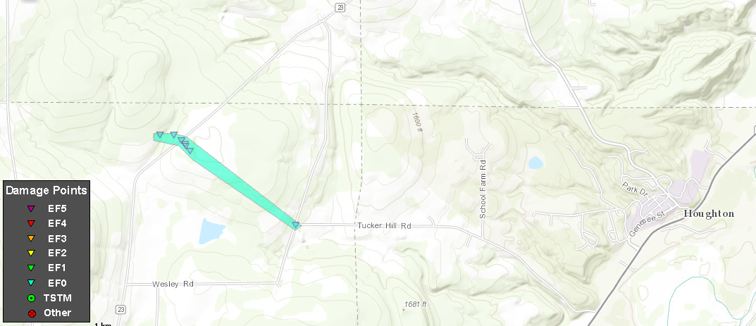
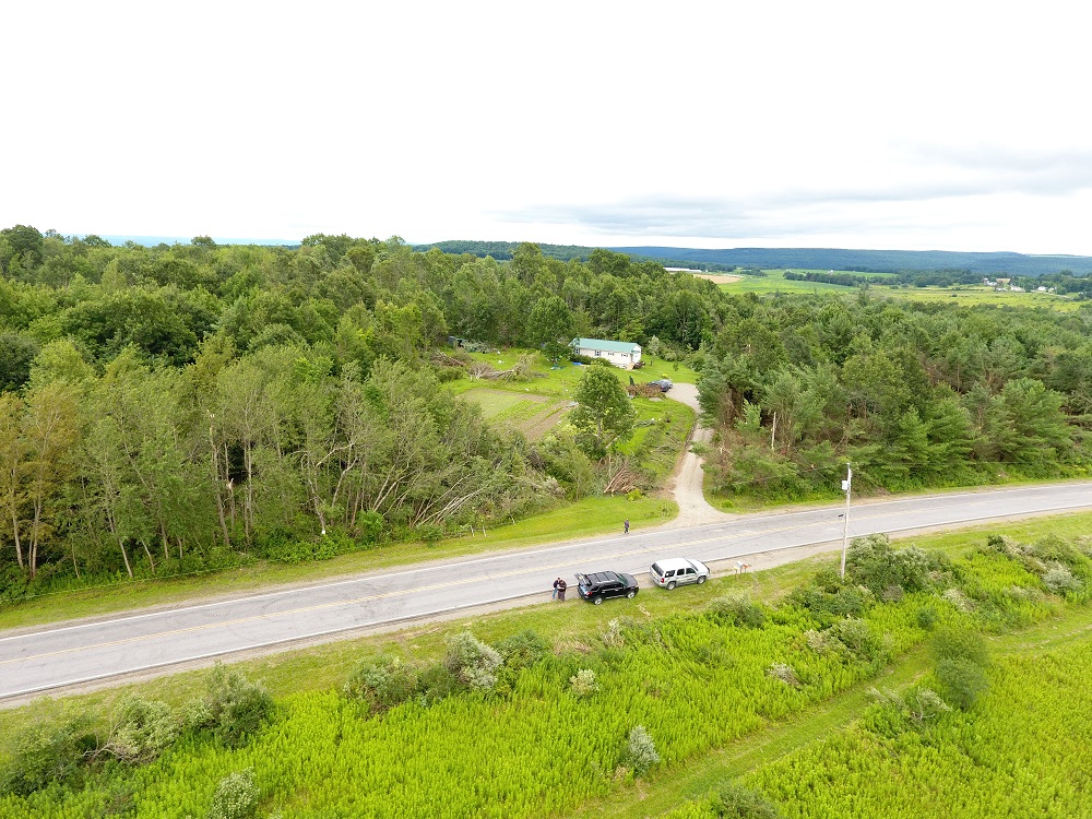
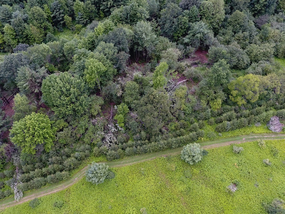
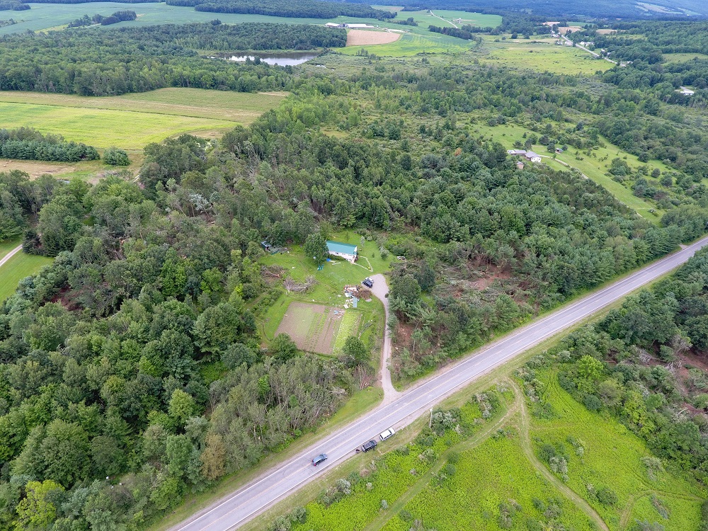
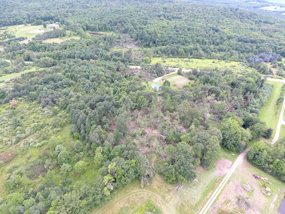
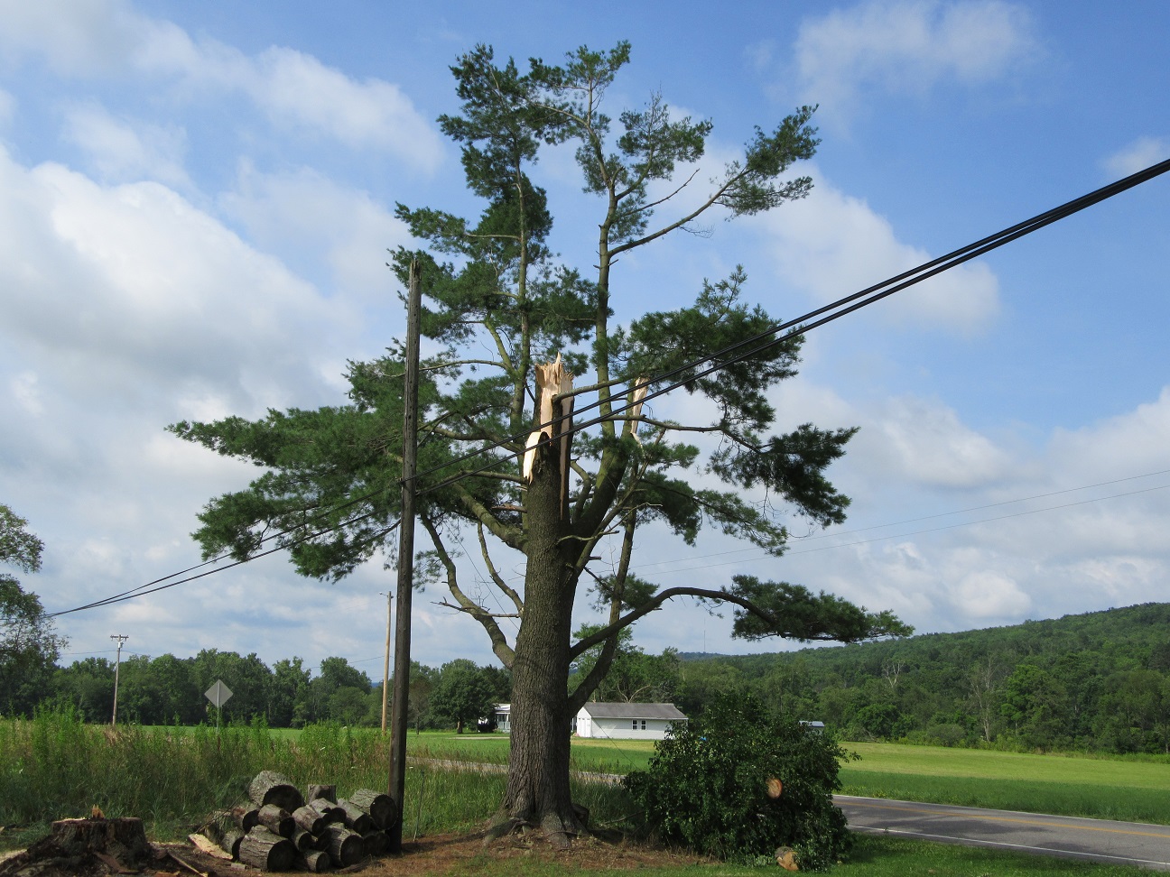
The storm briefing re-intensified near Rushford spinning up a weak tornado over a mainly wooded area. A small shed was destroyed and drone video shows a path of downed and twisted trees.
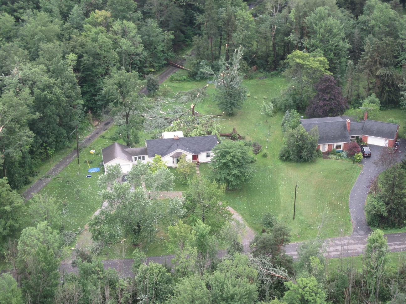
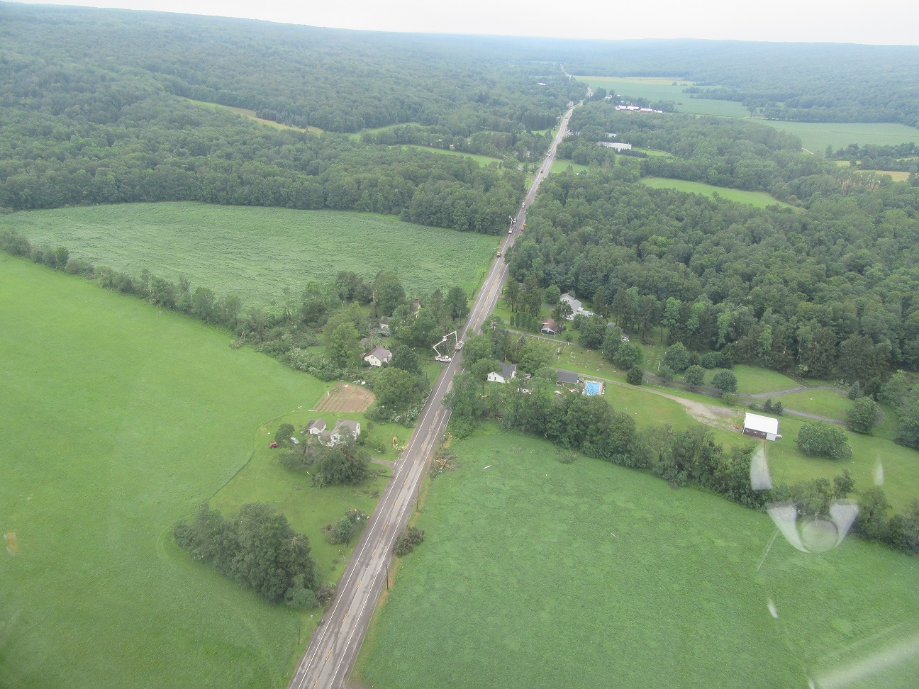
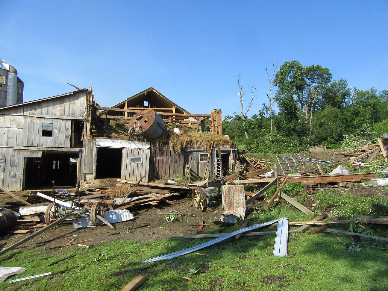
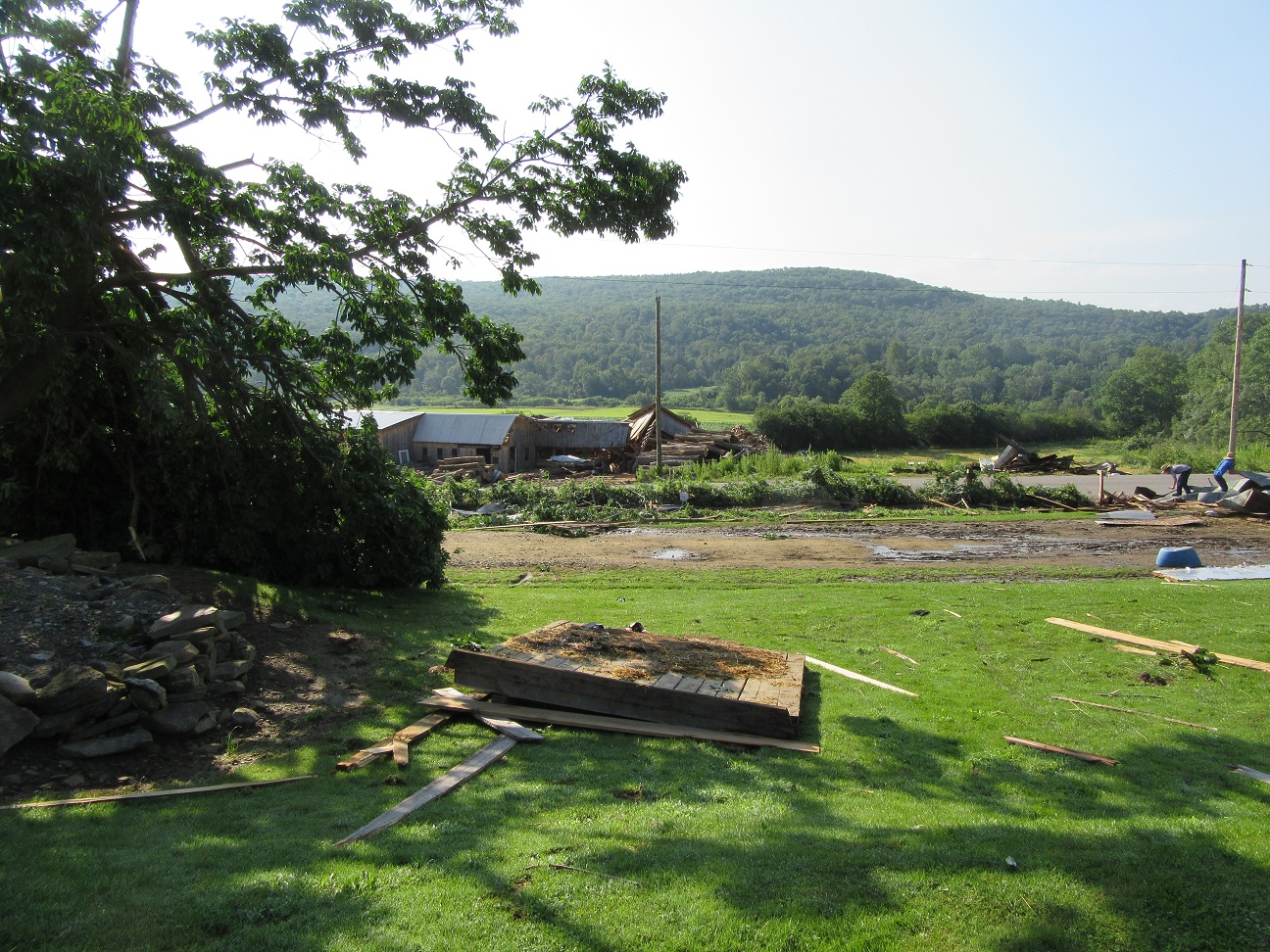
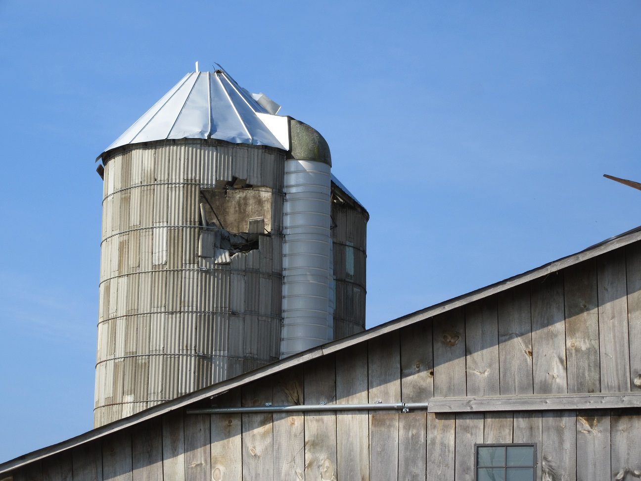
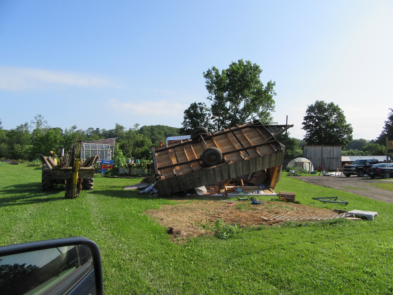
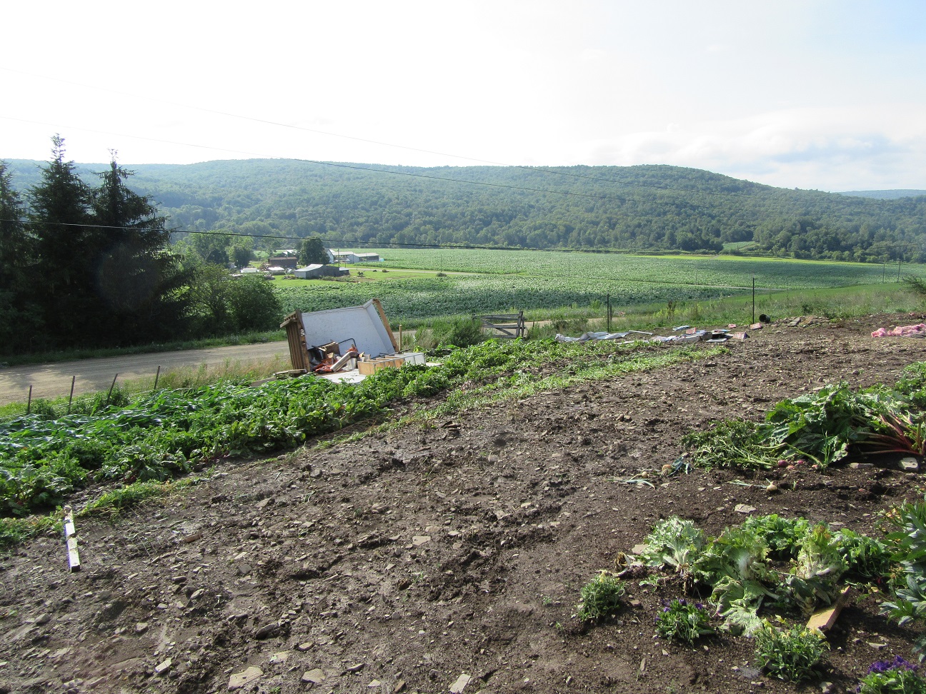
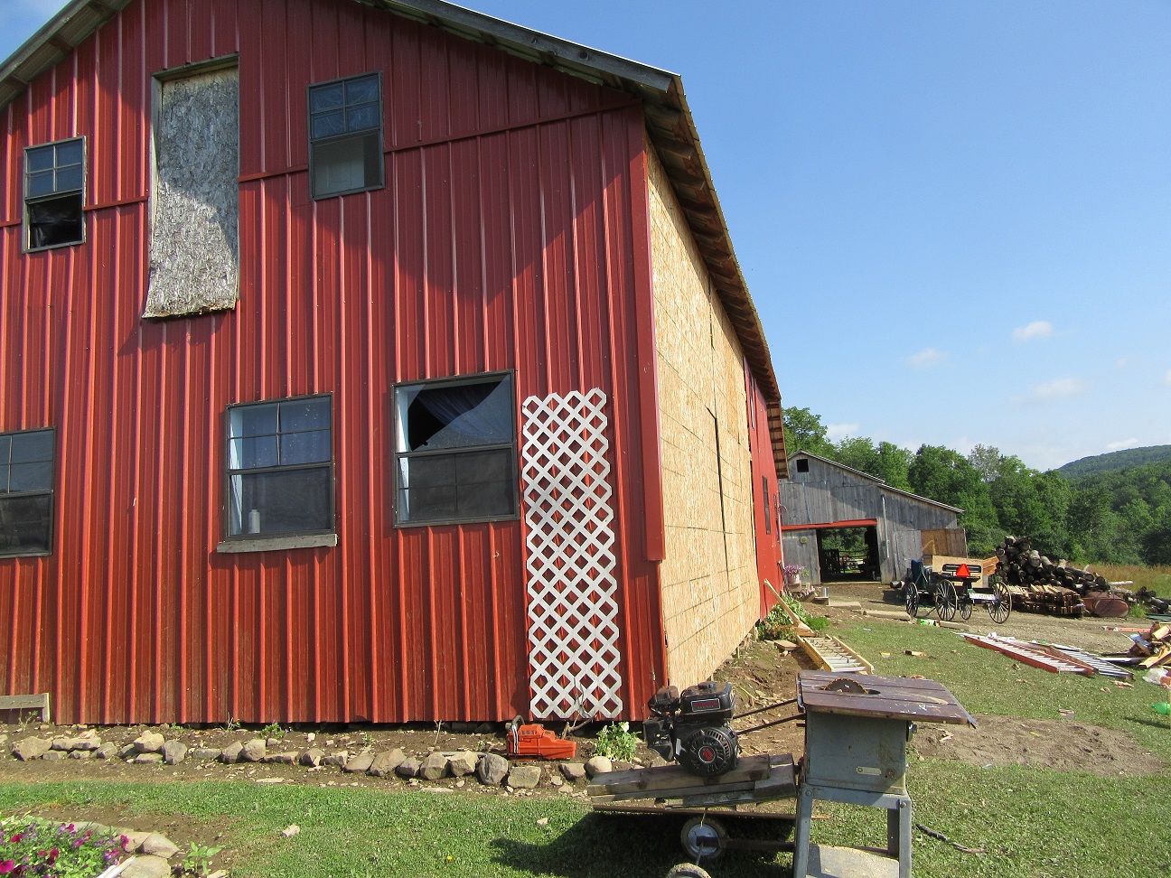
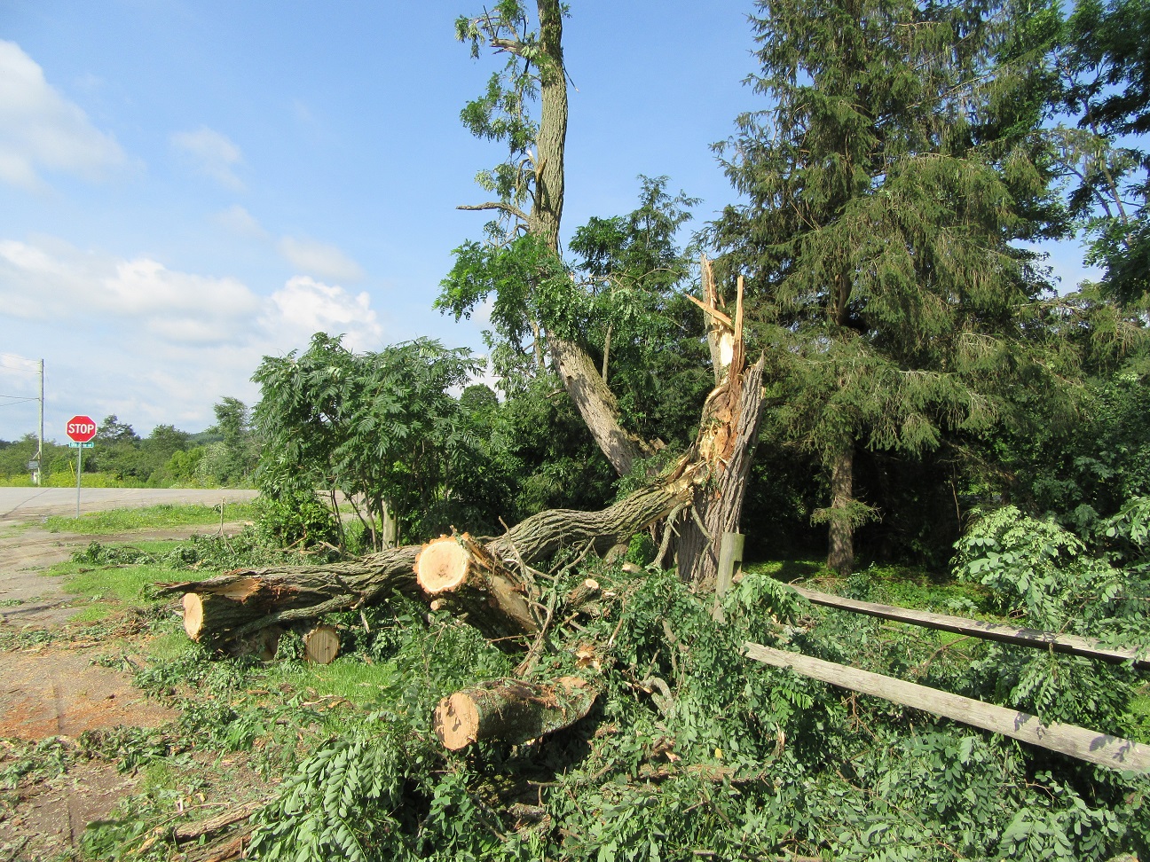
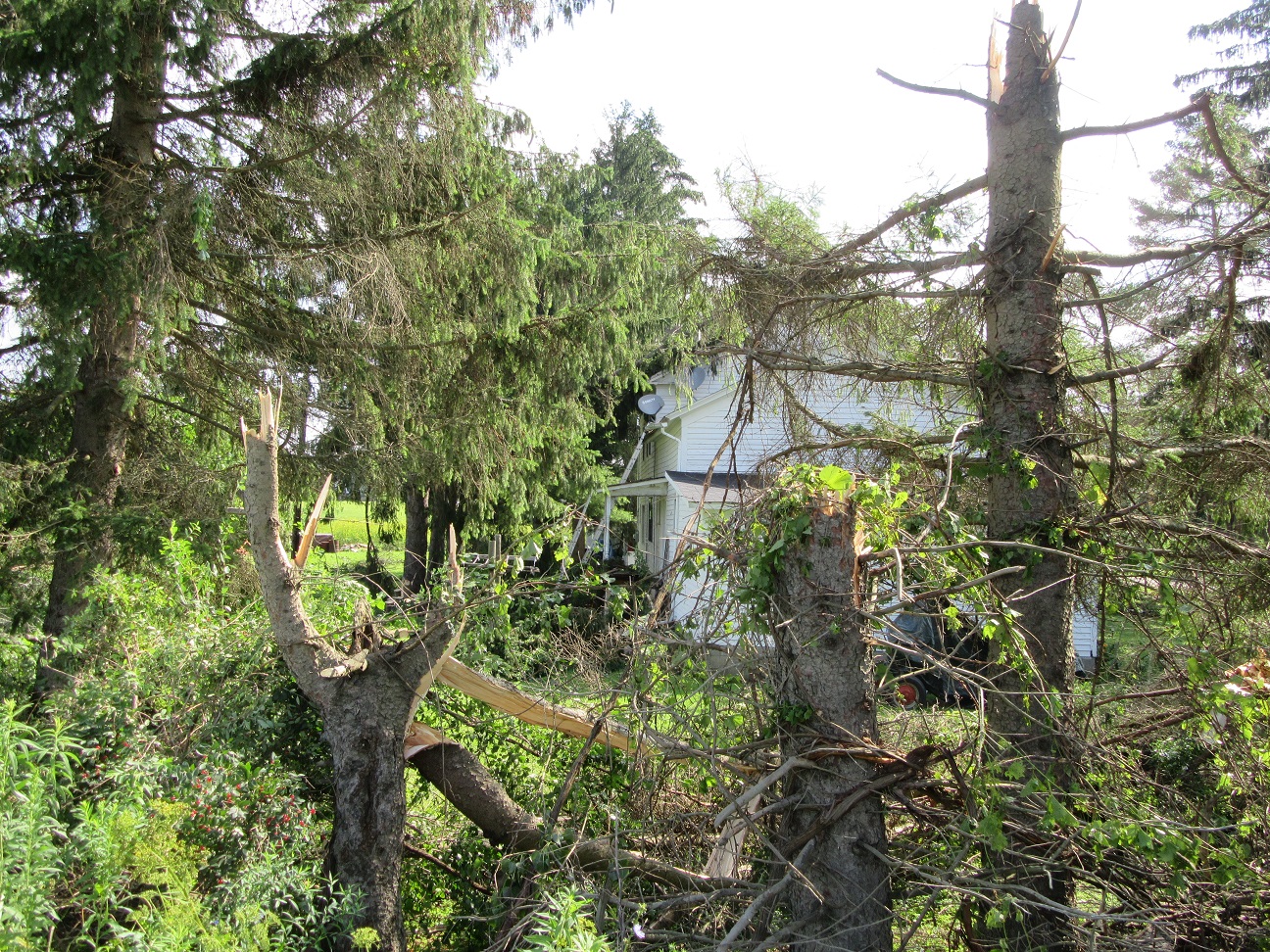
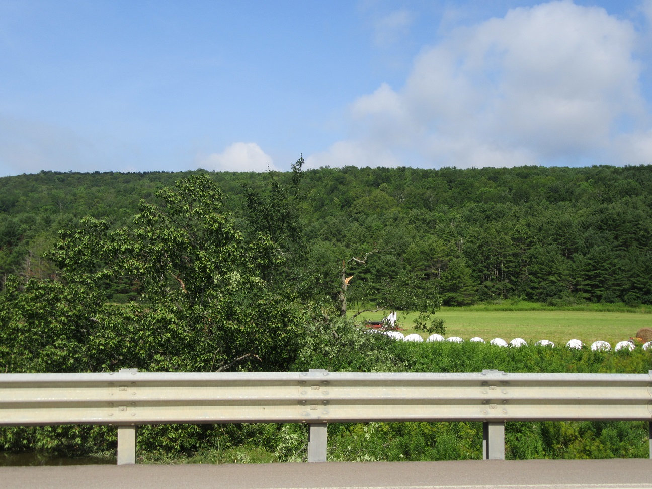
Finally, based on radar and spotter reports two thunderstorms merged and intensified and produced a tornado that extended from the Town of Allen across the Town of Angelica to the Town of West Almond. Several homes were damaged. A barn was severely damaged. Several sheds or small outbuildings were tipped and moved. Numerous large trees were shredded and downed. Some fell causing additional structural damage.
For reference: the Enhanced Fujita Scale classifies tornadoes into the following categories:
EF0...Wind speeds 65 to 85 mph
EF1...Wind speeds 86 to 110 mph
EF2...Wind speeds 111 to 135 mph
EF3...Wind speeds 136 to 165 mph
EF4...Wind speeds 166 to 200 mph
EF5...Wind speeds greater than 200 mph
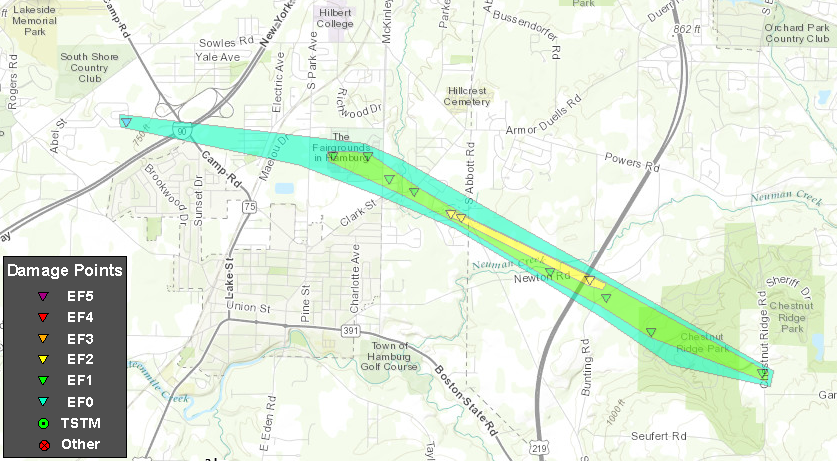
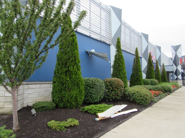
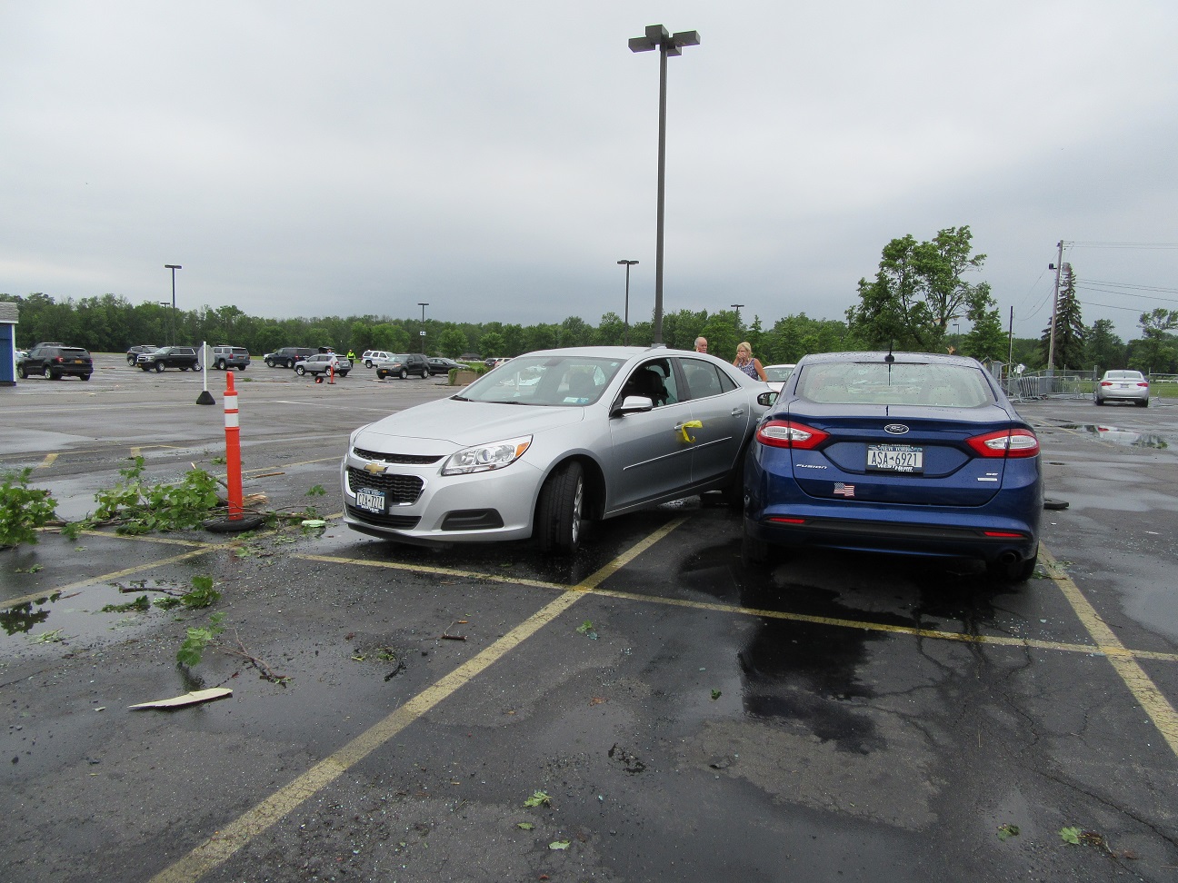
Tornado #1: Hamburg to Orchard Park, Erie County, NY on 7/20/17 12:30pm to 12:40pm
Maximum EF-Scale Rating...EF2
Estimated Maximum Wind Speed...115 mph
Maximum Path Width...700 yards
Path Length...6.2 miles
Beginning Lat/Lon...42.74N / 78.86W
Ending lat/Lon...42.71N / 78.75W
* Fatalities...0
* Injuries...0
* The information in this statement is preliminary and subject to change pending final review of the event(s) and publication in NWSStorm Data.
NWS Buffalo Damage Survey Photos
Tornado #2: Holland, Erie County, NY on 7/20/17 12:55pm to 12:56pm
Maximum EF-Scale Rating...EF1
Estimated Maximum Wind Speed...95 mph
Maximum Path Width...450 yards
Path Length...1.2 miles
Beginning Lat/Lon...42.66N / 78.56W
Ending lat/Lon...42.65N / 78.54W
* Fatalities...0
* Injuries...0
* The information in this statement is preliminary and subject to change pending final review of the event(s) and publication in NWSStorm Data.
NWS Buffalo Damage Survey Photos
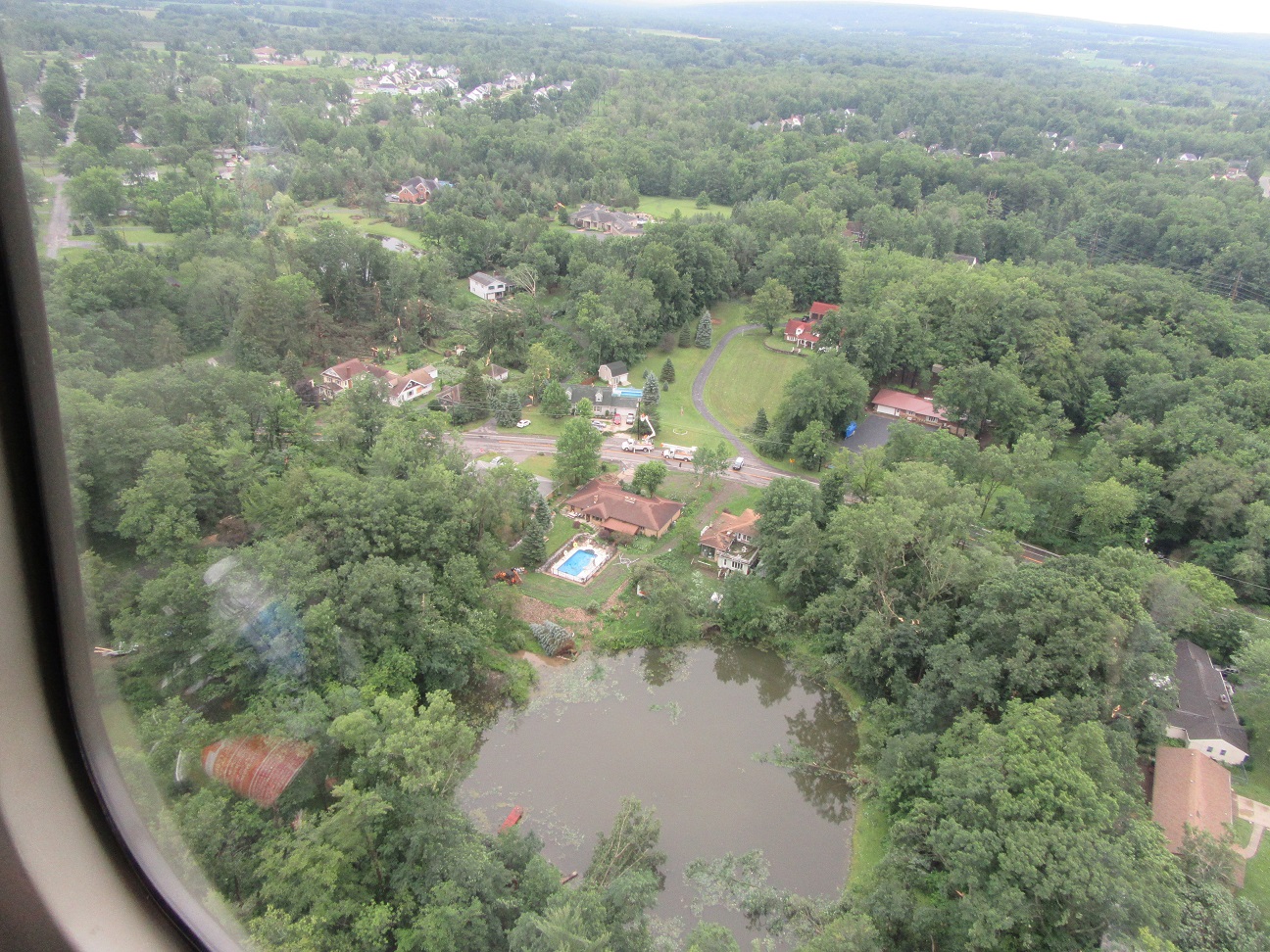
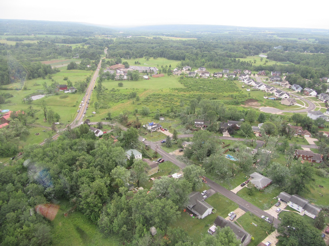
Tornado #3: Rushford, Allegany County, NY on 7/20/17 1:29pm to 1:30pm
Maximum EF-Scale Rating...EF0
Estimated Maximum Wind Speed...85 mph
Maximum Path Width...150 yards
Path Length...1.1 miles
Beginning Lat/Lon...42.43N / 78.22W
Ending lat/Lon...42.42N / 78.20W
* Fatalities...0
* Injuries...0
* The information in this statement is preliminary and subject to change pending final review of the event(s) and publication in NWSStorm Data.
Aerial Photos Courtesy of Allegany County Emergency Management
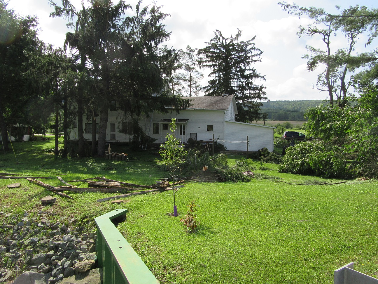
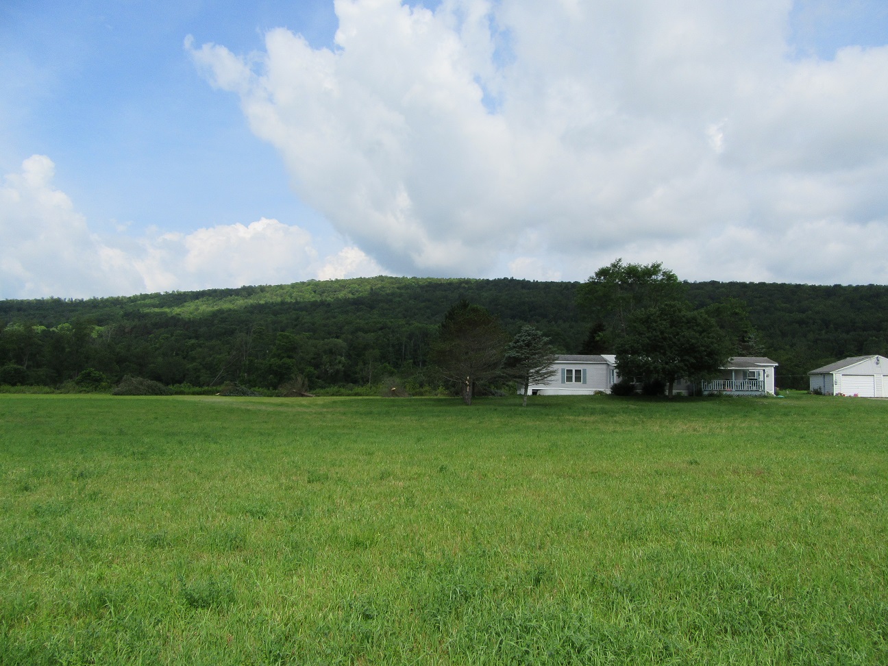
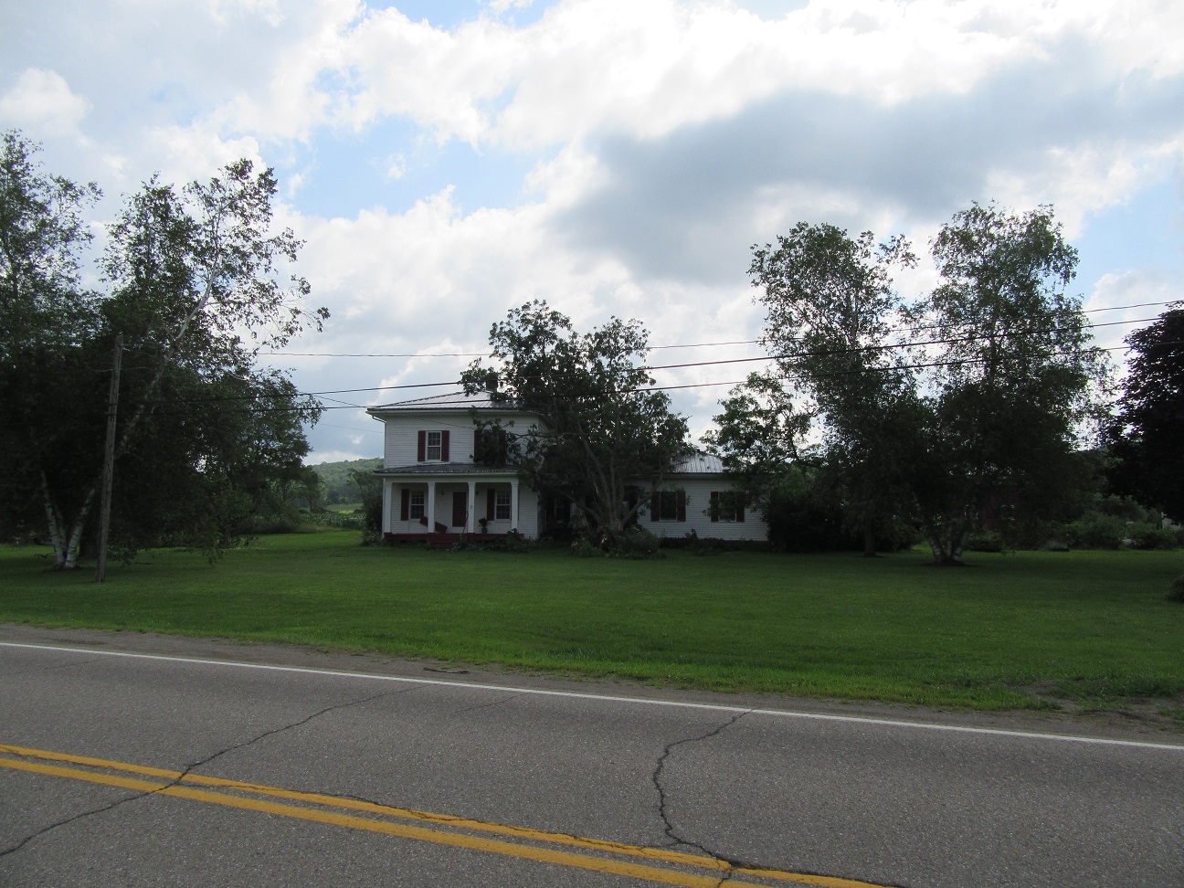
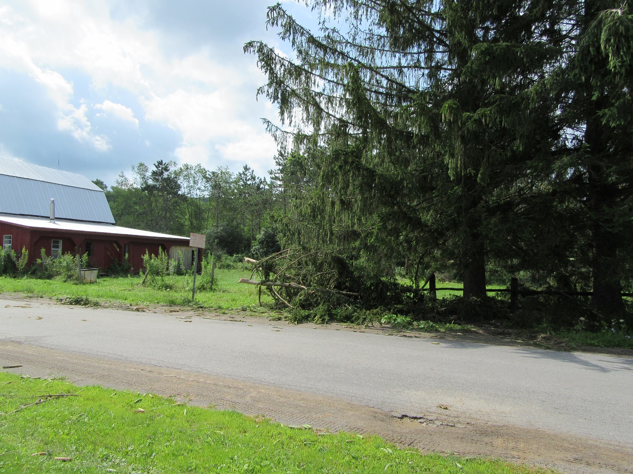
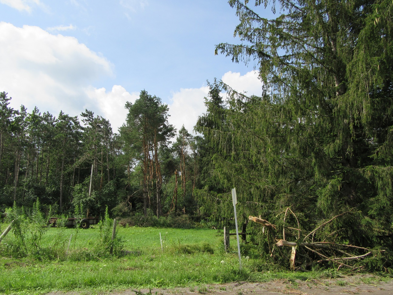
Tornado #4: Allen and Angelica, Allegany County, NY on 7/20/17 1:45pm to 1:52pm
Maximum EF-Scale Rating...EF1
Estimated Maximum Wind Speed...95 mph
Maximum Path Width...740 yards
Path Length...4.4 miles
Beginning Lat/Lon...42.35N / 78.02W
Ending lat/Lon...42.32N / 77.95W
* Fatalities...0
* Injuries...0
* The information in this statement is preliminary and subject to change pending final review of the event(s) and publication in NWSStorm Data.
NWS Buffalo Damage Survey Photos
Storm Following Radar Loop from 11:30AM to 2:20PM 7/20/2017
At the times of the Hamburg-Orchard Park tornado and the Holland tornado, a tornadic debris signature (TDS) can be seen on the radar. This is represented by the area of high reflectivity, tight circulation in velocity, and low correlation coefficient (blues and grays). The very low correlation coefficient values co-located with the rotation and high reflectivity values is indicative of a lot of irregularly shaped objects (debris) being lofted into the air by the tornado.