June 10, 2015 - EF0 Tornado in Ontario County
Summary
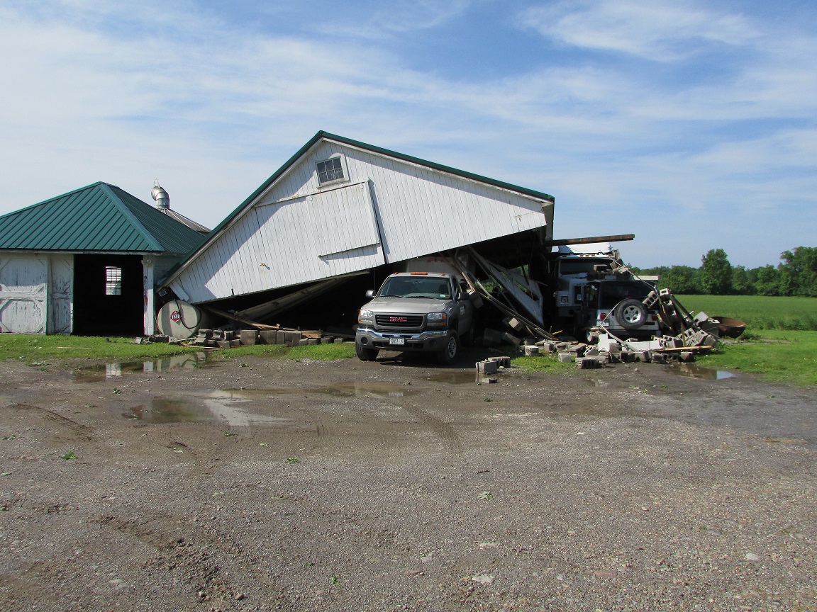
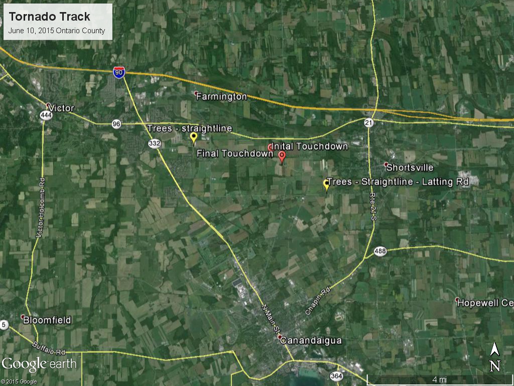
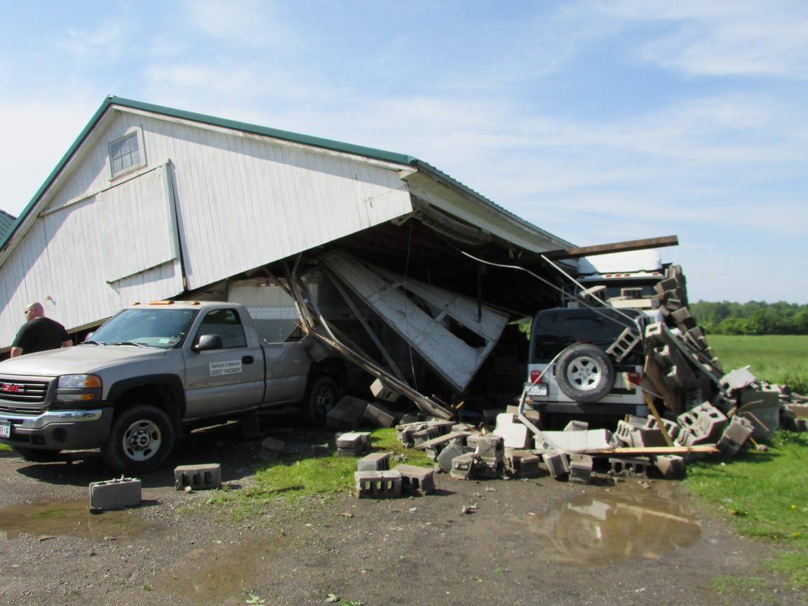
A small tornado moved eastward across a section of the town of Farmington in Ontario County at 950PM EDT June 10, 2015. The tornado was about 50 yards wide with a path of ½ mile as it moved across Shortsville Rd. There was some structural damage from the tornado. A garage and barn were destroyed, and a nearby silo was lifted and carried about 200 yards. Numerous trees were also uprooted or snapped as the tornado moved across the area. Additional tree damage was observed both upstream and downstream of the tornado, but a NWS storm survey determined that damage to be due to straight-line winds and not from a rotating wind field.
Meteorology
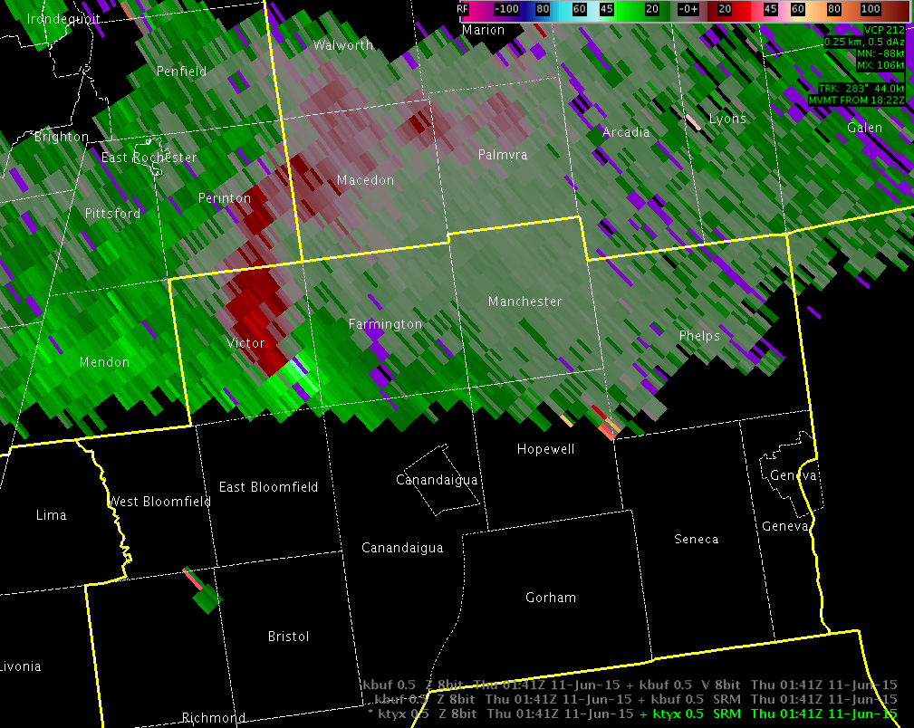
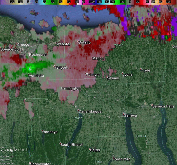
The day started off with a warm front approaching the region from the west and a cold front further upstream. Western NY was under a ‘Slight Risk’ for severe weather per the Storm Prediction Center. As the warm front moved across the region early in the afternoon, several storms formed and quickly moved eastward. Western NY was firmly in what meteorologists call ‘the warm sector’ following its passage. This tends to put a cap on any convective potential and allows instability to build until the cap breaks. This was the case as the cold front moved into the region. Several convective line segments quickly developed, with numerous storms rapidly becoming severe and dropping trees and powerlines across Monroe County as well as over other areas associated with the cold front further east. As the line of storms moved ESE into Ontario County, one storm developed a hook in the reflectivity field which is often indicative of a rotating updraft. With radars soon noting rotation, a tornado warning was issued at 946 PM, urging individuals under the warned area to take cover.
As is typical with rotating storms embedded within a line, the rotation was not particularly strong, and it did not last long. Still, the resulting tornado did cause property damage. Fortunately no one was injured. The storm survey concluded the tornado was an EF-0 magnitude with peak winds of 60 to 70 mph. The NWS strongly recommends you to be aware of significant weather, heed warnings, and take appropriate action in order to stay safe during severe thunderstorm events.
| Radar images | |
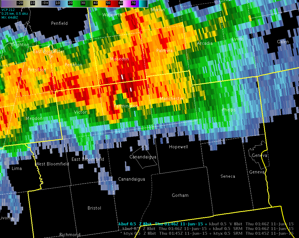 The above radar image at 946 PM shows a hook echo emedded within a line of convection moving ESE into Ontario County. This radar image comes from the KBUF radar site in Buffalo, NY. |
Although the Buffalo radar is closer, the velocity data only showed weak rotation. |
| Meteorological Parameters at 10 pm (Click for Larger Image) | ||
 |
 |
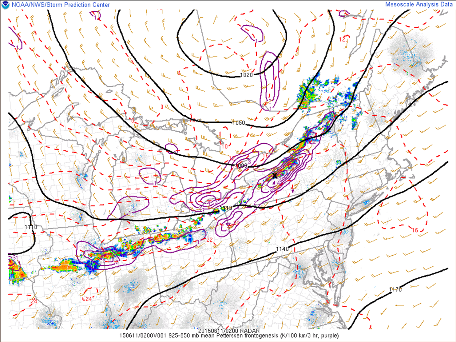 |
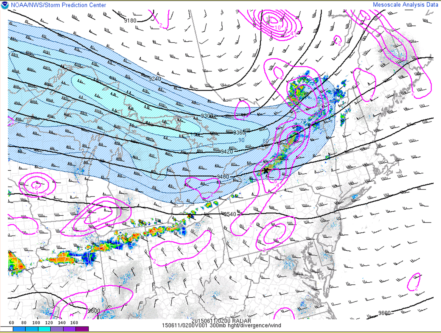
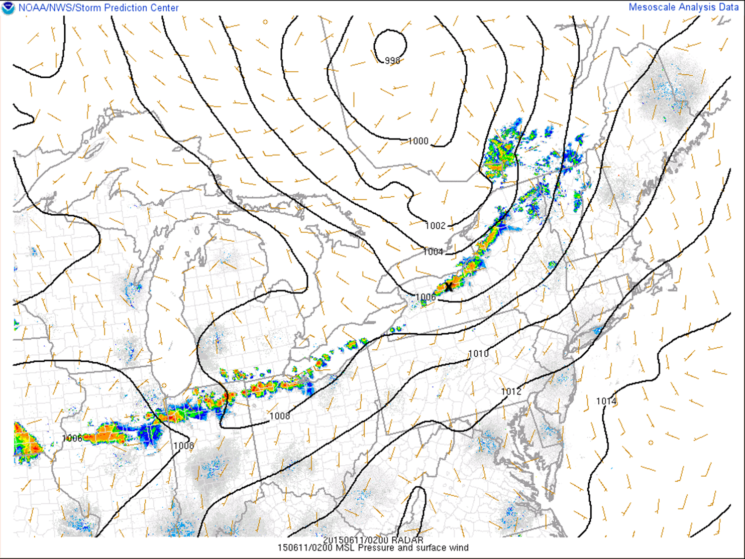
| Left exit region of a 100+ knot jet centered from near Rochester to Watertown. This provided plenty of lift to force the thunderstorms. Tornado location marked by black "X" | The surface low was well north of the area, with the surface front extending back across Lake Ontario & Erie and into northern Ohio. Tornado location marked by black "X" | The line of convection was being forced both by the encroaching jet streak and the associated low-level frontogenesis. Tornado location marked by black "X" |
 |
 |
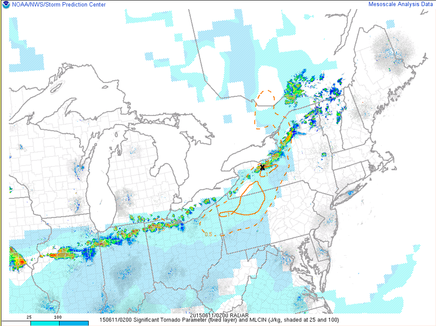 |
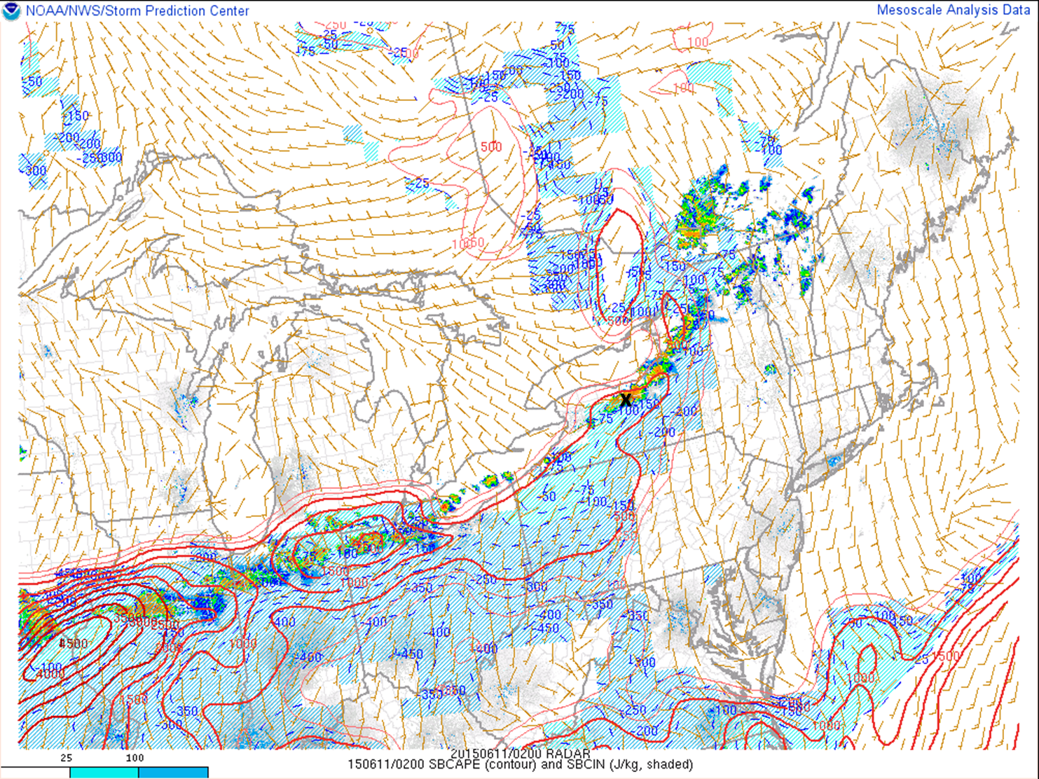
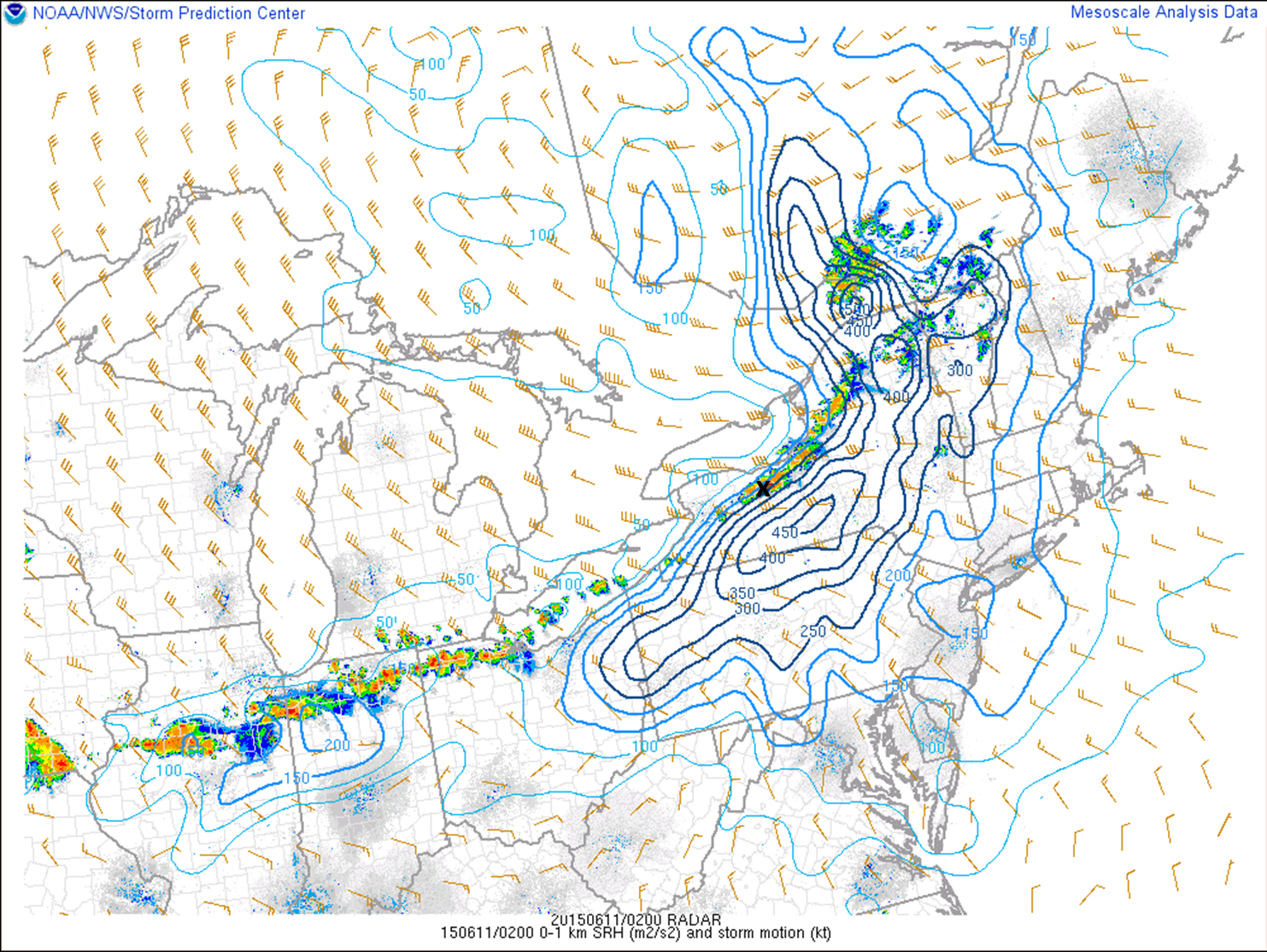
| Instability in the warm sector was not very impressive, with CAPE values only pushing 500 J/kg and the atmosphere still "capped" by about -75 J/kg of CIN. However, this was overcome by the strong forcing with the front. Tornado location marked by black "X" | There was plenty of available "spin" in the lowest 1km of the atmopshere due to the turning of winds over that layer, measured by a parameter called Storm Relative Helicity. Values in the tornado region were well over 200 m2/s2. Tornado location marked by black "X" | While the instability was not impressive, the wind shear (not shown) and low-level helicity values were enough to compensate. The Signficant Tornado Parameter, which weighs the above mentioned parameters, was near 1 in the vicity of the line of thunderstorms, indicating tornado develop was favored. Tornado location marked by black "X" |
Storm Survey Images and Additional Figures
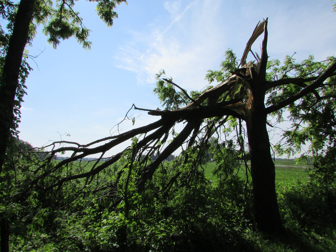
| Storm Survey Pictures | |||
|
|

|
|
|
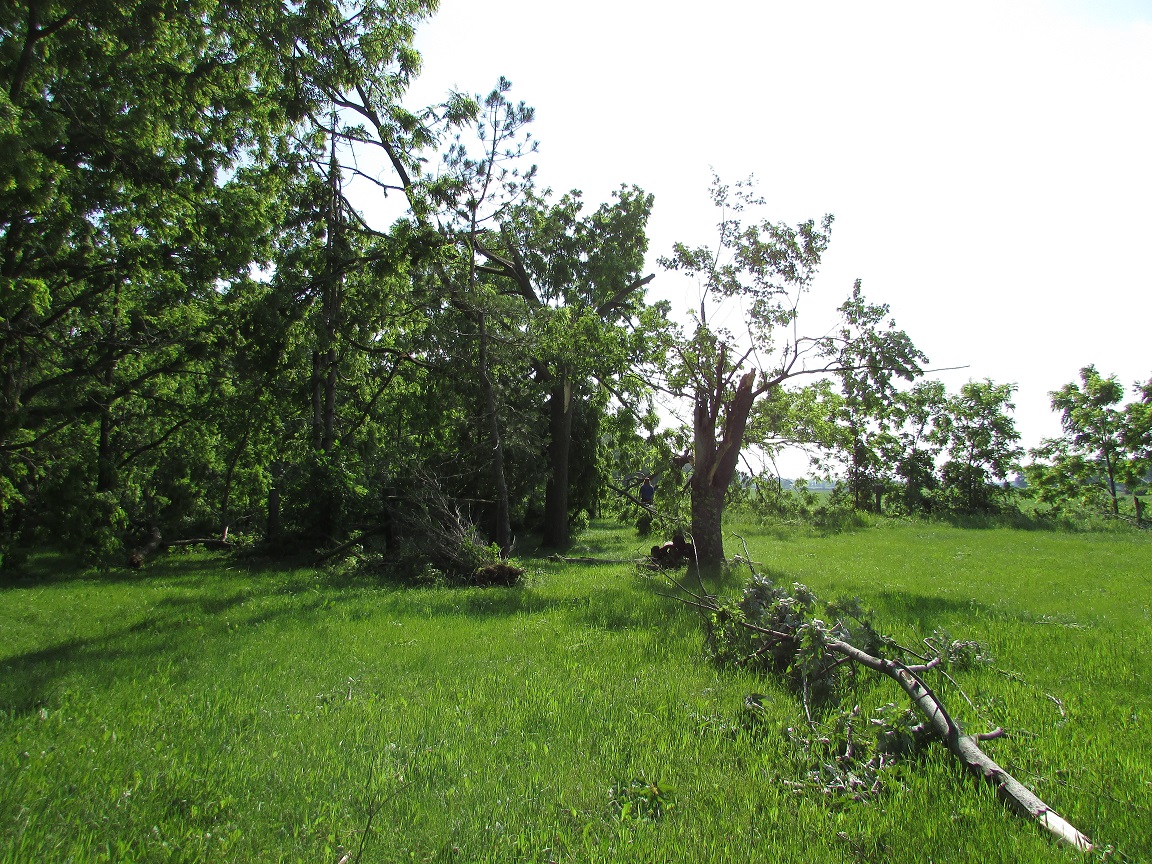
| Shortsville Rd Although tree damage seen above was noted upstream, these trees exhibited damage due to rotation as they were twisted and snapped rather than blown over. |
|||
|
|
 Shortsville Rd Shortsville Rd |
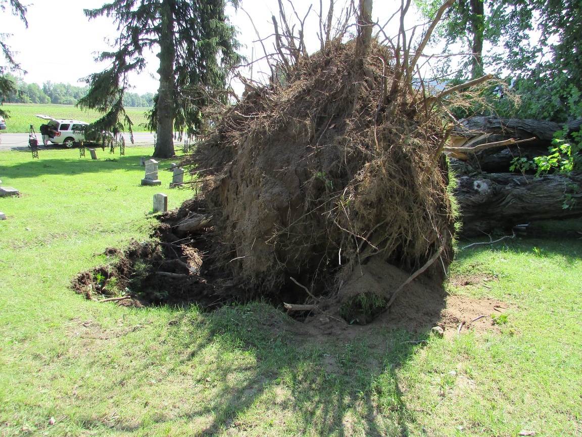
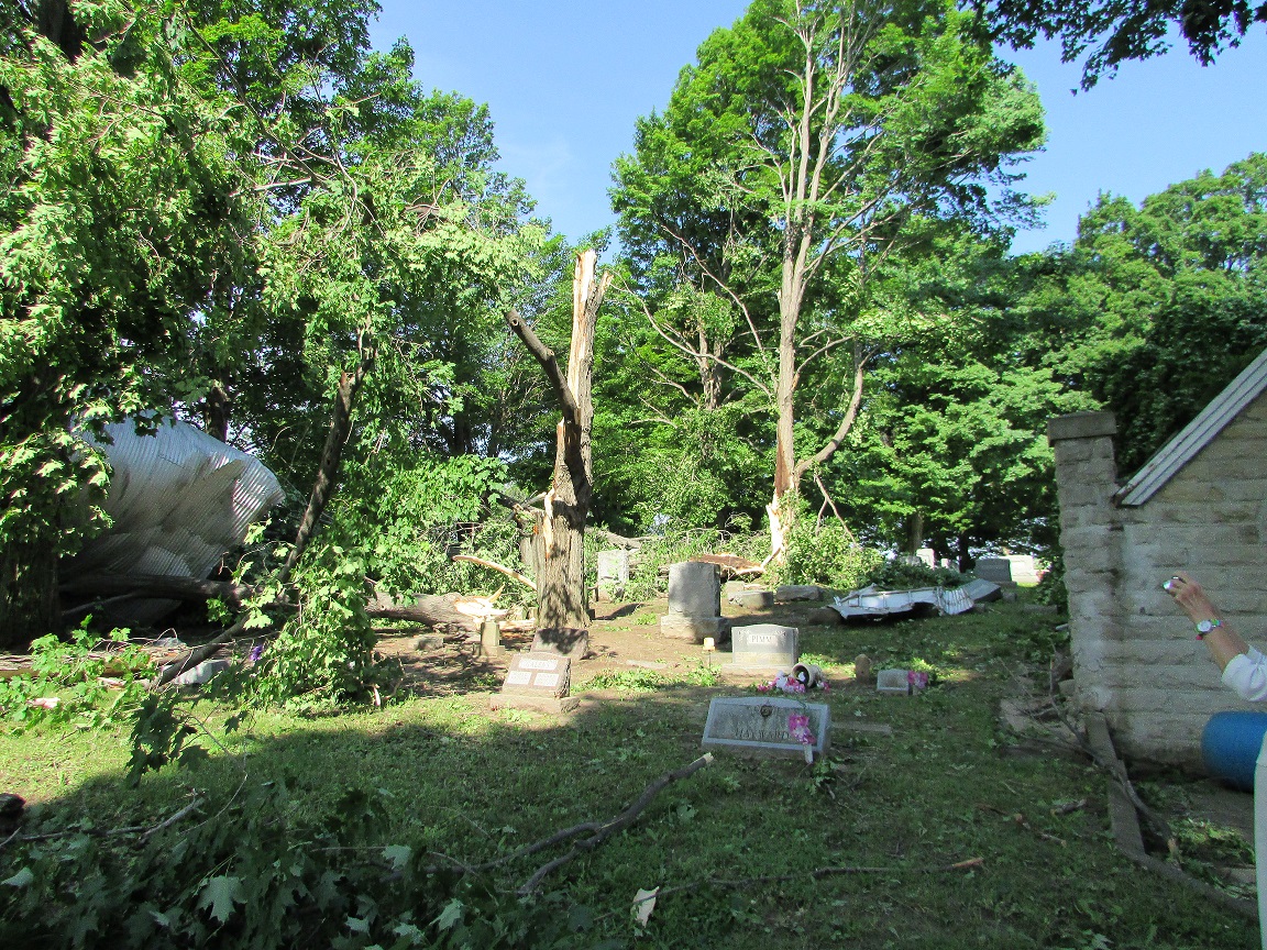 Shortsville Rd Shortsville RdA silo was lifted and moved about 200 yards. The remains of the silo landed in a nearby cemetery after knocking over several gravestones. |
|
|
|
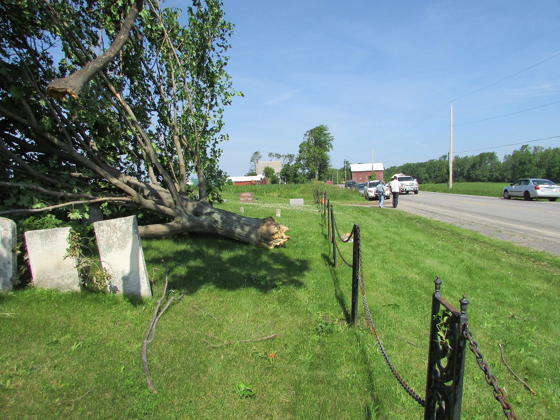 Shortsville Rd Shortsville RdSimilar to the silo, this tree was lifted and moved from it's original location. |
||
| Radar Loops with Terrain | |
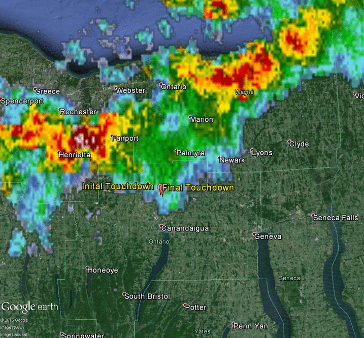 Radar reflectivity from KBUF between 9:24 PM and 10:02 PM. Tornado track marked by "Initial Touchdown" and "Final Touchdown" markers. |
|