Dangerous heat will expand from the Gulf Coast into the Southern Plains and Desert Southwest through week's end. Additional extreme heat impacting the Pacific Northwest will shift to the northern Plains by the weekend. Tropical Storm Bertha is expected to continue to impact portions of the northwestern Gulf Coast from south central Louisiana to the upper Texas coast today. Read More >
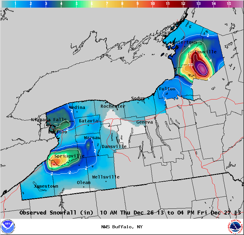
Lake Effect Summary - December 26-27, 2013
|
|
|
Maximum Snowfall: Lake Erie 10.5" (Perrysburg); Lake Ontario 20" (Lorraine) Duration: 30 hours +/-
Prime feature: Hybrid synoptic and marginal lake effect.
The fifth lake effect storm of the season was very similar to the fourth in that an upper level trough crossed the region on Thursday the 26th and brought a light snow across the region. Following this trough, light lake enhanced snow developed off Lake Erie across the northern Niagara Frontier and off of Lake Ontario over Jefferson County.
|