Buffalo, NY
Weather Forecast Office
Click on Image to see full size image of that Forecast hour. Use browser's back button to get back to this page from the full size image.
Images are BELOW the Forecast hour text.
Latest Model run:Jun 12, 06 UTC
|
Forecast hour 01  |
Forecast hour 02  |
Forecast hour 03  |
Forecast hour 04  |
|
Forecast hour 05  |
Forecast hour 06  |
Forecast hour 07  |
Forecast hour 08  |
|
Forecast hour 09  |
Forecast hour 10  |
Forecast hour 11  |
Forecast hour 12  |
|
Forecast hour 13  |
Forecast hour 14 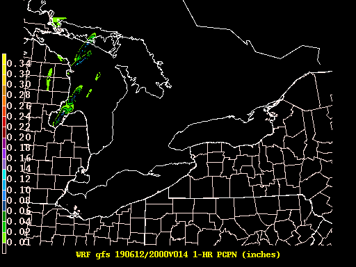 |
Forecast hour 15 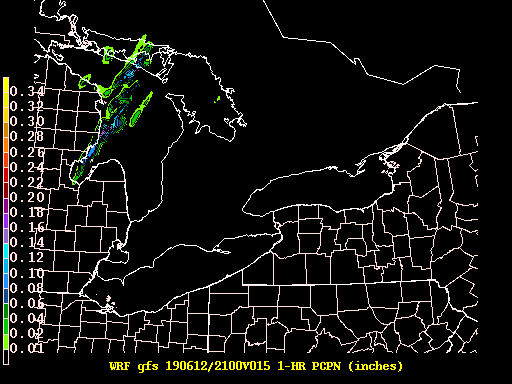 |
Forecast hour 16 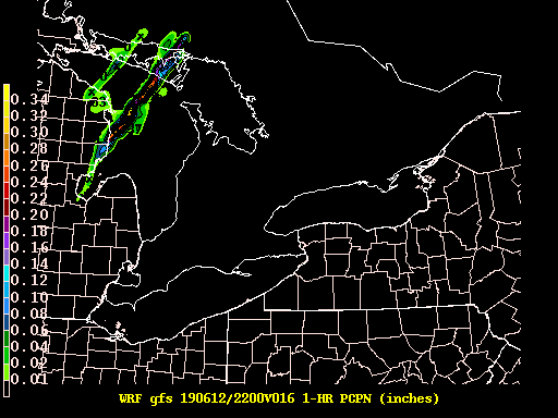 |
|
Forecast hour 17 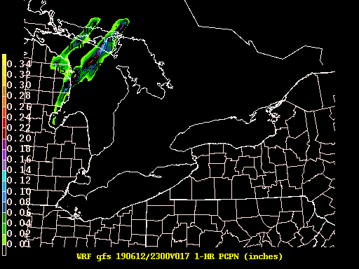 |
Forecast hour 18 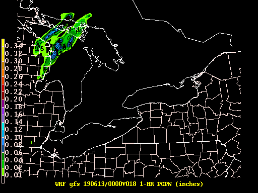 |
Forecast hour 19 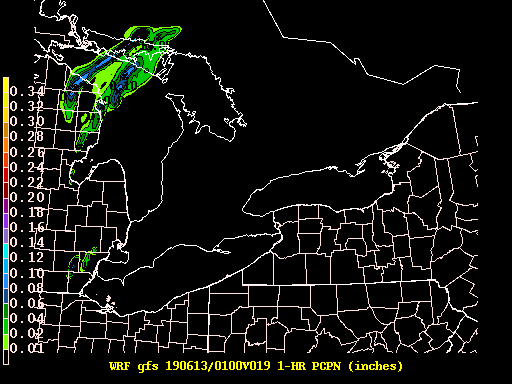 |
Forecast hour 20 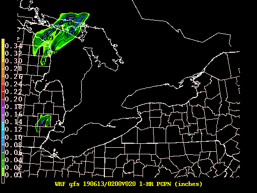 |
|
Forecast hour 21 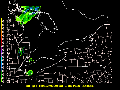 |
Forecast hour 22 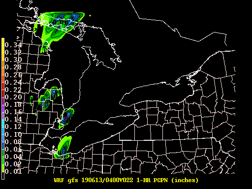 |
Forecast hour 23 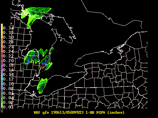 |
Forecast hour 24 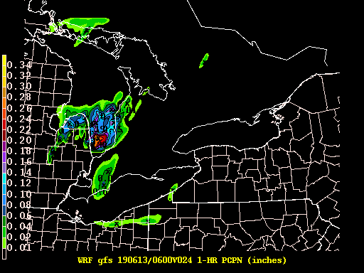 |
|
Forecast hour 25 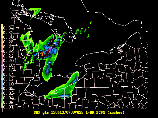 |
Forecast hour 26 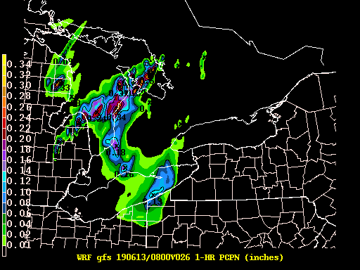 |
Forecast hour 27 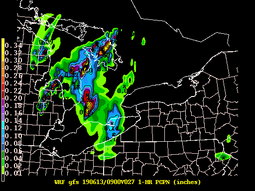 |
Forecast hour 28 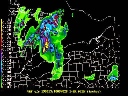 |
|
Forecast hour 29 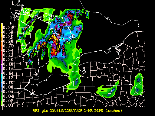 |
Forecast hour 30  |
Forecast hour 31 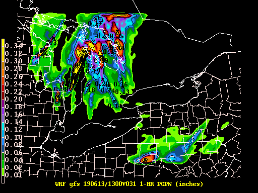 |
Forecast hour 32 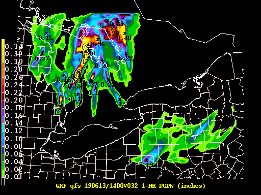 |
|
Forecast hour 33 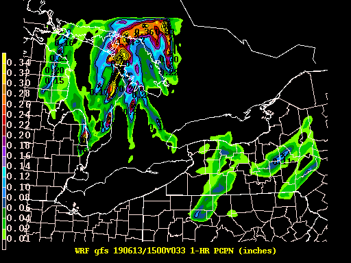 |
Forecast hour 34 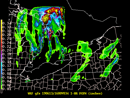 |
Forecast hour 35  |
Forecast hour 36 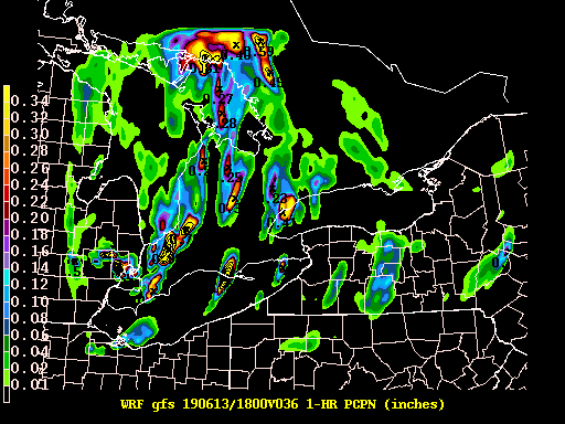 |
Forecast
Hourly Weather Graph
Graphical 2D
Aviation
Marine
Great Lakes
Fire Weather
Tropical Weather
UltraViolet Index
Winter
Air Quality
Beach
Hazards
Day 1 Outlook
Day 2 Outlook
Day 3 Outlook
National Briefing
National Warnings
Drought Monitor
Snowfall Rate Graphics
Enhanced Hazardous Weather Outlook
Climate
Lake Effect Page
Drought Outlook
First Snowfall Facts
Winter Season Summaries
Rochester Climate Graphs
WNY Weather History
Buffalo Climate Graphs
Model Data
Bufkit
Forecast Models
MOS Output
Hourly Mesoscale Analysis
Current Conditions
Sunrise/Sunset
Observations
Lake Temperatures
US Dept of Commerce
National Oceanic and Atmospheric Administration
National Weather Service
Buffalo, NY
587 Aero Drive
Cheektowaga, NY 14225
716-565-0204
Comments? Questions? Please Contact Us.

