Dangerous heat will expand from the Gulf Coast into the Southern Plains and Desert Southwest through week's end. Additional extreme heat impacting the Pacific Northwest will shift to the northern Plains by the weekend. Tropical Storm Bertha is expected to continue to impact portions of the northern Gulf Coast from the western Florida Panhandle to southeastern Louisiana through tonight. Read More >
Overview
|
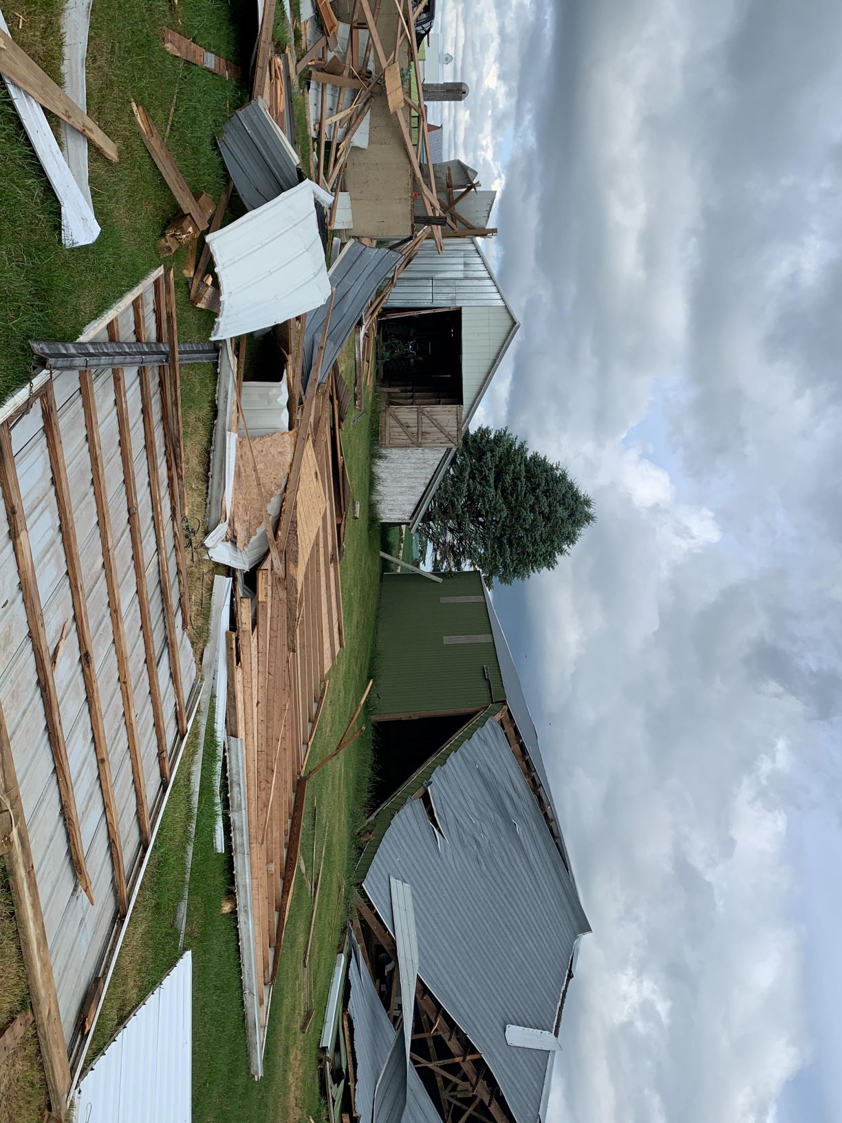
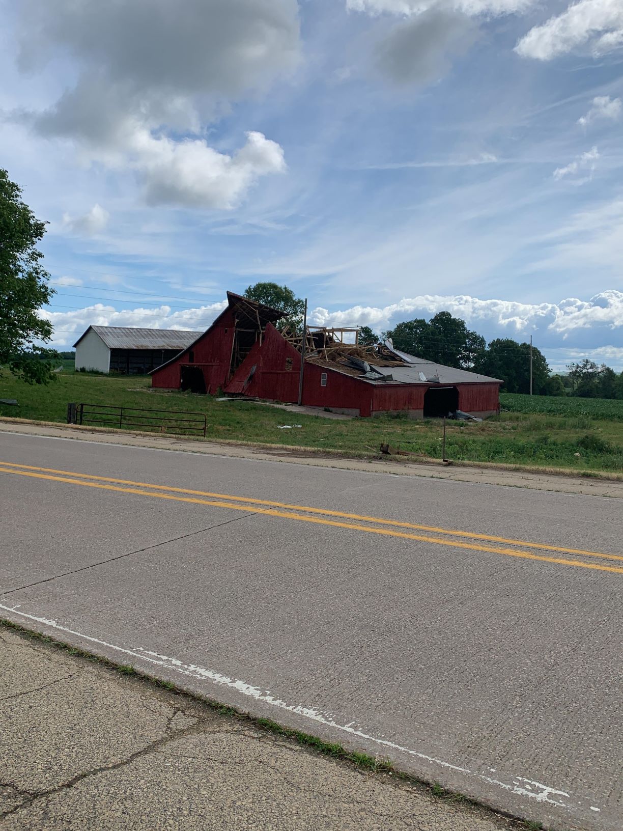
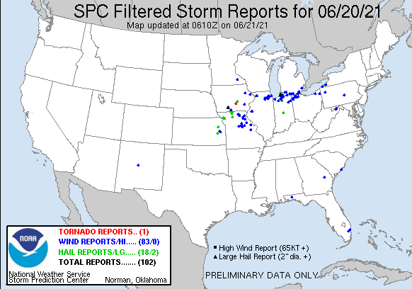
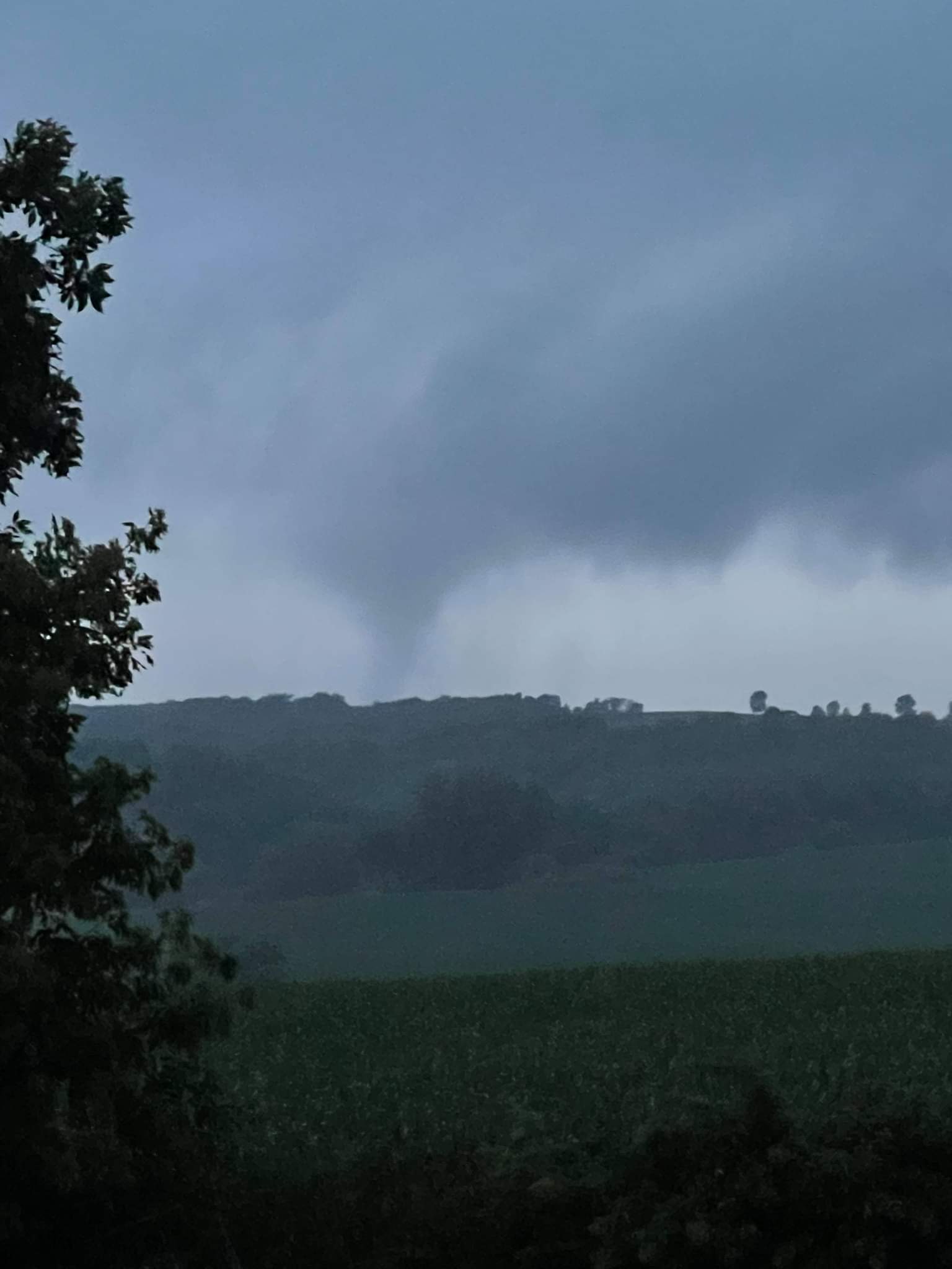
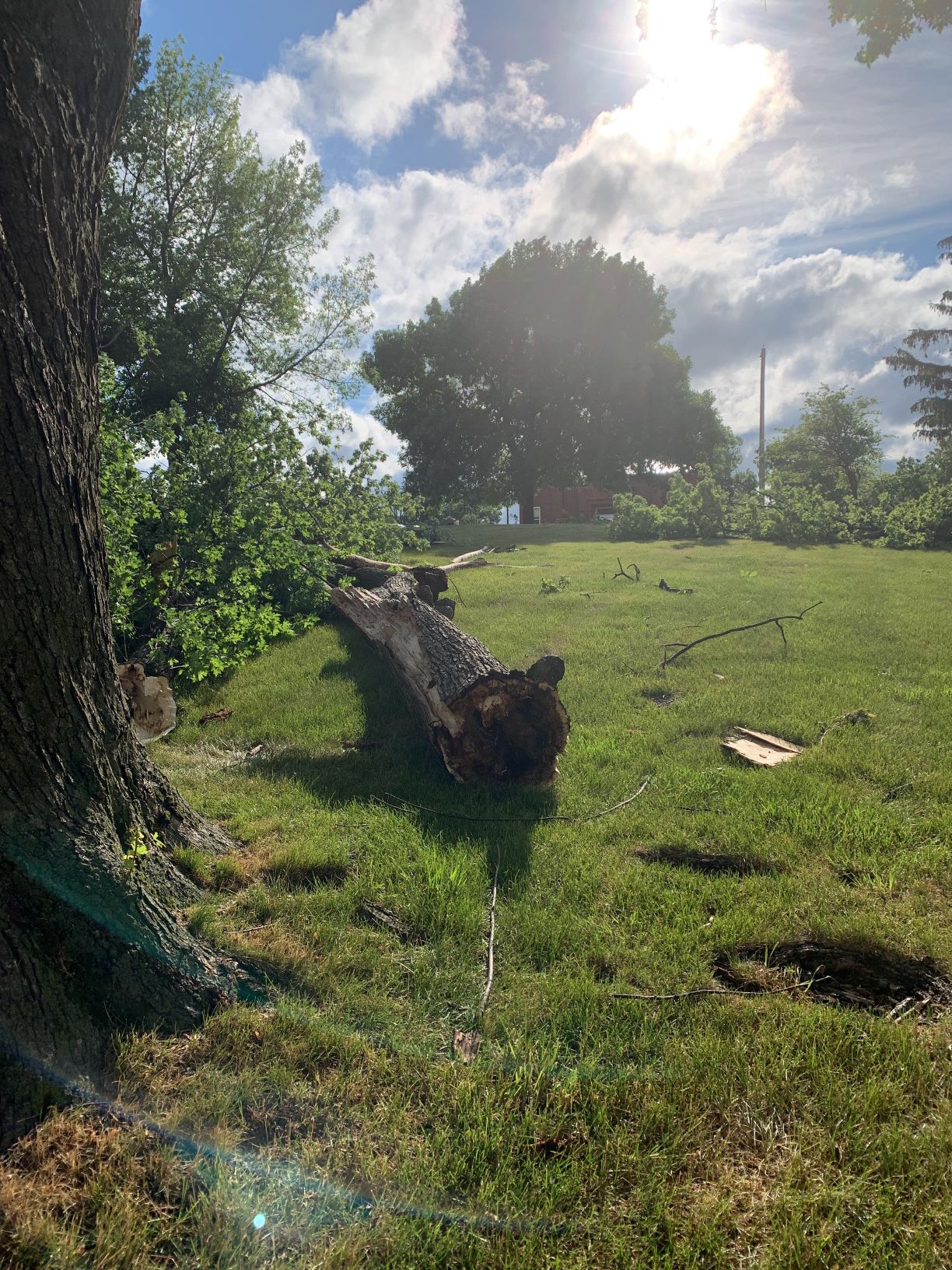
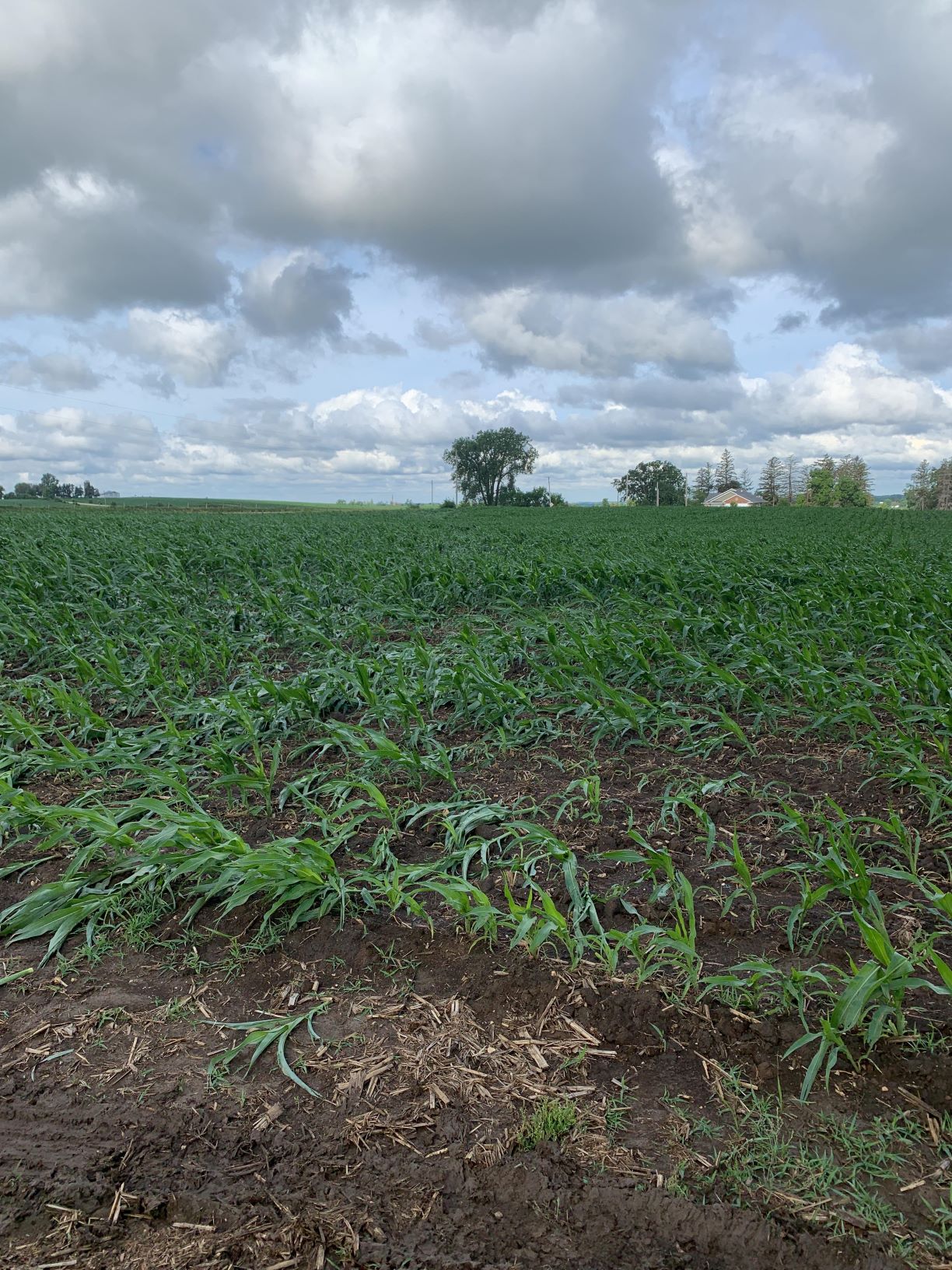
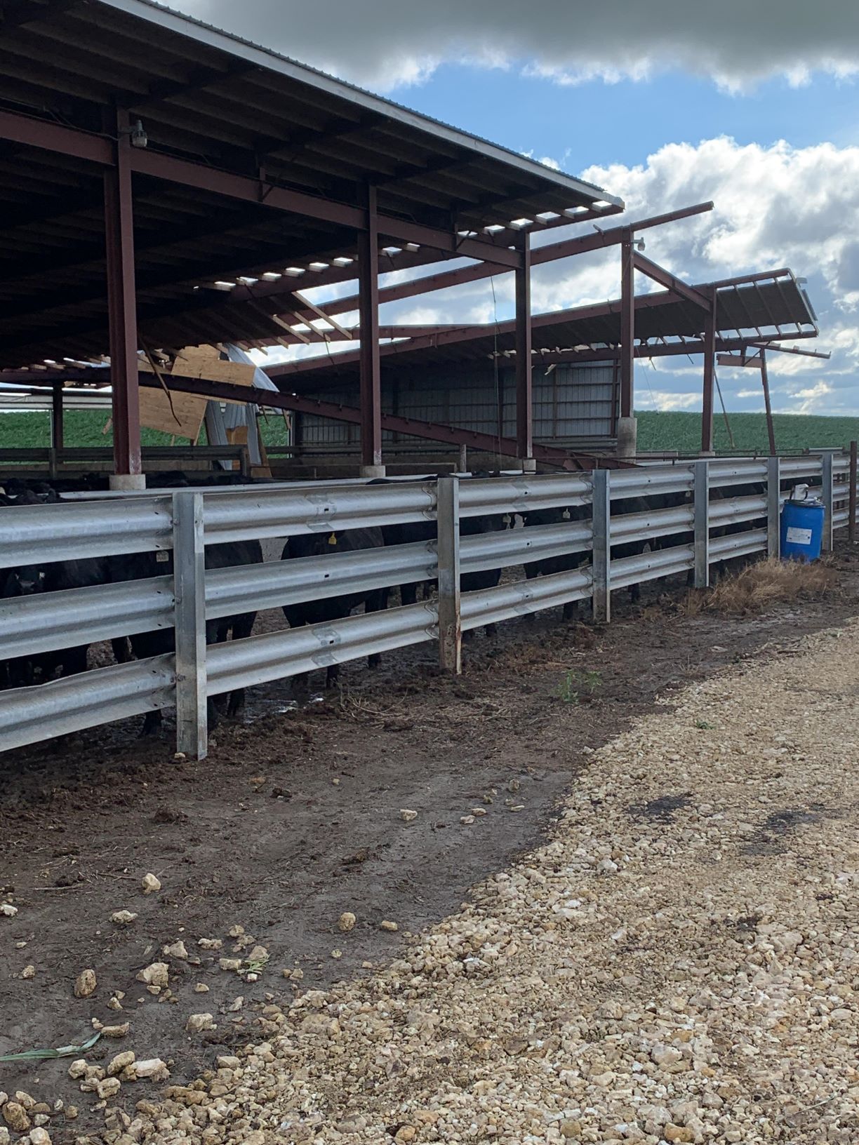
Severe thunderstorms developed across Iowa, Illinois and Missouri on Sunday, June 20th. Early in the morning, an MCS from the night before moved into our area along a stationary boundary and brought widespread rain showers to the area. This died off early in the day and then some clear skies moved in, providing some surface heating ahead of an approaching cold front. Ahead of this front, several discrete supercell thunderstorms formed, which posed a threat for tornadoes, hail, and severe wind gusts. Later in the day. these supercells generally grew upscale into a line of thunderstorms with embedded supercell structures. A tornado was spotted near Bernard, Iowa and lead to some damage to trees and farm outbuildings. Otherwise, severe winds reports and a few hail reports resulted from these storms. The severe threat continued on after our area heavily impacted some suburbs near Chicago. Please see NWS Chicago's webpage for more information.
Surrounding Office Summaries |
Tornado near Bernard, Iowa. (Courtesy Sabra Lyons) |
Tornadoes:
|
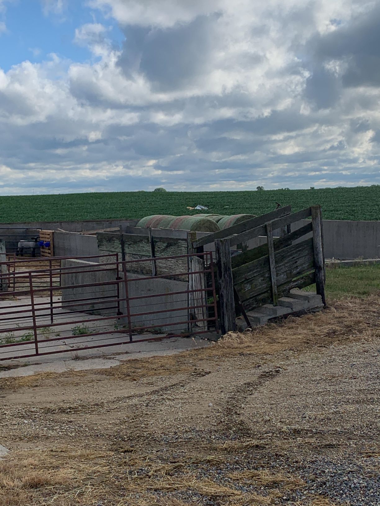
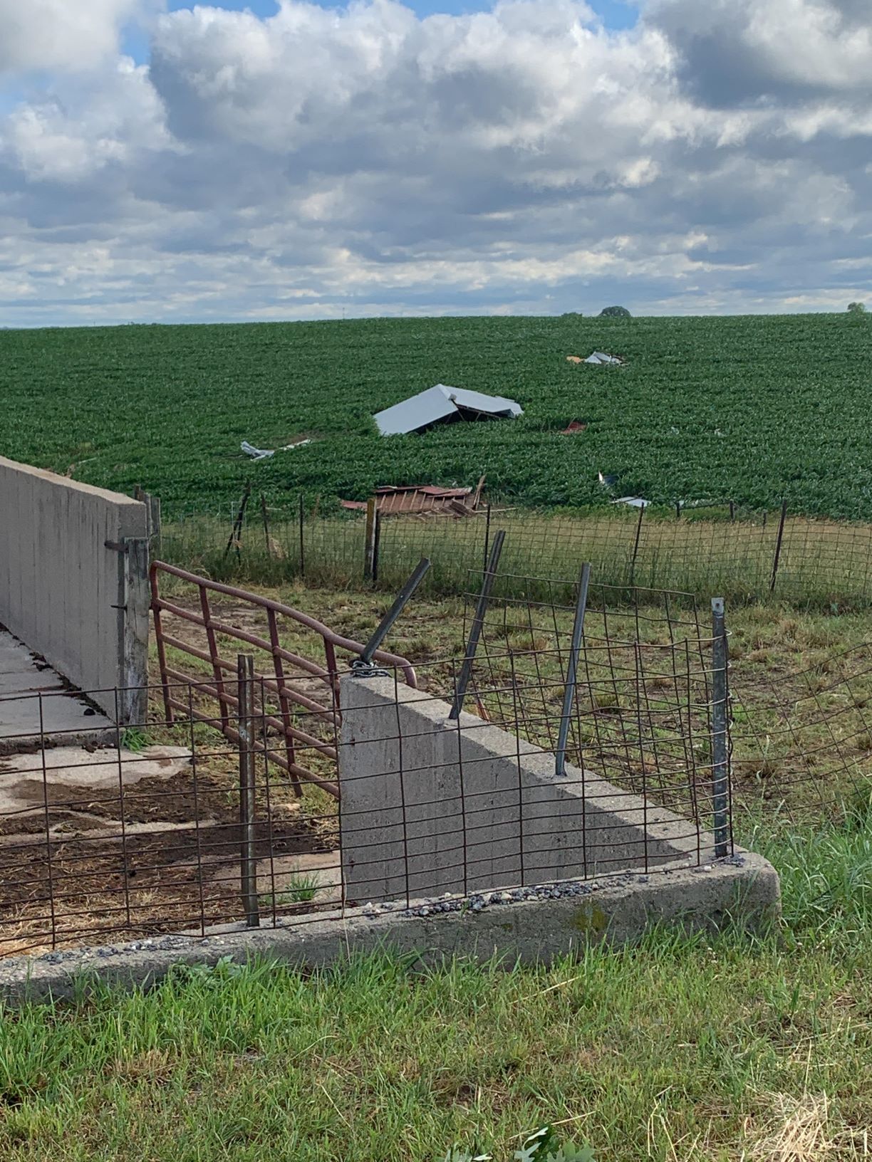
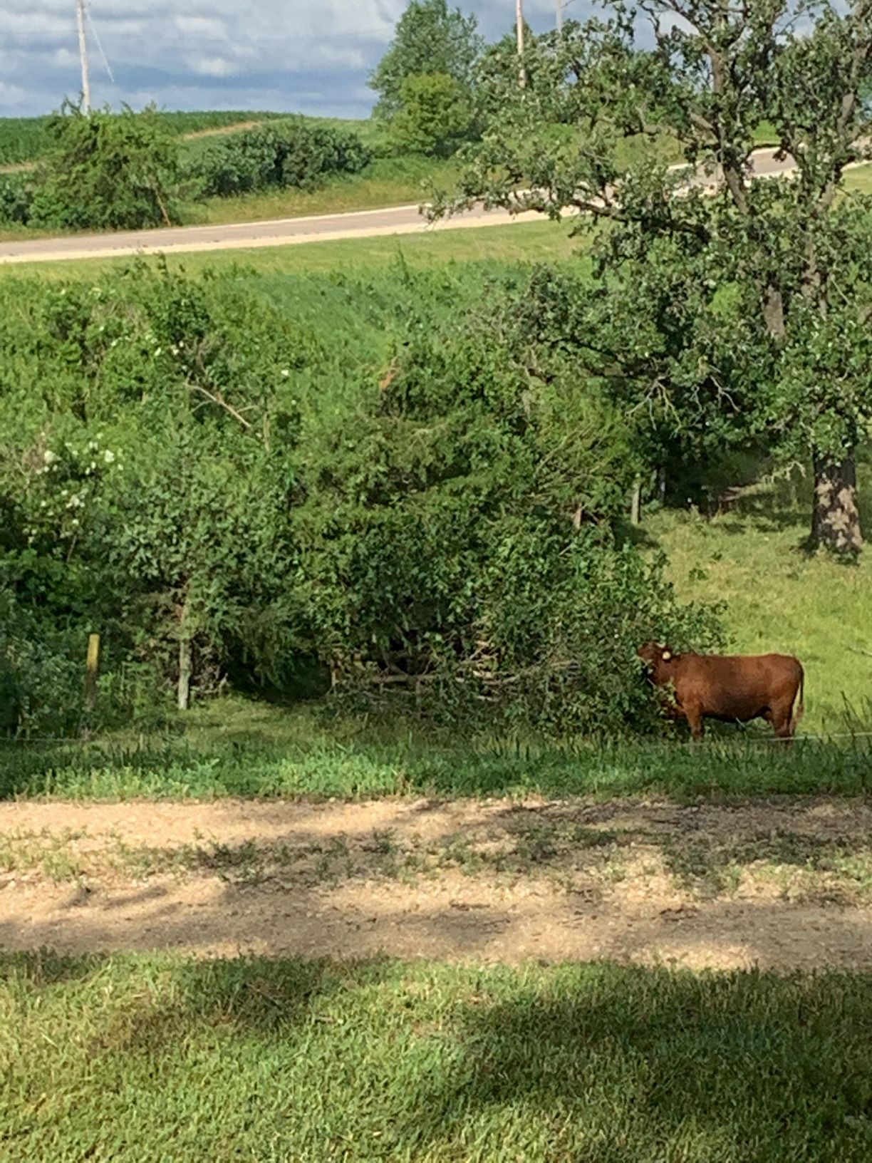
Tornado #1 - South of Bernard, IA
|
|||||||||||||||||||||||||||||||||||
|
|||||||||||||||||||||||||||||||||||
The Enhanced Fujita (EF) Scale classifies tornadoes into the following categories:
| EF0 Weak 65-85 mph |
EF1 Moderate 86-110 mph |
EF2 Significant 111-135 mph |
EF3 Severe 136-165 mph |
EF4 Extreme 166-200 mph |
EF5 Catastrophic 200+ mph |
 |
|||||
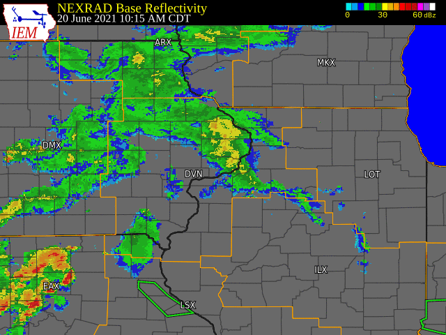
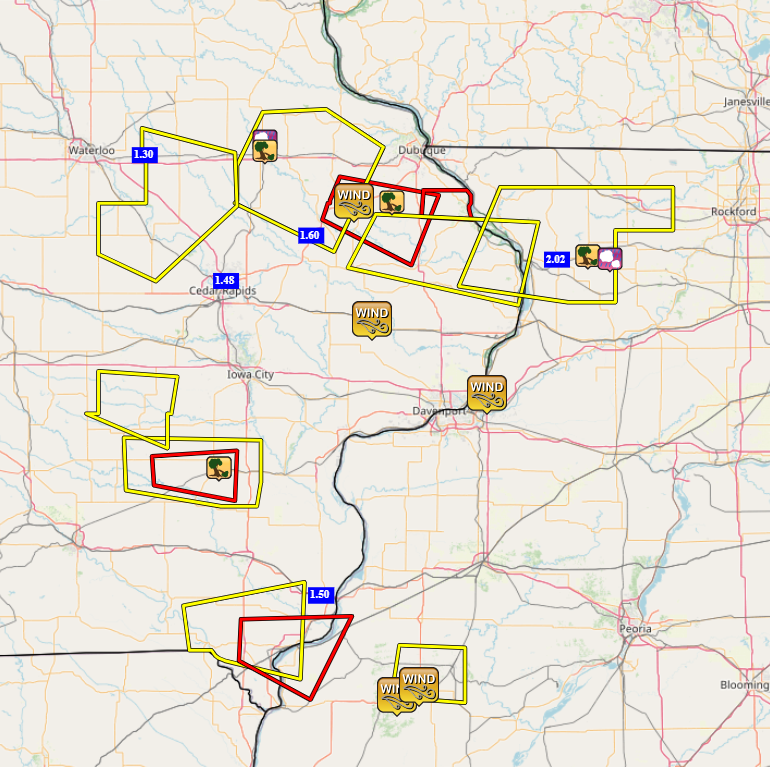
Storm Reports
| Interactive Storm Report Map (IEM) | SPC Storm Reports |
 |
 |
 |
|
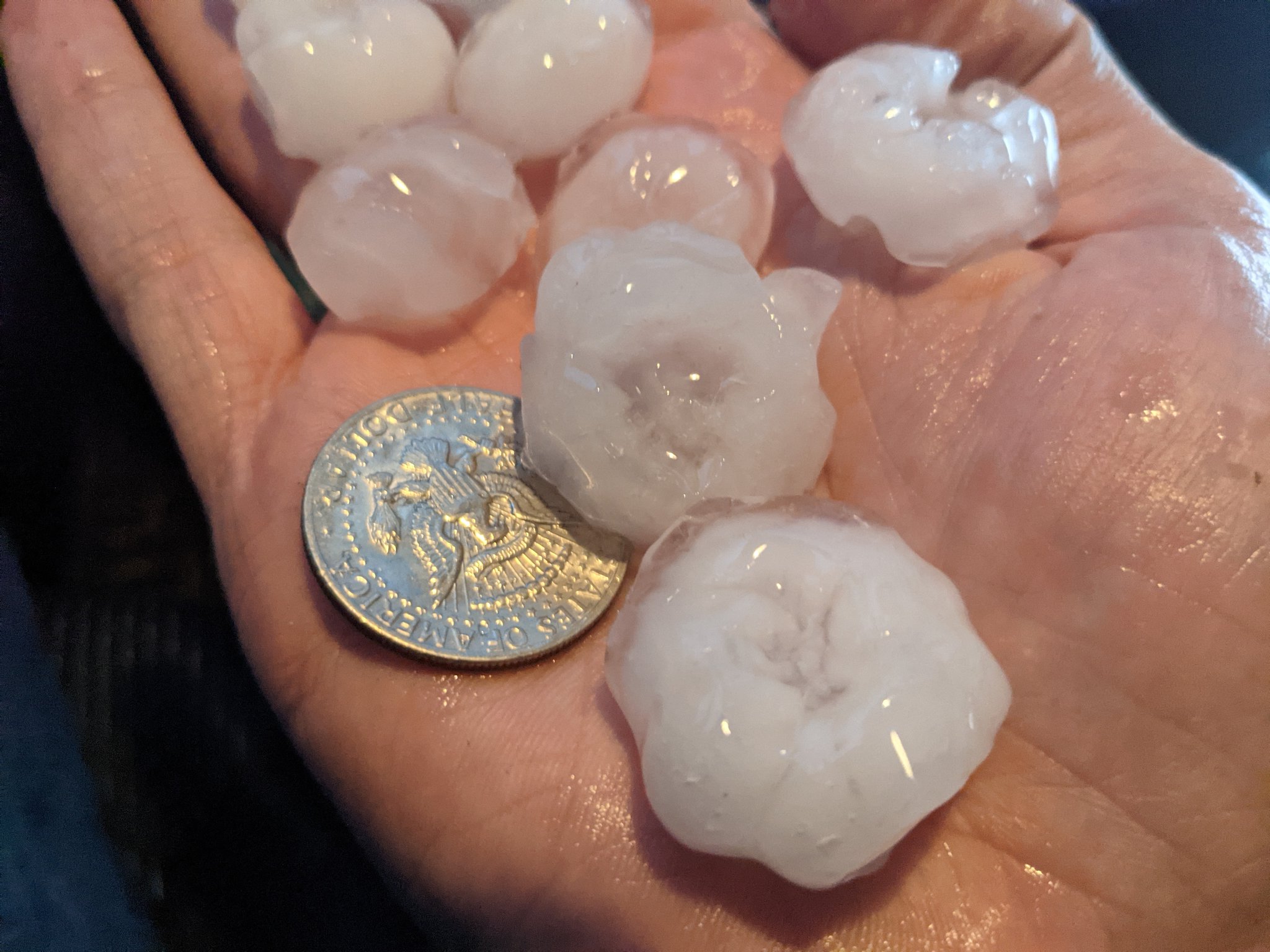
| Half-Dollar Sized Hail Near Washington, IA. Photo courtesy: Nick Stewart |
|
|
PRELIMINARY LOCAL STORM REPORT...SUMMARY ..TIME... ...EVENT... ...CITY LOCATION... ...LAT.LON... 1000 PM TSTM WND GST RAPIDS CITY 41.58N 90.34W
1028 PM TSTM WND GST COLCHESTER 40.43N 90.79W CORRECTS PREVIOUS TSTM WND GST REPORT FROM 1033 PM TSTM WND DMG 1 SW MACOMB 40.46N 90.70W LARGE TREE DOWN ON HIGHWAY 136 BLOCKING THE 1034 PM TSTM WND GST MACOMB 40.47N 90.68W WIND ESTIMATED. 0908 PM HAIL LANARK 42.10N 89.83W ALSO WIND GUST TO 45 MPH. 0910 PM TSTM WND DMG LANARK 42.10N 89.83W 7-8 INCH DIAMETER BRANCH DOWN FRANKLIN AND 0913 PM HAIL 4 SSE SHANNON 42.09N 89.72W MARBLE TO 1.25 INCH HAIL. LASTED 4 MINUTES. 1053 PM HEAVY RAIN 1 SW MOUNT CARROLL 42.09N 89.99W
0849 PM HAIL WASHINGTON 41.30N 91.69W
0859 PM TSTM WND DMG WASHINGTON 41.30N 91.69W FEW DOWNED LIMBS, ROOF OFF BASEBALL 0903 PM HEAVY RAIN 3 NNE CEDAR RAPIDS 42.01N 91.66W
0920 PM HEAVY RAIN 1 WSW LANGWORTHY 42.18N 91.23W
0809 PM TSTM WND DMG 1 NNE GARRY OWEN 42.30N 90.82W POWER LINES AND BUILDINGS DOWN ON MCDEVITT 0802 PM TSTM WND GST CASCADE 42.30N 91.01W
1003 PM HEAVY RAIN WEST BURLINGTON 40.82N 91.18W UPDATES THE PREVIOUS HEAVY RAIN REPORT FROM 0708 PM HAIL 3 NE MANCHESTER AIRPORT 42.53N 91.46W ALSO 40-45 MPH WIND GUST. 0720 PM TSTM WND DMG MANCHESTER 42.49N 91.46W BRANCHES DOWN REQUIRING CLEANUP BY THE CITY. 0920 PM TSTM WND GST LOWDEN 41.86N 90.92W 45 TO 50 MPH WIND GUST. 0745 PM HEAVY RAIN JESUP 42.48N 92.07W |
|
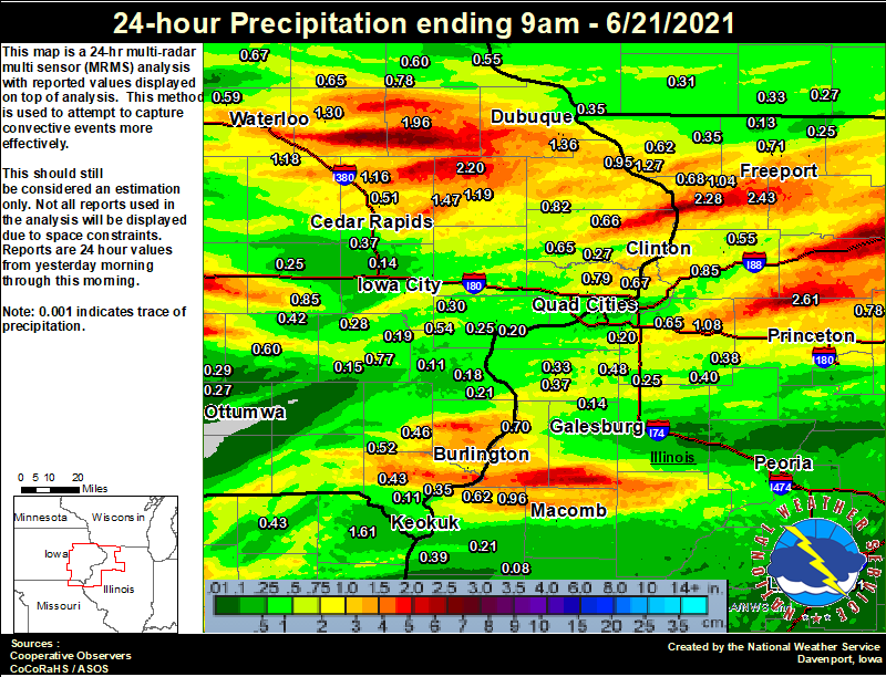
Rainfall Reports
| Local Rainfall Analysis | Regional Rainfall Analysis |
 |
 |
24 hour precipitation reports (in Inches),
for eastern Iowa, northwest and west central Illinois,
and northeast Missouri. Reported between 6 AM and 9 AM,
Monday June 21, 2021.
....IOWA....
Monticello 1 E                   2.20
Manchester                       1.96
Grinnell AWOS 2 SSW              1.69
Anamosa 3 SSW                    1.47
Dubuque #3 7 SW                  1.46
Perry 0 W                        1.39
Dubuque Arpt                     1.36
Independence 1.2 N               1.30
Burlington 0.8 SSE               1.27
Center Junction 2.6 W            1.19
Mount Auburn 2.2 NNW             1.18
Central City 6.7 W               1.16
Center Point 0.6 NNW             1.15
Beaconsfield 1 NNE               1.13
Cedar Rapids 2.7 NE              1.08
Burlington 2S                    1.04
Burlington Arpt                  1.02
Bellevue LD12                    0.95
Independence 0.9 WNW             0.94
Burlington 6.5 SSW               0.91
Parnell 0.1 SSW                  0.85
Maquoketa                        0.82
Camanche 1.2 W                   0.80
Cedar Rapids 5.2 NNE             0.80
Fayette 1 NW                     0.80
Park View 0.2 WSW                0.79
Strawberry Point                 0.78
Washington                       0.77
Iowa City                        0.70
Davenport Arpt                   0.68
Le Claire 1.8 NNE                0.67
Tripoli 0 N                      0.67
Charlotte 1.9 WNW                0.66
Oelwein 1E                       0.65
Marshalltown ASOS 4 N            0.65
Calamus 2.0 NE                   0.65
Elkader 6SSW                     0.60
Sigourney                        0.60
Waterloo ASOS 5 NW               0.59
Fairfax 4.0 NW                   0.58
Marshalltown 1 NW                0.55
Guttenberg Dam 10                0.55
Nichols 3.2 SSW                  0.54
Toledo 3 N                       0.53
Salem 1S                         0.52
Pella 4 N                        0.52
Marion 1.7 NNW                   0.51
Ames US 30 2 SSE                 0.48
Mason City ASOS 6 W              0.46
New London 1.5 SW                0.46
Donnellson                       0.43
North English                    0.42
Mason City 1 NNE                 0.37
Cedar Rapids Arpt                0.37
Williamsburg                     0.37
NWS Johnston* 5 NNW              0.36
Dubuque LD11                     0.35
Le Claire LD14                   0.35
Fort Madison 0.9 NE              0.35
Keokuk LD19                      0.32
West Liberty 0.7 NNW             0.30
Oskaloosa AWOS 9 ESE             0.29
Wellman 4.0 E                    0.28
Brighton                         0.27
De Witt                          0.27
Ottumwa ASOS 6 NNW               0.27
Muscatine 1.4 N                  0.25
Marengo 2.6 SSW                  0.25
Hampton 1 N                      0.24
Muscatine 2N                     0.23
Centerville 0 NE                 0.23
West Branch 2.0 NNW              0.23
Wapello 5.4 SE                   0.21
Iowa City Arpt                   0.21
Ainsworth 7.4 N                  0.19
Wapello 0.2 S                    0.18
Washington 5.8 SW                0.15
North Liberty 0.7 SSW            0.14
Boone 1 SSW                      0.12
Montrose 4.5 NNW                 0.11
Columbus Jct 2 SSW               0.11
Rathbun Reservoir 2 N            0.04
Pella AWOS 2 WSW                 0.00
....ILLINOIS....
Walnut 5.3 ENE                   2.61
Lanark 6.0 E                     2.43
Mount Carroll                    2.28
Steward                          1.56
Mundelein                        1.40
Hanover 0.2 NW                   1.27
Gladstone LD18                   1.20
Ridott 0.1 NE                    1.13
Paw Paw 1 E                      1.10
Atkinson 2.6 NNE                 1.08
Lanark 5.3 N                     1.04
Joliet                           1.03
La Harpe                         0.96
Romeoville                       0.93
Morrison 5.9 SSW                 0.85
Ottawa 4 SW                      0.80
Freeport 1.7 NW                  0.79
Mendota 2 SE                     0.78
Fulton LD13                      0.73
Freeport 2.0 NW                  0.71
Oquawka 0.5 N                    0.70
Mount Carroll 6.8 NNW            0.68
Geneseo 2.0 NW                   0.65
Freeport                         0.62
Dallas City 3.0 SSE              0.62
Elizabeth                        0.62
Rockford ASOS                    0.60
Coleta 1.4 SSW                   0.55
Morrison 3.2 E                   0.53
Sterling 4.9 WSW                 0.51
Princeton                        0.48
New Windsor 2.0 N                0.48
Princeton 1.1 SE                 0.48
Galva 2.7 NE                     0.40
Warsaw 5.8 SE                    0.39
Kewanee 1 E                      0.38
Aledo                            0.37
Stockton 3.4 NNE                 0.35
Aledo 0.4 NE                     0.33
Alpha 2.3 N                      0.33
Alpha 0.7 N                      0.29
St Anne                          0.27
Woodhull 0.3 ESE                 0.25
Davis 0.5 N                      0.25
Bentley                          0.21
Colchester 3.5 NE                0.20
Coal Valley 1.9 SE               0.20
Ill. City LD16 3 WNW             0.20
Coal Valley 2.6 E                0.19
Peoria ASOS                      0.15
Alexis 1 SW                      0.14
New Boston LD17                  0.14
Winslow 4.3 ESE                  0.13
Quincy ASOS                      0.09
Augusta                          0.08
Quad City Arpt                   0.06
Bloomington Airport              0.01
Lincoln NWS                      0.01
Decatur Airport                  0.00
Jacksonville AWOS                0.00
Rochelle AWOS                    0.00
Moline 2.5 W                     0.00
....MISSOURI....
Kahoka 0.6 S                     1.61
Kirksville ASOS                  1.06
Columbia                         0.97
Chillicothe 2 NW                 0.49
Memphis 0.1 S                    0.43
....WISCONSIN....
Beloit-College                   0.55
Madison-ASOS                     0.41
Monroe 1 W                       0.33
Darlington                       0.31
Whitewater                       0.31
Prairie du Chien AWOS            0.30
La Crosse WFO                    0.30
Brodhead 1 SW                    0.27
Watertown-AWOS                   0.24
Allenton-WWTP .6 NW              0.19
....MINNESOTA....
Theilman 1SSW                    1.62
Preston                          0.59
Environment
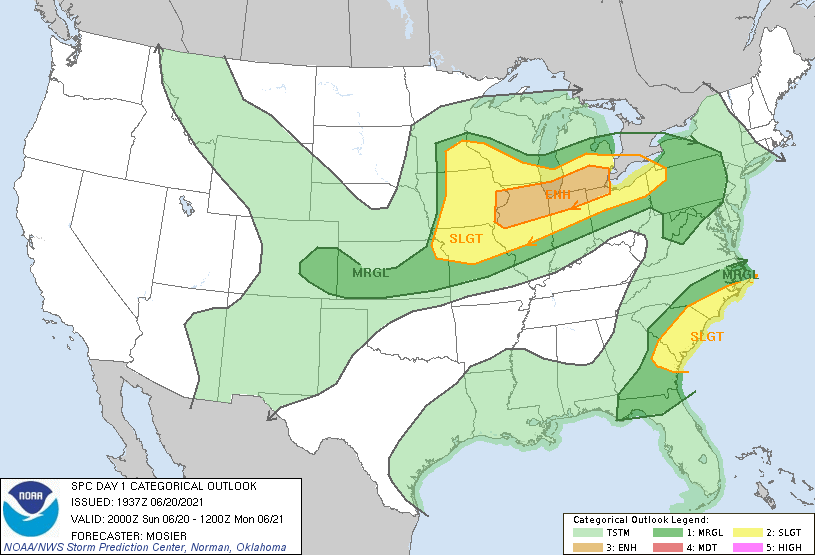
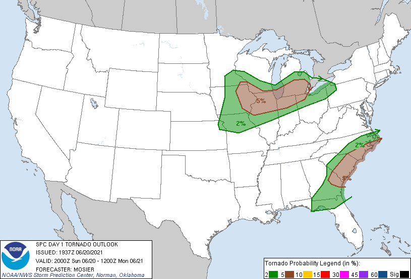
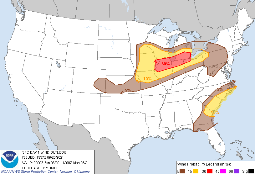
SPC EVENT REVIEW PAGE: 06/20/2021
SPC Categorical/Tornado/Hail/Wind Outlooks
 |
 |
 |
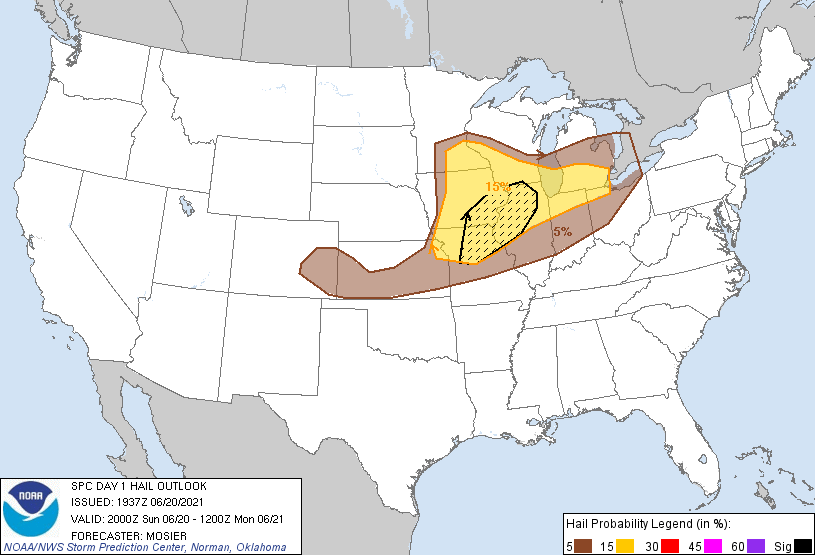 |
| SPC Categorical Outlook | Tornado Outlook | Wind Outlook | Hail Outlook |
DVN Observed Sounding Analysis
 |
 |
| 12 PM DAVENPORT, IA SOUNDING | 7 PM DAVENPORT, IA SOUNDING |
SPC Mesoscale Discussions
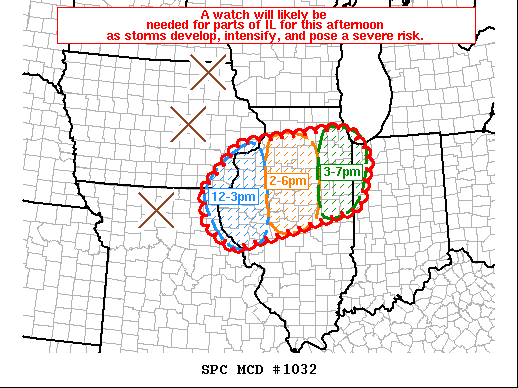 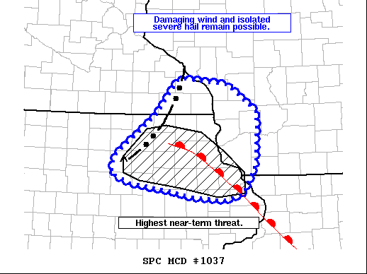 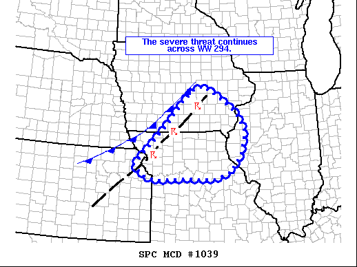 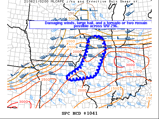 |
| MCD 1032, 1037, 1039, and 1041 |
SPC Convective Watches
 |
 |
| Severe Thunderstorm Watch #294 | Severe Thunderstorm Watch #296 |
 |
Media use of NWS Web News Stories is encouraged! Please acknowledge the NWS as the source of any news information accessed from this site. |
|


.PNG)

.jpg)