Tropical Storm Bertha could bring tropical storm conditions to portions of the Florida Panhandle and Alabama coast through Wednesday, where a Tropical Storm Watch and Storm Surge Watch is in effect. Numerous severe thunderstorms with heavy rainfall are expected from the Ohio Valley into the Mid-Atlantic and Northeast Tuesday. Read More >
Overview
|
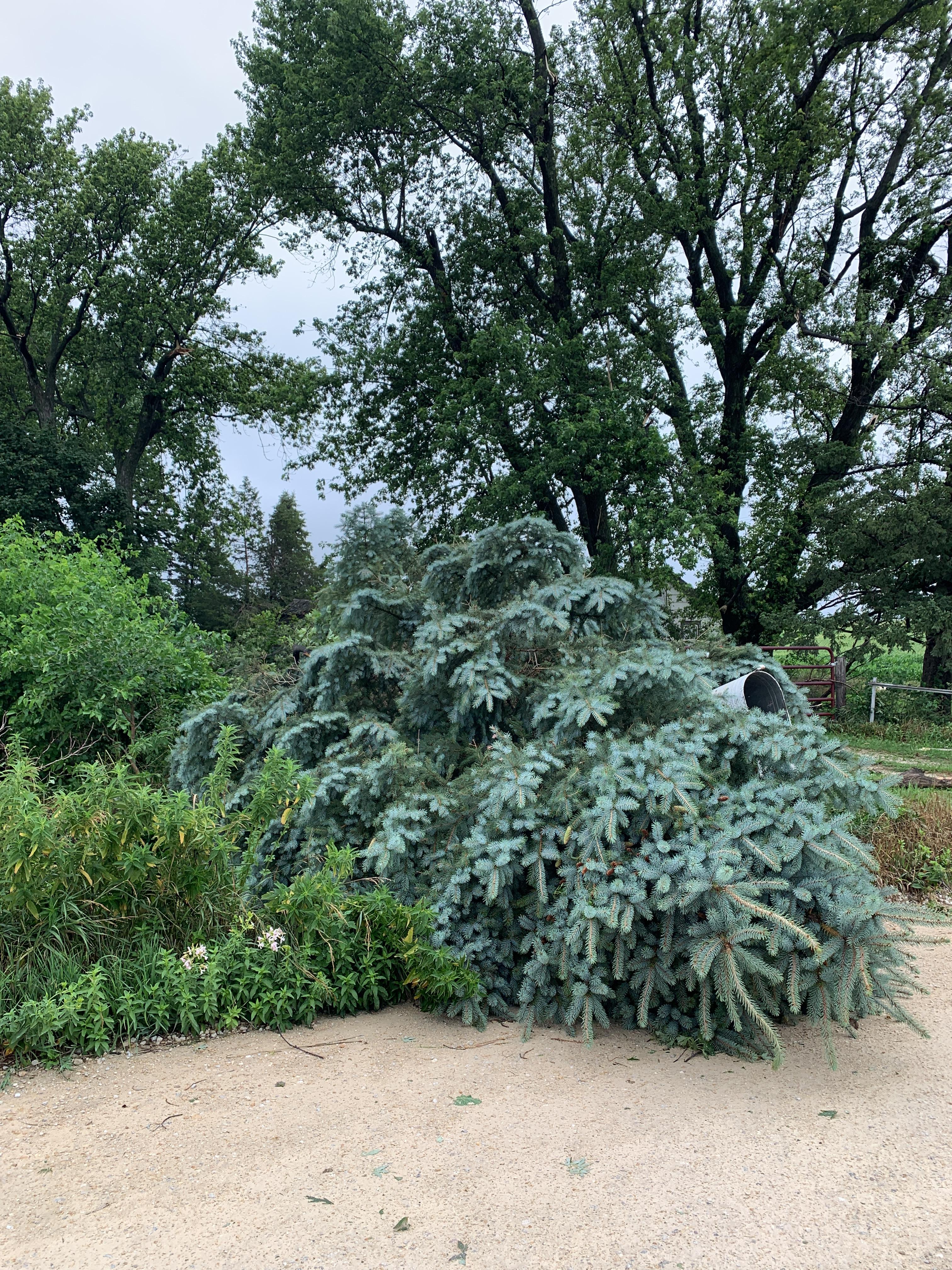
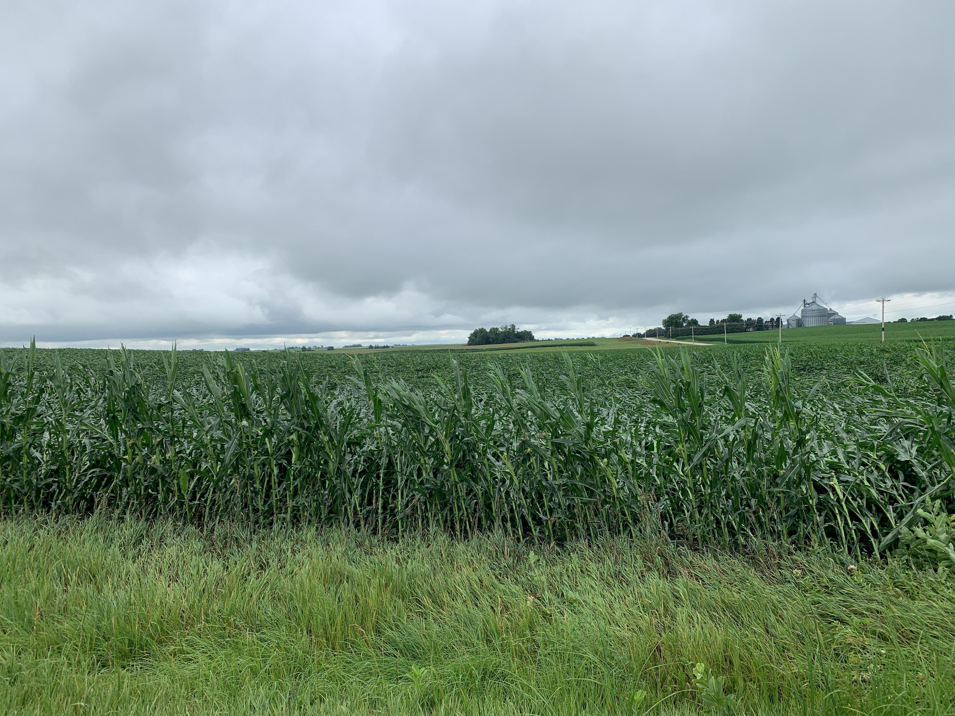
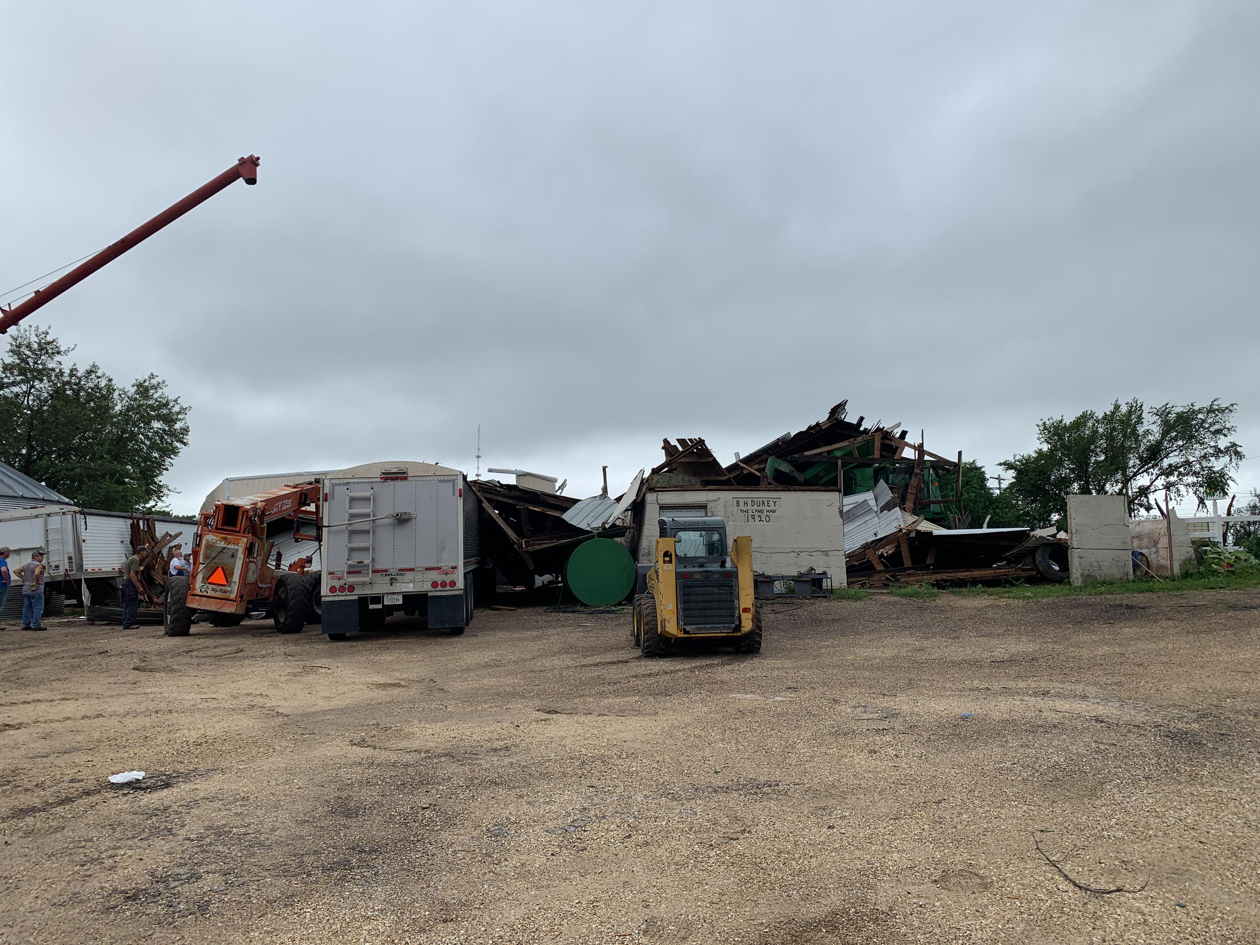
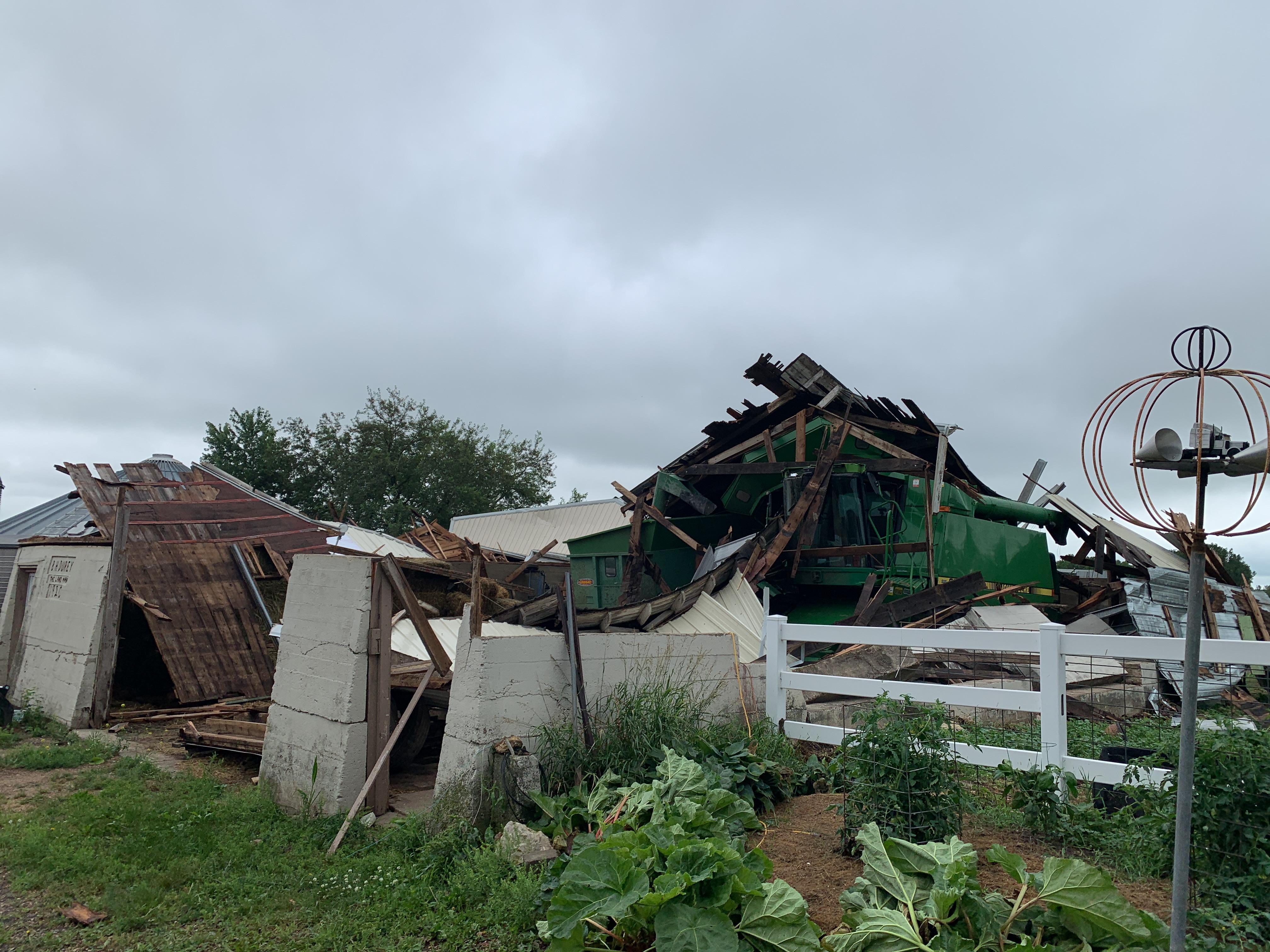
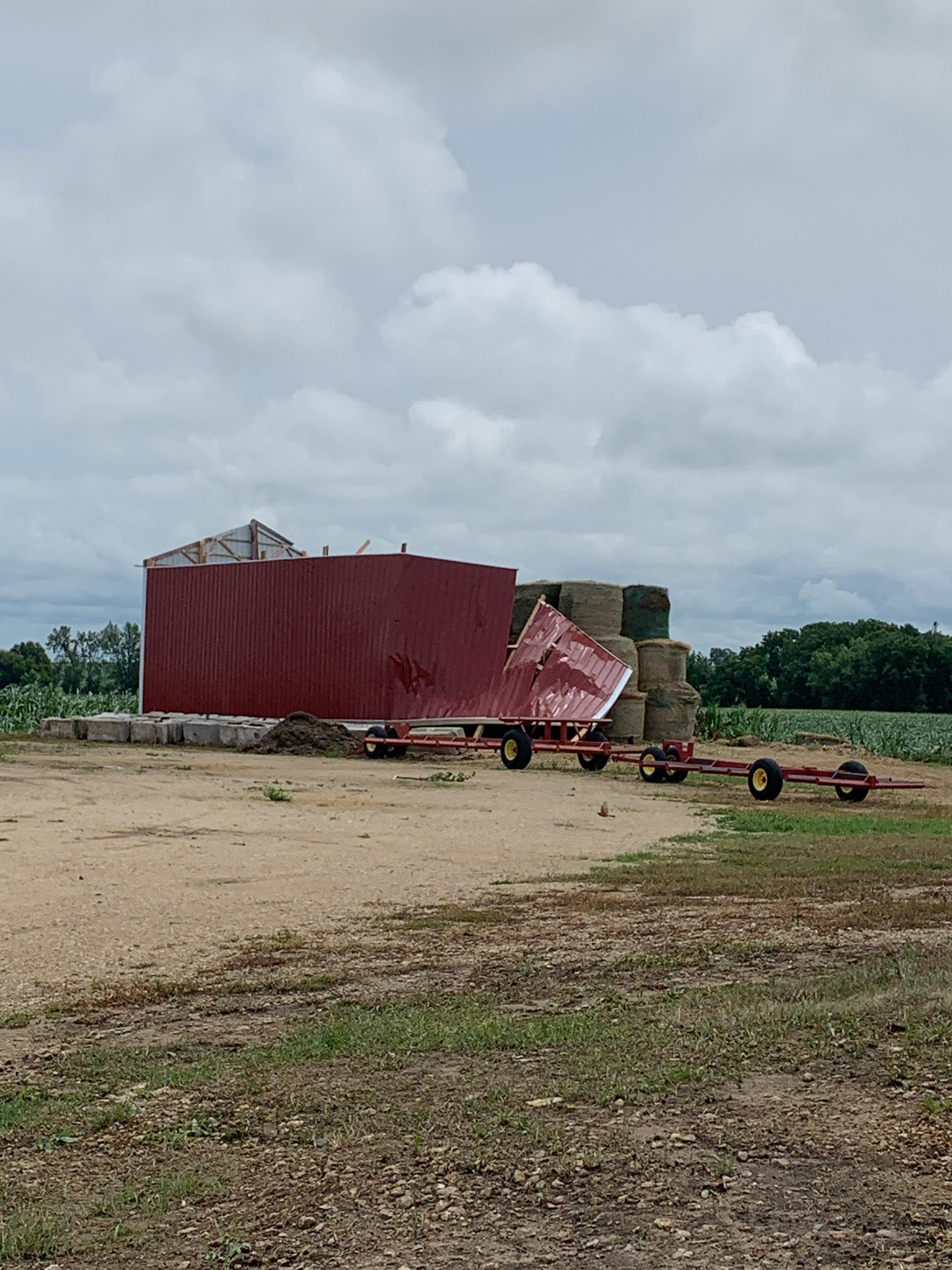
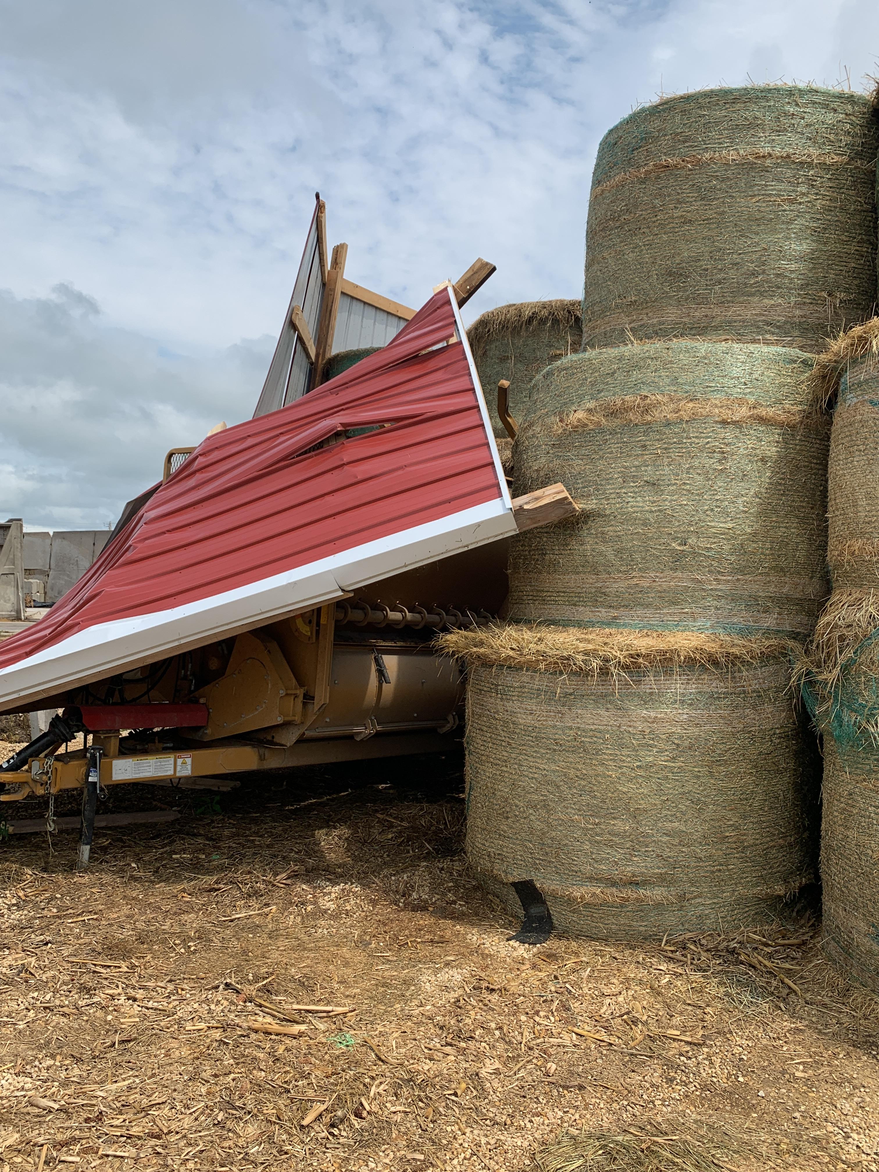
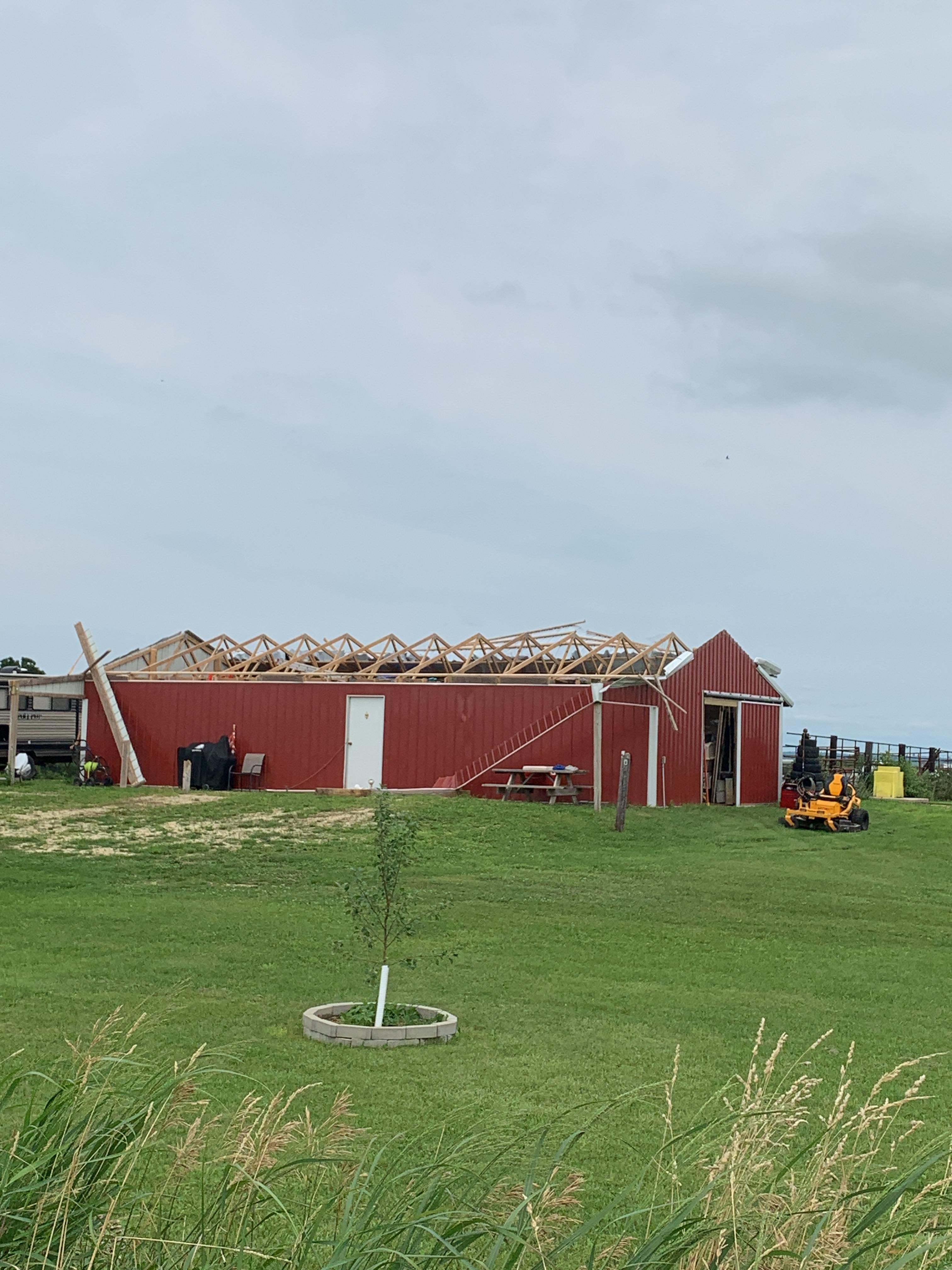
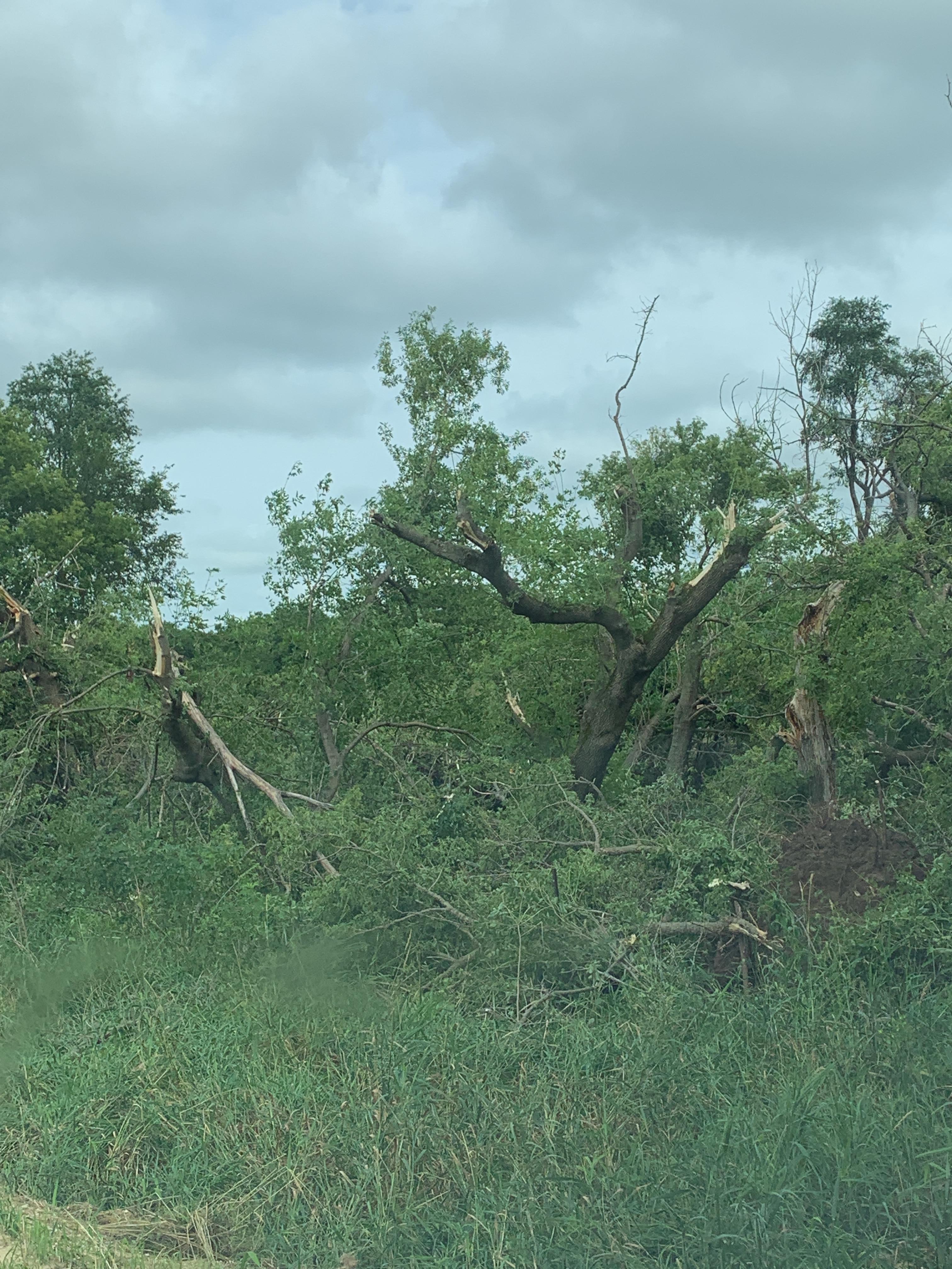
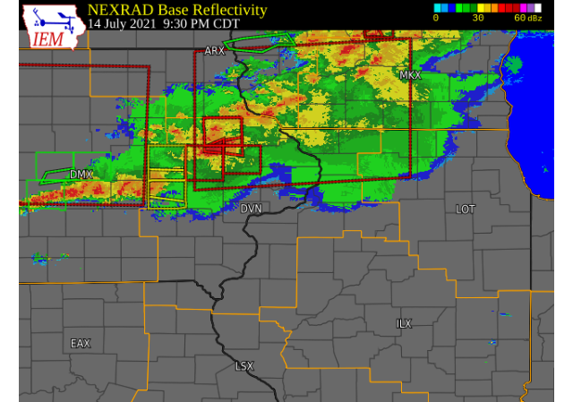
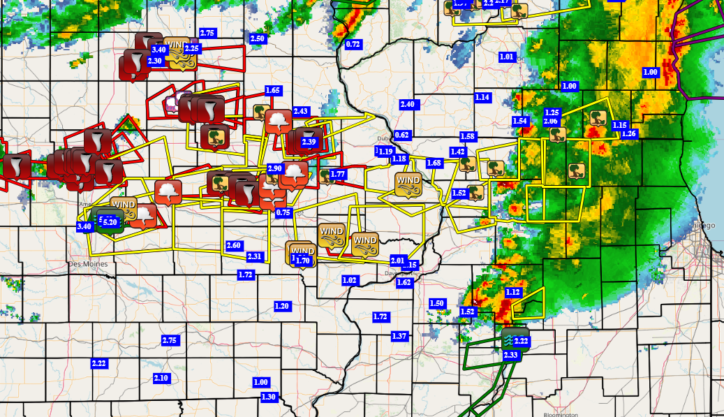
Severe thunderstorms developed ahead of an approaching cold front during the afternoon and evening of Wednesday, July 14. Some of the storms produced damaging winds and several tornadoes, most of which briefly touchdown. Brief torrential rainfall was also observed with the stronger storm cells. The areas that were hit hardest were in Delaware and Jones counties in IA, where a total of 5 tornadoes occurred. An additional 7 tornadoes touched down in eastern IA, with no visible damage reported. Click here for latest Public Information Statement. Click here for KML of tornadoes.
|
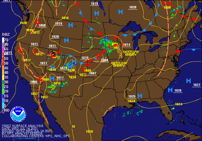 Weather Prediction Center - Surface Map Loop |
Tornadoes:
|
Tornado 1 - 2 SE JAKWAY PARK
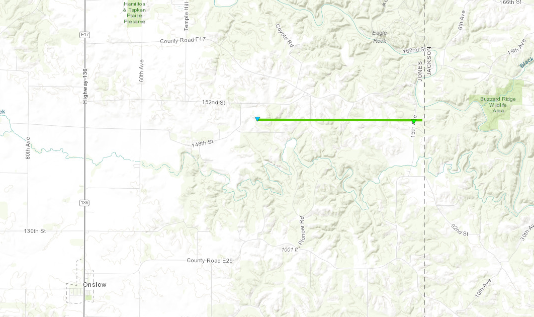
Track Map 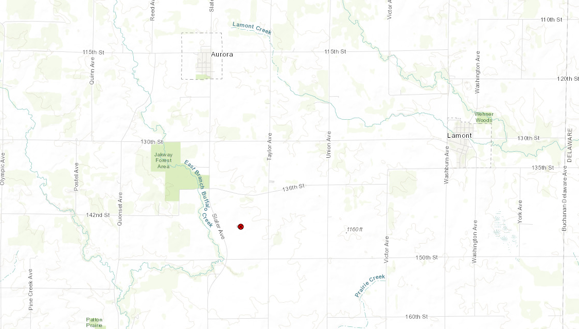 
|
||||||||||||||||
|
Tornado 2 - 4 ENE Dysart
Track Map 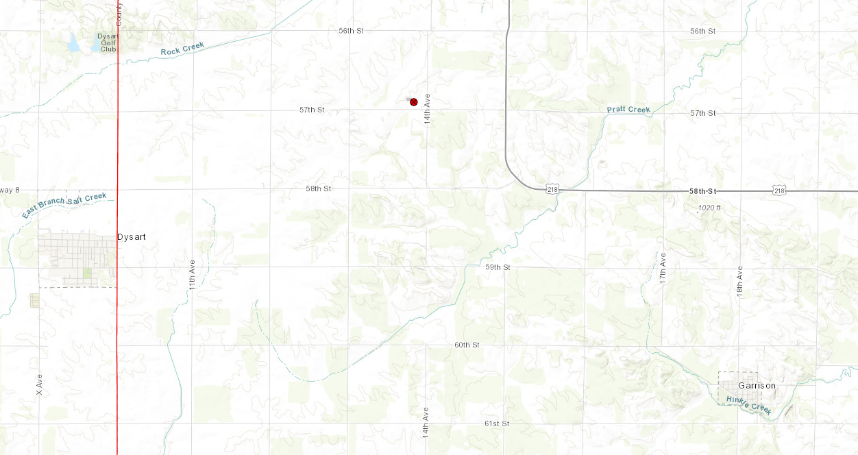
|
||||||||||||||||
|
Tornado 3 - 3 E Garrison
Track Map 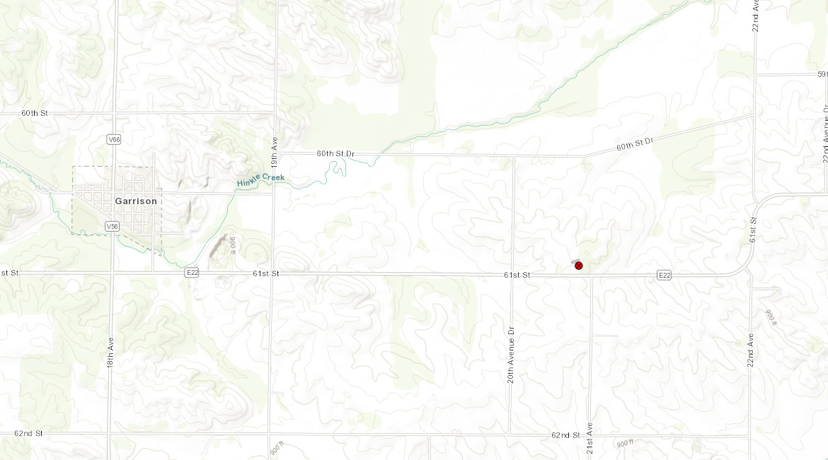
|
||||||||||||||||
|
Tornado 4 - 3 S Coffins Grove Park
Track Map 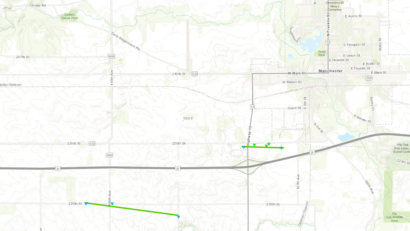
|
||||||||||||||||||||
|
Tornado 5 - 2 SW Manchester
Track Map 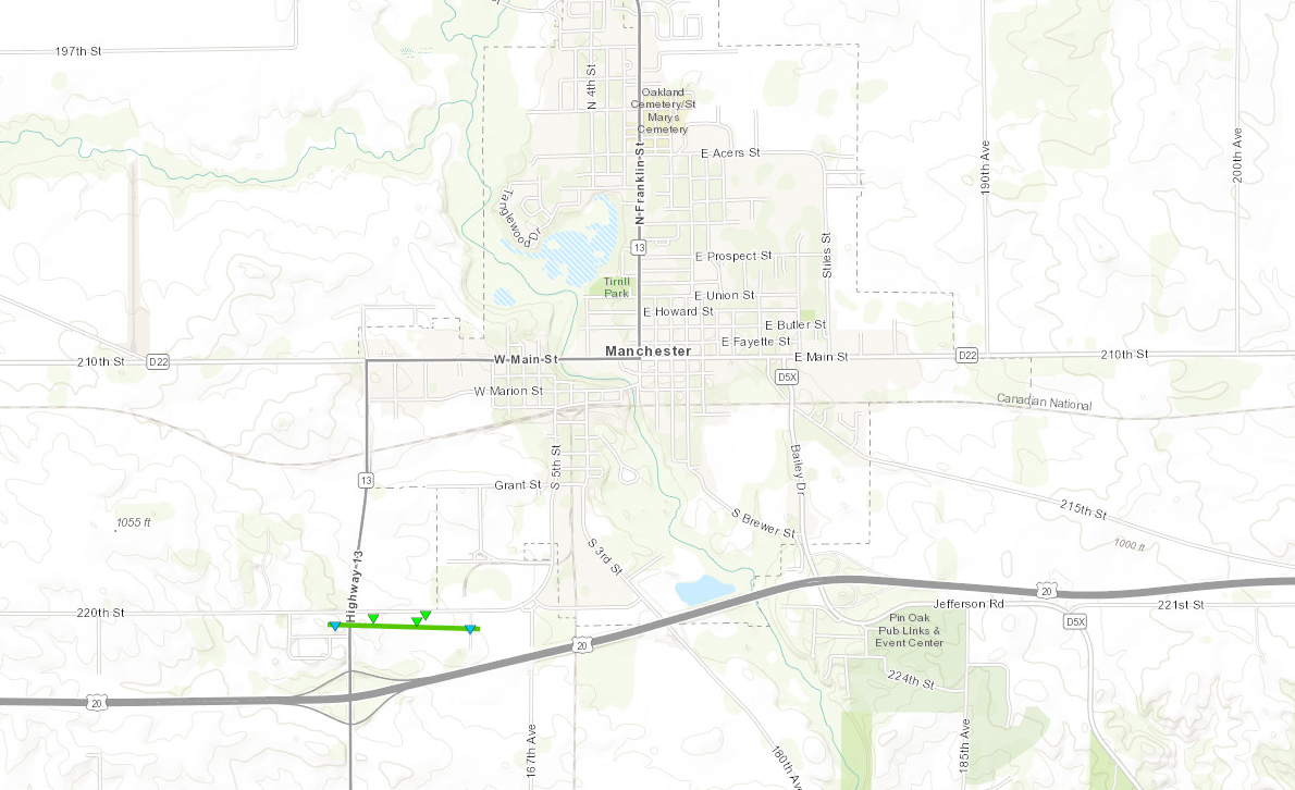
|
||||||||||||||||||||
|
Tornado 6 - 2 SW Benton City Park
Track Map 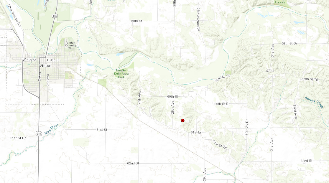
|
||||||||||||||||
|
Tornado 7 - 4 SSW Benton County Fairgrounds
Track Map 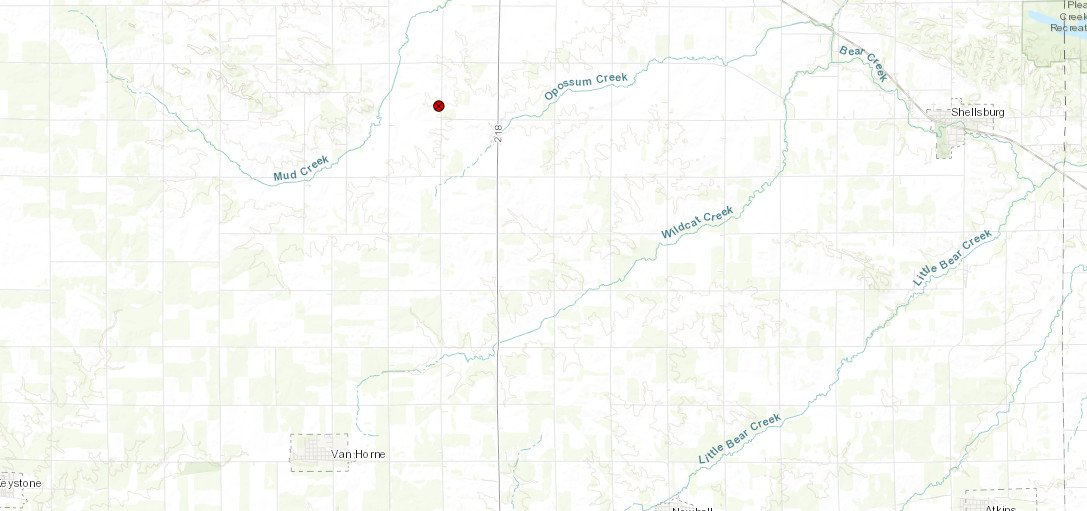
|
||||||||||||||||
|
Tornado 8 - 4 NNE Lafayette
Track Map 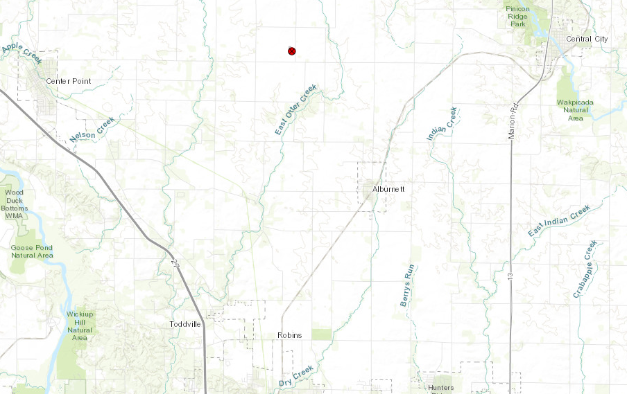
|
||||||||||||||||
|
Tornado 9 - 3 N Center Point
Track Map 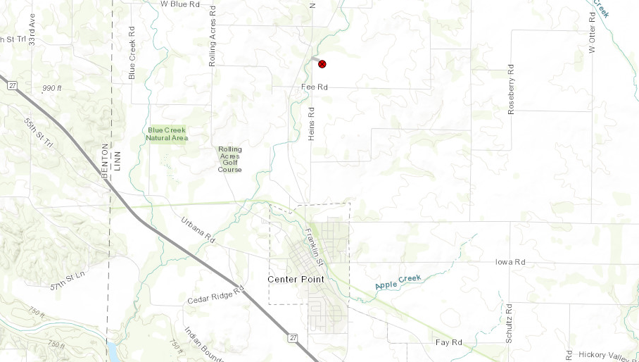
|
||||||||||||||||
|
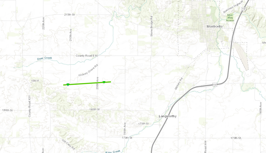
Tornado 10 - 4 WNW Langworthy
Track Map
|
||||||||||||||||||||
|
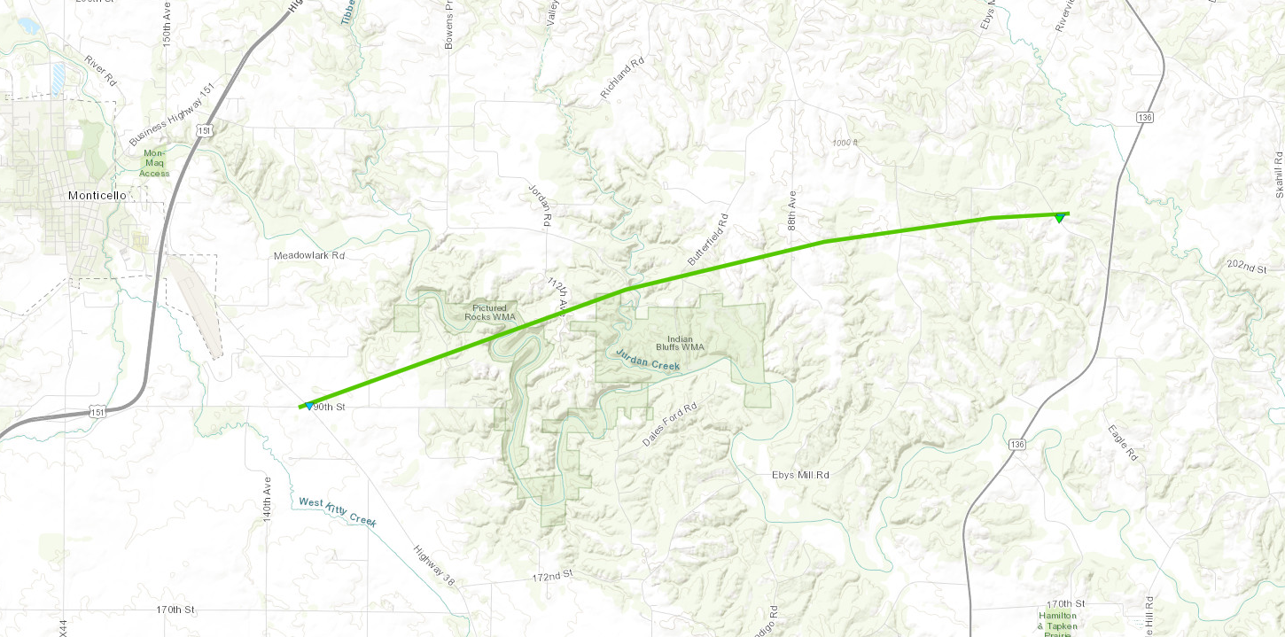
Tornado 11 - 1 WSW Pictured Rocks Wildlife Area
Track Map
|
||||||||||||||||||||
|
Tornado 12 - 3 WSW Canton
Track Map
|
||||||||||||||||||
The Enhanced Fujita (EF) Scale classifies tornadoes into the following categories:
| EF0 Weak 65-85 mph |
EF1 Moderate 86-110 mph |
EF2 Significant 111-135 mph |
EF3 Severe 136-165 mph |
EF4 Extreme 166-200 mph |
EF5 Catastrophic 200+ mph |
 |
|||||
Rain Reports
 |
||||
|
||||
Environment
SPC Event Archive
| Outlook | Tornado |
 |
 |
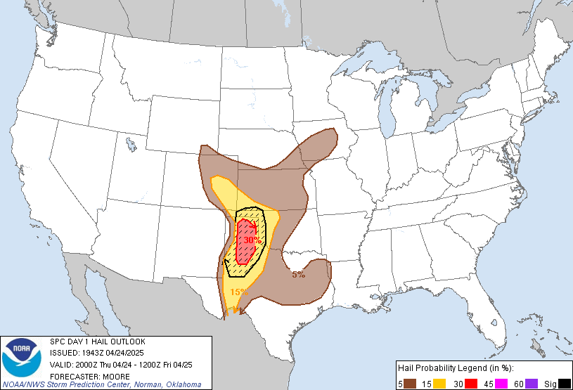
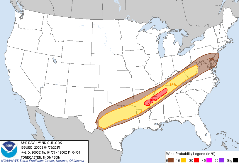
| Hail | Wind |
 |
 |
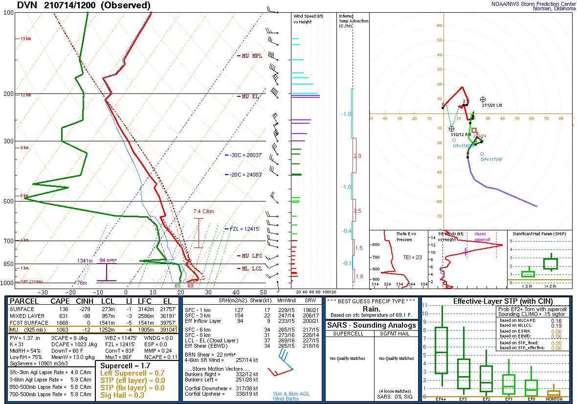
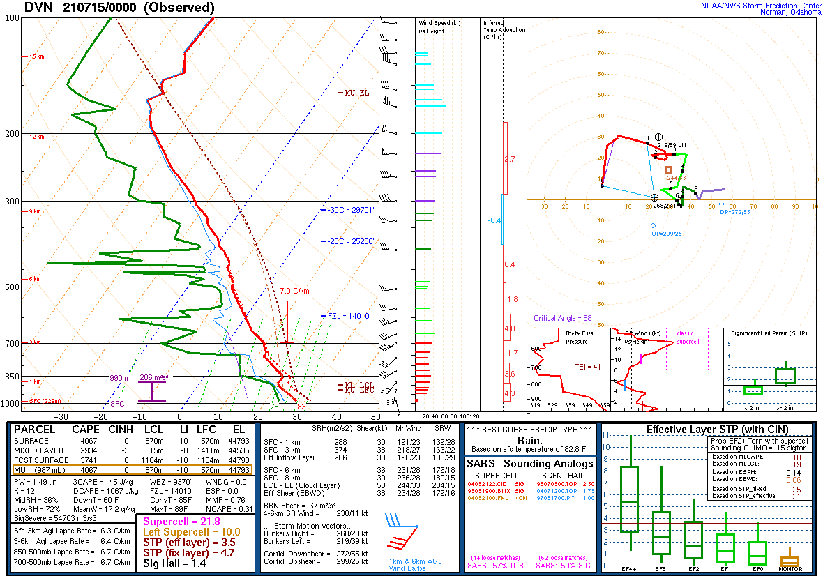
| 7am DVN Sounding | 7pm DVN Sounding |
 |
 |
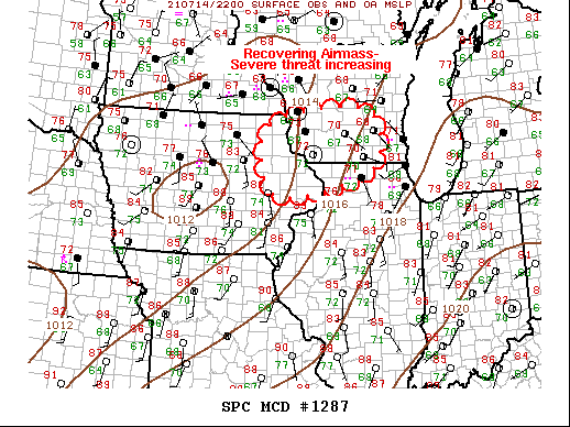
| 1287 | 1288 |
 |
 |
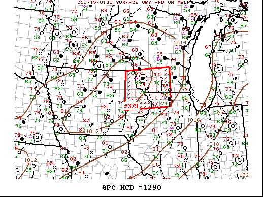
| 1289 | 1290 |
 |
 |
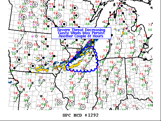
| 1291 | 1292 |
 |
 |
Excerpt from the early morning Area Forecast Discussion on July 14.
.SHORT TERM...(Today through Thursday)
ISSUED AT 210 AM CDT Wed Jul 14 2021
[Key Messages]
*Threat for severe thunderstorms today and Thursday as cold front
and shortwave slowly move through the area
*All severe hazards possible including torrential rainfall
which could produce flash flooding
[Discussion]
A busy short term period is expected across all of eastern Iowa,
northwest Illinois, and far northeast Missouri. Showers and storms
currently in place from South Dakota to Nebraska will work their way
east, eventually finding their way to northeast Iowa, southeast
Minnesota and southwest Wisconsin. These should be elevated for the
majority of the duration as they feed off off a fairly potent and
moisture filled eastward moving 30-40 kt LLJ.
These storms are progged by the CAMs to reach that area during the
midday hours (11am-2pm), and should have decent coverage to them as
the LLJ is forecast to not lose too much strength despite the
increasing daytime heating. Storms are likely to impact areas mainly
along and north of the Hwy 20 corridor before eventually moving out
of the area by the mid-afternoon. These could become strong as they
move into an area untapped with some heating and become surface
based, but this threat is likely to remain more into southwest
Wisconsin. This activity should leave an outflow boundary behind
across the area, which will be the focus for additional storm
development during the late afternoon and evening.
While clouds are expected to increase across the area thanks to the
morning convection, they should not pose much of a hindrance to
afternoon/evening development. This is due to the approaching
shortwave in northwest flow aloft, with some pockets of CVA due to
move into the area during this time frame. Forecast soundings show
mid-level lapse rates steepening in response to the approaching
shortwave, and when combined with added convergence from the remnant
outflow boundary, approaching surface front and deepening surface
low moving into Iowa this should be enough to induce late afternoon-
evening storm development.
Think where that outflow boundary sets up will be crucial to where
severe weather is most favored across our area. As is typical in
most of these situations, CAMs are not in good agreement on
placement of the late afternoon/evening formation in the latest runs
due to disagreements on handling of the morning MCS activity. But
there are a couple of potential scenarios:
1) There is a signal in some CAMs that the outflow boundary sets up
around the Hwy 20 to Hwy 30 corridor, in a zone that will be
relatively uninterrupted by morning storms. If this were to hold,
potential would be there w/ the increased convergence of discrete
storms to start (latest runs of the HRRR showing this potential).
Surface instability forecast to climb into 2000-3000 J/kg range with
increasing shear due to the approaching shortwave and LLJ would
favor all severe hazards to start. Eventually, developing storms
would merge and pose more of a damaging wind and torrential rain
threat into the evening hours as cold pool processes take over.
2) With the deepening low pressure to our west, there is an added
option that the leftover outflow boundary gets shunted back north by
strengthening southerly flow near to or just north of the Hwy 20
corridor. This would favor more discrete storms and the favored
tornado/hail threat back into northern and northeast Iowa, with our
area more likely to be impacted by damaging winds and torrential
rain during the late evening. This is the scenario I'm leaning
more towards with this package.
Therefore, much of today's severe threat is deeply tied to the
mesoscale and will likely undergo more changes as the morning
progresses. As of early this morning, the Storm Prediction Center
maintains a Level 3 (enhanced risk) for severe thunderstorms
generally along and north of Hwy 30, with a Level 2 (slight risk)
north of a line from Sigourney IA to Dixon IL.
Eventually, the severe threat should wane overnight as precip
transitions into a more typical MCS setup for the area. Activity
should focus more on the convergence zone of the LLJ and southward
moving cold front, which is forecast to reach the northwest CWA
during the early morning Thursday. The threat will then turn to
torrential rain, as the added convergence of the LLJ/front a
moisture filled PWAT feed from the south focus on the area.
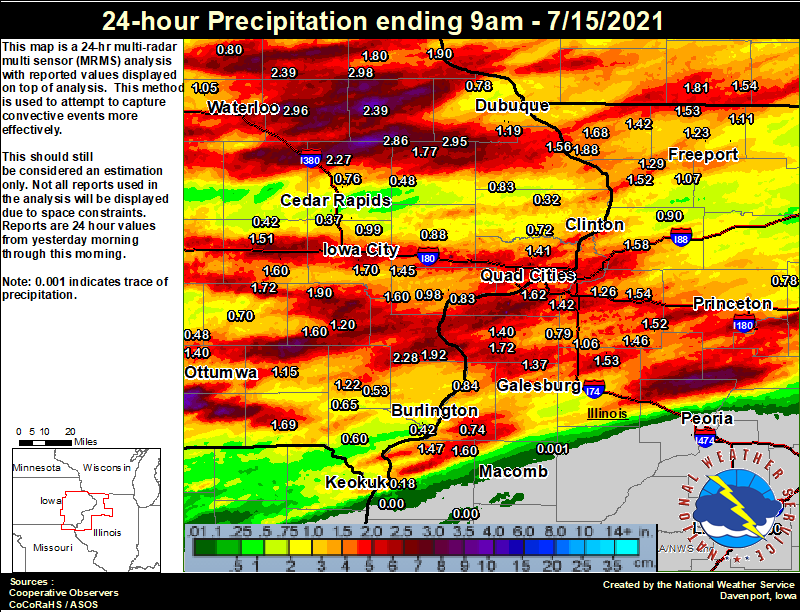
There is good news and bad news. The good news, is that area FINALLY
gets some needed rain. However, it's going to be falling all at once
and quickly, given the deep warm cloud depths and high amount of
moisture. Because the soil is hard and not as permeable due to the
drought conditions, there is likely to be more runoff than not,
making for a higher potential for flash flooding concerns. This is
reflected well in the WPC excessive rainfall outlook, which paints
areas north of I-80 in a Level 2 (slight risk). Given CAM
uncertainty of where the favored convergence zone sets up, decided
against a flash flood watch for the level 2 area at this time.
However, this will be further analyzed later.
|
|
 |
Media use of NWS Web News Stories is encouraged! Please acknowledge the NWS as the source of any news information accessed from this site. |
|