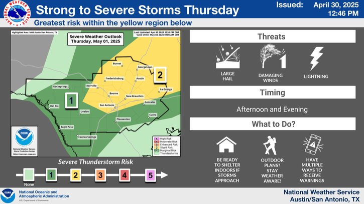
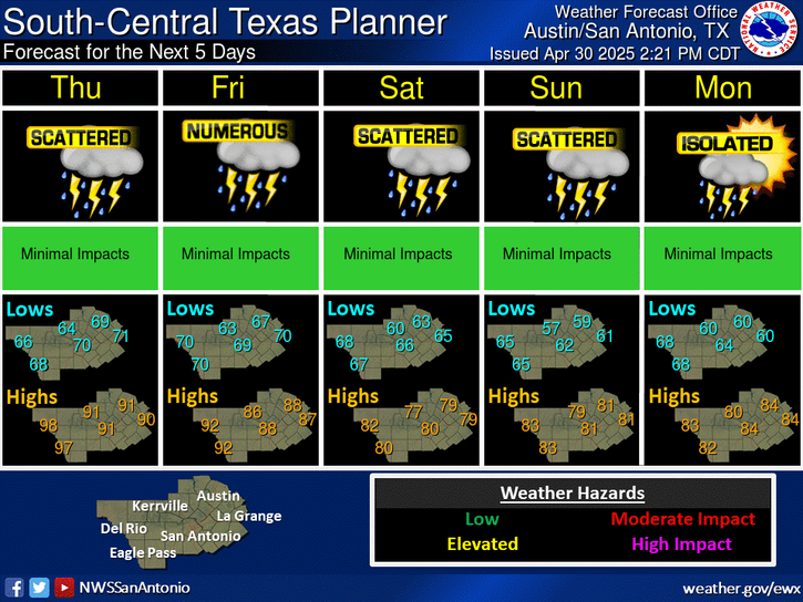
Scattered showers and an isolated storm will linger through this evening, with activity expected to decrease during the overnight hours. It will remain warm and humid with lows in the 60s and low 70s and light south-southeasterly winds of 5 to 15 mph.
Warm and humid conditions persist through much of next week. Daily highs will stay mostly in the 80s, climbing into the 90s for some areas on Thursday and Friday. Low-to-medium rain chances are possible early to mid-week before a slightly cooler airmass arrives late next weekend in addition to increased chances for rain.


 Austin/San Antonio Radar
 Weather Map
 Satellite Imagery
 Del Rio Radar
 Digital Forecast Map
 Tropical Outlook
 Drought Status
 Air Quality
 Fire Weather Forecasts
 Observed Rainfall
 Observed Temperatures
 Daily Climate Graphs