Even as dry weather returns to the forecast, it is critical to remain away from elevated creeks, rivers, and standing waters after our recent flooding over the past several days. These areas continue to present a serious public safety risk, as deep or stagnant water can conceal active, invisible hazards capable of causing severe illness, injury, or death. Hidden dangers include displaced animals and stinging insects, active live wires, harmful bacteria, toxic chemicals, raw sewage, and sharp submerged objects or debris.
Expect a warm and humid night across South-Central Texas with overnight low temperatures settling into the low to mid 70s. Cloud cover will steadily increase across the region overnight and persist into early Saturday morning. The vast majority of the area will remain completely dry, with the sole exception being a very low chance of a brief, light shower over mostly rural portions of Val Verde County.
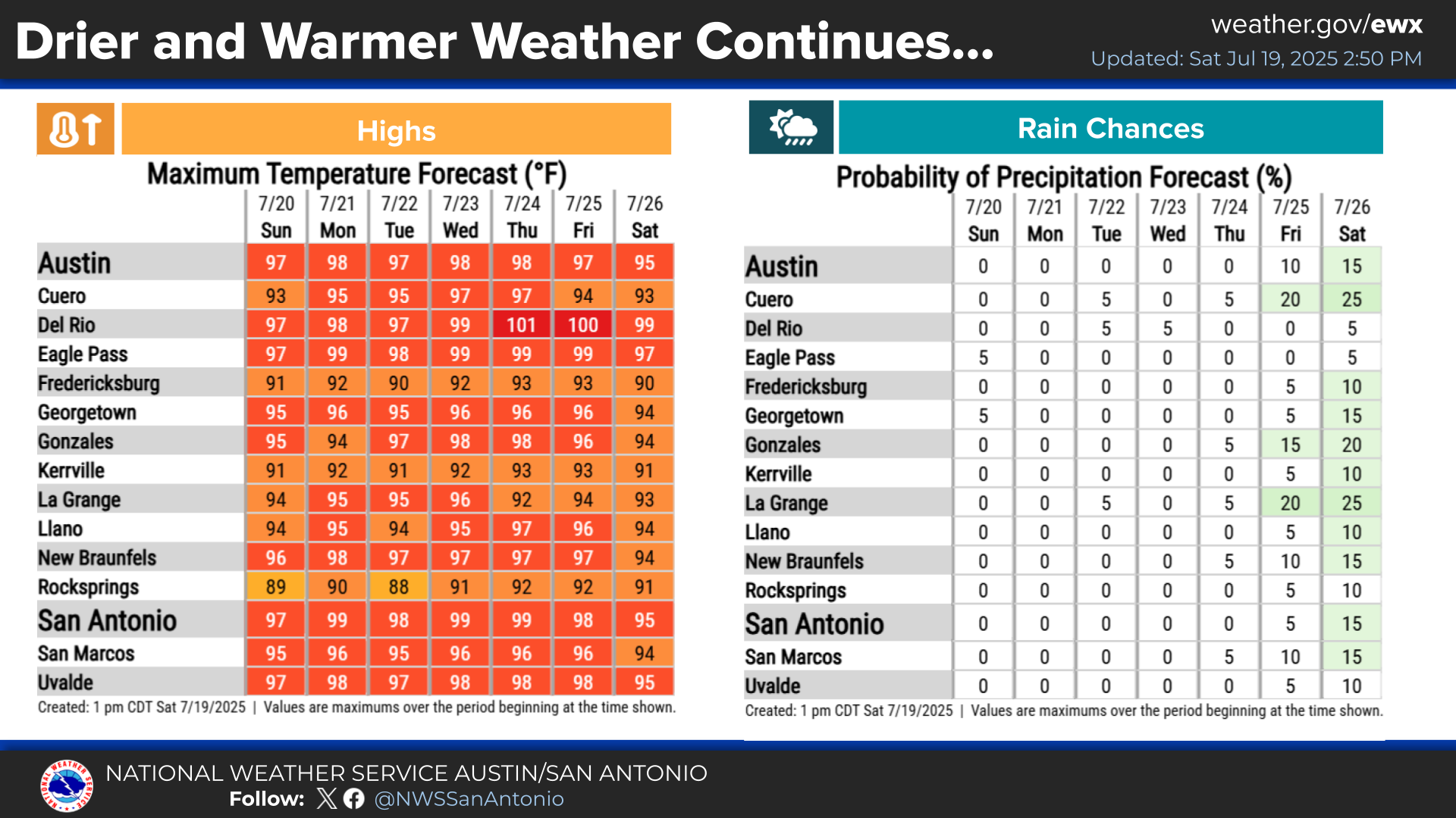
A return to typical summer heat and generally rain-free weather is locked in for the upcoming week, spanning Saturday, July 18 through next Friday, July 24. High temperatures will be in the 90s for most. Rain probabilities drop to 0 to 5% region-wide for almost the entire period, signaling a hot and dry weather pattern.


 Austin/San Antonio Radar
 Weather Map
 Satellite Imagery
 Del Rio Radar
 Digital Forecast Map
 Tropical Outlook
 Drought Status
 Air Quality
 Fire Weather Forecasts
 Observed Rainfall
 Observed Temperatures
 Daily Climate Graphs