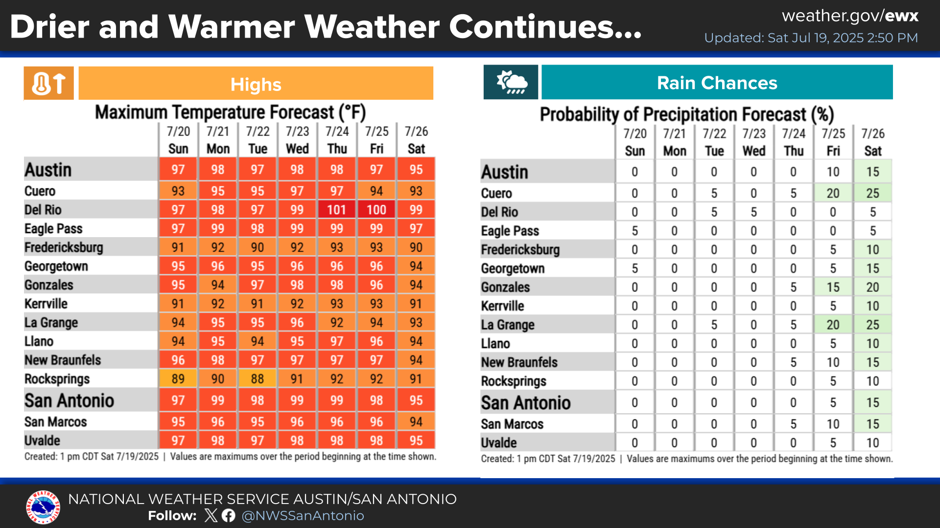
Summer heat is ramping up across South-Central Texas heading into August. Expect highs reaching 100 to 103 degrees and peak heat index values climbing between 105 and 110 degrees for many areas late this week and weekend. Overnight lows will remain warm in the 70s to low 80s.


 Austin/San Antonio Radar
 Weather Map
 Satellite Imagery
 Del Rio Radar
 Digital Forecast Map
 Tropical Outlook
 Drought Status
 Air Quality
 Fire Weather Forecasts
 Observed Rainfall
 Observed Temperatures
 Daily Climate Graphs