| Previous Month | Next Month |
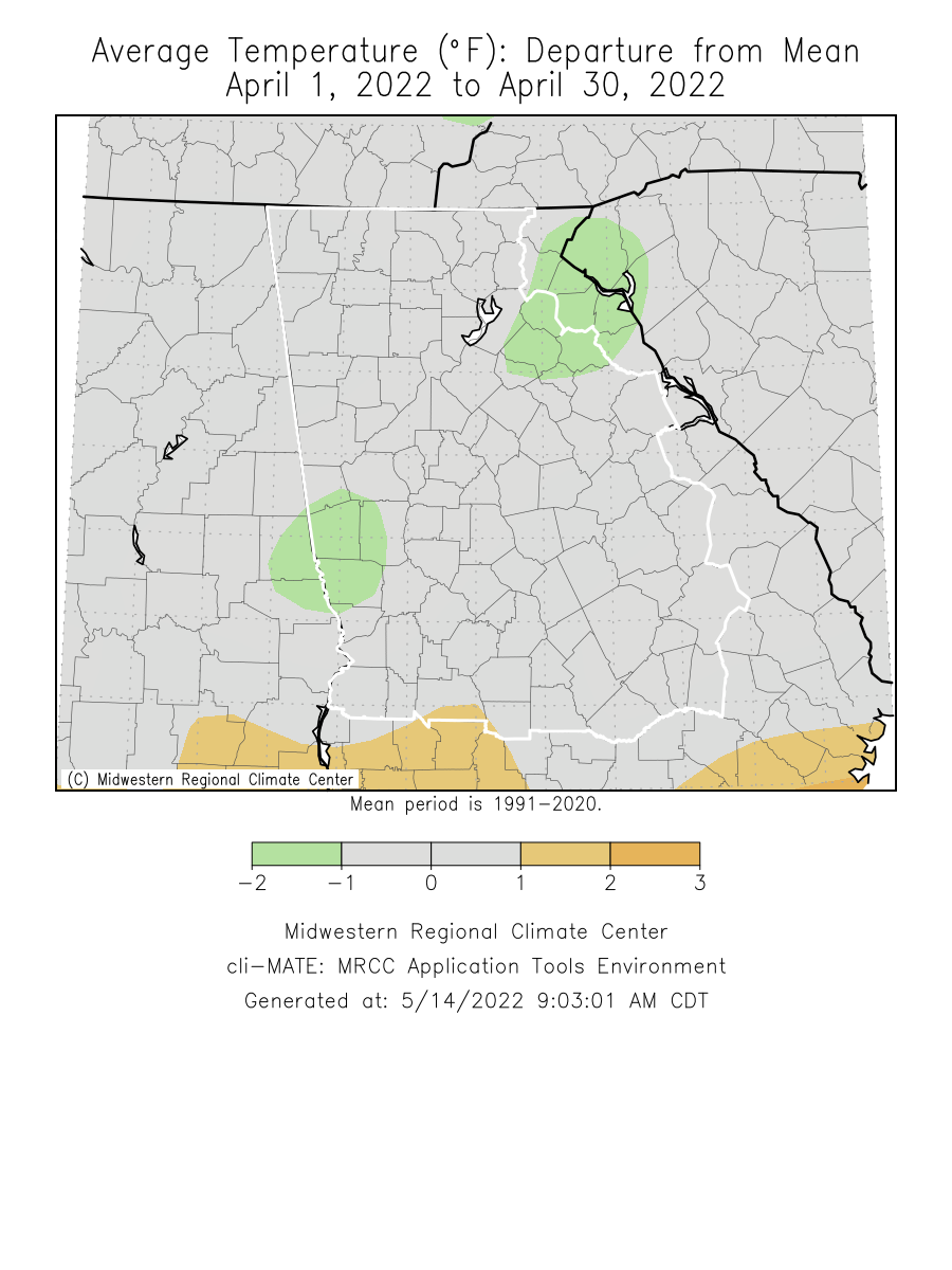
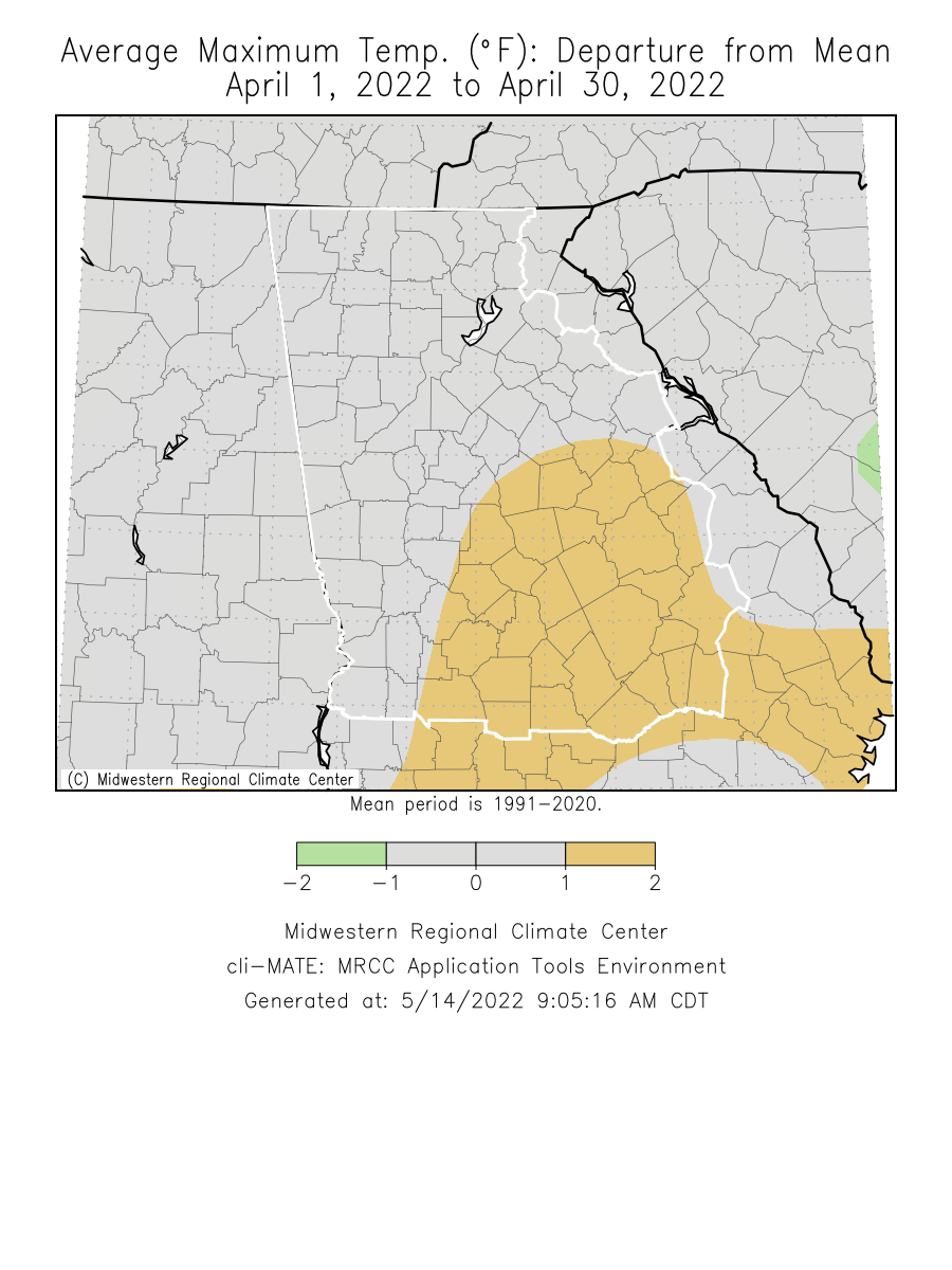
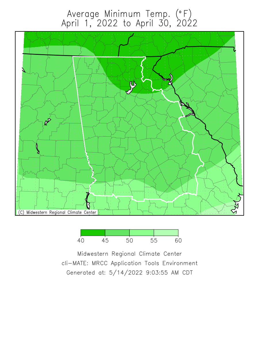
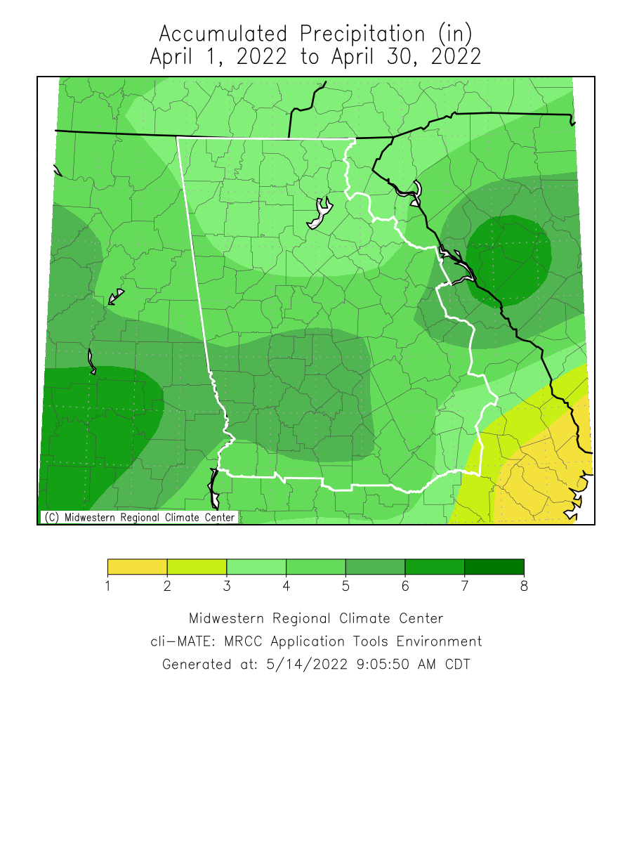
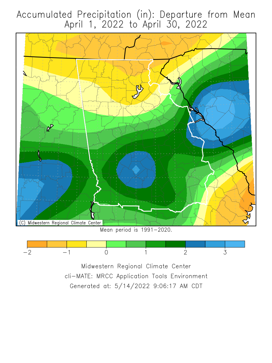
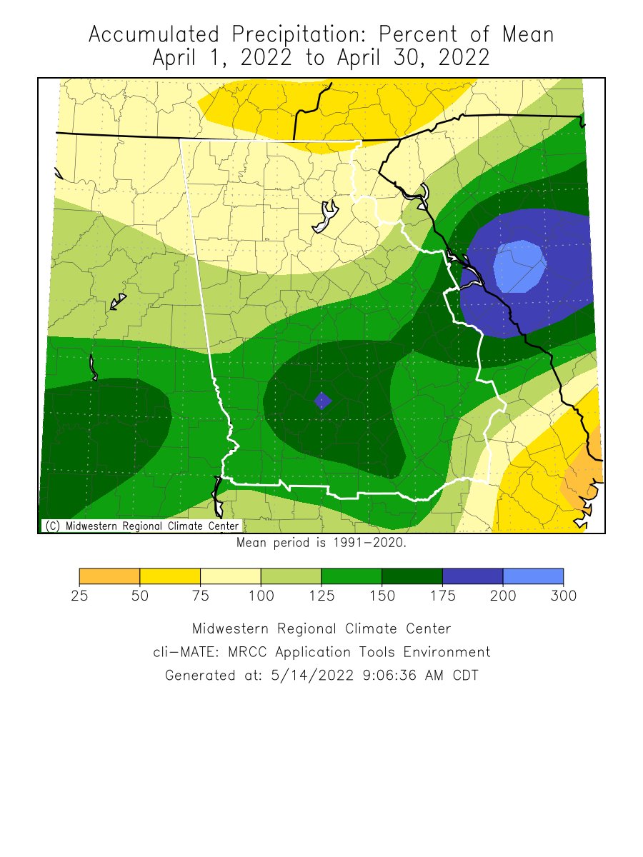
Temperatures through the month of April were within 1 degree of normal. Precipitation through the month of April was around half an inch above normal.
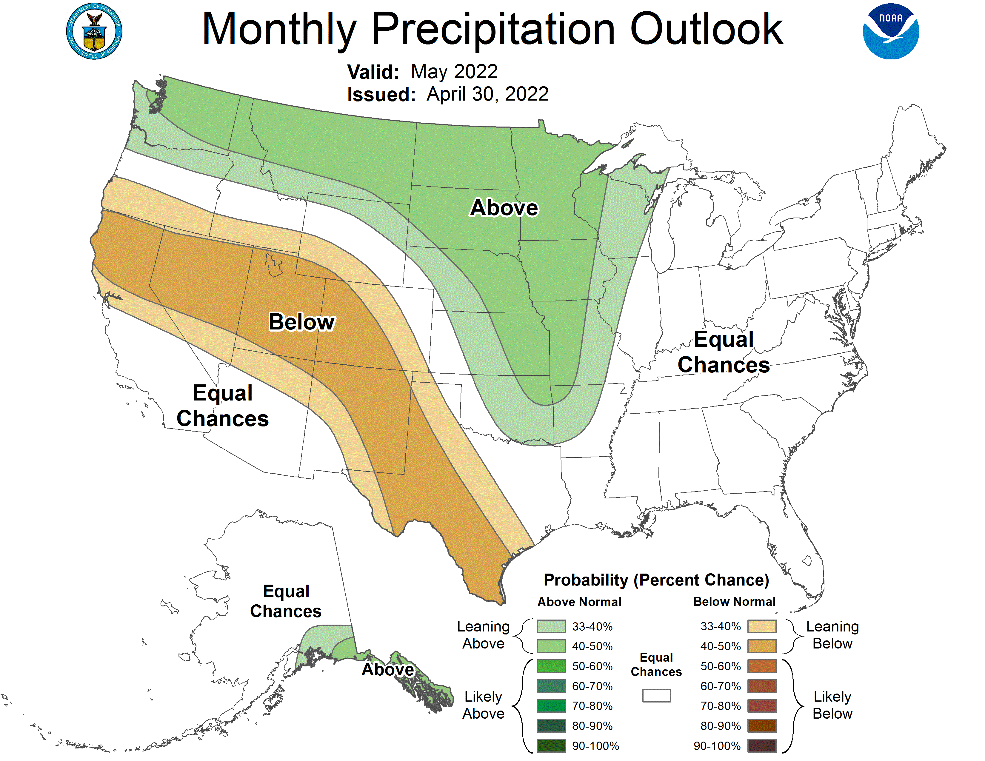
Climate Site Maximum Temperature Max T Date Climate Site Total Precipitation DFN (Departure Climate Site Maximum Daily Precip (in inches) Maximum Precip Date *Indicates a daily record was set Data prepared by NWS Peachtree City/Atlanta April 5-6 Severe Weather Outbreak April 5th: A moist and unstable airmass brought widespread severe thunderstorms to central Georgia with damaging winds and tornadoes commonplace. Fifteen tornadoes occurred during the afternoon and evening hours of April 5th across central Georgia. While most tornadoes were EF-0 to EF-1 intensity, the strongest were an EF-2 tornado in Dooly County and an EF-3 tornado in Houston County. Fortunately, no serious injuries or deaths occurred. April 6th: Out ahead of an approaching cold front, warm humid air caused widespread destabilization again during the afternoon of April 6th. Scattered reports of large hail and damaging wind gusts occurred through the afternoon and evening. Additionally, six more tornadoes of EF-0 and EF-1 intensity occurred in central Georgia. A cold front on the night of April 6th finally put an end to the severe weather threat. For more information on this outbreak, please visit our event page. Based on the Climate Prediction Center's outlook for May, North Georgia has a 33% to 40% chance for above normal temperatures while central Georgia has a 40% to 50% chance for above normal temperatures. For precipitation, all of Georgia has an equal chance for above or below normal precipitation. Data prepared by NWS Peachtree City/Atlanta
Overview
Climate Graphics
Records
Events
May Outlook
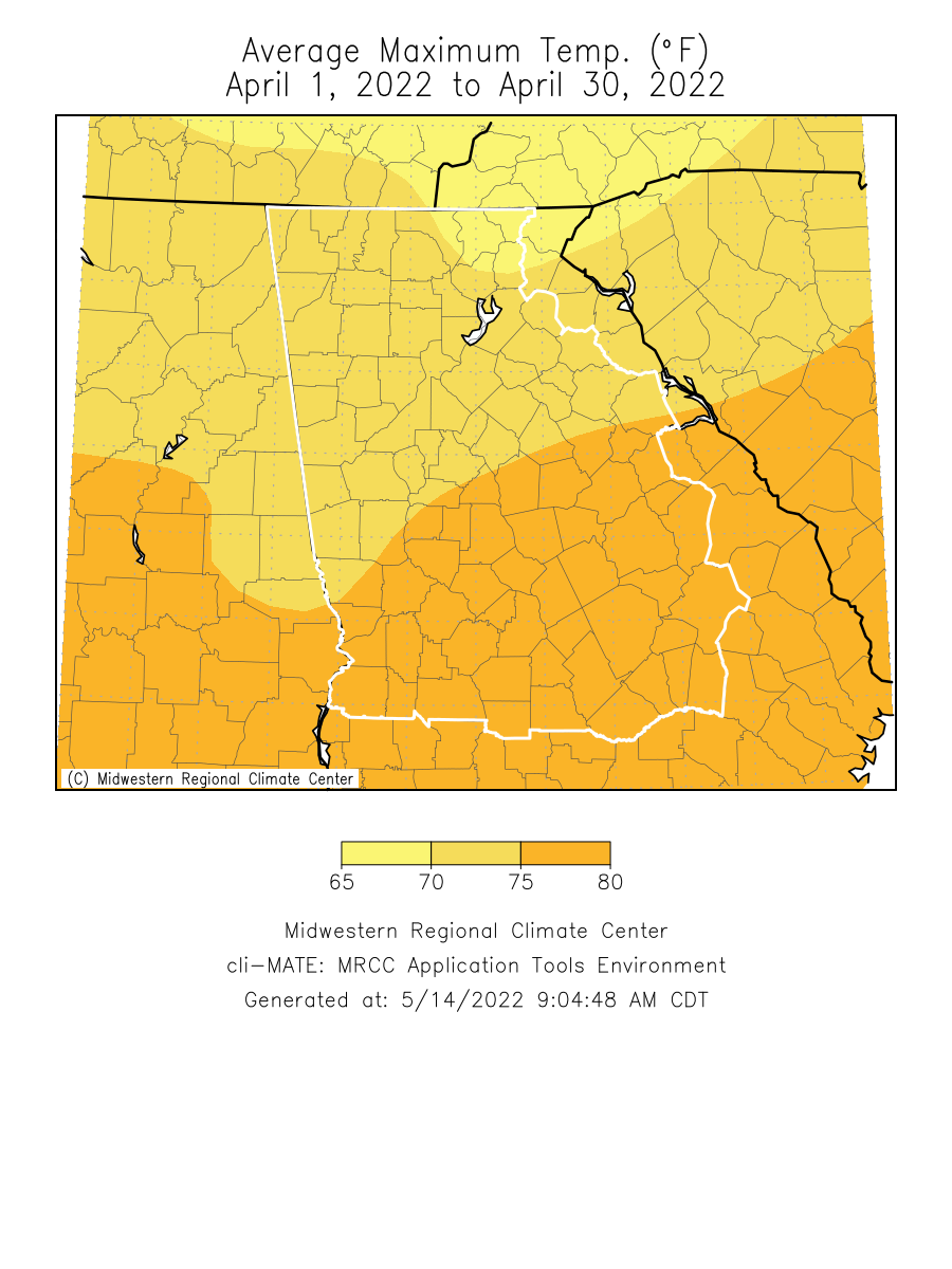
Below are the overview stats for April 2022 for our 10 climate sites.
April 2022 Climate Averages
Climate Site
April Temp (°F)
Average Temp
Departure from normal
61.3
62.3
-1.0
63.2
63.2
0.0
64.7
65.8
-1.1
63.9
64.5
-0.6
60.4
60.2
0.2
59.6
60.9
-1.3
61.0
61.7
-0.7
60.7
60.9
-0.2
61.7
62.4
-0.7
61.6
61.4
0.2
April 2022 Temperature Climate Statistics
Minimum Temperature
Min T Date
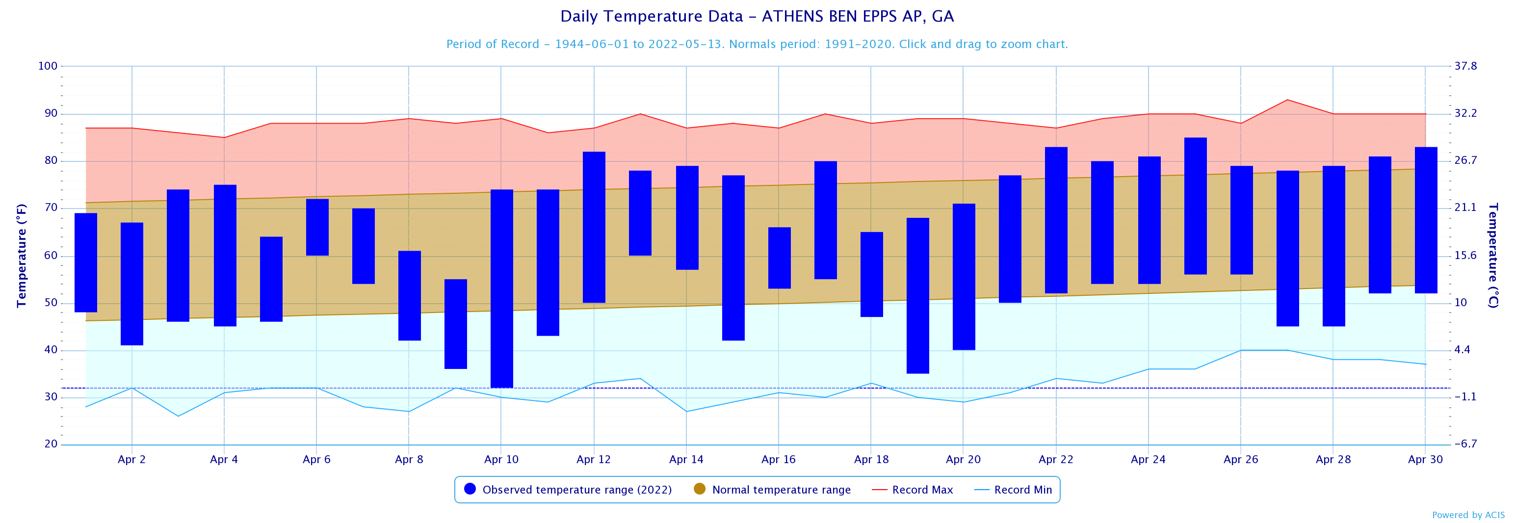
Athens
85
4/25
32
4/10
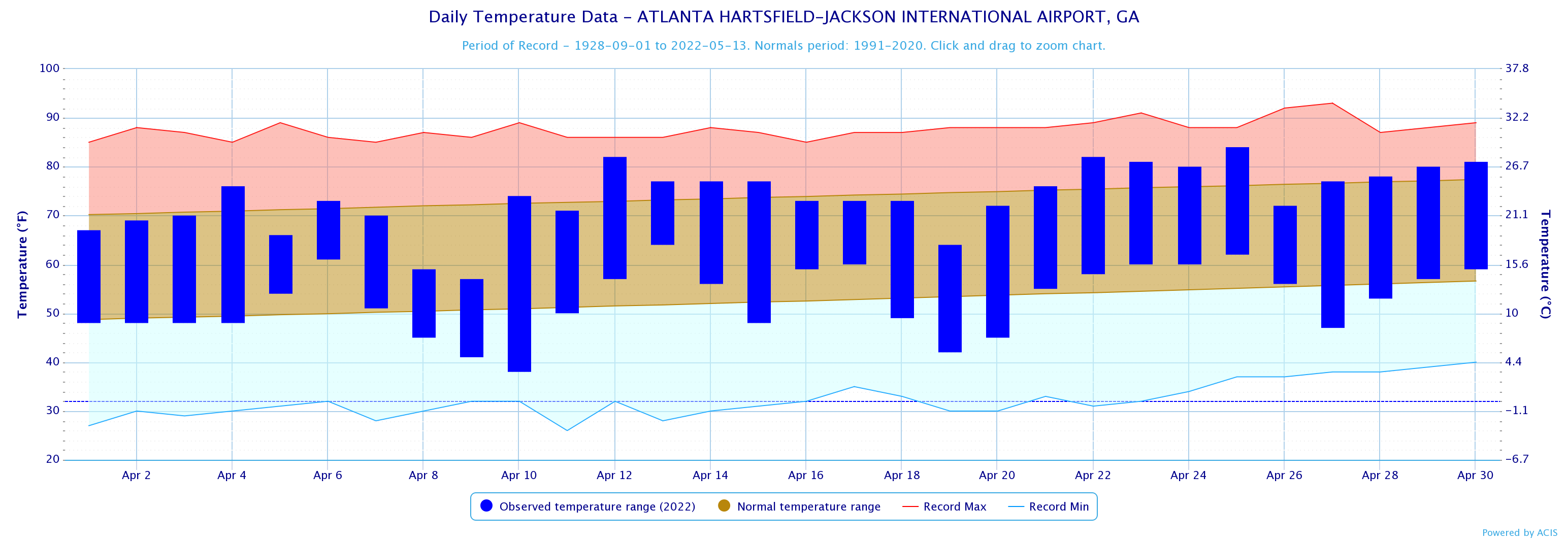
Atlanta
84
4/25
38
4/10
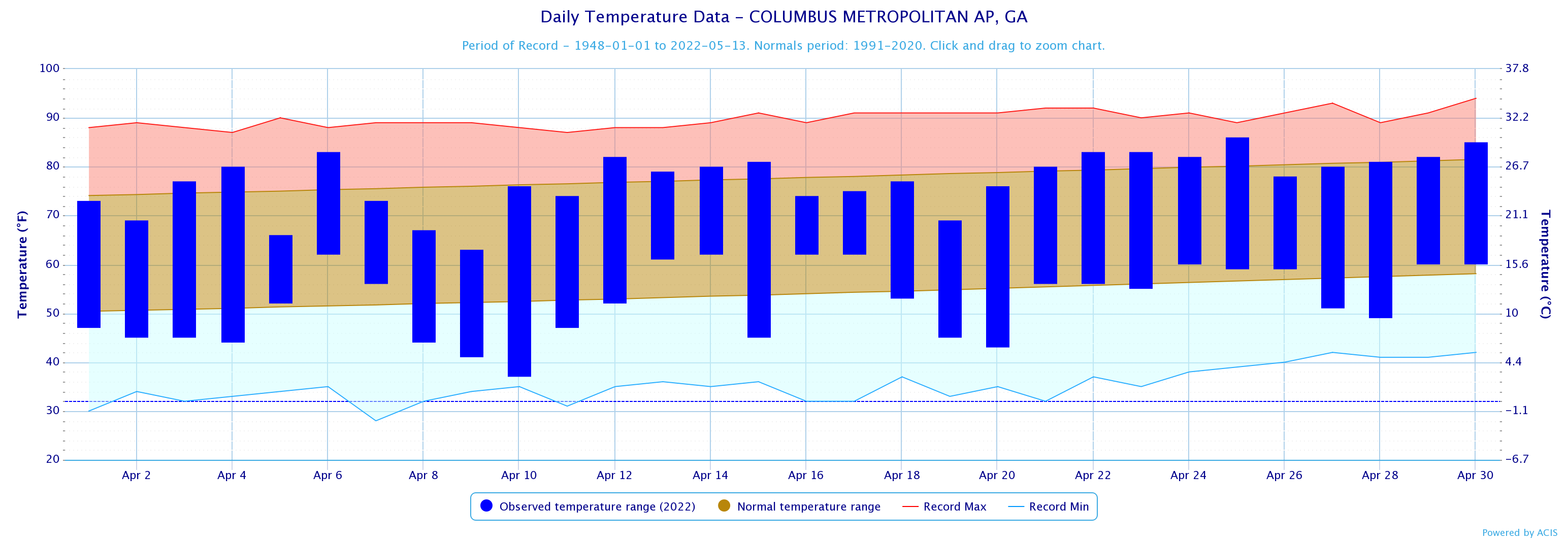
Columbus
86
4/25
34
4/10
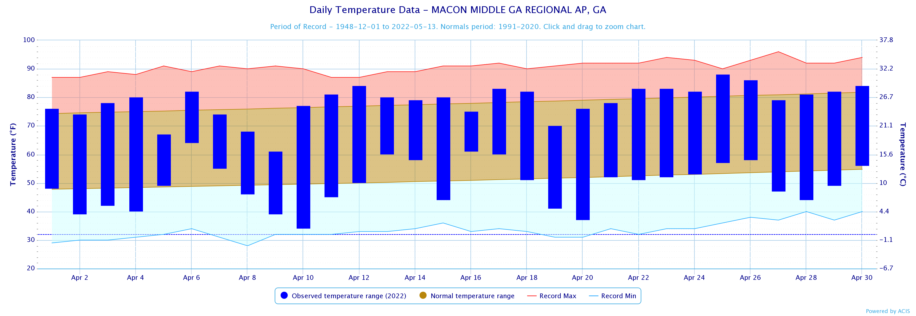
Macon
88
4/25
34
4/10
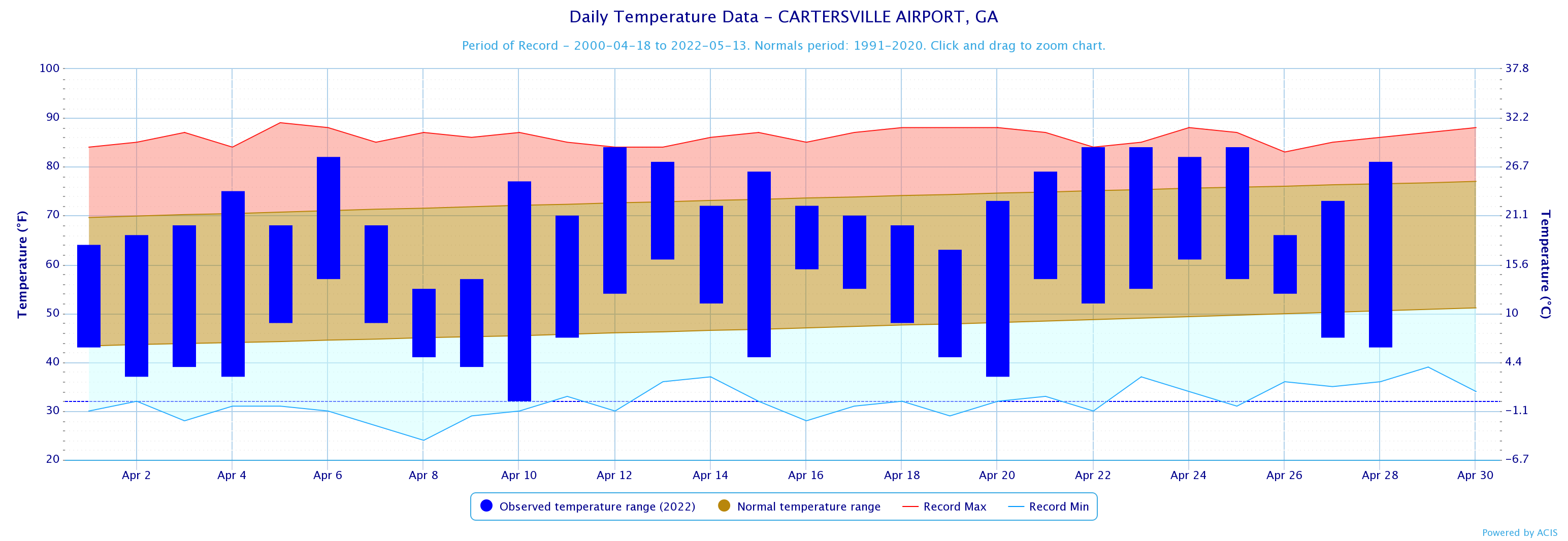
Cartersville
84
4/25
32
4/10
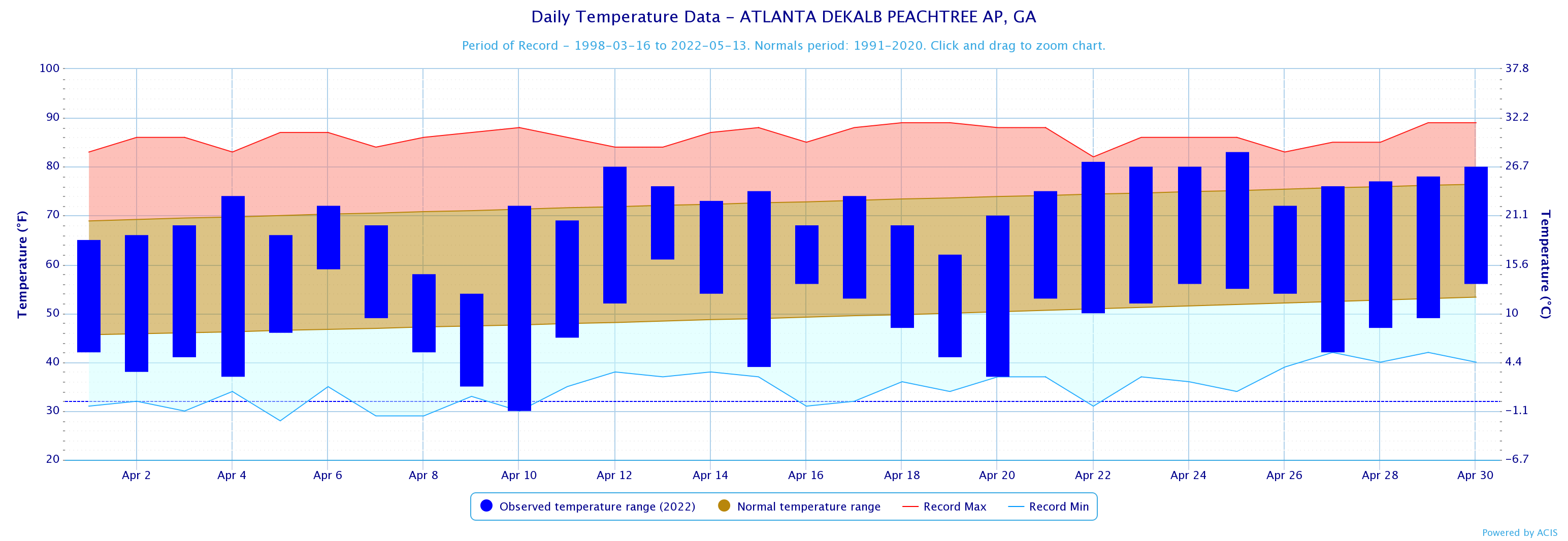
Dekalb Peachtree Arpt
83
4/25
30
4/10
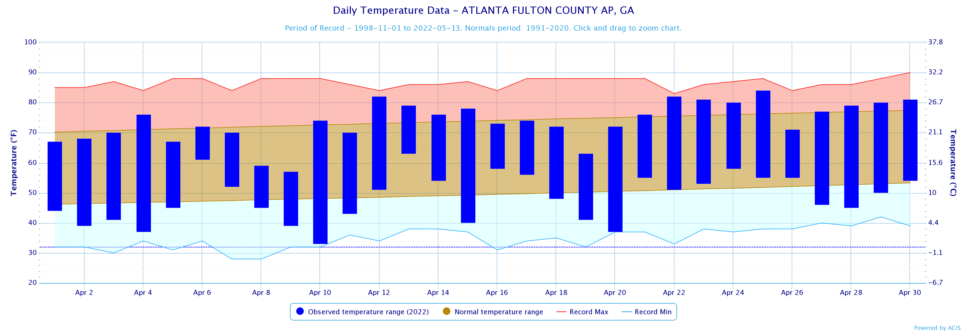
Fulton Co Arpt
84
4/25
33
4/10
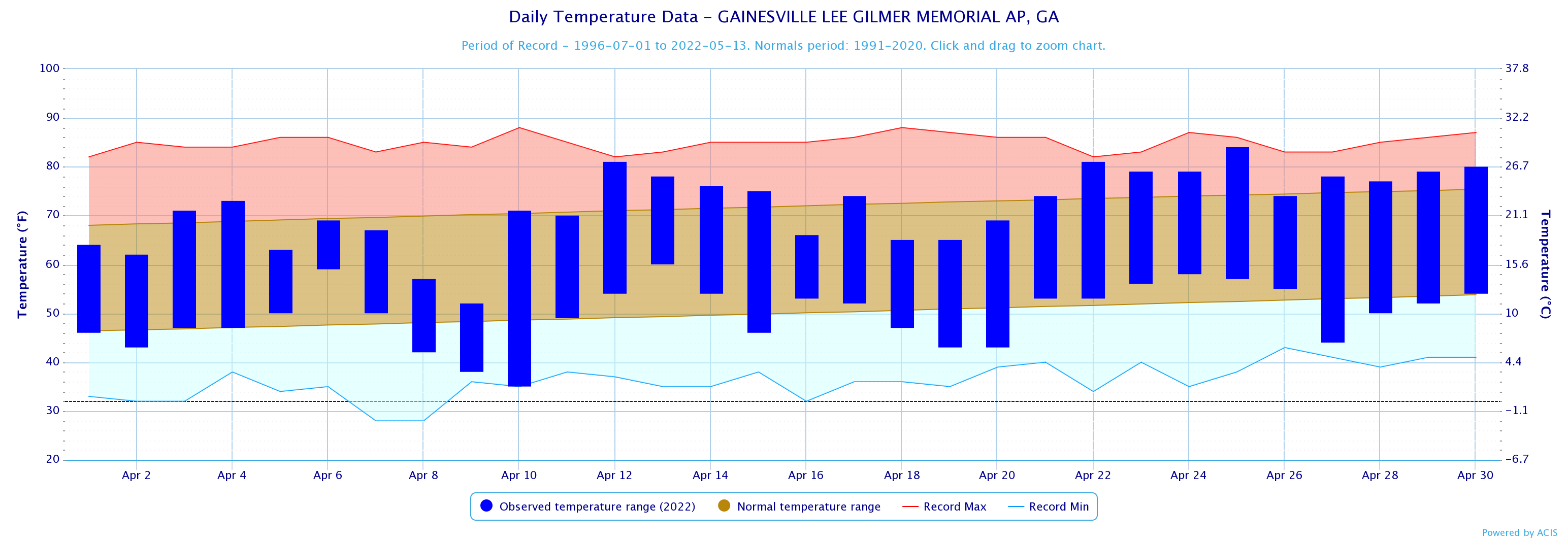
Gainesville
84
4/25
35
4/10
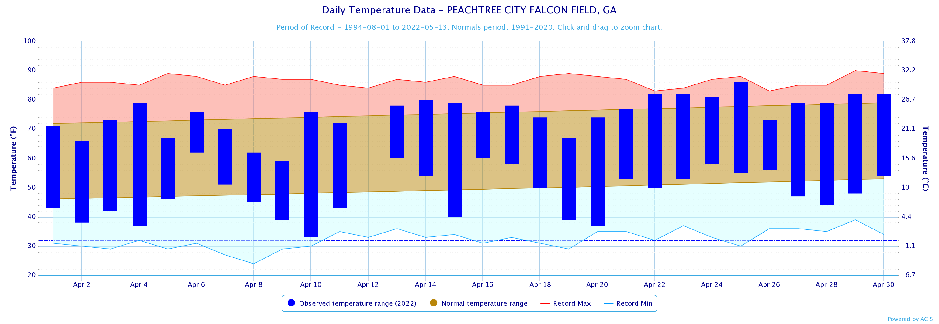
Peachtree City
86
4/25
33
4/10
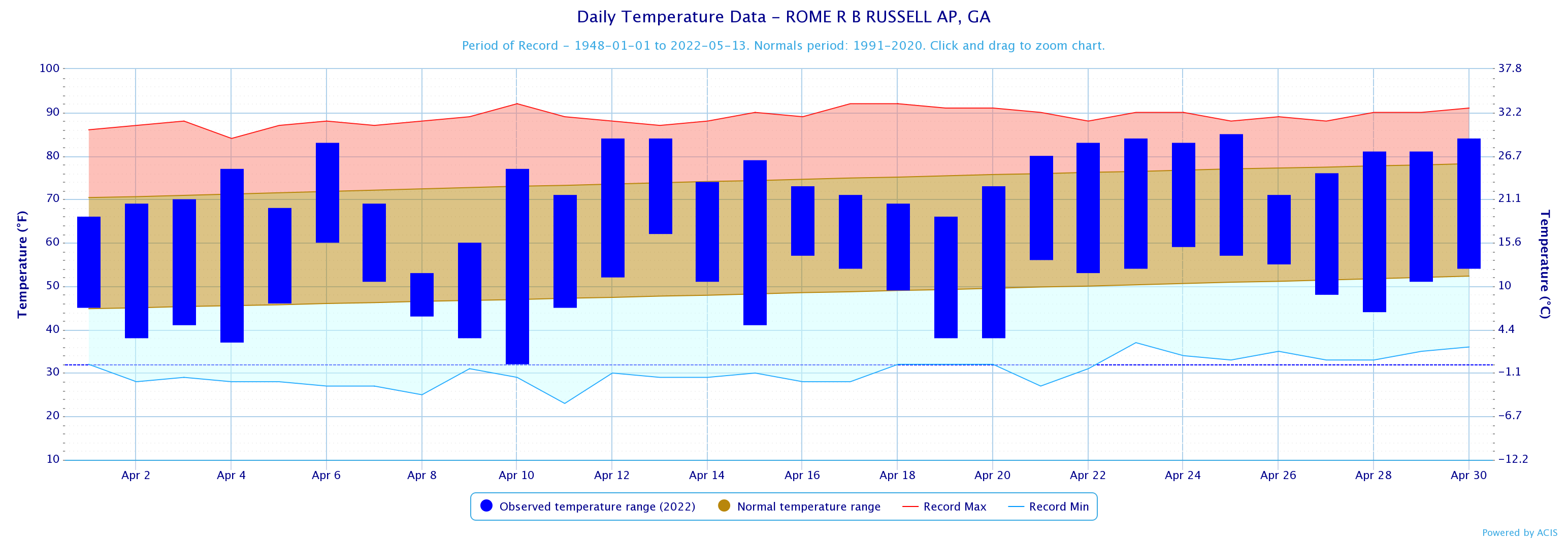
Rome
85
4/25
32
4/10
April 2022 Precipitation Climate Statistics
Average Precipitation
From Normal)
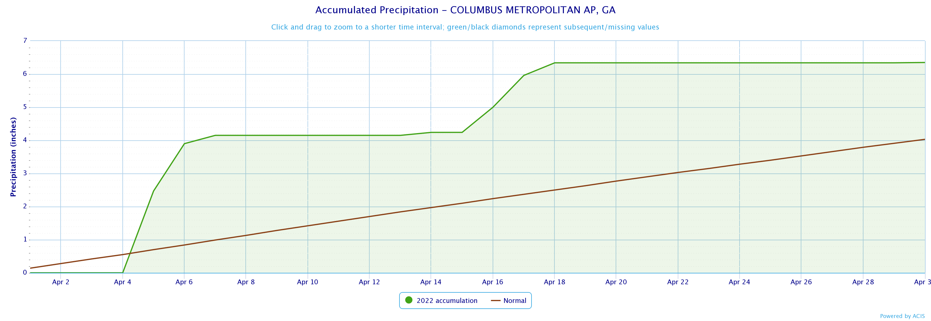
2.92
3.52
-0.60
4.36
3.81
0.55
6.35
4.03
2.32
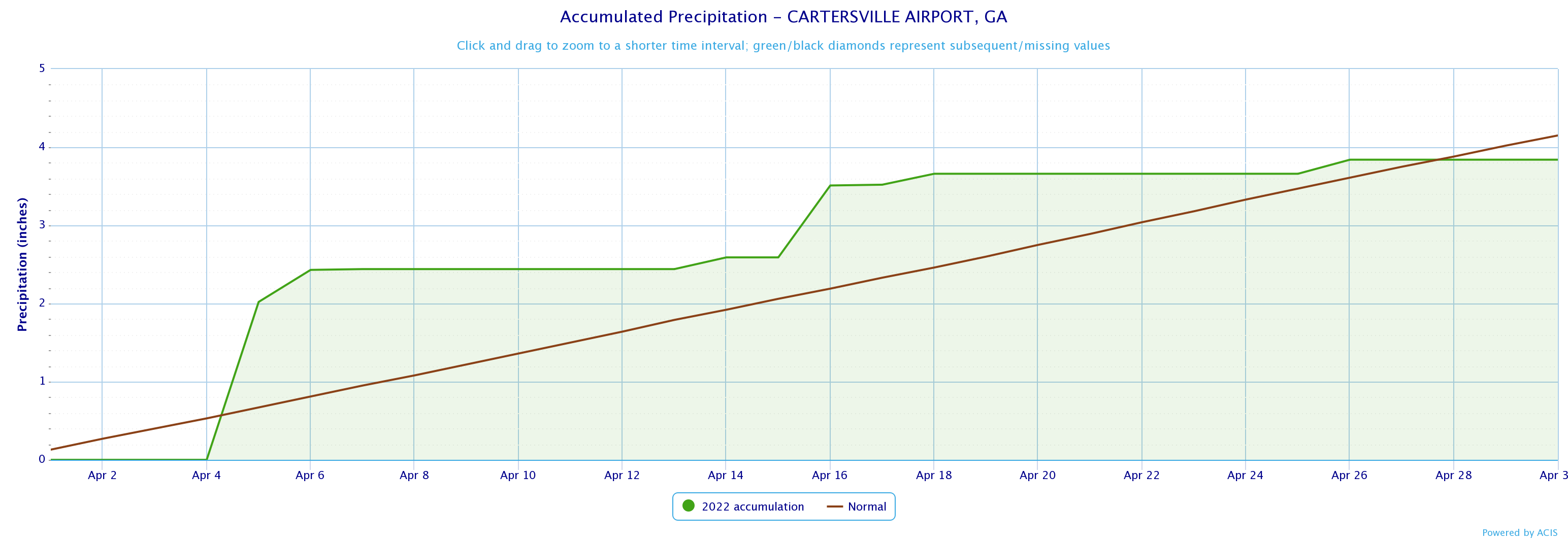
6.01
3.62
2.39
3.84
4.15
-0.31
3.73
3.87
-0.14
3.84
3.61
0.23
2.72
3.98
-1.26
4.95
3.77
1.18
4.08
4.46
-0.38
April 2022 Precipitation Climate Statistics
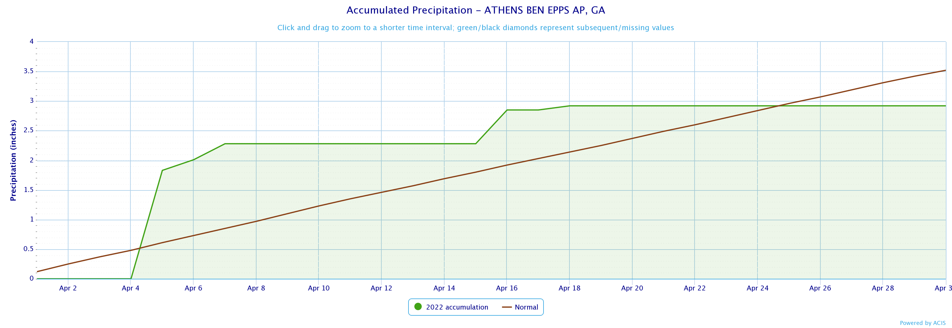
Athens
1.83
4/5
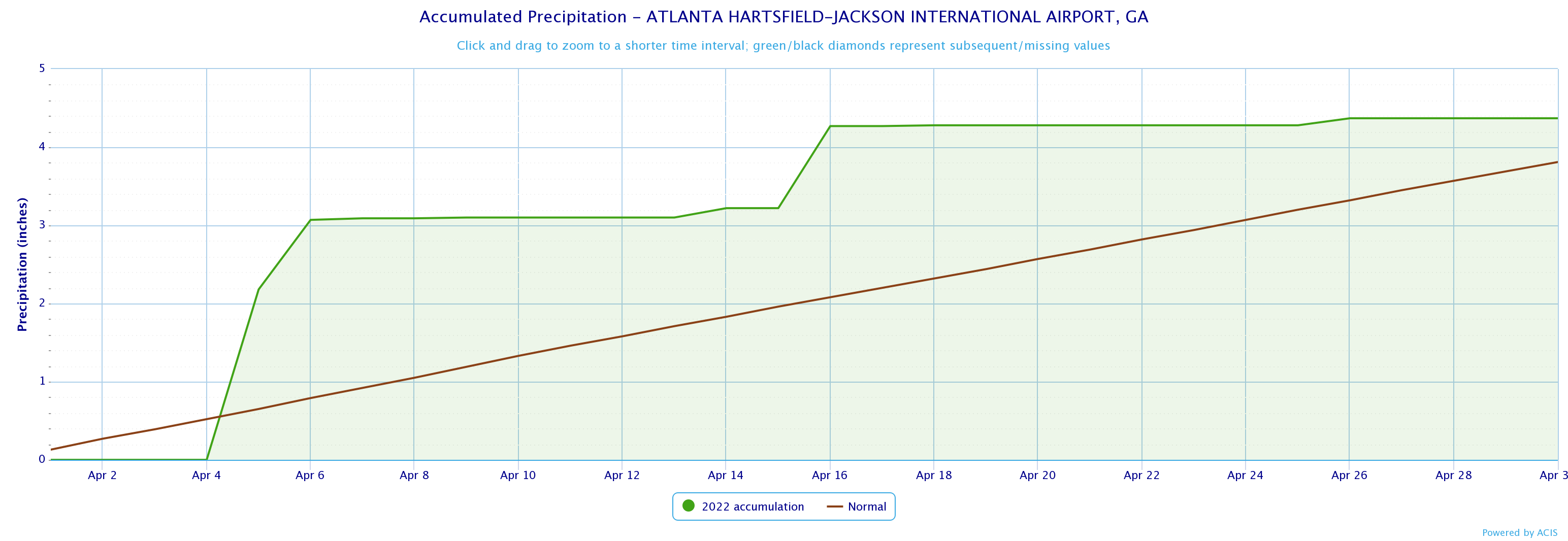
Atlanta
2.18
4/5
Columbus
2.48
4/5
Macon
4.18*
4/6*
Cartersville
2.02
4/5
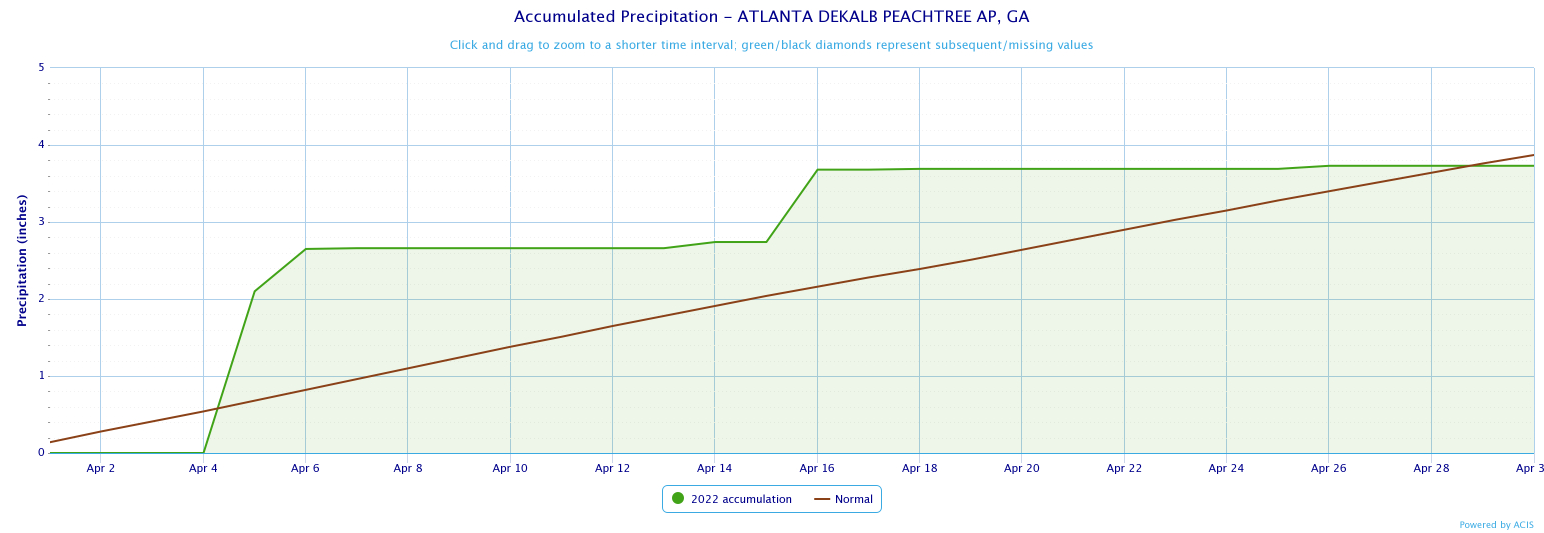
Dekalb Peachtree Arpt
2.10
4/5
Fulton Co Arpt
1.75
4/5
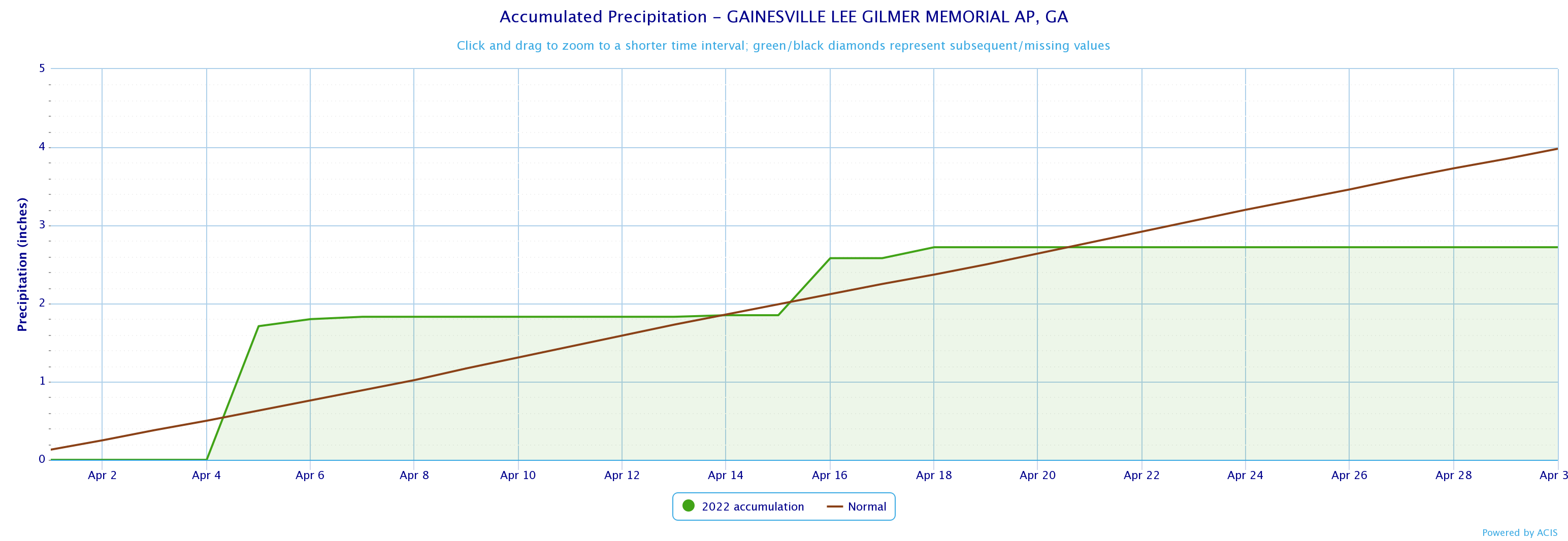
Gainesville
1.71
4/5
Peachtree City
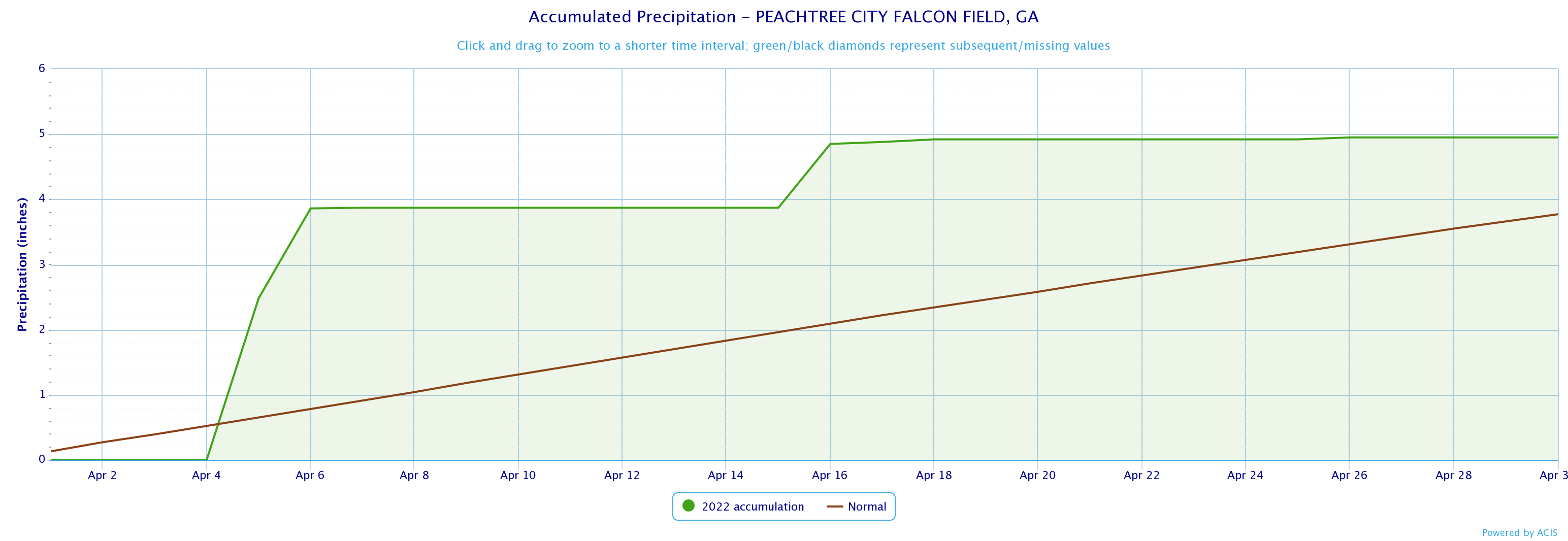
2.48
4/5
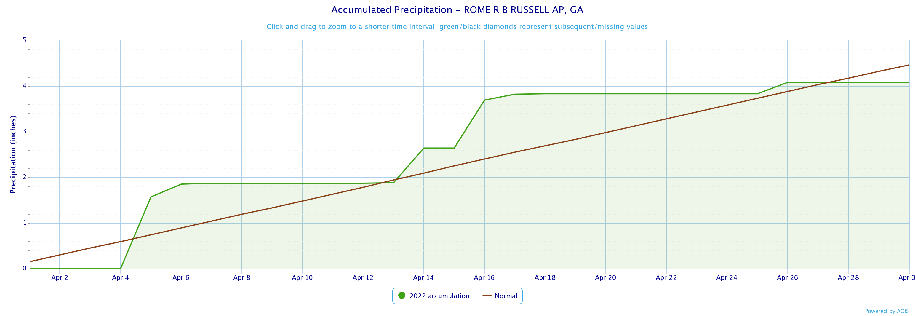
Rome
1.57
4/5
Click the links below to explore the temperature and precipitation data across north and central Georgia for the month of April 2022.
Temperature Maps
Precipitation Maps
Temperature Graphs
Precipitation Graphs
.png)


Temperature and precipitation records at our 4 main climate sites are located below.
April 2022 Climate Records
An all time daily precipitation record of 4.18" was set at MCN on 4/6. This breaks the old record of 2.10" set in 1964.
Larger events that occurred across north and central Georgia this past April can be found here.
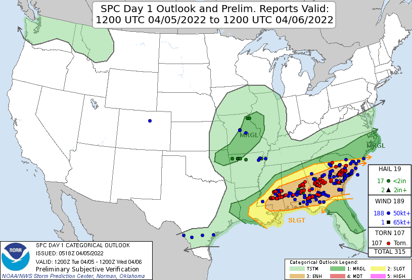
An Enhanced Risk (Level 3) was in place for much of the area south of Interstate 20. Storms strengthened amid increasing instability through the afternoon with tornadoes and wind damage common across Middle Georgia.
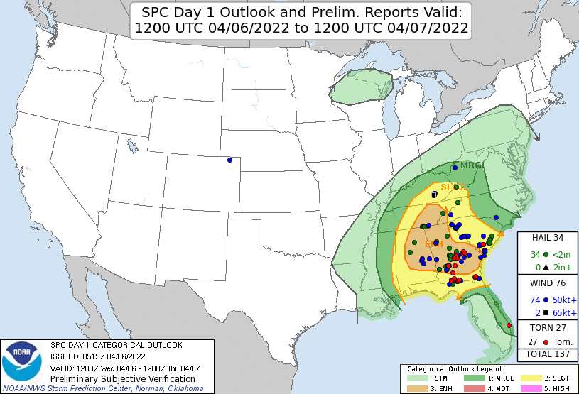
An Enhanced Risk was again issued for most of the area on April 6th. Hail and damaging wind reports were scattered across the area with the concentration of additional tornadoes again across Middle Georgia.
The May climate outlook is below.
May Outlook