
Widespread strong to severe thunderstorms are expected from the Upper Ohio Valley into the Mid-Atlantic through Friday, with damaging winds as the primary threat. Dangerous heat will continue from the South-Central U.S. to the Midwest, Ohio/Tennessee valleys, and Mid-Atlantic. Widespread Major to Extreme Heat Risk is forecast into the weekend and will confine to the South-Central U.S. by Labor Day Read More >
Last Map Update: Fri, Sep 4, 2026 at 1:58:21 am CDT

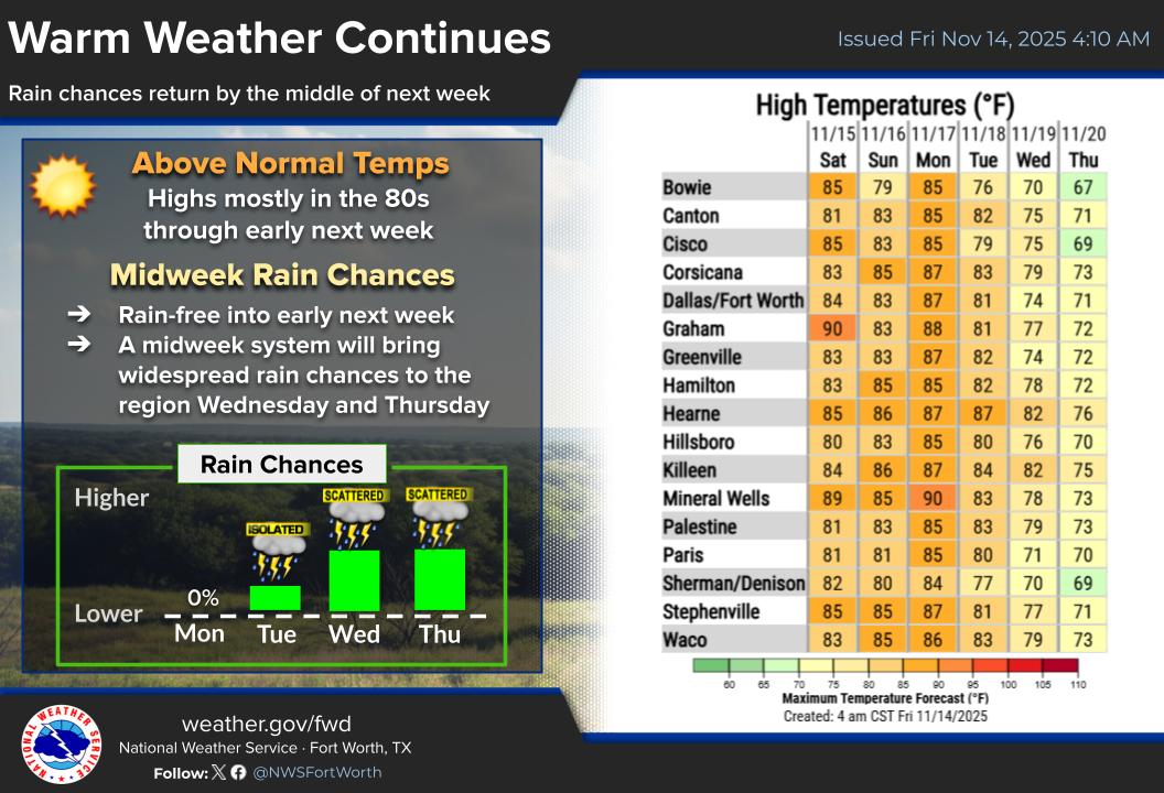
|
Text Product Selector (Selected product opens in current window)
|
|
|
Latest Text Products Issued (Experimental)
|
|
 |
 |
 |
 |
 |
 |





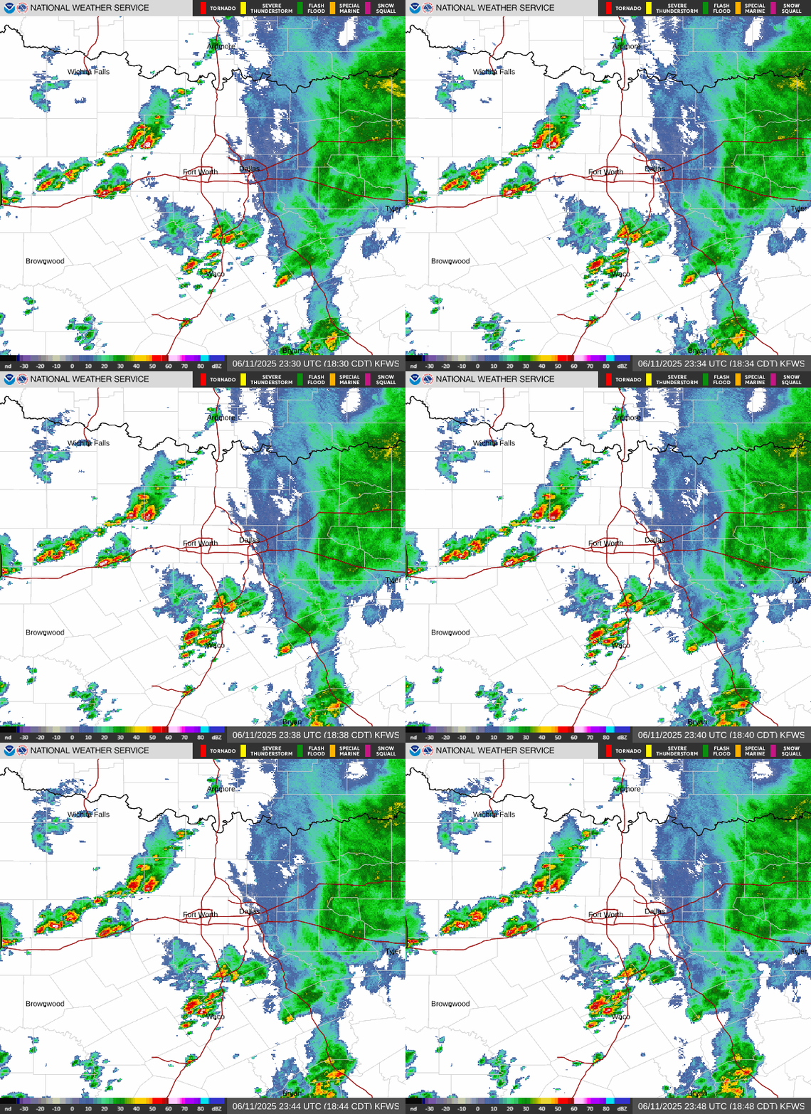 Local Radar
 Weather Map
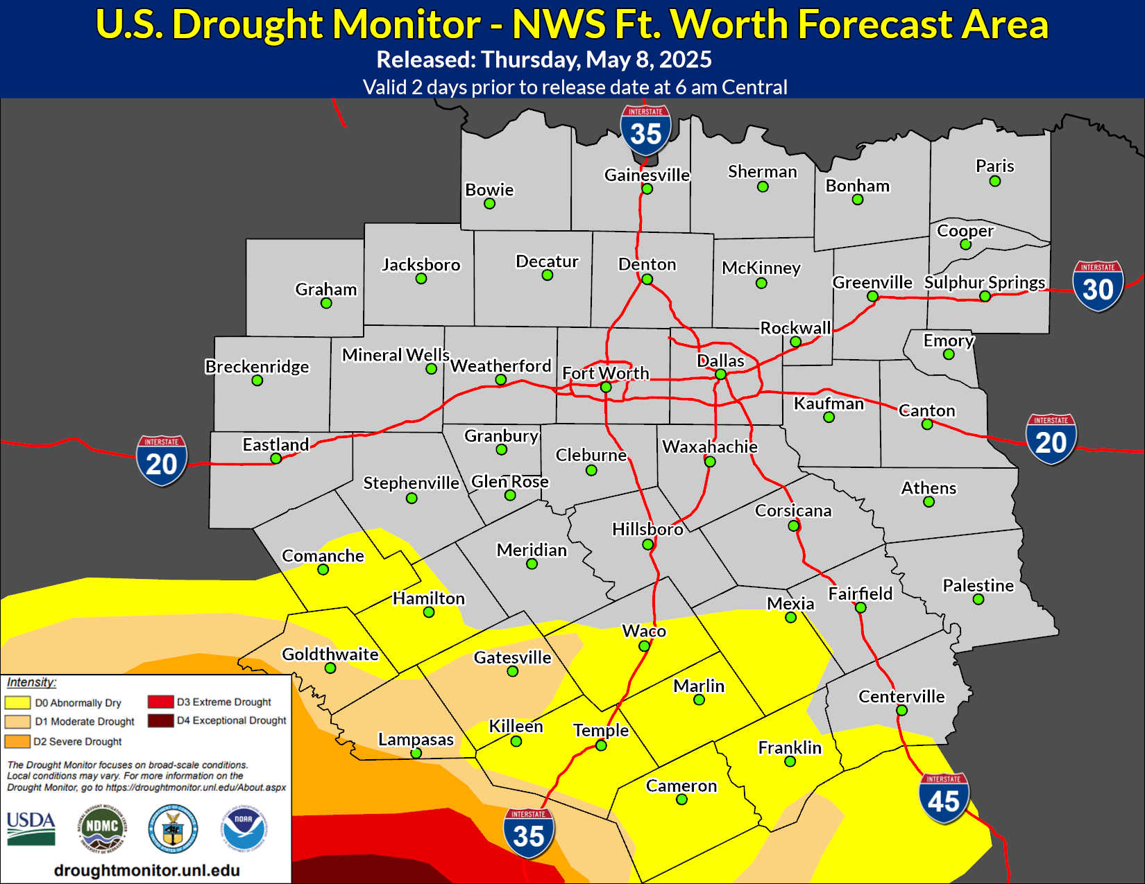 Drought Monitor
 Follow us on X
 Follow us on Facebook
 Follow us on YouTube
 FWD RSS Feed