A heat wave over the Southwest will intensify this week, peaking and expanding into the Intermountain West and northern High Plains this weekend. Critical to extremely critical fire weather conditions are forecast from the Northwest and the northern Great Basin this weekend. Particularly Dangerous Situation Red Flag Warnings have been issued. Read More >
Fort Worth/Dallas, TX
Weather Forecast Office
|
April 3rd 2012 Severe Weather Outbreak
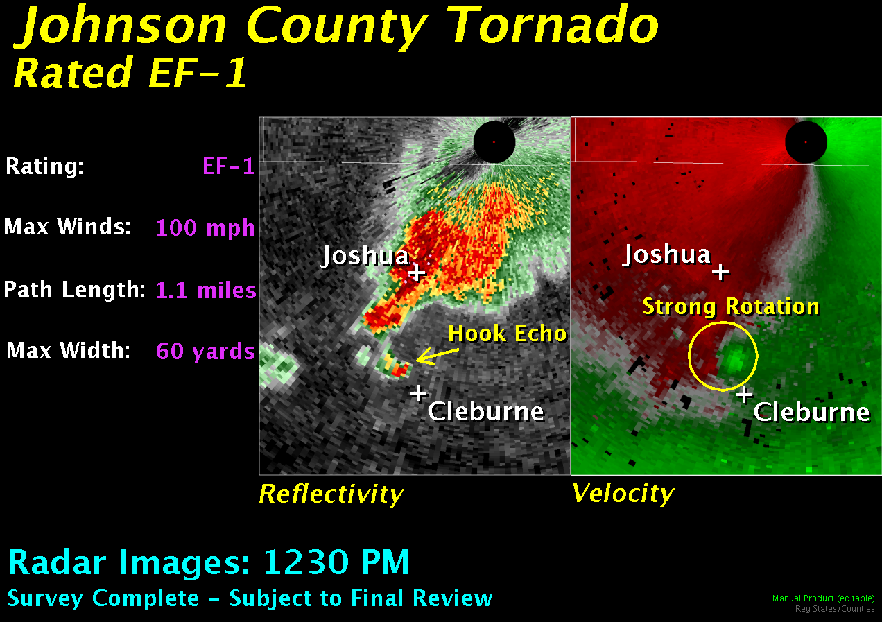
Johnson County Tornado Meteorologists from the National Weather Service in Fort Worth have given portions of the damage near Joshua a preliminary rating of EF-1, with estimated wind speeds up to 100 mph. The tornado had a path length of 1.1 miles and a maximum width of 60 yards. Additional information will be added to this page as it becomes available.
|
Current Hazards
National Outlooks
Tropical
Local Storm Reports
Storm Reports (Graphical)
Submit Storm Report
Tornado Warnings
Severe Thunderstorm Warnings
Flash Flood Warnings
Forecasts
Forecast Discussion
Graphical Forecast
Aviation Forecasts
Fire Weather
Hazard Planner
N. Texas Convective Parameters
US Dept of Commerce
National Oceanic and Atmospheric Administration
National Weather Service
Fort Worth/Dallas, TX
3401 Northern Cross Blvd.
Fort Worth, TX 76137
817.429.2631
Comments? Questions? Please Contact Us.