Scattered thunderstorms with severe gusts, hail and a tornado risk are possible near a cold front from the Ohio Valley to the Mid-Atlantic tonight. Tropical Storm Bertha is expected to bring tropical storm conditions to portions of the Gulf Coast from the panhandle of Florida into Louisiana through Wednesday. Read More >
|
April 3rd 2012 Severe Weather Outbreak
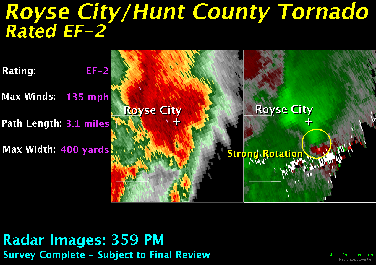
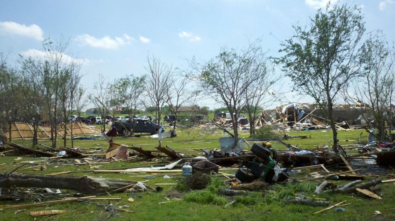
Rockwall/Hunt County Tornado Meteorologists from the National Weather Service in Fort Worth have given portions of the damage near Royse City a preliminary rating of EF-2, with estimated wind speeds up to 135 mph. The tornado had a path length of 3.1 miles and a maximum width of 400 yards. Additional information will be added to this page as it becomes available.
|
||||||||||||||