
Scattered severe thunderstorms are possible today across central and eastern Minnesota, Iowa, and western Wisconsin. A few tornadoes, isolated very large hail, and damaging winds may occur. An upper level low will help trigger scattered thunderstorms over portions of central and southern California today along with a few inches of snow in the central Sierra Nevadas. Read More >
Last Map Update: Thu, Sep 19, 2024 at 10:50:15 am MDT

|
Text Product Selector (Selected product opens in current window)
|
|


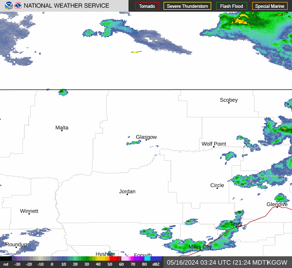 Glasgow Radar
 Satellite
 Current observations
 Webcams
 Forecast discussion
 Montana weather
 Fire weather
 Recreation forecasts
.png) Transportation forecast
Transportation forecast.png) Weather Prediction Center
Weather Prediction Center Storm Prediction Center
 Aviation weather
.png) Skywarn
Skywarn