
Wildfire smoke continues to impact air quality from the Great Lakes region into New England and the Mid-Atlantic today with widespread Air Quality Alerts in effect. Severe thunderstorms are expected across portions of the Ohio Valley and Lower Great Lakes into the Mid-Atlantic and Northeast, this afternoon into the evening. Monsoonal thunderstorms may bring areas of flooding to the Southwest. Read More >
Overview:
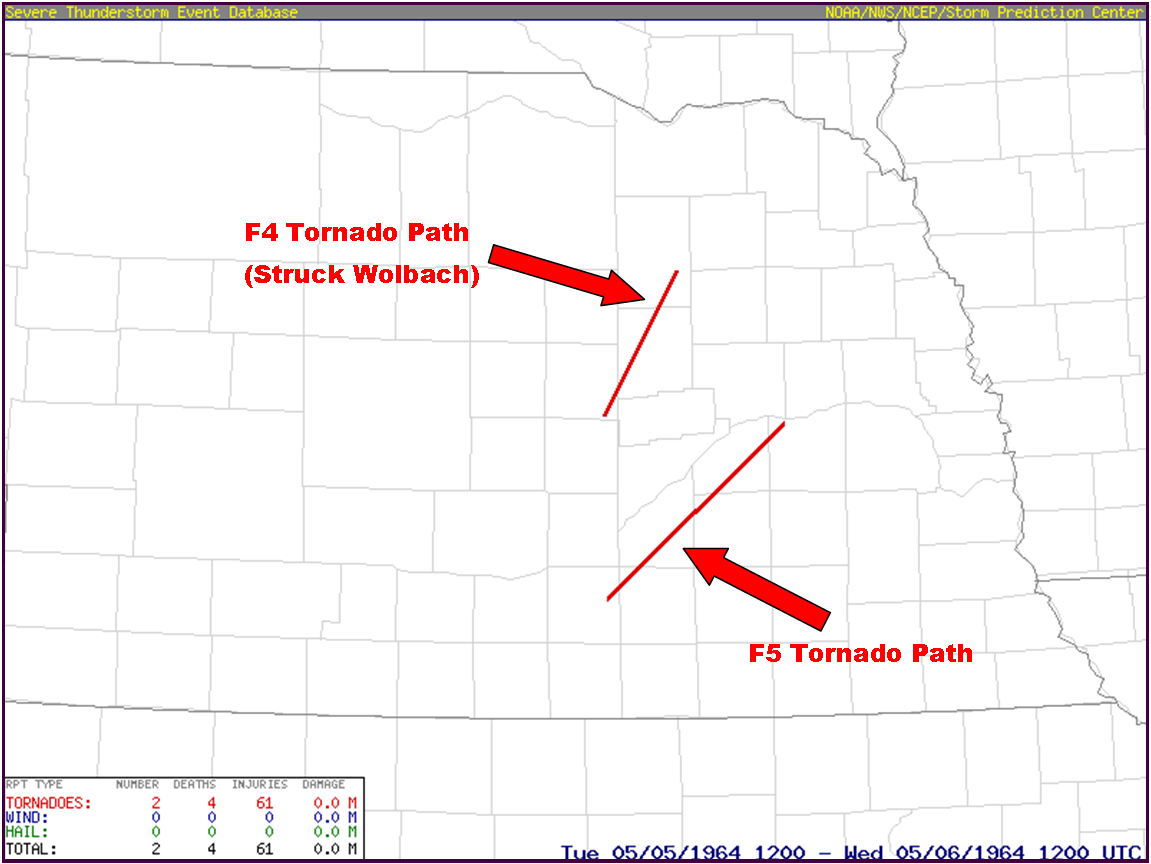
Tuesday, May 5, 1964, a historic, damaging and deadly tornado event affected several counties within central and eastern Nebraska. Within the present-day NWS Hastings coverage area, two particularly damaging/violent tornadoes occurred, one rated F5 and the other rated F4. |
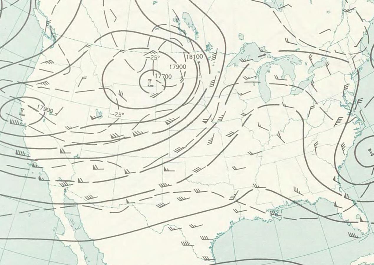
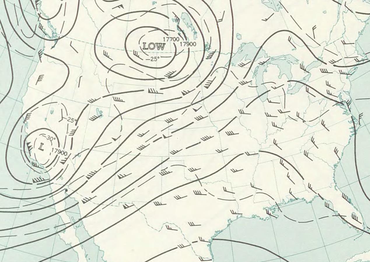
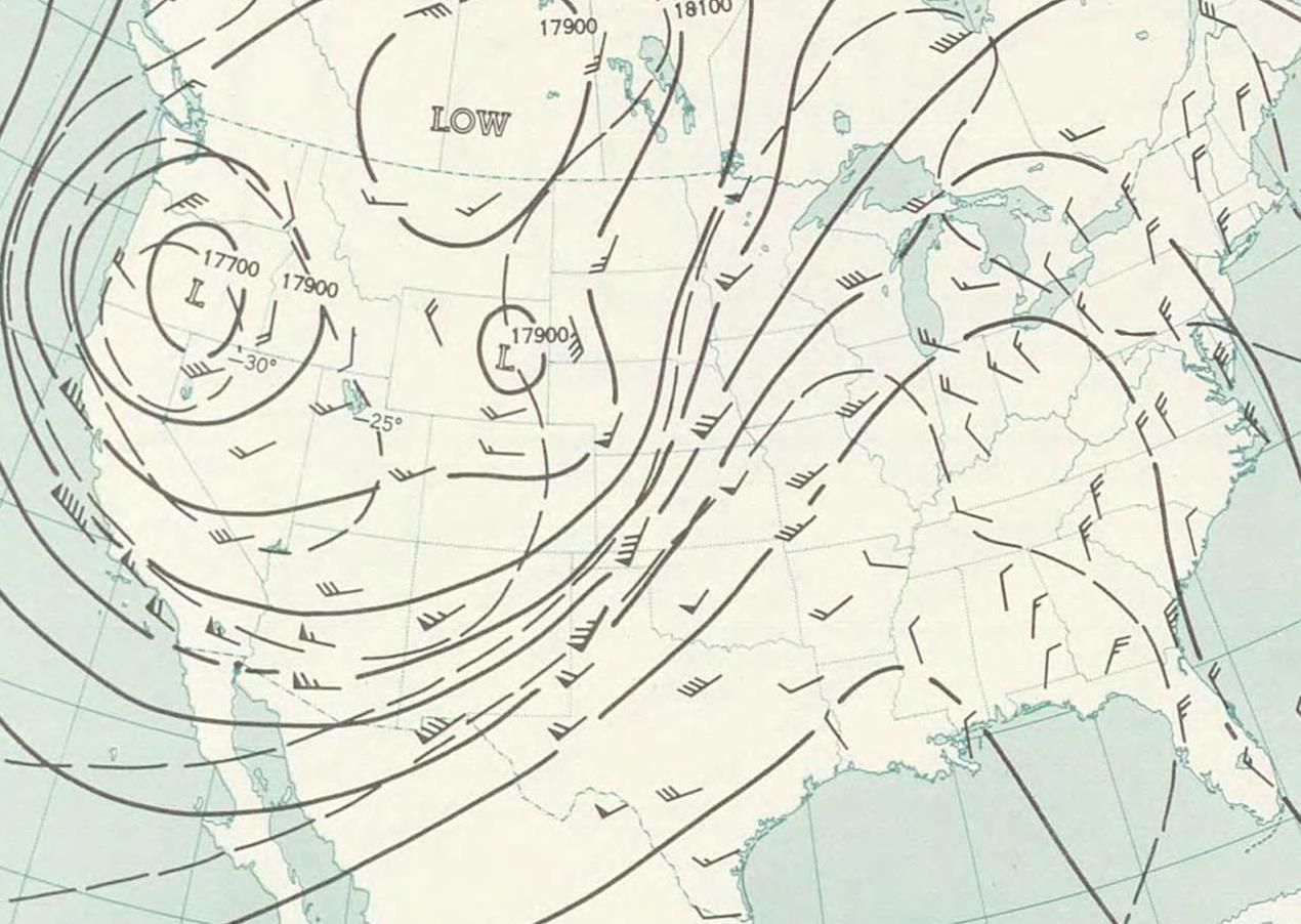
500mb Upper Air Maps:
 |
 |
 |
|
| 7 PM CDT - May 3rd | 7 PM CDT - May 4th | 7 PM CDT - May 5th | |
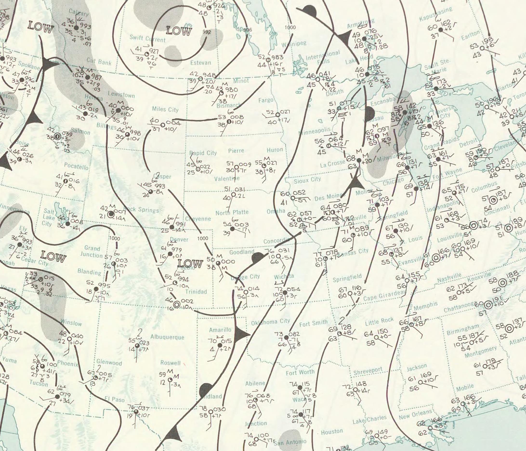
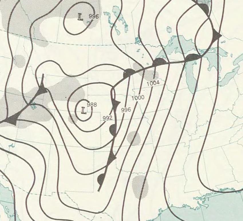
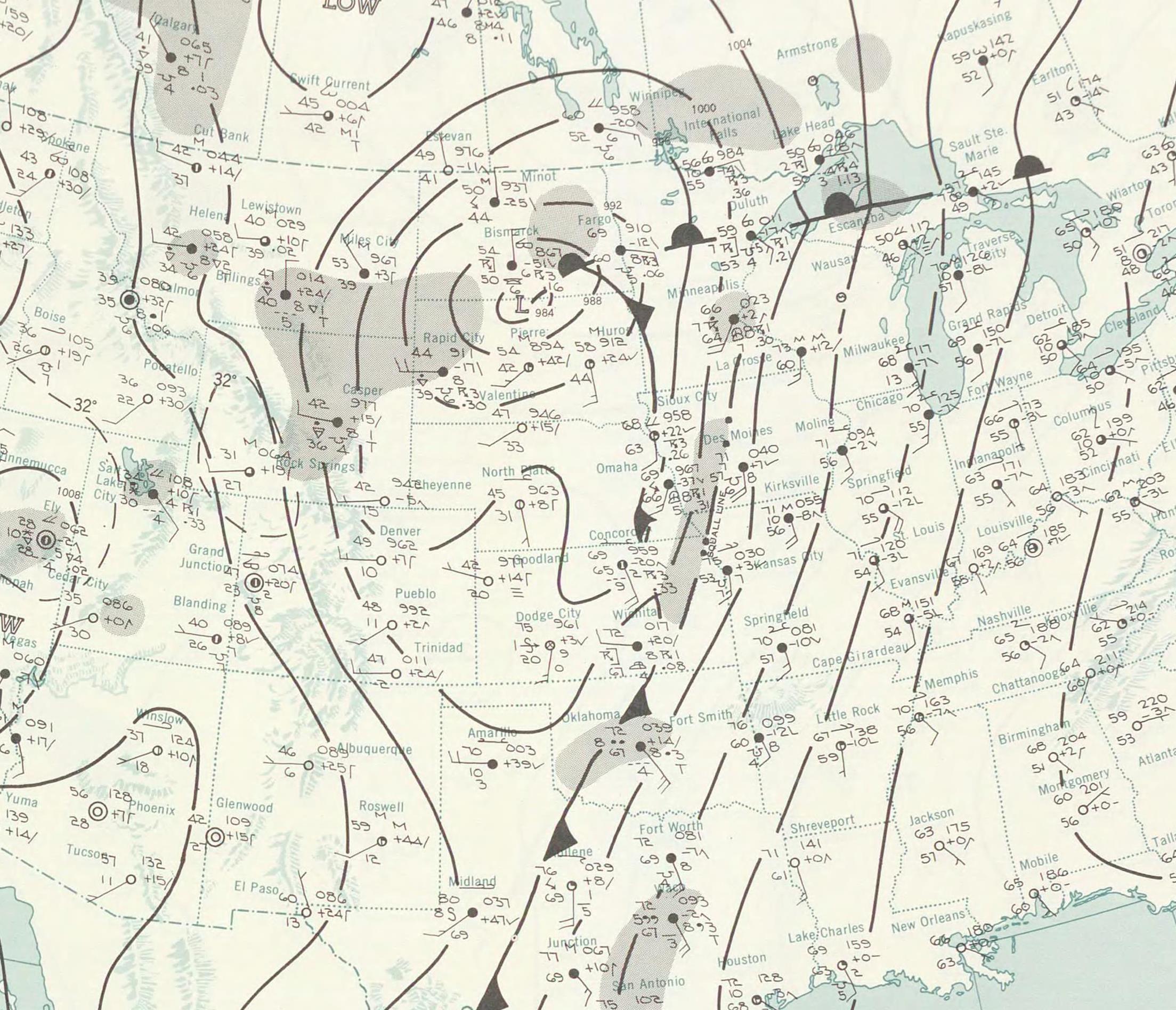
Surface Maps:
 |
 |
 |
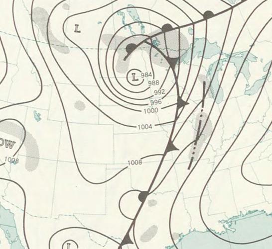 |
| 1 AM CDT - May 5th | 1 PM CDT - May 5th | 1 AM CDT - May 6th | 1 PM CDT - May 6th |
Tornado Track Information:
 |
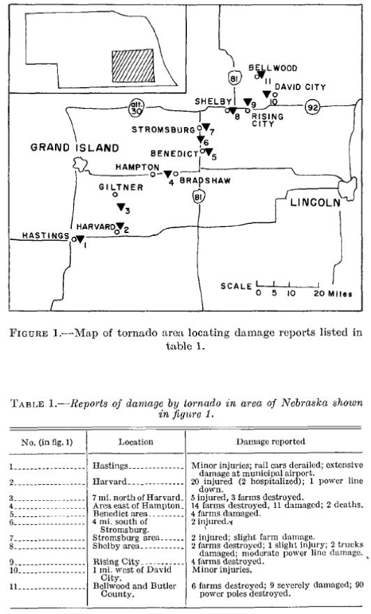 |
| Tornado track map courtesy of the Storm Prediction Center. | Damage points along the path. Courtesy of Monthly Weather Review. |
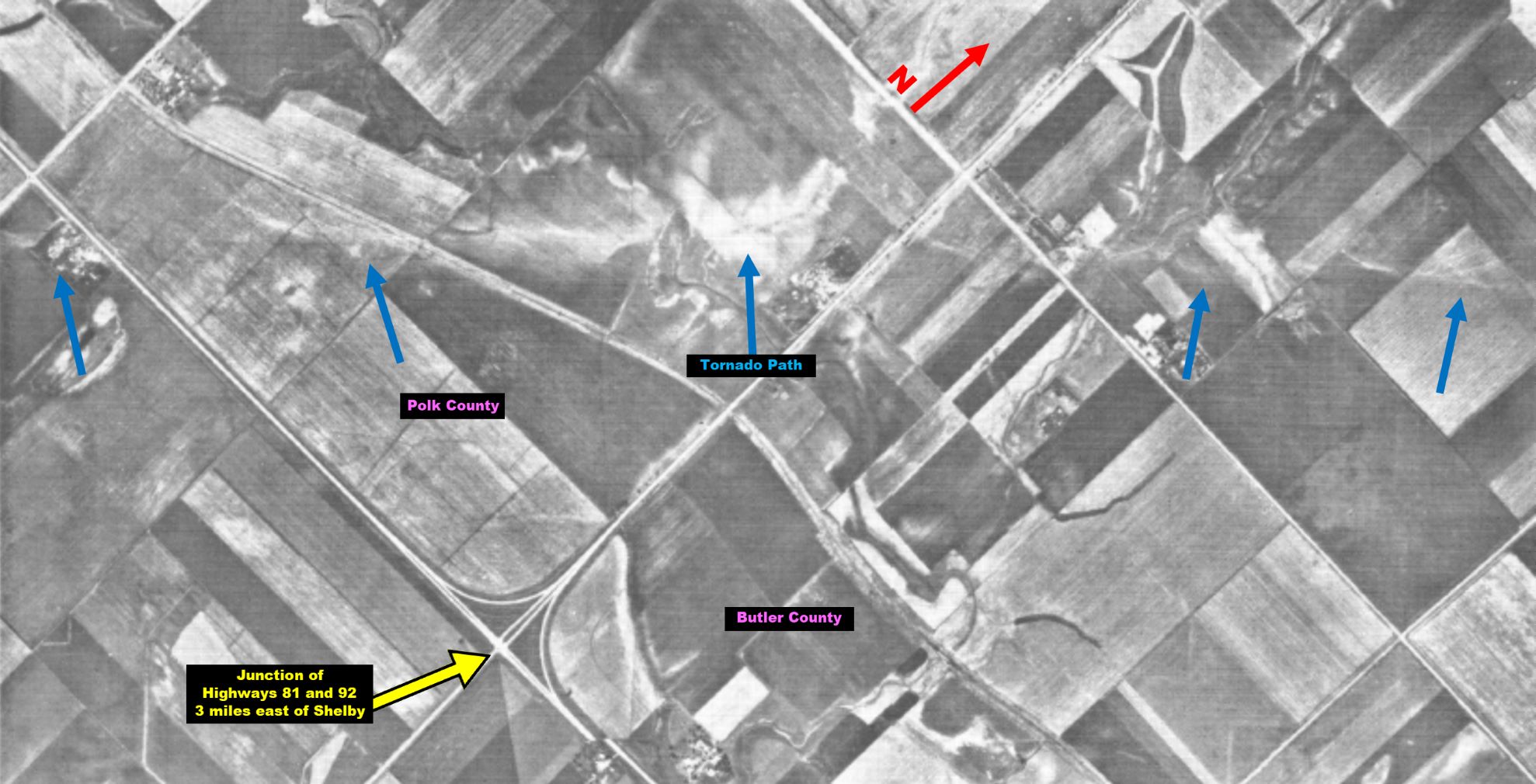 |
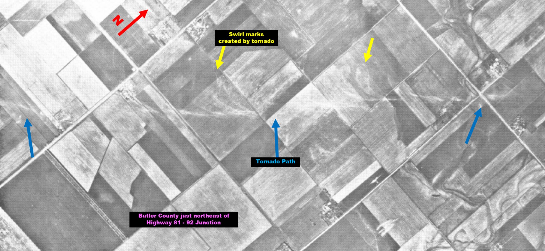 |
| Aerial tornado track images, taken near the Polk/Butler County line. Courtesy of Monthly Weather Review. | |
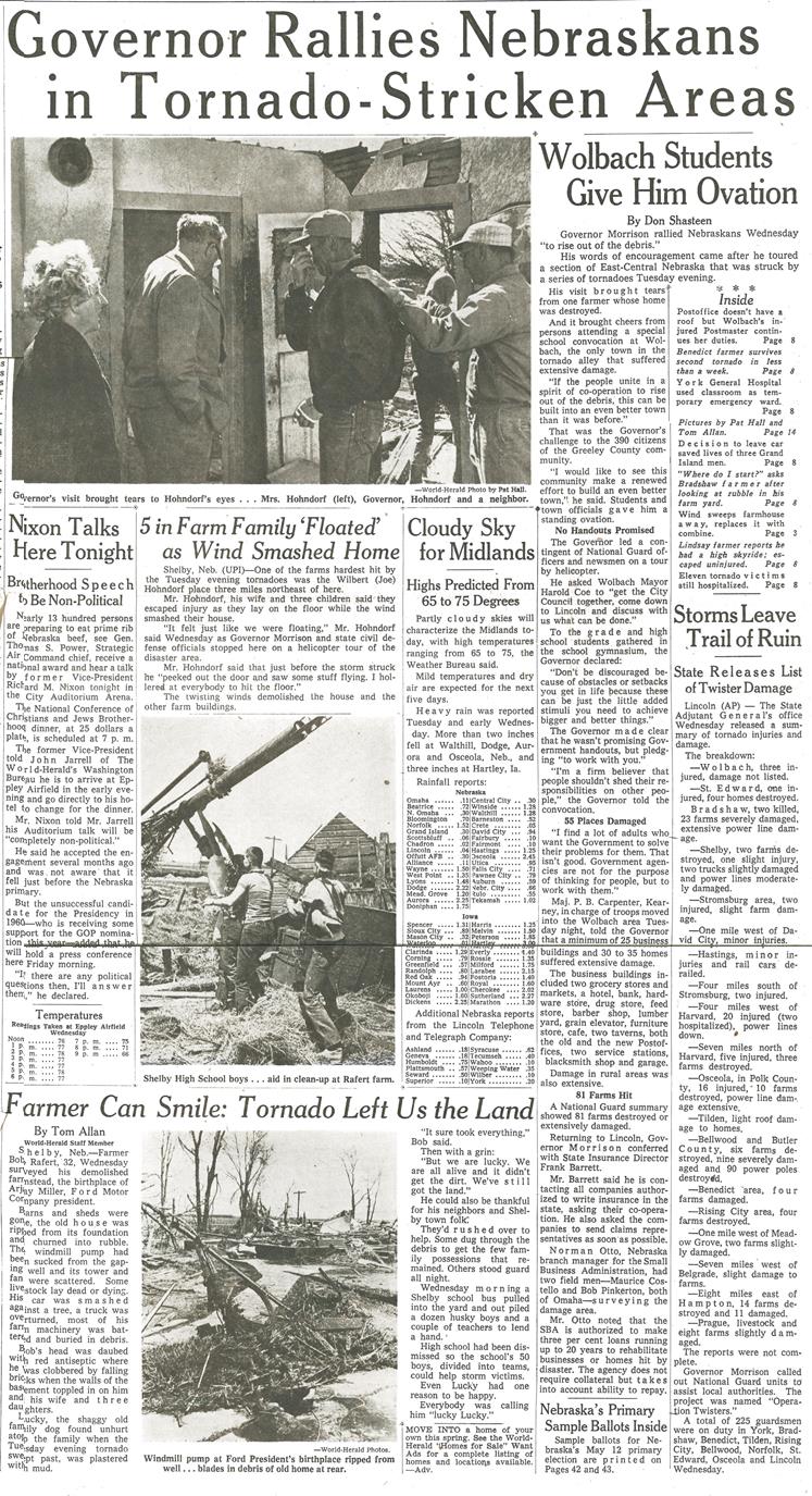
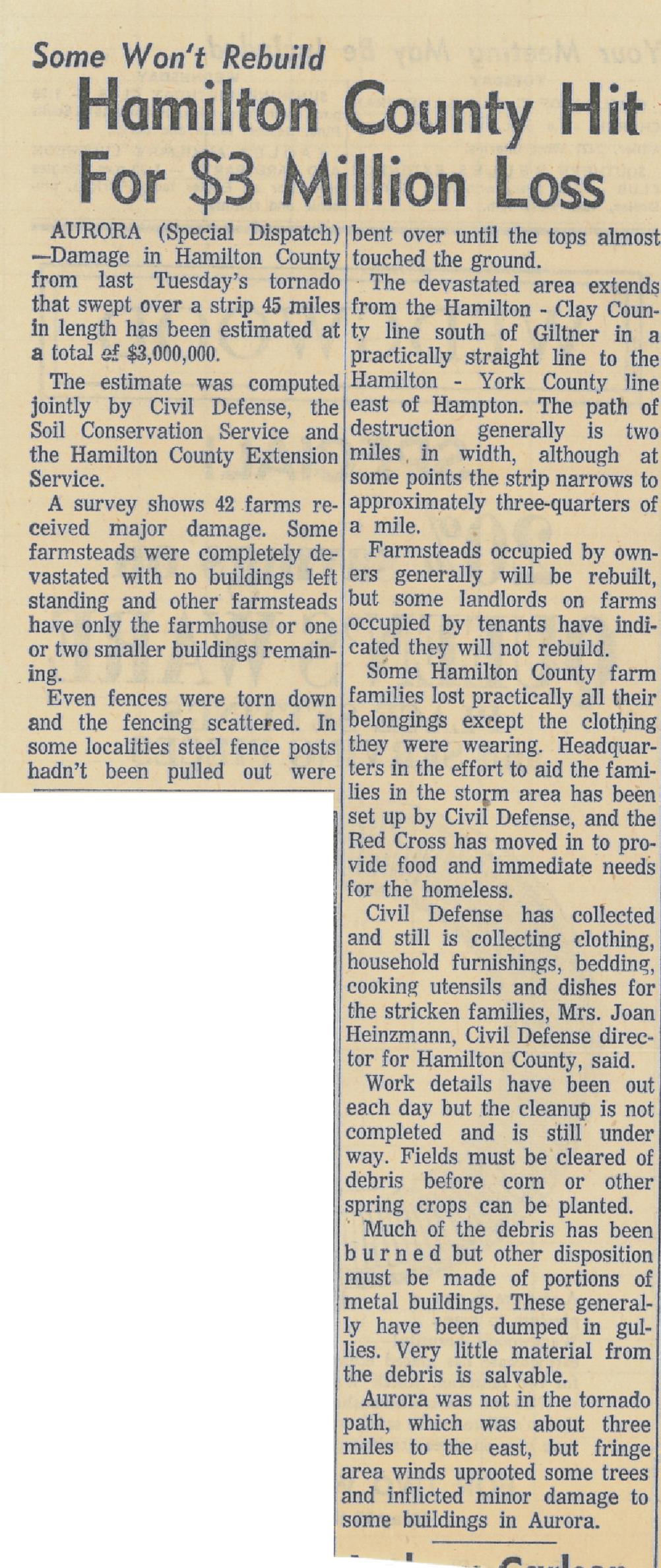
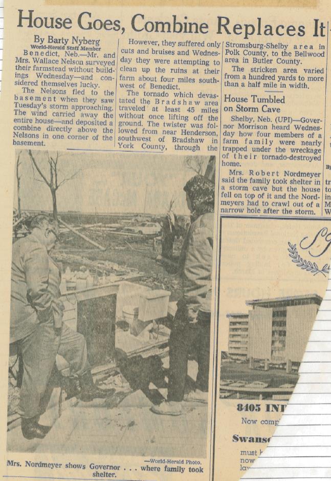
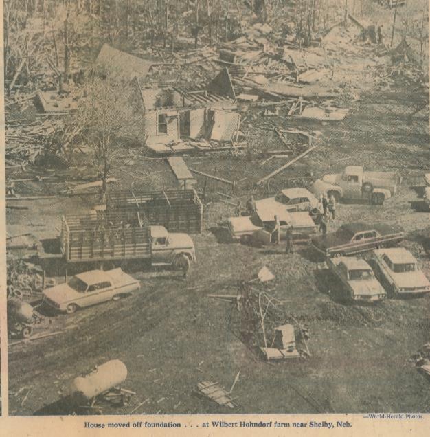
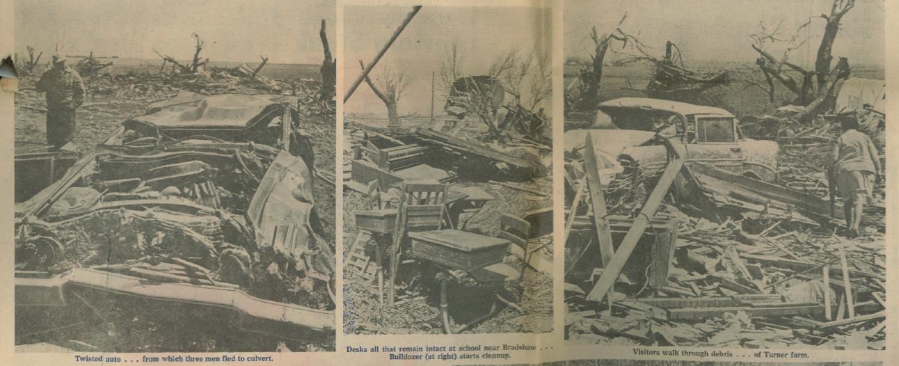
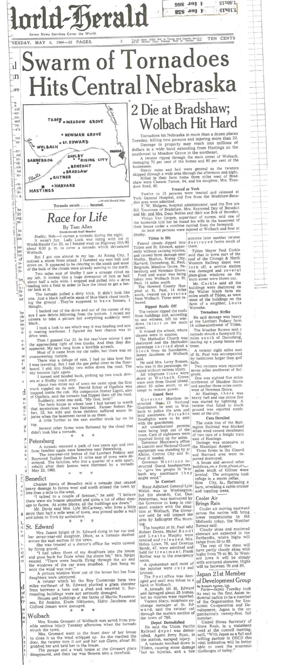
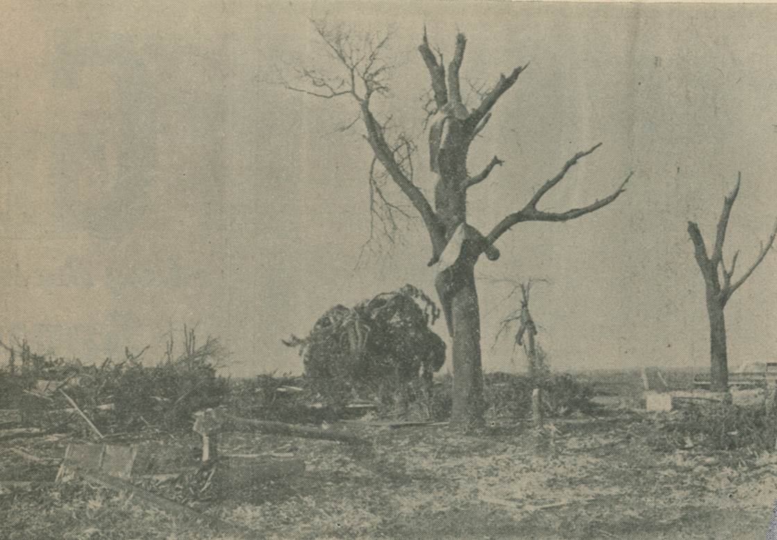
Newspaper Articles & Images:
The following images are from the Omaha World Herald, dated May 6-7, 1964.
 |
 |
 |
 |
 |
 |
 |
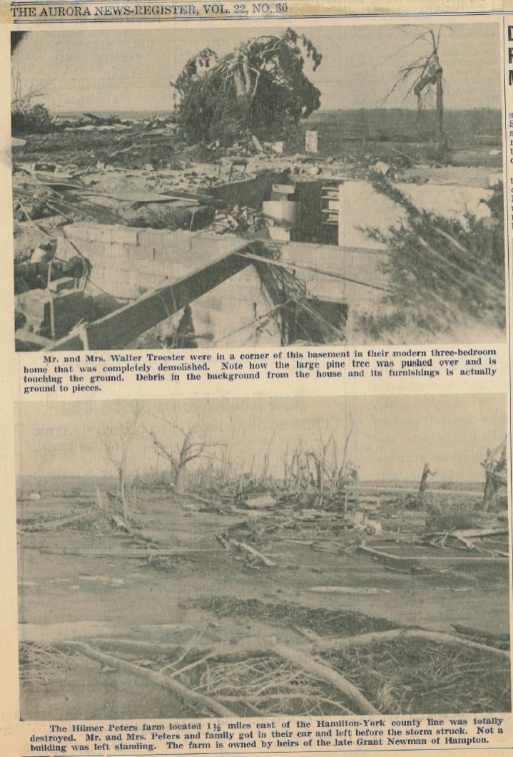
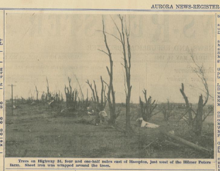
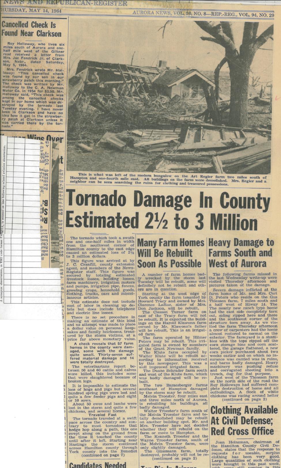
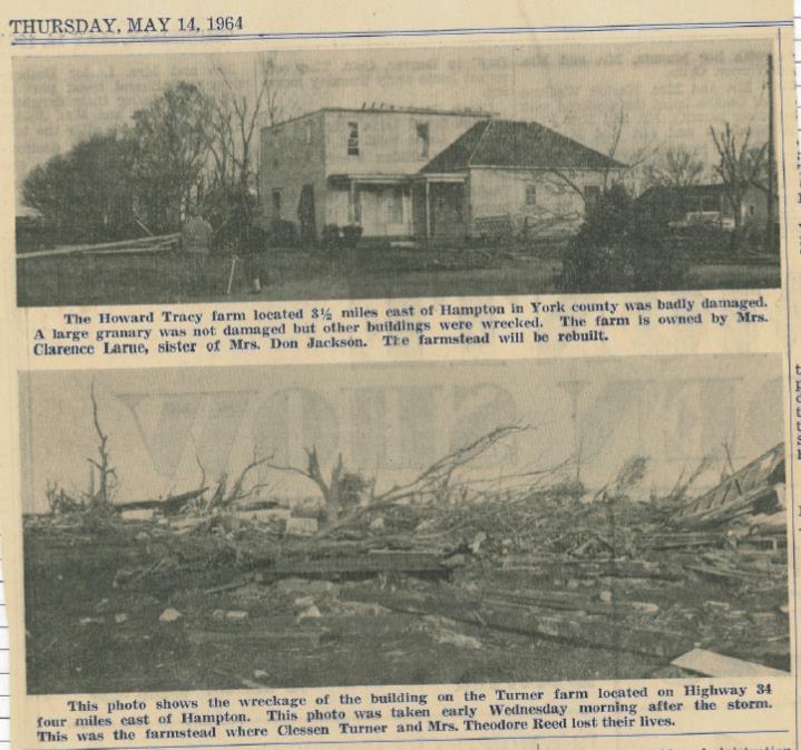
The following images are from the Aurora News-Register, dated May 14, 1964.
 |
 |
 |
 |
 |
 |
 |
 |
Media use of NWS Web News Stories is encouraged! Please acknowledge the NWS as the source of any news information accessed from this site. |
|


