Click to see the NWS Hastings poster about this event. Click to see the NWS Hastings poster about this event. |
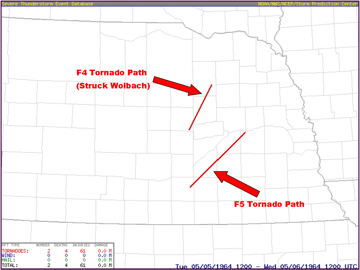
Tuesday, May 5, 1964, a historic, damaging and deadly tornado event affected several counties within central and eastern Nebraska. Within the present-day NWS Hastings coverage area, two particularly damaging/violent tornadoes occurred, one rated F5 and the other rated F4.
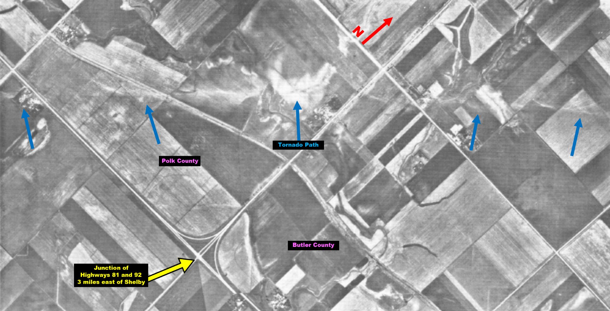
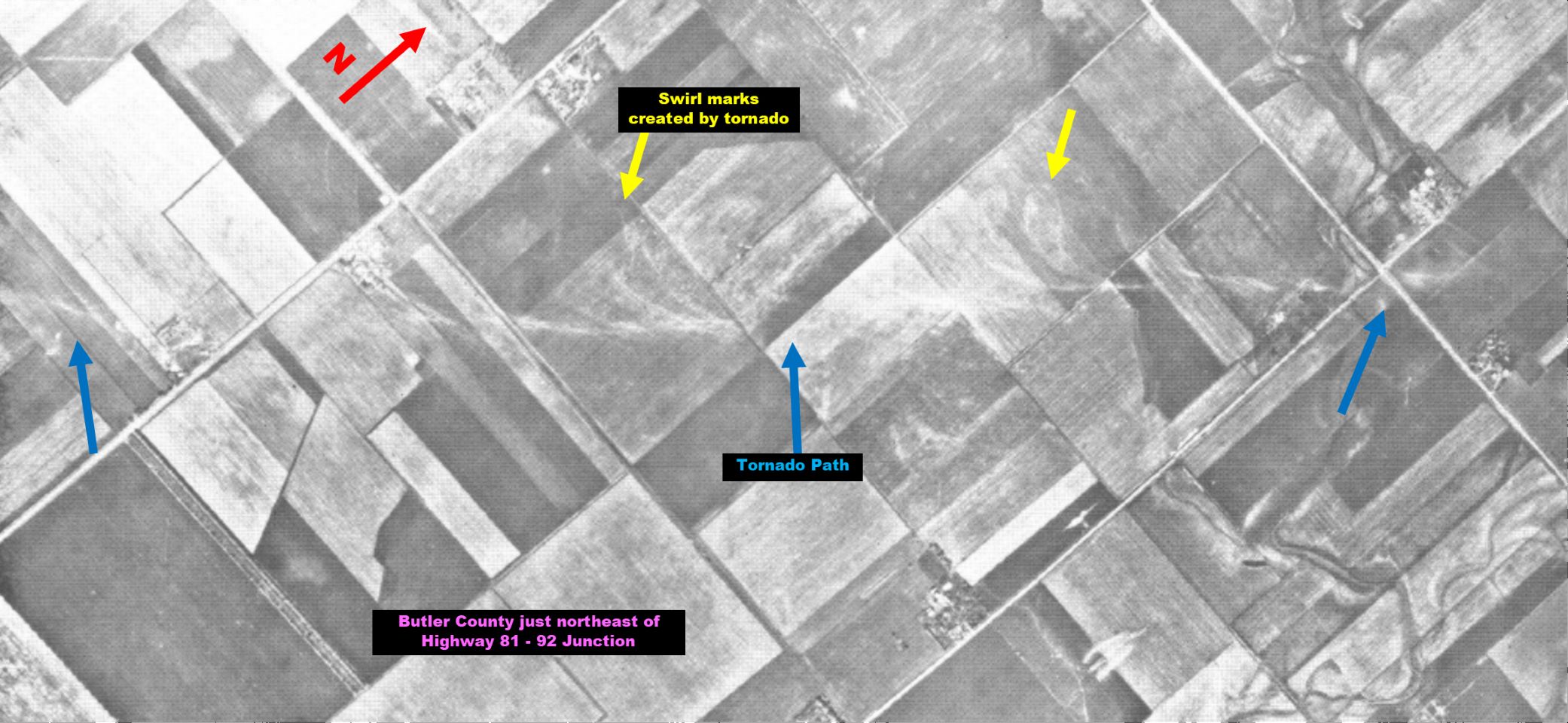
As a matter of fact, the F5 tornado that trekked nearly 70 miles from eastern Adams County to northwestern Butler County is THE LAST F5/EF5 TORNADO RECORDED WITHIN NEBRASKA (there has not been one rated this strong since).
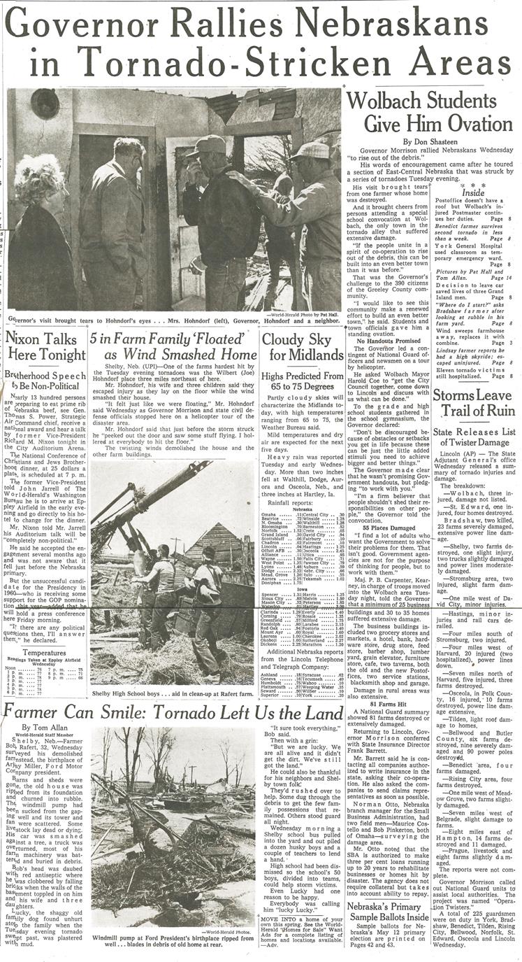
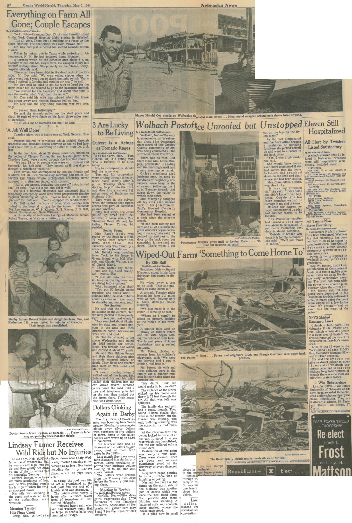
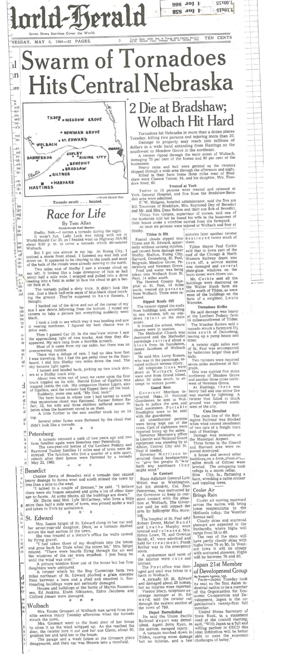
For some folks in central and eastern Nebraska, May 5, 1964, started out like any other day, but by sunset would be a day of total destruction. During the afternoon, severe thunderstorms flared up and quickly pushed northeast. One of these storms spawned an F4 tornado that initially touched down in southeastern Greeley County and destroyed much of the community of Wolbach and caused several injuries (although fortunately no fatalities).
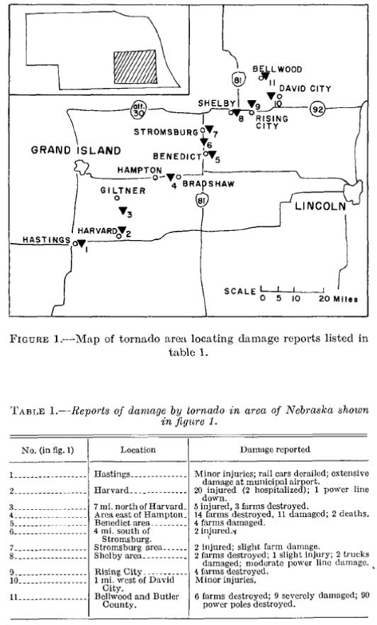
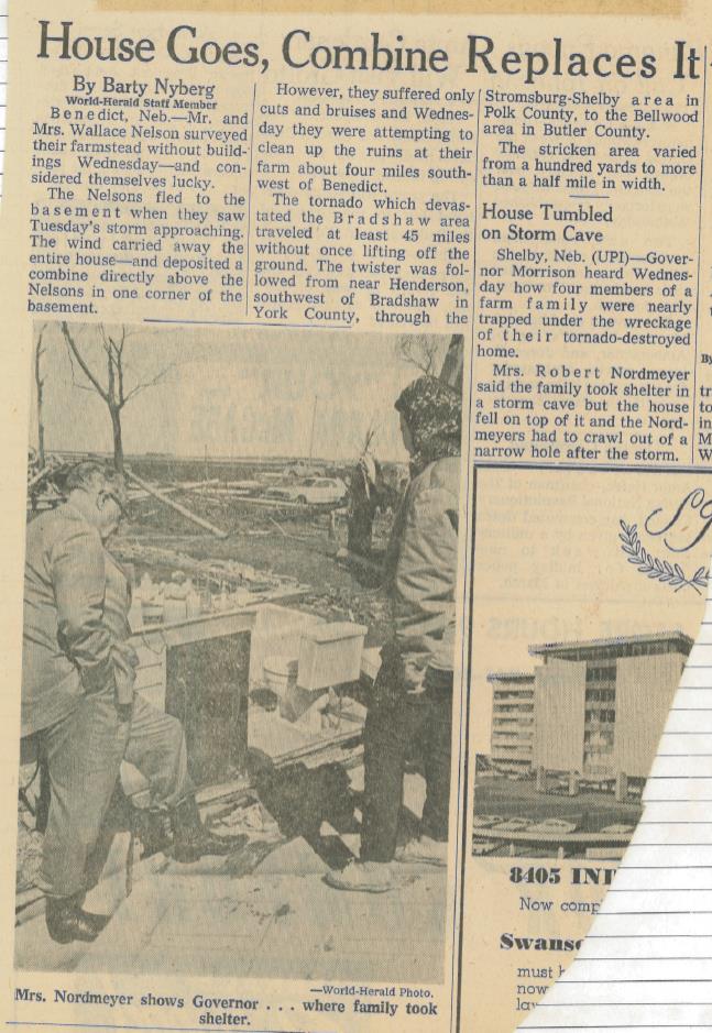
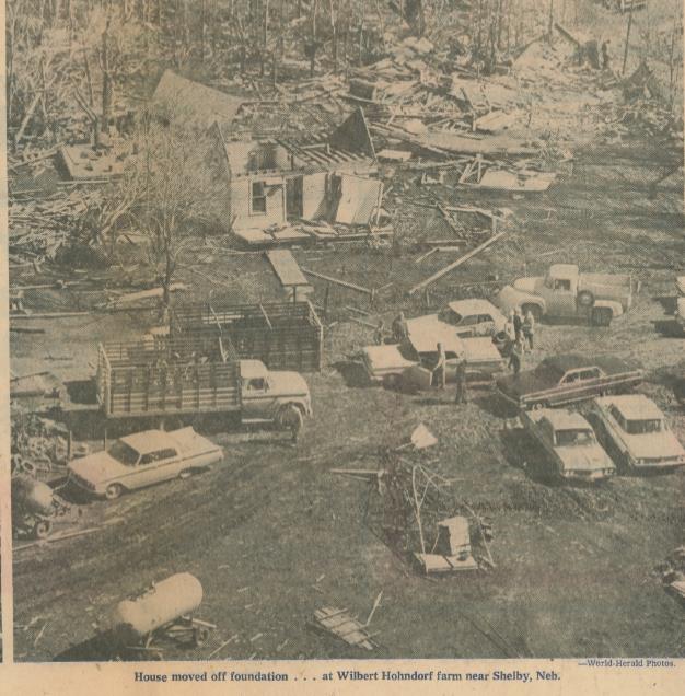
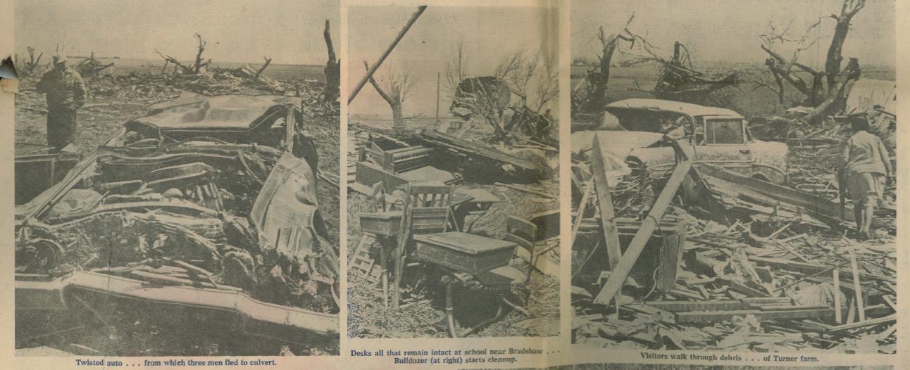
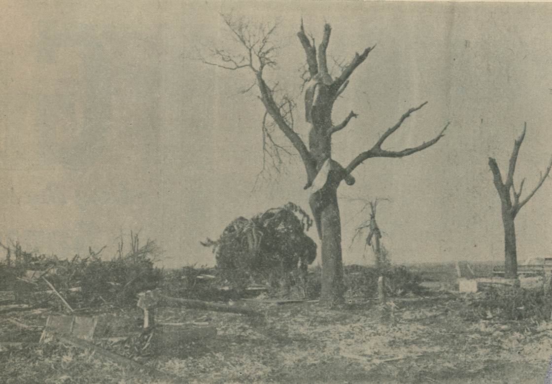
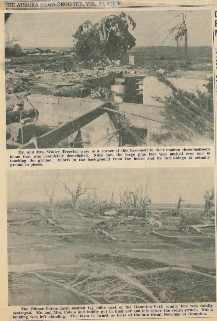
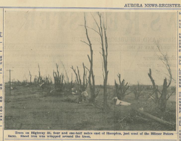
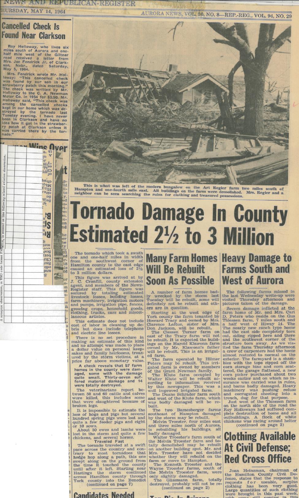
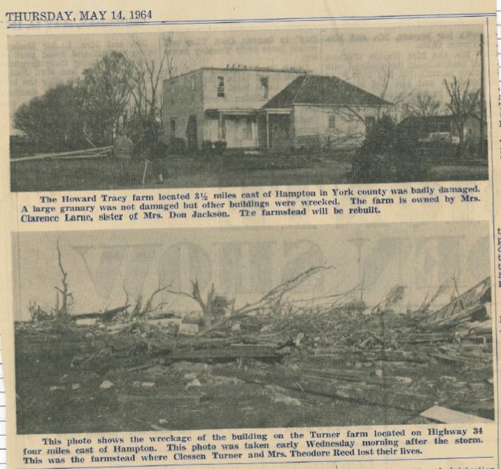
However, the biggest tornado was yet to come: By 5 p.m., a tornado touched down just southeast of Hastings and developed into an F5 on the Fujita Scale (the strongest possible). Two people were killed by this tornado on a farm three miles northwest of Bradshaw, and there were also numerous injuries, including 15 near Shelby. Fortunately, several towns along the way were narrowly spared a direct hit, including Hampton, Bradshaw, Benedict, Stromsburg and Shelby. There was complete destruction of all farmsteads in the direct path. It was a large and intense tornado that completely destroyed at least a dozen of these farms within the first 30 miles. The tornado width was generally 1/4 mile and at times 2-3 separate damaging funnels extended from the same cloud. Severe hail preceded, accompanied, and followed the funnel contact with the ground. After lifting near Bellwood in Butler County, the tornado briefly touched the ground a few times in the next 40 miles. There was a heavy loss of livestock. (The preceding information is based on data published in NCDC StormData, and supplemented by information in the book 'Significant Tornadoes 1680-1991,' by Thomas P. Grazulis)
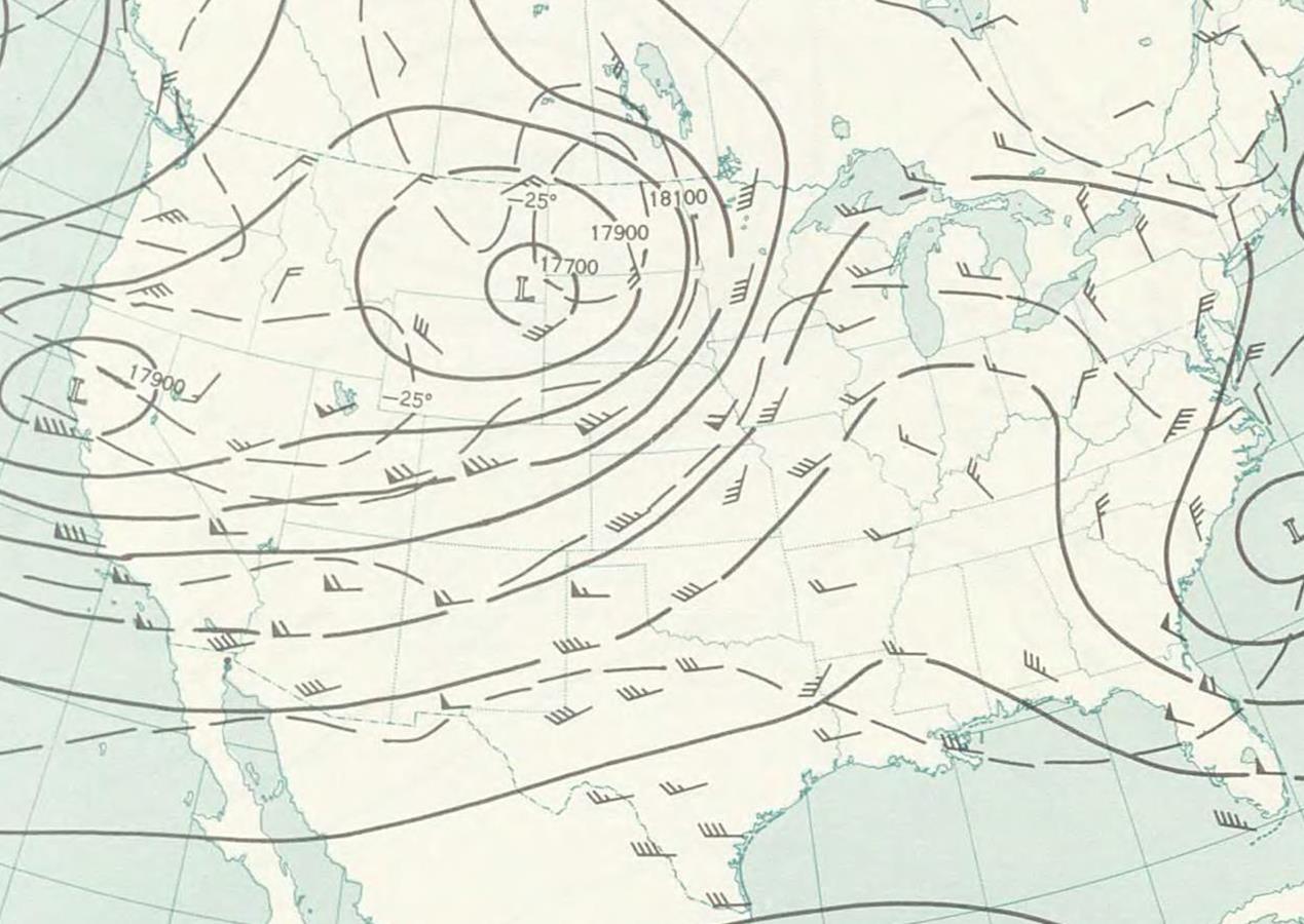
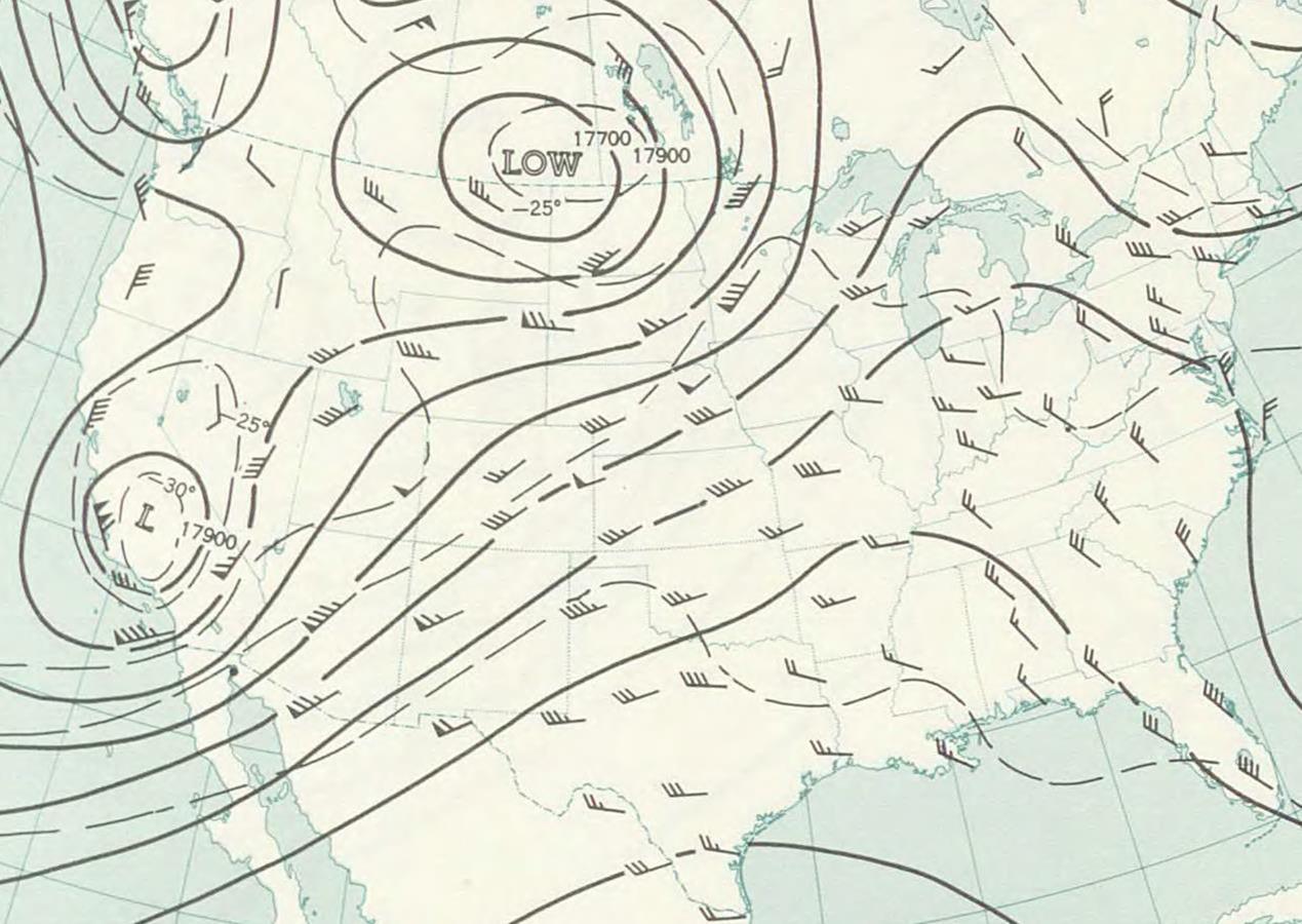
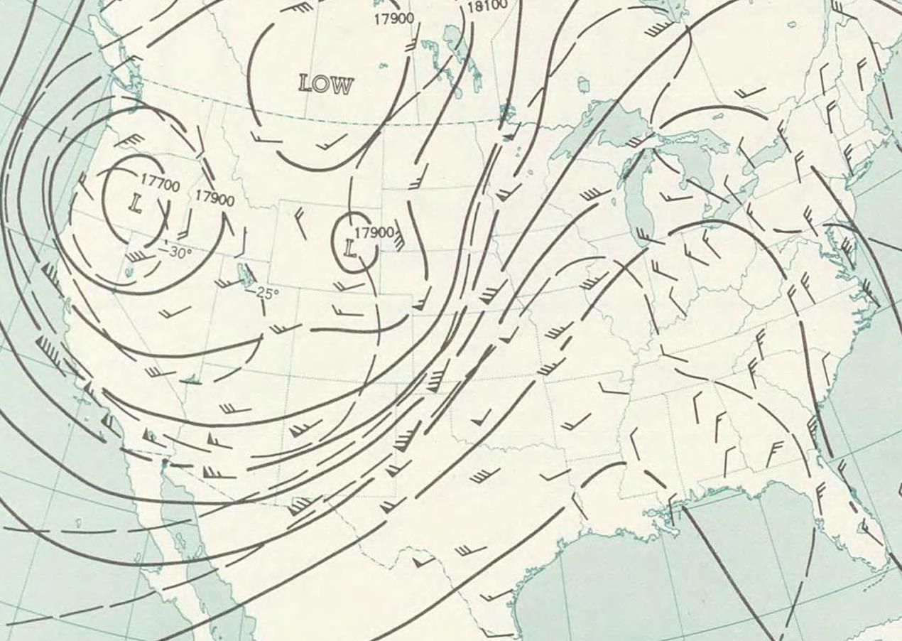
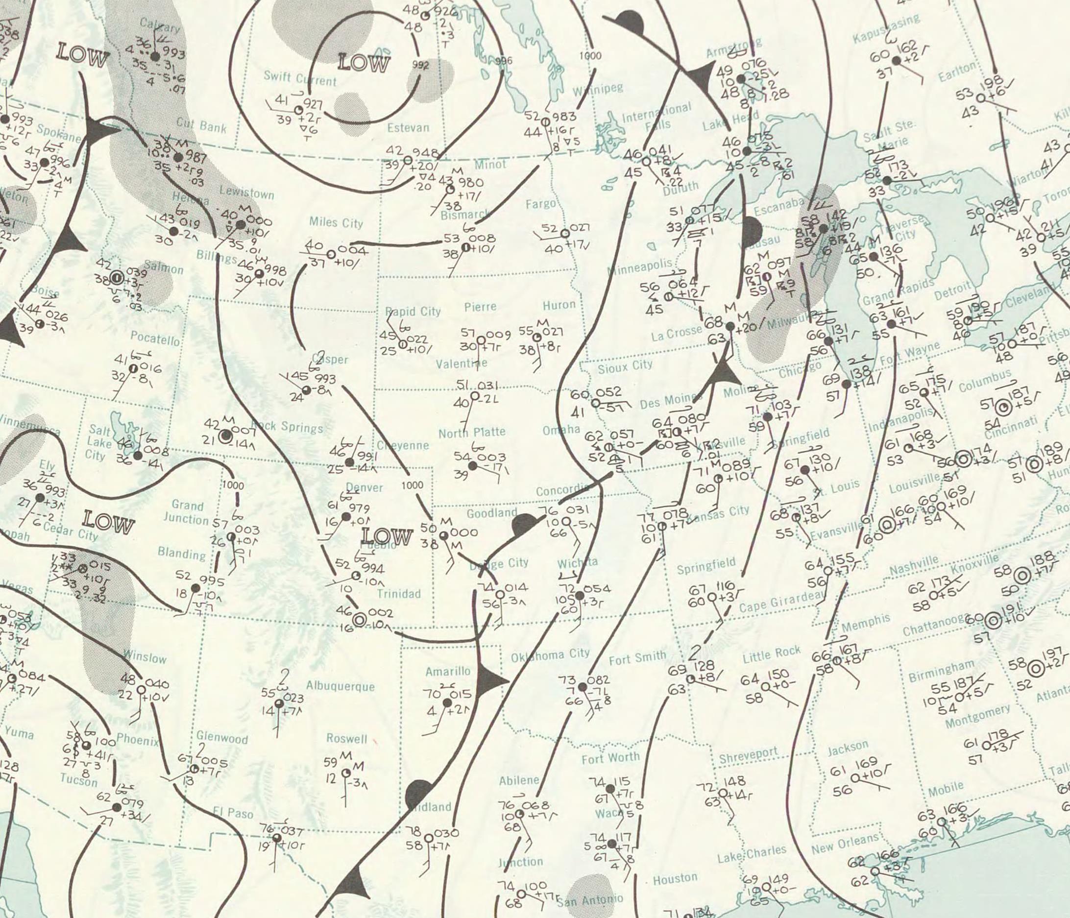
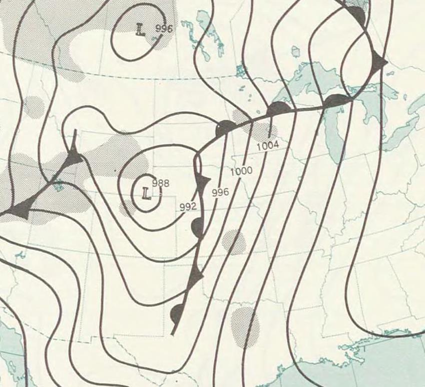
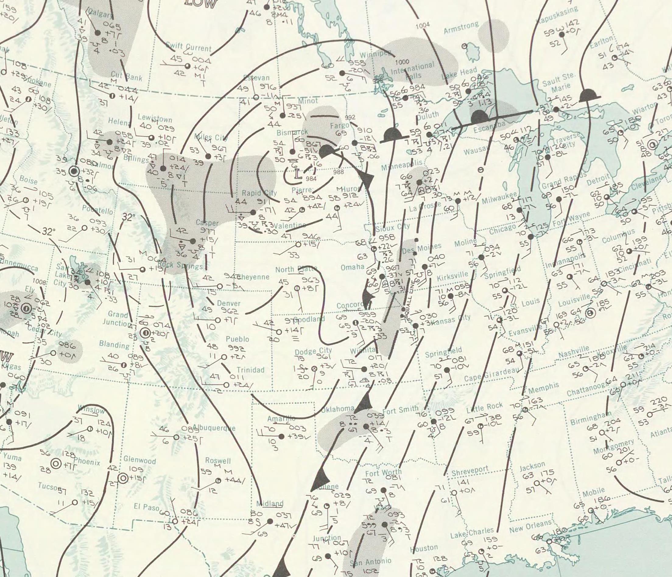
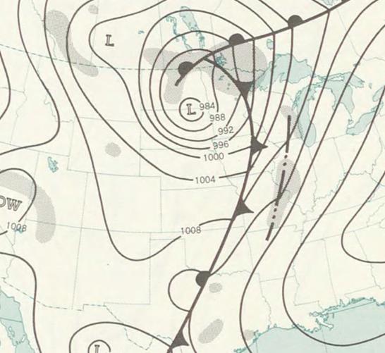
Below are a number of things that will help "tell the story" of what happened that day, including tornado path maps, upper air and surface weather maps, and original newspaper clippings from the days following this disaster:
|