
A significant heat wave is underway for the Intermountain West, Northern Plains, and Upper Great Lakes, peaking in intensity through midweek and lingering across parts of the Northern Plains and Midwest until this weekend. In southwest Texas, excessive rainfall may bring a risk for potentially life-threatening flash and arroyo flooding through Thursday. Read More >
Overview:
|
On the evening of Friday, May 17, 2019, a long-tracked supercell thunderstorm tracked from southwest-to-northeast through western portions of Dawson County Nebraska, producing three confirmed tornadoes (two rated EF-1 and one EF-0), and also large hail up to at least 2" in diameter. See tabs below for specific tornado details. Fortunately, there were no reported injuries within Dawson County, although two of the tornadoes narrowly missed striking the communities of Farnam and Cozad. This was the first confirmed EF-1 (or stronger) tornado within the NWS Hastings coverage area since Aug. 6, 2018, when an EF-1 touched down in rural York County, north of Bradshaw. |
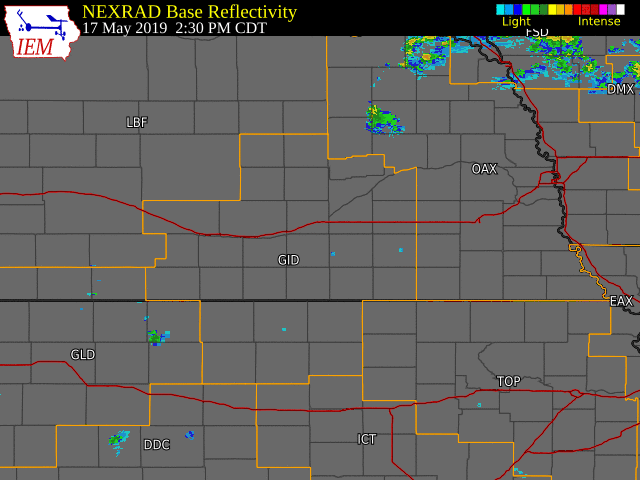 NWS Hastings radar loop from 2:30 PM May 17th through 4:00 AM May 18th. The NWS Hastings coverage area is outlined in orange and labled "GID". The red lines are interstates. |
Tornadoes:
|
|
||||||||||
|
||||||||||
|
Tornado #1 - Farnam
Track Map 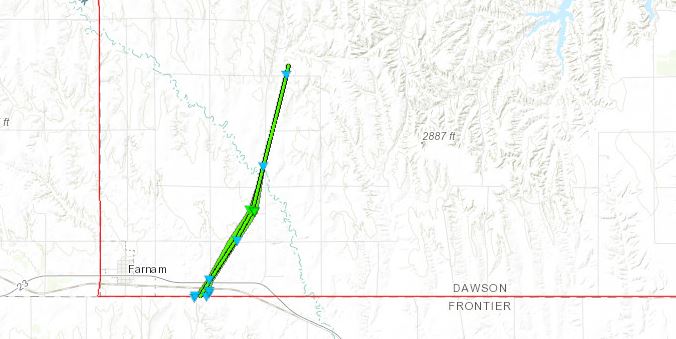 
|
||||||||||||||||
|
Tornado #2 - Cozad
Track Map 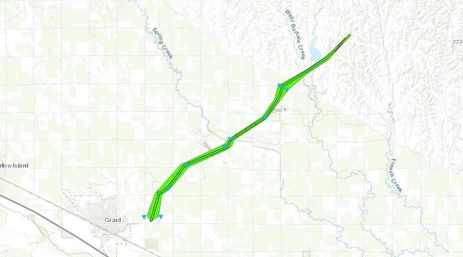
|
||||||||||||||||
|
Tornado #3 - Eddyville
Track Map 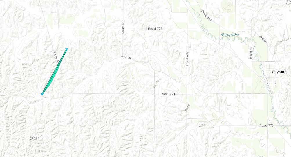
|
||||||||||||||||
The Enhanced Fujita (EF) Scale classifies tornadoes into the following categories:
| EF0 Weak 65-85 mph |
EF1 Moderate 86-110 mph |
EF2 Significant 111-135 mph |
EF3 Severe 136-165 mph |
EF4 Extreme 166-200 mph |
EF5 Catastrophic 200+ mph |
 |
|||||
Photos
Header
 |
 |
 |
 |
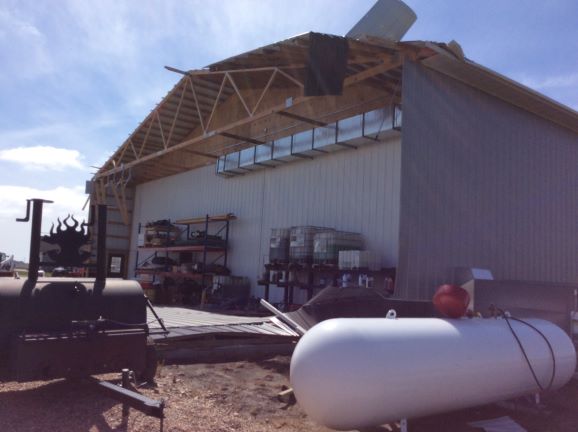 |
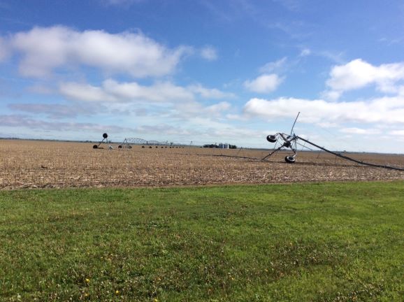
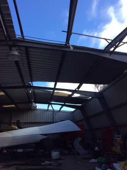
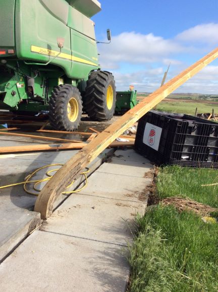
| Damage northeast of Cozad. Photos from NWS Survey. | ||||
 |
 |
 |
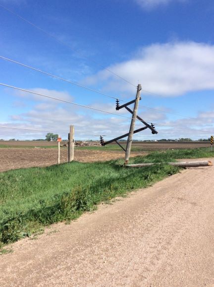
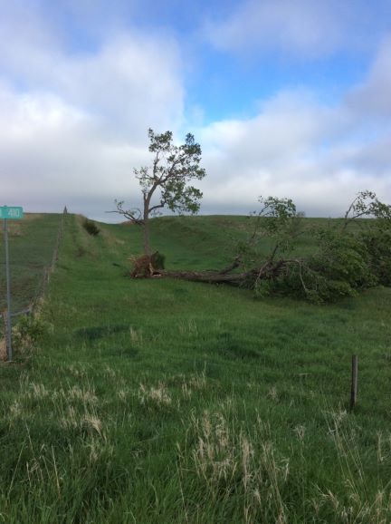
| Tree & outbuilding damage near Farnam. Photos from NWS Survey. | ||
 |
 |
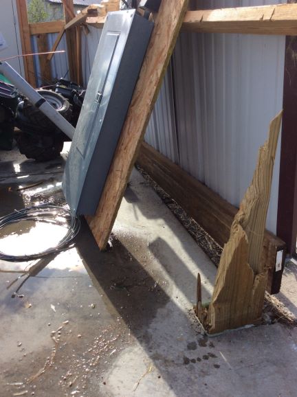 |
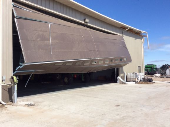
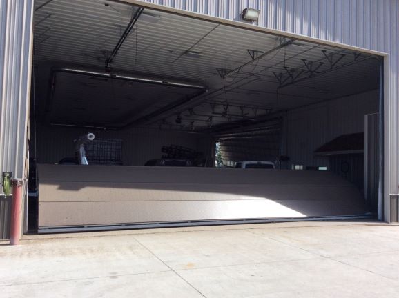
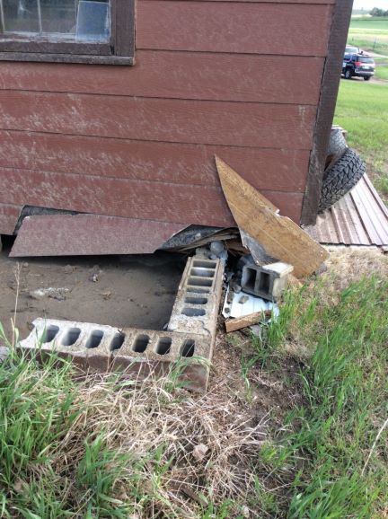
| Outbuilding damage near Farnam. Photos from NWS Survey. | ||
 |
 |
 |
 |
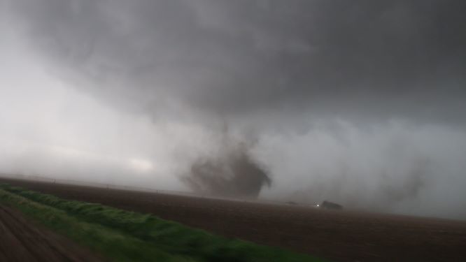
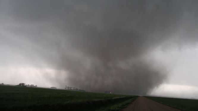
| Southwest of Cozad. Photo by Dustin Wilcox. |
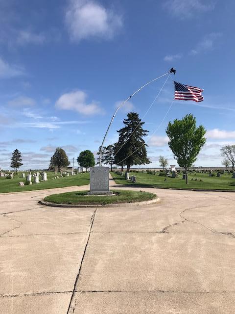
Damage at Cozad Cemetary. Photo by Mike Moritz. |
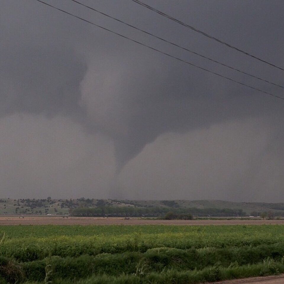
South of Willow Island. Photo by San Dienst. |
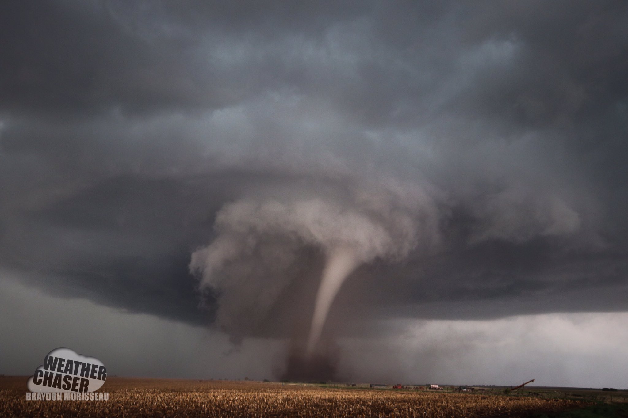
Near Farnam. Photo by Braydon Morisseau. |
 |
 |
 |
 |
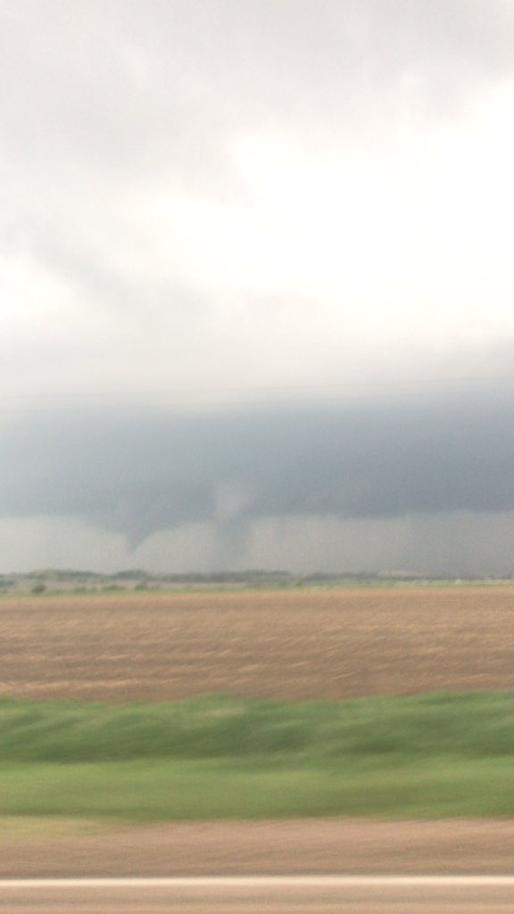
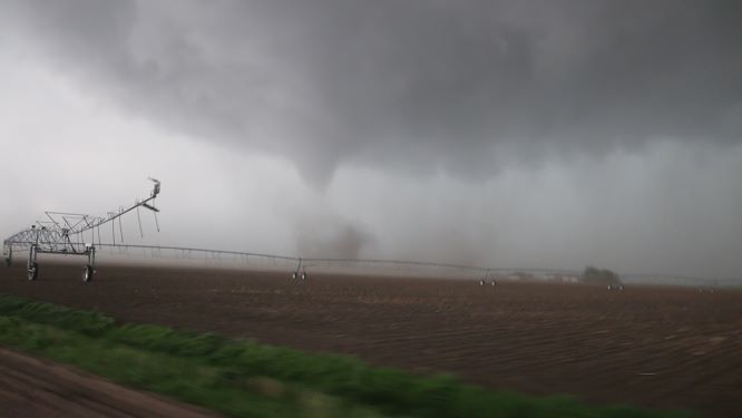
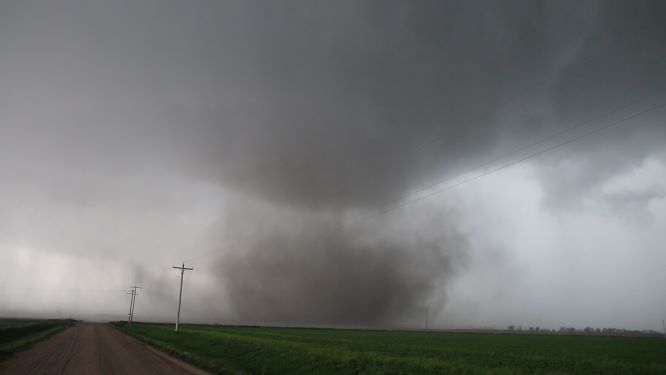
| Tornado near Cozad. Photo by Dustin Wilcox. |
|||
 |
 |
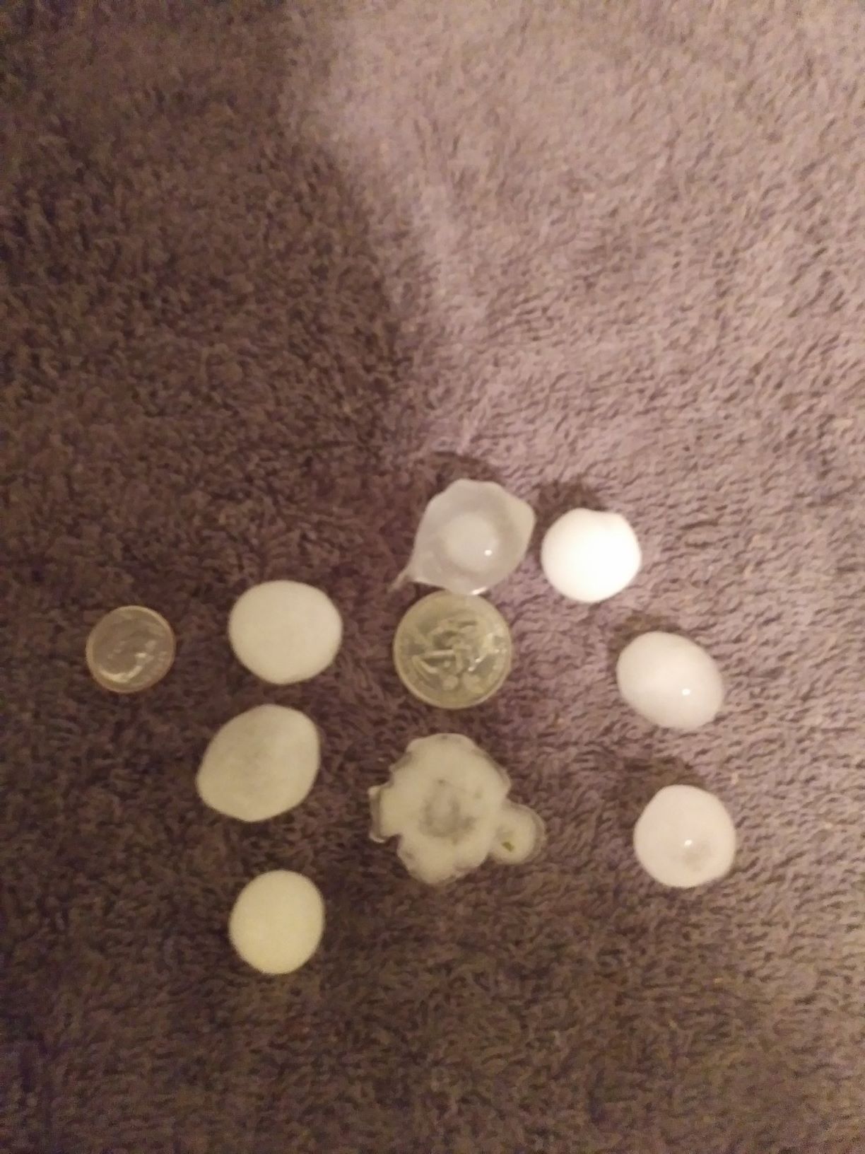 |
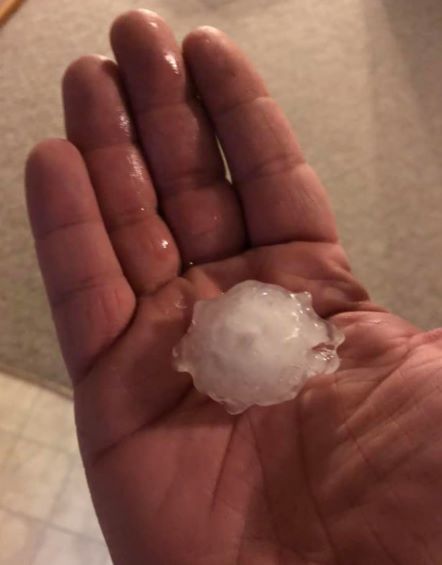
| Hail in Cozad. Photo by Brent Graves. |
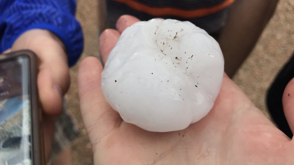
Hail just west of Farnam. Photo by Michael Charnick. |
Hail in Osborne, KS. Photo by Brian Wilson. |
Storm Reports
Listed below are the significant non-tornado reports from the area:
 |
| Map of Local Storm Reports Click on map for more details. |
 |
Media use of NWS Web News Stories is encouraged! Please acknowledge the NWS as the source of any news information accessed from this site. |
|

