Dangerous heat will expand from the Gulf Coast into the Southern Plains and Desert Southwest through week's end. Additional extreme heat impacting the Pacific Northwest will shift to the northern Plains by the weekend. Tropical Storm Bertha is expected to continue to impact portions of the northern Gulf Coast from the western Florida Panhandle to southeastern Louisiana through tonight. Read More >
Overview
|
A strong storm system crossed the Great Plains on Friday while a cold front was draped across the Sandhills, setting the stage for severe thunderstorms. One particular supercell thunderstorm moved from near McCook to near Oconto during the early evening hours. The storm was responsible for numerous tornadoes, including seven in Frontier County and one in southern Custer County. Other thunderstorms produced hail up to golf ball size and wind gusts exceeding 50 mph across southwest Nebraska and the Sandhills. The storms also produced multiple rounds of heavy rain, resulting in spots receiving over two inches of rain by the night's end. |
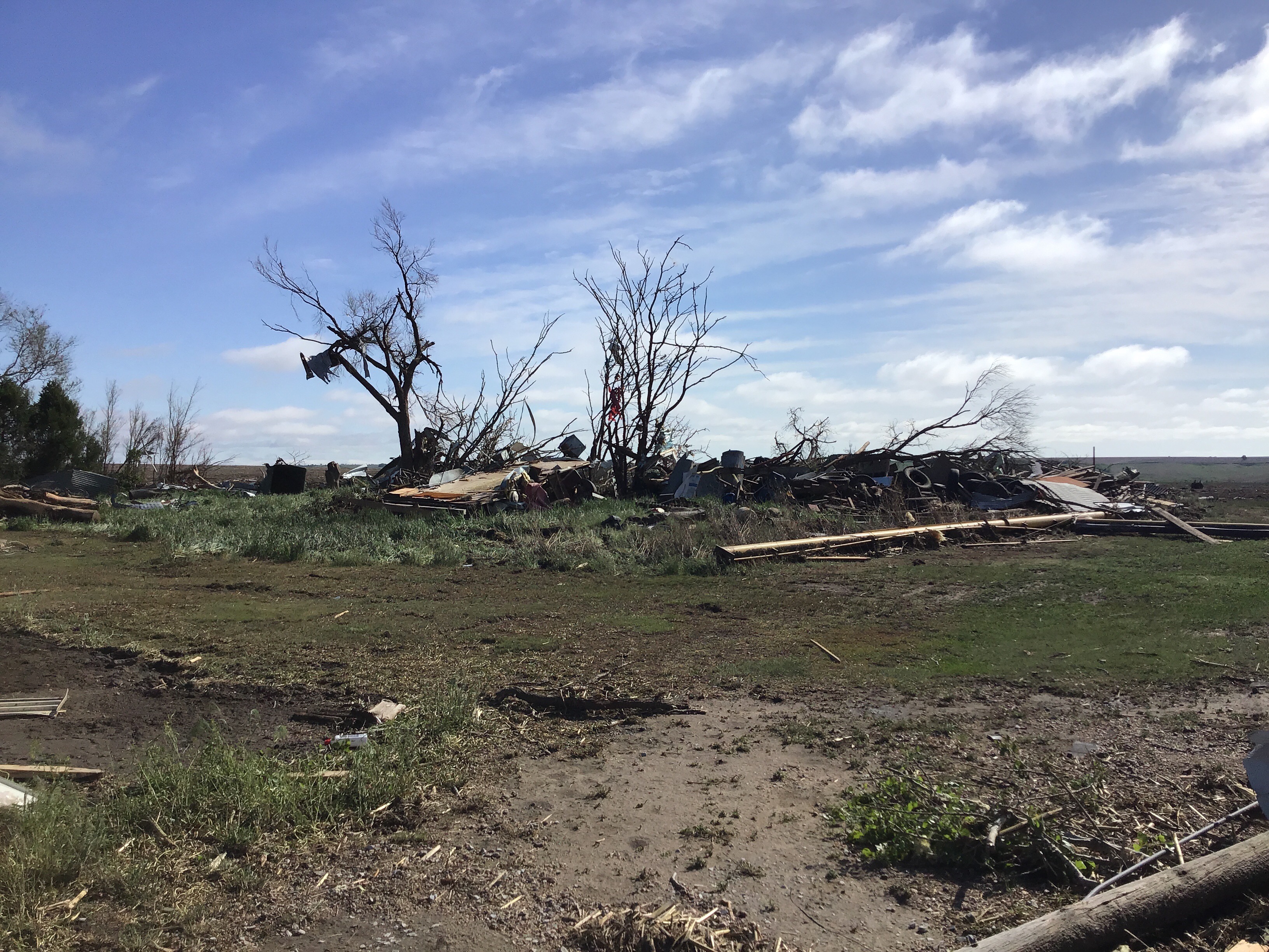
Photo from NWS storm survey |
Tornadoes:
|
Tornado #1 6 miles southwest of Stockville
Track Map 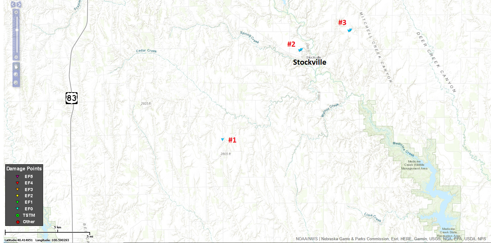  |
||||||||||||||||
|
Tornado #2 Northwest edge of Stockville
Track Map
|
||||||||||||||||
|
Tornado #3 3 miles northeast of Stockville
Track Map
|
||||||||||||||||
|
Tornado #4 5 miles northeast of Stockville
Track Map 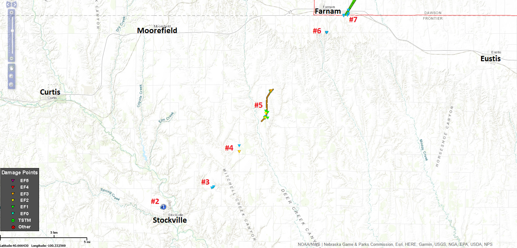
|
||||||||||||||||
|
Tornado #5 8 miles northeast of Stockville
Track Map
|
||||||||||||||||
|
Tornado #6 14 miles northeast of Stockville
Track Map
|
||||||||||||||||
|
Tornado #7 9 miles west of Eustis
Track Map
|
||||||||||||||||
|
Tornado #8 7 miles southeast of Oconto
Track Map 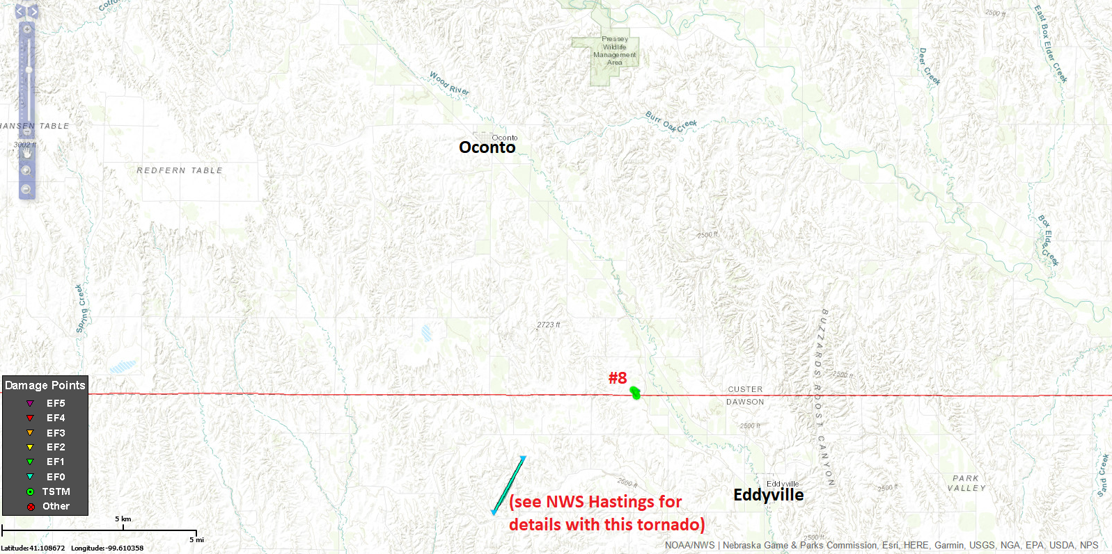
|
||||||||||||||||
For information of the McCook area tornadoes, see NWS Goodland, KS webpage: https://www.weather.gov/gld/may17tornadoes
For information of the Dawson County tornadoes, see NWS Hastings webpage: https://www.weather.gov/gid/may172019
The Enhanced Fujita (EF) Scale classifies tornadoes into the following categories:
| EF0 Weak 65-85 mph |
EF1 Moderate 86-110 mph |
EF2 Significant 111-135 mph |
EF3 Severe 136-165 mph |
EF4 Extreme 166-200 mph |
EF5 Catastrophic 200+ mph |
 |
|||||
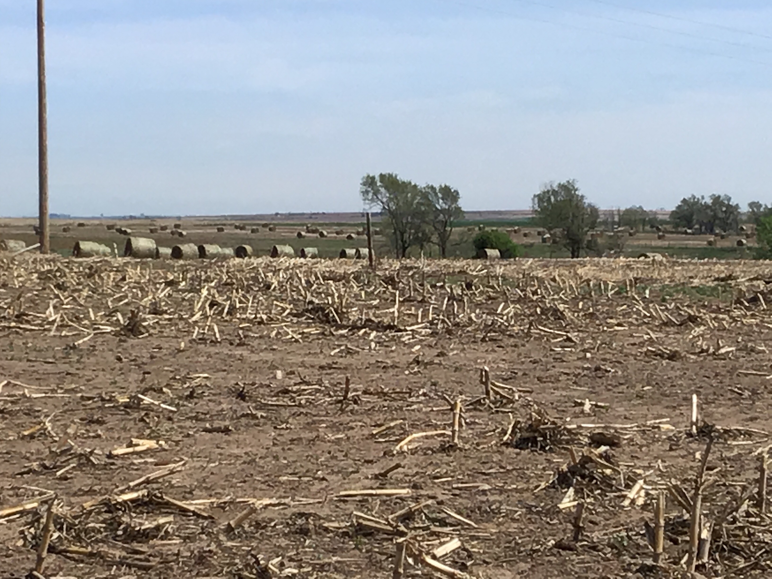
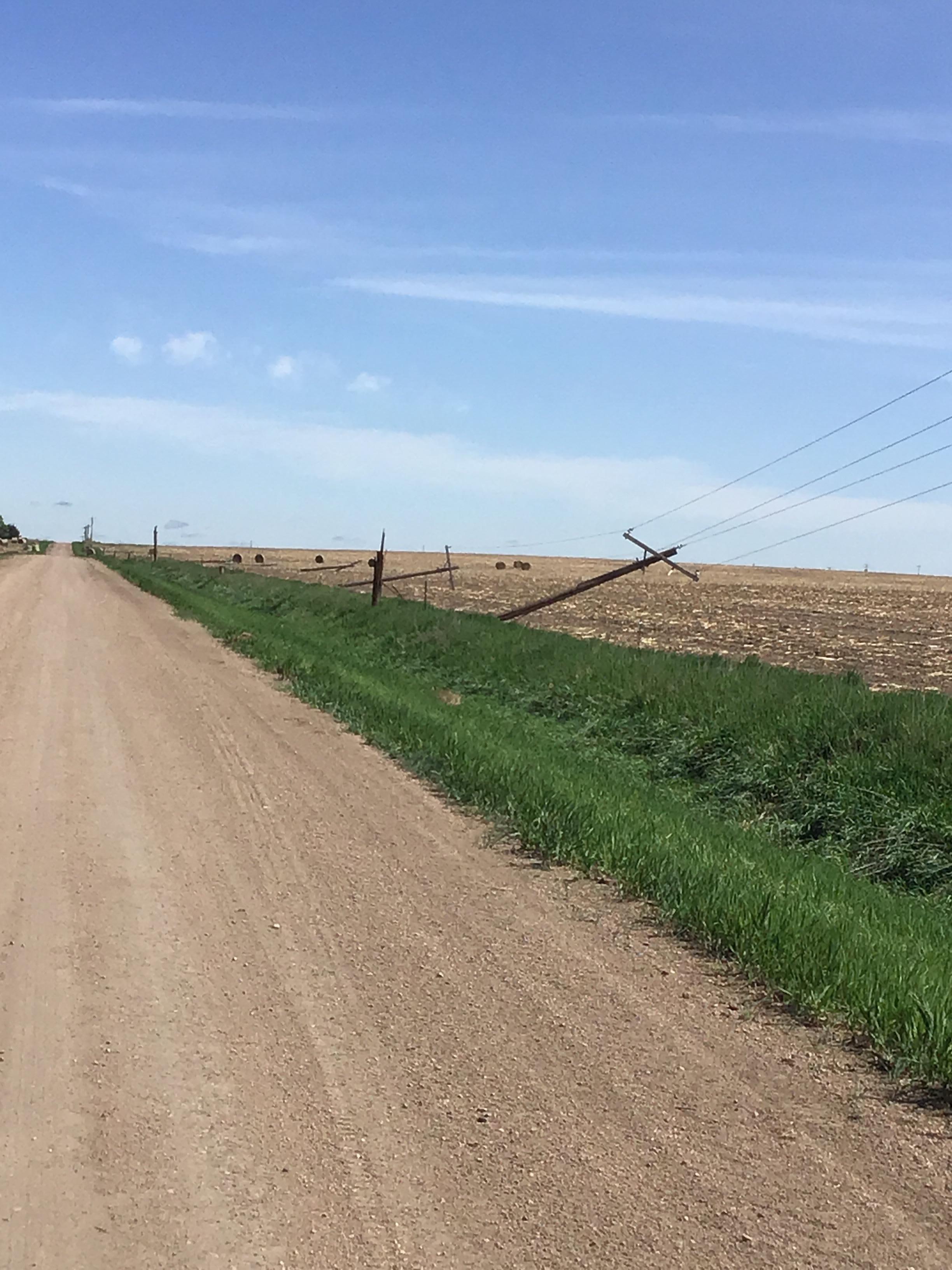
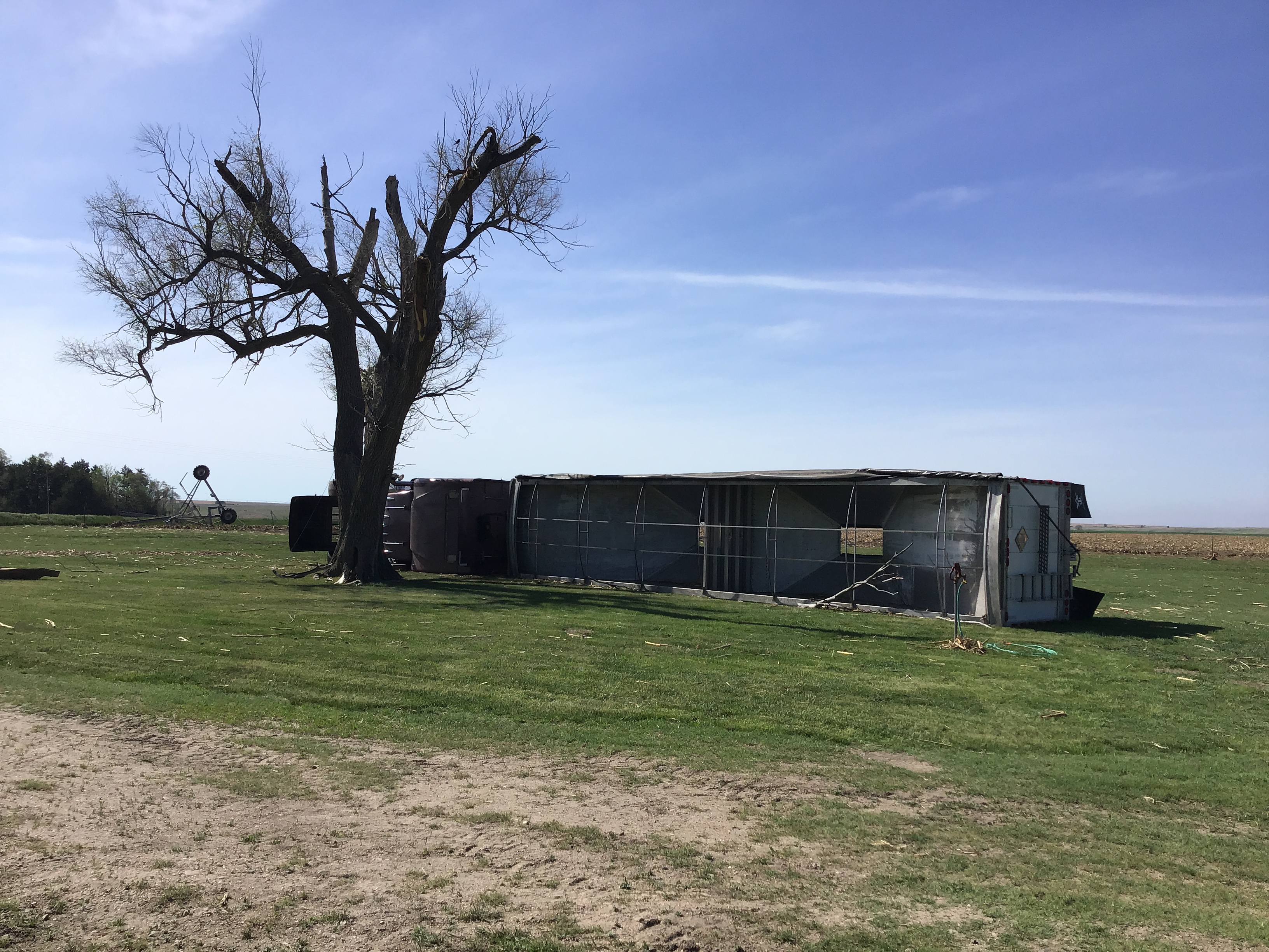
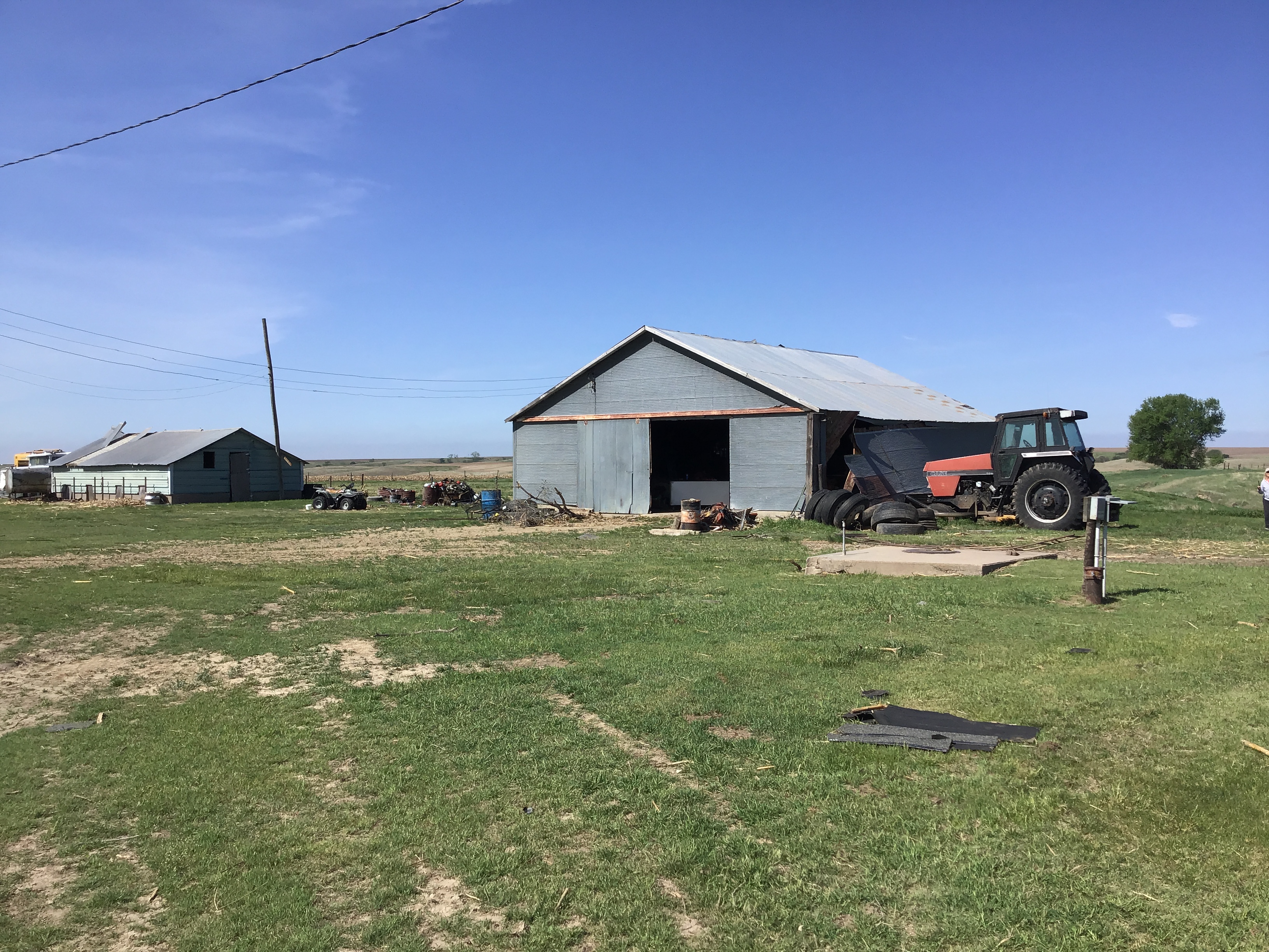
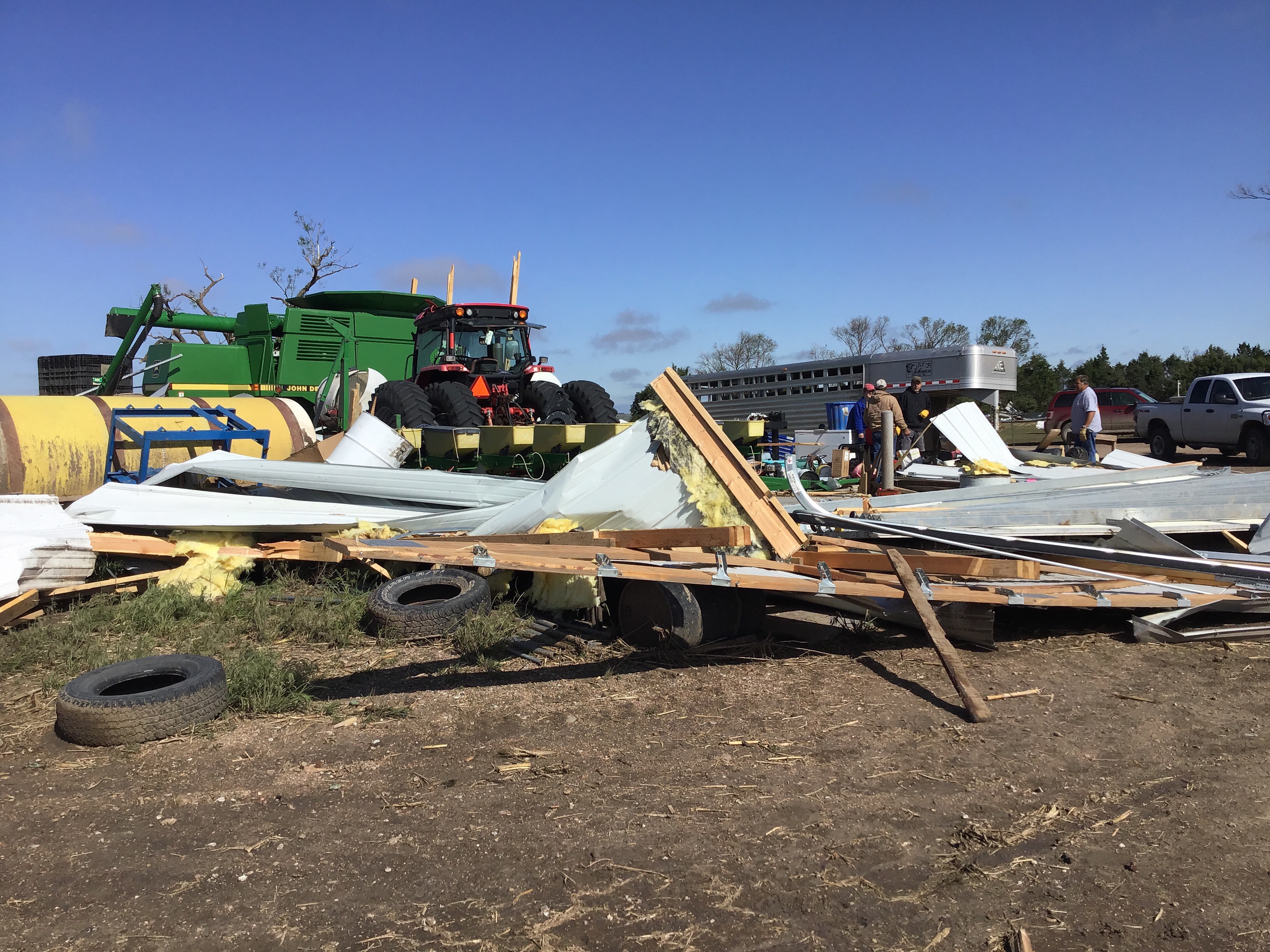
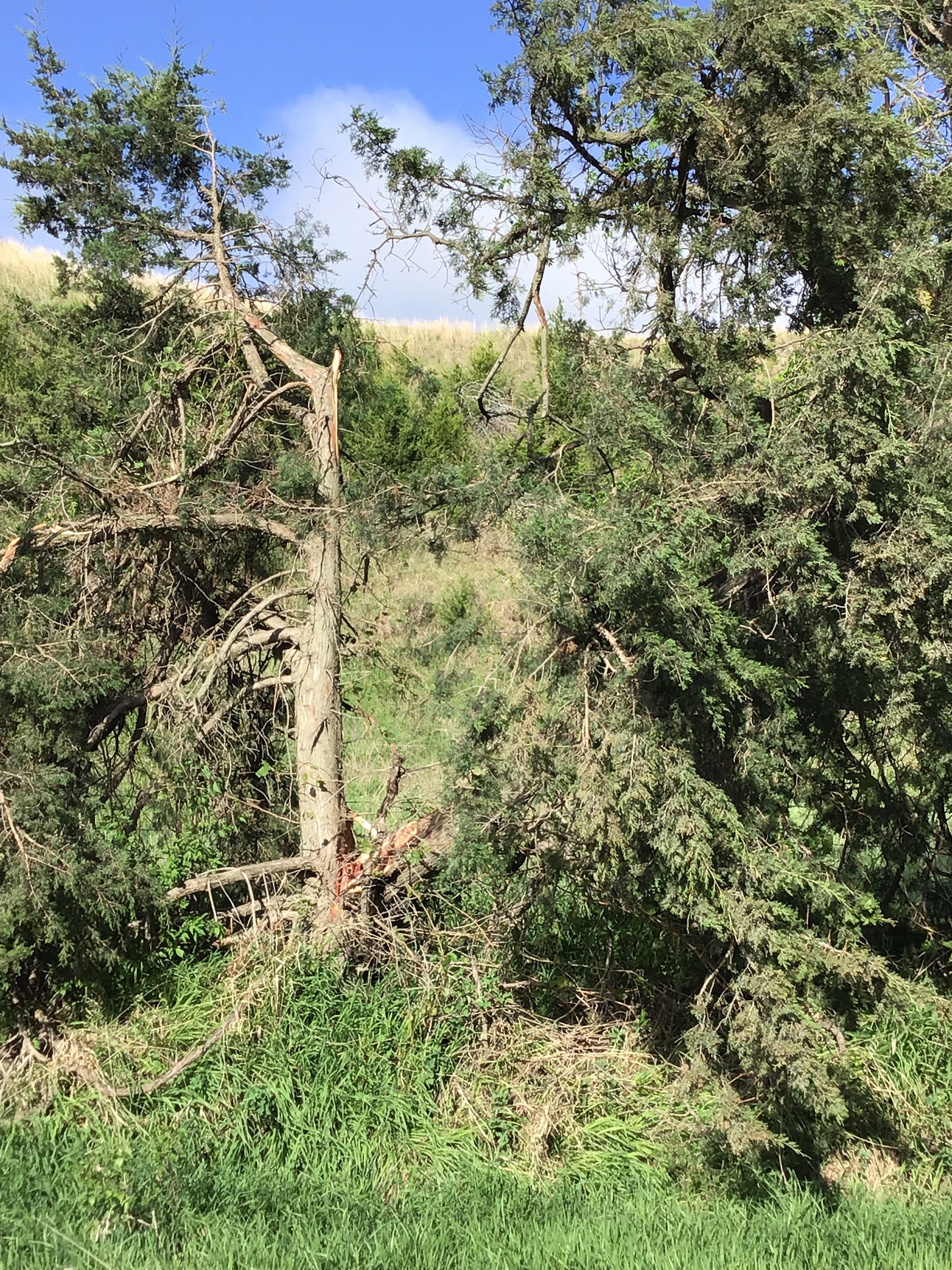
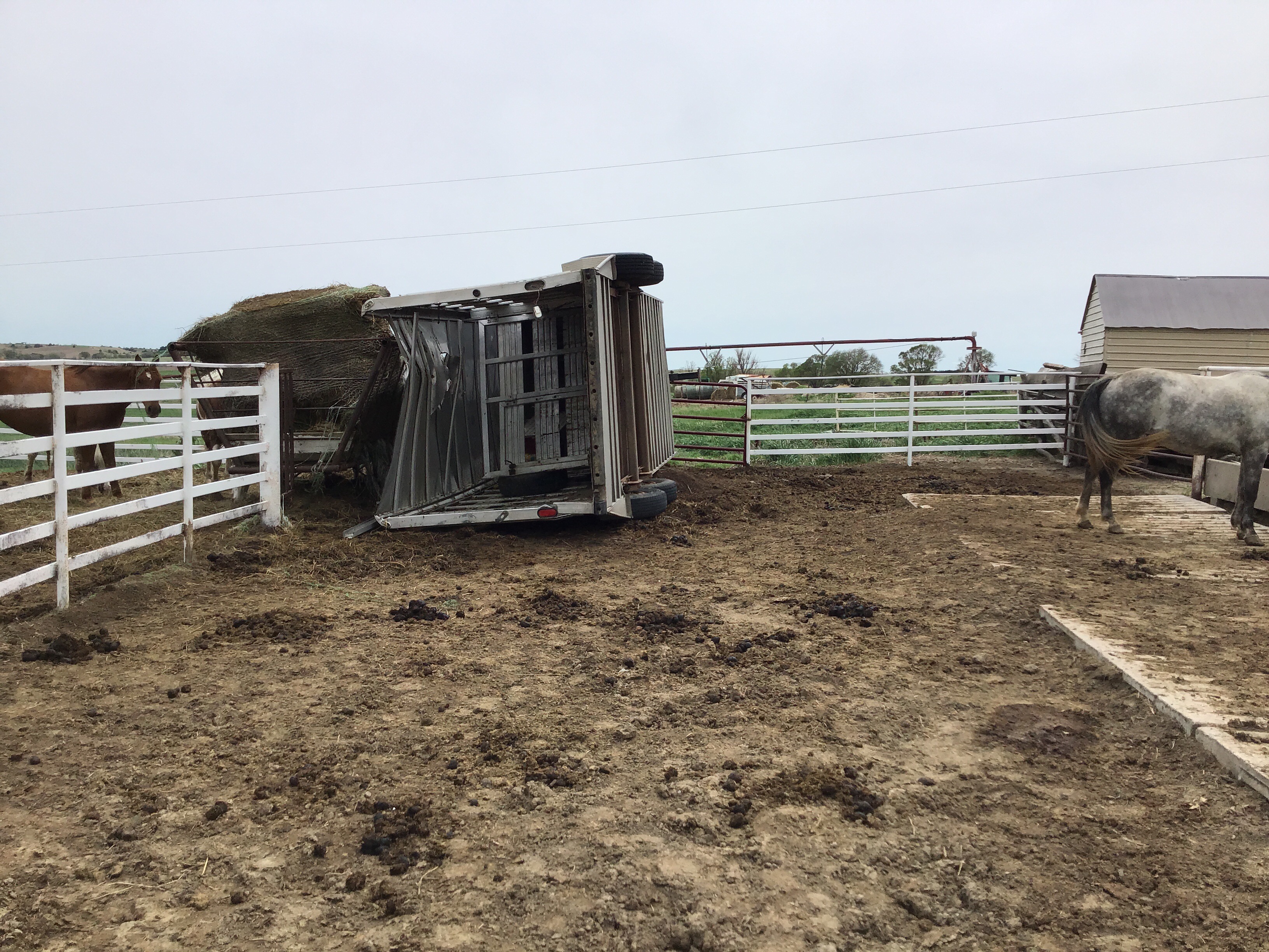
Photos
 |
 |
 |
 |
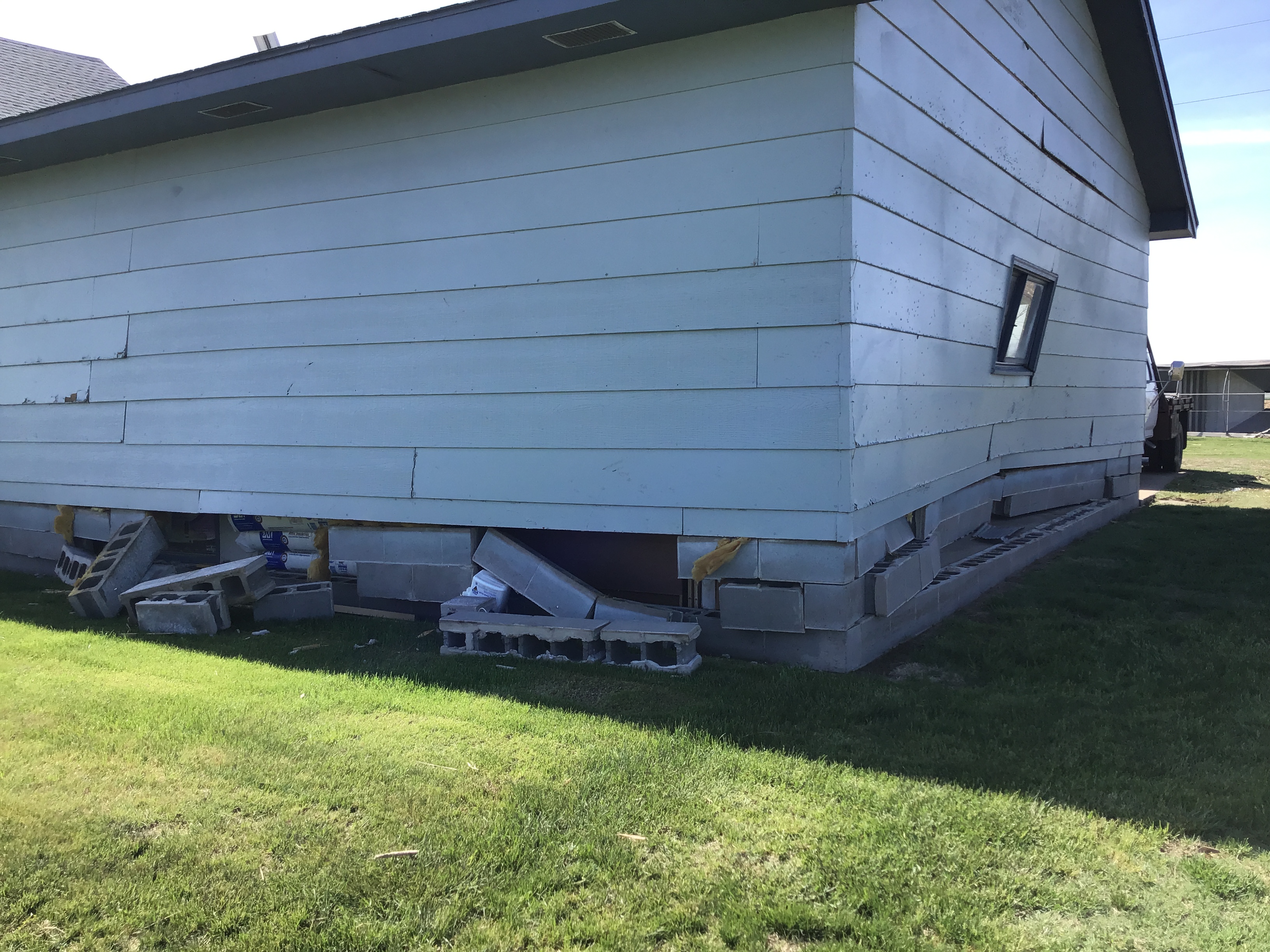
| Tornado #3 - EF-0 damage (NWS storm survey) |
Tornado #4 - EF-2 damage (NWS storm survey) |
Tornado #5 - EF-0 damage (NWS storm survey) |
Tornado #5 - EF-1 damage (NWS storm survey) |
 |
 |
 |
 |
| Tornado #5 - EF-2 damage (NWS storm survey) |
Tornado #5 - EF-1 damage (NWS storm survey) |
Tornado #5 - EF-0 damage (NWS storm survey) |
Tornado #5 - EF-1 damage (NWS storm survey) |
 |
 |
 |
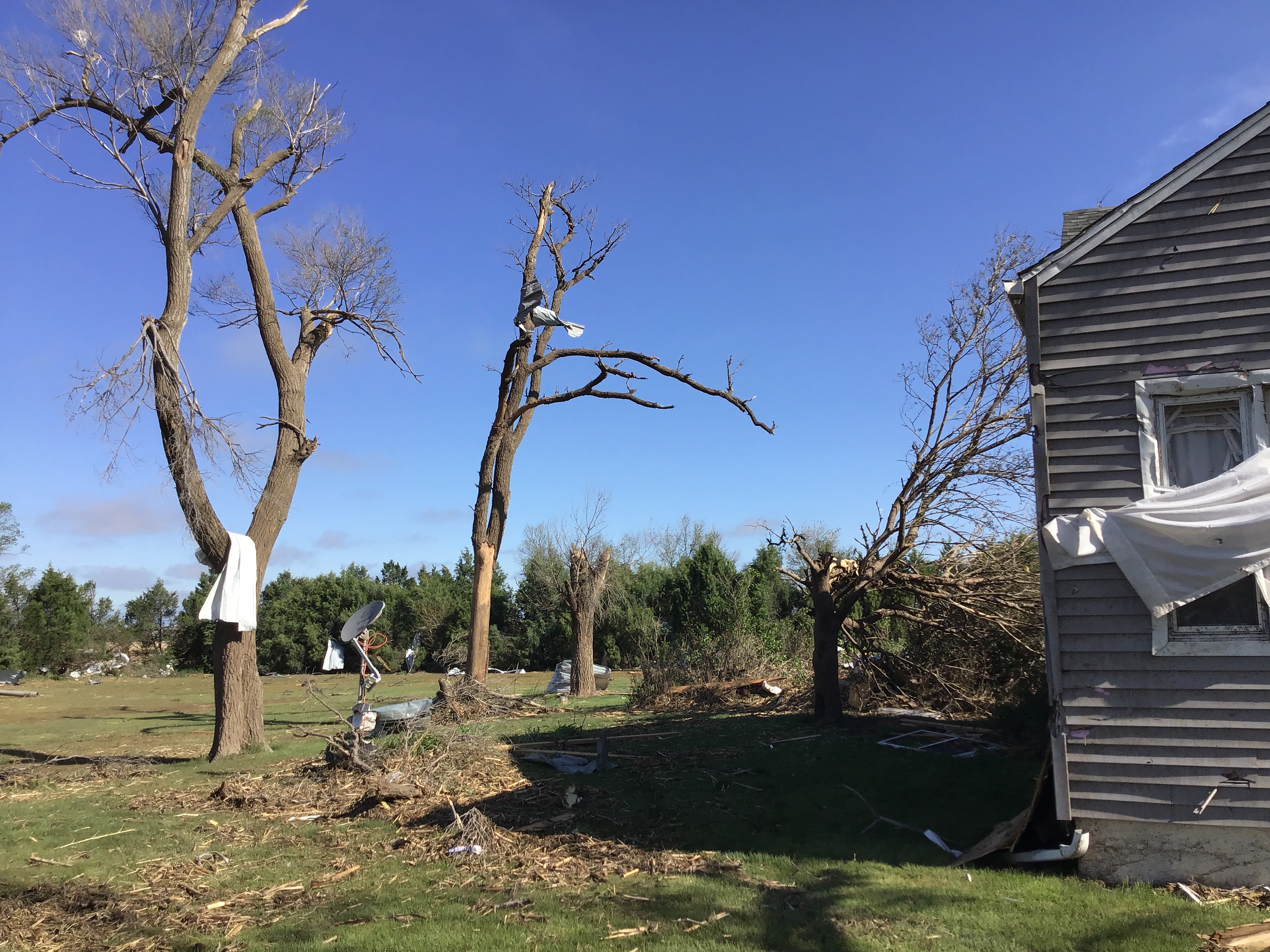 |
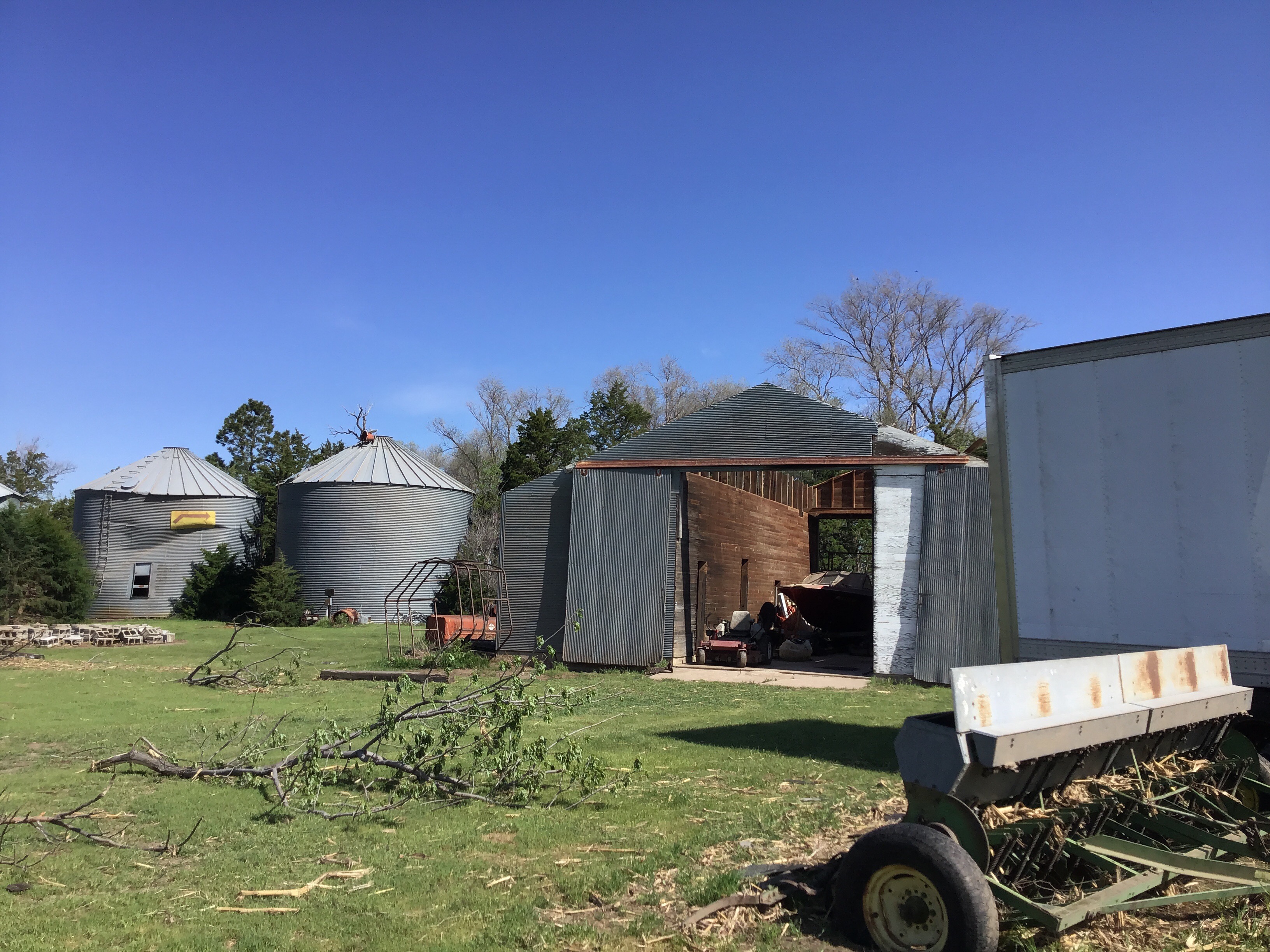
| Tornado #5 - EF-2 damage (NWS storm survey) |
Tornado #5 - EF-2 damage (NWS storm survey) |
Tornado #5 - EF-2 damage (NWS storm survey) |
Tornado #5 - EF-2 damage (NWS storm survey) |
 |
 |
.png) |
 |
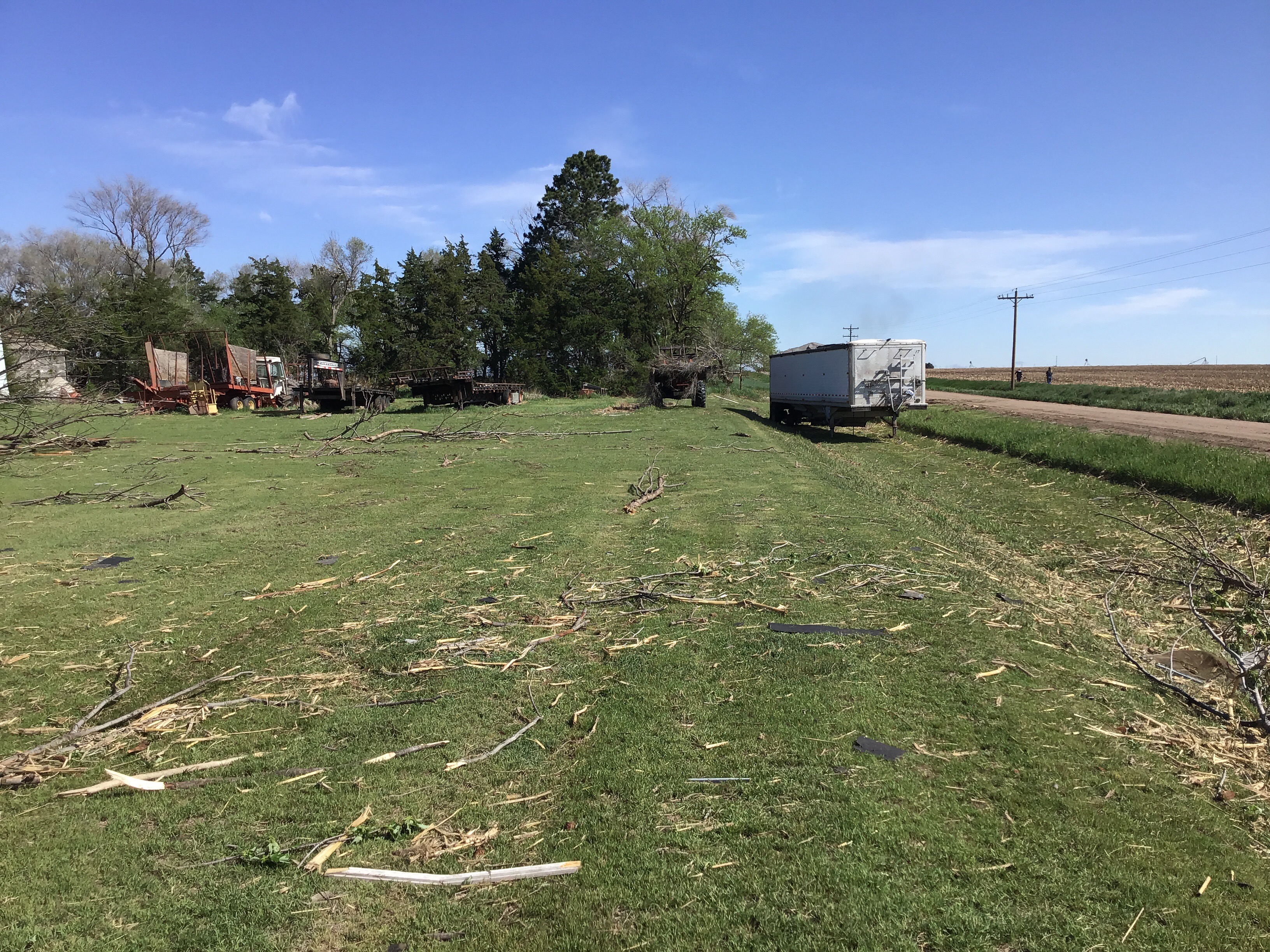
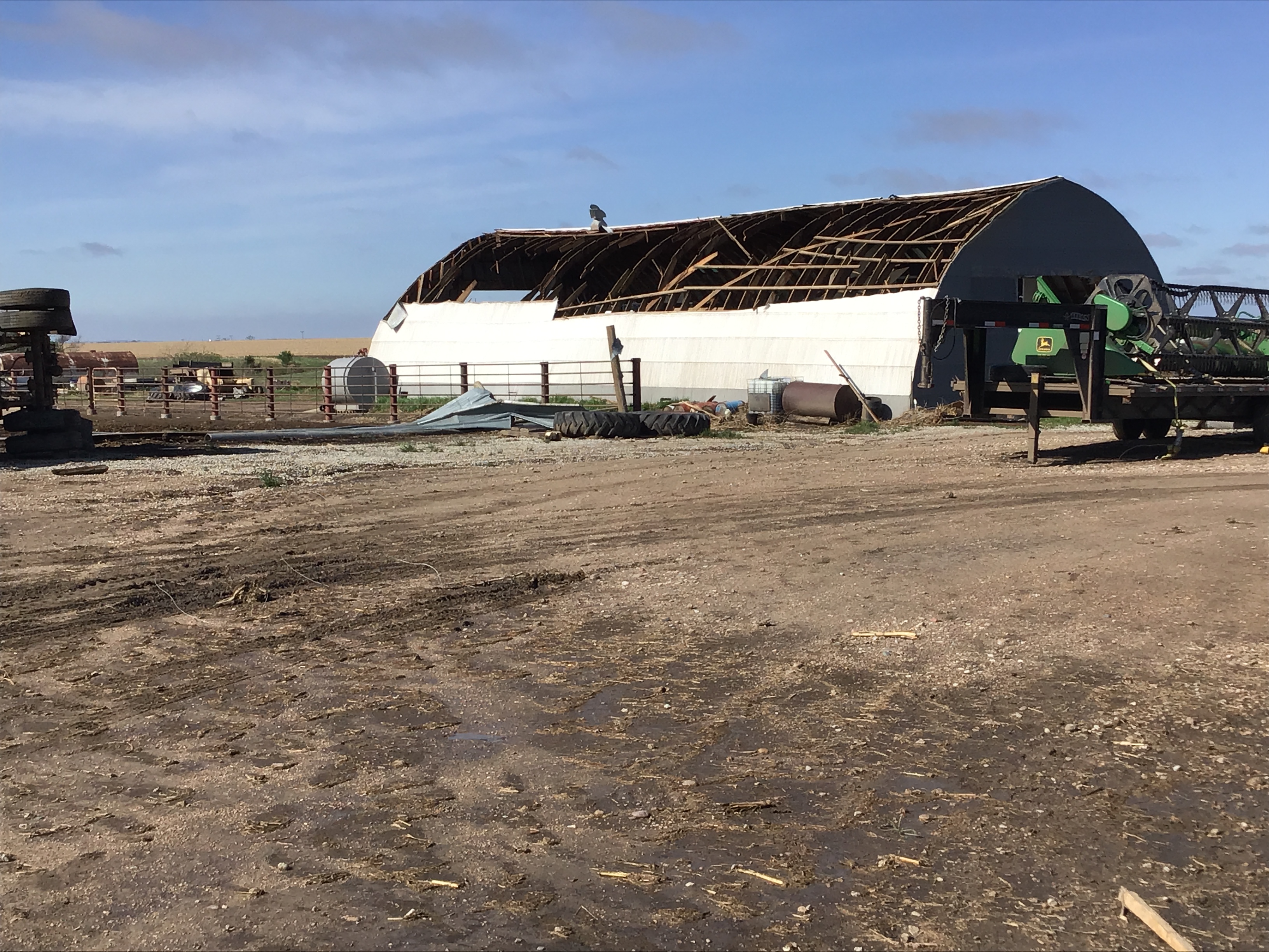
| Tornado #5 - EF-2 damage (NWS storm survey) |
Tornado #6 - EF-0 damage (NWS storm survey) |
Tornado #8 - EF-1 damage (NWS storm survey) |
Tornado #8 - EF-1 damage (NWS storm survey) |
 |
 |
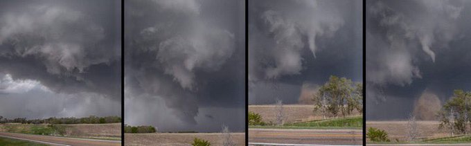 |
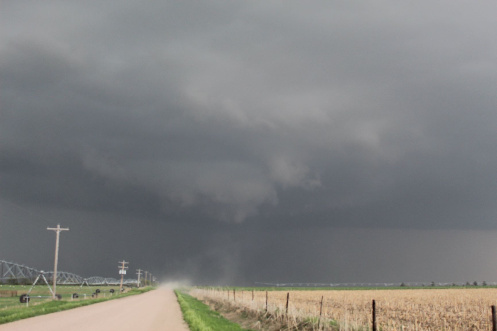
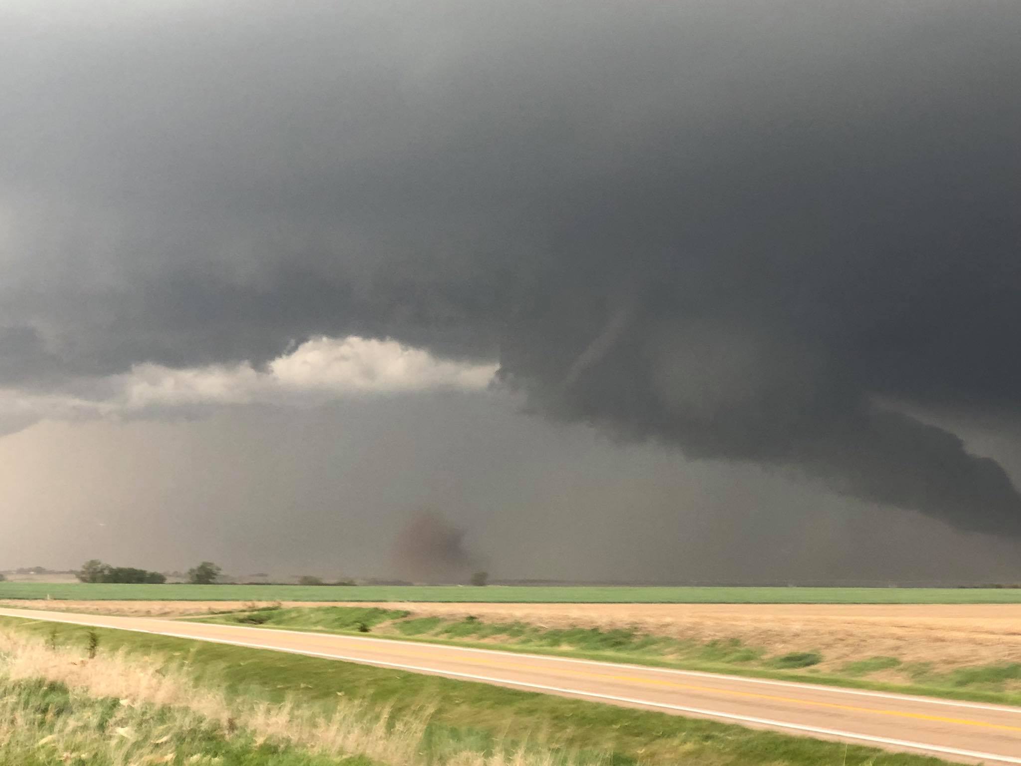
| Tornado southwest of Stockville (photo credit: Jon Bothe) |
Tornado near Stockville (photo credit: Aaron Edwards) |
Tornado near Stockville (photo credit: Shawn Erickson) |
 |
 |
 |
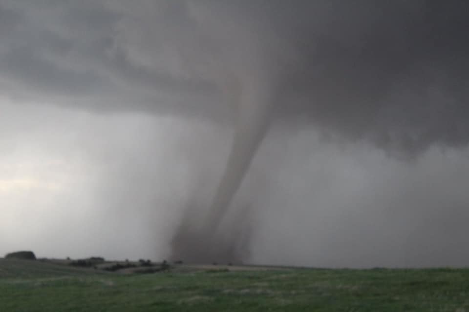 |
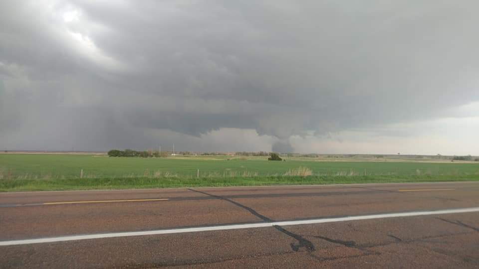
| Tornado near Stockville (photo credit: Joshua Janulewicz) |
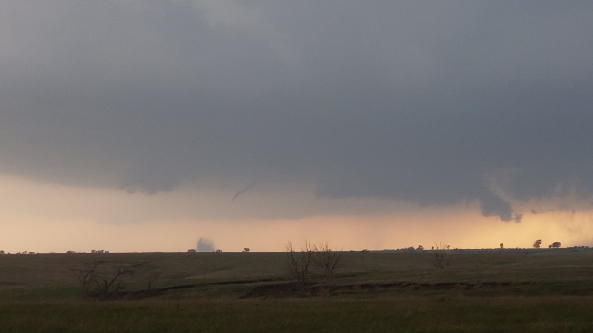
Tornado near Farnam (photo credit: Jacob Terrell) |
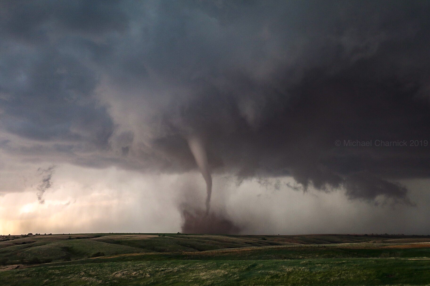
Tornado near Farnam (photo credit: Michael Charnick) |
Tornado near Farnam (photo credit: Eric Mortimore) |
 |
 |
 |
| Tornado near Farnam (photo credit: Mike Umscheid) |
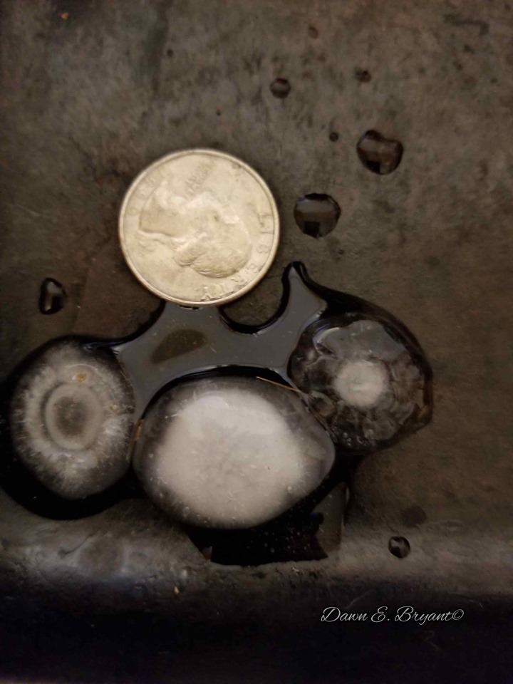
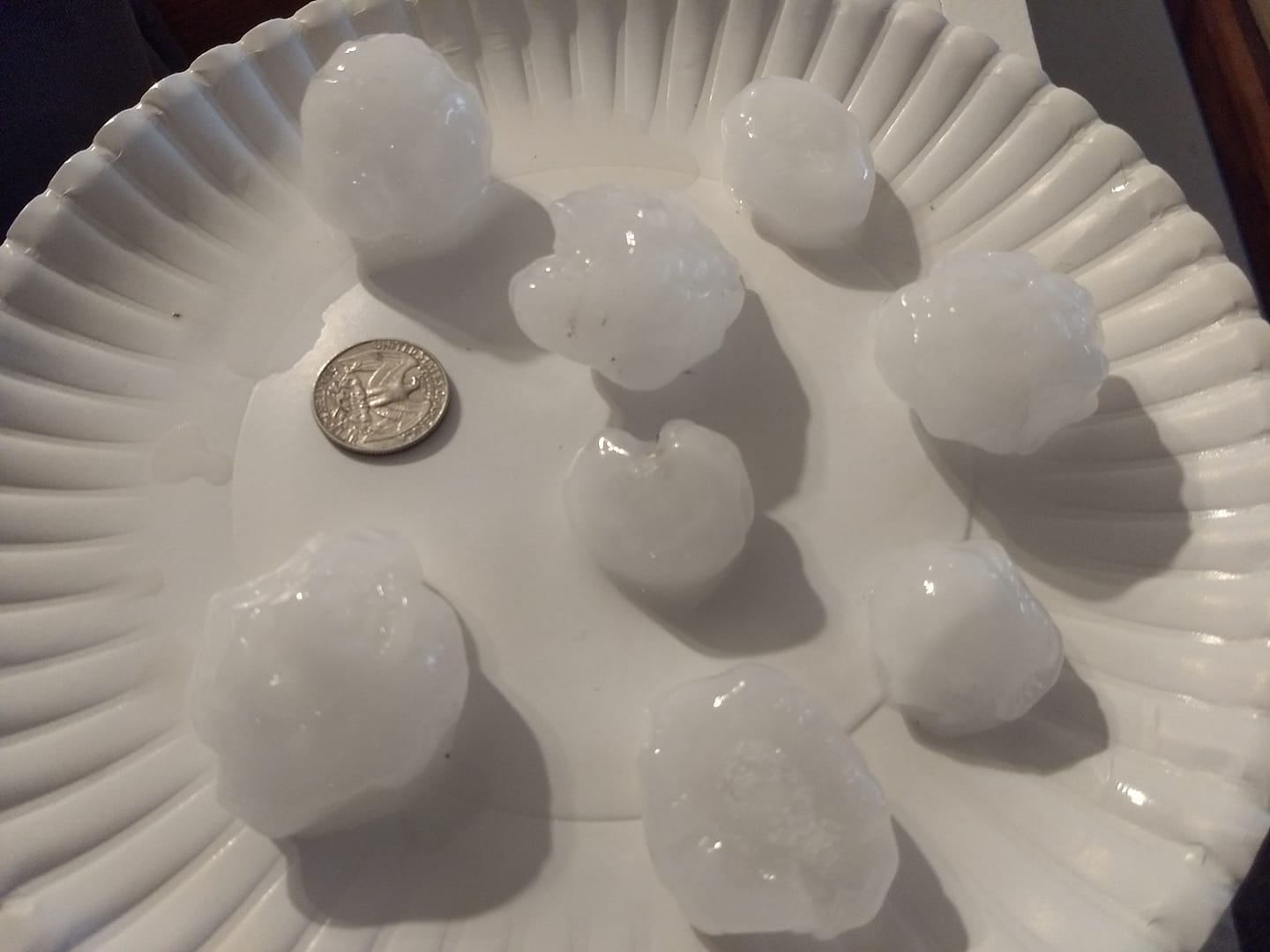
Hail in Thedford (photo credit: Dawn Bryant) |
Hail in Mullen (photo credit: Adrienne Deibler) |
For pictures of the McCook area tornadoes, see NWS Goodland, KS webpage: https://www.weather.gov/gld/may17tornadoes
For pictures of the Dawson County tornadoes, see NWS Hastings webpage: https://www.weather.gov/gid/may172019
Radar
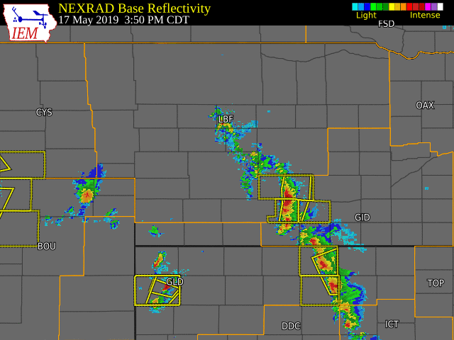 |
|
Radar loop courtesy of Iowa Environmental Mesonet red boxes = Tornado Warnings, yellow boxes = Severe Thunderstorm Warnings orange outlines = NWS boundaries (LBF: North Platte, GID: Hastings, GLD: Goodland KS, BOU: Boulder CO, CYS: Cheyenne WY) |
Storm Reports & Survey Summary
Tornado storm survey preliminary summary: https://nwschat.weather.gov/p.php?pid=201905200141-KLBF-NOUS43-PNSLBF
Storm reports:
Regional map: https://nwschat.weather.gov/lsr/#LBF,GID,GLD,BOU,CYS/201905172100/201905180600/0100
Local list:
..TIME...   ...EVENT...      ...CITY LOCATION...     ...LAT.LON...
..DATE...   ....MAG....      ..COUNTY LOCATION..ST.. ...SOURCE....
            ..REMARKS..

0410 PM     HAIL             4 E THEDFORD            41.98N 100.50W
05/17/2019  E1.75 INCH       THOMAS             NE   PUBLIC

            MOSTLY QUARTER SIZE WITH A HANDFUL OF GOLF BALL SIZE HAIL


0415 PM     HAIL             THEDFORD                41.98N 100.57W
05/17/2019  M1.00 INCH       THOMAS             NE   PUBLIC

0435 PM     HAIL             2 N BRANDON             40.83N 101.93W
05/17/2019  E1.50 INCH       PERKINS            NE   PUBLIC

0450 PM     HAIL             4 NE CHAPPELL           41.13N 102.41W
05/17/2019  E1.00 INCH       DEUEL              NE   PUBLIC

0521 PM     HAIL             15 N ALMERIA            42.05N 99.54W
05/17/2019  E1.00 INCH       LOUP               NE   PUBLIC

0540 PM     HAIL             8 WNW LEMOYNE           41.33N 101.94W
05/17/2019  E1.00 INCH       KEITH              NE   TRAINED SPOTTER

0540 PM     HAIL             8 WNW LEMOYNE           41.33N 101.94W
05/17/2019  E1.00 INCH       KEITH              NE   PUBLIC

0540 PM     HAIL             7 WNW LEMOYNE           41.32N 101.93W
05/17/2019  E1.00 INCH       KEITH              NE   PUBLIC

            PEA TO QUARTER

0556 PM     HAIL             5 NE JOHNSTOWN          42.62N 99.99W
05/17/2019  E1.75 INCH       BROWN              NE   PUBLIC

0630 PM     HAIL             13 NW HAYES CENTER      40.64N 101.20W
05/17/2019  E1.00 INCH       HAYES              NE   PUBLIC

0643 PM     HAIL             NNW STOCKVILLE          40.54N 100.39W
05/17/2019  E2.75 INCH       FRONTIER           NE   TRAINED SPOTTER

            REPORT VIA MPING. TIME BASED ON RADAR.

0658 PM     TORNADO          5 NE STOCKVILLE         40.58N 100.32W
05/17/2019                   FRONTIER           NE   STORM CHASER

            BRIEF ROPE TORNADO ONE THE GROUND FOR A SHORT TIME

0700 PM     HAIL             16 SSW MULLEN           41.83N 101.16W
05/17/2019  M1.00 INCH       HOOKER             NE   PUBLIC

            TIME ESTIMATED. DELAYED REPORT

0709 PM     TORNADO          10 NE STOCKVILLE        40.64N 100.25W
05/17/2019                   FRONTIER           NE   STORM CHASER

            TORNADO ON THE GROUND VIA LIVE STREAM

0712 PM     HAIL             11 SW MULLEN            41.93N 101.19W
05/17/2019  E1.00 INCH       HOOKER             NE   PUBLIC

            NICKEL TO QUARTER

0714 PM     HAIL             1 NE MOOREFIELD         40.70N 100.39W
05/17/2019  M2.50 INCH       LINCOLN            NE   PUBLIC

            DELAYED REPORT VIA SOCIAL MEDIA PICTURE

0714 PM     HAIL             10 SW MULLEN            41.94N 101.18W
05/17/2019  E1.75 INCH       HOOKER             NE   PUBLIC

            PEA TO GOLF BALL

0723 PM     HAIL             3 S MULLEN              42.00N 101.04W
05/17/2019  E1.00 INCH       HOOKER             NE   LAW ENFORCEMENT

0727 PM     TSTM WND GST     8 W LEMOYNE             41.30N 101.95W
05/17/2019  M58.00 MPH       KEITH              NE   TRAINED SPOTTER

            WEST NORTHWEST DIRECTION

0730 PM     HAIL             MULLEN                  42.04N 101.04W
05/17/2019  E1.75 INCH       HOOKER             NE   PUBLIC

0740 PM     HAIL             8 ENE MOOREFIELD        40.73N 100.26W
05/17/2019  M2.50 INCH       LINCOLN            NE   STORM CHASER

            LOCATION OF THE REPORT WAS LATITUDE 40.700 AND LONGITUDE
            -100.261 OR ABOUT 8 MILES EAST NORTHEAST OF MOOREFIELD.

0740 PM     HAIL             8 ENE MOOREFIELD        40.73N 100.26W
05/17/2019  M2.50 INCH       LINCOLN            NE   STORM CHASER

            STORM CHASER REPORTS TENNIS BALL SIZE HAIL AT LATITUDE
            40.700 AND LONGITUDE -100.261 OR APPROXIMATELY 8 MILES
            EAST NORTHEAST OF MOOREFIELD.

0740 PM     HAIL             8 ENE MOOREFIELD        40.73N 100.26W
05/17/2019  M2.50 INCH       LINCOLN            NE   STORM CHASER

0743 PM     HAIL             2 SE JOHNSTOWN          42.55N 100.03W
05/17/2019  E1.00 INCH       BROWN              NE   PUBLIC

0753 PM     HAIL             9 N SENECA              42.17N 100.83W
05/17/2019  E1.00 INCH       CHERRY             NE   PUBLIC

0817 PM     HAIL             NE HERSHEY              41.16N 101.00W
05/17/2019  E1.00 INCH       LINCOLN            NE   PUBLIC

            REPORT VIA MPING.

0830 PM     TORNADO          3 S OCONTO              41.10N 99.76W
05/17/2019                   CUSTER             NE   EMERGENCY MNGR

            STORM SPOTTER OBSERVED. REPORT RELAYED BY EMERGENCY
            MANAGER

0845 PM     HAIL             OCONTO                  41.14N 99.76W
05/17/2019  E2.00 INCH       CUSTER             NE   TRAINED SPOTTER

            REPORT VIA SPOTTER NETWORK. TIME ESTIMATED FROM RADAR.

0902 PM     HAIL             5 W STAPLETON           41.48N 100.61W
05/17/2019  E1.25 INCH       LOGAN              NE   CO-OP OBSERVER

            REPORT FROM OBSERVER. HAIL ENDED AT 0902 CDT.

0907 PM     HAIL             9 SSW BERWYN            41.23N 99.58W
05/17/2019  E1.25 INCH       CUSTER             NE   PUBLIC

            TIME ESTIMATED FROM RADAR.

0930 PM     HAIL             BRADY                   41.02N 100.37W
05/17/2019  E1.00 INCH       LINCOLN            NE   CO-OP OBSERVER

0935 PM     HAIL             11 N ARNOLD             41.58N 100.19W
05/17/2019  E1.00 INCH       CUSTER             NE   PUBLIC

            HAIL OF WIDE RANGE OF SIZES WITH A 1 INCH STONES. TIME
            ESTIMATED FROM RADAR.

0949 PM     HAIL             4 ESE BRADY             41.00N 100.30W
05/17/2019  M1.00 INCH       LINCOLN            NE   TRAINED SPOTTER
 |
Media use of NWS Web News Stories is encouraged! Please acknowledge the NWS as the source of any news information accessed from this site. |
|