Wildfire smoke continues to impact air quality from the Great Lakes region into New England and the Mid-Atlantic today with widespread Air Quality Alerts in effect. Severe thunderstorms are expected across portions of the Ohio Valley and Lower Great Lakes into the Mid-Atlantic and Northeast, this afternoon into the evening. Monsoonal thunderstorms may bring areas of flooding to the Southwest. Read More >
Republican River Flood of May 30, 1935
This website is dedicated to preserving the history of the Republican River Flood of 1935.
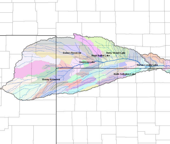
A series of dams and reservoirs were constructed along the Republican River Basin to control the river flow to prevent future floods, for agriculture irrigation, and recreational uses. The project to create most of these dams was the Pick Sloan Missouri River Basin Program Project. The divisions of this project that encompass the Republican River are the Armel Unit (Bonny Dam/Reservoir), Frenchman-Cambridge Division (Enders Dam/Reservoir, Harry Strunk Reservoir/Medicine Creek Dam, Hugh Butler Reservoir/Red Willow Dam, Swanson Reservoir/Trenton Dam), Bostwick (Harlan County Dam/Lake), and Almena Unit (Norton Dam/Keith Sebelius Reservoir). Click on the map below to get the current reservoir data.
The U.S. Department of the Interior, Bureau of Reclamation manages the dams located along the Republican River Basin. For more information about each dam along the basin, click on the "more details" link. Photos, an overview, general history, dimensions, hydraulic and hydrology, and contact information can be found when you follow the link. Along the South Fork of the Republican - Bonny (more details) Along the Frenchman Creek - Enders (more details) Along the Red Willow Creek - Hugh Butler (more details) Along the Medicine Creek - Harry Strunk (more details) Along the Republican - Swanson (more details) - Harlan County (more details) Trenton Dam and Swanson Lake Ground Breaking Celebration Along the Prairie Dog Creek - Keith Sebelius (more details) ------- An additional impact of the flood includes ground water use between the three states as regulated by the |