Lenticular Clouds, technically known as altocumulus standing lenticularus, are a strange looking cloud formation that form as strong winds blow over and around rough terrain. Some people have mistaken them for UFOs due to their smooth saucer like shape. They are fairly common over the western half of the mainland due to the Rockies, but relatively rare in Hawaii.
However a couple of long lasting lenticular clouds occurred over the Big Island on November 25. During the early morning hours of November 25, strong winds of 40 to 60 mph from the southwest developed at altitudes above 10,000 feet over the Big Island. The upper portions of Mauna Loa and Mauna Kea (both reaching heights of about 13,000 feet) forced these strong winds to flow over and around the peaks of the mountains, resulting in "waves" in the atmosphere just downwind of both of the summits. With the atmosphere containing enough moisture at mid and upper levels, lenticular clouds formed in the region where the "wave" was peaking. These clouds are also a sign to pilots that there is turbulence around. Click this link for a profile of temperature, moisture and winds (skew-T chart) based upon the afternoon radiosonde launch from Hilo.
Here is a simple little "cartoon" schematic of how a lenticular cloud forms. Note the wavelike path of the air as it flows over the mountain. 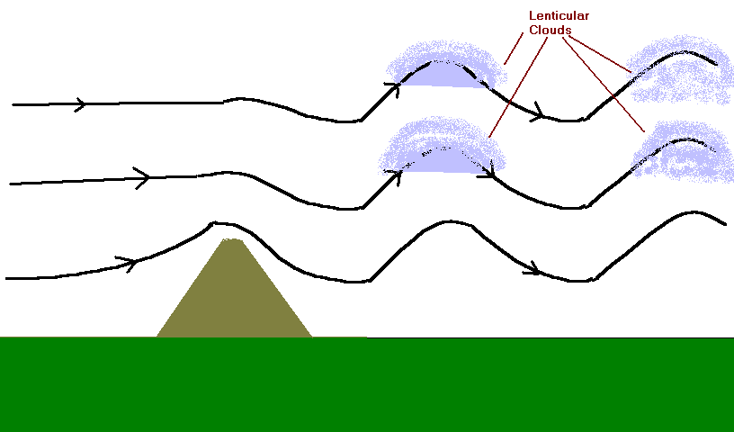
As the winds remained steady and strong the entire day, the clouds appeared to not move at all. In fact, the cloud was constantly reforming on the side where the air moves upward and dissipating on the side with the descending air.
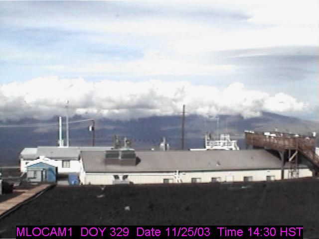
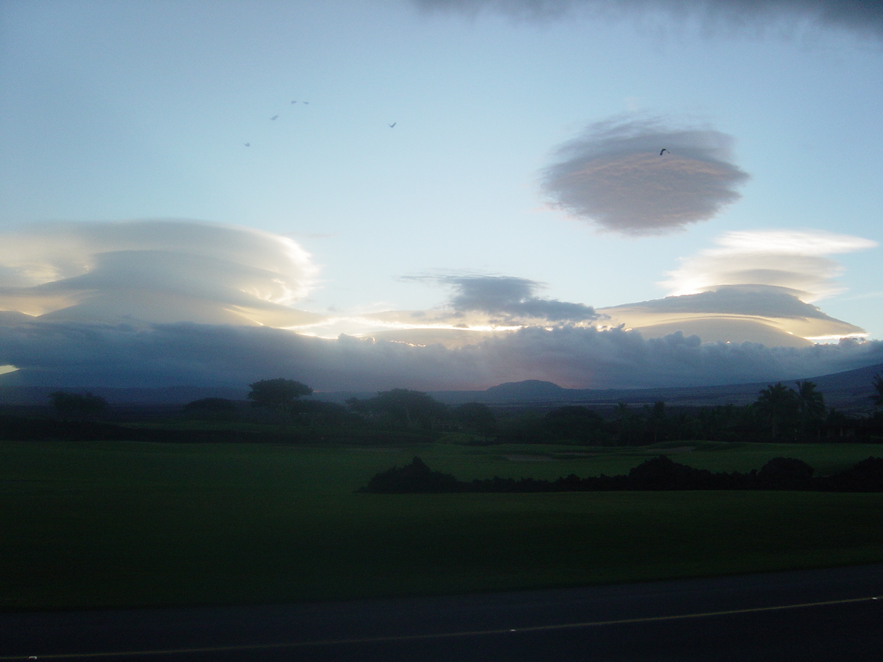
Here are a couple of views several hours apart from the Mauna Loa Observatory looking north toward Mauna Kea. Notice the lenticular cloud in the upper right hand portion of both pictures. Click on the image for a larger version. 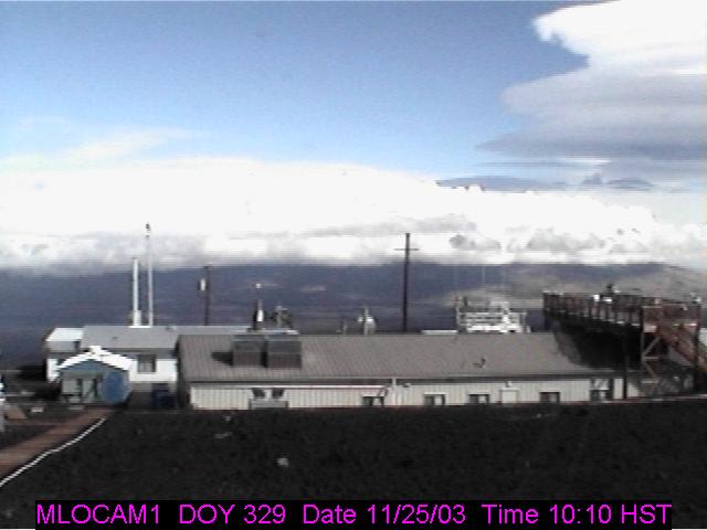
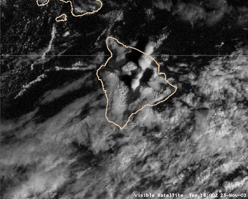
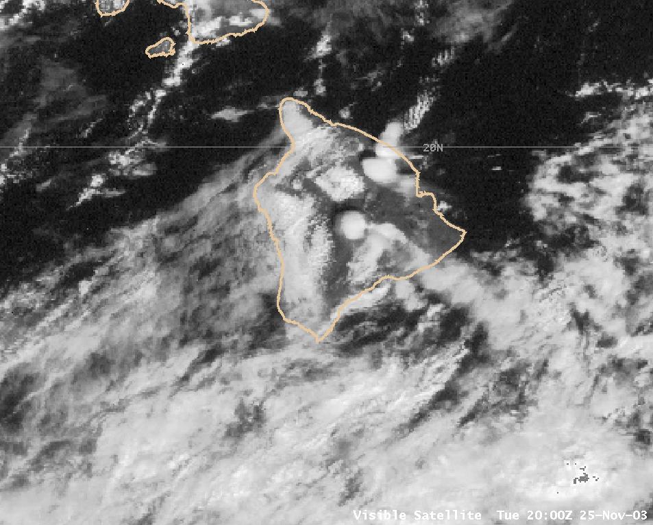
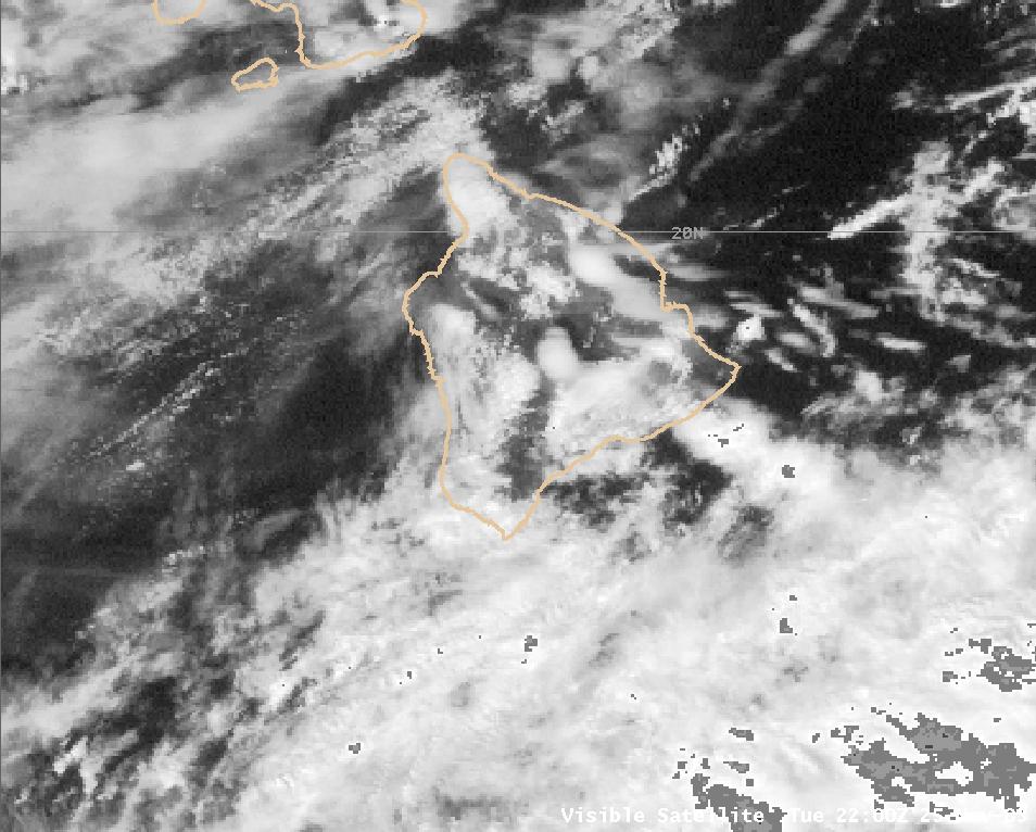
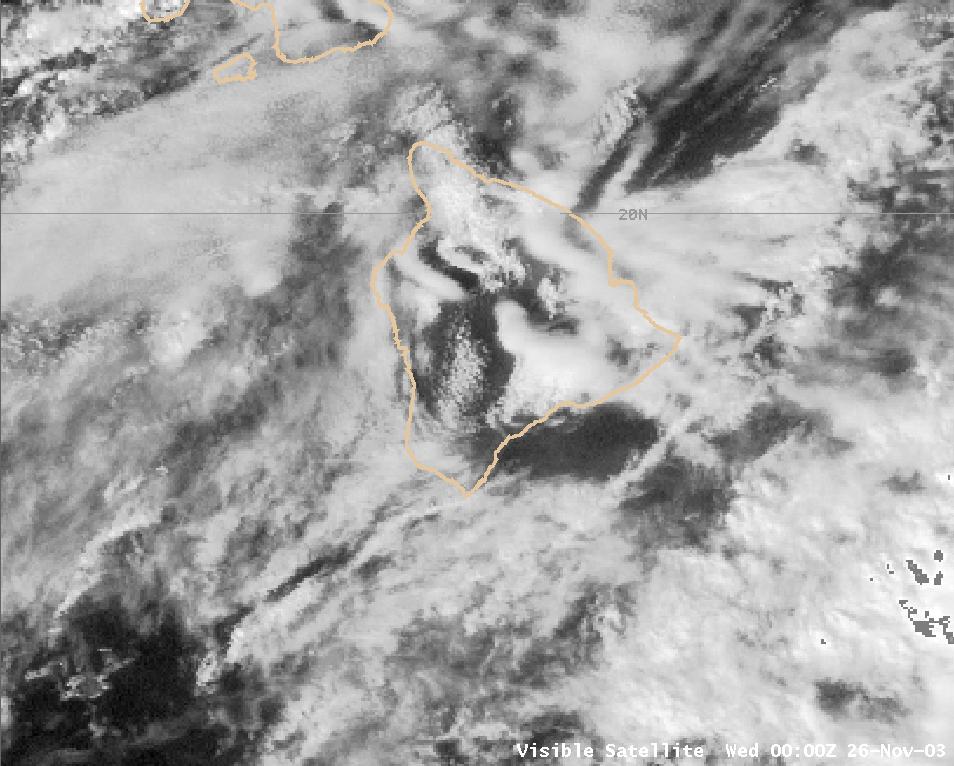
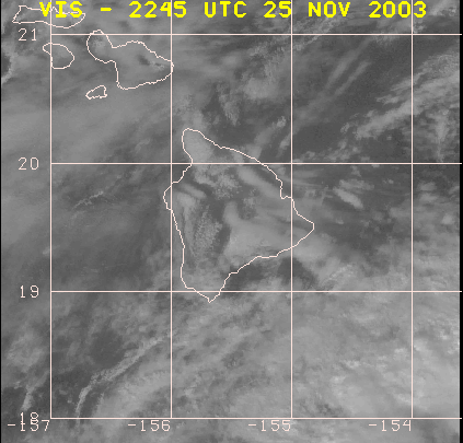
These clouds were also large enough to show up on high resolution satellite imagery. Again note how the clouds basically remain in place throughout the entire day! Based upon satellite imagery data, the tops of these clouds may have reached 40,000 feet high at times. Click on each image for a larger version. Click here for a loop of satellite images between 12:45-1:45 pm.
-
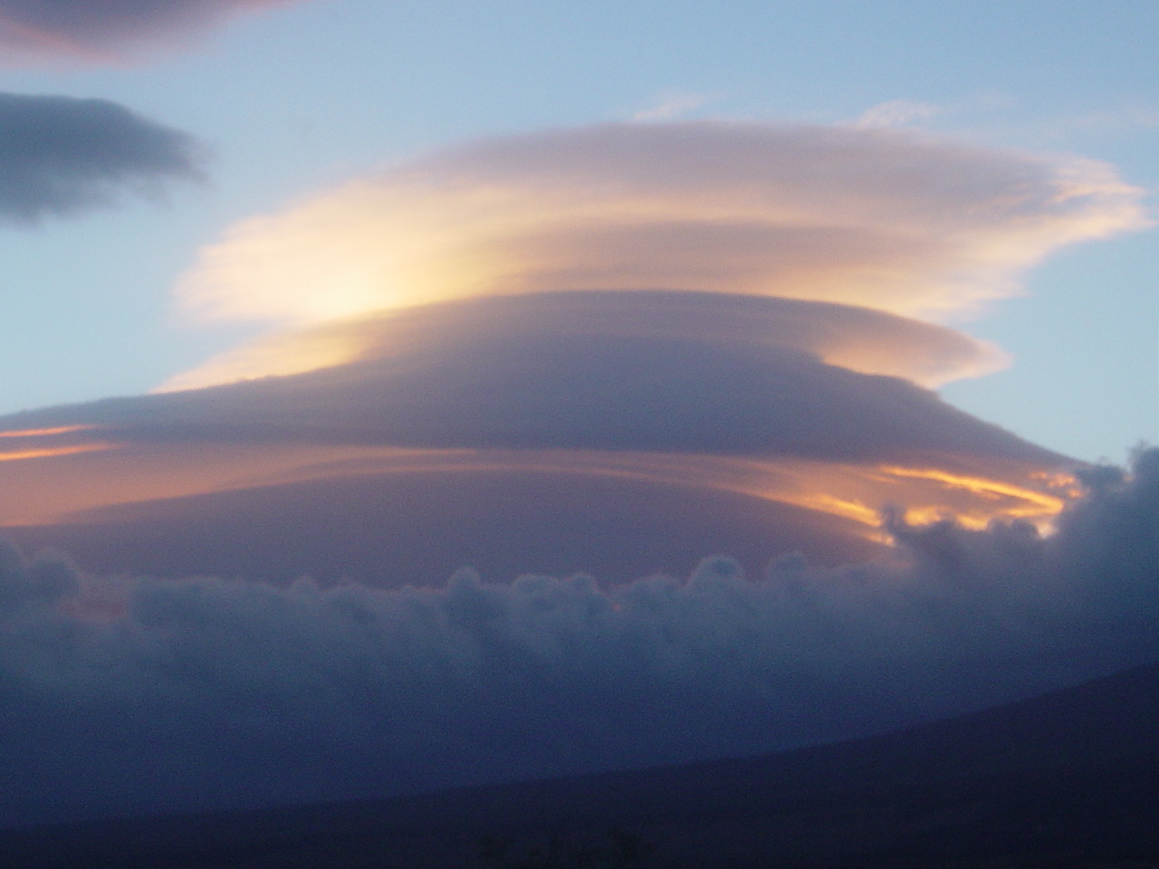
Note the lenticular clouds being brightly lit by the sun --- before the sun has risen high enough above the horizon to shine on the lower level clouds, land and water. 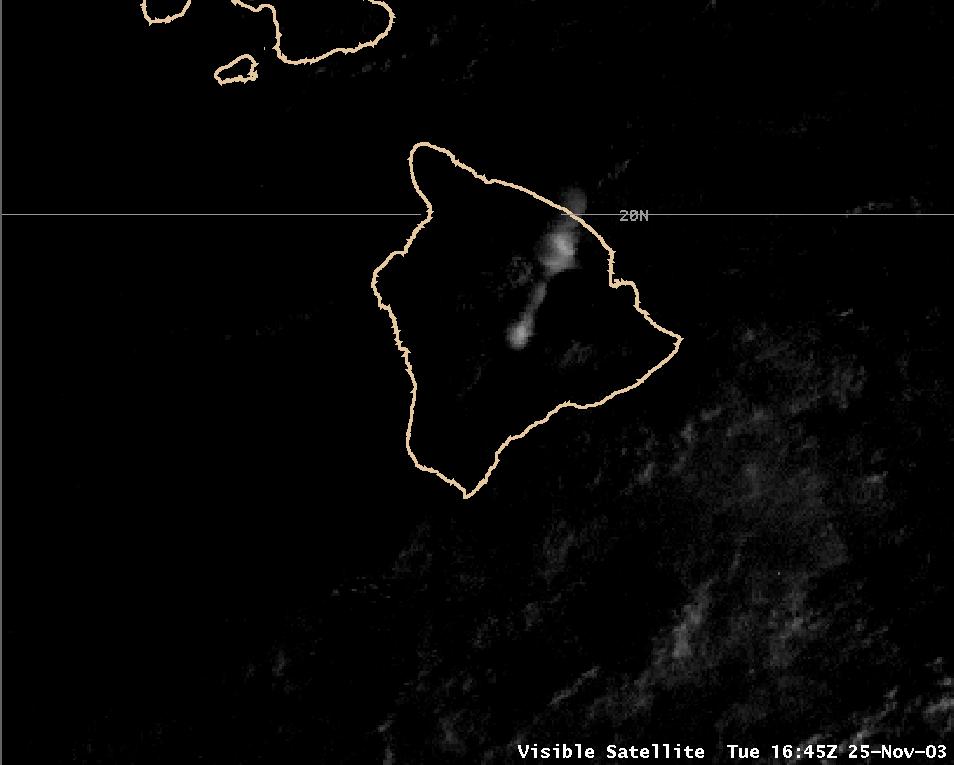

