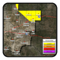
Last Map Update: Thu, Jul 3, 2025 at 3:58:37 am CDT
|
Text Product Selector (Selected product opens in current window)
|
|
 |
 |
 |
 |
 |
 |
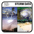
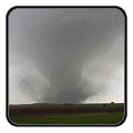
| Storm Reports | Spotter Briefing | Storm Spotters | Storm Data | Tornado Statistics | Social Media |
 |
 |
 |
 |
 |
 |
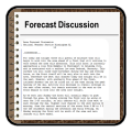
| Forecast Discussion | Hourly Forecast | Graphical Forecast | Fire Weather | Aviation | Hydrology |
 |
 |
 |
 |
 |
 |
| Observations | Air Quality | Satellite | Climate | Past Events | Weather Radio |


 Local Radar
 Weather Map
 Satellite