Overview
|
Beginning in the early morning hours of January 3rd, 2018, a rare winter storm affected southeast Georgia and northeast Florida. The storm produced a variety of wintry precipitation, including snow, sleet and freezing rain. Snowfall spread across much of southeast Georgia with snowfall amounts ranging from a trace to 3.5 inches. The Bacon County Airport (KAMG) located in Alma, GA measured 3.0 inches of snow making it the second highest daily snowfall total of all-time since records began for the site in 1948. Ice accumulated from the Suwannee Valley up through the Georgia coastline and extended as far south as Gilchrist and Alachua counties. This resulted in widespread power outages, downed trees and road closures. The last major winter storm to impact the area occurred on December 22-24, 1989. |
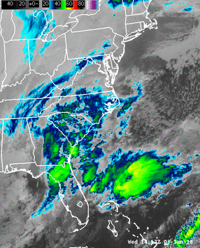 GOES-16 infrared satellite loop from January 3-4, 2018 showing the winter storm rapidly intensifying along the U.S. East Coast. Brighter colors indicate higher and colder cloud tops. |
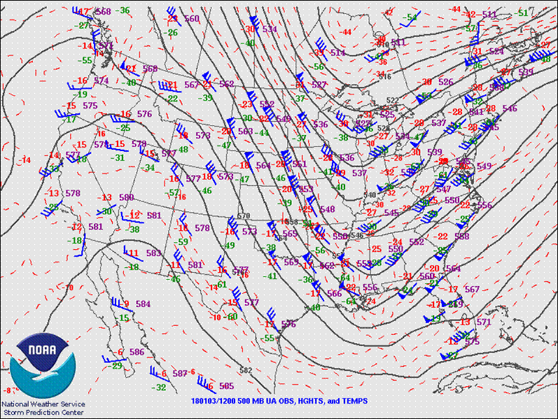
A strong upper level trough deepened over the eastern U.S. and tracked across the Gulf approaching the region from the west (Figure 1). While at the surface, a low pressure system near the northern Bahamas developed and moved north-northeastward along the Florida Atlantic coast (Figure 2). This setup caused moisture to lift northward up the Florida peninsula and overrun the cold arctic air in place at the surface over the area.
 |
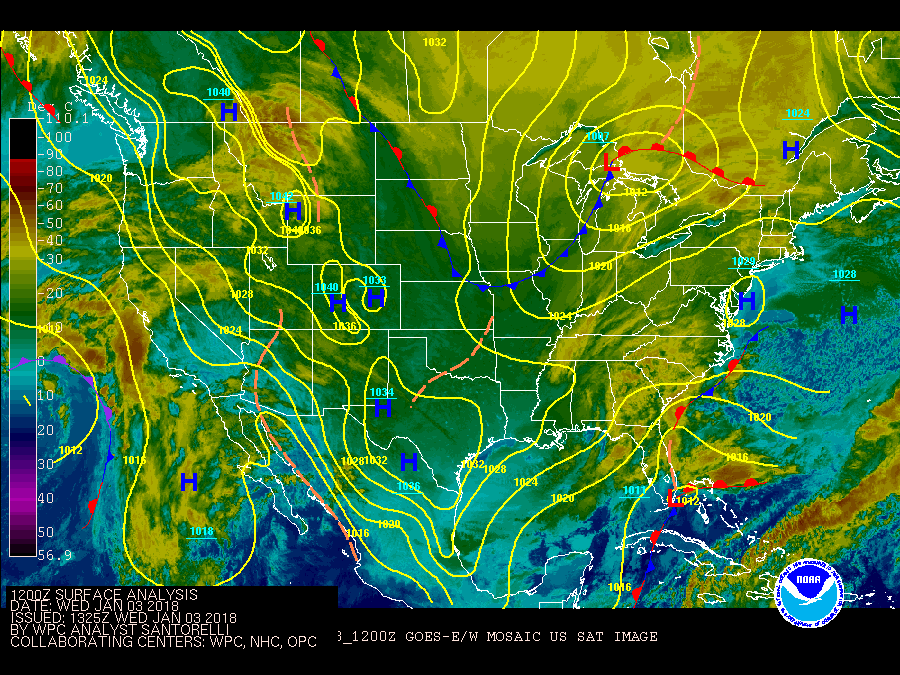 |
| Figure 1: SPC Upper Air Analysis map for 1/3/18 12Z. | Figure 2: Loop of WPC Surface Analysis and GOES-E/W mosaic satellite imagery |
|
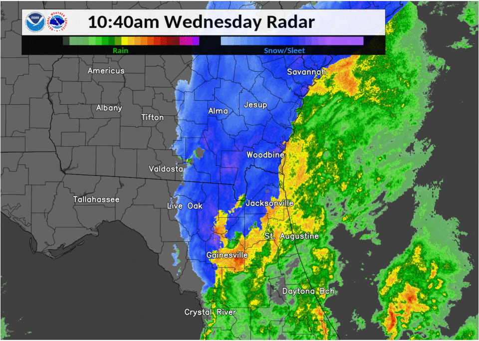
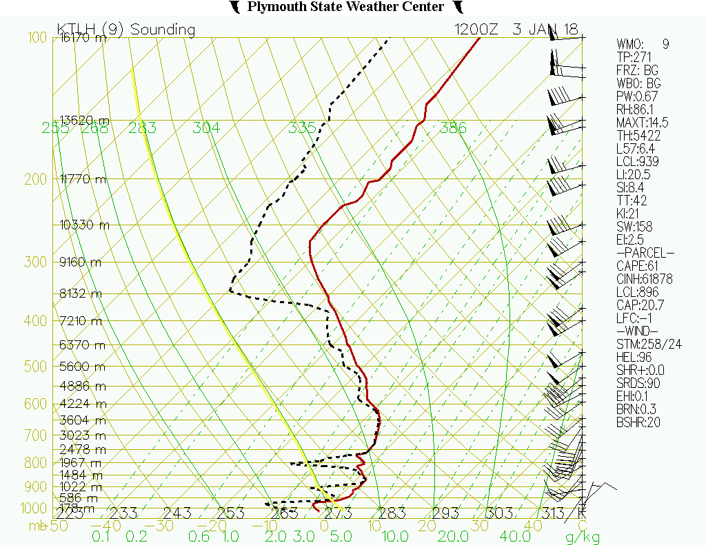
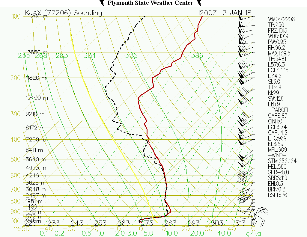
In the early morning hours, light precipitation spread across northeastern Florida and southeastern Georgia. Precipitation began as wet snow mixed with sleet over inland southeastern Georgia and freezing rain mixed with sleet over the Suwannee Valley. Surface temperatures Wednesday morning were at or below freezing along the I-10 corridor just west of the Jacksonville metropolitan area, along/west of the I-75 corridor in north central Florida and across all of southeastern Georgia (Figure 3). Above the freezing surface layer was an above-freezing melting layer which was deep and warm enough to melt the snow that fell through the layer as shown in the 12 UTC (7 AM EST) upper-air soundings from Tallahassee and Jacksonville. In Tallahassee, the shallower melting layer melted the snow, however, the layer between the cloud bases and the surface was below freezing causing freezing rain and even some liquid droplets to re-freeze into ice pellets (sleet) before reaching the surface. To the northeast of Tallahassee, the melting layer becomes smaller resulting in mainly snow. To the south and east of Tallahassee, the melting layer becomes deeper and warmer resulting in mainly freezing rain where the liquid water droplets freeze upon contact with the surface. Near Jacksonville, along the Florida Atlantic coast and central Florida, the melting layer is deep and warm enough to melt all the snow particles resulting in cold rain. Later in the morning, as the upper trough pushed past the region, colder air began to advect in due to the upper level winds shifting from southwesterly to northwesterly. With colder air overtaking the low level melting layer, the precipitation type became mainly snow across southeastern Georgia allowing for some heavier snow bands to develop. Precipitation continued to move northeastward until ending in the afternoon hours (Figure 4). |
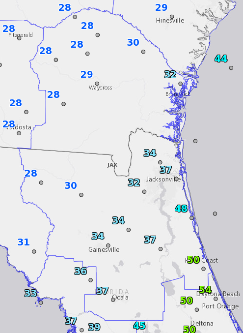 |
| Figure 3: Temperatures at 7 AM EST on January 3, 2018. |
 |
|
Figure 4: Radar loop of NSSL's Multi-Radar/Multi-Sensor (MRMS) reflectivity with the precipitation-type option. Note: KVAX radar was down during the beginning of the event. |
The low pressure system off the Florida Atlantic coast went on to rapidly intensify as it interacted with the upper-level trough and the Gulf Stream (Figure 5). As this storm continued its track northeastward along the U.S. East Coast, it brought heavy snow, high winds, high tides, and brutally cold temperatures.
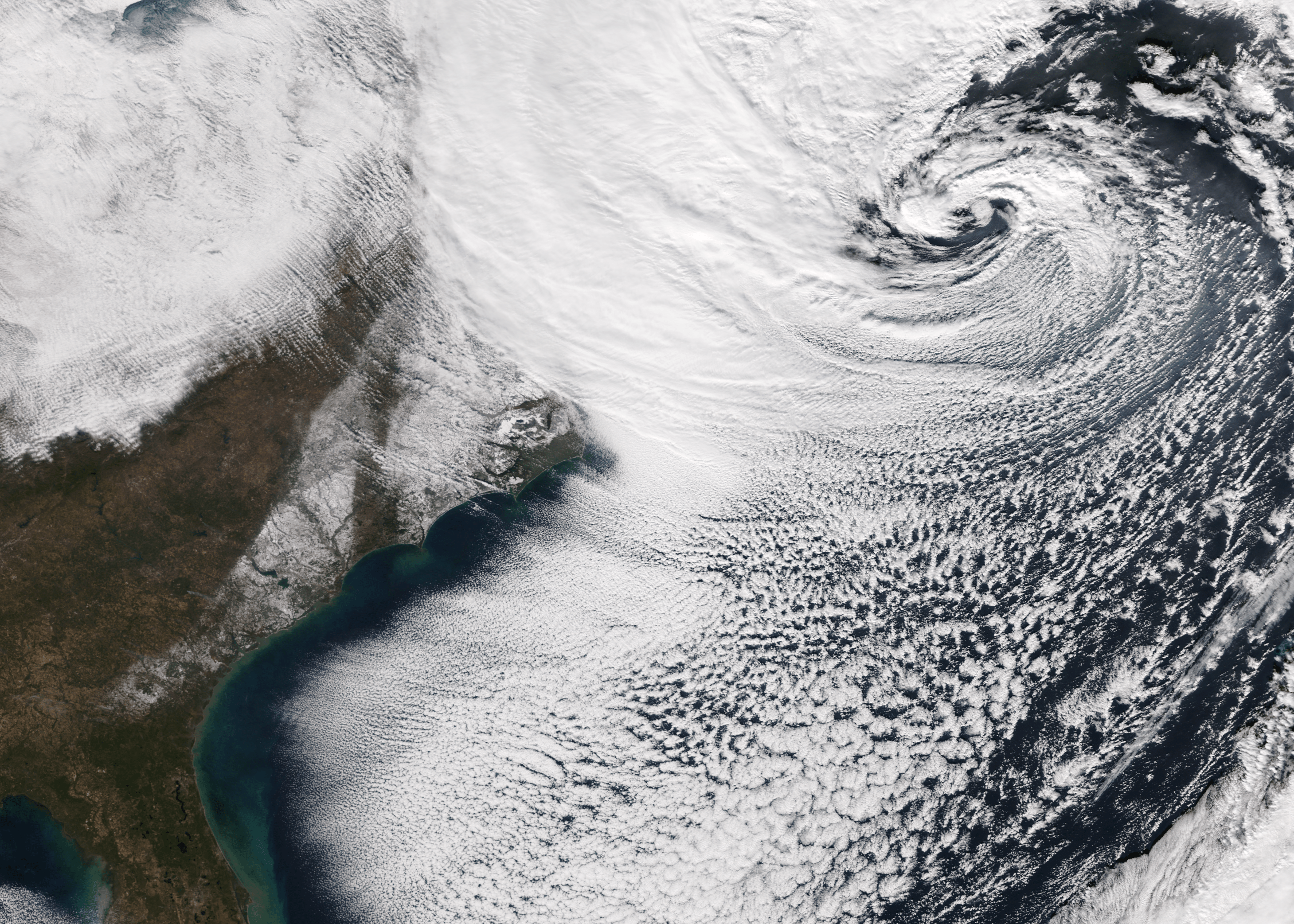 |
| Figure 5: CIRA GOES-16 GeoColor satellite imagery from January 4, 2018 showing the strengthened low off the U.S. East Coast and snowfall stretching from southern Georgia to Virginia. |
Reports:
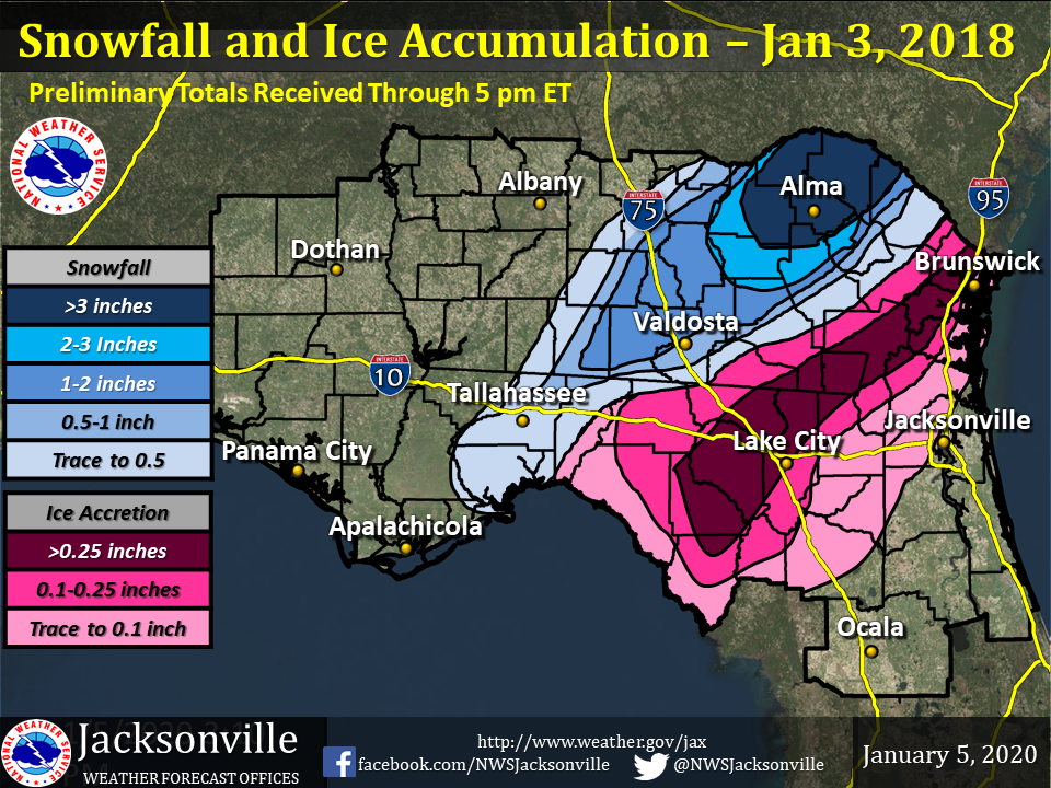 |
| Snow and ice totals based on official and unofficial measurements. Graphic created by NWS Tallahassee. |
Records:
RECORD EVENT REPORT
NATIONAL WEATHER SERVICE JACKSONVILLE FL
155 AM EST THU JAN 04 2018

...SECOND HIGHEST DAILY SNOWFALL ON RECORD AT ALMA...

SNOWFALL OF 3.0" INCHES AT ALMA YESTERDAY SET THE DAILY RECORD FOR
JANUARY 3RD AND ALSO WAS SECOND HIGHEST DAILY TOTAL ALL-TIME SINCE
RECORDS BEGAN IN 1948.

ALL-TIME DAILY SNOWFALL RECORDS FOR ALMA (AMG) GEORGIA...
4.4" ON 02-10-1973
3.0" ON 01-03-2018
2.3" ON 12-23-1989
0.5" ON 02-08-1968
RECORD EVENT REPORT
NATIONAL WEATHER SERVICE JACKSONVILLE FL
146 AM EST THU JAN 04 2018

...RECORD LOW MAXIMUM TEMPERATURE SET AT ST SIMONS ISLAND...

A RECORD LOW MAXIMUM TEMPERATURE OF 32 DEGREES WAS SET AT ST SIMONS
ISLAND ON JANUARY 3RD. THIS BREAKS THE PRIOR RECORD OF 36 DEGREES
SET IN 1979.

THIS WAS ONLY THE FOURTH TIME SINCE RECORDS BEGAN IN 1948 THAT ST.
SIMONS ISLAND DID NOT GO ABOVE FREEZING ON AN INDIVIDUAL CALENDAR
DAY. THE OTHER DATES INCLUDE MAXIMUM TEMPERATURES OF ONLY 24 DEGREES
ON 12-23-1989, 27 DEGREES ON 01-21-1985, 29 DEGREES ON 12-25-1983.
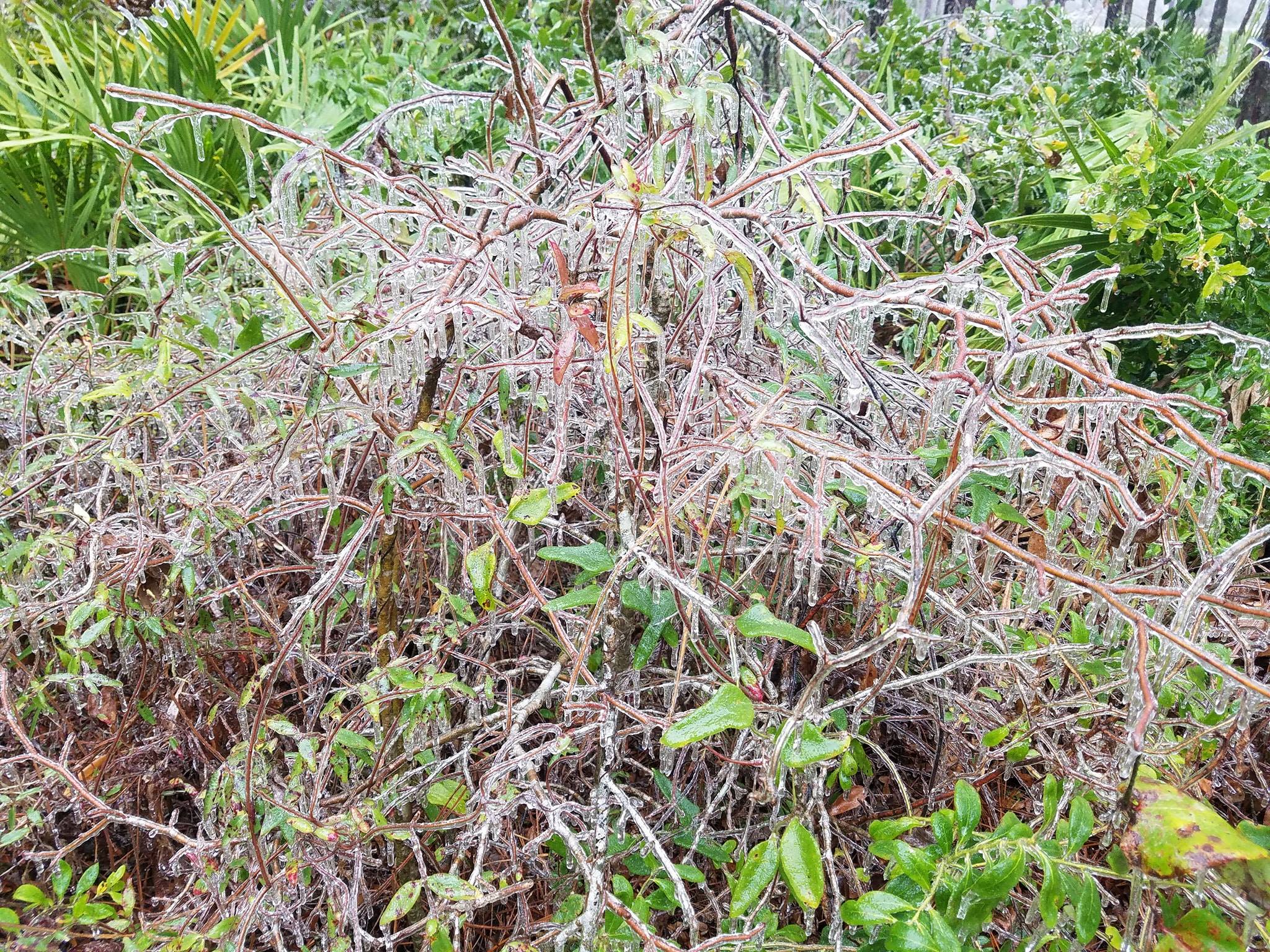
Photos:
 |
 |
 |
 |
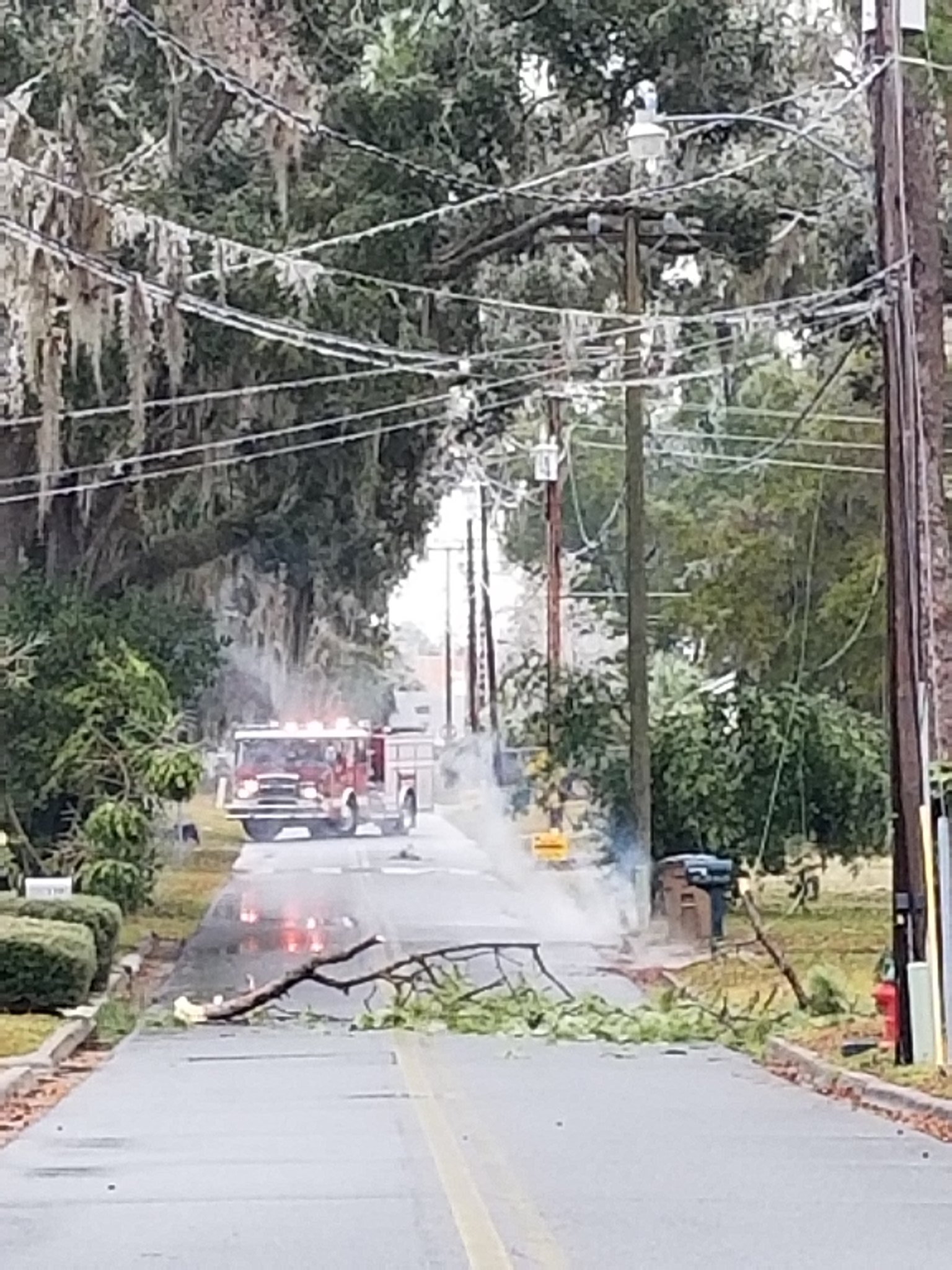
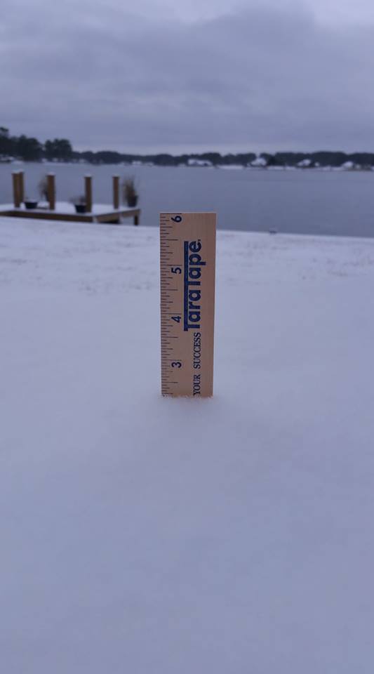
| Woodbine, GA Courtesy of Heidi Dragneff |
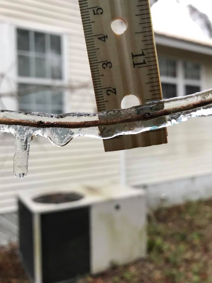
Damage from ice in Lake City, FL Courtesy of Lake City PD |
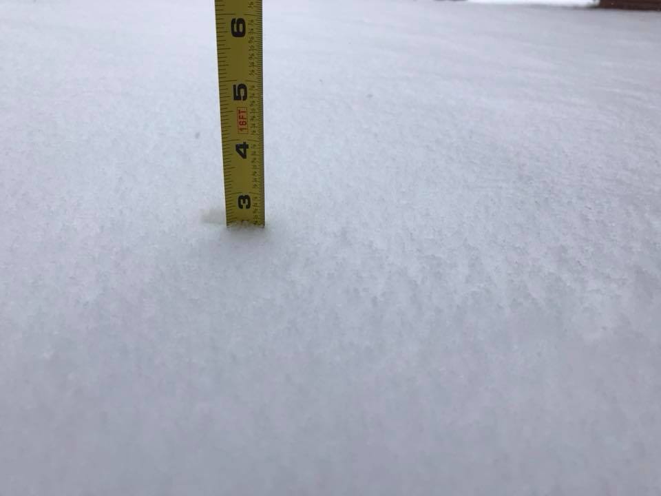
Lake City, FL Courtesy of Barbara Breitburg |
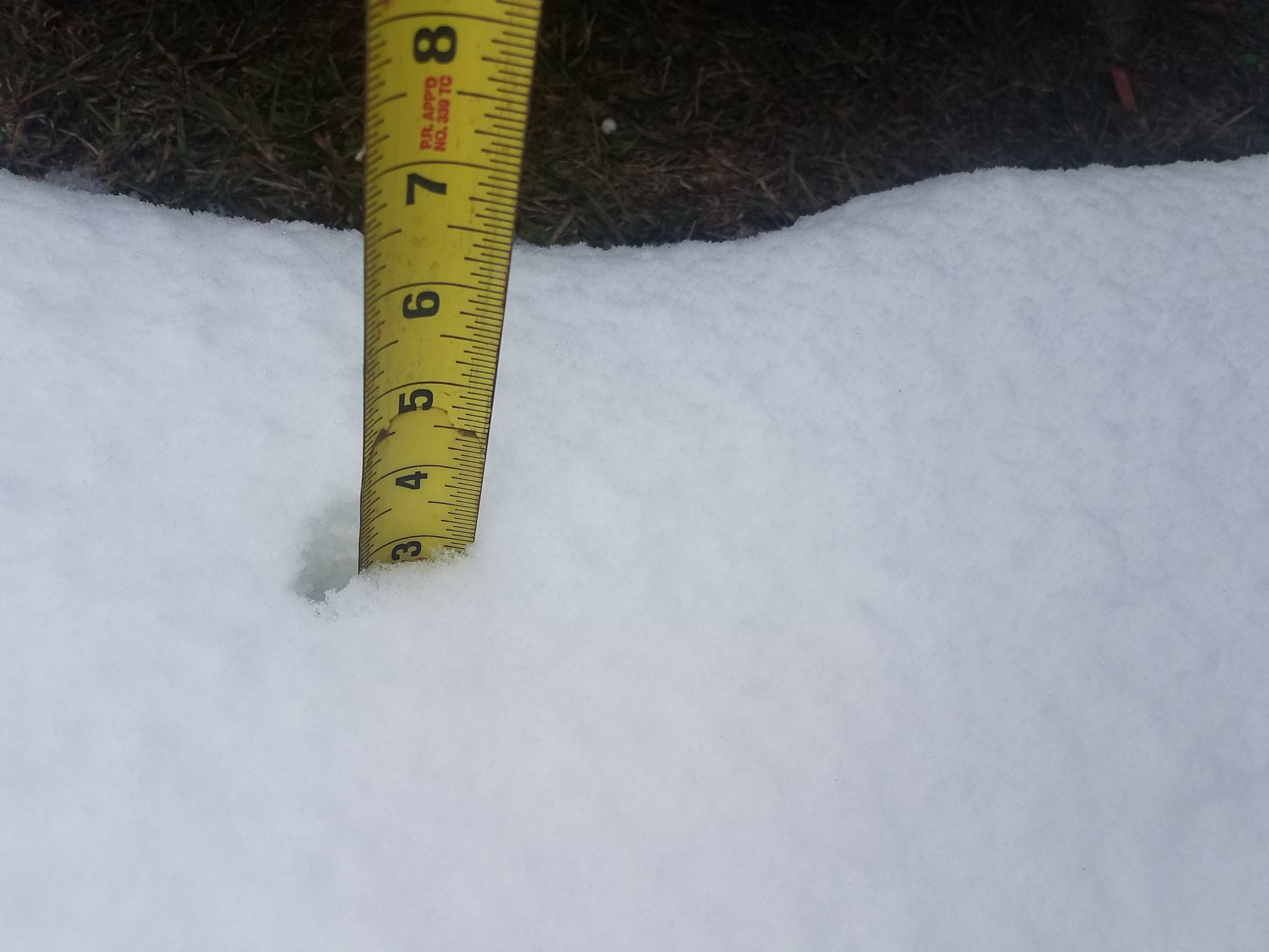
Alma, GA Courtesy of Daisha Rewis |
 |
 |
 |
 |
| Denton, GA Courtesy of Dan & Tammy Herrin |
Dixie Union, GA Courtesy of Josh King |
Ambrose, GA Courtesy of Ginger Weber Loper |
Douglas, GA Courtesy of Christy Pevaley |
 |
Media use of NWS Web News Stories is encouraged! Please acknowledge the NWS as the source of any news information accessed from this site. |
|

