Overview
|
A deepening low pressure system swept through the southeastern states during the afternoon and evening hours of March 31st, driving a strong cold front across southeast Georgia and northeast Florida. A squall line of strong to severe thunderstorms traversed the Suwannee Valley and northeast Florida ahead of this cold front, spawning two confirmed damaging tornadoes. |
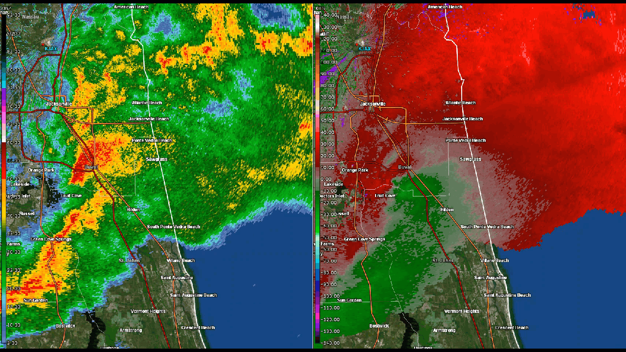
 Radar reflectivity loop of line of strong to severe storms moving across northeast Florida. |
Tornadoes:
|
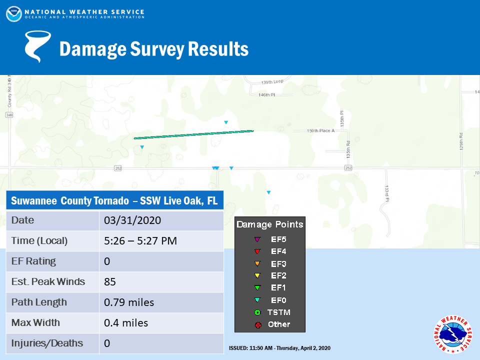
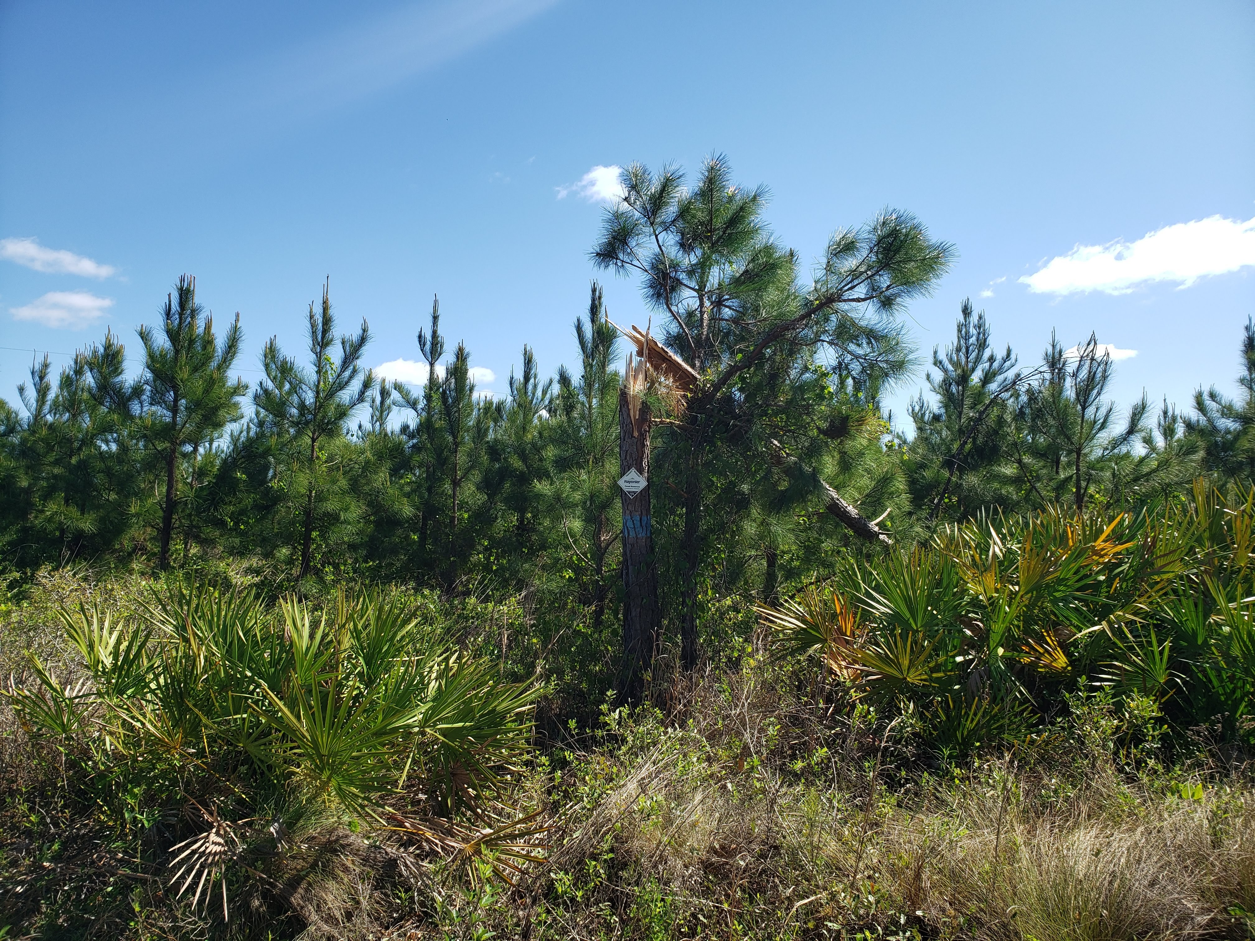
Tornado - 9 mi SSW Live Oak, FL
|
||||||||||||||||
|
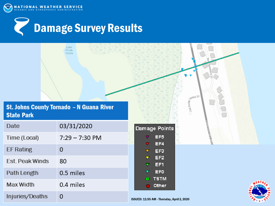
Tornado - Ponte Vedra Beach, FL
|
||||||||||||||||
The Enhanced Fujita (EF) Scale classifies tornadoes into the following categories:
| EF0 Weak 65-85 mph |
EF1 Moderate 86-110 mph |
EF2 Significant 111-135 mph |
EF3 Severe 136-165 mph |
EF4 Extreme 166-200 mph |
EF5 Catastrophic 200+ mph |
 |
|||||
Photos
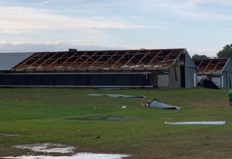
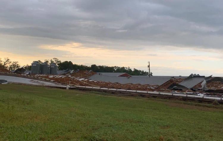
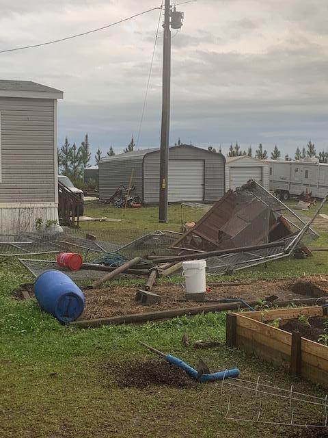
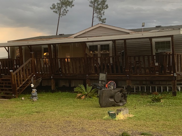
Suwannee County, FL Tornado Damage
 |
 |
 |
 |
| EF-0 Damage South of Live Oak, FL Photo from Suwannee County EM |
EF-0 Damage South of Live Oak, FL Photo from Suwannee County EM |
EF-0 Damage South of Live Oak, FL Photo from Suwannee County EM |
EF-0 Damage South of Live Oak, FL Photo from Suwannee County EM |
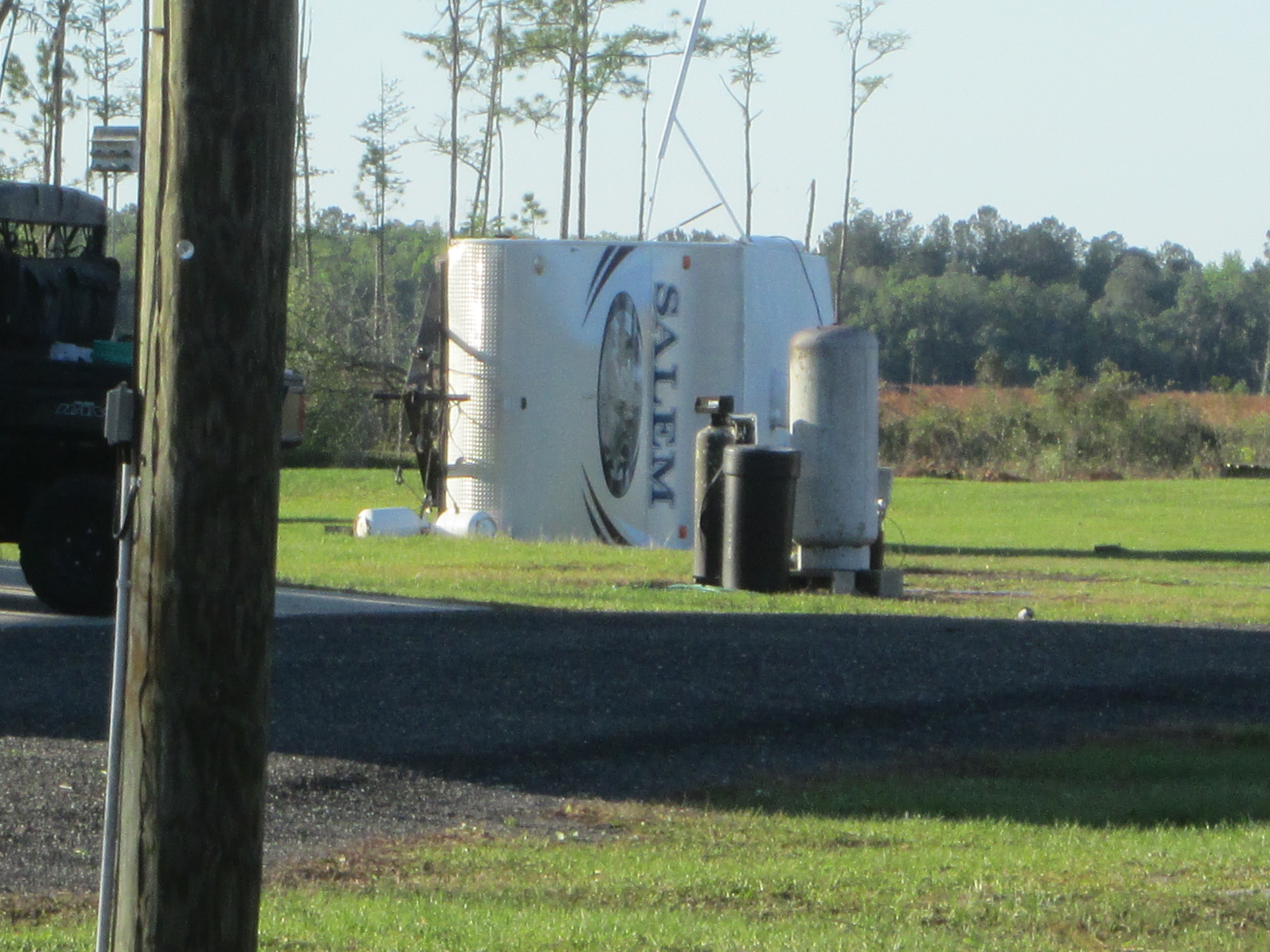
Columbia County, FL Wind Damage
 |
 |
 |
 |
| Wind Damage in Lake City, FL Photo from Columbia County EM |
Wind Damage in Lake City, FL Photo from Columbia County EM |
Wind Damage in Lake City, FL Photo from Columbia County EM |
Wind Damage in Lake City, FL Photo from Columbia County EM |
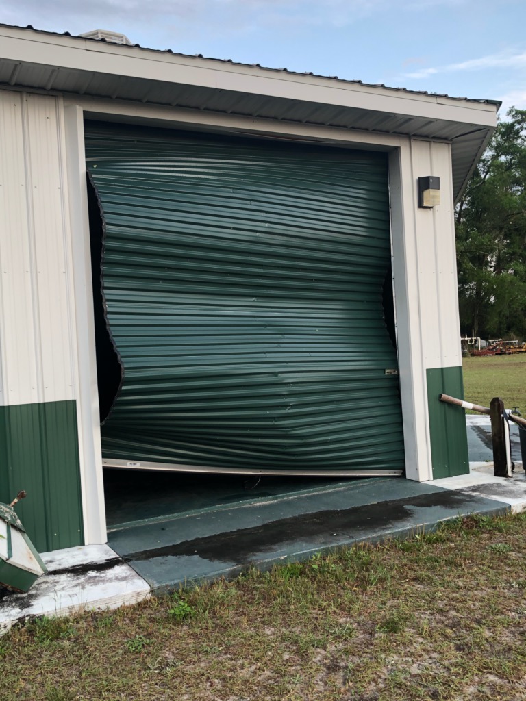
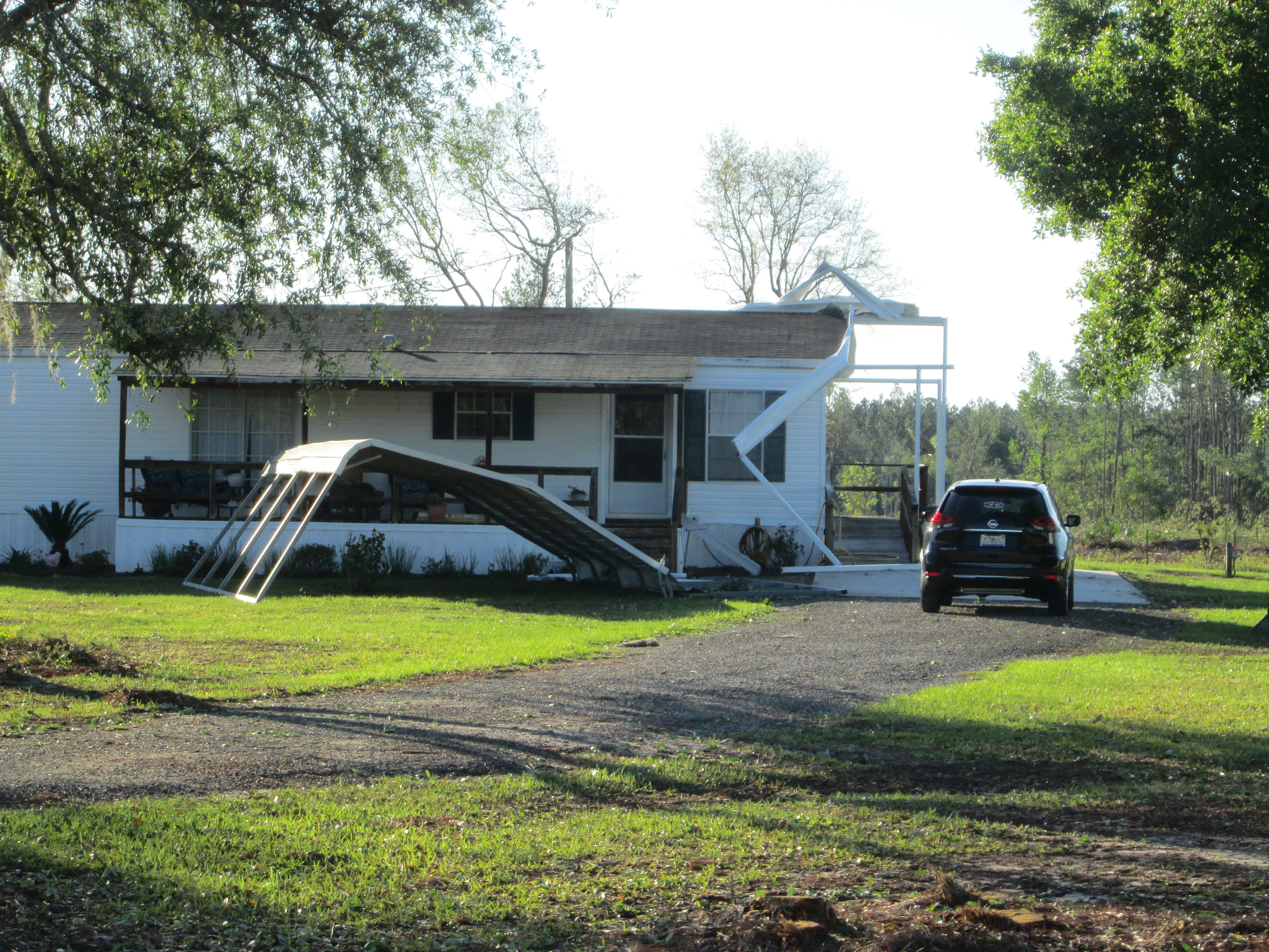
Baker County, FL Wind Damage
 |
 |
 |
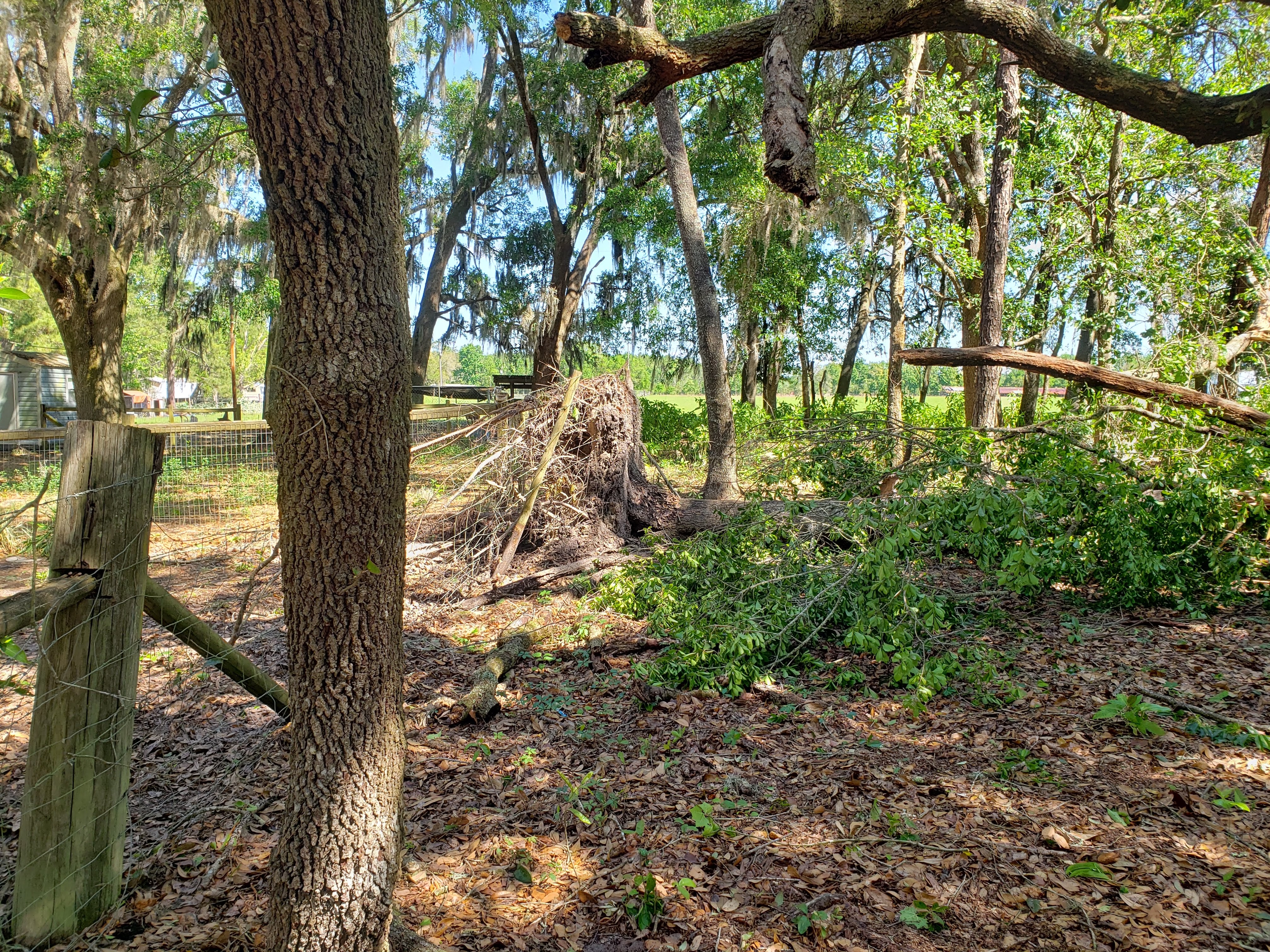 |
| Wind Damage in Sanderson, FL Photo from Baker County EM |
Wind Damage in Sanderson, FL Photo from Baker County EM |
Wind Damage in Sanderson, FL Photo from Kyle Bolton |
Wind Damage in Sanderson, FL Photo from Kyle Bolton |
St. Johns County, FL Tornado and Wind Damage
 |
 |
 |
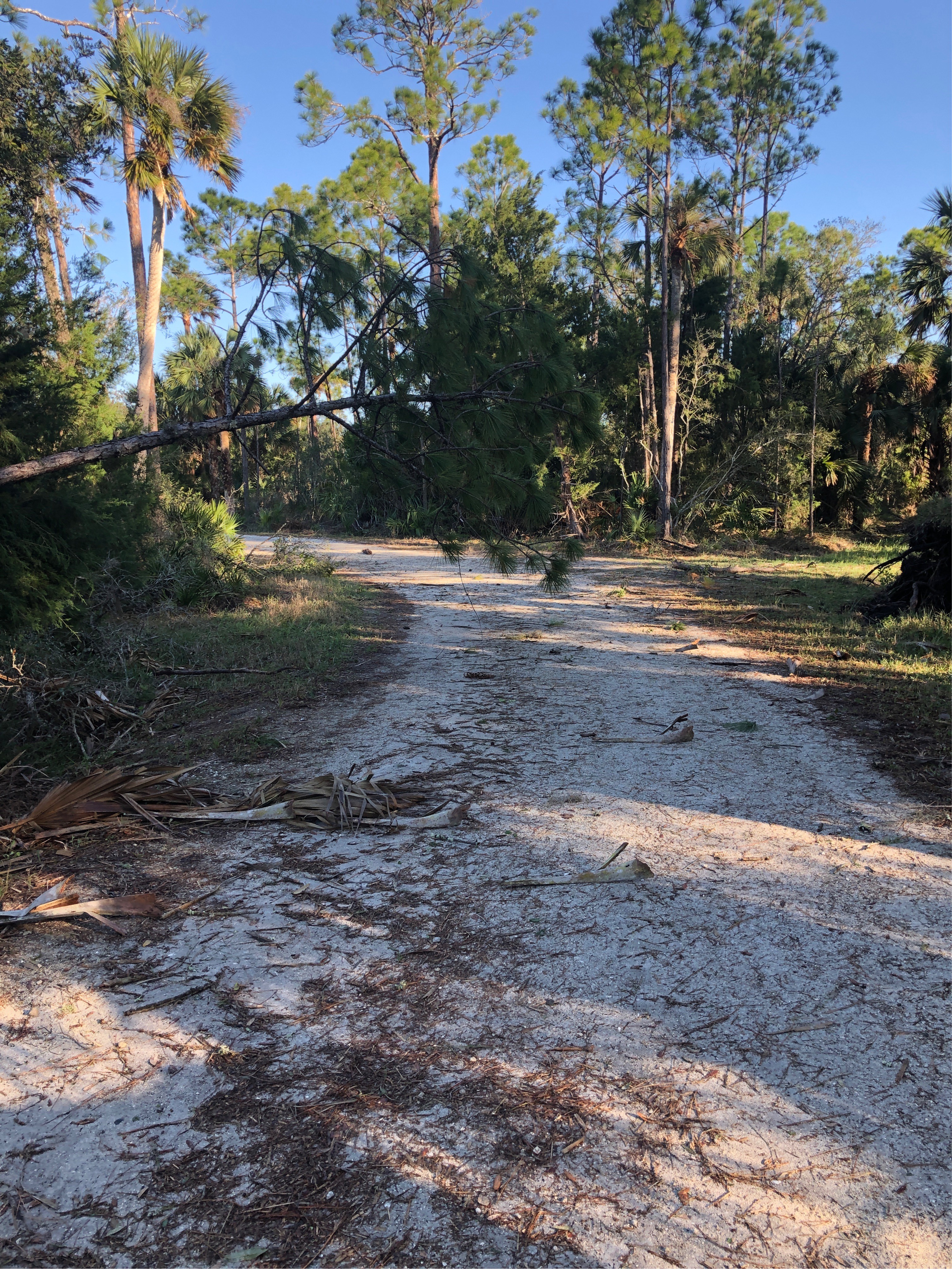 |
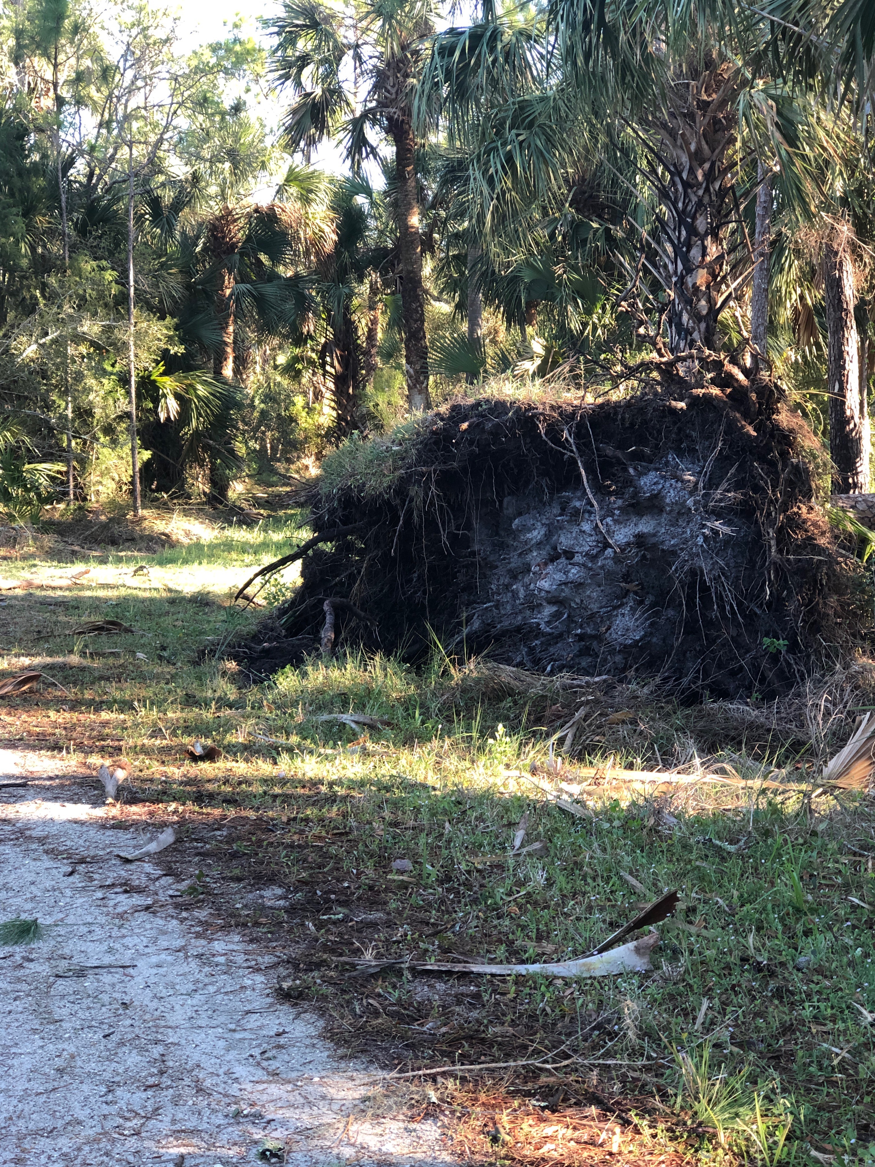
| EF-0 Damage in Mickler's Landing NWS Storm Survey |
EF-0 Damage in Mickler's Landing NWS Storm Survey |
Wind Damage at Guana River Wildlife Management Are Photo from Davy Cline |
Wind Damage at Guana River Wildlife Management Are Photo from Davy Cline |
Radar & Environment
Synoptic Overview
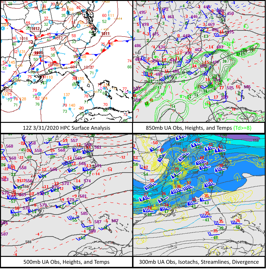
A cut off mid-level low swung from the mid-Mississippi Valley into the Tennessee Valley, with a deepening area of surface low pressure moving across the southeast from central Mississippi/Alabama to the coast of South Carolina through the day. A strong southern stream jet was laid out along the northern Gulf coast, enhancing upper level divergence aloft of the southeastern US as it moved through the evening of Tuesday, March 31.
 |
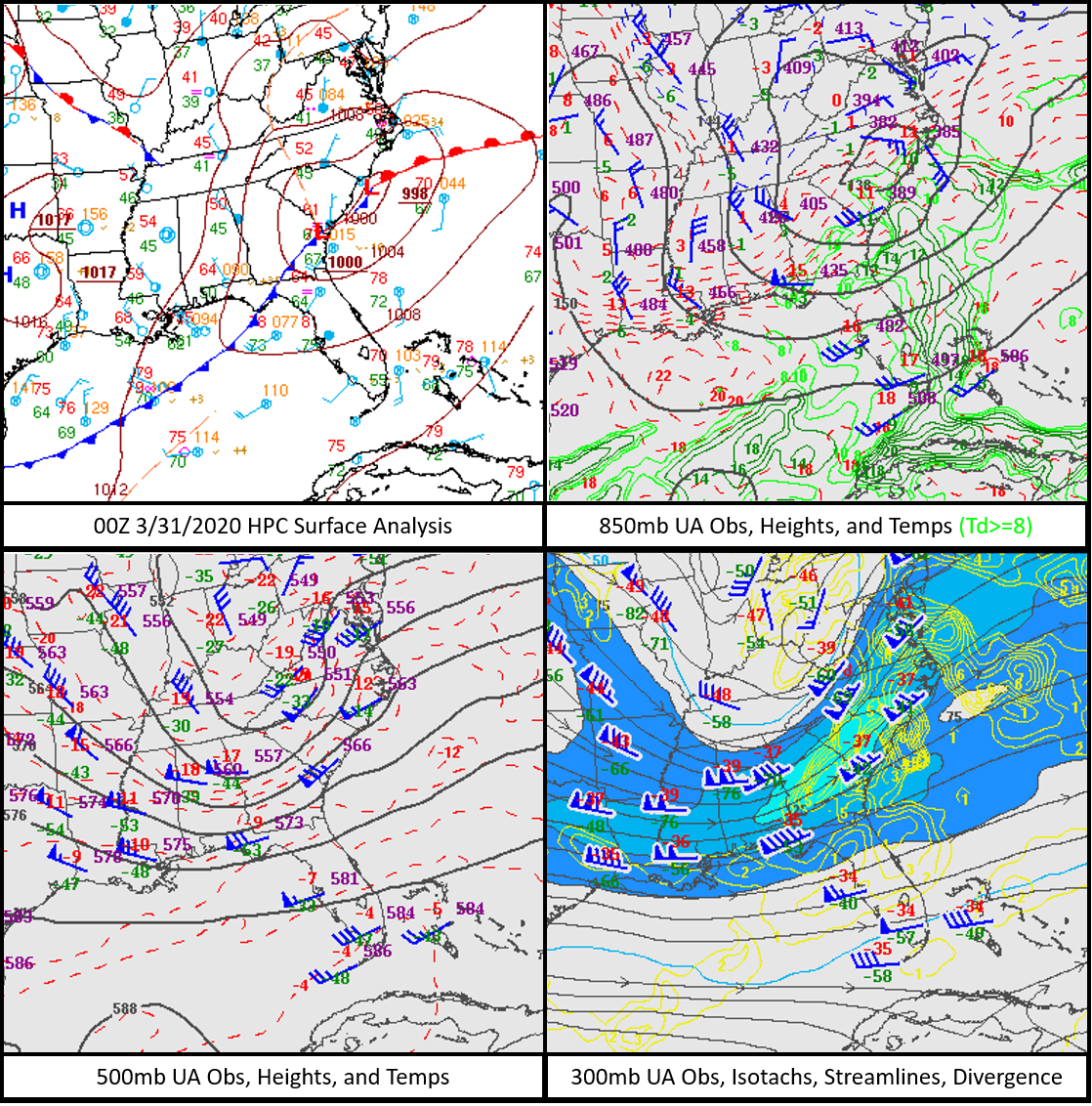 |
| 12Z 3/31/2020 Analysis at the surface (top, left), 850mb (top, right), 500mb (bottom, left), and 300mb (bottom, right) | 00Z 4/1/2020 Analysis at the surface (top, left), 850mb (top, right), 500mb (bottom, left), and 300mb (bottom, right) |
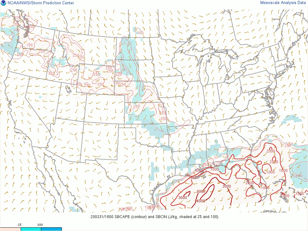
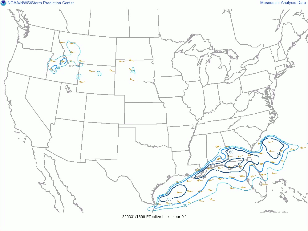
Mesoanalysis
The strong winds from this deep low also led to increased deep layer shear and persistent west-southwest low level flow from the Gulf fed low level instability values over the local area. As storms approached the region, with SBCAPE of 1000-2000 J/kg gliding along and just south of I-10 between 18-00Z. While the effective bulk shear of 60+ kts was along and north of I-10, there was still a large sector with 40-60 kt bulk shear overlapping with the area of highest instability, with a solid 60 kts of bulk shear coinciding with the storms at 23Z. Likewise, 0-1 km SRH was peaking at 200+ m2/s2 north of I-10, but values of 100-200 m2/s2 could be seen with storms in the most unstable part of the air mass and there was a solid area with 200 m2/s2 0-1 km SRH with those storms right at 23Z. The enhancement in the bulk shear and 0-1 km SRH really seemed to have fed the tornado that spun up over Ponte Vedra Beach, FL as it moved into the warm, moist coastal interface.
 |
 |
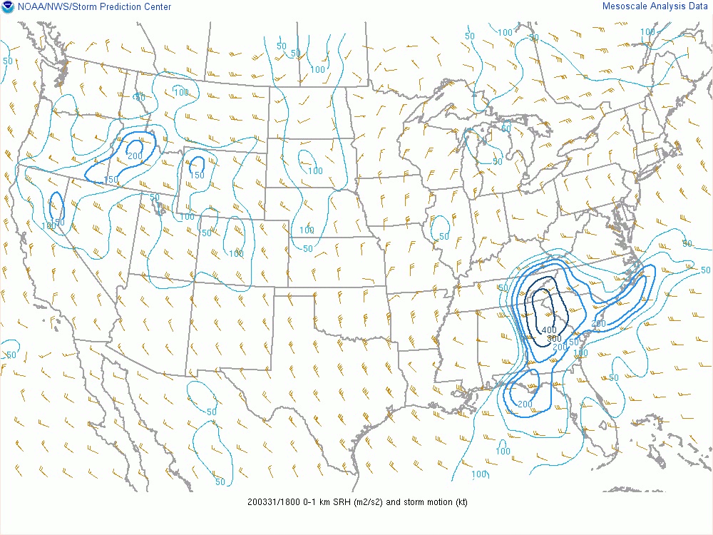 |
| Loop of SBCAPE from 3/31 18Z - 4/1 00Z | Loop of Effective Bulk Shear from 3/31 18Z - 4/1 00Z | Loop of 0-1km Storm Relative Helicity from 3/31 18Z - 4/1 00Z |
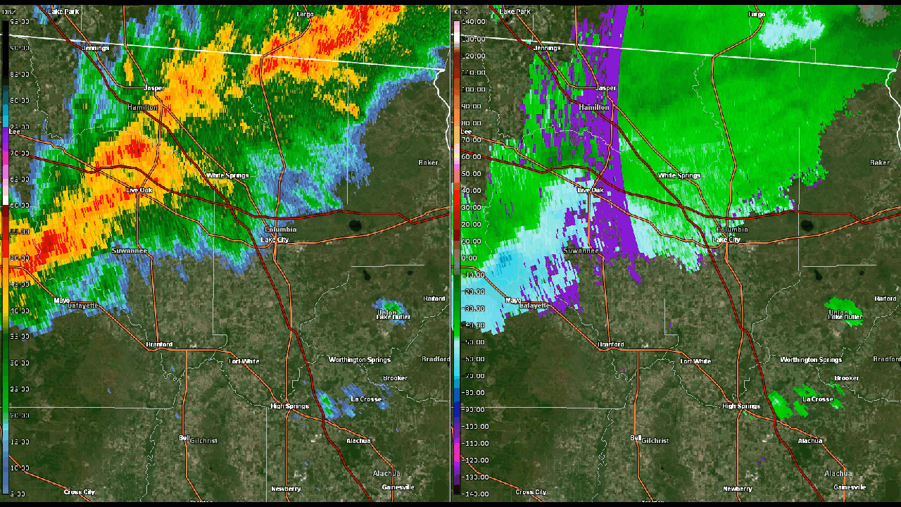
Radar Data From the Two Confirmed Tornadoes
 |
 |
| Reflectivity and base velocity loop of Suwannee County, FL tornado. | Reflectivity and base velocity loop of Ponte Vedra Beach, FL tornado. |
Storm Reports
PRELIMINARY LOCAL STORM REPORT...SUMMARY
NATIONAL WEATHER SERVICE JACKSONVILLE FL
1230 PM EDT THU APR 2 2020
..TIME... ...EVENT... ...CITY LOCATION... ...LAT.LON...
..DATE... ....MAG.... ..COUNTY LOCATION..ST.. ...SOURCE....
..REMARKS..
0526 PM TSTM WND DMG 9 SSW LIVE OAK 30.17N 83.04W
03/31/2020 SUWANNEE FL EMERGENCY MNGR
EMERGENCY MANAGER WAS IN ROUTE TO REPORTS
FROM 911 DISPATCH OF DAMAGE TO A CHICKEN
HOUSE AND NUMEROUS TREES DOWN ALONG CR252
BETWEEN CR129 AND CR349. TIME ESTIMATED BY
RADAR.
0526 PM TORNADO 9 SSW LIVE OAK 30.17N 83.04W
03/31/2020 SUWANNEE FL NWS STORM SURVEY
PRELIMINARY REPORTS FROM AN EMERGENCY
MANAGER OF DAMAGE TO SEVERAL CHICKEN HOUSES
AND NUMEROUS TREES DOWN INDICATE A POSSIBLE
WEAK TORNADO.TIME ESTIMATED BASED ON RADAR.
0526 PM TORNADO 9 SSW LIVE OAK 30.18N 83.05W
03/31/2020 SUWANNEE FL EMERGENCY MNGR
NWS CONFIRMED AN EF-0 TORNADO WITH 85 MPH
WINDS BRIEFLY TOUCHED DOWN NORTH OF CR 252
SOUTH OF LIVE OAK, FL. THIS TORNADO DAMAGED
A CHICKEN COOP AND TREES IN THE AREA, ONE
LARGE TREE BRANCH FELL ON A HOUSE. PATH
LENGTH WAS 0.79 MILES AND PATH WIDTH WAS 0.4
MILES.
0600 PM TSTM WND DMG 5 SW LAKE CITY 30.15N 82.70W
03/31/2020 COLUMBIA FL TRAINED SPOTTER
LARGE TREE DOWN ABOUT 1.5 MILES NORTH OF THE
INTERSECTION OF HIGHWAYS 247 AND 242.
0601 PM TSTM WND DMG 3 SE CALLAHAN 30.53N 81.80W
03/31/2020 NASSAU FL 911 CALL CENTER
911 DISPATCH REPORTED A WIRE DOWN AT THE
INTERSECTION OF LEE DRIVE AND ANN DRIVE.
TIME ESTIMATED BASED ON RADAR.
0620 PM TSTM WND DMG 5 NNW RAIFORD 30.13N 82.28W
03/31/2020 UNION FL TRAINED SPOTTER
MULTIPLE TREES REPORTED DOWN ALONG CR229 IN
NORTHEASTERN UNION COUNTY.
0620 PM TSTM WND DMG 6 NW ELLERBEE 30.15N 82.30W
03/31/2020 BAKER FL PUBLIC
REPORT FROM MPING: TREES UPROOTED OR
SNAPPED; ROOF BLOWN OFF.
0627 PM TSTM WND DMG 2 WSW MACCLENNY 30.27N 82.16W
03/31/2020 BAKER FL 911 CALL CENTER
911 DISPATCH REPORTS THUNDERSTORM POSSIBLE
DAMAGE TO A RESIDENCE,A CHICKEN COUP, AND
TREES DOWN THROUGHOUT THE COUNTY.
0640 PM TSTM WND DMG 3 SSW MAXVILLE 30.15N 82.03W
03/31/2020 CLAY FL BROADCAST MEDIA
MANY TREES REPORTED DOWN NEAR INTERSECTION
OF HIGHWAYS 301 AND 218. TIME ESTIMATED BY
RADAR.
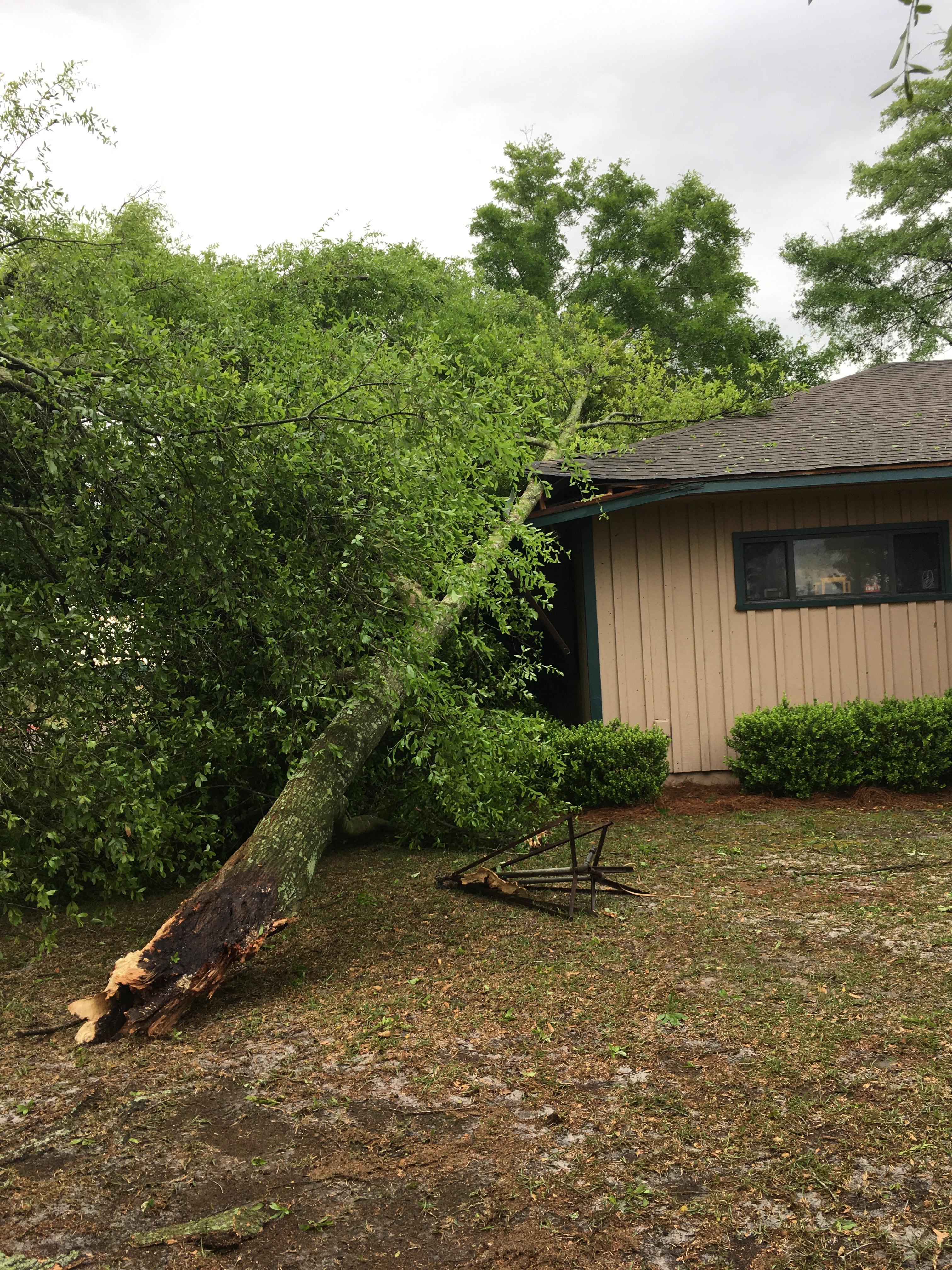
0650 PM TSTM WND DMG 4 WNW LAKESIDE 30.15N 81.83W
03/31/2020 CLAY FL BROADCAST MEDIA
FENCE DAMAGED AND GARAGE DOOR BLOWN INWARD
IN OAKLEAF AREA NEAR MIDDLEBURG. TIME
ESTIMATED BY RADAR.
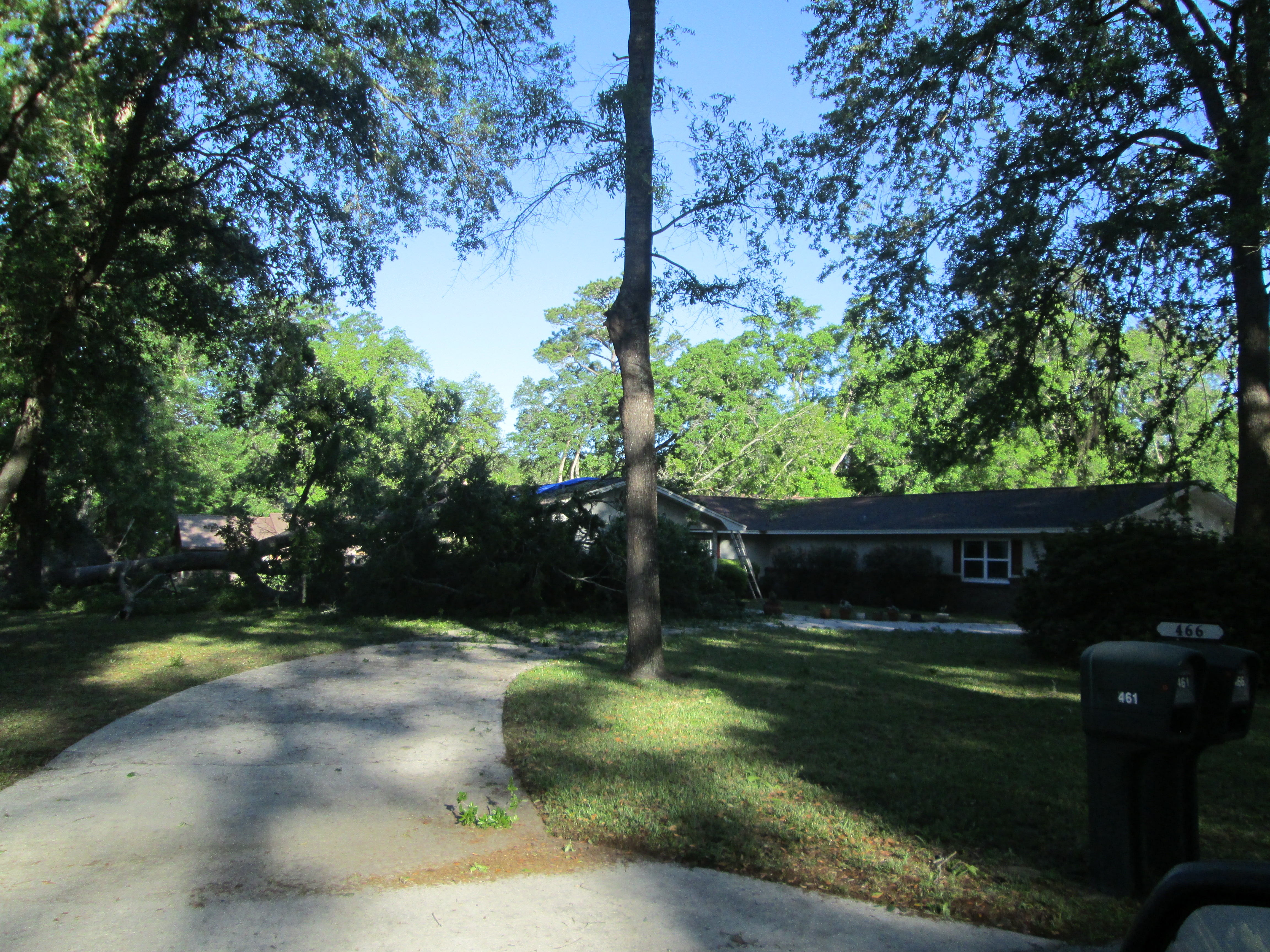
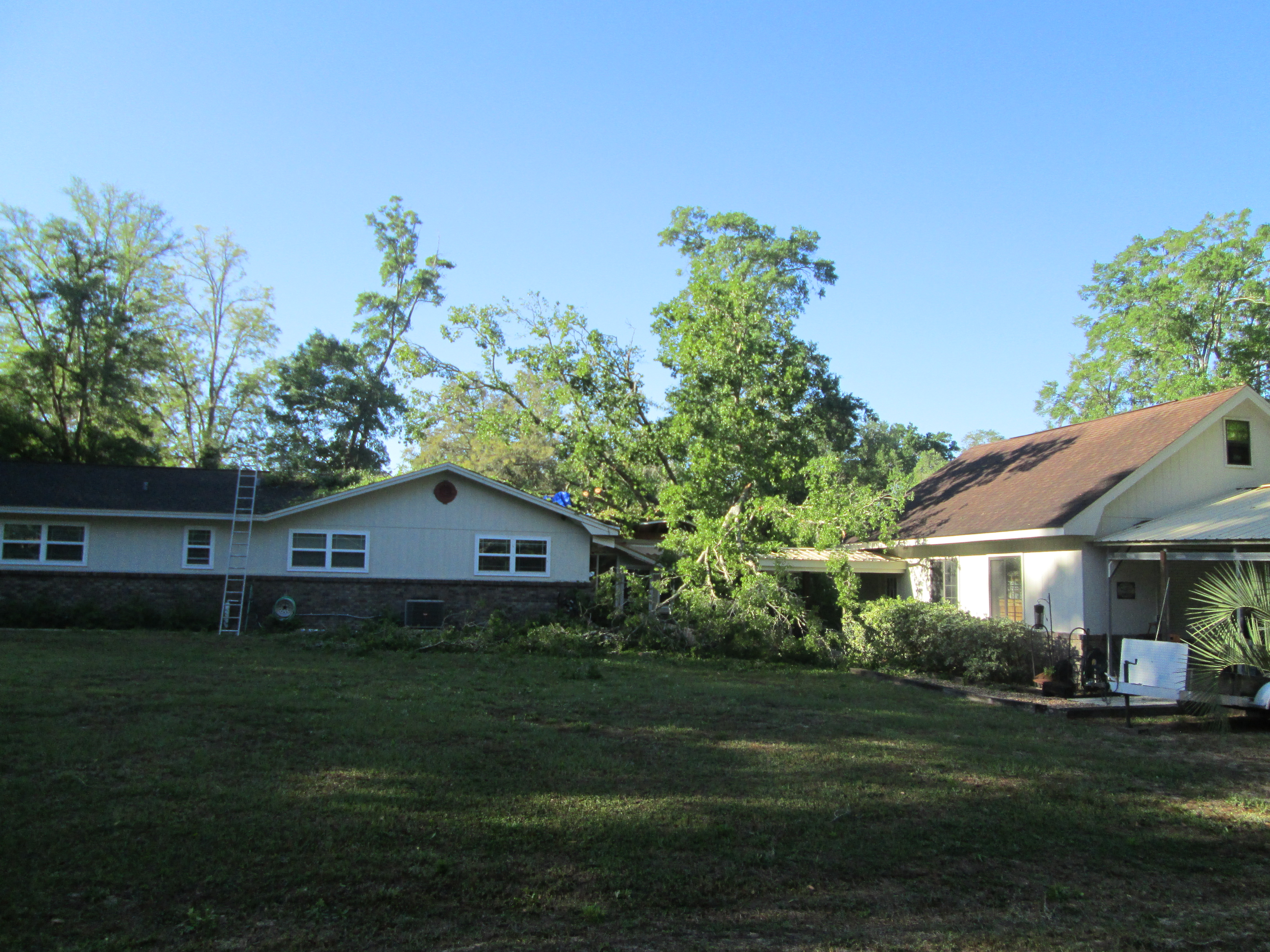
0700 PM TSTM WND DMG 5 WSW FRUIT COVE 30.07N 81.69W
03/31/2020 CLAY FL BROADCAST MEDIA
TREE FELL ON A HOUSE CAUSING MAJOR DAMAGE ON
FLEMING ISLAND. TIME ESTIMATED BY RADAR.
0705 PM TSTM WND DMG 3 NNE FRUIT COVE 30.14N 81.60W
03/31/2020 DUVAL FL EMERGENCY MNGR
TREE ACROSS SOUTH BURNING TREE LANE IN
MANDARIN. POWER OUTAGES REPORTED.
0710 PM TSTM WND DMG 4 NW FRUIT COVE 30.15N 81.67W
03/31/2020 DUVAL FL BROADCAST MEDIA
LARGE TREE DOWN IN YARD ON MANDARIN ROAD.
0729 PM TORNADO 4 NNW GUANA RIVER STATE 30.14N 81.36W
03/31/2020 ST. JOHNS FL NWS STORM SURVEY
NWS DAMAGE ASSESSMENT FOUND AN EF-0 TORNADO
WITH 80 MPH WINDS BRIEFLY TOUCHED DOWN IN
PONTE VEDRA BEACH NEAR GUANA RIVER STATE
PARK. THIS TORNADO CAUSED TREE DAMAGE AND
SOME DAMAGE TO NEARBY HOUSES INCLUDING
ABROKEN WINDOW.
0845 PM TSTM WND DMG 3 NE BUNNELL 29.50N 81.23W
03/31/2020 FLAGLER FL EMERGENCY MNGR
TREES DOWN ON ROYAL PALMS AND BELLE TERRE.
&&
$$
 |
Media use of NWS Web News Stories is encouraged! Please acknowledge the NWS as the source of any news information accessed from this site. |
|