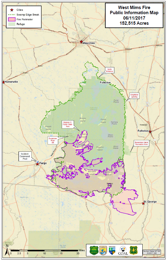
Overview
The West Mims Fire was first began on April 6th, 2017, as a result of a lightning strike impacting 7 miles east of Fargo and 2.5 miles northeast of Eddy Fire Tower on West Mims Island. Over the course of the following 3 months, the West Mims Fire would go on to burn 152,515 acres with the spreading fires affecting both Georgia and Florida. On May 7th, the fire had jumped Georgia 94 W which prompted the shutdown of roads, with a mandatory evacuation of nearby St George later followed by much of southern Charlton County as well. Thanks to the efforts of what would become an overall force of 1000 personnel, 4 air tankers, 9 helicopters, and a good amount of rainfall in June and July, the fire would have the last signs of smoke on June 10th and would finally be declared 100% contained on July 10th, 2017.
Satellite image of smoke plume originating from second day of West Mims Fire, with the plume reaching out over Jacksonville.
GIF Image courtesy of CIRA.
Burn Path
All images are courtesy of Inciweb.
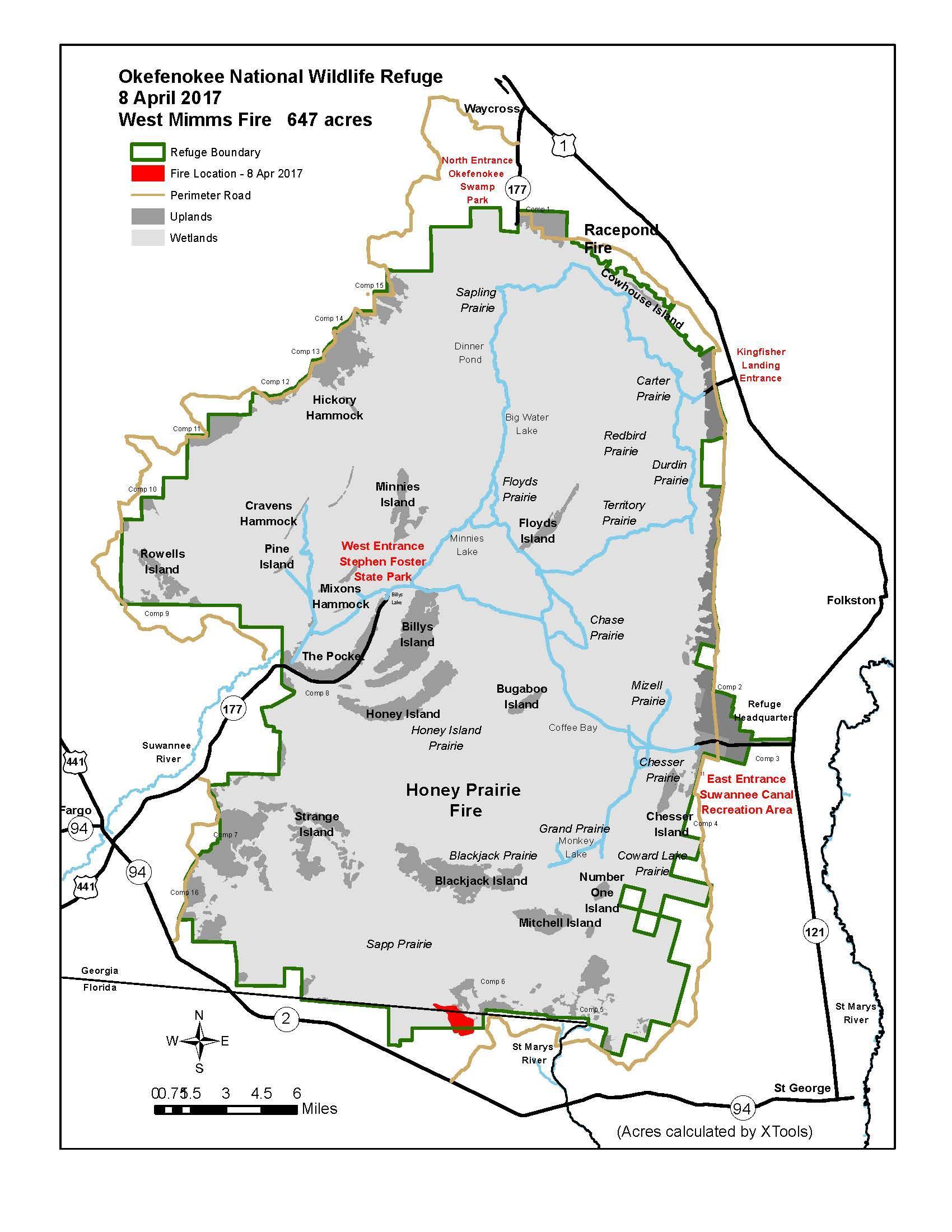
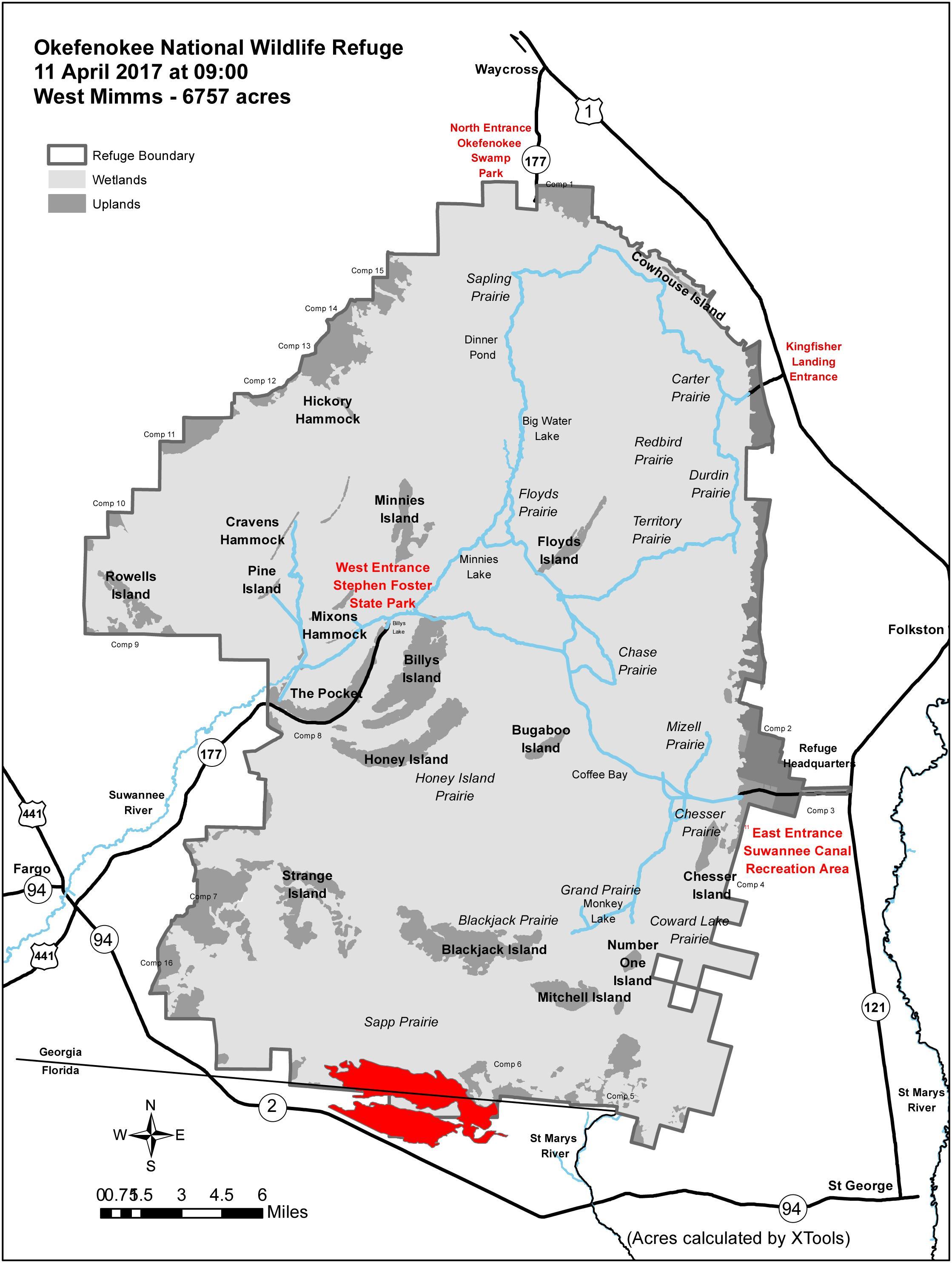
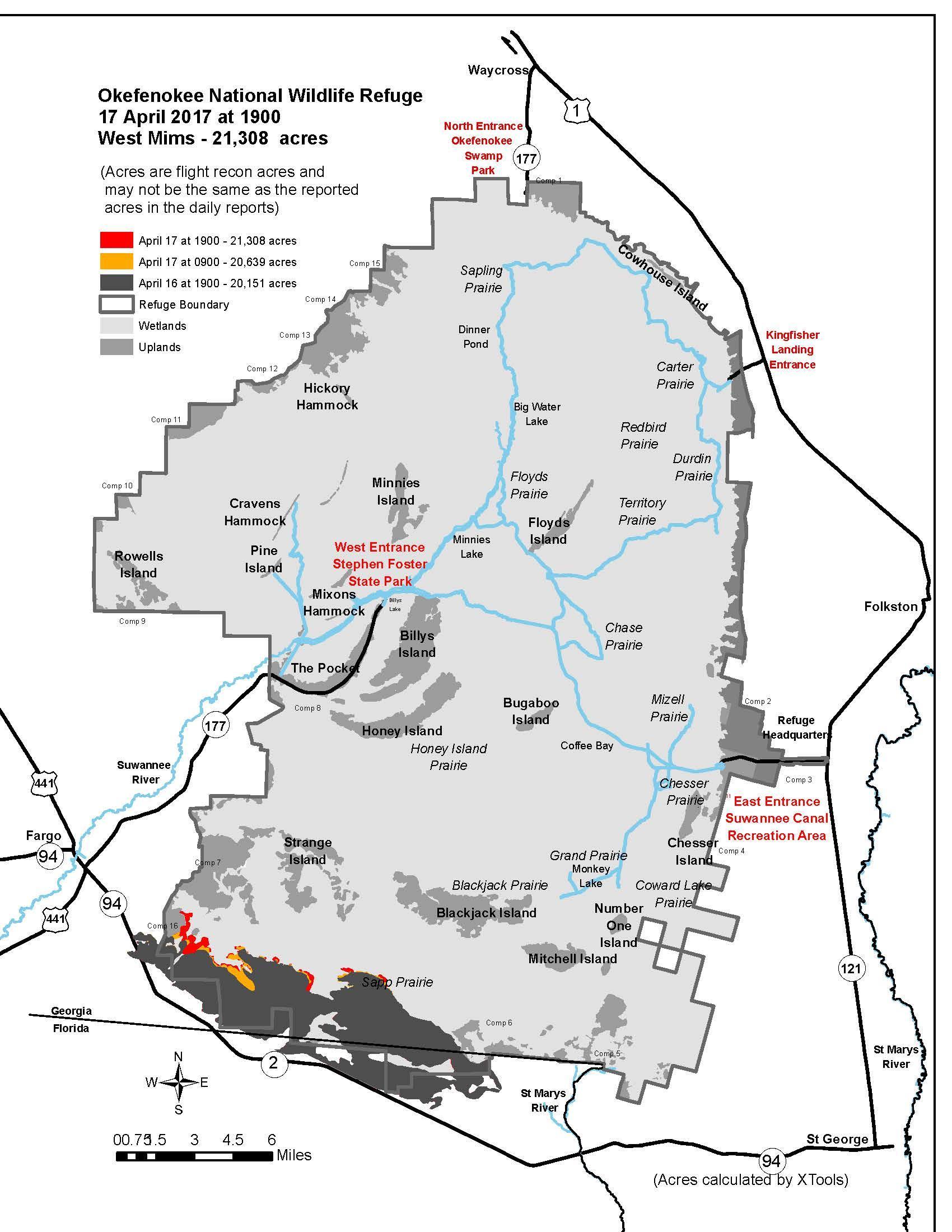
April 6th - April 22nd: In the early stages of the fire, the blaze expands rapidly but after a brief period of southern expansion it remains bounded within the swamp
 |
 |
|
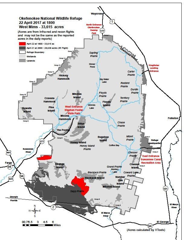 |
| April 8: 647 acres | April 11: 6757 acres | April 17: 21,308 acres | April 22: 33,615 acres |
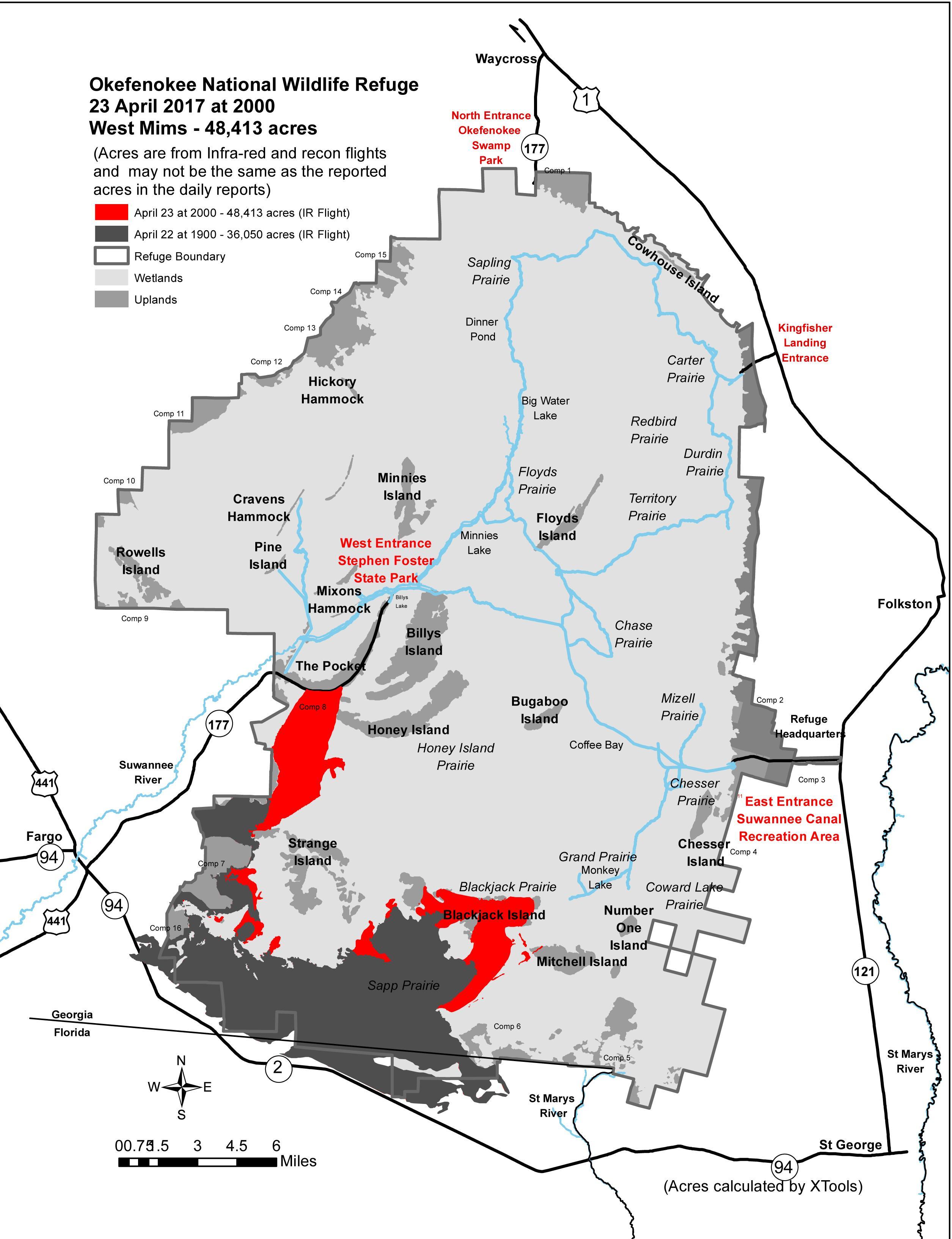
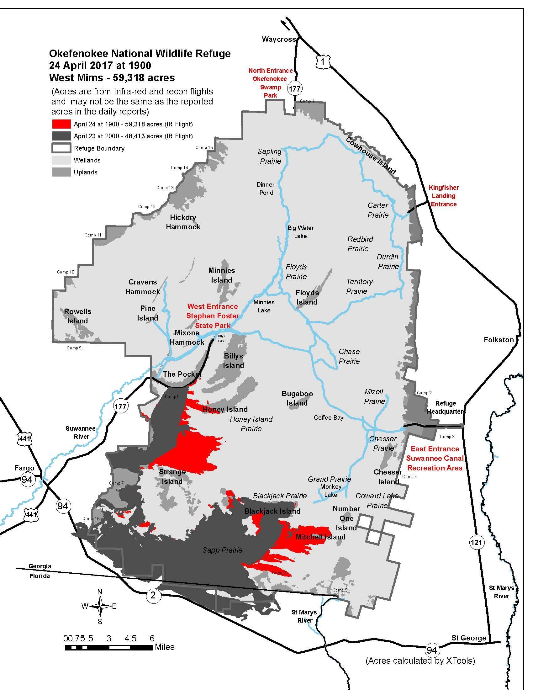
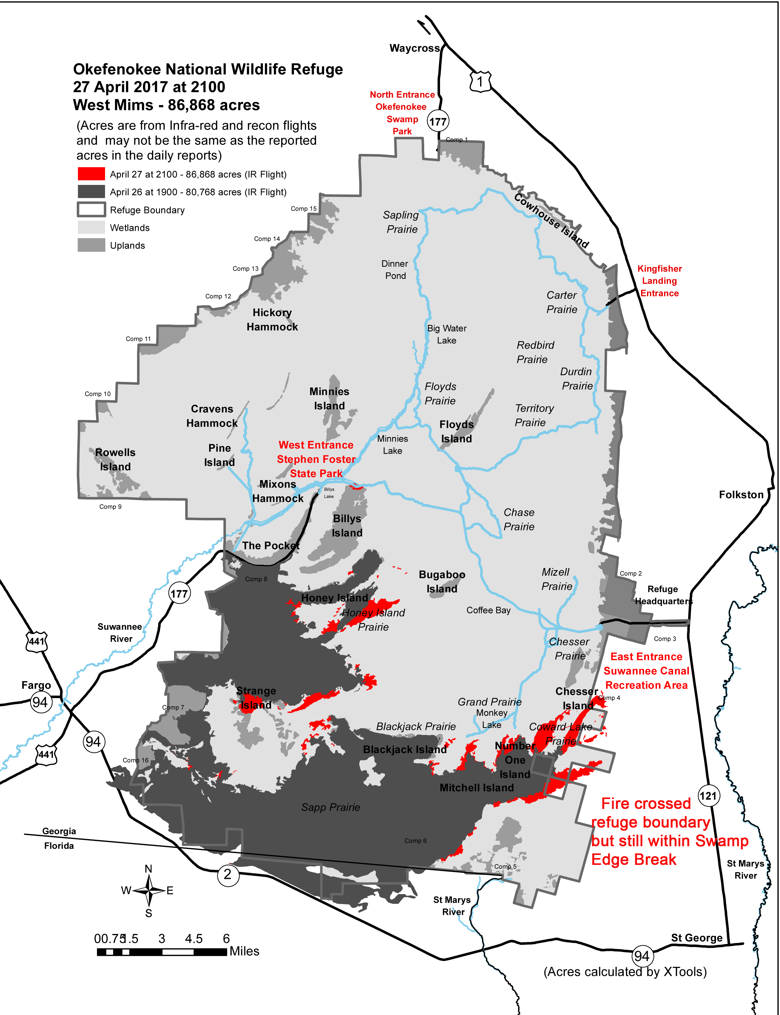
April 23rd - Apr 28th: Fire spreads further north and east, fueled by SW-W winds. New burn areas begin pressing against the eastern edges of the swamp boundary. Fire expands at a rate of nearly 10K acres per day.
 |
 |
 |
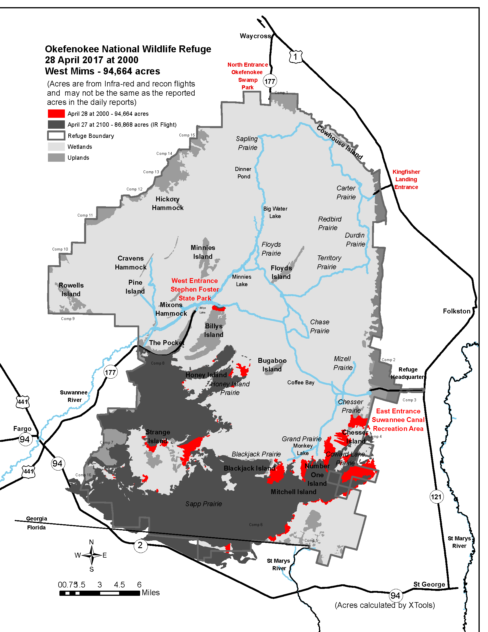 |
| April 23: 48,413 acres | April 24: 59,318 acres | April 27: 86,868 acres | April 28: 94,664 acres |
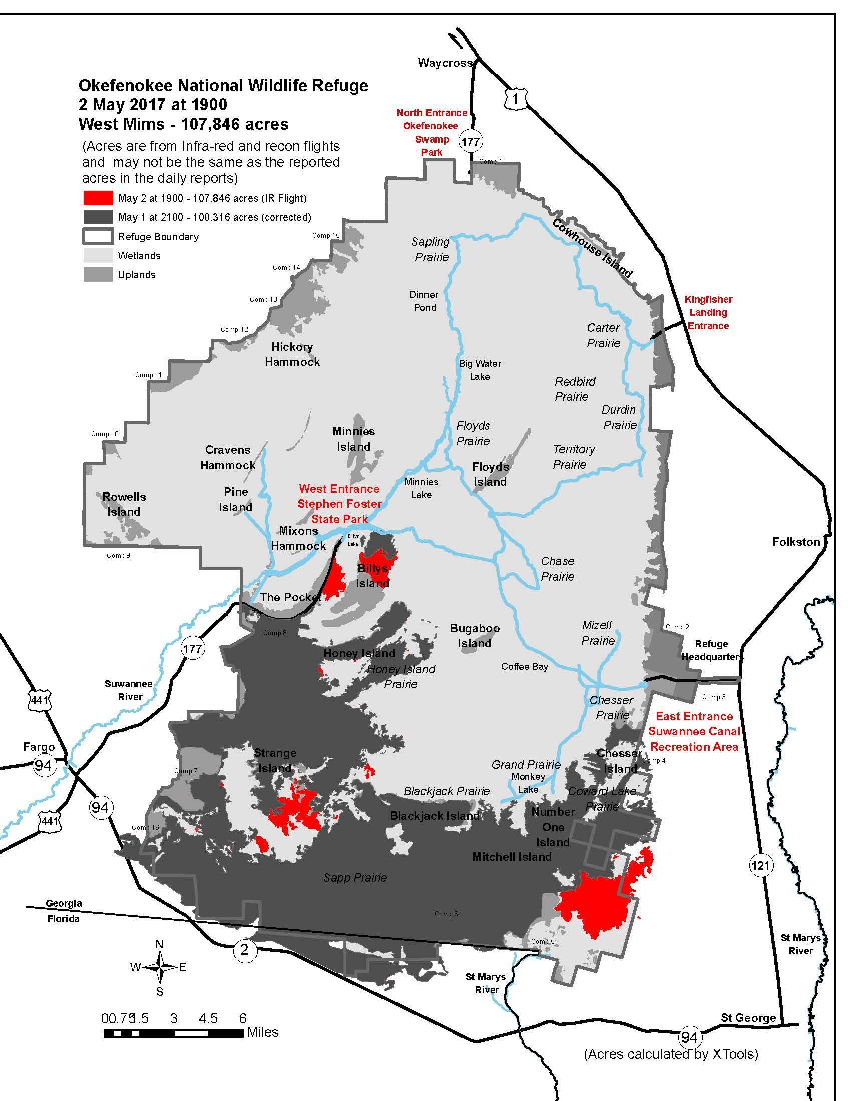
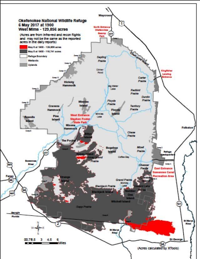
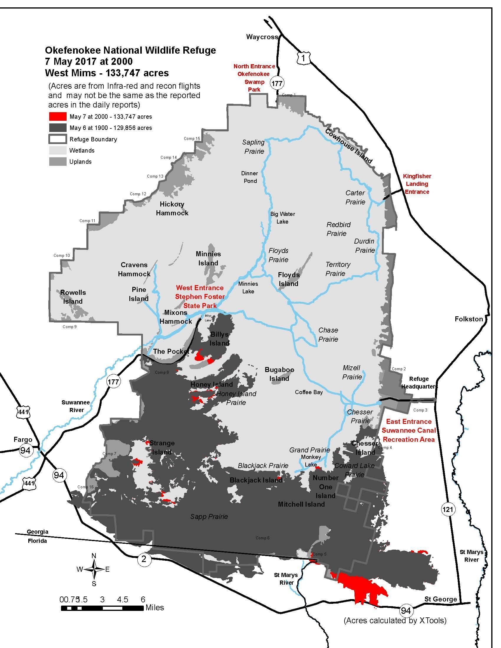
May 2nd - Jun 11th: Fire rapidly expands outwards, from out of the southeastern portion of the swamp as winds build from the west, approaching St George, crossing Georgia 94 W, and potentially endangering other nearby communities. Fire also expands further northward into the swamp during this period.
 |
 |
 |
 |
| May 2: 107,846 acres | May 6: 129,856 acres | May 7: 133,747 acres | June 11: 152,515 acres |
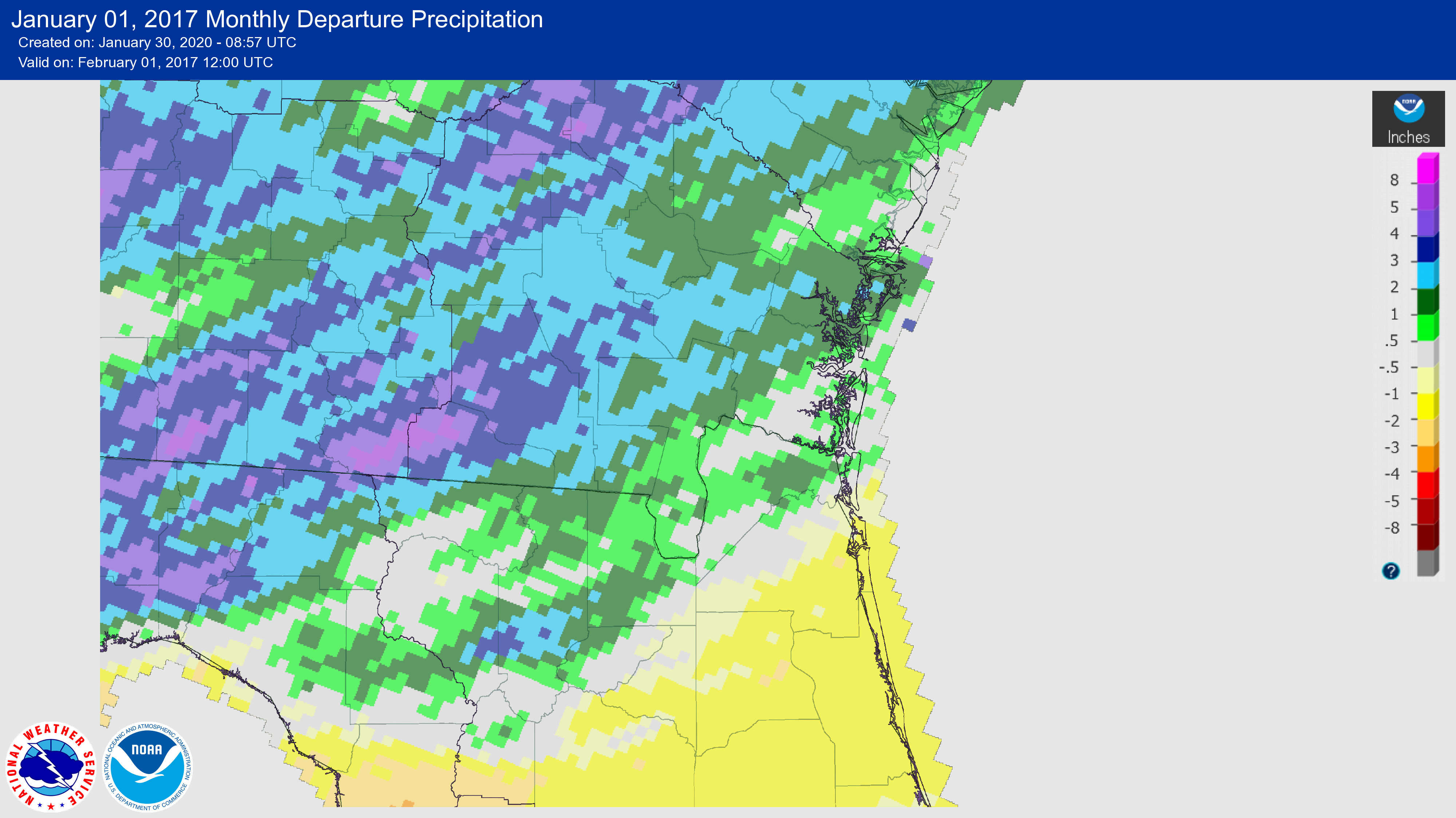
Environment/Rainfall
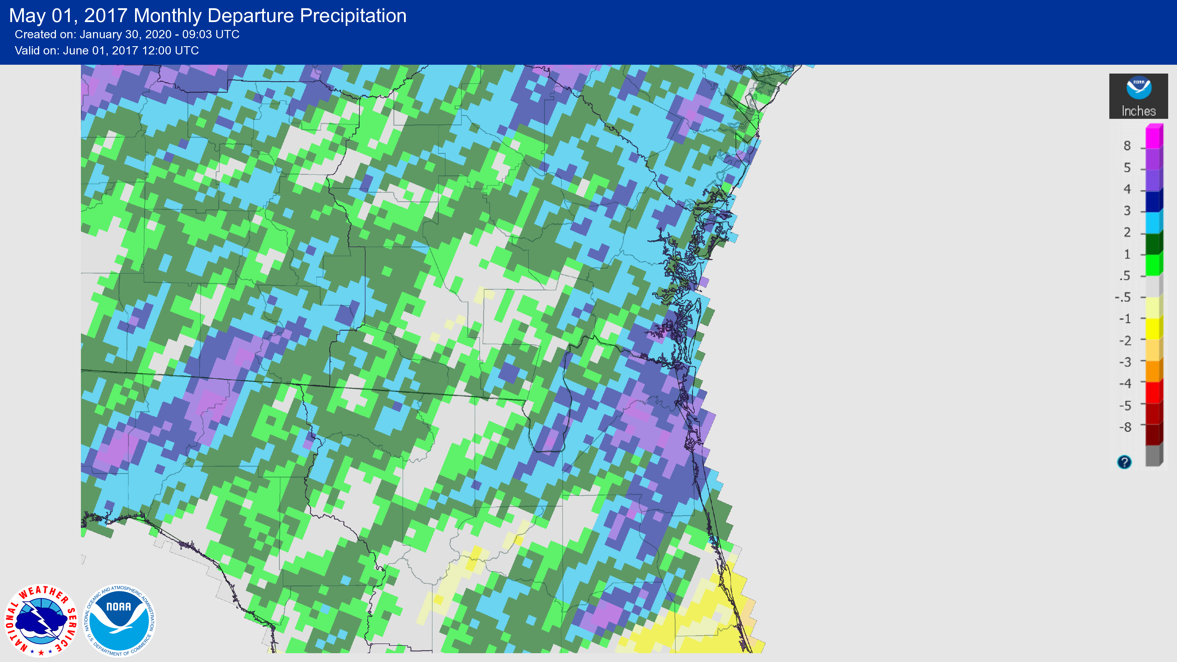
Climatic conditions were very favorable towards the likelihood of fire development in the Okefenokee Swamp in spring of 2017. The winter of 2016-2017 was already on record at the time as being the 2nd warmest winter on record for the region and multiple months and areas around the swamp classified as experiencing drought conditions, marked by below average rainfall amounts with March 2017 being the 9th driest March recorded since 1895. The Suwannee River measurement gauge located at Fargo recorded a record low of 91.25 feet in May 2017, making it the 12th lowest level recorded from that sight since at least 1931. Dry conditions coincide with a weak La Niña pattern taking place in the Pacific, typically resulting in dry weather patterns for the continental US.
 |
.png) |
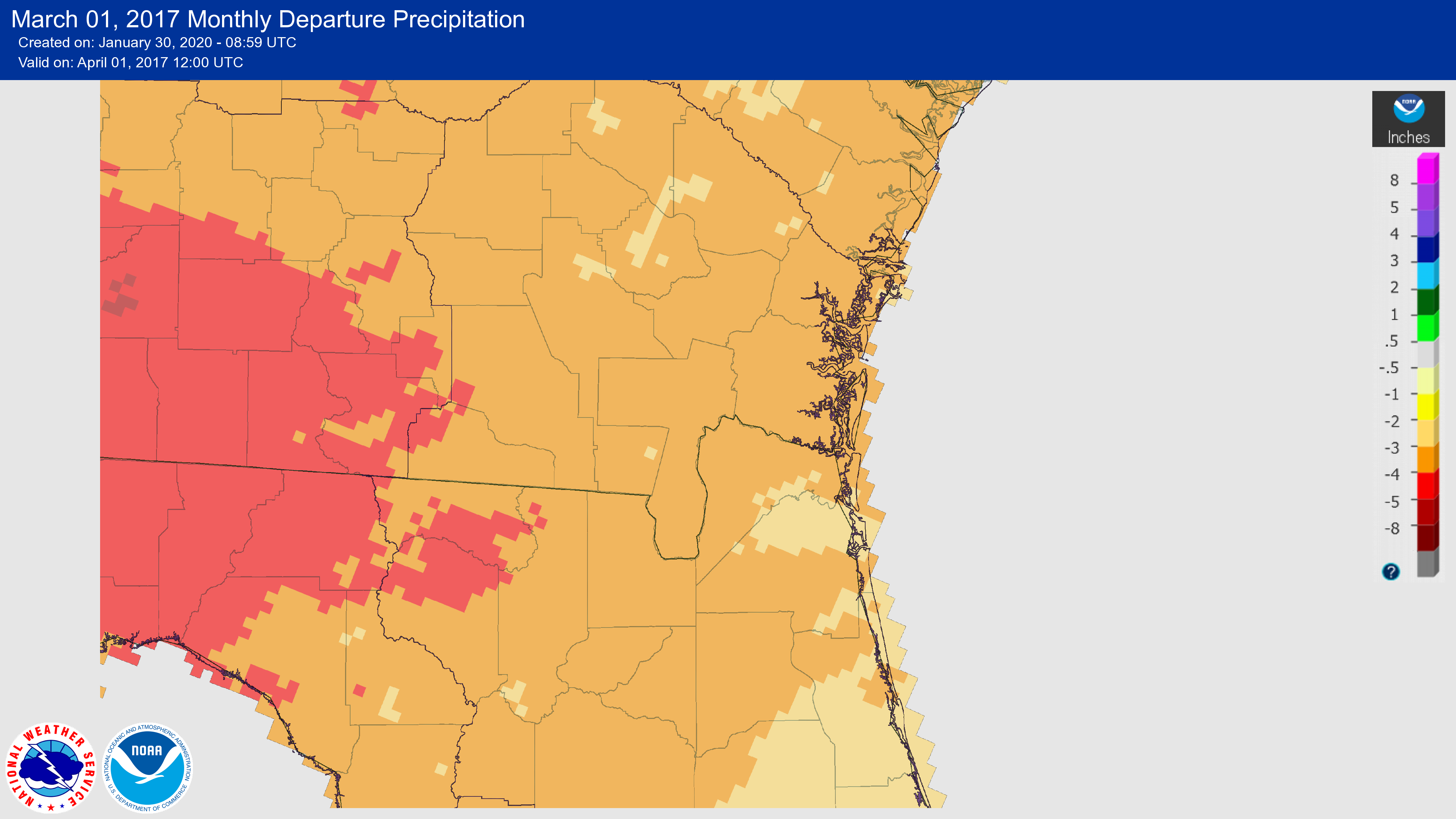 |
| January 2017: Rainfall rates are actually slightly above normal for the Okefenokee area. | February 2017: Below average rainfall and unseasonably warm temperatures. | March 2017: Drought conditions continue into spring with significantly lower rainfall amounts. |
 |
 |
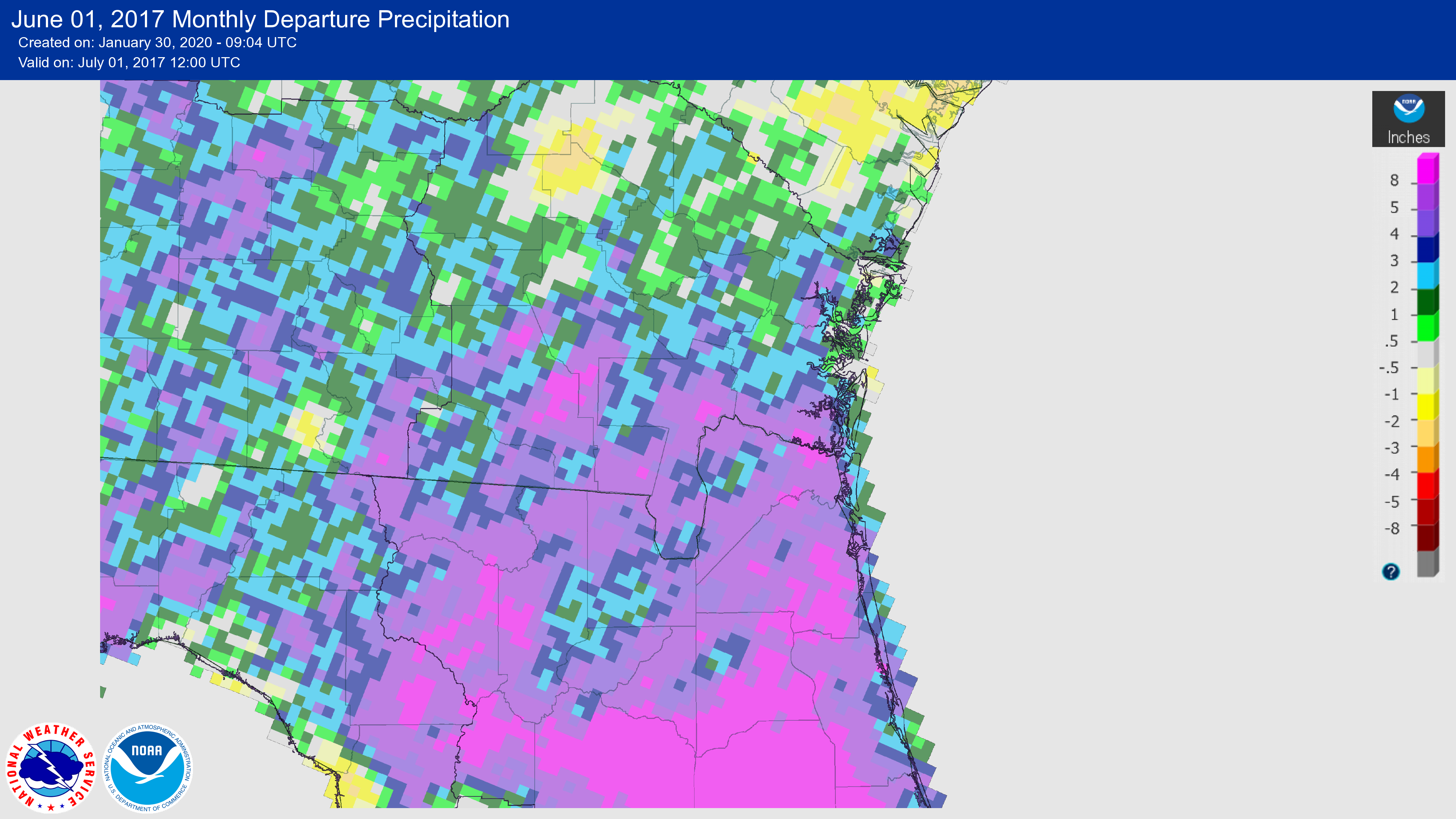 |
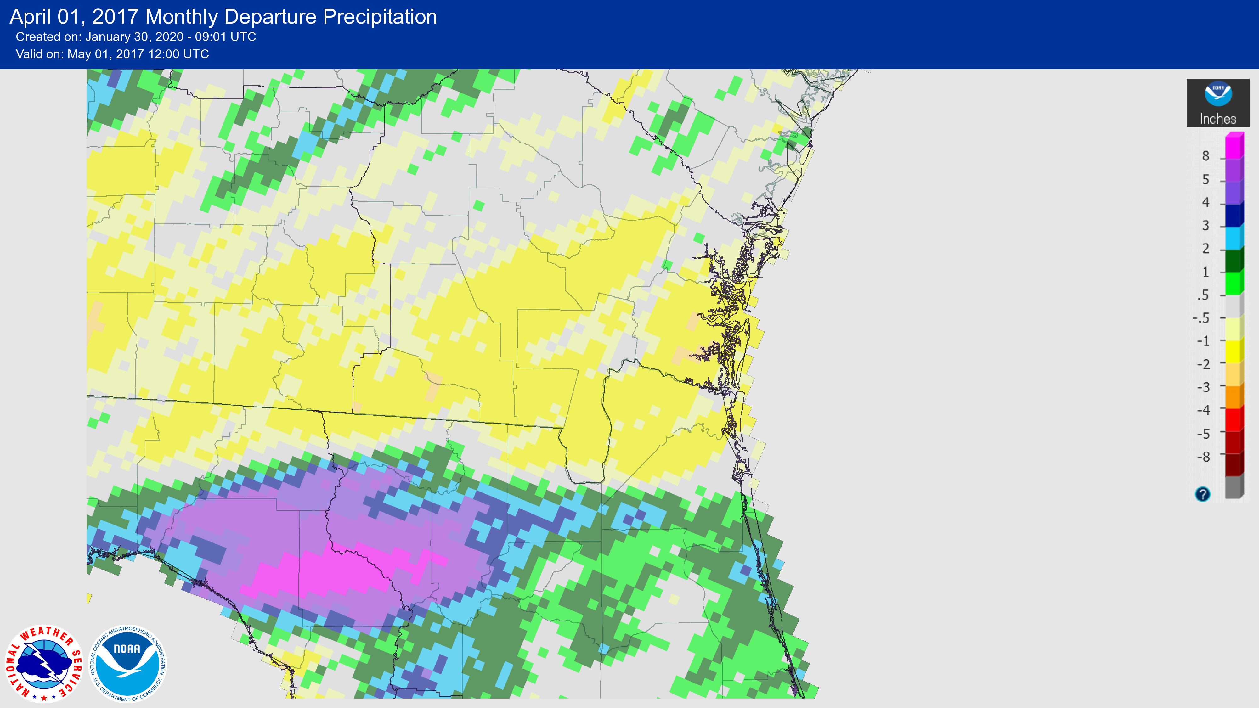
| April 2017: Increased rainfall amounts for NE Florida but still below average for the burn site. | May 2017: Rainfall amounts increase somewhat for Okefenokee area. | June 2017: Above average precipitation amounts work to suppress further expansion of the fire. |
 |
 |
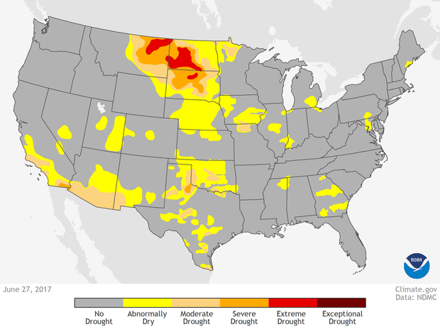 |
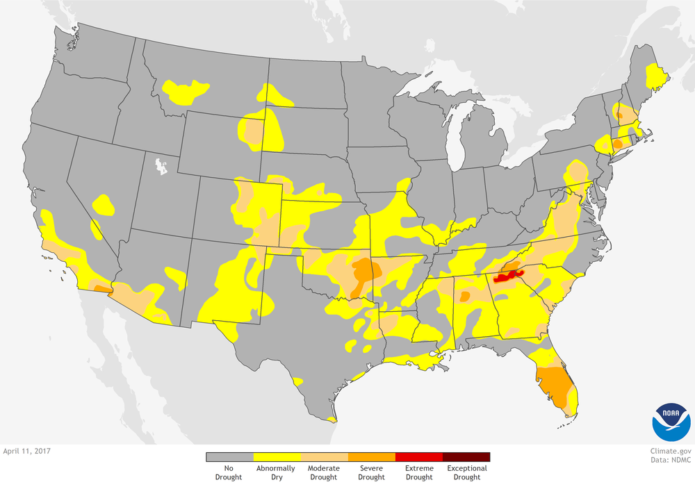
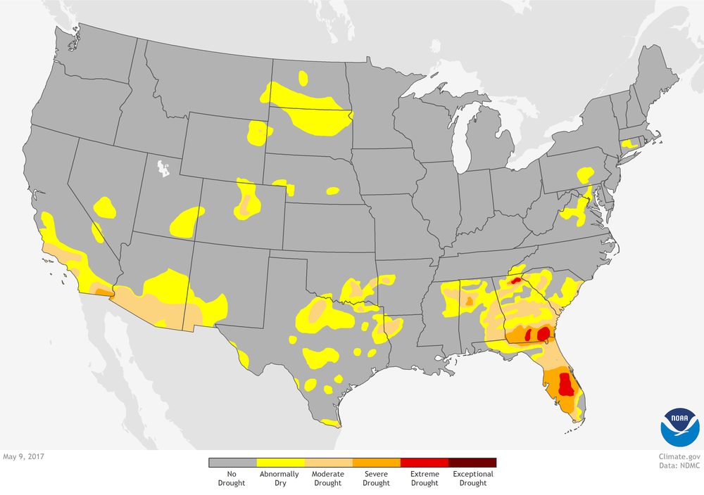
| April 2017: Conditions near the burn area range between Abnormally Dry and Moderate Drought. | May 2017: Drought levels worsen to Severe Drought and Extreme Drought. | June 2017: Increased rainfall begins to negate drought conditions by the end of the month. |
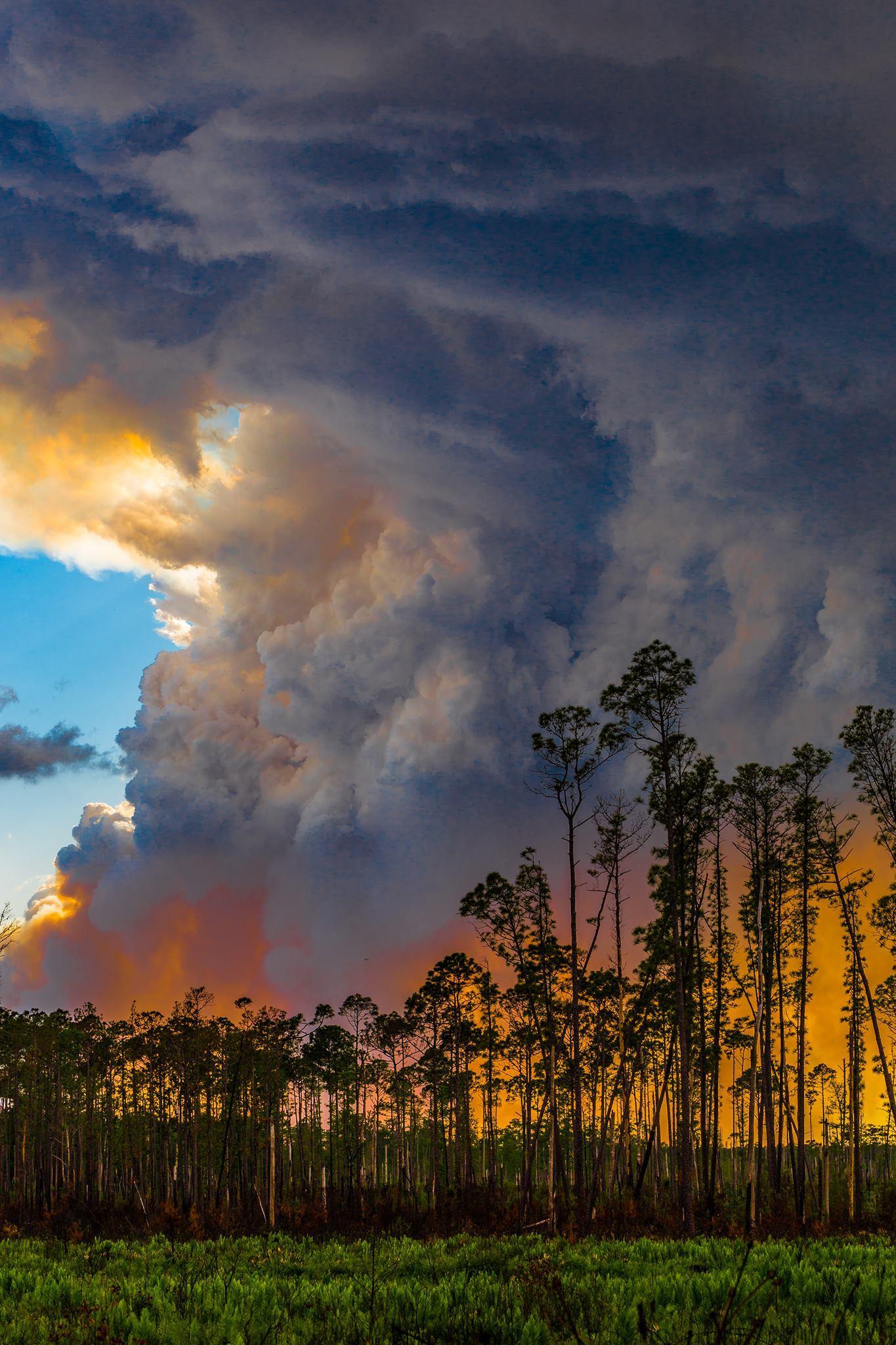
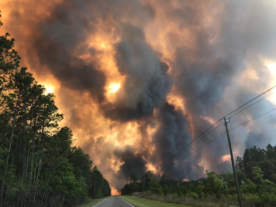
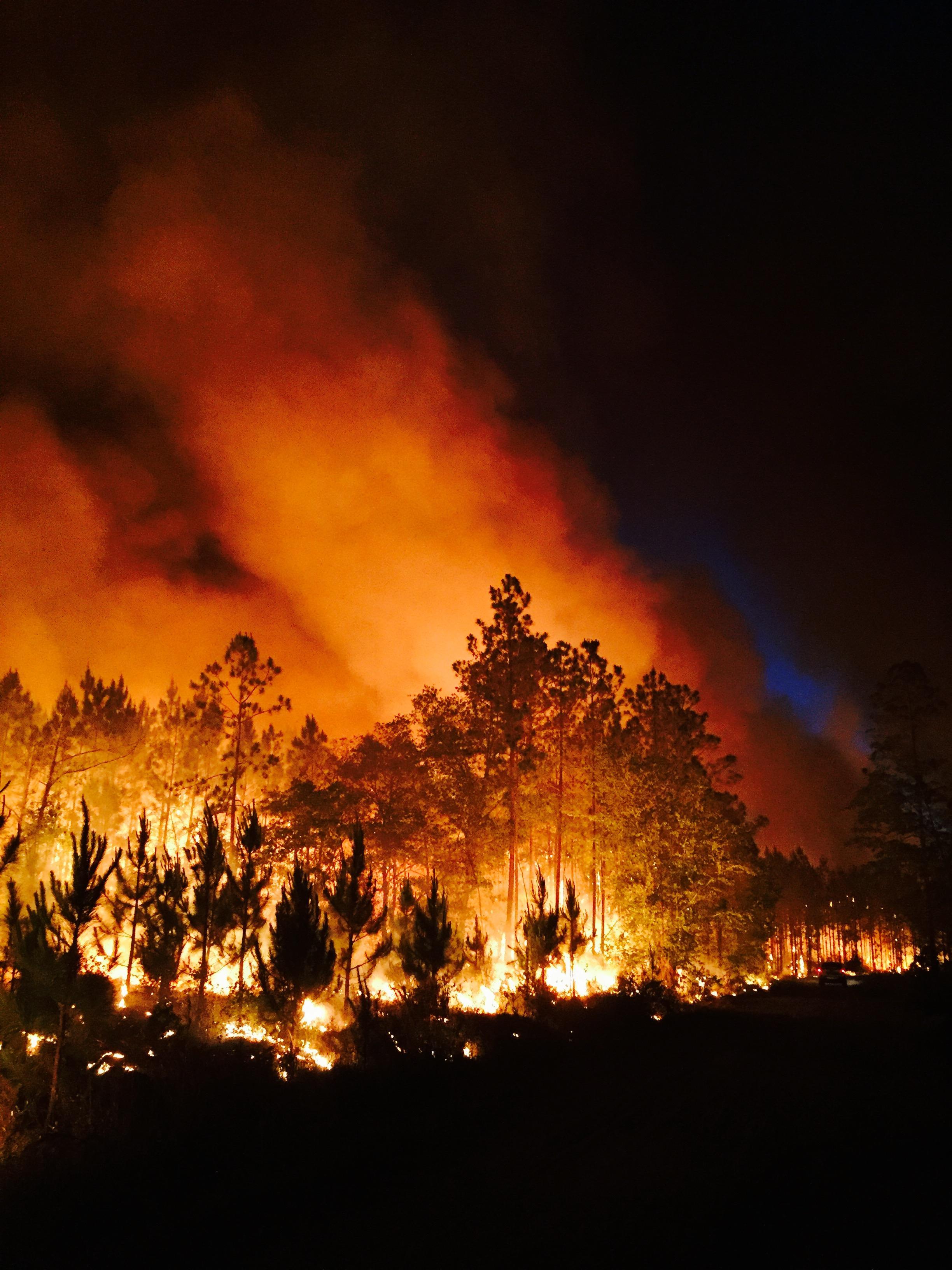
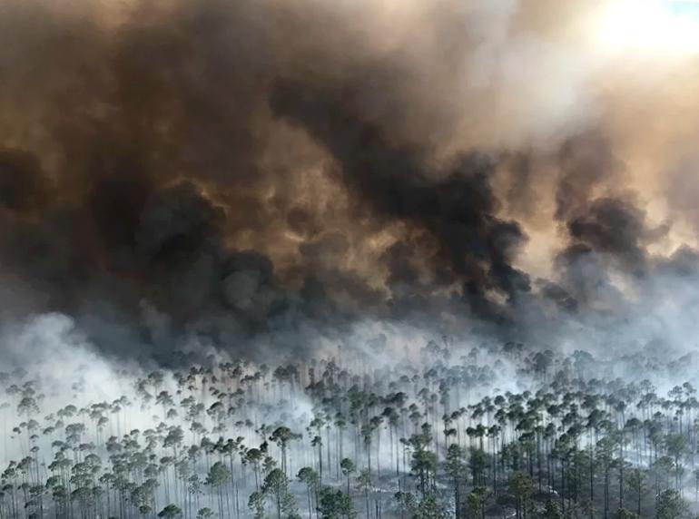
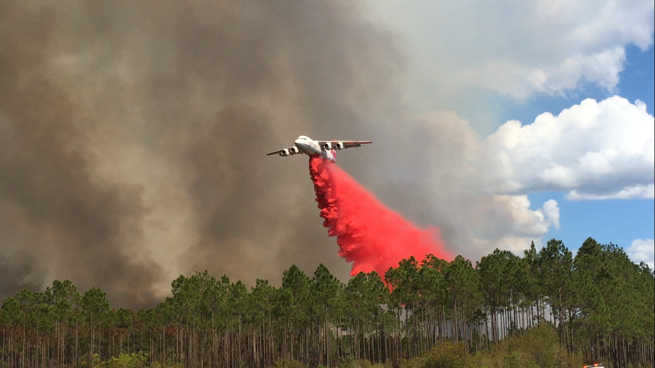
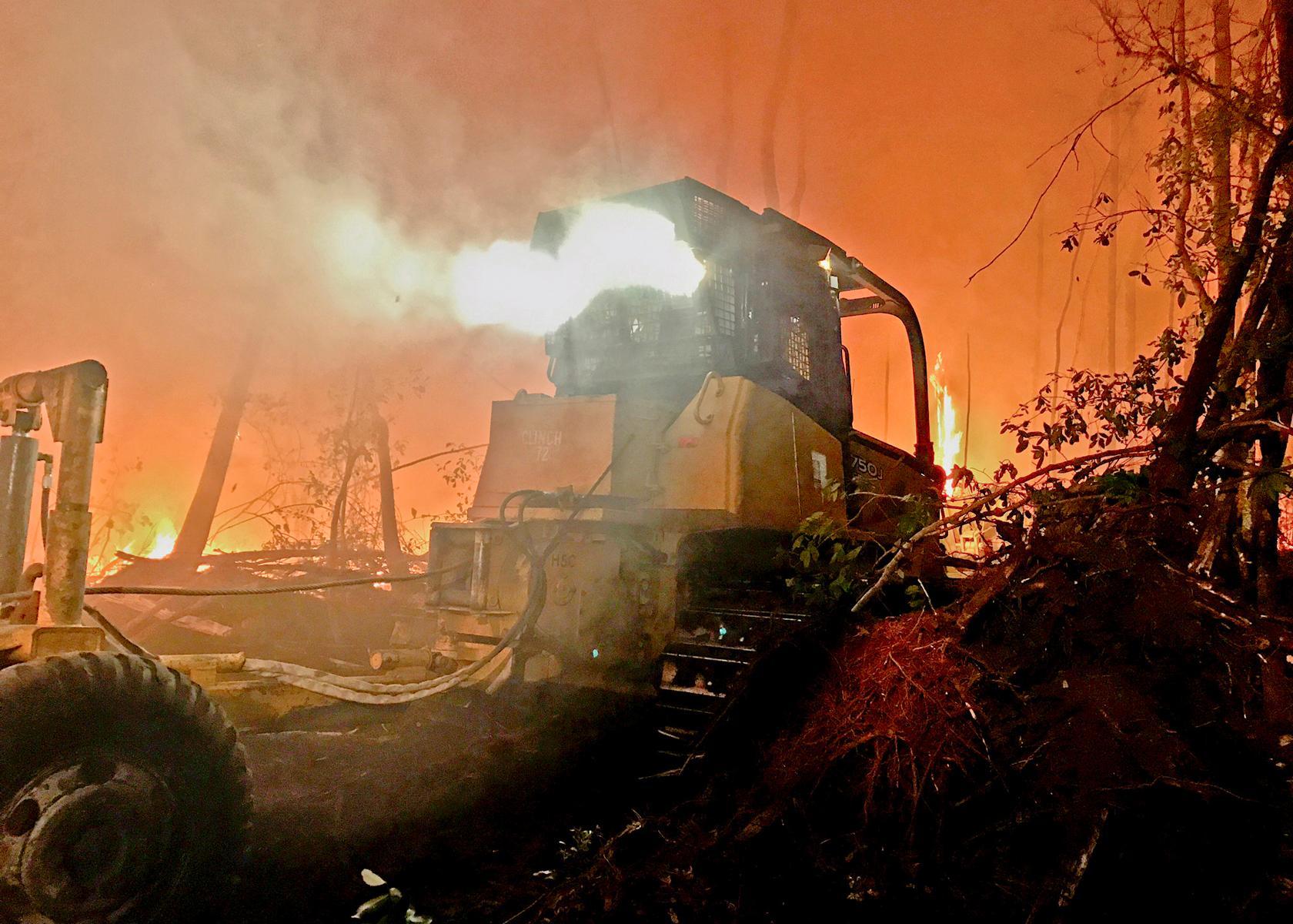
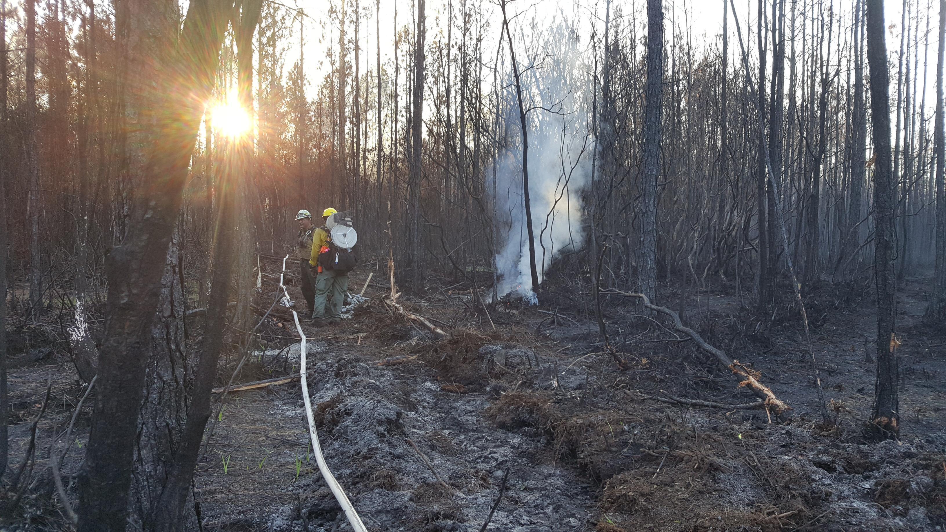
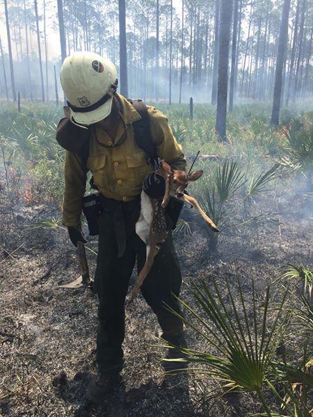
Photos
All Photos are Courtesy of Inciweb
 |
 |
 |
 |
 |
 |
 |
 |
 |
Media use of NWS Web News Stories is encouraged! Please acknowledge the NWS as the source of any news information accessed from this site. |
|

