
Dangerous and extreme heat will remain across portions of the southern U.S. this week. Heavy rainfall may bring significant flash flooding across portions of the Mid-Atlantic and Northeast through the night, and additional flash flooding concerns across New England on Wednesday. Monsoonal thunderstorms will bring a flash flood risk to the Four Corners region, especially in burn scar areas Read More >
Jackson, KY
Weather Forecast Office
Overview
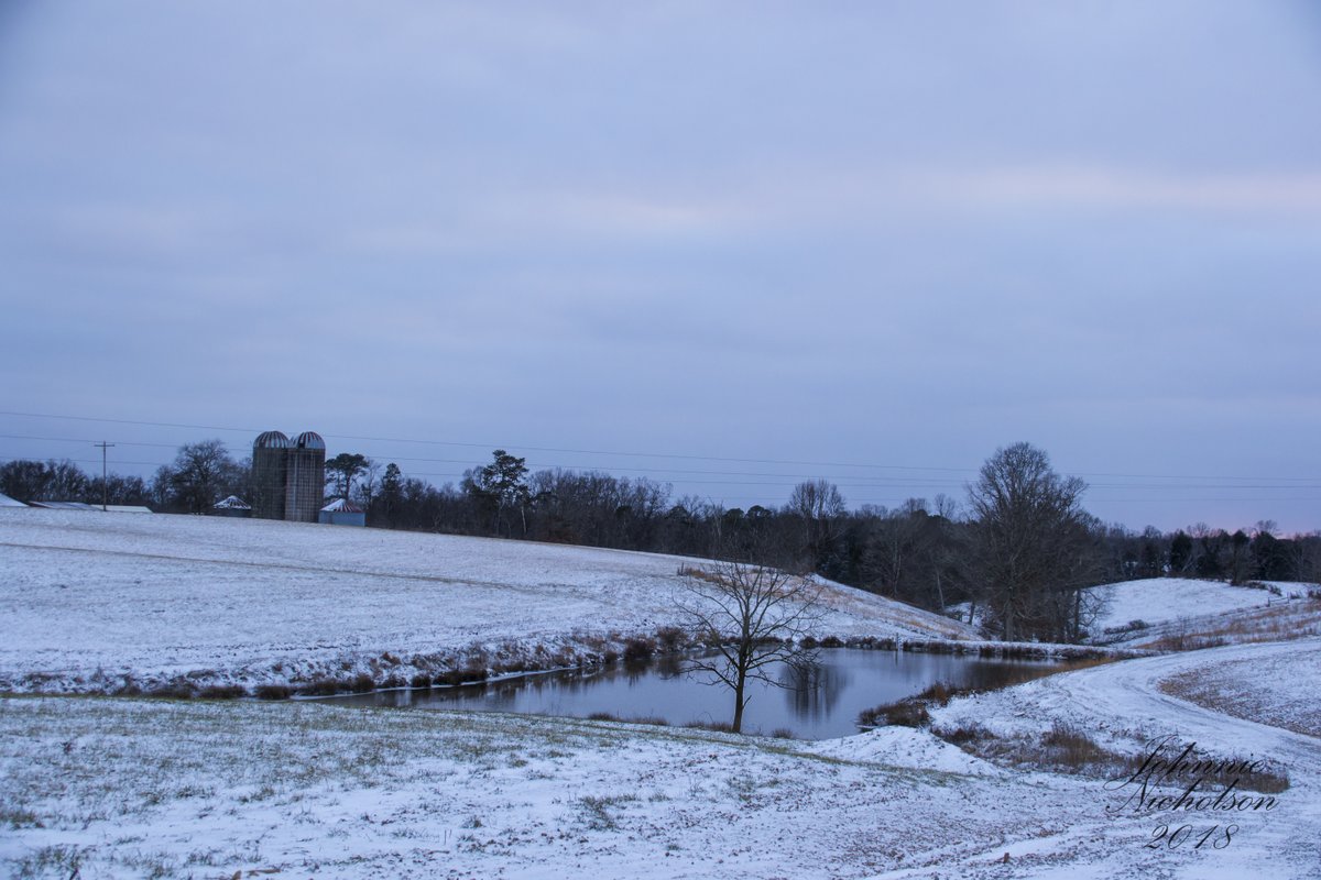
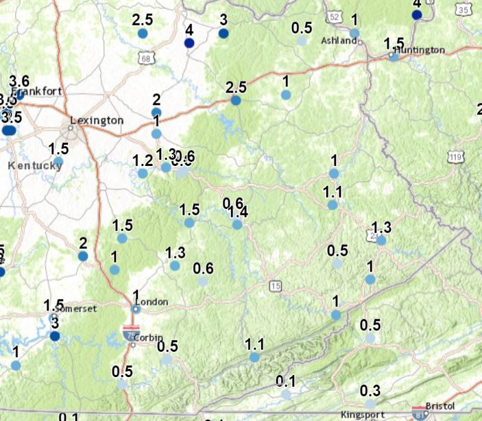
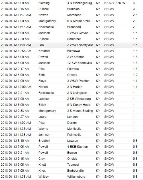
An area of low pressure tracked across Kentucky on Friday, January 12th into Saturday, January 13th, bringing widespread precipitation to the state. Precipitation began as rain across east Kentucky on Friday and quickly changed over to snow from west to east Friday evening. Snowfall totals generally ranged from a half an inch up to 4 inches across east Kentucky with the highest amounts north of I-64.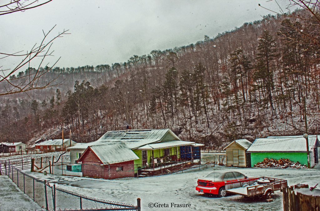 |
 |
 |
| Harold, Kentucky. Courtesy Greta Frasure. |
Hatfield, Kentucky. Courtesy Mary Reed Runyon. |
London, Kentucky. Courtesy Johnnie Nicholson. |
Storm Reports
 |
Media use of NWS Web News Stories is encouraged! Please acknowledge the NWS as the source of any news information accessed from this site. |
|
Warnings/Hazards
Decision Support - Outlooks
Current Weather Hazards
Hazards Criteria
Weather Story Graphic
Recent Storm Reports
Submit a Report
Forecasts
Decision Support - Forecast
Aviation Forecasts
Fire Weather Forecasts
Hourly Weather Forecast
Activity Planner
River Forecasts
Forecast Discussion
Current Conditions
Regional Radar
Decision Support - Current
Rivers and Lakes
Hourly Airport Weather
Local Radar
Satellite
Kentucky Mesonet
Past Weather
Local Climate Info
Temp/Precip Summary
How Much Rain Fell?
How Much Snow Fell?
Past Weather Events
Drought Information
Local Coop Observers
US Dept of Commerce
National Oceanic and Atmospheric Administration
National Weather Service
Jackson, KY
1329 Airport Road
Jackson, KY 41339
606-666-8000
Comments? Questions? Please Contact Us.

