|
857 FLUS43 KJKL 312022 CCA HWOJKL Hazardous Weather Outlook...CORRECTED National Weather Service Jackson KY 422 PM EDT Fri Jul 31 2026 KYZ044-050>052-058>060-068-069-079-080-083>088-104-106>120-012000- Fleming-Montgomery-Bath-Rowan-Estill-Powell-Menifee-Rockcastle- Jackson-Pulaski-Laurel-Wayne-McCreary-Whitley-Knox-Bell-Harlan- Elliott-Morgan-Johnson-Wolfe-Magoffin-Floyd-Lee-Breathitt-Knott- Owsley-Perry-Clay-Leslie-Letcher-Martin-Pike- 422 PM EDT Fri Jul 31 2026 This Hazardous Weather Outlook is for a portion of eastern Kentucky. .DAY ONE...Tonight. No hazardous weather is expected at this time. .DAYS TWO THROUGH SEVEN...Saturday through Thursday. Thunderstorms are possible at times from Saturday through Thursday. Some of the thunderstorms could be strong to severe late Saturday afternoon and evening with gusty winds the primary hazard, with the highest risk closer to the Bluegrass, Red River Gorge, and Lake Cumberland areas. An isolated brief tornado cannot be ruled out west of I-75 and over the Bluegrass. The threat for strong to severe thunderstorms shifts eastward on Sunday, focusing more on the Big Sandy River Basin. Showers and thunderstorms will be capable of producing torrential rainfall on both weekend days as well as on Monday and Tuesday, leading to the potential for isolated flash flooding. At this time, the greatest risk for any flash flooding appears to be late Saturday and Saturday night. .SPOTTER INFORMATION STATEMENT... Spotters are encouraged to report any instances of flash flooding or storm damage this weekend. $$ GINNICK/GEERTSON |
Weather Story |
 |
|
| Today's Forecast Map | |
 |
|
| Tomorrow's Forecast Map | |
 |
|
| Day 3 Forecast Map | |
 |
 |
Current Watches |
Storm Trend Discussions |
Today's Storm Reports |
Yesterday's Storm Reports |
| SPC Day 1 Thunderstorm Outlook | SPC Day 1 Tornado Outlook | SPC Day 1 Severe Wind Outlook | SPC Day 1 Severe Hail Outlook |
 |
 |
 |
 |
| SPC Day 1 Thunderstorm Outlook Narrative | |||
| SPC Day 2 Thunderstorm Outlook | SPC Day 3 Thunderstorm Outlook | SPC Day 4-8 Thunderstorm Outlook |
 |
 |
 |
| SPC Day 2 Outlook Narrative | SPC Day 3 Outlook Narrative | SPC Day 4-8 Outlook Narrative |

| Day 1 Excessive Rainfall Outlook | Day 2 Excessive Rainfall Outlook | Day 3 Excessive Rainfall Outlook |
 |
 |
 |
| Day 1 Precipitation | Day 2 Precipitation | Day 3 Precipitation |
 |
 |
 |
| Day 4-5 Precipitation | Day 6-7 Precipitation | 7-Day Total Precipitation |
 |
 |
 |
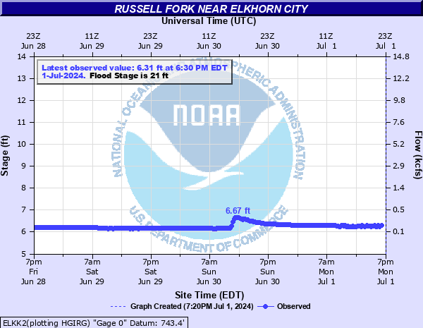
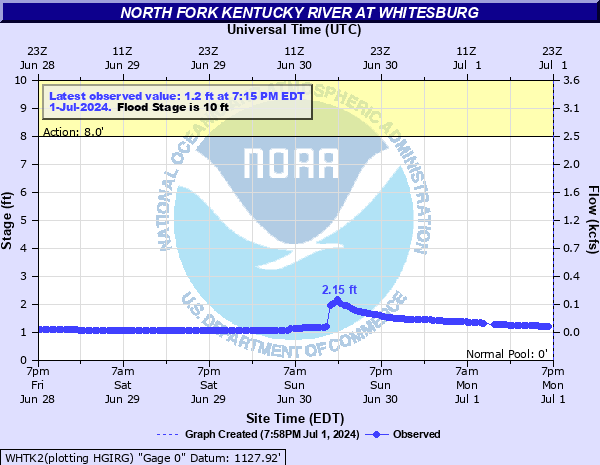
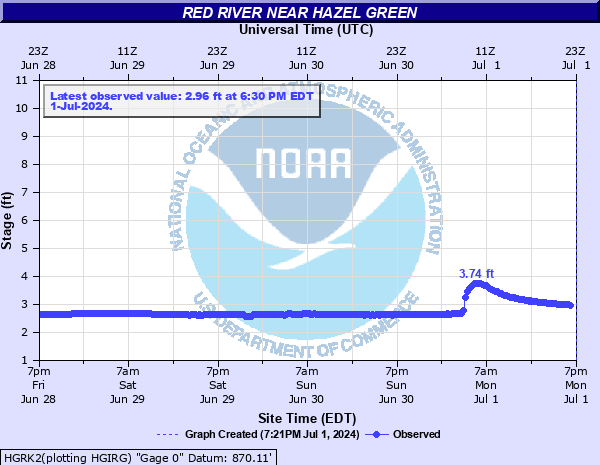
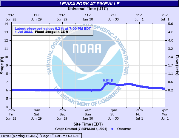
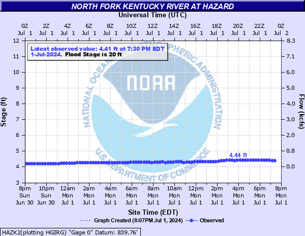
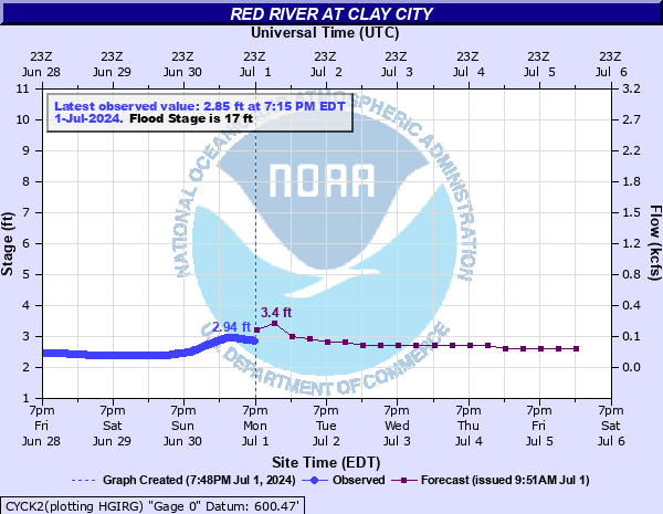
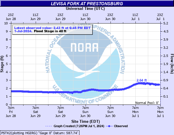
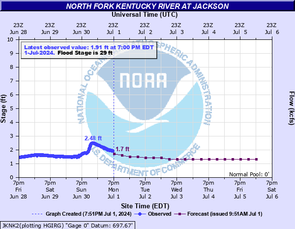
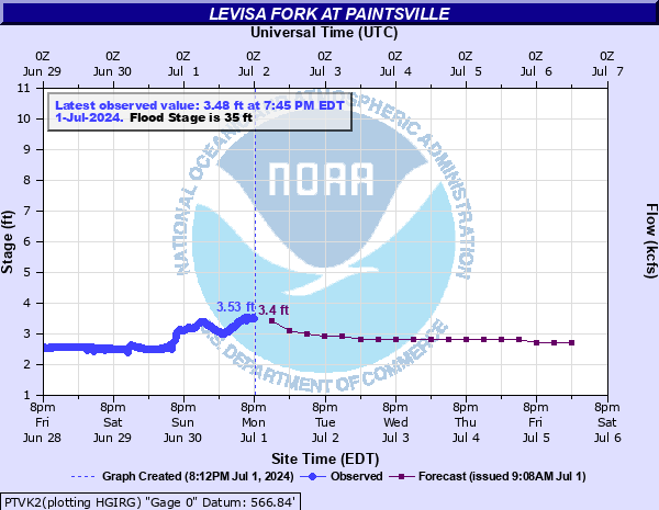
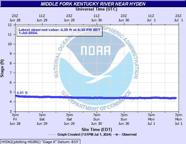
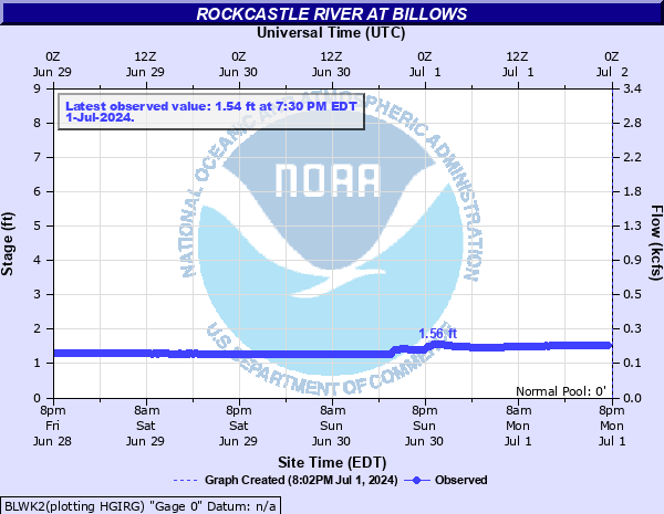
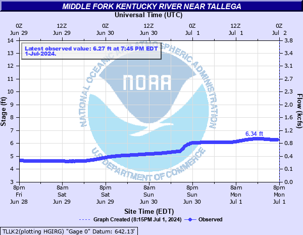
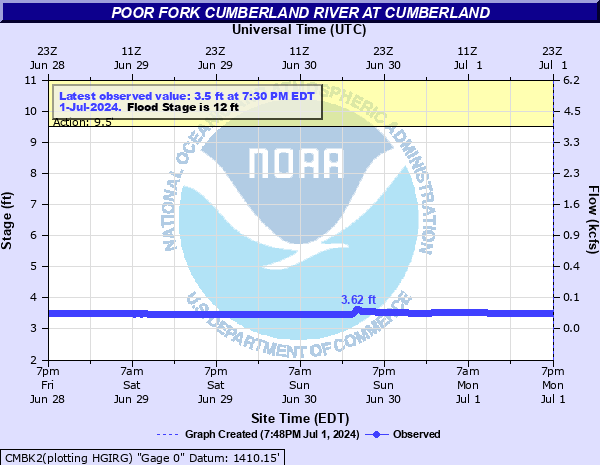
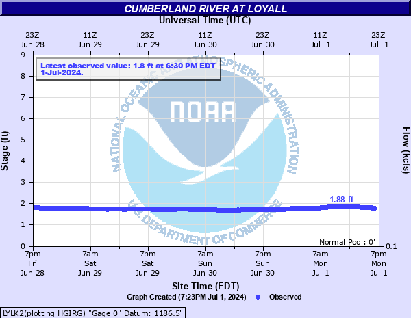
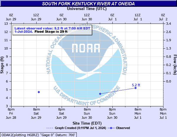
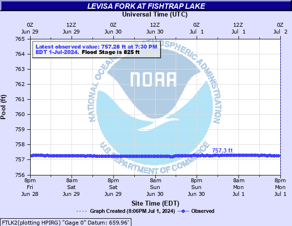
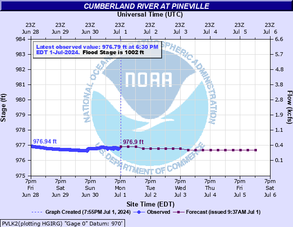
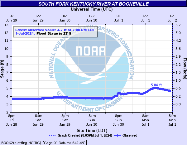
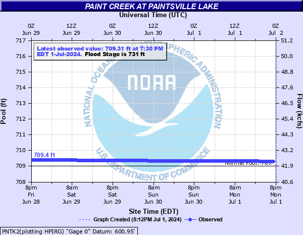
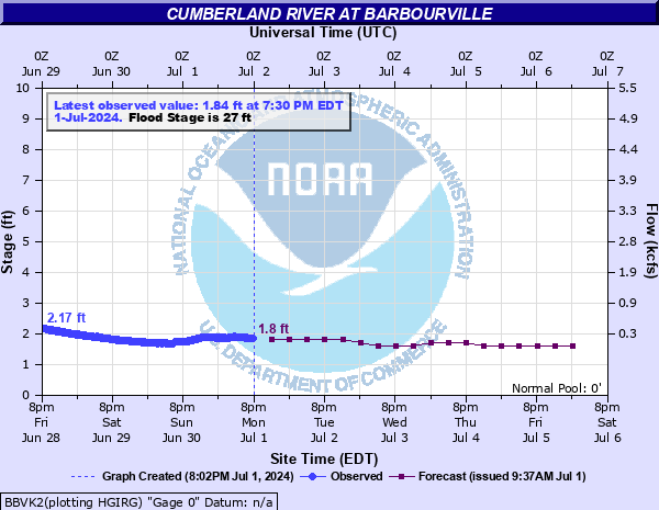
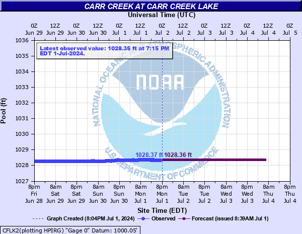
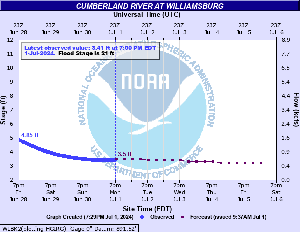
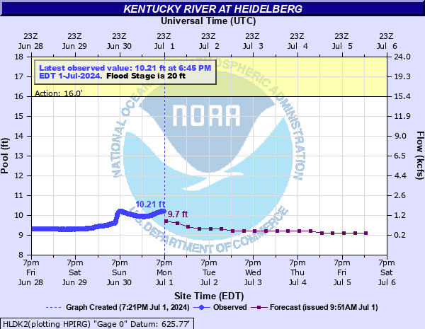
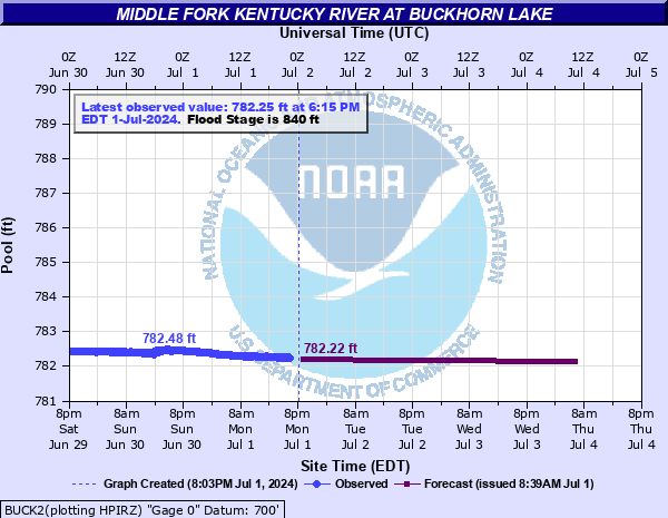
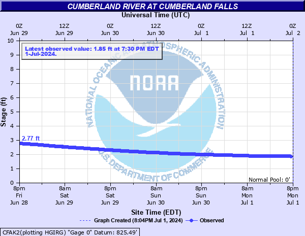
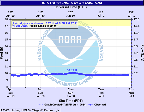
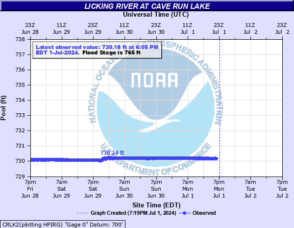
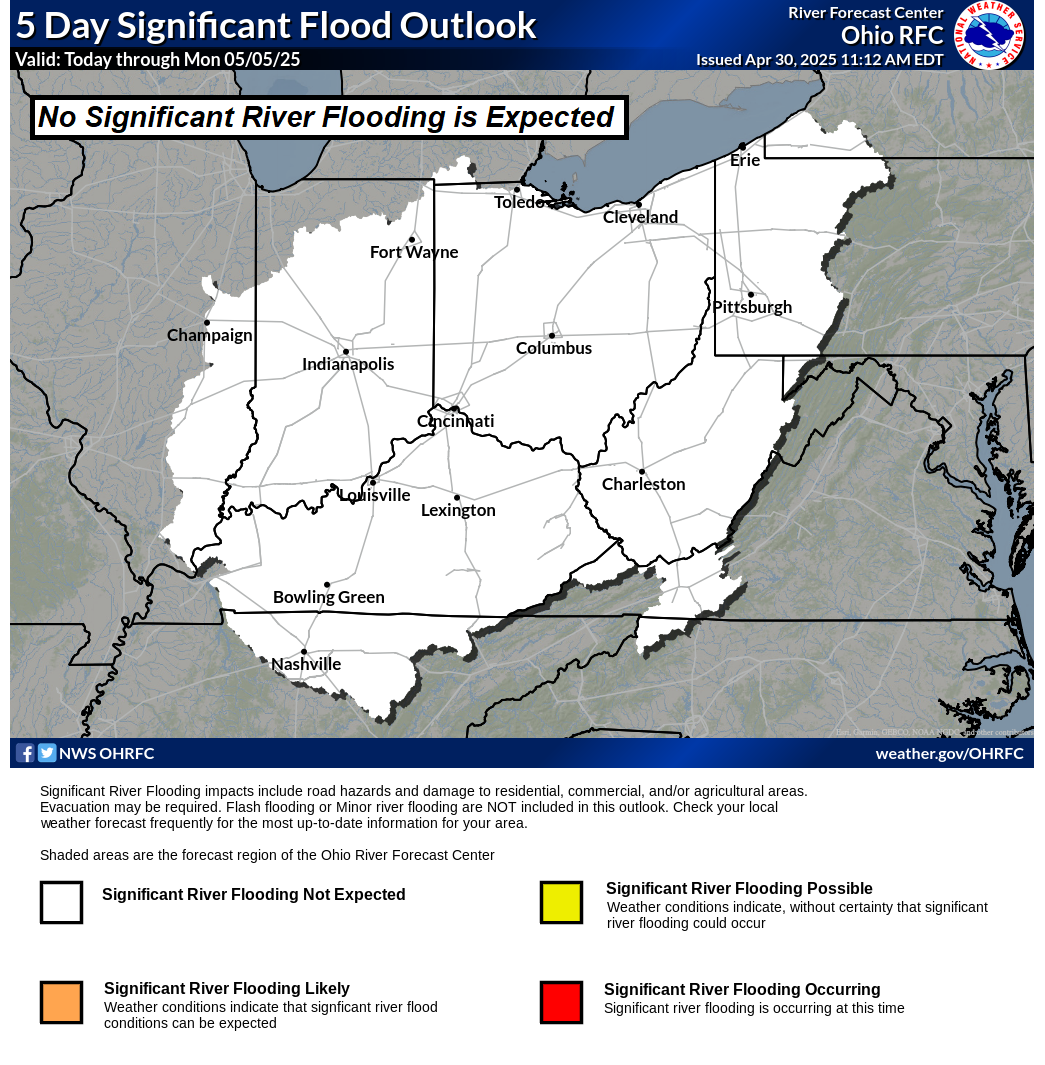
| Rivers/Lakes Quick Glance (click icons to enlarge or click here for more info and additonal locations) | Ohio River Basin Flood Outlook | ||||||||||||||||||||||||||||||||||||||||||||||||||||||||||||||||||||||||||||||
|
 |
||||||||||||||||||||||||||||||||||||||||||||||||||||||||||||||||||||||||||||||
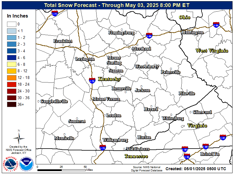
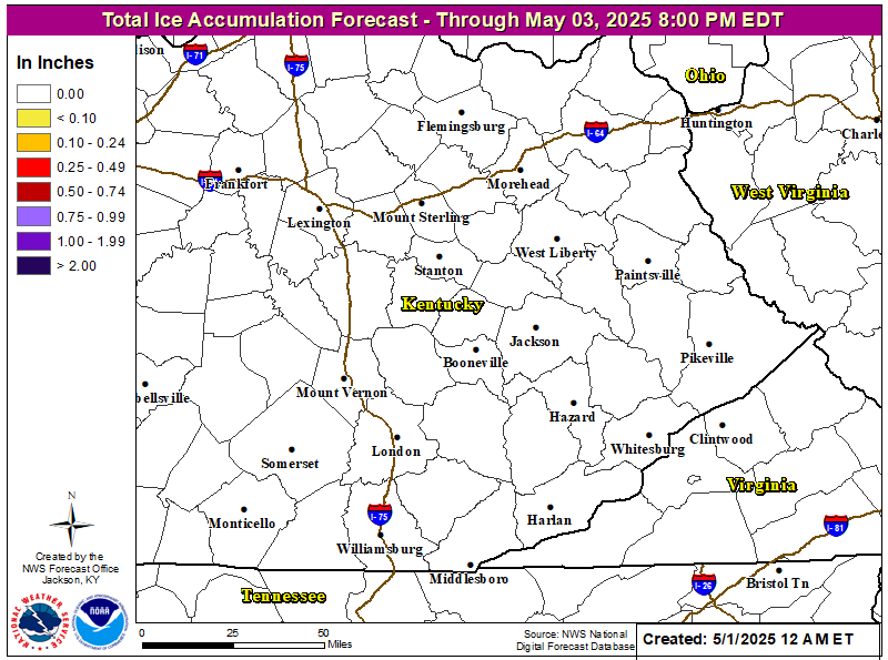
| Local Office Snow & Ice Forecasts | |
 |
 |
| Day 1 Snowfall Greater Than 4" | Day 2 Snowfall Greater Than 4" | Day 3 Snowfall Greater Than 4" |
 |
 |
 |
| Day 1 Freezing Rain Greater than 1/4" | Day 2 Freezing Rain Greater than 1/4" | Day 3 Freezing Rain Greater than 1/4" |
 |
 |
 |
WFAS Observed Fire Danger Rating |
WFAS Forecast Fire Danger Rating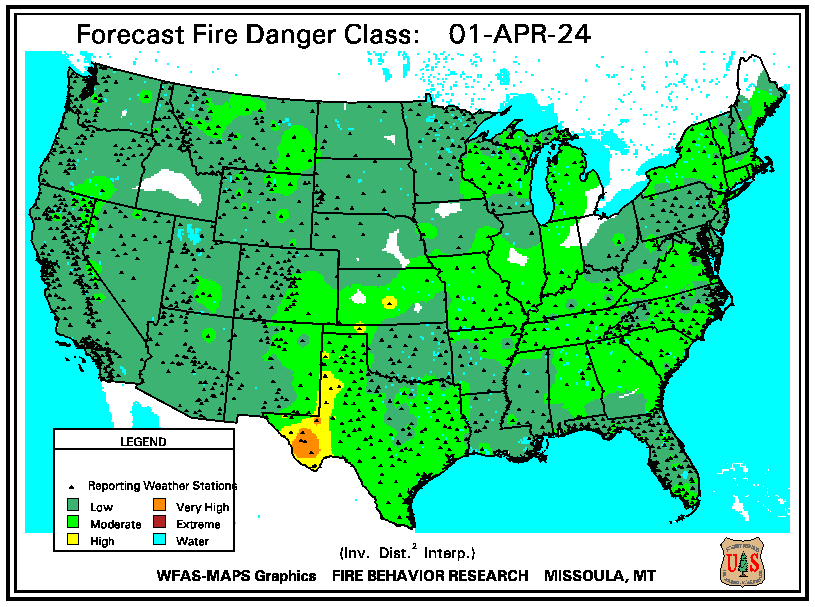 |
| SPC Fire Weather Day 1 Outlook | SPC Fire Weather Day 2 Outlook | SPC Fire Weather Day 3-8 Outlook |
 |
 |
 |
| Drought Monitor | Seasonal Drought Outlook | NICC Significant Fire Potential Outlook |
 |
 |
 |
 |