 |
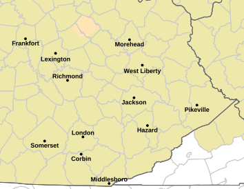
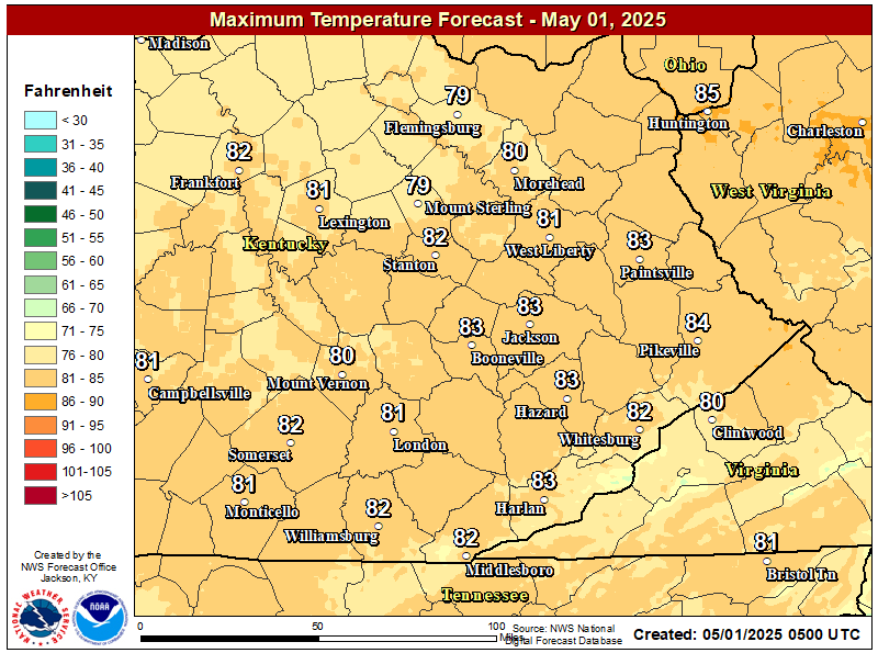
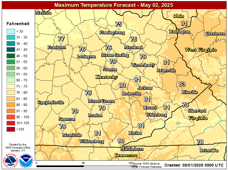
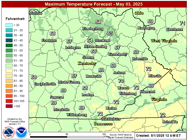
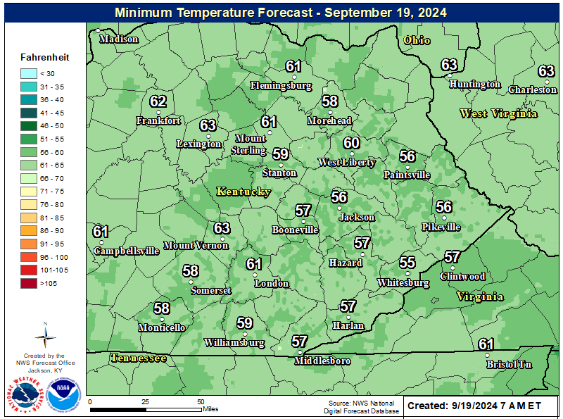
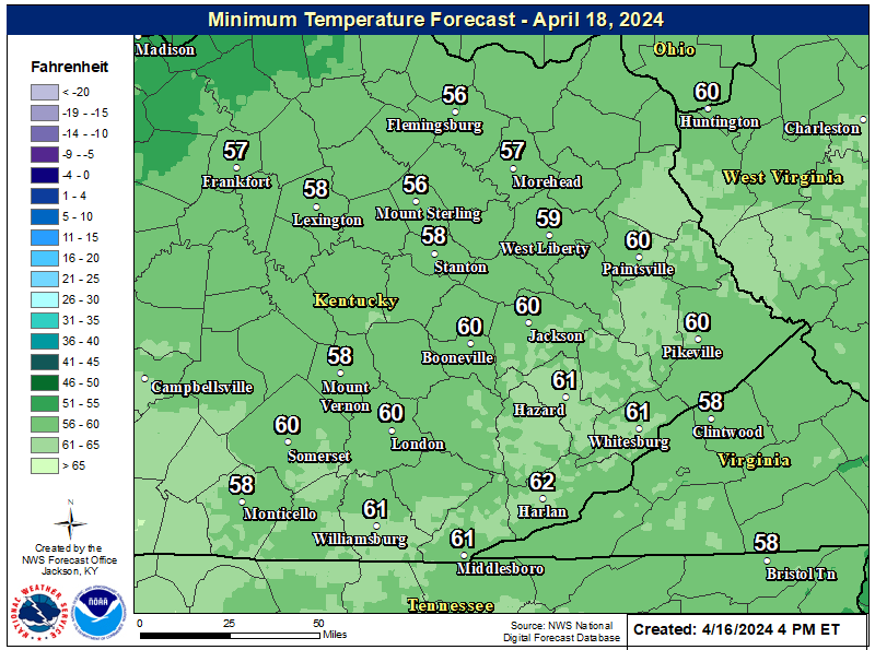
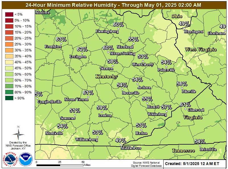
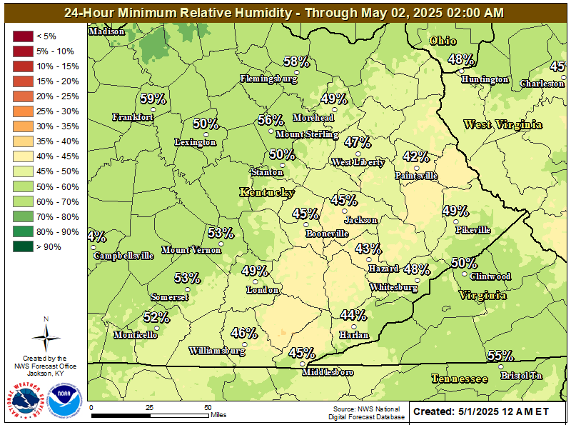
WFO Jackson has fire weather responsibility for most of eastern Kentucky, including the Daniel Boone National Forest, portions of the Big South Fork National River and Recreation area, Cumberland Gap National Historical Park, and Jefferson National Forest. The normal fire season is separated into the spring season running February 15 through April 30 and the fall season running October 1 through December 15. These dates may change depending on the severity of the fire season. |
  |
|
Routine Fire Wx Fcst (With/Without 6-10 Day Outlook) Issued: 07/31/2026 02:15:00 PM UTC
|
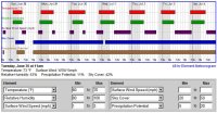
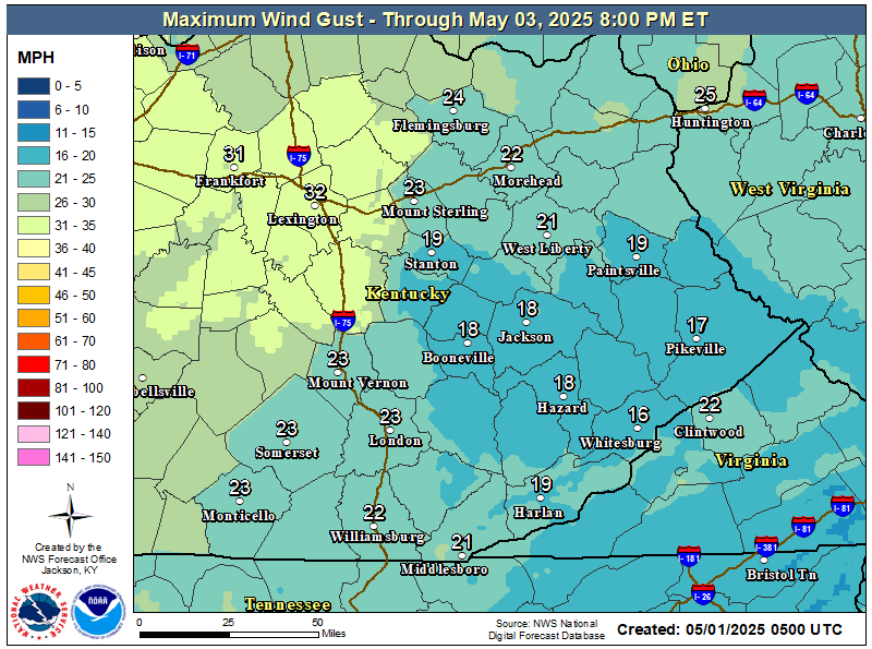
Local Weather Briefing
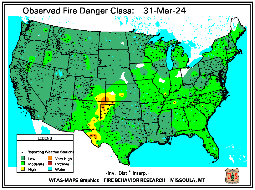
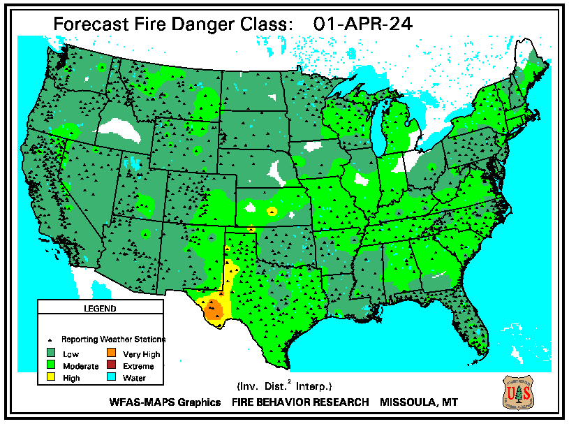
Fire Weather/Drought Information and Outlooks
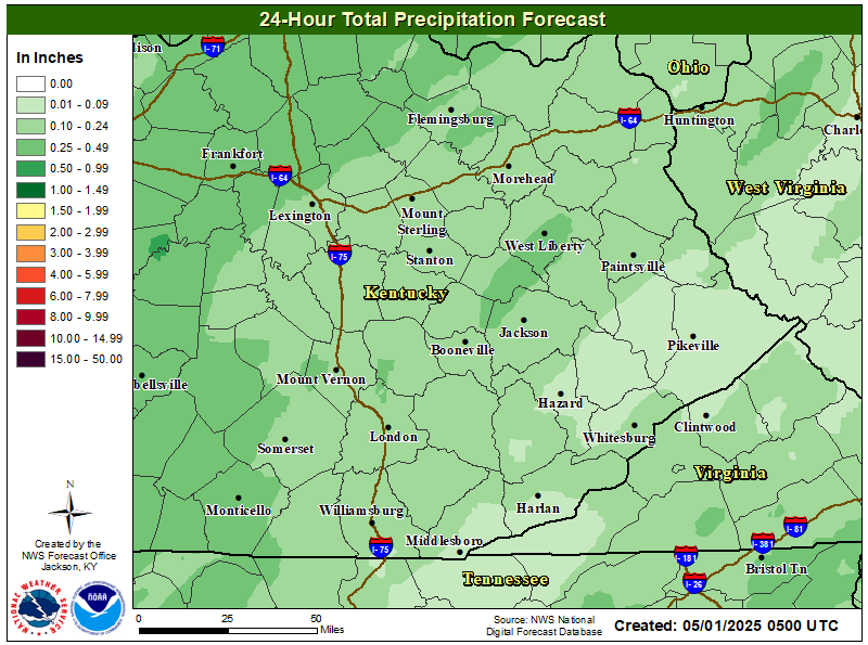
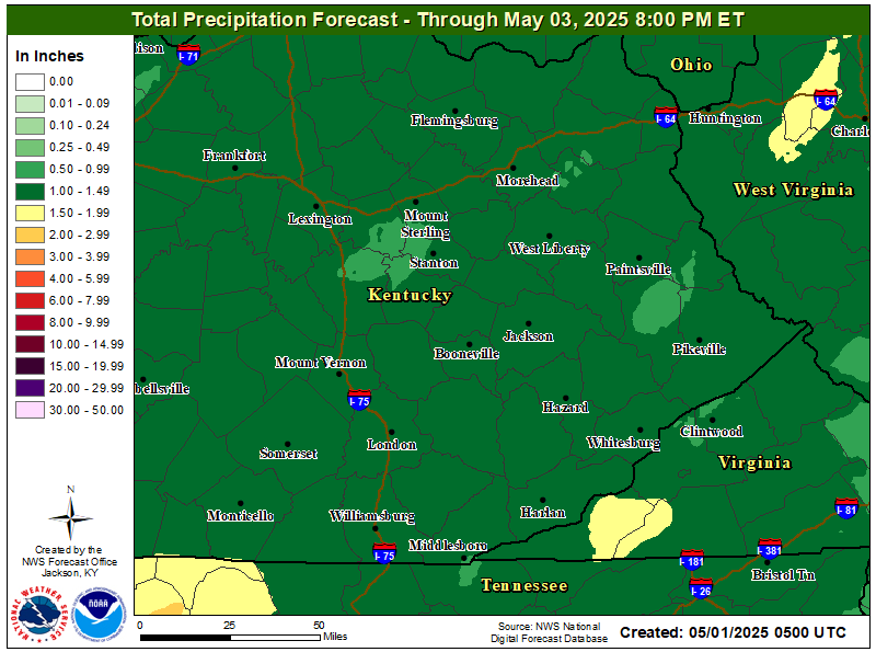
Rainfall Information and Outlooks
Medium and Long Range Temperature & Precipitation Outlooks
|
|||||||||||||||||||||||||||||||||||||||||||||||||||||||||||||||||||||||||||||||||||||||