Jackson, KY
Weather Forecast Office
Overview
|
One of the strongest storms of the century and a rare true blizzard for eastern Kentucky, brought 6 to 30 inches of snow to eastern and southeastern Kentucky from March 12-14, 1993. Strong winds accompanied the snow, resulting in blizzard conditions and snow drifts of 6 to 10 feet. Interstate 75 was closed from Lexington to the Tennessee border and Interstate 64 was closed from Lexington to the West Virginia border, both for a period of two days. Between 3,000 and 4,000 motorists were stranded along both highways, causing emergency shelters to be set up in Ashland and London. In Whitley County, a man froze to death when he tried to walk from his home into Corbin as temperatures plummeted below zero behind the storm. Some of the heavier snowfall amounts were: Perry County - 30 inches, Pikeville - 24 inches, Ashland - 22 inches, and London - 22 inches. At the Jackson National Weather Service Office, 19.8 inches fell in 24 hours. At Hazard, the 24 hour snowfall record for the state of Kentucky was set as 25 inches fell. In the higher terrain of Harlan County, 4 to 5 feet of snow were reported around Mary Ellen. |
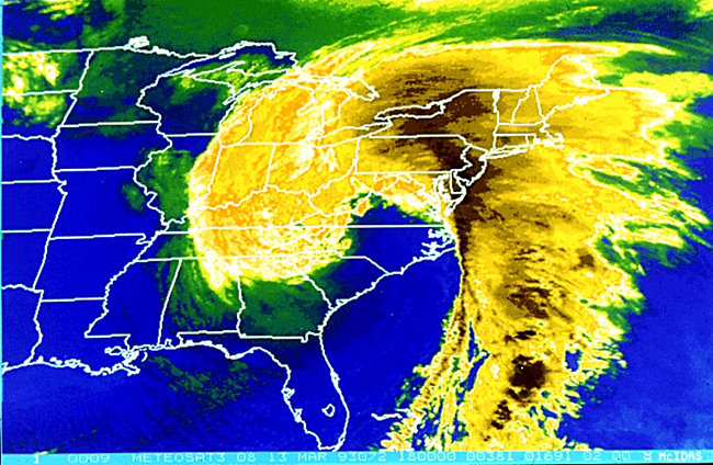 Satellite imagery from March 13, 1993 |
Snowfall
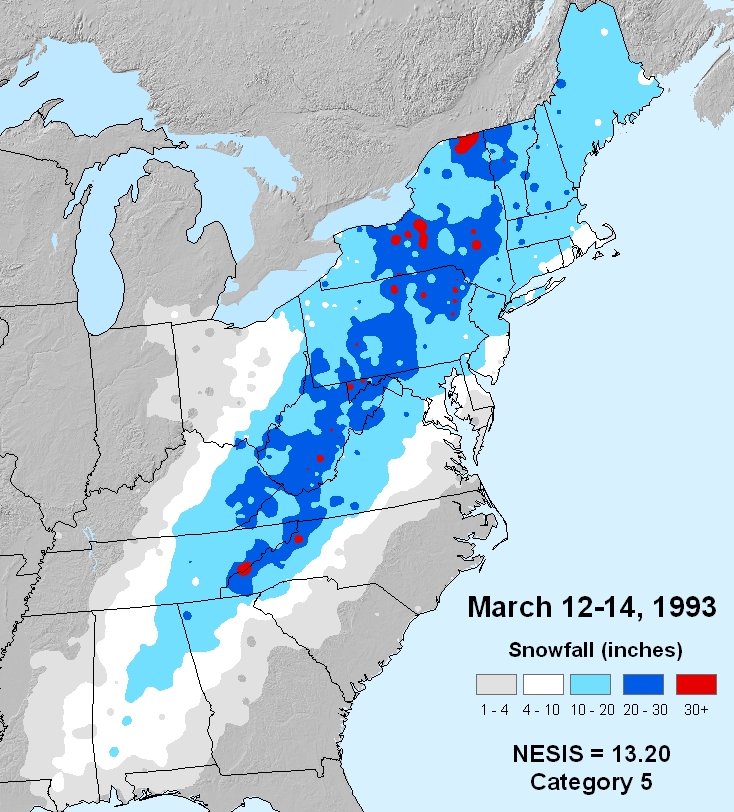 |
| Snowfall totals from March 12-14, 1993. |
Satellite Imagery
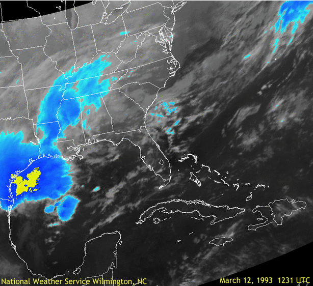 |
| Infrared satellite animation through the duration of the storm. |
Surface Map
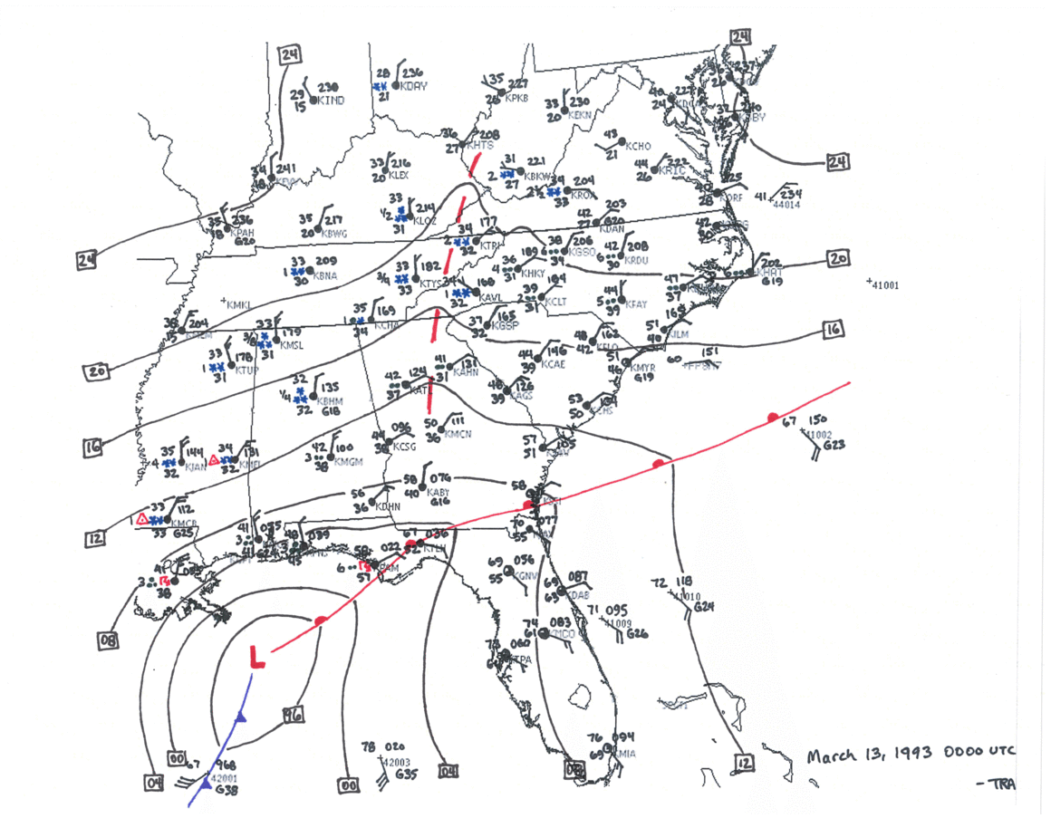 |
| Surface map animation through the duration of the storm. |
 |
Media use of NWS Web News Stories is encouraged! Please acknowledge the NWS as the source of any news information accessed from this site. |
|
Warnings/Hazards
Decision Support - Outlooks
Current Weather Hazards
Hazards Criteria
Weather Story Graphic
Recent Storm Reports
Submit a Report
Forecasts
Decision Support - Forecast
Aviation Forecasts
Fire Weather Forecasts
Hourly Weather Forecast
Activity Planner
River Forecasts
Forecast Discussion
Current Conditions
Regional Radar
Decision Support - Current
Rivers and Lakes
Hourly Airport Weather
Local Radar
Satellite
Kentucky Mesonet
Past Weather
Local Climate Info
Temp/Precip Summary
How Much Rain Fell?
How Much Snow Fell?
Past Weather Events
Drought Information
Local Coop Observers
US Dept of Commerce
National Oceanic and Atmospheric Administration
National Weather Service
Jackson, KY
1329 Airport Road
Jackson, KY 41339
606-666-8000
Comments? Questions? Please Contact Us.

