
Numerous severe thunderstorms are expected across a broad region from the Ohio Valley to the Mid-Atlantic and Northeast States today into tonight. Swaths of damaging wind gusts are expected and some tornadoes are possible. Bertha is expected to bring tropical storm conditions to portions of the Gulf Coast from the Florida Panhandle westward to southeastern Louisiana later today and Wednesday. Read More >
Overview
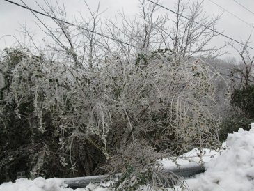
An area of low pressure tracked across the Cumberland Valley spreading Gulf of America moisture northward over a very cold air mass the night of Wednesday December 15th and the morning of Thursday December 16th, 2010. This resulted in a wintry mix of freezing rain, sleet, and snow falling across eastern Kentucky, with significant accumulations of ice and snow for many areas.
The precipitation began west of I-75 early in the evening on Wednesday December 15th as freezing rain, with a little snow and sleet mixed in. As the precipitation advanced northeastward during the evening, it fell largely as snow. Warmer air progressing northward above the surface brought a changeover to freezing rain from south to north overnight, with the changeover occurring all the way to the Mountain Parkway by dawn on Thursday. The precipitation fell largely as snow for the entire event north of the Mountain Parkway.
 |
 |
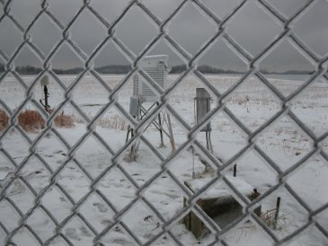
| Nearly 1/3 of an inch of ice accumulated on top of over 1 inch of snow at NWS Jackson. | |
Snow/Ice
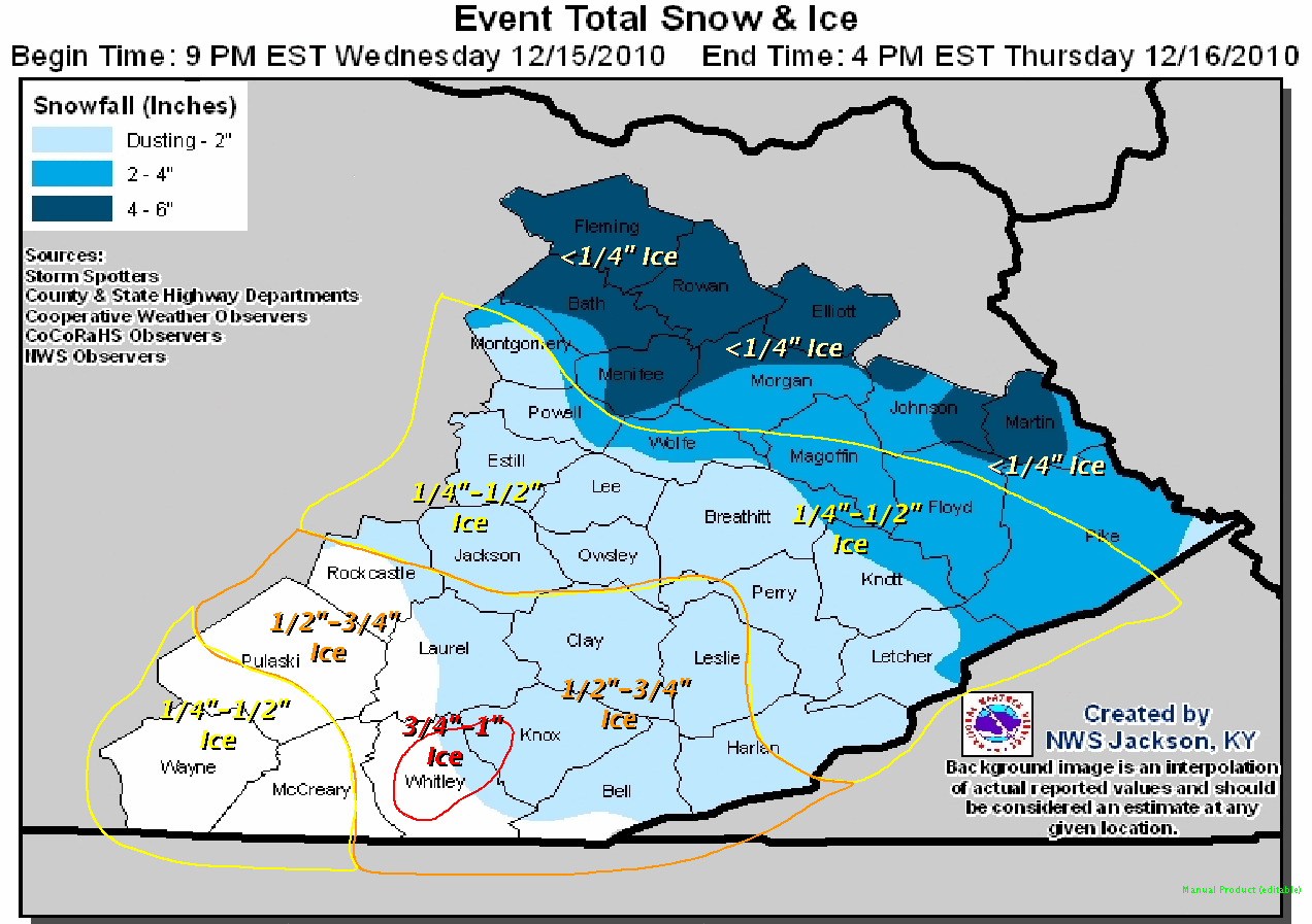 |
| Snowfall Reports | |||
| Inches | Location | County | |
| 6.0 | Cranston | Rowan | |
| 5.0 | Flemingsburg | Fleming | |
| 4.0 | Morehead | Rowan | |
| 4.0 | Inez | Martin | |
| 4.0 | Sandy Hook | Elliott | |
| 4.0 | Flatgap | Johnson | |
| 4.0 | West Liberty | Morgan | |
| 4.0 | 2 W Hazel Green | Wolfe | |
| 4.0 | Frenchburg | Menifee | |
| 4.0 | Owingsville | Bath | |
| Ice/Sleet Reports | |||
| Inches | Location | County | |
| 0.75 | Williamsburg | Whitley | |
| 0.50 | Buckhorn | Perry | |
| 0.50 | Mount Vernon | Rockcastle | |
| 0.50 | Pineville | Bell | |
| 0.50 | Harlan | Harlan | |
| 0.50 | Barbourville | Knox | |
| 0.40 | 8 NNE Pikeville | Pike | |
| 0.33 | 2 W Stanton | Powell | |
| 0.30 | 4 NE Jackson | Breathitt | |
| 0.25 | Royalton | Magoffin | |
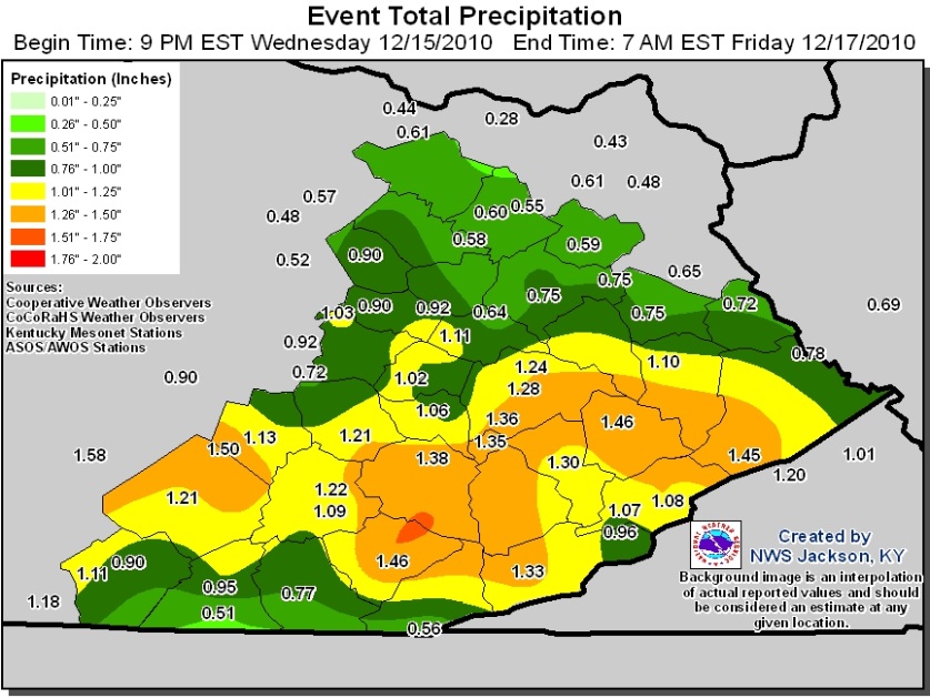
Liquid Precipitation
 |
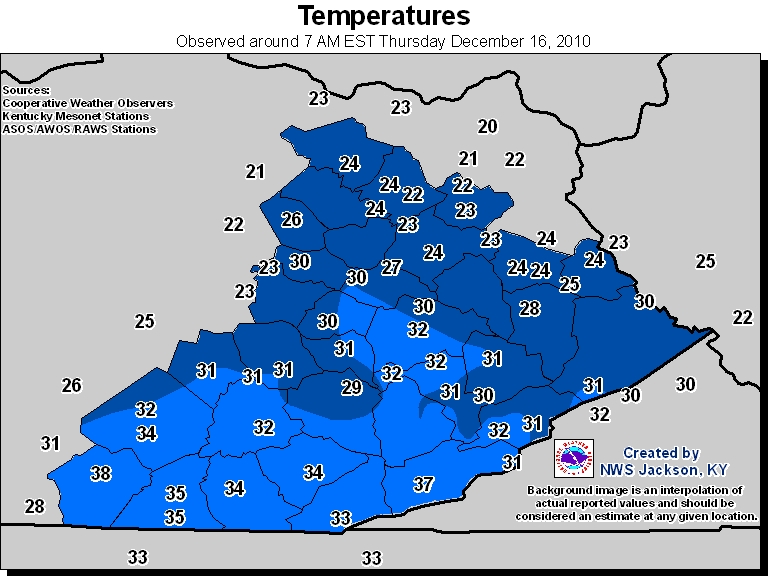
Temperatures
 |
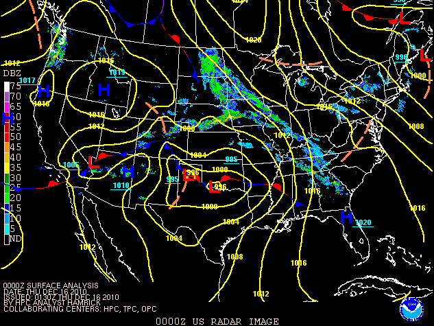
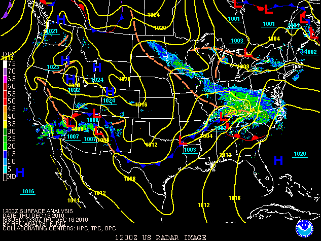
Surface Analysis & Radar Composite Charts
 |
 |
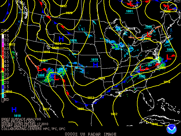 |
| 7 PM EST 12/15/2010 | 7 AM EST 12/16/2010 | 7 PM EST 12/16/2010 |
 |
Media use of NWS Web News Stories is encouraged! Please acknowledge the NWS as the source of any news information accessed from this site. |
|

