
Dangerous heat will expand from the Gulf Coast into the Southern Plains and Desert Southwest through week's end. Additional extreme heat impacting the Pacific Northwest will shift to the northern Plains by the weekend. Tropical Storm Bertha is expected to continue to impact portions of the northwestern Gulf Coast from south central Louisiana to the upper Texas coast today. Read More >
Jackson, KY
Weather Forecast Office
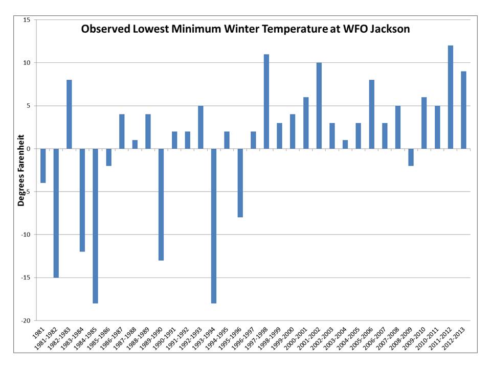
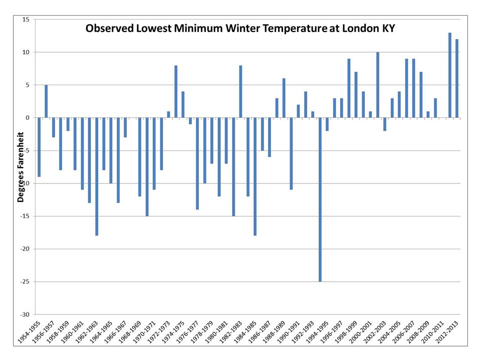
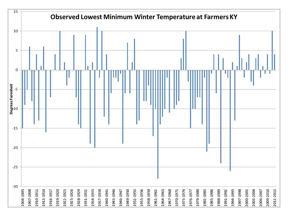
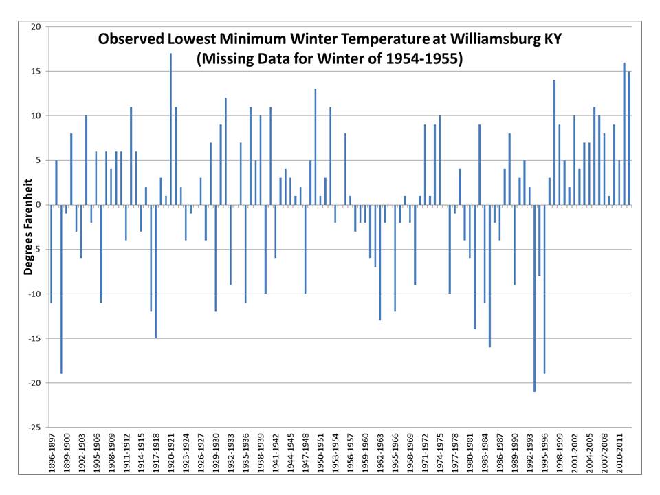
February ends meteorological winter, and eastern Kentucky has passed through yet another winter without a major cold air outbreak. Since the winter of 1995-1996 there have not been any extreme cold weather events in eastern Kentucky with temperatures falling well below zero. This unusually long stretch of winters without extreme cold is unprecedented in the past 100 years.
The coldest temperatures this winter occurred during the first couple days of February when single digit lows were observed across parts of eastern Kentucky. While the lowest temperatures observed this winter were colder than those observed in the winter of 2011-2012, eastern Kentucky once again escaped any extreme cold.
The following 4 graphs show the coldest temperatures observed for each winter at Jackson, London, Farmers and Williamsburg. Records date back to 1981 at Jackson, 1954 at London, 1904 at Farmers, and 1896 at Williamsburg. All four graphs show the absence of extreme cold temperatures since the middle 1990s.
Warnings/Hazards
Decision Support - Outlooks
Current Weather Hazards
Hazards Criteria
Weather Story Graphic
Recent Storm Reports
Submit a Report
Forecasts
Decision Support - Forecast
Aviation Forecasts
Fire Weather Forecasts
Hourly Weather Forecast
Activity Planner
River Forecasts
Forecast Discussion
Current Conditions
Regional Radar
Decision Support - Current
Rivers and Lakes
Hourly Airport Weather
Local Radar
Satellite
Kentucky Mesonet
Past Weather
Local Climate Info
Temp/Precip Summary
How Much Rain Fell?
How Much Snow Fell?
Past Weather Events
Drought Information
Local Coop Observers
US Dept of Commerce
National Oceanic and Atmospheric Administration
National Weather Service
Jackson, KY
1329 Airport Road
Jackson, KY 41339
606-666-8000
Comments? Questions? Please Contact Us.

