
Widespread life-threatening flash and urban flooding continues in south-central Texas, with considerable flooding impacts possible across central Texas. Wildfire smoke is impacting air quality across much of the Great Lakes region into southern New England and the Mid-Atlantic. Monsoonal thunderstorms may produce isolated to scattered flash flooding across the Southwest into the Great Basin. Read More >
Jackson, KY
Weather Forecast Office
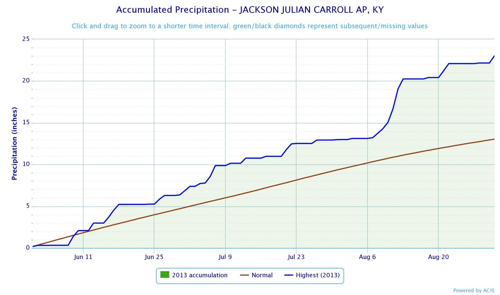
The summer of 2013 was one of the wettest on record across eastern Kentucky. Meteorologists break down the seasons differently from what you see on the calendar. Meteorological summer technically runs from June 1st through August 31st. The National Weather Service office just outside of Jackson finished the meteorological summer with a total of 23.02" of rain, which was nearly 10 inches above normal. This is the wettest meteorological summer on record at NWS Jackson, and the wettest season on record. Climate records began at NWS Jackson, KY in 1981.
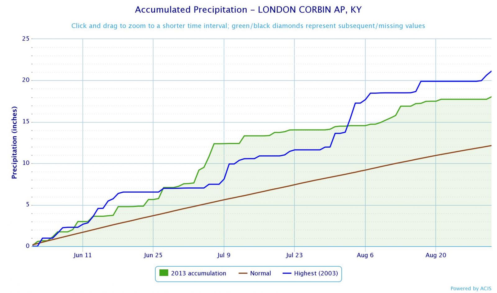
Meanwhile, the London-Corbin Airport, which has weather records dating back to November 1954, recorded 18.03" of rain for the meteorological summer. This is 3rd place for total rainfall during a meteorological summer. The wettest summer on record at London occurred in 2003 when 21.13" of rain fell.
Warnings/Hazards
Decision Support - Outlooks
Current Weather Hazards
Hazards Criteria
Weather Story Graphic
Recent Storm Reports
Submit a Report
Forecasts
Decision Support - Forecast
Aviation Forecasts
Fire Weather Forecasts
Hourly Weather Forecast
Activity Planner
River Forecasts
Forecast Discussion
Current Conditions
Regional Radar
Decision Support - Current
Rivers and Lakes
Hourly Airport Weather
Local Radar
Satellite
Kentucky Mesonet
Past Weather
Local Climate Info
Temp/Precip Summary
How Much Rain Fell?
How Much Snow Fell?
Past Weather Events
Drought Information
Local Coop Observers
US Dept of Commerce
National Oceanic and Atmospheric Administration
National Weather Service
Jackson, KY
1329 Airport Road
Jackson, KY 41339
606-666-8000
Comments? Questions? Please Contact Us.

