
Tropical moisture from Isaias and Rachel will impact portions of the Southeast and Southwest this weekend. Flash flooding, strong winds and even a threat for severe thunderstorms and tornadoes are possible. Meanwhile, strong winds and dry fuels are raising fire weather concerns across the central Great Basin and western High Plains. Across the northern Rockies, first winter storm of the season. Read More >
Jackson, KY
Weather Forecast Office
July 2015 was the wettest July on record for the state of Kentucky...
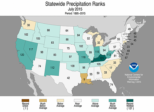
New monthly precipitation records for July in eastern Kentucky included:
Jackson had its second wettest July with 8.87 inches of rain. Williamsburg had its fourth wettest July with 10.16 inches.
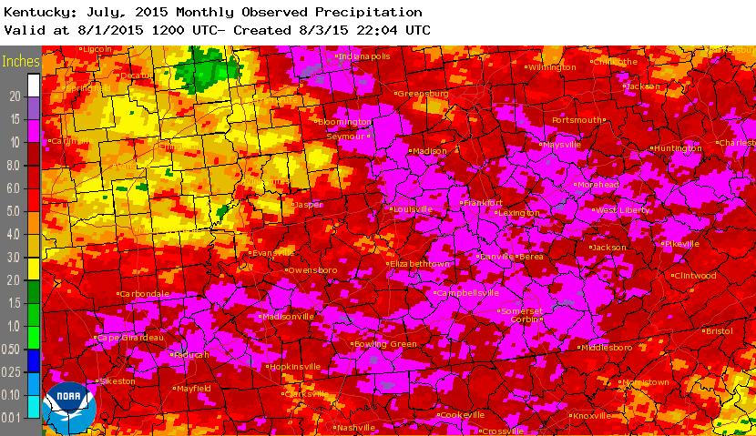
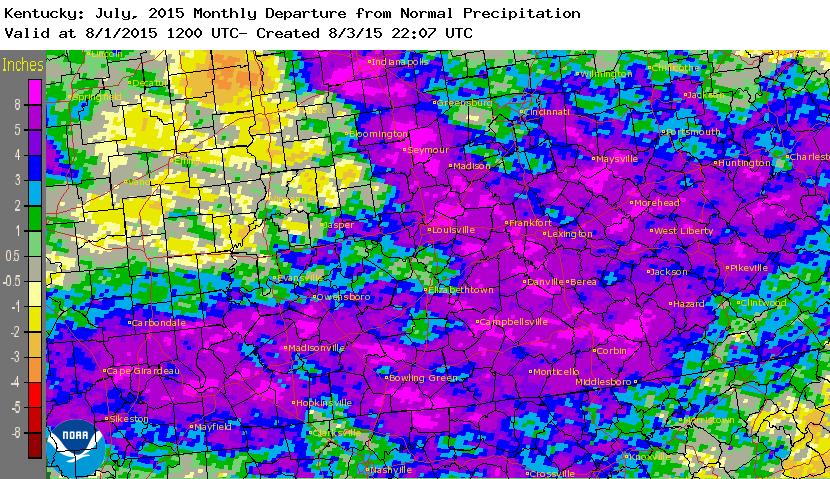
The graphics below show the estimated July 2015 rainfall from Kentucky and surrounding areas, as well as the departure from normal.
Warnings/Hazards
Decision Support - Outlooks
Current Weather Hazards
Hazards Criteria
Weather Story Graphic
Recent Storm Reports
Submit a Report
Forecasts
Decision Support - Forecast
Aviation Forecasts
Fire Weather Forecasts
Hourly Weather Forecast
Activity Planner
River Forecasts
Forecast Discussion
Current Conditions
Regional Radar
Decision Support - Current
Rivers and Lakes
Hourly Airport Weather
Local Radar
Satellite
Kentucky Mesonet
Past Weather
Local Climate Info
Temp/Precip Summary
How Much Rain Fell?
How Much Snow Fell?
Past Weather Events
Drought Information
Local Coop Observers

US Dept of Commerce
National Oceanic and Atmospheric Administration
National Weather Service
Jackson, KY
1329 Airport Road
Jackson, KY 41339
606-666-8000
Comments? Questions? Please Contact Us.


 Follow us on X
 Follow us on Facebook
 Follow us on YouTube
 JKL RSS Feed