Numerous severe thunderstorms are expected across a broad region from the Ohio Valley to the Mid-Atlantic and Northeast States today into tonight. Swaths of damaging wind gusts are expected and some tornadoes are possible. Bertha is expected to bring tropical storm conditions to portions of the Gulf Coast from the Florida Panhandle westward to southeastern Louisiana later today and Wednesday. Read More >
Overview
|
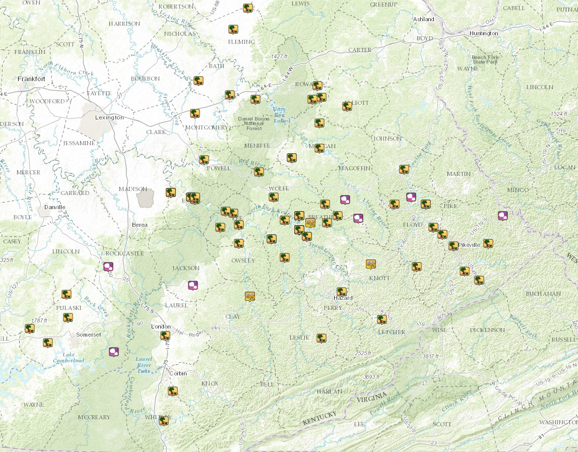
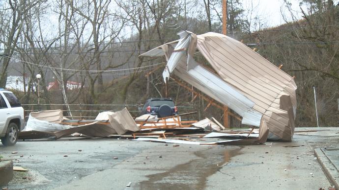
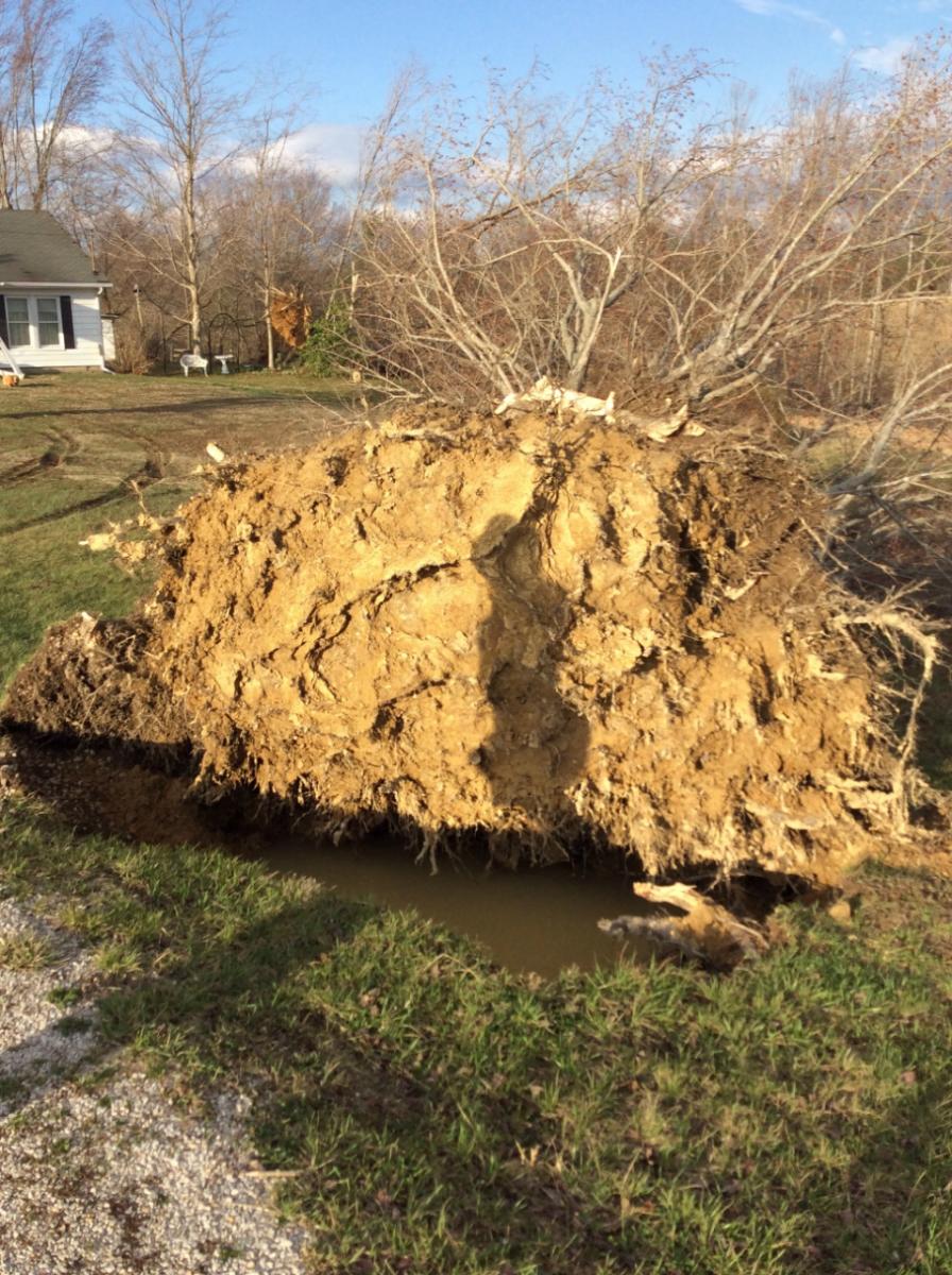
A powerful storm system moved across the Ohio Valley during the evening of Tuesday February 28, 2017 through the morning hours of Wednesday March 1, 2017. Numerous tornado, damaging wind, and large hail reports occurred from the lower Great Lakes through the Tennessee Valley, including copious occurrences of damaging wind gusts across eastern Kentucky as a squall line of thunderstorms pushed through from northwest to southeast Wednesday morning. Numerous reports of storm-related damage were received related to trees down across roads. Several commercial, residential, and manufactured structures sustained damage, including several sustaining significant roof damage or having their roof blown off. The potent winds overturned a number of vehicles and manufactured structures, while tens of thousands of power outages occurred due to downed utility poles. Additionally, minor roof damage was sustained at the National Weather Service office in Jackson as commercial power was lost for several hours. The strongest estimated winds occurred near Winston in Estill County, where a downburst led to an approximate 100 mph gust. Vehicles and buildings sustained severe damage, while one man was injured by flying glass as he attempted to shut the front door of his home. One vehicle was rolled over by the wind, and roof damage also occurred to several structures with a garage being completely destroyed. Several large trees were also uprooted. |
 Significant structural damage was sustained in Estill County, particularly near Winston where an approximate 100 mph wind gust occurred underneath a downburst. Courtesy WKYT. |
 |
 |
 |
| A mobile home overturned by severe winds in Quicksand in Breathitt County. Courtesy WYMT. | Severe thunderstorm winds knocked down this building near the Martin Volunteer Fire Department in Floyd County. Courtesy WYMT. | A two-story garage was blown down in Fleming County. Courtesy WKYT. |
 |
 |
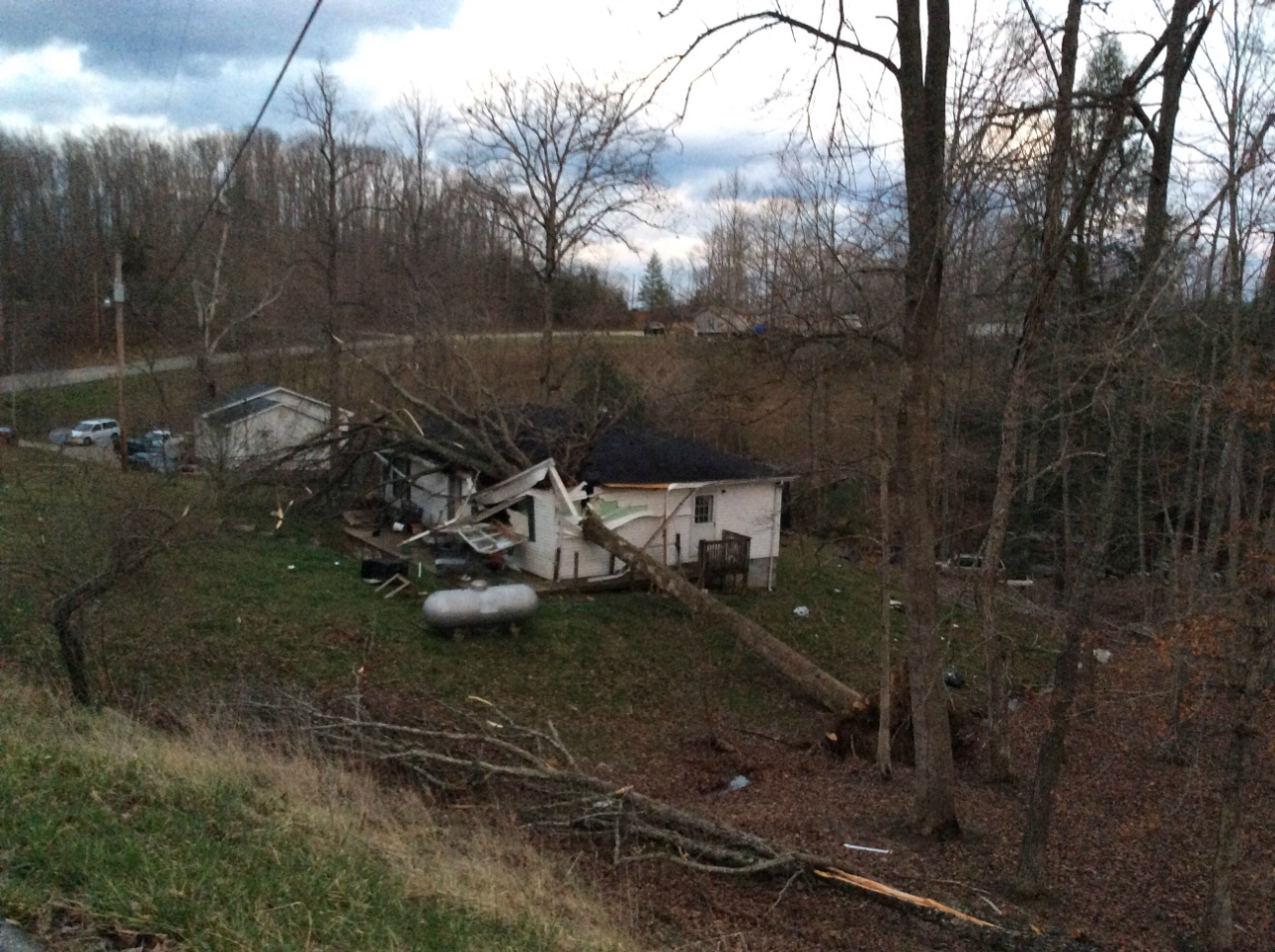 |
| Roof damage in Ravenna. Photo taken from NWS Storm Survey. | A large tree uprooted in western Estill County. Photo taken from NWS Storm Survey. | Severe thunderstorm winds toppled a large tree onto a home in western Lee County. Photo taken from NWS Storm Survey. |
 |
 |
 |
| Structural damage east of Owingsville in Bath County. Courtesy WKYT. | Thunderstorm wind damage in Ravenna in Estill County. Courtesy WKYT. | A mobile home in Rowan County near Elliottville flipped by severe thunderstorm winds. Courtesy WYMT. |
Radar
 |
| Radar imagery showing the evolution of the squall line of thunderstorms that moved through eastern Kentucky. |
 |
Media use of NWS Web News Stories is encouraged! Please acknowledge the NWS as the source of any news information accessed from this site. |
|