Jackson, KY
Weather Forecast Office
Overview
|
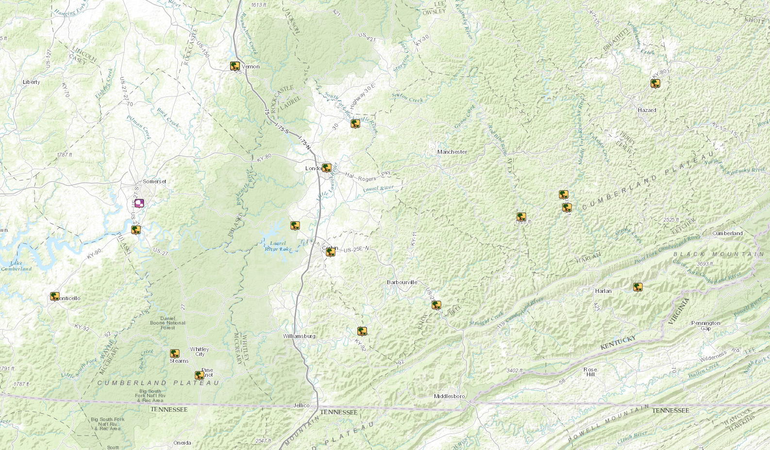
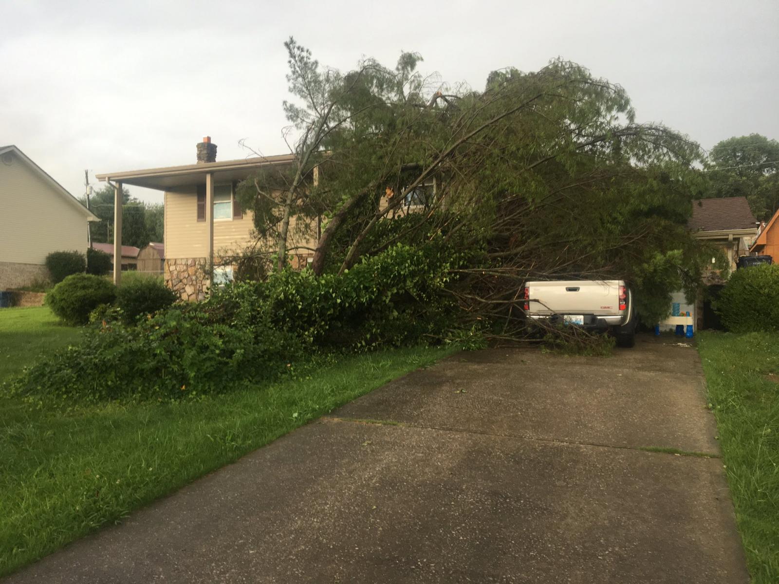
An intense line of thunderstorms developed late this afternoon across south-central Kentucky as daytime heating and increasing instability combined with a passing upper level disturbance. Numerous reports of wind damage were reported across the Lake Cumberland region and along the Interstate 75 corridor. This included multiple trees and power poles/lines being knocked down, as well as a couple of roofs being significantly damaged. This line of storms initially produced sub-severe hail, signifying its intensity in a rather warm summertime environment. One instance of flooding was reported in Mount Vernon as several days of moderate to heavy rainfall preceded heavy rain moving through this evening. Additional wind damage took place throughout southeastern Kentucky as this line raced east, resulting in additional downed trees and utility equipment. |
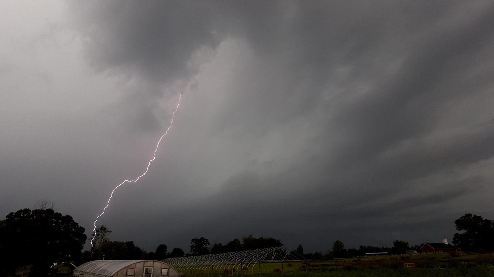 A cloud to ground lightning strike produced from a storm entering Bee Lick in Pulaski County. Courtesy Greg Cundiff. |
Photos
 |
 |
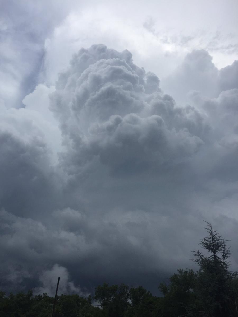
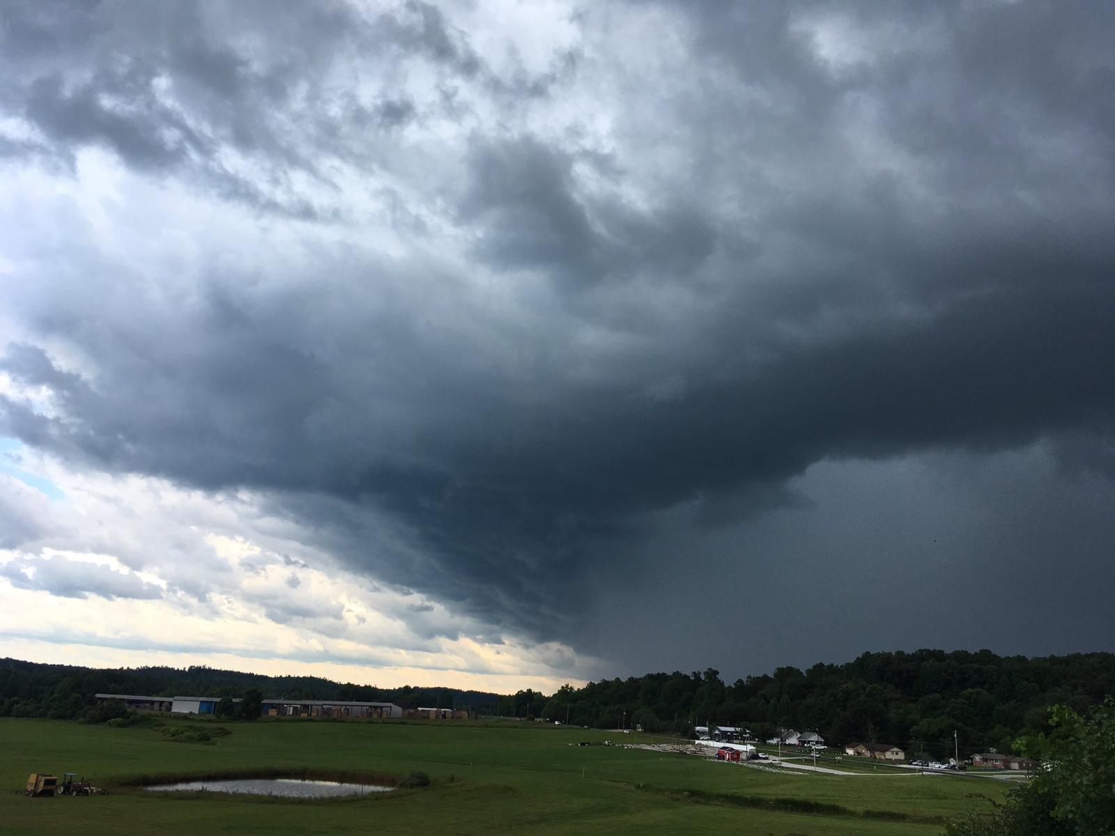
| A thunderstorm showing explosive growth near Paintsville. Courtesy Adam Preece. | A shelf cloud in Laurel County. Courtesy Darren. |
 |
 |
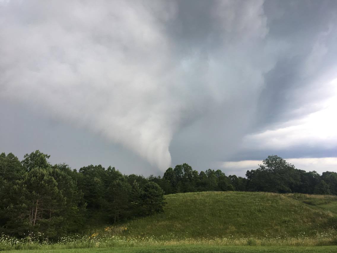
| Wind damage in Bronston in Pulaski County. Courtesy Conor McCue. | A thunderstorm downdraft in Lily in Laurel County. Courtesy Melva Pearce. |
Radar
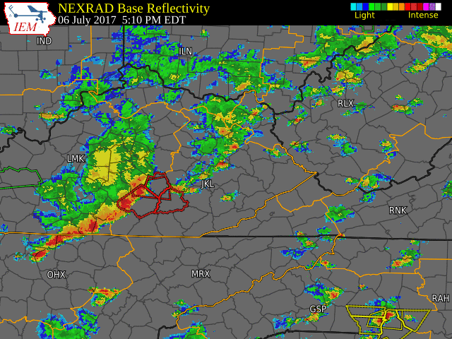 |
| Radar imagery depicting evolution of the squall line of thunderstorms on July 6, 2017. |
 |
Media use of NWS Web News Stories is encouraged! Please acknowledge the NWS as the source of any news information accessed from this site. |
|
Warnings/Hazards
Decision Support - Outlooks
Current Weather Hazards
Hazards Criteria
Weather Story Graphic
Recent Storm Reports
Submit a Report
Forecasts
Decision Support - Forecast
Aviation Forecasts
Fire Weather Forecasts
Hourly Weather Forecast
Activity Planner
River Forecasts
Forecast Discussion
Current Conditions
Regional Radar
Decision Support - Current
Rivers and Lakes
Hourly Airport Weather
Local Radar
Satellite
Kentucky Mesonet
Past Weather
Local Climate Info
Temp/Precip Summary
How Much Rain Fell?
How Much Snow Fell?
Past Weather Events
Drought Information
Local Coop Observers
US Dept of Commerce
National Oceanic and Atmospheric Administration
National Weather Service
Jackson, KY
1329 Airport Road
Jackson, KY 41339
606-666-8000
Comments? Questions? Please Contact Us.