
Gusty winds and heavy rainfall may impact the Big Island of Hawaii as a nearby tropical system passes west of the islands. From the Southwest U.S., Rockies and across the Gulf Coast, heavy rainfall could lead to isolated flash flooding. Severe thunderstorms are expected for areas of the Plains, Gulf Coast and Southeast through Tuesday. Extreme heat lingers for the southern Plains and Southwest. Read More >
Jackson, KY
Weather Forecast Office
Overview
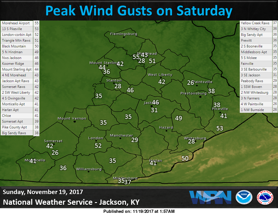
A strong cold front crossed eastern Kentucky on the evening of Saturday, November 18th. Strong southwest winds developed ahead of the front during the day Saturday with temperatures increasing into the 60s. As the front crossed the area, it brought an intense line of showers across eastern Kentucky producing some localized wind gusts over 50 mph. The winds caused sporadic tree damage and power outages across eastern Kentucky. As the front exited Saturday night, very cold air poured into the area with temperatures reaching into the 30s by Sunday morning.
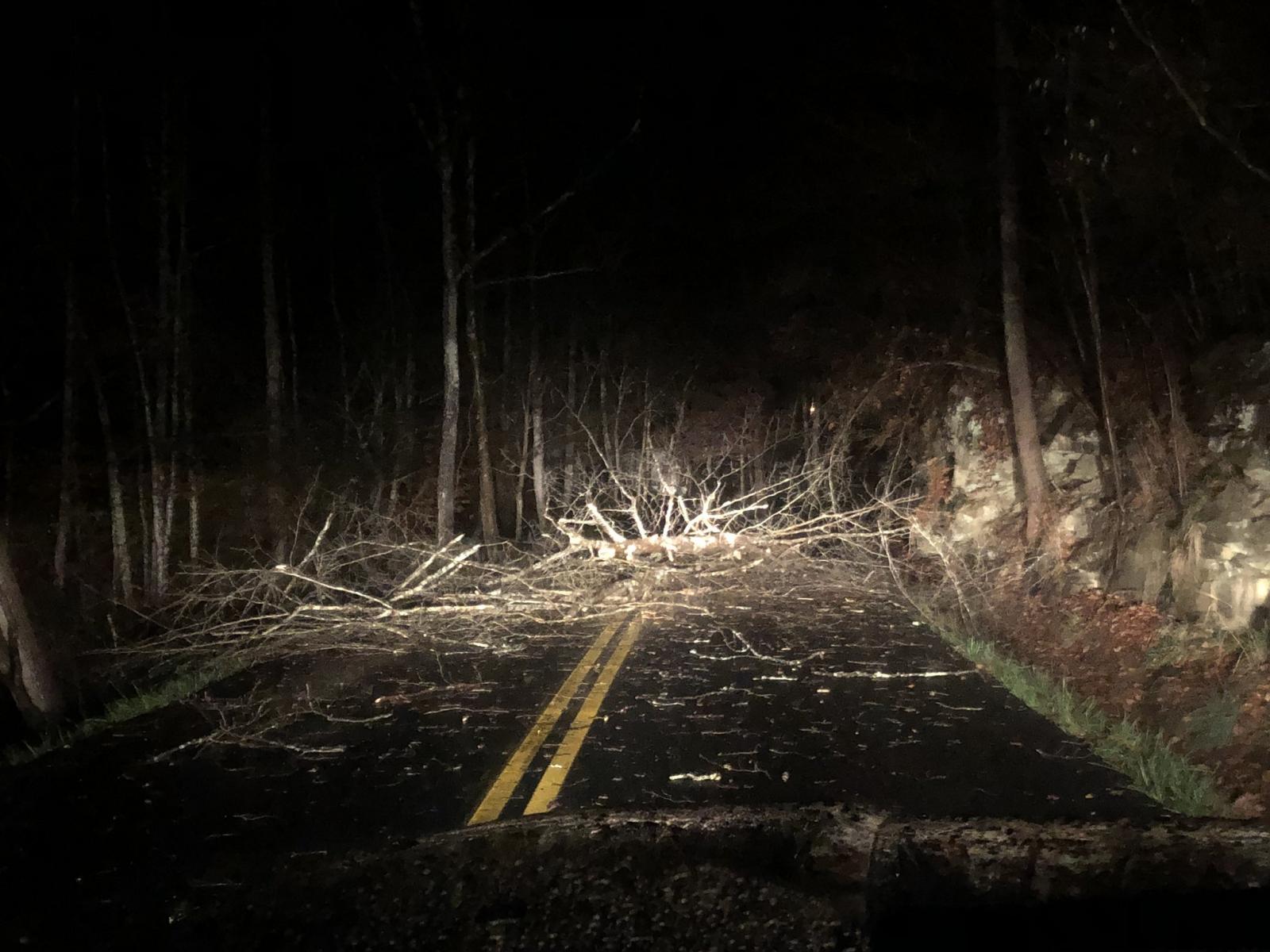 |
| KY 1862/Thornton Road near Worley Road in Letcher County (Photo Courtesy of Brandon Robinson). |
Wind Reports
 |
Radar
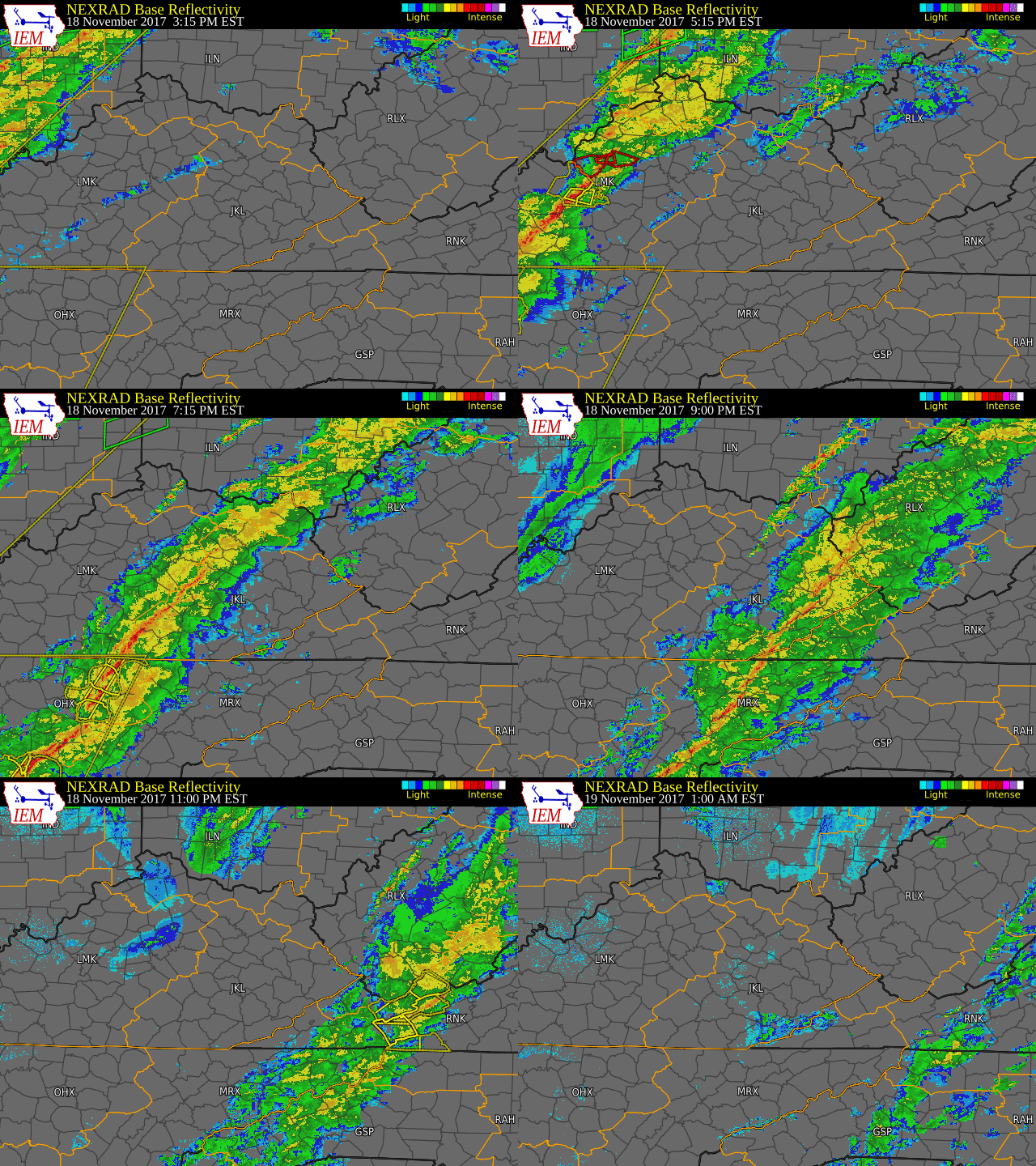 |
| Radar Loop 3:15 pm, November 18th, 2017 to 1:00 am, November 19th, 2017. |
Surface Map
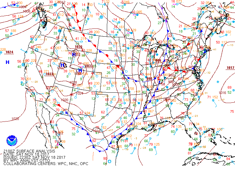 |
| Surface map showing a tight pressure gradient in place ahead of a cold front at 4:00 pm, November 18th, 2017. |
 |
Media use of NWS Web News Stories is encouraged! Please acknowledge the NWS as the source of any news information accessed from this site. |
|
Warnings/Hazards
Decision Support - Outlooks
Current Weather Hazards
Hazards Criteria
Weather Story Graphic
Recent Storm Reports
Submit a Report
Forecasts
Decision Support - Forecast
Aviation Forecasts
Fire Weather Forecasts
Hourly Weather Forecast
Activity Planner
River Forecasts
Forecast Discussion
Current Conditions
Regional Radar
Decision Support - Current
Rivers and Lakes
Hourly Airport Weather
Local Radar
Satellite
Kentucky Mesonet
Past Weather
Local Climate Info
Temp/Precip Summary
How Much Rain Fell?
How Much Snow Fell?
Past Weather Events
Drought Information
Local Coop Observers

US Dept of Commerce
National Oceanic and Atmospheric Administration
National Weather Service
Jackson, KY
1329 Airport Road
Jackson, KY 41339
606-666-8000
Comments? Questions? Please Contact Us.


 Follow us on X
 Follow us on Facebook
 Follow us on YouTube
 JKL RSS Feed