Jackson, KY
Weather Forecast Office
Overview
|
An upper level disturbance and warm front moved through eastern Kentucky during the morning and afternoon of January 8. Precipitation arrived during the early morning hours, beginning as some light freezing rain prior to temperatures quickly warming above freezing by late morning and early afternoon. Numerous areas received a light glazing of ice, leading to several vehicle accidents during the morning. Prior to this, a stretch of nearly two weeks of at or below freezing temperatures led to several instances of water line breaks and leaks in Martin, Floyd, Pike, Perry, and Martin Counties as well as the city of Manchester. Later in the week, record warmth was observed across eastern Kentucky. |
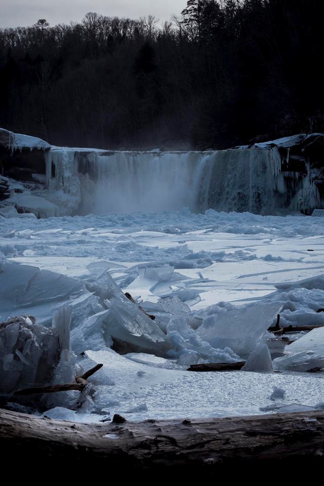 The long stretch of cold resulted in Cumberland Falls freezing up. Courtesy Anthony Roe. |
Radar
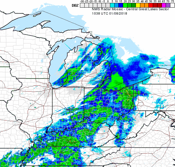 |
| Radar imagery from 5:38 a.m. to 6:48 a.m. on January 8, 2018. |
Temperatures
 |
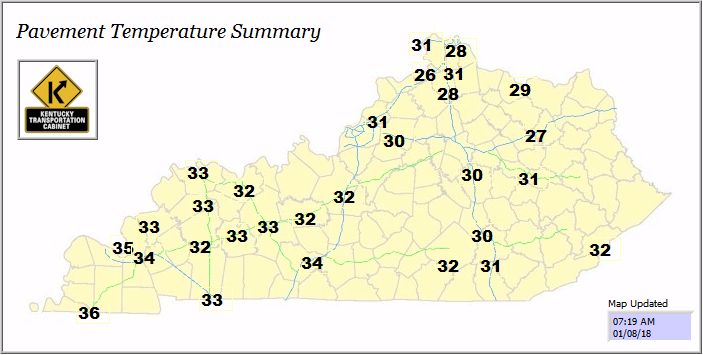 |
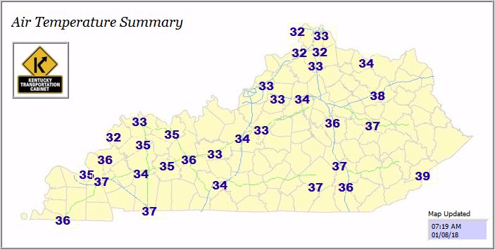
| Air temperatures above freezing at 7:19 a.m. Courtesy KYTC. | Road temperatures at or below freezing at 7:19 a.m. Courtesy KYTC. |
 |
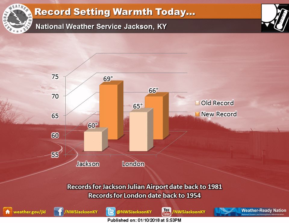 |
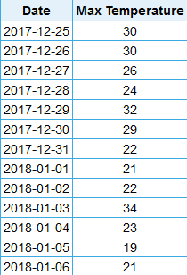
| High temperatures at Jackson, Kentucky for 13 days, ranging from Christmas through January 6, 2018. | Record warmth at Jackson and London, KY on January 10, 2018. |
 |
Media use of NWS Web News Stories is encouraged! Please acknowledge the NWS as the source of any news information accessed from this site. |
|
Warnings/Hazards
Decision Support - Outlooks
Current Weather Hazards
Hazards Criteria
Weather Story Graphic
Recent Storm Reports
Submit a Report
Forecasts
Decision Support - Forecast
Aviation Forecasts
Fire Weather Forecasts
Hourly Weather Forecast
Activity Planner
River Forecasts
Forecast Discussion
Current Conditions
Regional Radar
Decision Support - Current
Rivers and Lakes
Hourly Airport Weather
Local Radar
Satellite
Kentucky Mesonet
Past Weather
Local Climate Info
Temp/Precip Summary
How Much Rain Fell?
How Much Snow Fell?
Past Weather Events
Drought Information
Local Coop Observers
US Dept of Commerce
National Oceanic and Atmospheric Administration
National Weather Service
Jackson, KY
1329 Airport Road
Jackson, KY 41339
606-666-8000
Comments? Questions? Please Contact Us.

