Tropical Storm Bertha could bring tropical storm conditions to portions of the Florida Panhandle and Alabama coast through Wednesday, where a Tropical Storm Watch and Storm Surge Watch is in effect. Numerous severe thunderstorms with heavy rainfall are expected from the Ohio Valley into the Mid-Atlantic and Northeast Tuesday. Read More >
Overview
|
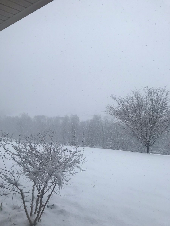
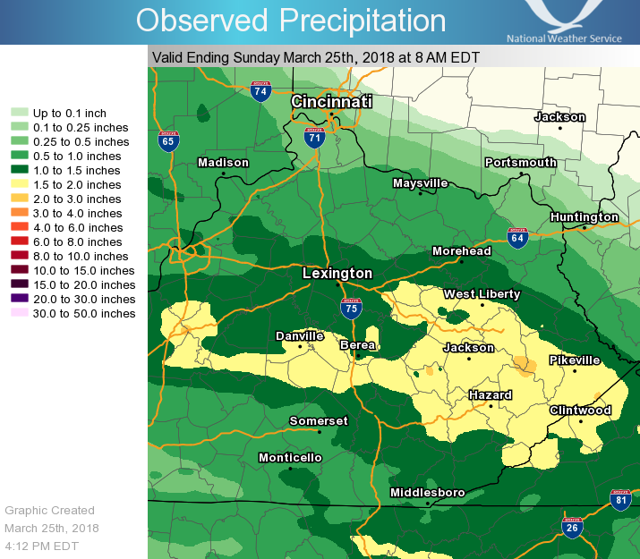
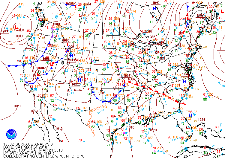
A strong early spring storm system impacted eastern Kentucky on March 24, 2018. Precipitation began as rain across the Lake Cumberland region during the early morning hours, while starting out as snow along and north of a line from about Lexington to Harlan. The highest snowfall amounts of 4 to 6 inches, with isolated higher amounts, occurred northeast of an Owingsville to Prestonsburg line, due to a strong dome of cold air remaining in place on the southwestern extent of a high pressure system residing from Quebec into northeastern Kentucky. Due to the strength of this low pressure system, thunderstorms developed across portions of south central to southeast Kentucky during the afternoon and evening. Pea sized hail was observed in London with temperatures only in the low to mid 40s! Additionally, total precipitation amounts of 1.5 to over 2 inches attributed to rises on portions of the Kentucky and Cumberland Rivers. |
|
 |
 |
 |
| Prestonsburg, KY. Courtesy Jon Pelton. | Ezel, KY. Courtesy Kristi Gullett. | Stanton, KY. Courtesy Tim Bruno. |
 |
 |
 |
| Snow and rain leading to rising creek waters in Stanton, KY. Courtesy Tim Bruno. | Haldeman, KY (Rowan County). Courtesy Reedogirl. | Pea sized hail in London, KY. Courtesy Johnnie Nicholson. |
Snowfall Map
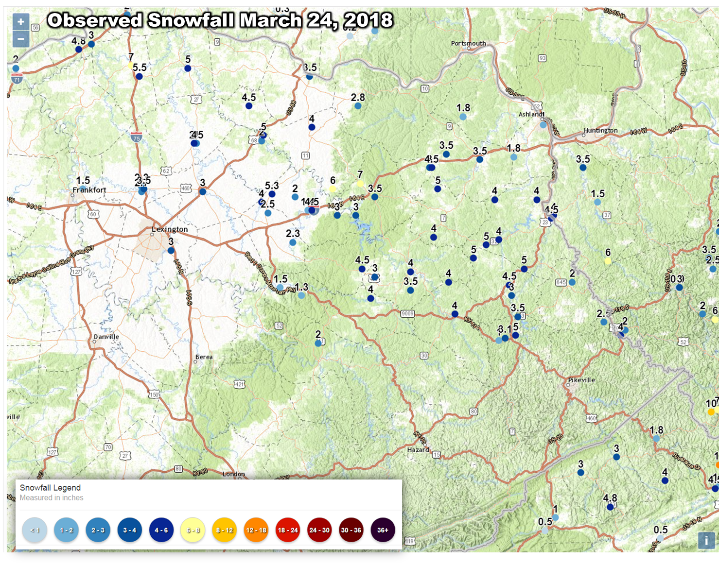 |
Rainfall Map
 |
Environment
 |
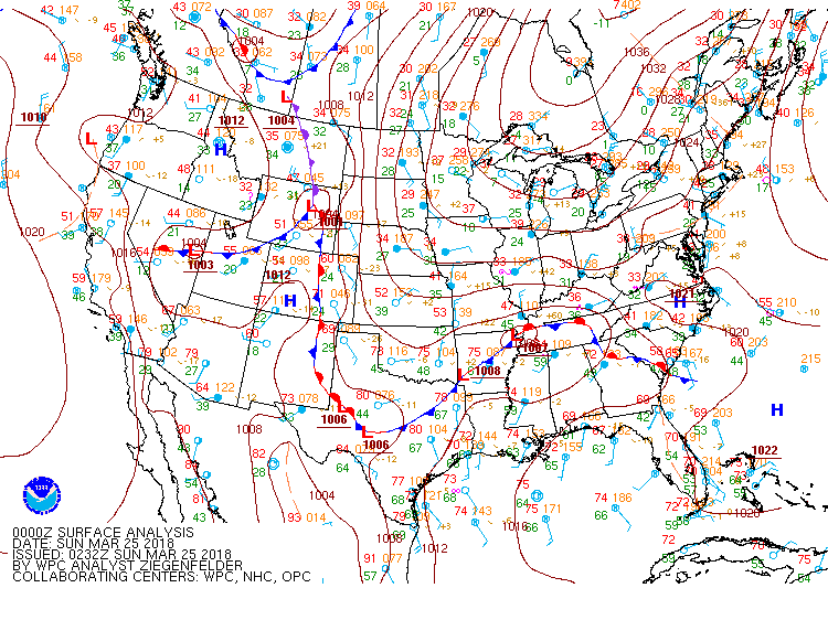 |
| 8 am surface analysis on March 24 showing an approaching warm front. | 8 pm surface analysis on March 24 depicting cold air remaining entrenched across northeast KY with lift shifting southeast. |
 |
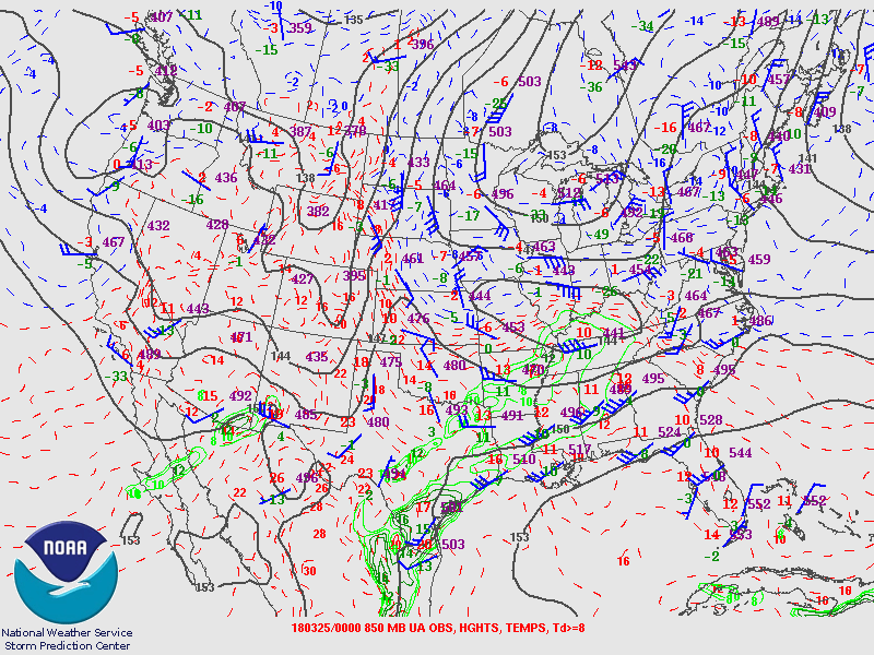 |
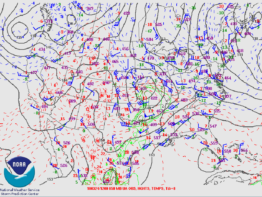
| 8 am 850 mb analysis showing a low pressure system moving into Missouri with moisture advecting toward Kentucky. | 8 pm 850 mb analysis demonstrating increased moisture and lift across eastern Kentucky. |
 |
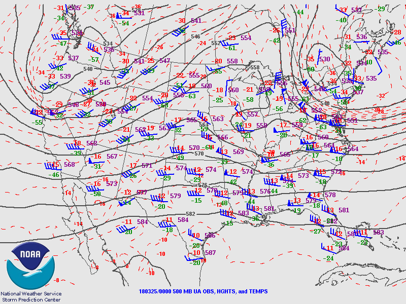 |
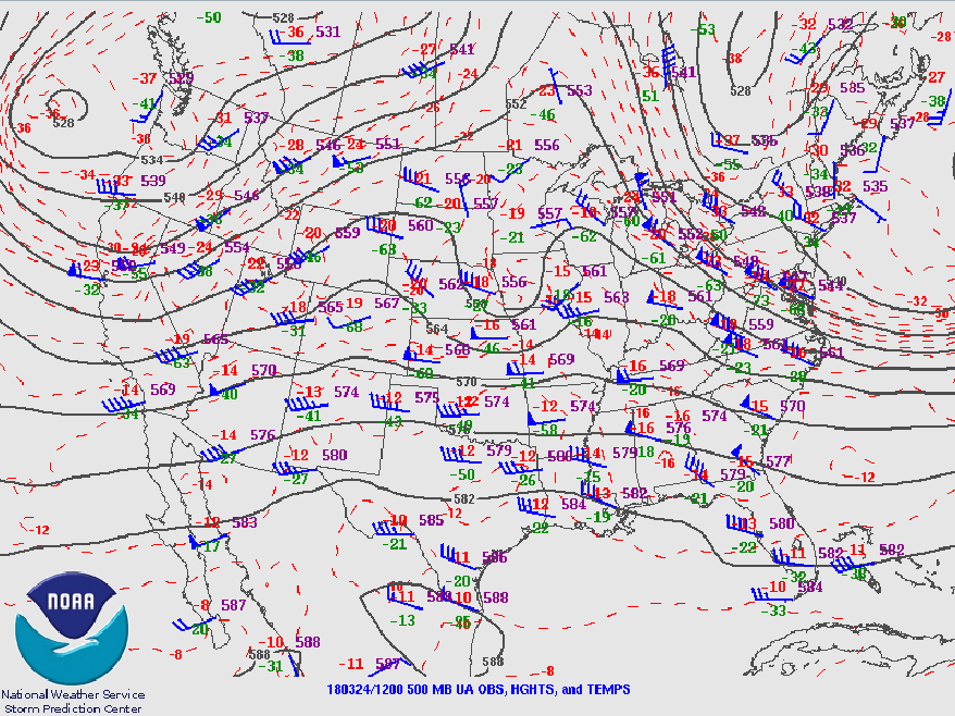
| 8 am 500 mb analysis depicting an upper level shortwave trough moving into the Midwest. | 8 pm 500 mb analysis showing the upper level disturbance and its associated lift migrating eastward. |
 |
Media use of NWS Web News Stories is encouraged! Please acknowledge the NWS as the source of any news information accessed from this site. |
|