Tropical Depression Two is expected to gradually strengthen and could bring tropical storm conditions to the Florida Panhandle beginning late Monday. Areas of flash flooding will be possible through Thursday along the eastern and central Gulf Coast. Severe thunderstorms will develop and move along a cold front crossing the Upper Midwest Monday, and through the Ohio Valley/Mid-Atlantic on Tuesday. Read More >
Overview
|
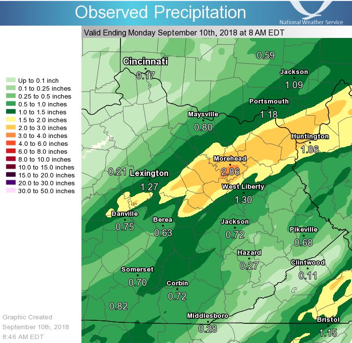
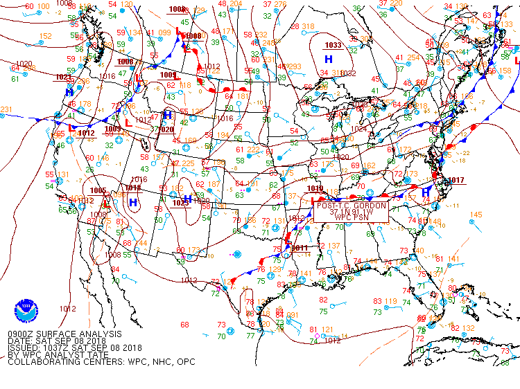
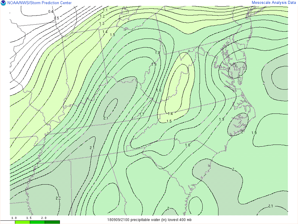
A slow moving low pressure system, in combination with the remnants of Tropical Cyclone Gordon, and abundant moisture brought a long duration heavy rainfall event to much of the Bluegrass region of eastern Kentucky. Southwesterly low level winds ahead of a very slow moving cold front ushered rich moisture into eastern Kentucky, which when combined with the available lift, resulted in copious amounts of rainfall. This, in combination with several inches of rain the past couple of days, led to widespread flooding and flash flooding.
Bath, Montgomery, and Menifee Counties all saw significant impacts. This includes 50-70 homes and 20-25 businesses, one of which was a school in Menifee County, being inundated with water. Numerous roads were damaged as culverts were washed out, forcing schools to close the following day. Disaster declarations were made for Montgomery and Menifee Counties while nearly a dozen water rescues were performed. Additionally, an eight year old boy was swept into a culvert in Morehead. |
 Significant flash flooding leading to a culvert on Dog Trot Road being completely washed out west of Frenchburg. Courtesy of Bill Helton. |
Flooding
|
|
 |
|
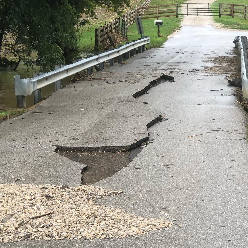
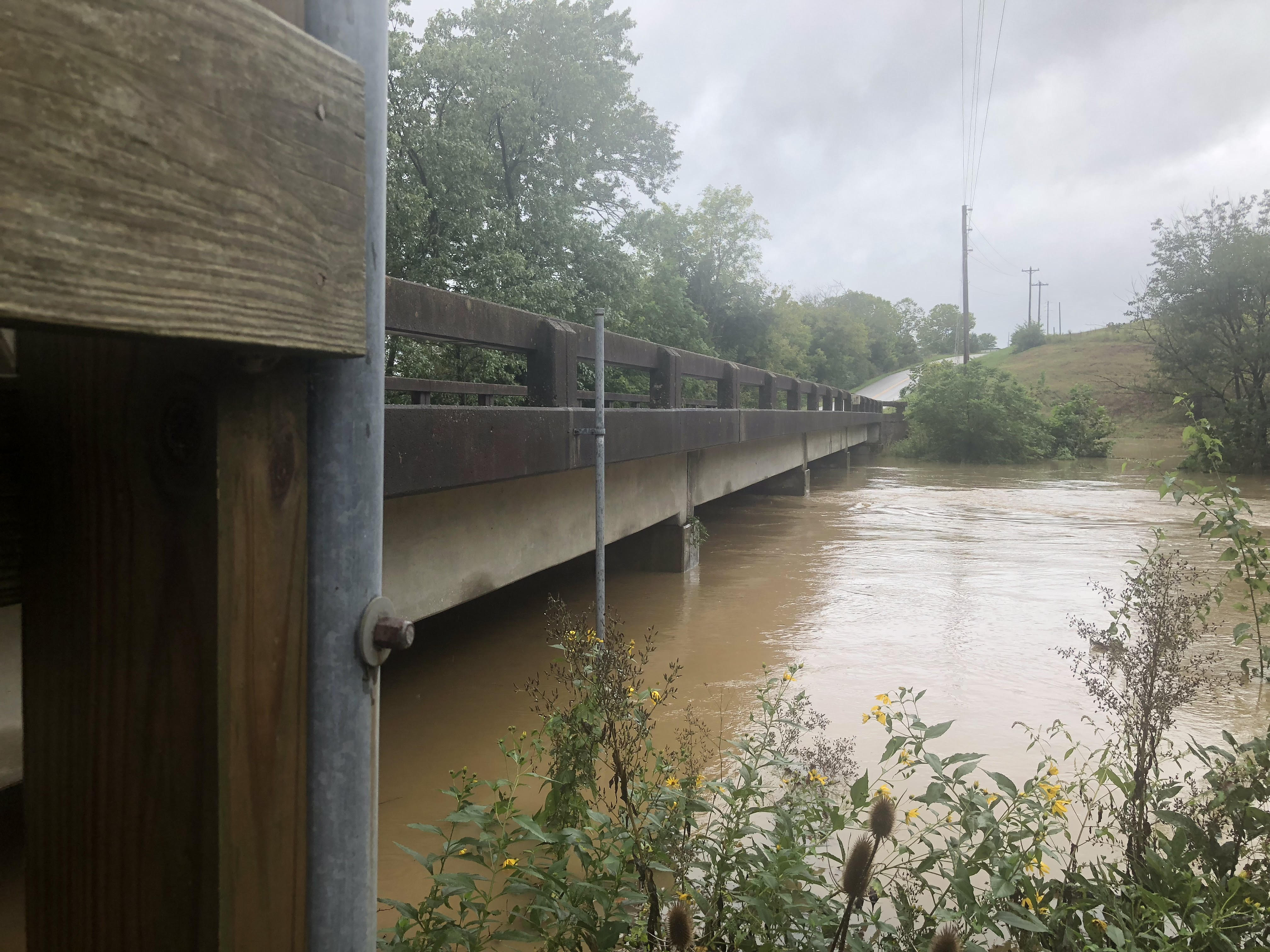
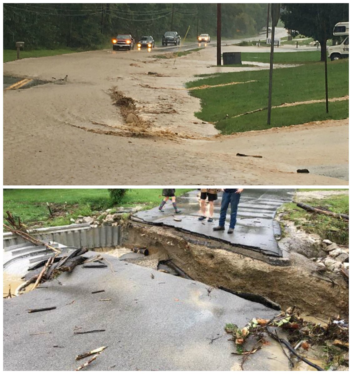
| Damage to the asphalt of the bridge at Harpers Ridge Road and Spencer Creek near Mount Sterling. Courtesy of Greg Beam. | Spencer Creek rising over Harpers Ridge Road near Mount Sterling. Courtesy of Greg Beam. | Slate Creek at Kentucky Highway 713 near Mount Sterling. Courtesy of Greg Beam. |
|
|
 |
|
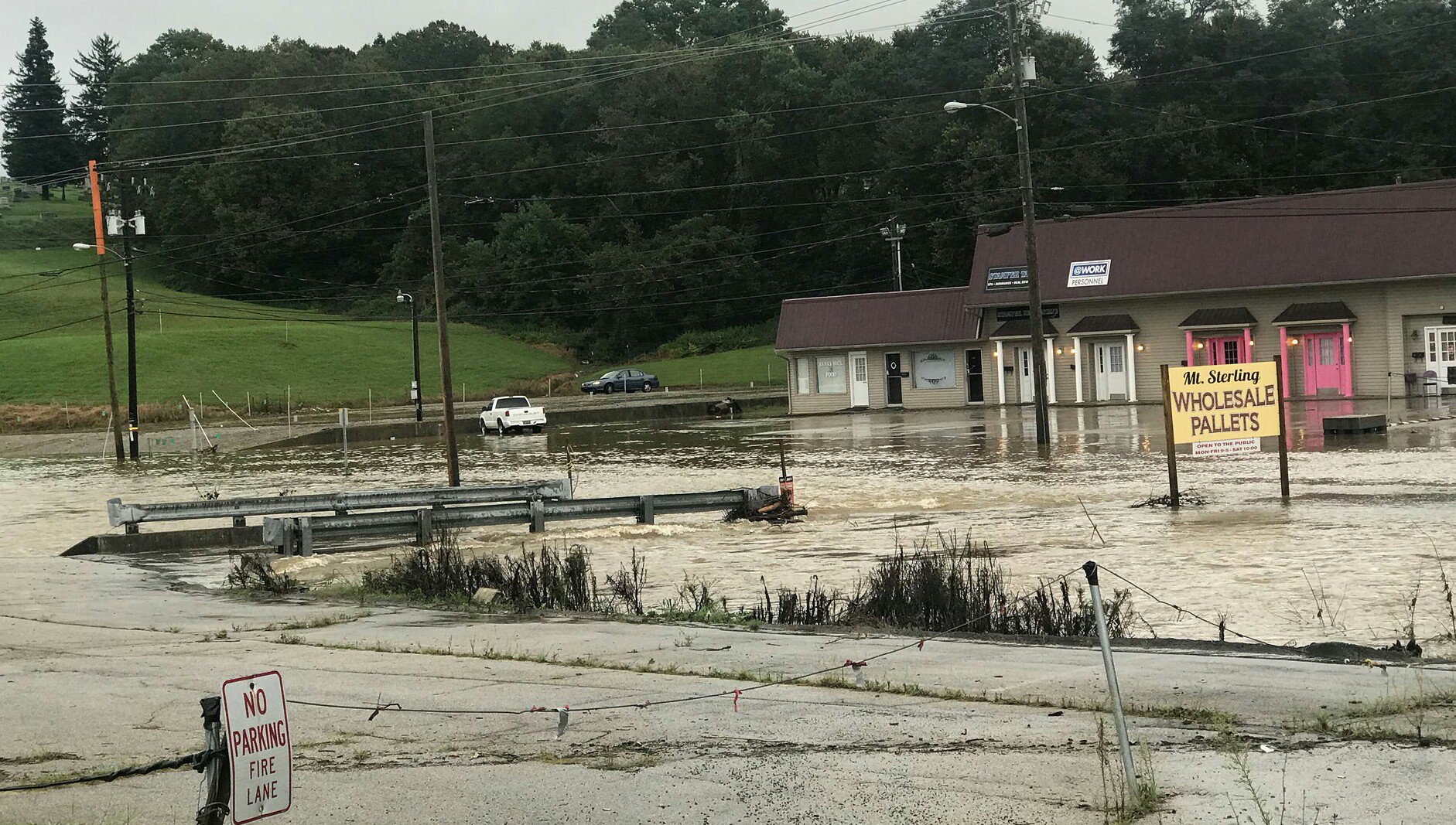
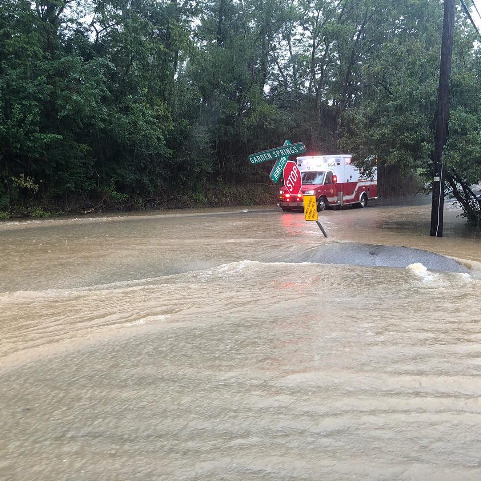
| Flooding leading to a road closure in Mount Sterling. Courtesy of Jon Kelly Johnson. | Water across the intersection of Hinkston Pike and Garden Springs Drive in Mount Sterling. Courtesy of Emergency Management. | Flood waters surrounding a business in Mount Sterling. Courtesy of Jon Kelly Johnson. |
 |
|
|
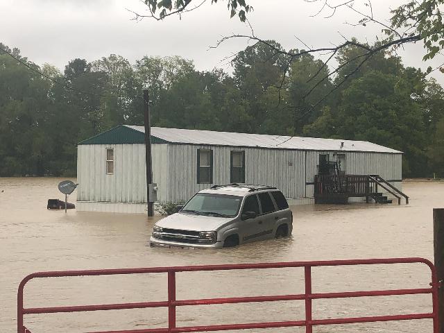
| Flood waters surrounding a manufactured home southeast of Jeffersonville in Montgomery County. Courtesy of Greg Beam. | Water over Saltwell Road west of Owingsville. Courtesy of Jason York. | Flooding in Bath County. Courtesy of Emergency Management. |
|
|
|
|
| Water surrounding a Dollar General store in Menifee County. Courtesy of Leigh Searcy. | Flood water surrounding a home in Frenchburg. Courtesy of Burtonyin Photography. | Water over the roadway outside of Frenchburg. Courtesy of @onlymscarter via Twitter. |
 |
|
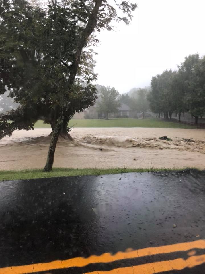 |
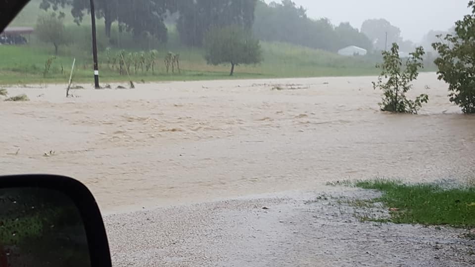
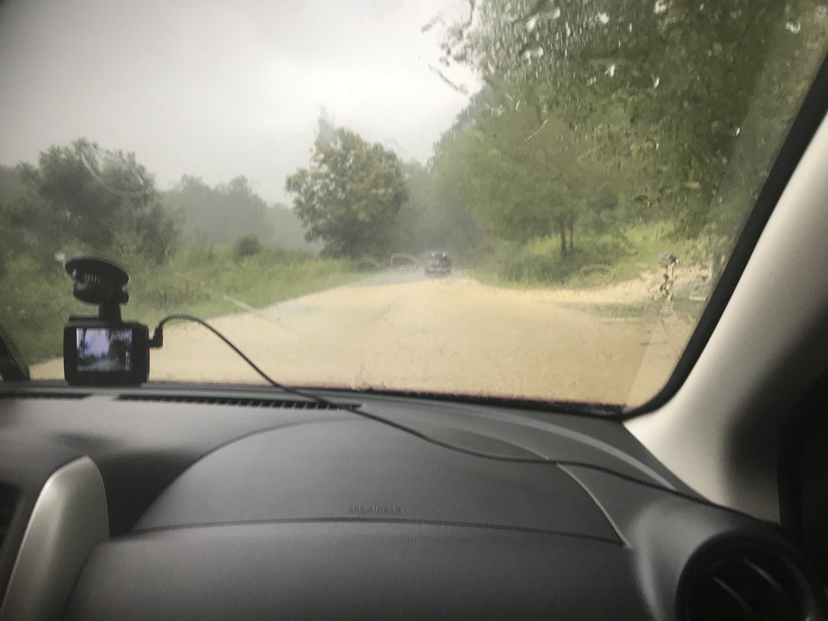
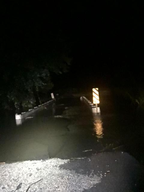
| Flood waters in Bowen in Powell County. Courtesy of Emergency Management. | Flooding along Kentucky Highway 15 east of Stanton. Courtesy of Tim Bruno. | Raging flood waters in Stanton. Courtesy of Jazmen Leanne Thorpe. |
|
|
 |
|
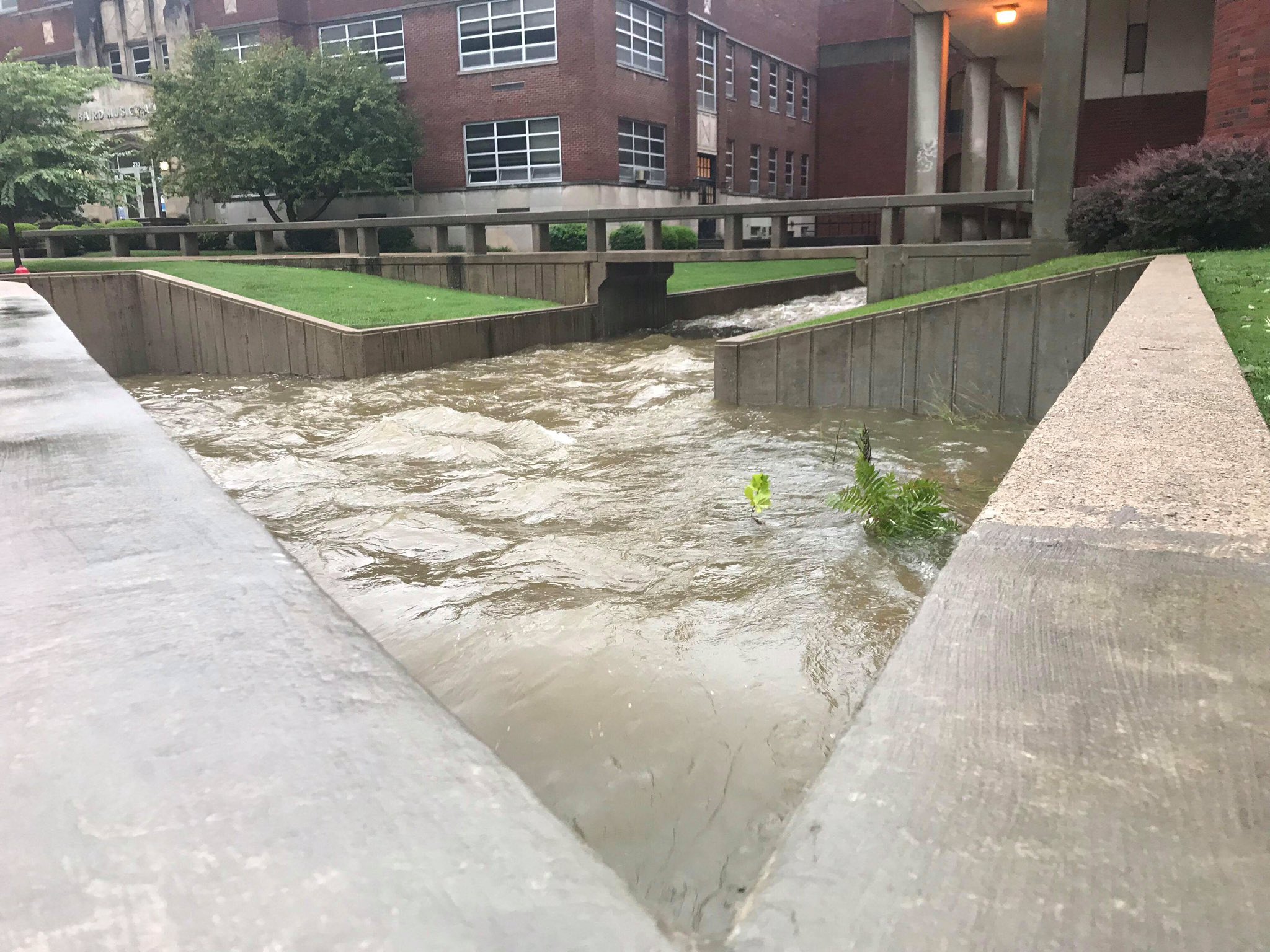
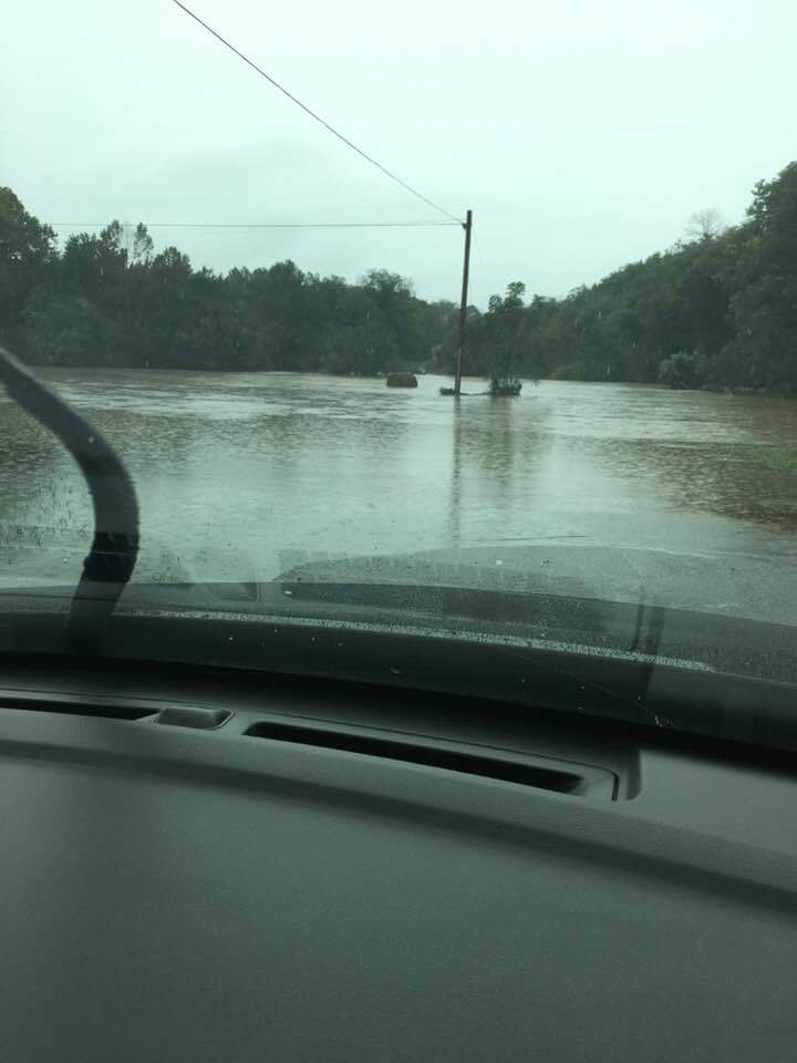
| The Red River at Clay City was forced into minor flood stage Monday evening into Tuesday. | Water over Martha Mills Road south of Flemingsburg. Courtesy of Andy Evans. | Flooding at Morehead State University. Courtesy of Noah Dockery. |
Storm Reports
| Local Storm Reports received from September 9, 2018 | ||
 |
||
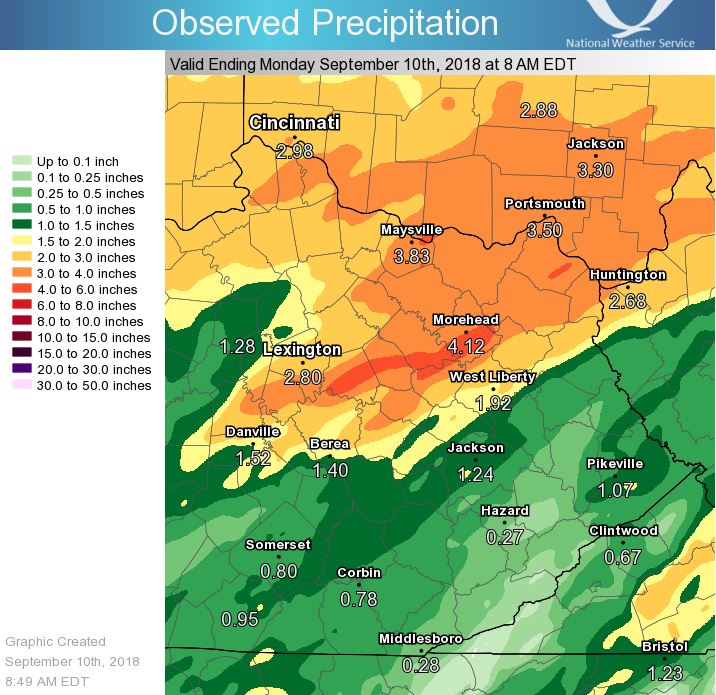
Rain Reports
|
|
|
|
| 24 hour rainfall totals from 8 a.m. Sunday through 8 a.m. Monday. | 48 hour rainfall totals from 8 a.m. Saturday through 8 a.m. Monday. | 48 hour rainfall totals across the hardest hit portions of eastern Kentucky. |
Environment
 |
 |
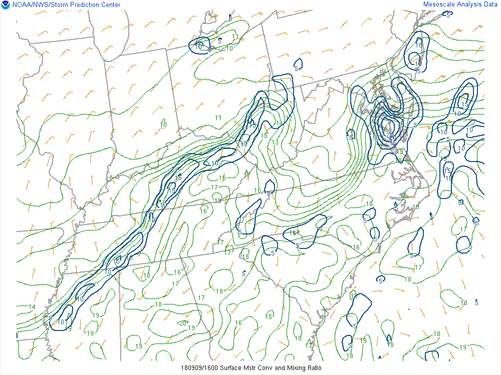 |
| Surface map from Saturday showing the position of a nearly-stationary frontal boundary and the remnants of Tropical Cyclone Gordon. | Precipitable water values near 2 inches in the Bluegrass region, corresponding with values in the 99th percentile or near maximums when compared with climatology. | Enhanced moisture convergence along and ahead of the frontal boundary across the Bluegrass region. |
 |
Media use of NWS Web News Stories is encouraged! Please acknowledge the NWS as the source of any news information accessed from this site. |
|