
Widespread life-threatening flash and urban flooding continues in south-central Texas, with considerable flooding impacts possible across central Texas. Wildfire smoke is impacting air quality across much of the Great Lakes region into southern New England and the Mid-Atlantic. Monsoonal thunderstorms may produce isolated to scattered flash flooding across the Southwest into the Great Basin. Read More >
Overview
|
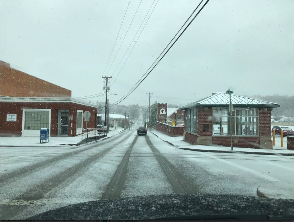
A winter storm system tracked across the south from the evening of December 8th through December 9th with a wintry mix of precipitation developing over southeastern Kentucky. The precipitation lifted northward into southeastern Kentucky overnight with a mixture of snow, freezing rain, and sleet. After dawn on Sunday, precipitation gradually changed over to heavy, wet snow across much of southeast Kentucky. The event came to an end on the evening of the 9th with some locations in far eastern Kentucky reporting over 6 inches of wet snow. Some locations also picked up a tenth to two tenths of an inch of ice. The combination of snow and ice resulted in fallen trees and power outages across southeastern Kentucky. Traffic impacts were also felt as the Kentucky State Police reported numerous accidents on Interstate 75 near and just south of London. |
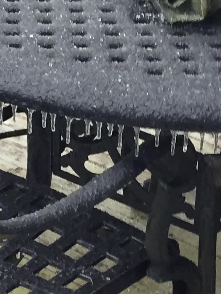
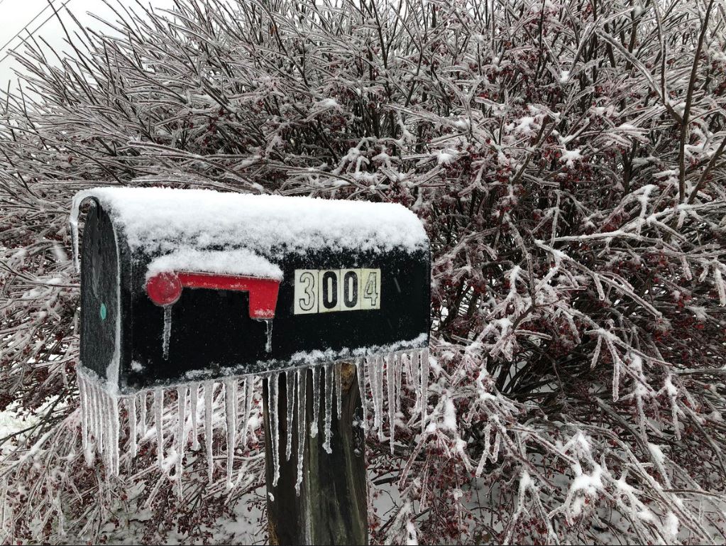 Ice and snow in London (Picture courtesy of Johnnie Nicholson) |
Snow/Ice
| Local Storm Reports received from December 8-9, 2018 | ||
 |
||
Photos & Video
 |
 |
 |
 |
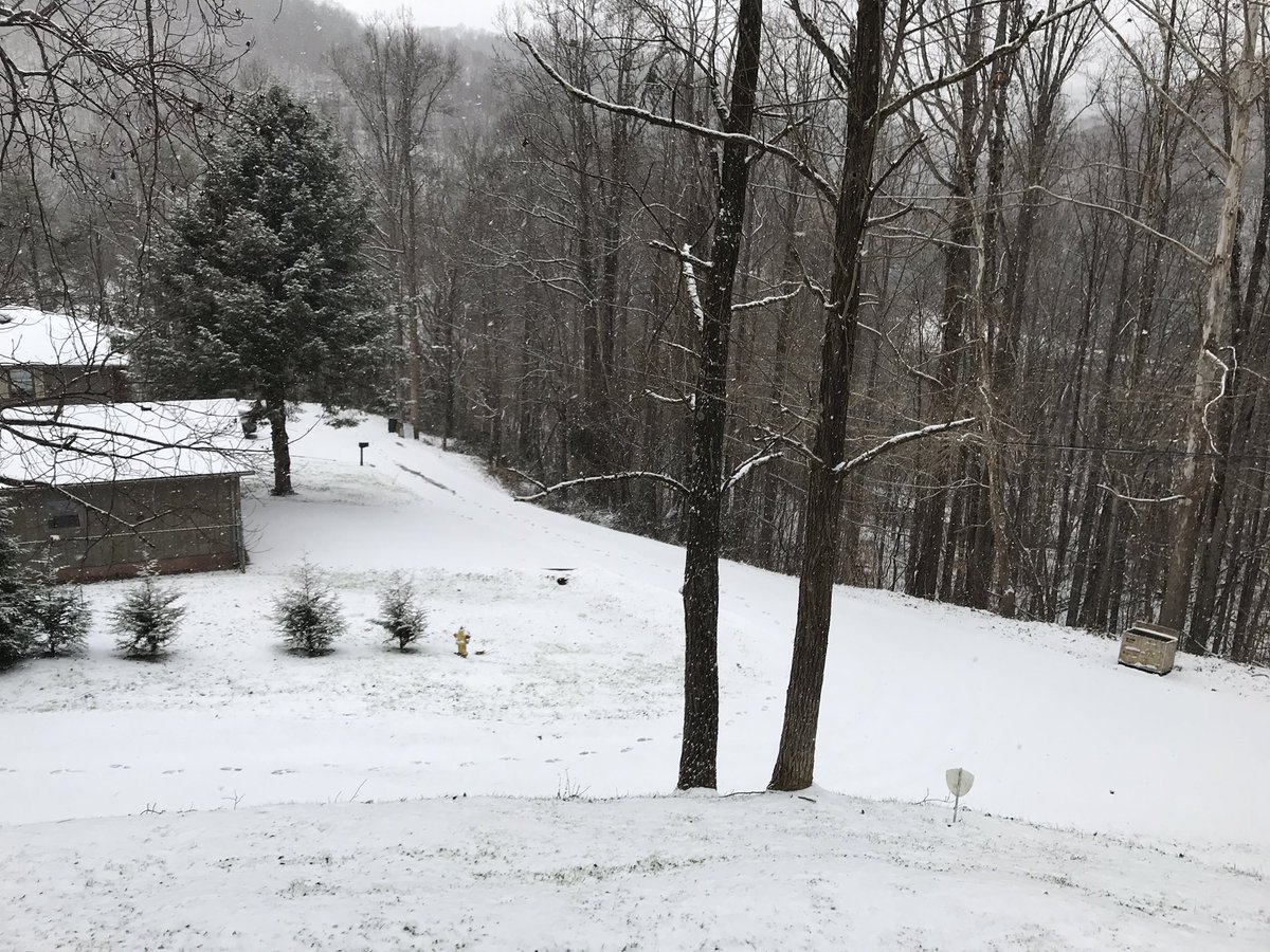
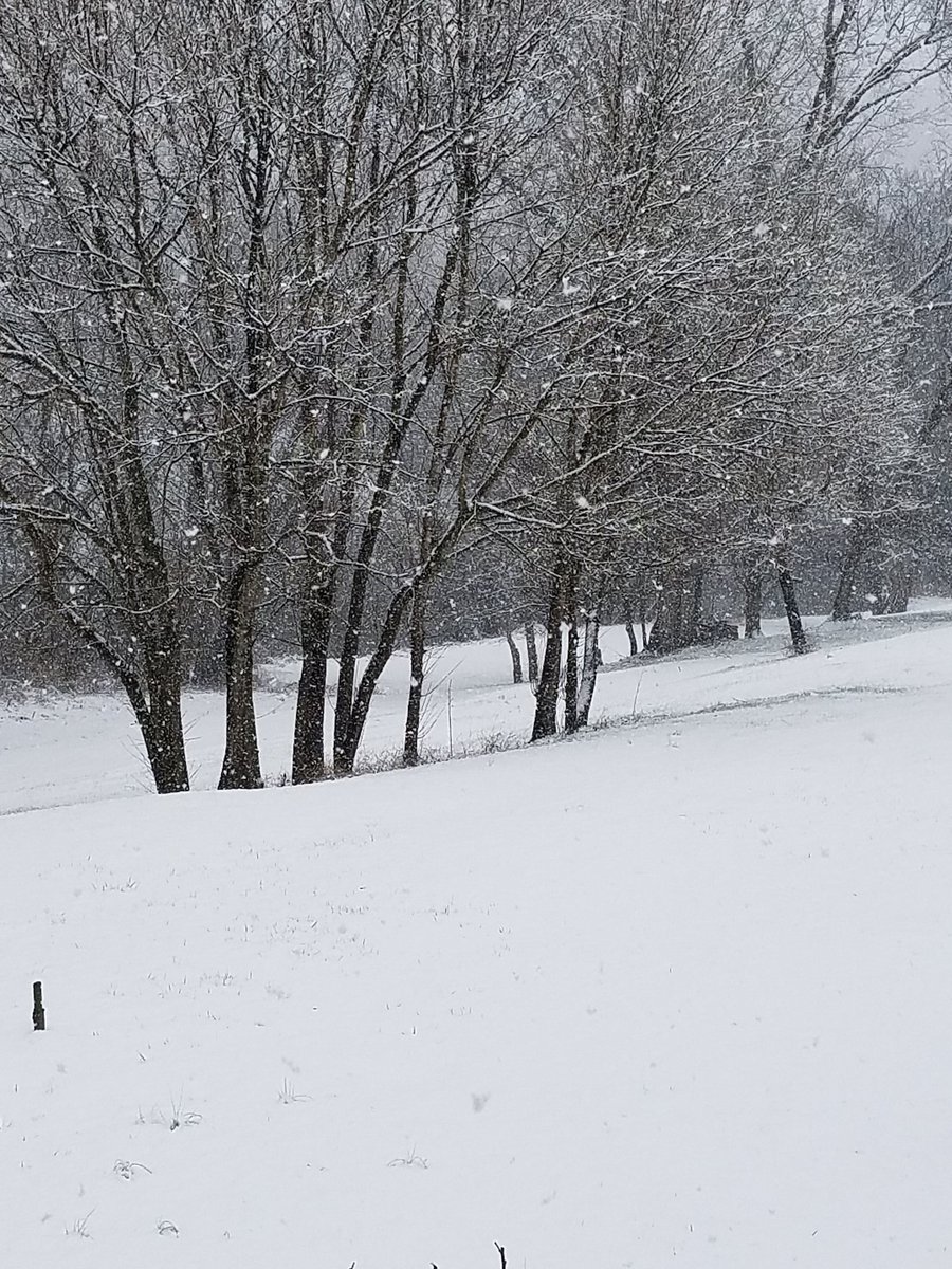
| Snow near Prestonsburg, KY (Courtesy of Jon Pelton) |
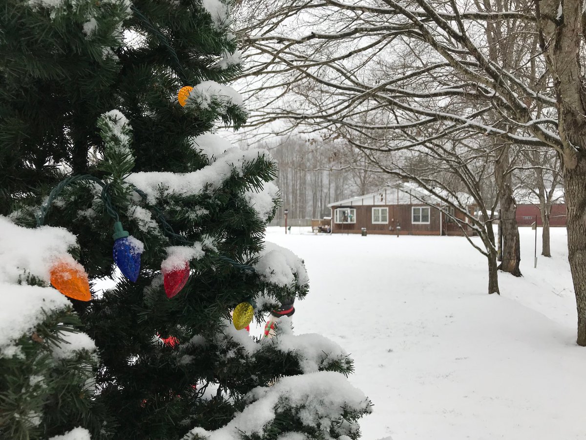
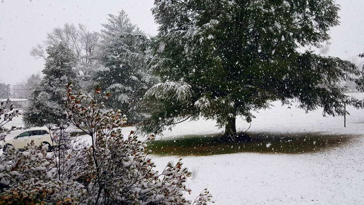
Snow in Emma, KY (Courtesy of Keith Arnett) |
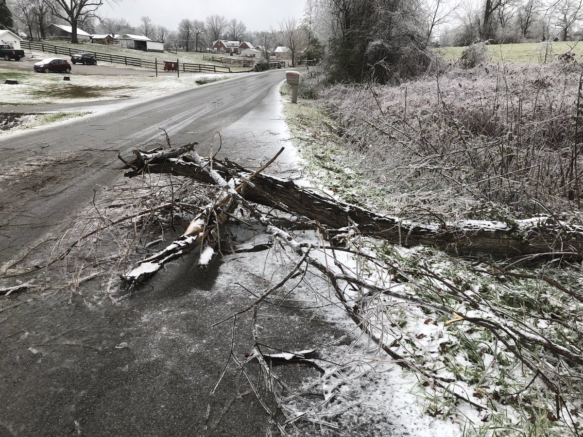
Tree limb down in London (Courtesy of Shane Smith) |
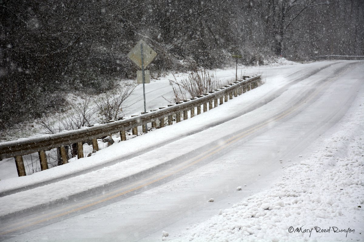
Snow/Ice Covered Roads in Hatfield, KY (Courtesy of Mary Reed Runyon) |
 |
 |
 |
 |
| Snow in Middlesboro, KY (Courtesy of Brandon Marsee) |
Freezing Rain in Mount Vernon, KY (Courtesy of Jordan Smith) |
Snow in Broadbottom, KY (Courtesy of Melissa Williams) |
Snow/Ice Covered Roads in London, KY (Courtesy of Johnnie Nicholson) |
Storm Reports
..TIME...   ...EVENT...      ...CITY LOCATION...     ...LAT.LON...
..DATE...   ....MAG....      ..COUNTY LOCATION..ST.. ...SOURCE....
            ..REMARKS..

1030 AM     HEAVY SNOW       2 NNE FONDE             36.63N 83.85W
12/09/2018  E3.5 INCH        BELL               KY   DEPT OF HIGHWAYS

            3-4 INCHES OF SNOW REPORTED ALONG STATE ROUTE 74 ON TOP
            OF FONDE MOUNTAIN

1100 AM     HEAVY SNOW       1 E BIG BLACK MOUNTAIN  36.92N 82.87W
12/09/2018  E7.5 INCH        HARLAN             KY   DEPT OF HIGHWAYS

            7.5 INCHES OF SNOW REPORTED ALONG STATE ROUTE 160 NEAR
            THE VIRGINIA STATE LINE

1136 AM     FREEZING RAIN    NANCY                   37.07N 84.75W
12/09/2018  E0.10 INCH       PULASKI            KY   PUBLIC

            FROM SOCIAL MEDIA.

1200 PM     FREEZING RAIN    LONDON                  37.13N 84.08W
12/09/2018  E0.20 INCH       LAUREL             KY   TRAINED SPOTTER

            A FEW LIMBS DOWN DUE TO THE WEIGHT OF THE ICE.

1242 PM     HEAVY SNOW       MANCHESTER              37.15N 83.77W
12/09/2018  E1.0 INCH        CLAY               KY   PUBLIC

            SOCIAL MEDIA.

1245 PM     HEAVY SNOW       EOLIA                   37.05N 82.79W
12/09/2018  E6.0 INCH        LETCHER            KY   PUBLIC

            PUBLIC REPORT VIA SOCIAL MEDIA.

0100 PM     FREEZING RAIN    HAZARD                  37.25N 83.20W
12/09/2018  E0.10 INCH       PERRY              KY   BROADCAST MEDIA

            FROM WYMT IN HAZARD.

0100 PM     SNOW             DUNHAM                  37.19N 82.65W
12/09/2018  E3.0 INCH        LETCHER            KY   PUBLIC

            REPORT VIA SOCIAL MEDIA.

0100 PM     FREEZING RAIN    4 E SLADE               37.79N 83.63W
12/09/2018  E0.10 INCH       WOLFE              KY   NWS EMPLOYEE

            AROUND A TENTH OF ICE WAS SEEN ON TREES EAST OF SLADE IN
            WOLFE COUNTY.

0130 PM     SNOW             5 W PRESTONSBURG        37.67N 82.86W
12/09/2018  M2.0 INCH        FLOYD              KY   TRAINED SPOTTER

0200 PM     HEAVY SNOW       KIMPER                  37.50N 82.35W
12/09/2018  M8.0 INCH        PIKE               KY   PUBLIC

0200 PM     HEAVY SNOW       1 NE PANCO              37.25N 83.51W
12/09/2018  E4.0 INCH        PERRY              KY   DEPT OF HIGHWAYS

            4 INCHES OF SNOW REPORTED ALONG STATE ROUTE 484 NEAR THE
            PERRY COUNTY LINE

0200 PM     SNOW             4 WSW PRESTONSBURG      37.65N 82.83W
12/09/2018  M3.3 INCH        FLOYD              KY   NWS EMPLOYEE

0200 PM     SNOW             HAZARD                  37.25N 83.20W
12/09/2018  E1.0 INCH        PERRY              KY   BROADCAST MEDIA

            AROUND 1 INCH OF SNOW WAS REPORTED AT WYMT STUDIOS IN
            HAZARD.

0245 PM     SNOW             ROBINSON CREEK          37.39N 82.54W
12/09/2018  M2.0 INCH        PIKE               KY   PUBLIC

0300 PM     HEAVY SNOW       CRANKS                  36.76N 83.17W
12/09/2018  E8.0 INCH        HARLAN             KY   PUBLIC

            REPORT VIA SOCIAL MEDIA.

0300 PM     HEAVY SNOW       1 NNW GIBBS             37.03N 83.90W
12/09/2018  E3.5 INCH        KNOX               KY   DEPT OF HIGHWAYS

            3.5 INCHES OF SNOW REPORTED ALONG STATE ROUTE 1803 NEAR
            THE LAUREL COUNTY LINE

0300 PM     HEAVY SNOW       CRANKS                  36.76N 83.17W
12/09/2018  E8.0 INCH        HARLAN             KY   PUBLIC

            REPORT VIA SOCIAL MEDIA.

0330 PM     HEAVY SNOW       2 SSW LEATHERWOOD       37.02N 83.19W
12/09/2018  E3.5 INCH        LESLIE             KY   DEPT OF HIGHWAYS

            3.5 INCHES OF SNOW REPORTED ALONG STATE ROUTE 221 NEAR
            THE PERRY COUNTY LINE

0400 PM     HEAVY SNOW       CANADA                  37.61N 82.33W
12/09/2018  E4.0 INCH        PIKE               KY   PUBLIC

0400 PM     HEAVY SNOW       2 SSE MAJESTIC          37.52N 82.09W
12/09/2018  E8.0 INCH        PIKE               KY   PUBLIC

0430 PM     HEAVY SNOW       MINNIE                  37.47N 82.75W
12/09/2018  E4.0 INCH        FLOYD              KY   DEPT OF HIGHWAYS

            4 INCHES OF SNOW REPORTED BY THE STATE HIGHWAY GARAGE AT
            MINNIE

0430 PM     HEAVY SNOW       DELPHIA                 37.03N 83.09W
12/09/2018  E4.0 INCH        PERRY              KY   DEPT OF HIGHWAYS

            STATE HIGHWAY GARAGE REPORTED AROUND 4 INCHES OF SNOW ON
            THE HIGHER ELEVATIONS ALONG HIGHWAY 699 AND HIGHWAY 463
            IN SOUTHERN PERRY COUNTY.

0437 PM     HEAVY SNOW       PHELPS                  37.51N 82.16W
12/09/2018  M7.8 INCH        PIKE               KY   PUBLIC

0500 PM     HEAVY SNOW       1 ENE JONANCY           37.32N 82.57W
12/09/2018  E5.5 INCH        PIKE               KY   PUBLIC

            5 TO 6 INCHES OF SNOW WAS REPORTED IN THE BOOKER FORK
            COMMUNITY TO THE SOUTHEAST OF VIRGIE.

0500 PM     SNOW             5 W PRESTONSBURG        37.67N 82.86W
12/09/2018  M3.0 INCH        FLOYD              KY   TRAINED SPOTTER

0500 PM     HEAVY SNOW       HARDY                   37.62N 82.24W
12/09/2018  M6.3 INCH        PIKE               KY   PUBLIC

            REPORT VIA SOCIAL MEDIA.

0500 PM     FREEZING RAIN    4 ENE JACKSON           37.58N 83.32W
12/09/2018  M0.13 INCH       BREATHITT          KY   ASOS

            12 HOUR ICE ACCUMULATION.

0500 PM     SNOW             4 ENE JACKSON           37.58N 83.32W
12/09/2018  M0.6 INCH        BREATHITT          KY   ASOS

            12 HOUR SNOWFALL.

0507 PM     HEAVY SNOW       HARDY                   37.62N 82.24W
12/09/2018  M6.2 INCH        PIKE               KY   BROADCAST MEDIA

0532 PM     HEAVY SNOW       CARRIE                  37.33N 83.03W
12/09/2018  M2.5 INCH        KNOTT              KY   PUBLIC

0552 PM     HEAVY SNOW       4 WSW PRESTONSBURG      37.65N 82.83W
12/09/2018  M4.1 INCH        FLOYD              KY   NWS EMPLOYEE

            STORM TOTAL.

0600 PM     SNOW             LAWSON                  37.60N 83.46W
12/09/2018  E0.2 INCH        BREATHITT          KY   NWS EMPLOYEE

0700 PM     SNOW             MONTICELLO              36.84N 84.85W
12/09/2018  E0.1 INCH        WAYNE              KY   911 CALL CENTER

0700 PM     SNOW             SOMERSET                37.08N 84.61W
12/09/2018  E0.1 INCH        PULASKI            KY   911 CALL CENTER

            ONLY A DUSTING OF SNOW WAS REPORTED WITH WINTRY
            PRECIPTATION FALLING AS FREEZING RAIN OR RAIN OR SLEET
            FOR MOST OF THE EVENT.

0700 PM     SNOW             MANCHESTER              37.15N 83.77W
12/09/2018  E1.0 INCH        CLAY               KY   911 CALL CENTER

0700 PM     SNOW             LILY                    37.02N 84.08W
12/09/2018  E0.8 INCH        LAUREL             KY   911 CALL CENTER

0700 PM     HEAVY SNOW       6 NW HINDMAN            37.39N 83.05W
12/09/2018  E3.5 INCH        KNOTT              KY   DEPT OF HIGHWAYS

            3 TO 4 INCHES OF SNOW WAS REPORTED IN THE BALL CREEK
            DRAINAGE AREA ALONG KY HIGHWAY 1087.

0700 PM     HEAVY SNOW       1 SSE GARDNER           36.95N 83.53W
12/09/2018  E3.5 INCH        CLAY               KY   DEPT OF HIGHWAYS

            3 TO 4 INCHES OF SNOW WAS REPORTED IN HIGHER ELEVATIONS
            OF SOUTHERN CLAY COUNTY NEAR THE BELL COUNTY LINE.

0700 PM     HEAVY SNOW       GARDNER                 36.97N 83.54W
12/09/2018  E3.5 INCH        CLAY               KY   911 CALL CENTER

            3 TO 4 INCHES OF SNOW WAS REPORTED NEAR THE CLAY AND
            LESLIE COUNTY LINE.

0800 PM     HEAVY SNOW       MARROWBONE              37.37N 82.41W
12/09/2018  E4.0 INCH        PIKE               KY   PUBLIC

0800 PM     SNOW             ISOM                    37.19N 82.90W
12/09/2018  E1.5 INCH        LETCHER            KY   BROADCAST MEDIA

0830 PM     HEAVY SNOW       3 W MOUTHCARD           37.38N 82.31W
12/09/2018  E5.0 INCH        PIKE               KY   PUBLIC

0900 PM     HEAVY SNOW       JENKINS                 37.18N 82.63W
12/09/2018  E6.0 INCH        LETCHER            KY   PUBLIC

            REPORT VIA SOCIAL MEDIA.

0900 PM     HEAVY SNOW       CUMBERLAND              36.98N 82.99W
12/09/2018  E4.0 INCH        HARLAN             KY   LAW ENFORCEMENT

0900 PM     SNOW             HARLAN                  36.84N 83.32W
12/09/2018  M0.0 INCH        HARLAN             KY   LAW ENFORCEMENT

            ONLY A TRACE OF SNOW WAS REPORTED IN DOWNTOWN HARLAN WITH
            NO ACCUMULATION REPORTED BY KY STATE POLICE.

0900 PM     HEAVY SNOW       SMITH                   36.74N 83.26W
12/09/2018  E4.5 INCH        HARLAN             KY   LAW ENFORCEMENT

            4 TO 5 INCHES OF SNOW WAS REPORTED IN THE SMITH
            COMMUNITY.

0930 PM     SNOW             LOST CREEK              37.48N 83.33W
12/09/2018  E0.5 INCH        BREATHITT          KY   NWS EMPLOYEE

1050 PM     SNOW             1 NW BRAINARD           37.67N 82.91W
12/09/2018  E3.0 INCH        FLOYD              KY   NWS EMPLOYEE

1100 PM     SNOW             SALYERSVILLE            37.75N 83.06W
12/09/2018  E2.0 INCH        MAGOFFIN           KY   NWS EMPLOYEE

1130 PM     SNOW             CAMP LEWIS              37.58N 83.19W
12/09/2018  E1.0 INCH        BREATHITT          KY   NWS EMPLOYEE

0700 AM     SNOW             1 E PAINTSVILLE         37.82N 82.79W
12/10/2018  M2.5 INCH        JOHNSON            KY   CO-OP OBSERVER

0700 AM     SNOW             1 SE SKYLINE            37.07N 82.97W
12/10/2018  M1.0 INCH        LETCHER            KY   CO-OP OBSERVER

0700 AM     SNOW             1 ESE HAZARD            37.25N 83.18W
12/10/2018  M3.0 INCH        PERRY              KY   CO-OP OBSERVER

0700 AM     SNOW             2 SE WHITESBURG         37.10N 82.80W
12/10/2018  M2.0 INCH        LETCHER            KY   CO-OP OBSERVER

0700 AM     HEAVY SNOW       4 WSW PRESTONSBURG      37.65N 82.83W
12/10/2018  M4.0 INCH        FLOYD              KY   NWS EMPLOYEE

            24 HOUR TOTAL 4 INCHES, STORM TOTAL 4.1 INCHES.
Environment
Surface Map:
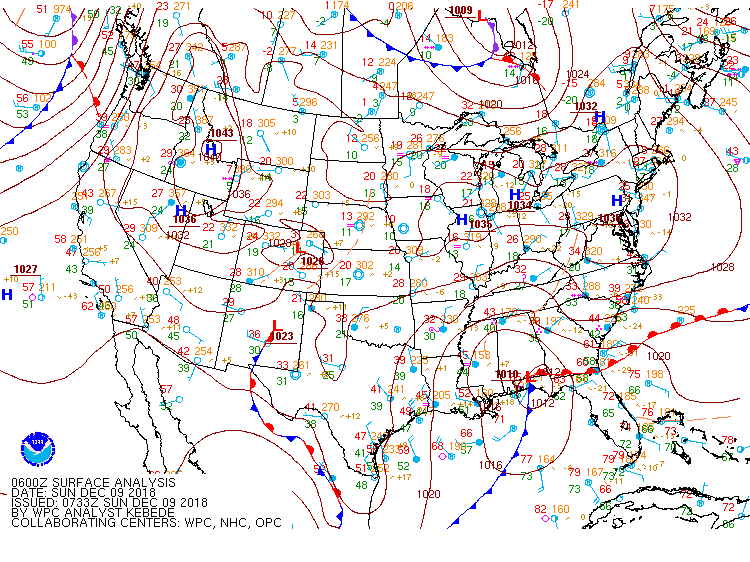 |
| Surface Maps (1 am Sunday to 1 pm Sunday) |
Maximum Wet Bulb Temperature Aloft:
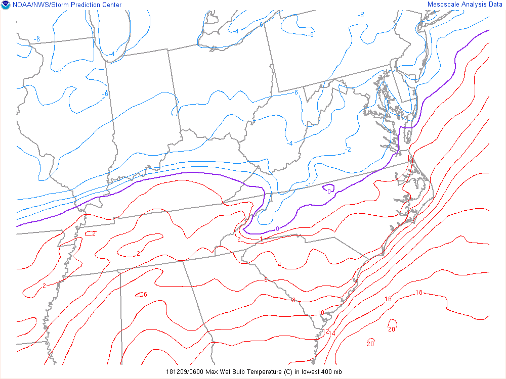 |
| Max Wet Bulb Temperature Aloft 1 am Sunday to 5 pm Sunday. Max wet bulb temperature aloft is a way to track the potential for a wintry mix verses all snow. When the wet bulb temperature gets above 0 degrees Celsius (purple line), mixed precipitation is likely because we have warm air above the ground. In this case, the purple line remained farther east through dawn on Sunday, keeping precipitation mixed with sleet and freezing rain dominating. Eventually as we went into Sunday, the purple line retreated back to the west as the warm air above the ground dissipated, allowing for the transition to more snow. |
 |
Media use of NWS Web News Stories is encouraged! Please acknowledge the NWS as the source of any news information accessed from this site. |
|

