
Dangerous heat will expand from the Gulf Coast into the Southern Plains and Desert Southwest through week's end. Additional extreme heat impacting the Pacific Northwest will shift to the northern Plains by the weekend. Tropical Storm Bertha is expected to continue to impact portions of the northern Gulf Coast from the western Florida Panhandle to southeastern Louisiana through tonight. Read More >
Overview
|
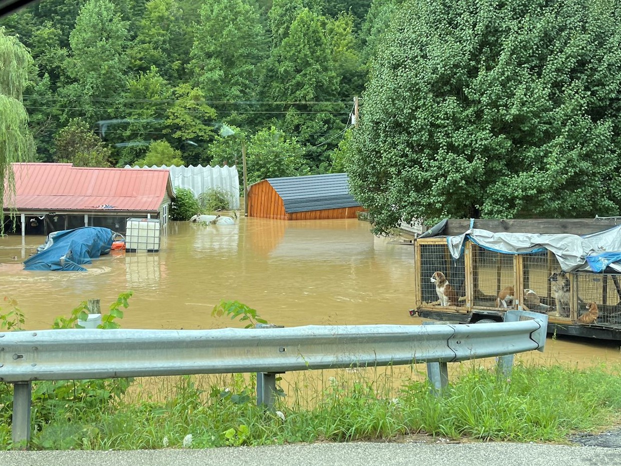
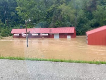
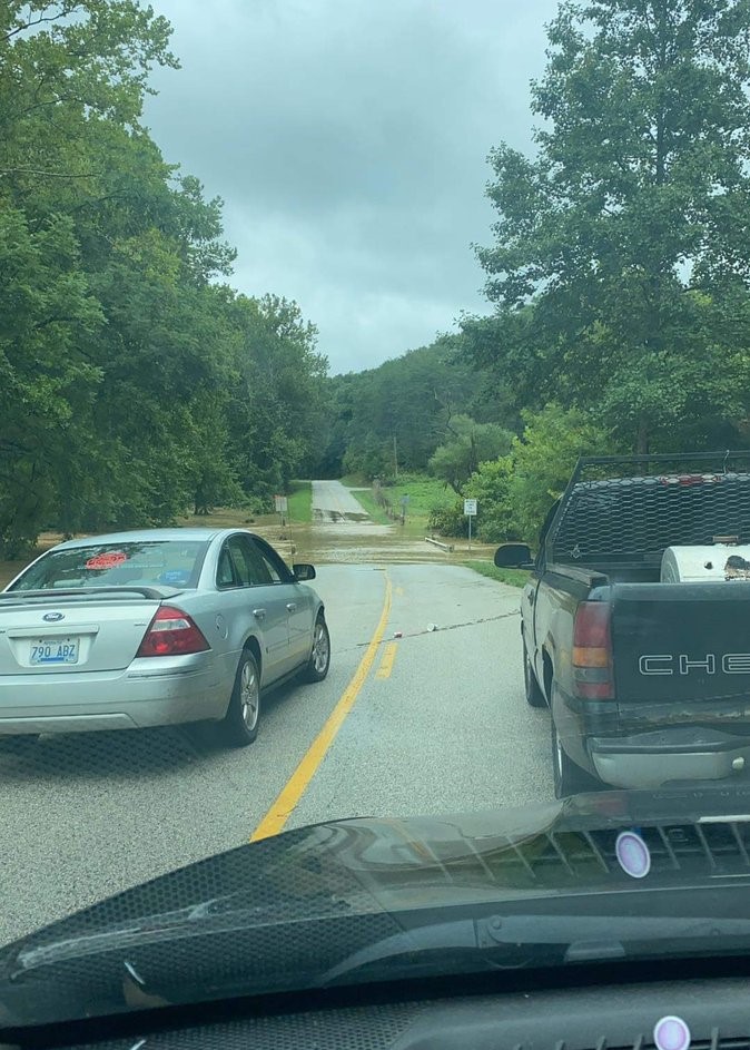
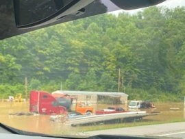
Despite high pressure being in general control at the surface, a weak shortwave moving into a very moist atmosphere during the overnight hours was sufficient to trigger showers and thunderstorms throughout the day across eastern Kentucky. Portions of eastern Kentucky had already been hit by heavy rains in the days leading up, saturating soils and priming those areas which later experienced flooding. Ultimately, the heaviest rainfall happened to occur over southern Wolfe County between 8 AM to 10 AM and was followed by significant flash flooding. Additional showers passed through the area around midday, likely exacerbating the situation. In particular, Holly Creek in Bethany and Hunting Fork along KY Highway 15 experienced some of the worst flooding. A number of houses were inundated, a few to a depth of multiple feet. Flooding was also observed in other portions of the county such as along Stillwater Creek between Malaga and the Mountain Parkway. |
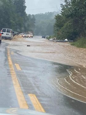
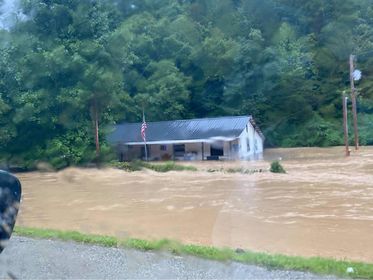 Flash Flooding along KY Highway 15 (Courtesy of WYMT ) |
Photos
Photos of Flooding
 |
 |
 |
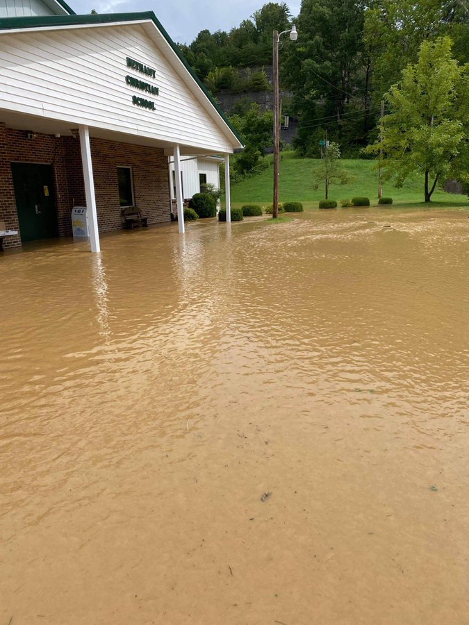
| Flooding at the Bethany School (Courtesy of Johnny Ray Feltner) |
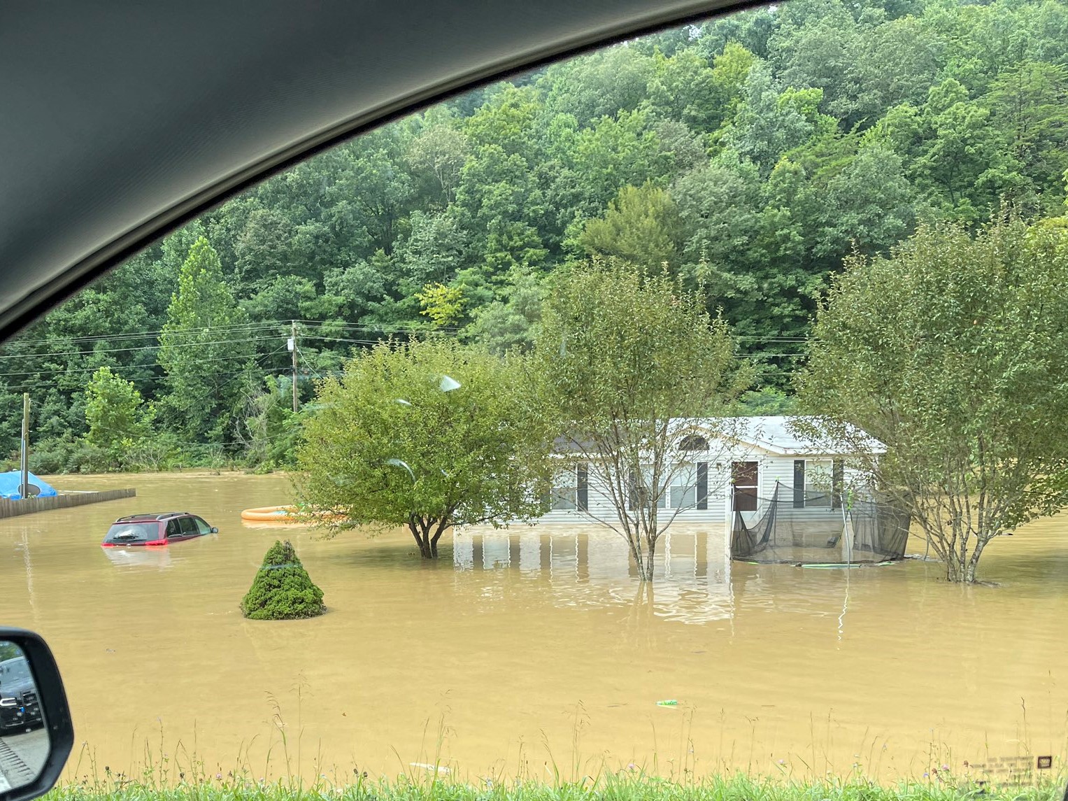
Inundated Home Along Hunting Fork (Courtesy of Michael Parsons) |
Inundated Trailer Home Along Hunting Fork (Courtesy of Johnny Ray Feltner) |
 |
 |
 |
| Flash Flooding along Stillwater Creek (Courtesy of Chris Whisman) |
Flash Flood Waters on KY-15 (Courtesy of WYMT) |
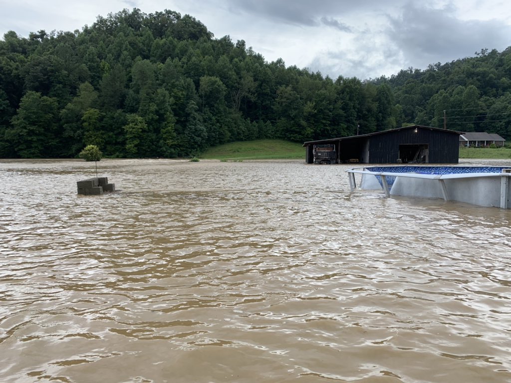
Significant Flash Flooding Along Hunting Fork (Courtesy of Michael Parsons) |
 |
 |
 |
| Flash Flooding along Hunting Fork (Courtesy of WYMT) |
Flash Flooding at Holly Creek and Spring Branch (Courtesy of Johnny Ray Feltner) |
Flash Flooding Along Hunting Fork (Courtesy of Johnny Ray Feltner) |
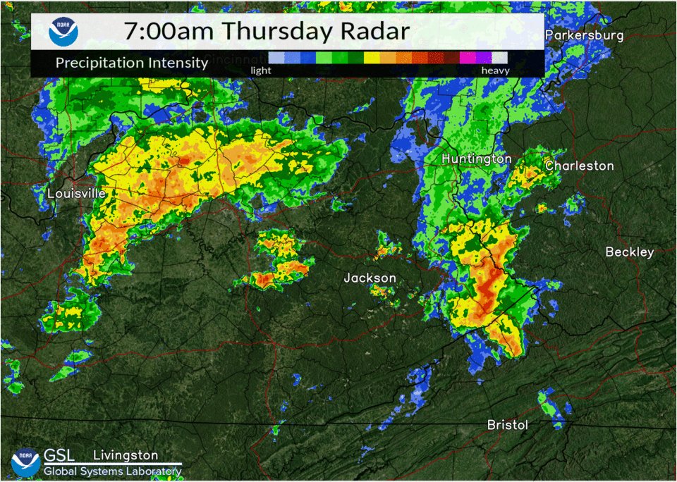
Radar
Radar Loop and Estimated Rainfall
 |
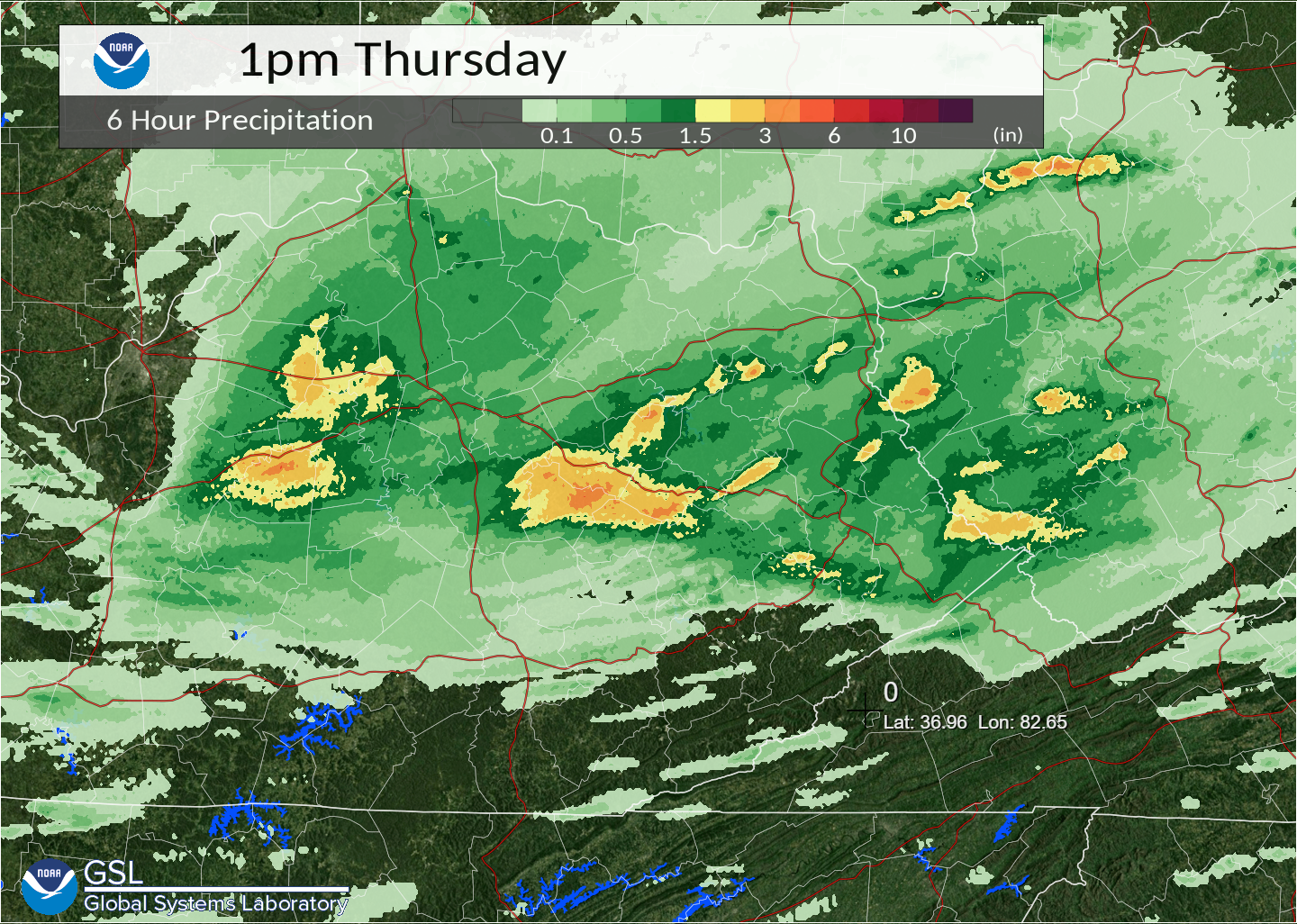 |
| Radar Loop from 7 AM to 1 PM | 6-Hour Rainfall Estimates from Radar |
Environment
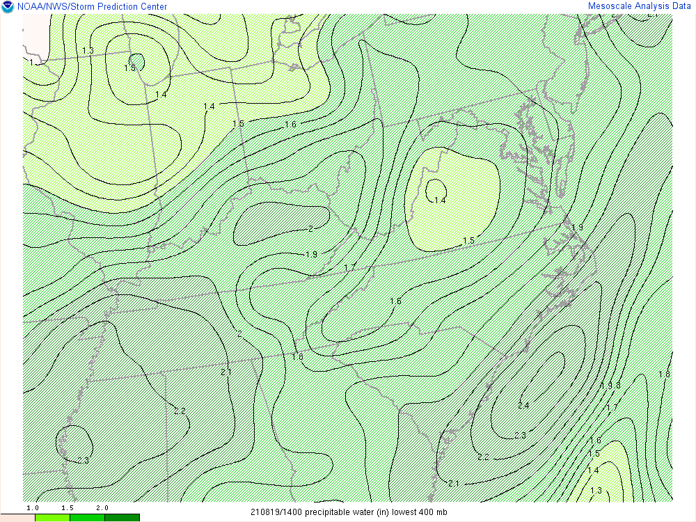
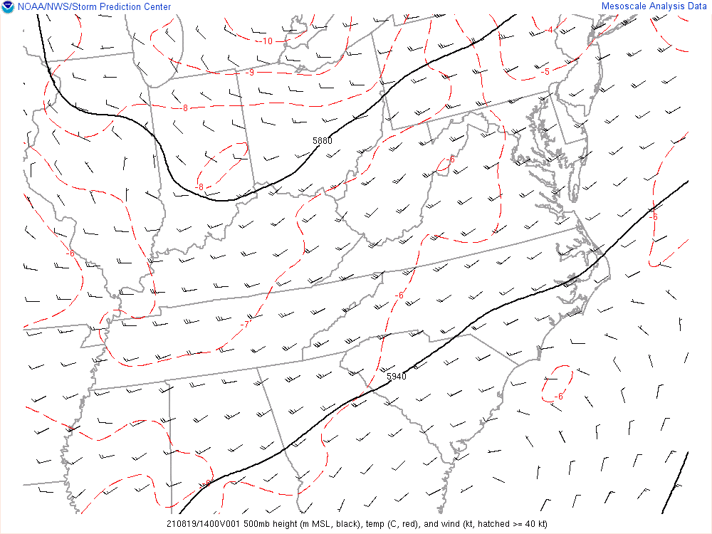
This event occurred in a very moist but weakly forced environment. Figure 1 show surface high pressure initially over the Southern Appalachians and Tennessee Valley early on the morning of August 19th.The remnants of Tropical Storm Fred were lifting across the Northeast but had brought a saturating rainfall and minor flood issues to the Wolfe County area in the previous 36 to 48 hours. In the wake of the system, an extremely moist environment (Figure 2) was in place as evidenced by precipitable water values of 2.0 inches — near climatological records. Heading through the mid-morning hours, a shallow trough in the upper levels, shown in Figure 3, ejected into the Ohio Valley. The upper level forcing, combined with some loosely organized low-level moisture convergence, and relatively weak MLCAPE (Figure 4) led to storm cluster development with efficient warm rain processes. As the storms moved into Eastern Kentucky, the heaviest activity set up in a favored area of moisture convergence over Wolfe County during the 8 AM to 10 AM timeframe. Additional lighter showers followed for the midday timeframe, only exacerbating the ongoing high water issues. Rainfall estimates from radar during this time are up to around 3 inches but observations from outside of Wolfe County suggest that the radar estimates may have been only half of what occurred. No observed rainfall measurements were received from the area of worst impacts.
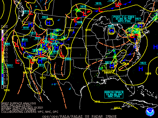 |
| Figure 1: Surface Analysis from 2 AM August 19th through 5 PM August 19th |
Near-storm environment around the period of heaviest rainfall.
 |
 |
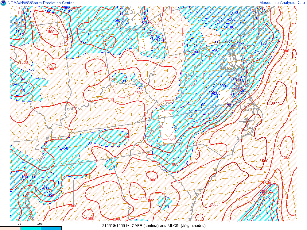 |
| Figure 2: Precipitable Water at 10 AM | Figure 3: 500 mb Heights at 10 AM | Figure 4: MLCAPE at 10 AM |
 |
Media use of NWS Web News Stories is encouraged! Please acknowledge the NWS as the source of any news information accessed from this site. |
|

