Dangerous heat will expand from the Gulf Coast into the Southern Plains and Desert Southwest through week's end. Additional extreme heat impacting the Pacific Northwest will shift to the northern Plains by the weekend. Tropical Storm Bertha is expected to continue to impact portions of the northern Gulf Coast from the western Florida Panhandle to southeastern Louisiana through tonight. Read More >
Overview
|
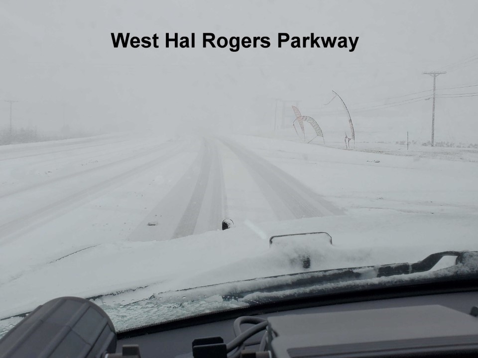
Heavy snow developed across eastern Kentucky on Thursday, January 6th as a potent low pressure system developed over the Deep South in the morning, rode up the spine of the southern Appalachians during the afternoon, and off to the northeast Thursday night - a climatologically favored track for heavy snow accumulations across eastern Kentucky. The first flakes reached the I-75 corridor by mid morning and spread eastward across the remainder of the area by early afternoon. Snowfall rates of 1" per hour or more were observed during a majority of the event. The nearly perfect combination of cold temperatures at the surface and aloft led to dry, fluffy snow-to-liquid ratios mostly between 12-15:1 and storm total accumulations on the order of 4 to 9 inches by the time snow tapered off late Thursday evening. The dry nature of the snow prevented any significant issues with downed trees and power lines. However, the warm roads, due to mild weather in recent weeks, partially melted the snow as it fell, leading to a slippery, slushy mess on area roadways. The most notable incident was a 50 to 75 vehicle pileup on I-64 near the Montgomery/Clark County line. Martin County also closed all county highways during the event. The hazardous travel contributed to many single vehicle incidents across eastern Kentucky. |
 Mount Sterling Multiple Vehicle Pileup (Courtesy of Justin Logan) |
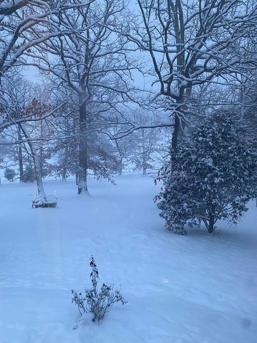
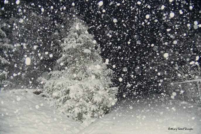
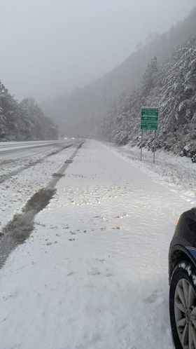
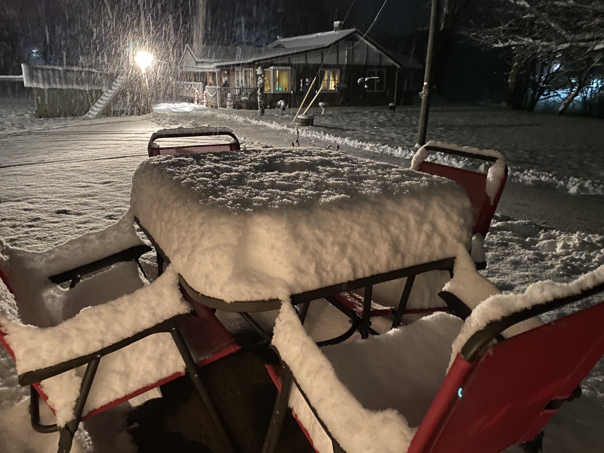
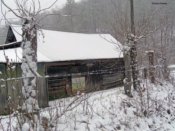
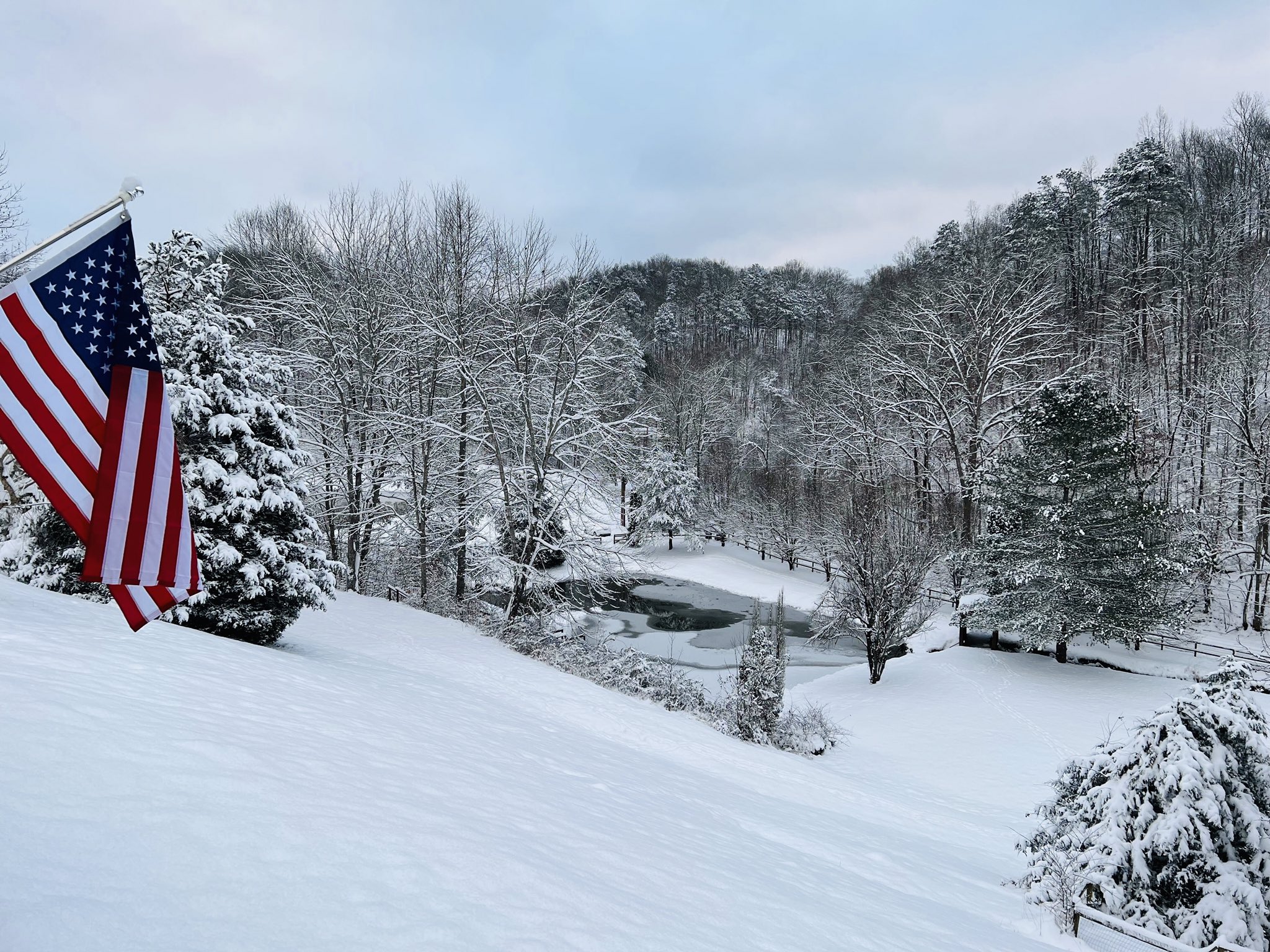
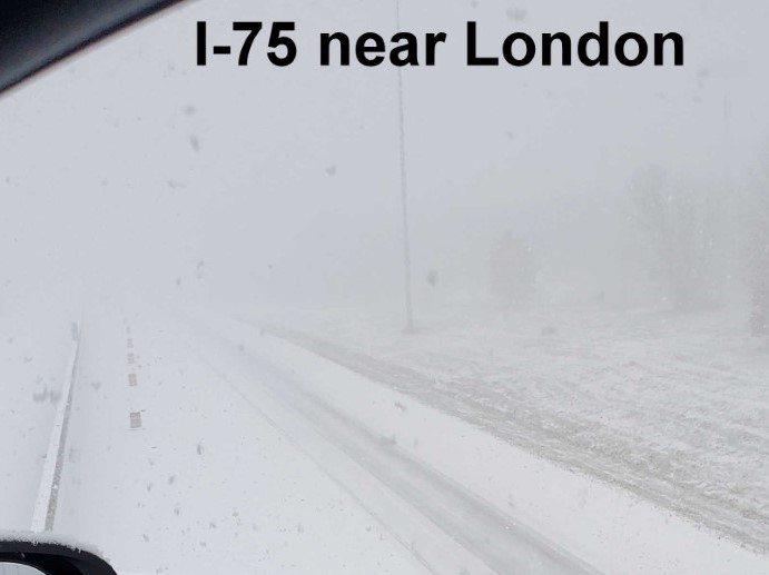
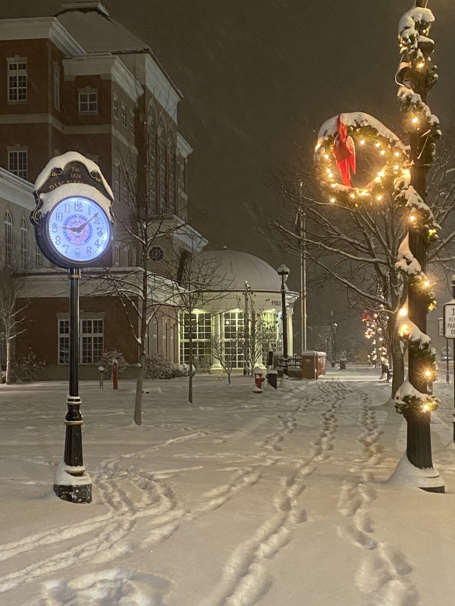
Photos & Video
Event Photos
Radar
Storm Radar Loop
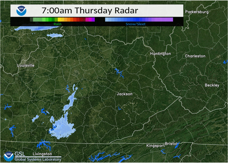 |
| Radar Loop - 8 AM to 11 PM January 6th, 2022 |
Storm Reports
                                                (Graphic Courtesy Danny Gant NWS Morristown)

Storm Total Snowfall Reports (Sorted By County)

Location                     Amount    Time/Date       Lat/Lon

Bath County
Cave Run Lake                7.1 in    0700 AM 01/07   38.12N/83.53W
1 NNW Owingsville            5.2 in    0800 AM 01/07   38.14N/83.76W

Bell County
2 ESE Meldrum                5.5 in    0700 AM 01/07   36.66N/83.66W
Beverly                      5.0 in    0827 PM 01/06   36.93N/83.53W
1 NNW Ferndale               4.8 in    0700 AM 01/07   36.71N/83.69W
Stony Fork                   4.0 in    0530 PM 01/06   36.83N/83.54W

Breathitt County
Stevenson                    8.0 in    1035 PM 01/06   37.58N/83.27W
NWS Office/Julian Carroll Ap 7.7 in    0700 AM 01/07   37.59N/83.32W
1 S Paxton                   7.6 in    0700 AM 01/07   37.66N/83.41W
1 S Fivemile                 7.5 in    0900 PM 01/06   37.57N/83.41W
Dumont                       7.0 in    0700 AM 01/07   37.53N/83.36W
Inverness                    6.0 in    0640 PM 01/06   37.53N/83.36W

Elliott County
9 SSE Olive Hill             6.5 in    0900 AM 01/07   38.19N/83.08W
Sandy Hook                   6.0 in    0533 PM 01/06   38.10N/83.12W

Estill County
1 NNE Spout Springs          8.5 in    0520 PM 01/06   37.83N/83.97W
Cressy                       8.2 in    0800 AM 01/07   37.83N/84.03W
Irvine                       7.3 in    0745 PM 01/06   37.70N/83.97W
1 NW Kimbrell                7.0 in    0647 PM 01/06   37.81N/84.00W

Fleming County
3 W Wallingford              4.0 in    0637 PM 01/06   38.41N/83.66W
Flemingsburg                 3.5 in    0400 PM 01/06   38.43N/83.74W

Floyd County
Emma                         8.0 in    0940 PM 01/06   37.63N/82.70W
3 WSW Prestonsburg           7.6 in    0700 AM 01/07   37.66N/82.83W
1 W Dotson                   7.5 in    0745 PM 01/06   37.65N/82.88W
Prestonsburg                 7.0 in    0700 PM 01/06   37.67N/82.77W
Harold                       6.0 in    0745 PM 01/06   37.54N/82.63W

Harlan County
1 E Big Black Mountain       8.0 in    0800 AM 01/07   36.91N/82.87W
1 ESE Clover                 8.0 in    0903 AM 01/07   36.93N/82.96W
1 ESE Bledsoe                7.0 in    0730 AM 01/07   36.92N/83.35W
Baxter                       6.0 in    0700 AM 01/07   36.86N/83.33W
1 SSW Cumberland             5.0 in    0610 PM 01/06   36.98N/82.99W
1S Harlan                    4.5 in    0600 AM 01/07   36.83N/83.33W

Jackson County
2 NNW Loam                   7.0 in    0800 AM 01/07   37.43N/84.14W
Morrill                      7.0 in    1030 PM 01/06   37.52N/84.20W
Sandgap                      6.0 in    0620 PM 01/06   37.49N/84.09W

Johnson County
Paintsville                  8.0 in    0815 PM 01/06   37.82N/82.81W
3 N Barnetts Creek           8.0 in    0818 PM 01/06   37.87N/82.88W
Paintsville                  7.8 in    0645 PM 01/06   37.82N/82.81W
1 SW Hagerhill               7.8 in    0720 PM 01/06   37.78N/82.80W
1 E Paintsville              7.0 in    0700 AM 01/07   37.82N/82.78W
1 SW Staffordsville          7.0 in    0708 PM 01/06   37.82N/82.85W

Knott County
1 ENE Ivan                   7.0 in    0700 AM 01/07   37.29N/82.81W
1 SE Hindman                 6.0 in    0700 AM 01/07   37.32N/82.96W

Knox County
Bimble                       6.5 in    0605 PM 01/06   36.88N/83.82W

Laurel County
North Corbin                 8.0 in    0845 PM 01/06   36.97N/84.10W
1 NE London                  7.3 in    0330 AM 01/07   37.14N/84.07W
London                       6.8 in    0920 PM 01/06   37.13N/84.08W
East Bernstadt               6.6 in    0652 PM 01/06   37.19N/84.12W

Lee County
4 N Beattyville              7.2 in    0900 AM 01/07   37.63N/83.72W
Beattyville                  6.0 in    0622 PM 01/06   37.58N/83.71W

Leslie County
Thousandsticks               8.0 in    0830 PM 01/06   37.19N/83.43W
1 ESE Kaliopi                5.5 in    0622 PM 01/06   37.23N/83.40W

Letcher County
2 SE Whitesburg              5.0 in    0700 AM 01/07   37.10N/82.80W
Skyline                      4.8 in    0700 AM 01/07   37.07N/82.97W
1 NNW Farraday               4.5 in    0722 PM 01/06   37.18N/82.78W

Magoffin County
Mid                          8.5 in    0700 AM 01/07   37.52N/82.90W
Royalton                     8.0 in    0700 AM 01/07   37.68n/83.02w
Gifford                      7.8 in    0600 AM 01/07   37.77N/83.13W
1 SE Swampton                6.0 in    1140 PM 01/06   37.65N/83.00W

Martin County
2 E Inez                     8.4 in    0700 AM 01/07   37.87N/82.52W
Debord                       8.3 in    0827 PM 01/06   37.83N/82.55W

McCreary County
Whitley City                 5.5 in    0505 PM 01/06   36.73N/84.47W

Menifee County
Frenchburg                   7.5 in    1020 PM 01/06   37.95N/83.63W

Montgomery County
1 S Oggs Station             7.6 in    0750 PM 01/06   38.01N/83.82W
1 SW Oggs Station            7.2 in    0630 AM 01/07   38.01N/83.84W

Morgan County
1 WSW Index                  9.0 in    1200 AM 01/07   37.89N/83.27W

Owsley County
4 ENE Booneville             7.2 in    0700 AM 01/07   37.50N/83.62W
Island City                  7.0 in    1100 AM 01/07   37.37N/83.77W

Perry County
3 SSW Dice                   8.0 in    0734 AM 01/07   37.33N/83.25W
1 N Viper                    6.0 in    0554 AM 01/07   37.19N/83.15W
Viper                        6.0 in    0603 AM 01/07   37.18N/83.15W
Hazard                       5.5 in    1025 PM 01/06   37.25N/83.20W

Pike County
Whitepost                    7.5 in    0830 PM 01/06   37.73N/82.35W
1 S Zebulon                  6.9 in    0610 AM 01/07   37.50N/82.47W
3 NE Belcher                 6.0 in    0600 AM 01/07   37.37N/82.34W
Pikeville                    6.0 in    0600 PM 01/06   37.48N/82.51W
3 W Mouthcard                5.5 in    0700 AM 01/07   37.39N/82.31W

Powell County
2 W Stanton                  8.6 in    0800 AM 01/07   37.86N/83.90W
2 ESE Clay City              8.0 in    1230 AM 01/07   37.85N/83.90W
1 WSW Stanton                7.3 in    0500 PM 01/06   37.84N/83.88W
1 SSE Stanton                7.0 in    0545 PM 01/06   37.83N/83.85W
1 WNW Clay City              6.0 in    0700 AM 01/07   37.87N/83.93W

Pulaski County
2 SE Quinton                 7.0 in    0709 PM 01/06   36.93N/84.60W
1 WNW Somerset               6.5 in    0825 PM 01/06   37.06N/84.63W
1 NNE Somerset               5.5 in    0915 AM 01/07   37.09N/84.60W
5 W Bee Lick                 5.0 in    0545 PM 01/06   37.33N/84.59W
Somerset                     5.0 in    0615 PM 01/06   37.08N/84.61W

Rockcastle County
Spiro                        6.7 in    0624 PM 01/06   37.35N/84.40W
1 W Burr                     6.5 in    0700 AM 01/07   37.34N/84.32W

Rowan County
Hilda                        8.0 in    0915 PM 01/06   38.24N/83.50W
1 S Morehead                 6.0 in    0645 PM 01/06   38.18N/83.44W
7 NE Morehead                5.5 in    0655 AM 01/07   38.24N/83.34W
Morehead                     5.3 in    0545 PM 01/06   38.19N/83.44W

Wayne County
1 S Monticello               8.0 in    0815 AM 01/07   36.83N/84.85W

Whitley County
7 SW Corbin                  7.0 in    0700 AM 01/07   36.87N/84.21W
1 NE Corbin                  6.0 in    0930 PM 01/06   36.94N/84.10W
Clio                         5.8 in    1257 PM 01/07   36.82N/84.20W
1 NE Williamsburg            4.5 in    0610 PM 01/06   36.74N/84.16W

Wolfe County
Campton                      8.3 in    0750 PM 01/06   37.73N/83.55W


Observations are collected from a variety of sources with varying equipment
and exposures. We thank all volunteer weather observers for their dedication.
Not all data listed are considered official.
Environment
Low pressure rapidly developed over the Deep South early on Thursday and then lifted northeastward across the Southern Appalachians during the afternoon and to over the Chesapeake Bay on Thursday night. Strong upper level divergence contributed to strong lift through a deepening dendritic growth zone to produce heavy snowfall rates in excess of one inch per hour.
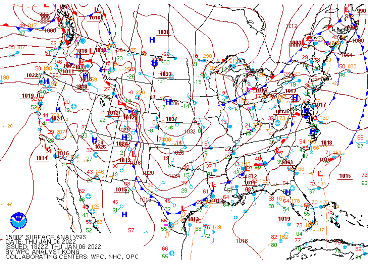 |
| Figure 1: Frontal Analysis Shows Low Pressure Riding from the Deep South to Mid-Atlantic |
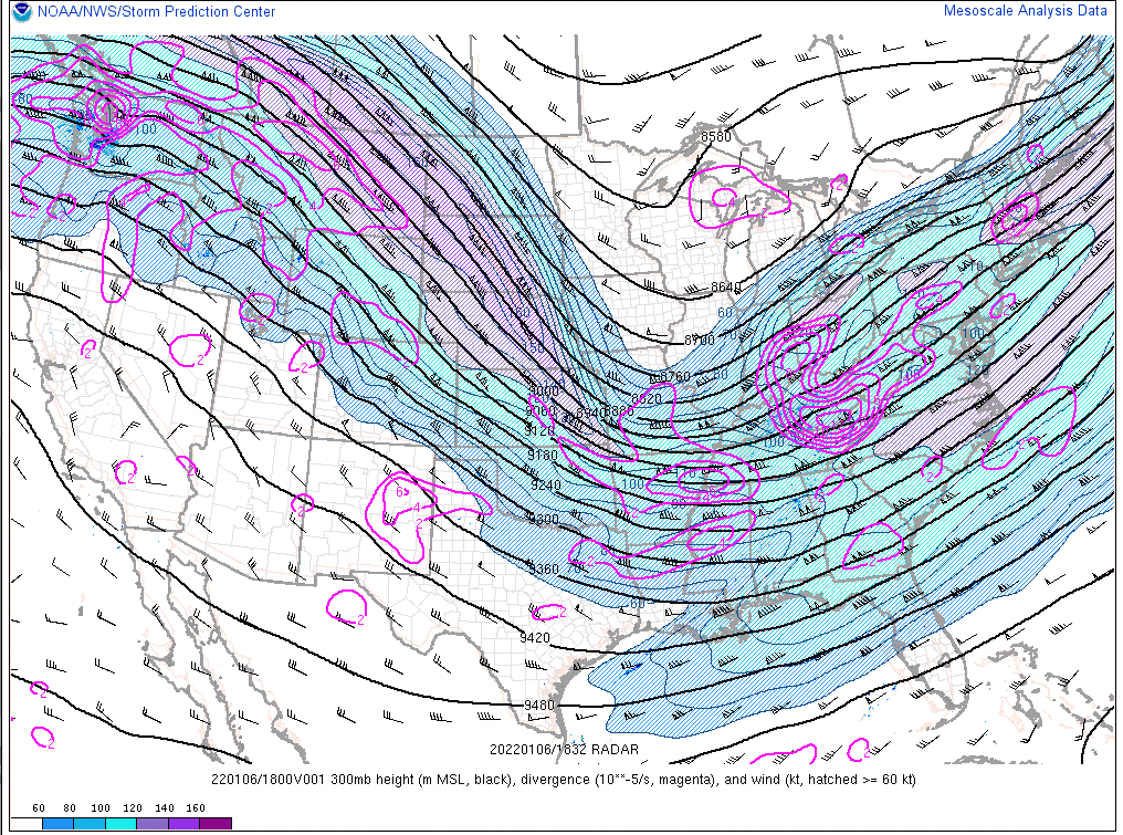
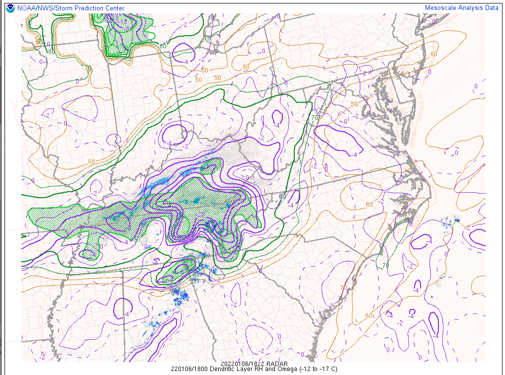
As the storm ramped up, several key factors were noted in the 1 PM mesoanalysis which revealed the reason for heavy snowfall rates across the area. The upper level jet structure (Figure 2) showed an ~120+ knot jet north of the Ohio River leading to strong upper level divergence (magenta contours) over eastern Kentucky. In Figure 3, the divergence caused strong lifting (purple-contoured omega values lower than -8) in the nearly saturated dendritic layer to spread into southern Kentucky. The dendritic layer is a portion of the atmosphere with temperatures between 0 and 10 degrees Fahrenheit — the optimal temperature range for the large, dry, fluffy snowflake development. Strong lifting through the moist dendritic layer led to very rapid, large flake development which in turn resulted in heavy snowfall. Figure 4 shows the depth of the dendritic layer, which increased through the event, leading to more efficient flake production. This was evident by snowfall rates averaging 1"+ per hour during the peak of the event and the snow-to-liquid ratios in the 12-15:1 range through the event — a bit higher than the climatological norm for this time of year.
 |
 |
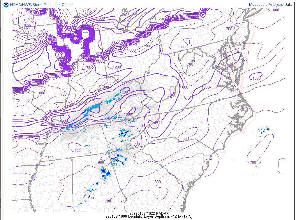 |
| Figure 2: 300 mb Winds & Divergence at 1PM | Figure 3: Dendritic Layer RH & Omega at 1PM | Figure 4: Dendritic Layer Depth at 1PM |
 |
Media use of NWS Web News Stories is encouraged! Please acknowledge the NWS as the source of any news information accessed from this site. |
|