Overview
|
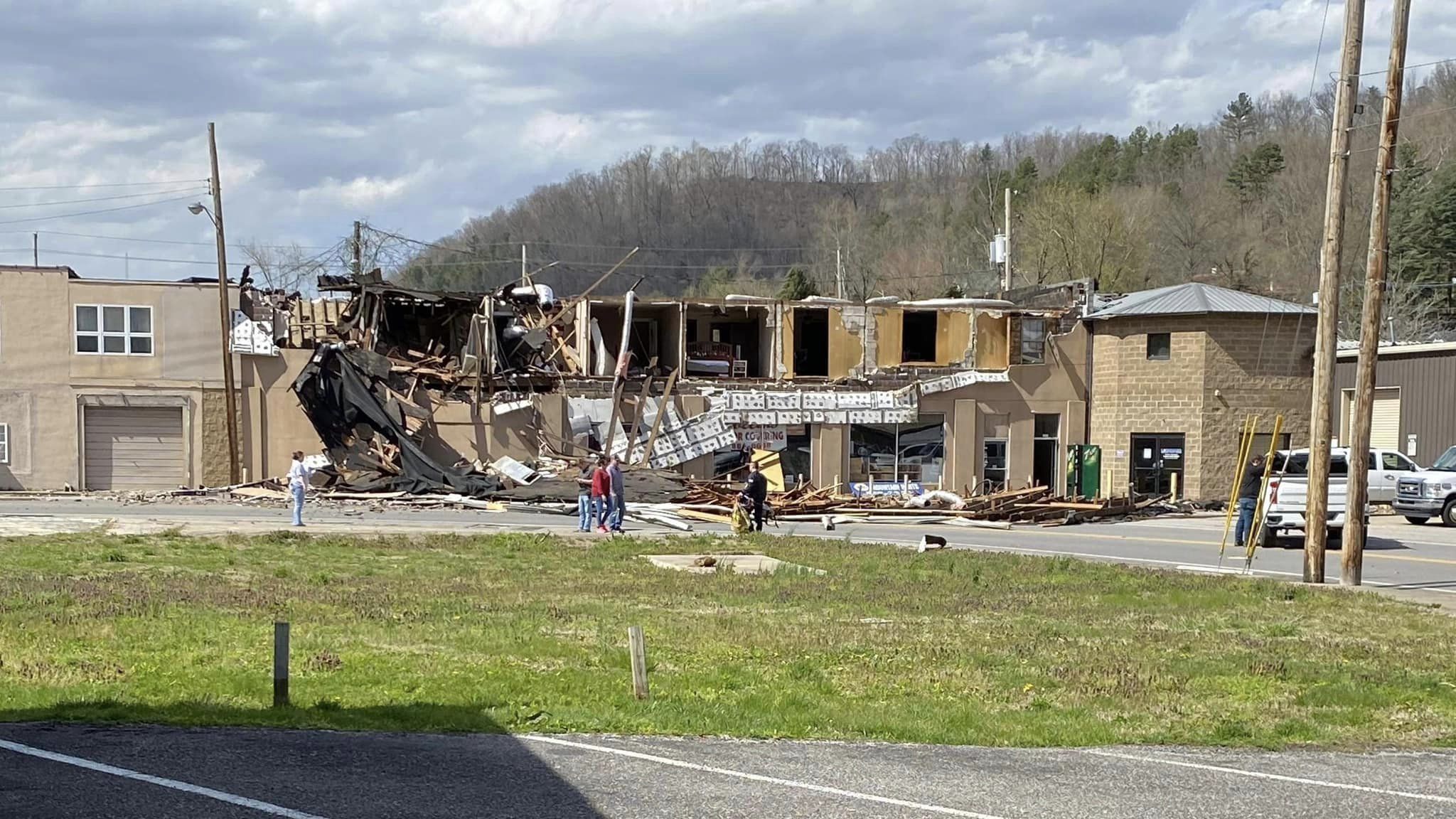
After an intense wind storm in early March, strong to damaging winds once again struck eastern Kentucky on April 1st. Another unseasonably intense low pressure system tracked from the Upper Midwest to across the Great Lakes, pulling a cold front across the area during the wee morning hours of April 1st. Storms along the front put down torrential downpours with pockets of strong gusty winds. This led to a few instances of poor drainage/small stream flooding as well as downed trees before sunrise. However, the more significant weather arrived mid to late morning as skies cleared and southwesterly winds increased sharply ahead of the storm system's secondary cold front. During the midday to mid afternoon hours, southwesterly wind gusts peaked between 30 and 50 mph in many of the valley locations with gusts of 55 to 60 mph commonly being observed in the more open countryside and atop ridges. The strongest reported gust, 70 mph, was observed at a Kentucky Mesonet station atop Flatwoods (elevation 2,774 feet ASL) in Pike County. The strong to damaging winds resulted in many trees being blown down onto power lines and snapped power poles. Power outages exceeded more than 50,000 customers across the Commonwealth. A vast majority of those outages were reported in eastern Kentucky and were most concentrated in the eastern Kentucky Coalfield. Kentucky Power, which covers much of southeast Kentucky, took 3+ days to restore power in their service area. Repairs included replacing at least 79 power poles, 30 miles of power lines, 70 cross arms, and 44 transformers. The Big Sandy RECC also took at least two days to restore power to 3,171 of its approximately 12,500 customers. Aside from damage to power infrastructure, two individuals reportedly sustained injuries during the high wind event -- a branch struck a hiker near Natural Bridge and another tree fell on a fire truck in Letcher County. There were also numerous reports of downed trees and multiple instances of structural damage. The most notable building damage was reported in Floyd County where the Triple A Market in Martin lost its roof and an apartment building in Prestonsburg partially collapsed. |
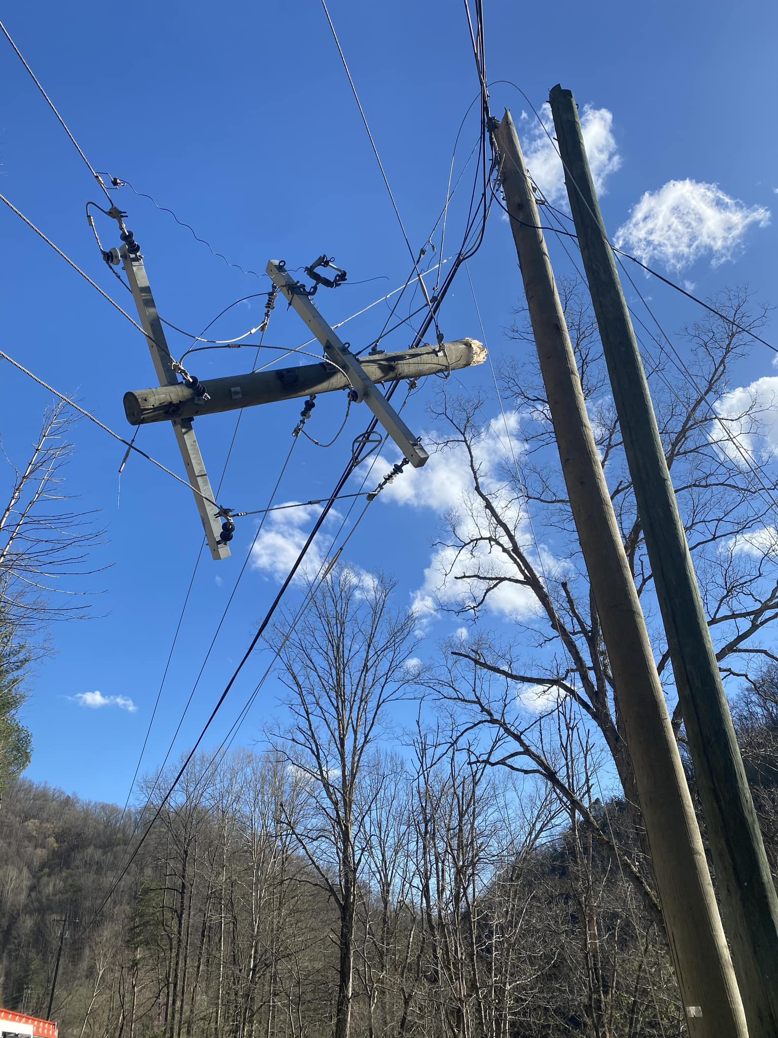 Power Pole Snapped on Spurlock Creek (Floyd County) (Courtesy of Big Sandy RECC) |
Photos
 |
 |
| Partially Collapsed Apartment Building in Prestonsburg (Floyd County) (Courtesy of Mountain Top News) |
Roof Debris from Triple A Market in Martin (Floyd County) (Courtesy of Martin City Police Department) |
 |
 |
 |
 |
| Colson VFD Truck after Struck By Falling Tree (Letcher County) (Courtesy of Colson VFD) |
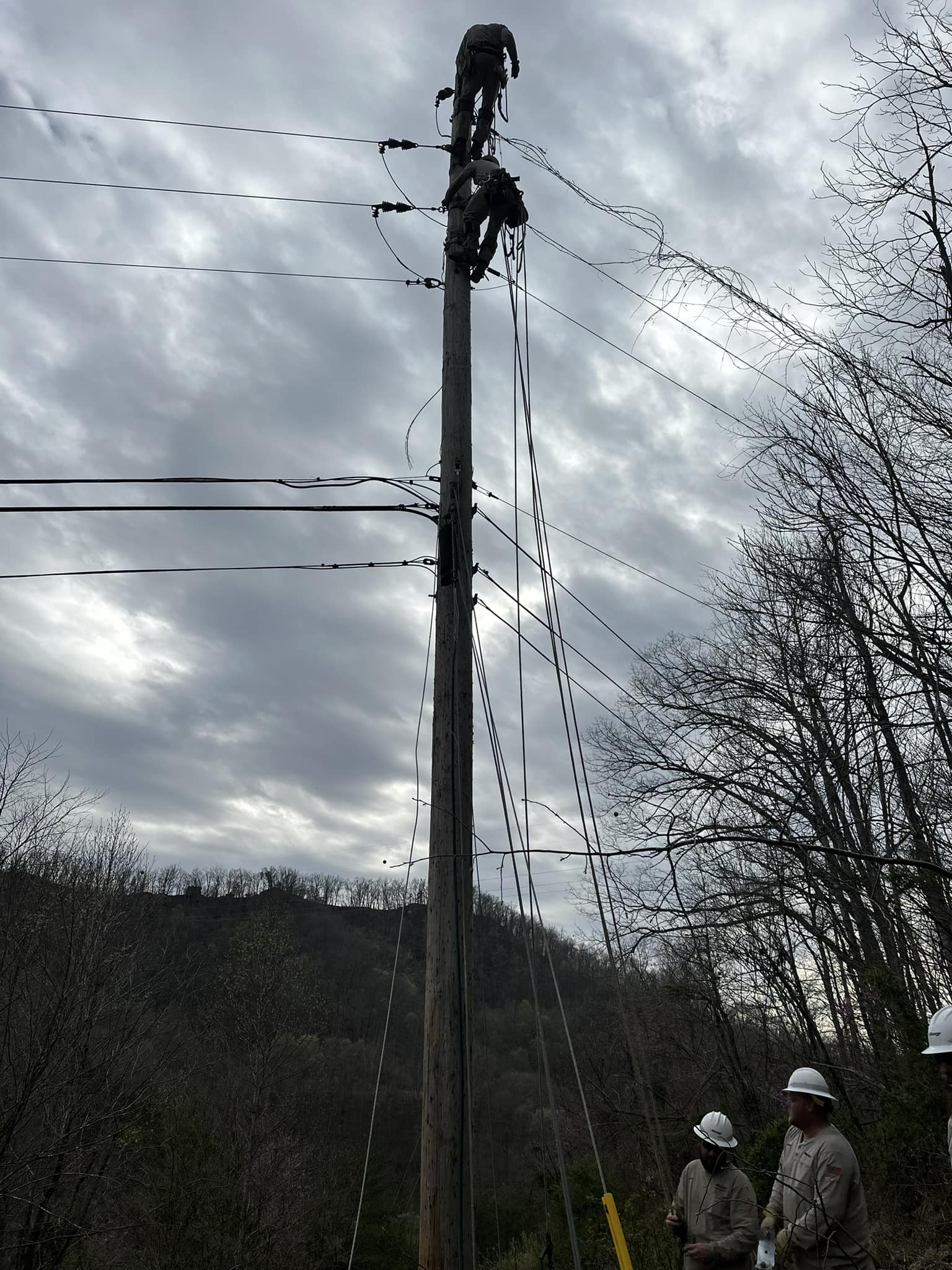
Lineman Climbing a Power Pole near Jenny Wiley (Floyd County) (Courtesy of Big Sandy RECC)) |
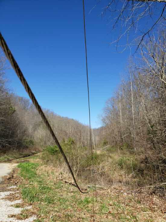
Down Power Line at Greasy (Pike County) (Courtesy of Big Sandy RECC) |
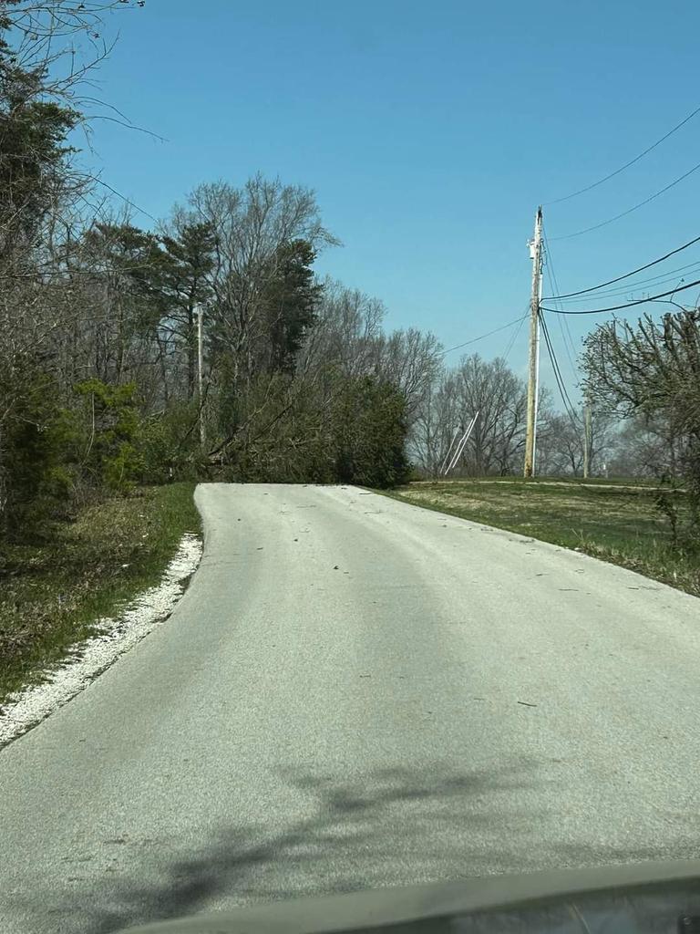
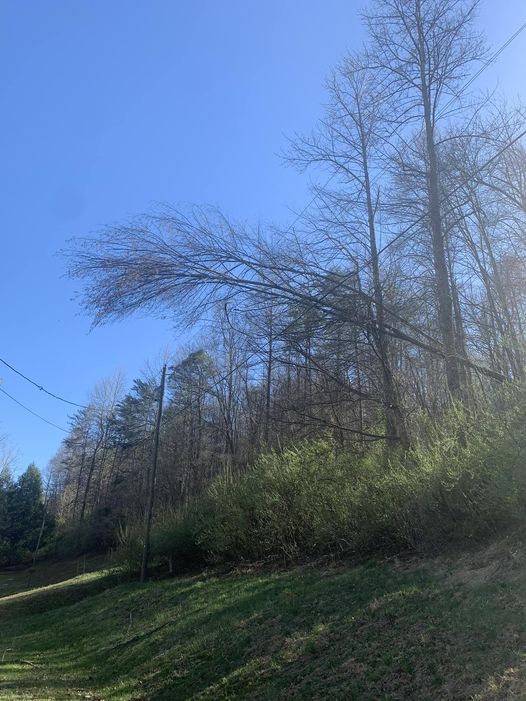
Tree over Road at Happy Top (Powell County) (Courtesy of Johnny Ray Feltner) |
 |
 |
 |
 |
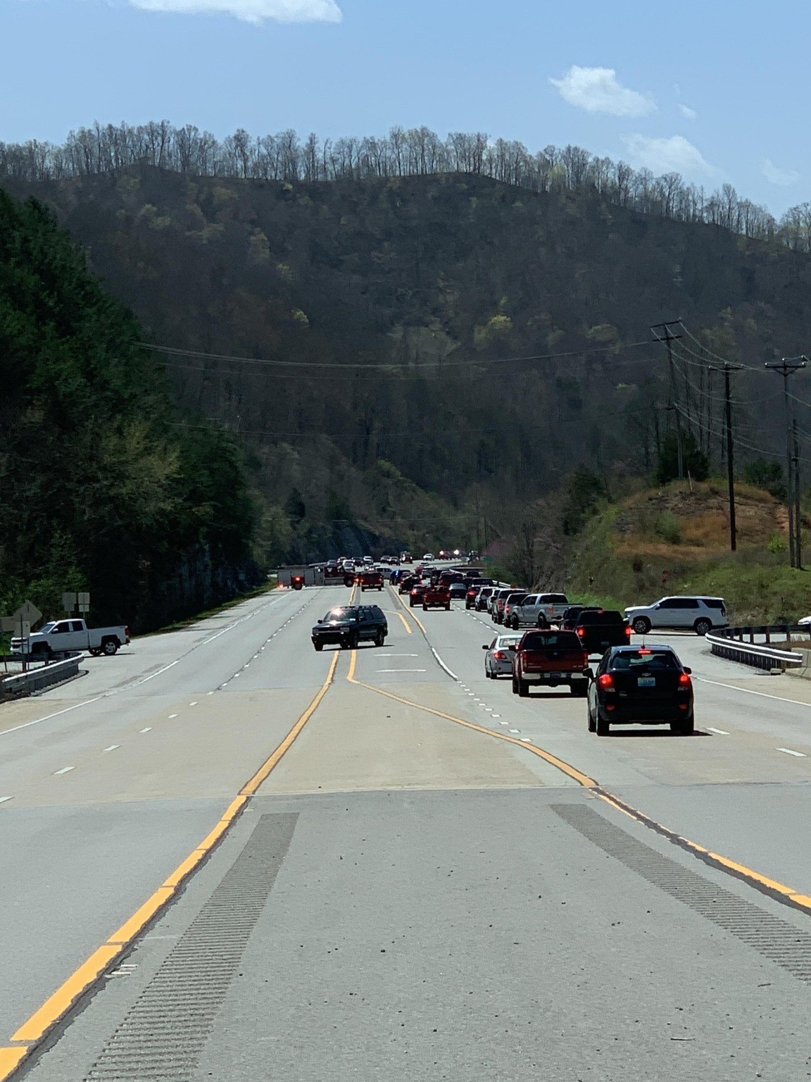
| Traffic Jam on KY-80 Due to Down Power Line (Floyd County) (Courtesy of Martin City Police Department) |
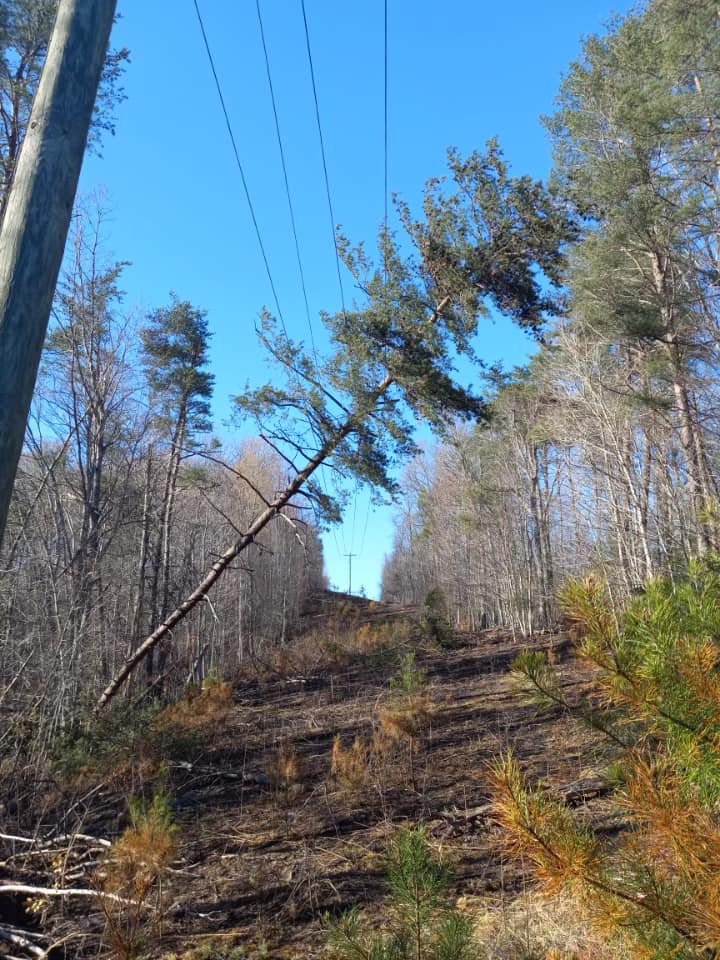
Large Pine on Power Line near Elna (Johnson County) (Courtesy of Big Sandy RECC) |
Large Pine on Power Line at Jenny Wiley (Floyd County) (Courtesy of Big Sandy RECC)) |
Large Pine on Power Line near Copperas Lick (Floyd County) (Courtesy of Big Sandy RECC) |
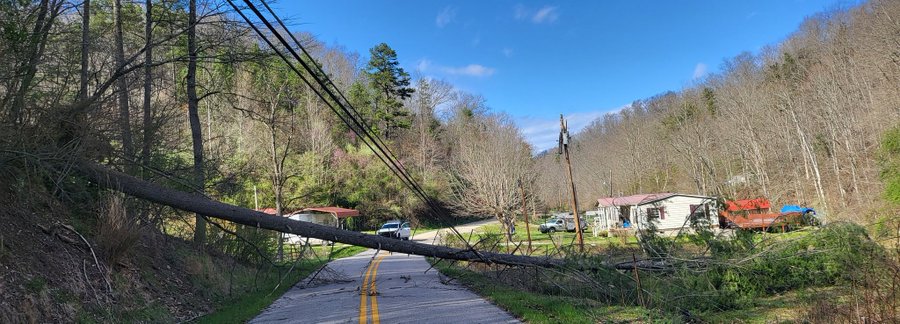 |
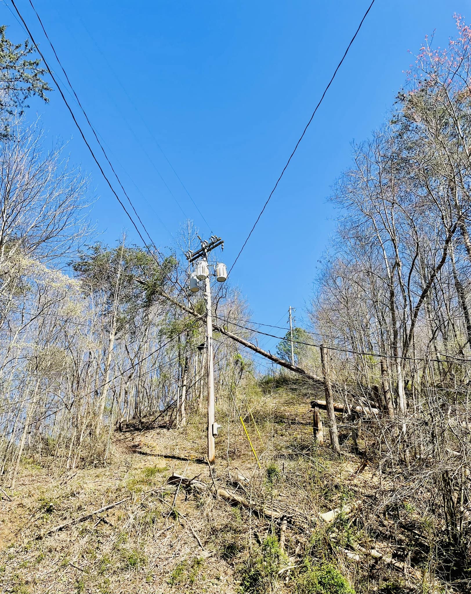
| Tree over Power Line and Roadway at Lakeside (Magoffin County) (Courtesy of Austin Gibson)) |
Peak Wind Gusts
...HIGHEST WIND GUST REPORTS ON SATURDAY, APRIL 1ST, 2023 (8 AM TO 6 PM EDT)...

Location                     Speed     Time/Date       Lat/Lon/Elev (ft.)

...Kentucky...

...Bath County...
Owingsville 4 S              55 MPH    1255 PM 04/01   38.09N/83.76W/829

...Bell County...
Middlesboro Apt              51 MPH    0415 PM 04/01   36.62N/83.73W/1154
Yellow Creek RAWS            41 MPH    0126 PM 04/01   36.60N/83.70W/1089

...Breathitt County...
NWS Jackson                  59 MPH    0148 PM 04/01   37.60N/83.32W/1382
Jackson 14 SE                54 MPH    0200 PM 04/01   37.43N/83.18W/1373
Jackson 14 ESE               32 MPH    1130 AM 04/01   37.46N/83.16W/833

...Clay County...
Peabody RAWS                 39 MPH    0101 PM 04/01   37.14N/83.58W/1464

...Estill County...
Irvine                       46 MPH    1145 AM 04/01   37.71N/84.07W/850

...Harlan County...
Harlan Apt                   51 MPH    0349 PM 04/01   36.87N/83.37W/1551
Gatun                        47 MPH    0139 PM 04/01   36.88N/83.31W/1850
Harlan 24 E                  46 MPH    0535 AM 04/01   36.92N/82.91W/4031

...Jackson County...
McKee 5 S                    43 MPH    0220 PM 04/01   37.36N/83.97W/1319

...Johnson County...
Paintsville 4 W              33 MPH    0305 PM 04/01   37.83N/82.88W/755

...Knott County...
Hindman 5 N                  61 MPH    0210 PM 04/01   37.41N/82.99W/1556

...Knox County...
Barbourville 3 E             40 MPH    0200 PM 04/01   36.87N/83.83W/1016

...Laurel County...
London-Corbin Apt            59 MPH    0123 PM 04/01   37.08N/84.07W/1212

...Letcher County...
Payne Gap 1 NE               58 MPH    0255 PM 04/01   37.17N/82.65W/1821
Whitesburg 2 NW              39 MPH    0150 PM 04/01   37.13N/82.84W/1152

...Martin County...
Big Sandy Apt                46 MPH    1255 PM 04/01   37.75N/82.63W/1221
Big Sandy RAWS               44 MPH    0156 PM 04/01   37.75N/82.63W/1180

...McCreary County...
Whitley City 3 N             49 MPH    0105 PM 04/01   36.77N/84.48W/1312

...Menifee County...
Frenchburg 6 SSW             39 MPH    0320 PM 04/01   37.87N/83.65W/1253

...Montgomery County...
Mount Sterling Apt           47 MPH    0235 PM 04/01   38.05N/83.98W/1020

...Morgan County...
West Liberty 2 SW            53 MPH    0240 PM 04/01   37.90N/83.27W/1071
Wellington                   45 MPH    1215 PM 04/01   37.97N/83.43W/1129

...Owsley County...
Booneville 2 S               44 MPH    0230 PM 04/01   37.45N/83.69W/784

...Perry County...
Hazard Apt                   47 MPH    0355 PM 04/01   37.39N/83.26W/1256
Jeff 2 E                     42 MPH    0449 PM 04/01   37.20N/83.10W/1289

...Pike County...
Pikeville 13 S               70 MPH    1250 PM 04/01   37.28N/82.52W/2774
Pike County Apt              48 MPH    0455 PM 04/01   37.57N/82.57W/1473
Board Tree 1 W               45 MPH    0429 PM 04/01   37.54N/82.19W/900
Kimper 3 NNW                 42 MPH    0309 PM 04/01   37.54N/82.37W/853

...Pulaski County...
Somerset 7 NNE               54 MPH    0225 PM 04/01   37.18N/84.56W/1085
Somerset Apt                 51 MPH    1255 PM 04/01   37.05N/84.62W/927
Somerset RAWS                50 MPH    0101 PM 04/01   37.05N/84.61W/921

...Rockcastle County...
Wabo                         58 MPH    0209 PM 04/01   37.31N/84.39W/1181

...Rowan County...
Triangle Mtn RAWS            54 MPH    0102 PM 04/01   38.18N/83.41W/1359
Morehead 4 NE                47 MPH    0325 PM 04/01   38.22N/83.48W/851
Morehead Apt                 46 MPH    1215 PM 04/01   38.22N/83.58W/1028

...Wayne County...
Monticello                   52 MPH    0230 PM 04/01   36.96N/84.83W/921
Monticello 4 NW              51 MPH    1230 PM 04/01   36.87N/84.90W/1045

...Whitley County...
Williamsburg Apt             49 MPH    1255 PM 04/01   36.80N/84.20W/1178
Williamsburg                 47 MPH    0327 PM 04/01   36.84N/84.21W/1236

...Wolfe County...
Koomer Ridge RAWS            55 MPH    1209 PM 04/01   37.78N/83.63W/1299
Storm Damage Reports
..TIME...   ...EVENT...      ...CITY LOCATION...     ...LAT.LON...
..DATE...   ....MAG....      ..COUNTY LOCATION..ST.. ...SOURCE....
            ..REMARKS..

1125 AM     Non-Tstm Wnd Dmg 2 WSW Galen             37.88N 82.84W
04/01/2023                   Johnson            KY   Public

            Report of multiple trees down near the Sitka
            Church along Route 201.

1130 AM     Non-Tstm Wnd Dmg Preston                 38.09N 83.75W
04/01/2023                   Bath               KY   911 Call Center

            A tree was reported to have been blown down
            in the vicinity of Preston. The time of the
            event is estimated.

1130 AM     Non-Tstm Wnd Dmg 2 SE Sextons Creek      37.30N 83.76W
04/01/2023                   Clay               KY   Emergency Mngr

            A tree was reported to have been blown down
            on Ellis Branch. The time of the event is
            radar estimated.

1130 AM     Non-Tstm Wnd Dmg 4 SSW Dice              37.31N 83.25W
04/01/2023                   Perry              KY   911 Call Center

            A tree was reported to have been blown down
            near the intersection of KY 15 and
            Entertainment Drive.

1140 AM     Non-Tstm Wnd Dmg 1 SSW Hoskinston        37.06N 83.40W
04/01/2023                   Leslie             KY   911 Call Center

            A tree was blown down along US 421 about 10
            miles south of Hyden. The time of the event
            is estimated.

1145 AM     Non-Tstm Wnd Dmg Annville                37.32N 83.96W
04/01/2023                   Jackson            KY   911 Call Center

            2 occurrences of powerlines blown down
            leading to fires in the Annville community.
            The time of the event is estimated from
            nearby wind gusts.

1145 AM     Non-Tstm Wnd Dmg 2 SSW Wooton            37.16N 83.32W
04/01/2023                   Leslie             KY   Emergency Mngr

            A tree was reported down along KY 80 East.
            The time of the event is radar estimated.

1145 AM     Non-Tstm Wnd Dmg Tabor                   37.91N 83.66W
04/01/2023                   Menifee            KY   911 Call Center

            A tree was reported to have been blown down.

1145 AM     Non-Tstm Wnd Dmg Farmers                 38.14N 83.55W
04/01/2023                   Rowan              KY   911 Call Center

            A tree was reported to have been blown down
            along Old US 60.

1150 AM     Non-Tstm Wnd Dmg 2 NW Pelfrey            38.13N 83.42W
04/01/2023                   Rowan              KY   911 Call Center

            A tree was reported to have been blown down
            on KY 519.

1155 AM     Non-Tstm Wnd Dmg Tyner                   37.34N 83.90W
04/01/2023                   Jackson            KY   911 Call Center

            A powerline was blown down leading to a fire
            in the Tyner community. The time of the
            event is estimated from nearby wind gusts.

1155 AM     Non-Tstm Wnd Dmg Gray Hawk               37.39N 83.94W
04/01/2023                   Jackson            KY   911 Call Center

            A powerline was blown down leading to a fire
            in the Gray Hawk community. The time of the
            event is estimated from nearby wind gusts.

1155 AM     Non-Tstm Wnd Dmg 2 N Denniston           37.94N 83.53W
04/01/2023                   Menifee            KY   911 Call Center

            A tree was reported to have been blown down
            around noon.

1200 PM     Non-Tstm Wnd Dmg Barbourville            36.87N 83.89W
04/01/2023                   Knox               KY   911 Call Center

            Multiple reports of trees down in
            Barbourville and throughout Knox County
            beginning around noon.

1200 PM     Non-Tstm Wnd Dmg 1 ENE Natural Bridge St 37.78N 83.67W
04/01/2023                   Powell             KY   Fire Dept/Rescue

            *** 1 INJ ***
            Per Powell County Search and Rescue, a hiker
            was struck by a falling branch on the
            Whittleton Branch Campground hiking trail
            and fell unconscious while pinned underneath
            the branch. First responders were able to
            successfully get the hiker out for further
            treatment.

1200 PM     Non-Tstm Wnd Dmg 1 NE Williamsburg       36.74N 84.16W
04/01/2023                   Whitley            KY   911 Call Center

            Multiple reports of trees and powerlines
            down in Williamsburg and throughout Whitely
            County beginning around noon.

1210 PM     Non-Tstm Wnd Dmg 1 S Mount Vernon        37.35N 84.34W
04/01/2023                   Rockcastle         KY   911 Call Center

            A tree was reported to have been blown down.

1212 PM     Non-Tstm Wnd Dmg Barnetts Creek          37.83N 82.88W
04/01/2023                   Johnson            KY   911 Call Center

            Report of multiple trees and powerlines down
            near Pickle Fork at Route 40 W.

1220 PM     Non-Tstm Wnd Dmg 2 W Somerset Pulaski Co 37.06N 84.64W
04/01/2023                   Pulaski            KY   911 Call Center

            Trees and powerlines were reported down near
            the Intersection of W Oak Hill Road and KY
            914.

1230 PM     Non-Tstm Wnd Dmg 1 WSW Twentysix         37.94N 83.37W
04/01/2023                   Morgan             KY   911 Call Center

            A tree was reported to have been blown down
            on KY 772.

1230 PM     Non-Tstm Wnd Dmg 2 SSE Bulan             37.27N 83.15W
04/01/2023                   Perry              KY   911 Call Center

            A tree was reported to have been blown down
            onto powerlines about 3 miles up Upper
            Second Creek.

1230 PM     Non-Tstm Wnd Dmg 1 SSW Saul              37.26N 83.50W
04/01/2023                   Perry              KY   911 Call Center

            A tree was reported to have been blown down
            onto powerlines in the Saul community and
            led to a forest fire.

1240 PM     Non-Tstm Wnd Dmg 1 N Renfro Valley       37.40N 84.33W
04/01/2023                   Rockcastle         KY   911 Call Center

            A tree was blown down at the KOA campground.

1245 PM     Non-Tstm Wnd Dmg Alphoretta              37.56N 82.76W
04/01/2023                   Floyd              KY   Public

            Roofing material was blown off of a business
            in the city of Martin.

1245 PM     Non-Tstm Wnd Dmg 1 W Lick Branch         37.96N 83.25W
04/01/2023                   Morgan             KY   911 Call Center

            A tree was reported to have been blown down
            along KY 1161.

1250 PM     Non-Tstm Wnd Dmg 2 WNW Jeffersonville    37.98N 83.85W
04/01/2023                   Montgomery         KY   Public

            Two trees were reported to have been blown
            down at a residence. Time of the event is
            estimated.

1252 PM     Non-Tstm Wnd Dmg 1 SE Stidham            37.88N 82.58W
04/01/2023                   Martin             KY   911 Call Center

            Multiple trees reported down along Tomahawk
            Rd NW or Inez.

1255 PM     Non-Tstm Wnd Dmg 3 N Blue Heron          36.72N 84.55W
04/01/2023                   McCreary           KY   911 Call Center

            A tree was reported to have been blown down
            on KY 1363 near Yamacraw. The even time is
            estimated from nearby wind gust
            observations.

0100 PM     Non-Tstm Wnd Dmg Preston                 38.09N 83.75W
04/01/2023                   Bath               KY   911 Call Center

            Trees were again reported to have been blown
            down in the Preston vicinity. The event time
            is estimated.

0100 PM     Non-Tstm Wnd Dmg Marshes Siding          36.74N 84.48W
04/01/2023                   McCreary           KY   911 Call Center

            A tree was reported to have been blown down
            at Marshes Siding.

0110 PM     Non-Tstm Wnd Dmg 3 SW Hollyhill          36.63N 84.37W
04/01/2023                   McCreary           KY   911 Call Center

            A tree was reported to have been blown down
            in the Hay Creek Community.

0110 PM     Non-Tstm Wnd Dmg 2 ESE Strunk            36.62N 84.40W
04/01/2023                   McCreary           KY   911 Call Center

            A tree was reported to have been blown down
            on KY 1470 near Strunk.

0110 PM     Non-Tstm Wnd Dmg 1 WNW Steubenville      36.89N 84.82W
04/01/2023                   Wayne              KY   911 Call Center

            A utility line was reported to have been
            blown down.

0115 PM     Non-Tstm Wnd Dmg 1 SSE Hardy             37.60N 82.23W
04/01/2023                   Pike               KY   Emergency Mngr

            A tree was reported to have been blown down
            on an occupied vehicle.

0115 PM     Non-Tstm Wnd Dmg 1 SSE Morehead          38.18N 83.44W
04/01/2023                   Rowan              KY   911 Call Center

            Multiple trees were reported to have been
            blown down in Morehead along with powerlines
            down between 1 and 130 PM.

0120 PM     Non-Tstm Wnd Dmg Kellioka                36.90N 83.25W
04/01/2023                   Harlan             KY   Public

            Roofing material was blown off of a carport
            at a residence.

0130 PM     Non-Tstm Wnd Dmg Pleasureville           38.48N 83.60W
04/01/2023                   Fleming            KY   911 Call Center

            A tree was reported to have been blown down
            on Foxport Road. The event time is
            estimated.

0130 PM     Non-Tstm Wnd Dmg 1 S High Falls          37.71N 83.58W
04/01/2023                   Wolfe              KY   911 Call Center

            A powerline was blown down and caught some
            grass on fire along Sandy Ridge Road.

0140 PM     Non-Tstm Wnd Dmg 2 WSW Isonville         38.06N 83.08W
04/01/2023                   Elliott            KY   911 Call Center

            A tree was reported to have been blown down
            along KY 1621. A powerline was also blown
            down in the vicinity that led to a fire. The
            event time is estimated and occurred before
            2 PM.

0145 PM     Non-Tstm Wnd Dmg 1 ENE Culver            38.09N 82.98W
04/01/2023                   Elliott            KY   911 Call Center

            A tree was reported to have been blown down
            near the intersection of Wallow Hole Road KY
            486. The event time is estimated.

0145 PM     Non-Tstm Wnd Dmg 2 ENE Stark             38.18N 83.09W
04/01/2023                   Elliott            KY   911 Call Center

            A tree was reported to have been blown down
            along KY 504. The time of the event is
            estimated.

0145 PM     Non-Tstm Wnd Dmg Bethany                 37.65N 83.47W
04/01/2023                   Wolfe              KY   911 Call Center

            A tree was reported to have been blown down.

0150 PM     Non-Tstm Wnd Dmg 1 ENE Spout Springs     37.84N 83.95W
04/01/2023                   Powell             KY   Public

            A large pine tree was blown down onto and
            blocking Happy Top Road.

0200 PM     Non-Tstm Wnd Dmg 1 SSW Indian Lakes Park 37.39N 84.47W
04/01/2023                   Rockcastle         KY   911 Call Center

            A tree was reported to have been blown down.

0300 PM     Non-Tstm Wnd Dmg 1 NW Ferndale           36.70N 83.69W
04/01/2023                   Bell               KY   911 Call Center

            Dispatcher noted that trees and powerlines
            were blown down near Ferndale off of 25E
            around 3 PM.

0300 PM     Non-Tstm Wnd Dmg 1 ESE Fairview          38.44N 83.91W
04/01/2023                   Fleming            KY   911 Call Center

            A tree was reported down on Ewing Road
            around 12 highway miles from Flemingsburg.
            The event time is estimated.

0300 PM     Non-Tstm Wnd Dmg Deane                   37.24N 82.78W
04/01/2023                   Letcher            KY   Fire Dept/Rescue

            *** 1 INJ ***
            Per Colson Volunteer Fire Department, a
            volunteer firefighter operating the CFD
            Engine-1 was injured when a tree fell off
            the side of a hill and struck the vehicle.
            The firefighter sustained a concussion and
            abrasion to the head and was transported to
            the ER for treatment.

0325 PM     Non-Tstm Wnd Dmg 1 W Ravenna             37.69N 83.96W
04/01/2023                   Estill             KY   Utility Company

            KY 1645 closed due to downed power lines.
            Time is approximate.

0330 PM     Non-Tstm Wnd Dmg 1 SSW Prestonsburg      37.67N 82.77W
04/01/2023                   Floyd              KY   Broadcast Media

            Social media pictures of apartment building
            missing the roof and a wall. Time is
            approximate.

0335 PM     Non-Tstm Wnd Dmg 2 WNW Billows           37.18N 84.33W
04/01/2023                   Pulaski            KY   911 Call Center

            Trees were reported to have been blown onto
            the roadway near this location prior to 347
            PM. Additional trees and powerlines were
            reported down in the vicinity during the
            afternoon.

0400 PM     Non-Tstm Wnd Dmg Evarts                  36.87N 83.19W
04/01/2023                   Harlan             KY   911 Call Center

            Multiple utility lines down along HWY 38
            near Evarts.

0405 PM     Non-Tstm Wnd Dmg 3 WSW Fincastle         37.63N 83.69W
04/01/2023                   Lee                KY   911 Call Center

            A tree was reported to have been blown down
            onto a powerline leading to a fire.

0412 PM     Non-Tstm Wnd Dmg Coalpoint               37.79N 82.44W
04/01/2023                   Martin             KY   911 Call Center

            Multiple trees down along N Wolf Creek.

0420 PM     Non-Tstm Wnd Dmg 1 NNE Lakesville        37.73N 83.06W
04/01/2023                   Magoffin           KY   Public

            Large pine tree blown down on KY1090. It
            took out the powerlines and part of a power
            pole. Time is approximate.

0430 PM     Non-Tstm Wnd Dmg 1 WNW Pomeroyton        37.88N 83.53W
04/01/2023                   Menifee            KY   911 Call Center

            A tree was reported to have been blown down.
            The event time is estimated.

0438 PM     Non-Tstm Wnd Dmg 1 NE Whitepost          37.74N 82.33W
04/01/2023                   Pike               KY   Public

            Roof blown into the road on KY 292. Time is
            approximate.

0440 PM     Non-Tstm Wnd Dmg 1 NNW Owingsville       38.15N 83.76W
04/01/2023                   Bath               KY   911 Call Center

            Trees were reported to have been blown down
            in the vicinity of Owingsville. The time of
            the event is estimated.

0440 PM     Non-Tstm Wnd Dmg Gordon Ford             37.89N 83.23W
04/01/2023                   Morgan             KY   911 Call Center

            A tree was blown down onto Steele Branch
            Road.

0445 PM     Non-Tstm Wnd Dmg Salt Lick               38.12N 83.62W
04/01/2023                   Bath               KY   911 Call Center

            A tree was reported to have been blown down
            in the Salt Lick vicinity. The event time
            is estimated.
Environment
Anomalously deep low pressure tracked from the Upper Midwest to Northeast on April 1st (Figure 1). Much drier air moved in behind a cold front during the morning hours (evident by the dew point gradient to our east in Figure 2). This caused skies to clear allowing for strong heating of the surface during the daylight hours. At the same time, low level cold air advection began cooling temperatures aloft (Figure 3). These combined phenomena caused lapse rates to become very steep at the low levels (Figure 4). At the same time, winds within several thousand feet above ground level (around 50 knots at 850 mb in Figure 3) remained very strong due to the departing low pressure's intensity. These winds were able to mix down to surface as the steepening low-level lapse rates caused the near surface air mass to become unstable. Wind speeds aloft diminished notably as the secondary cold front passed during the afternoon hours and that allowed for the strong wind gusts to subside toward from west to east later in the afternoon and evening.
 |
| Figure 1: Surface Analysis 11 PM March 31st through 8 PM April 1st |
 |
 |
 |
| Figure 2: Surface Temperature, Dewpoint, and Mean Sea Level Pressure at 2 PM April 1st | Figure 3: 850 mb Winds and Temperature Advection at 2 PM April 1st | Figure 4: Surface to 3 km Lapse Rates |
 |
Media use of NWS Web News Stories is encouraged! Please acknowledge the NWS as the source of any news information accessed from this site. |
|

