Overview
|
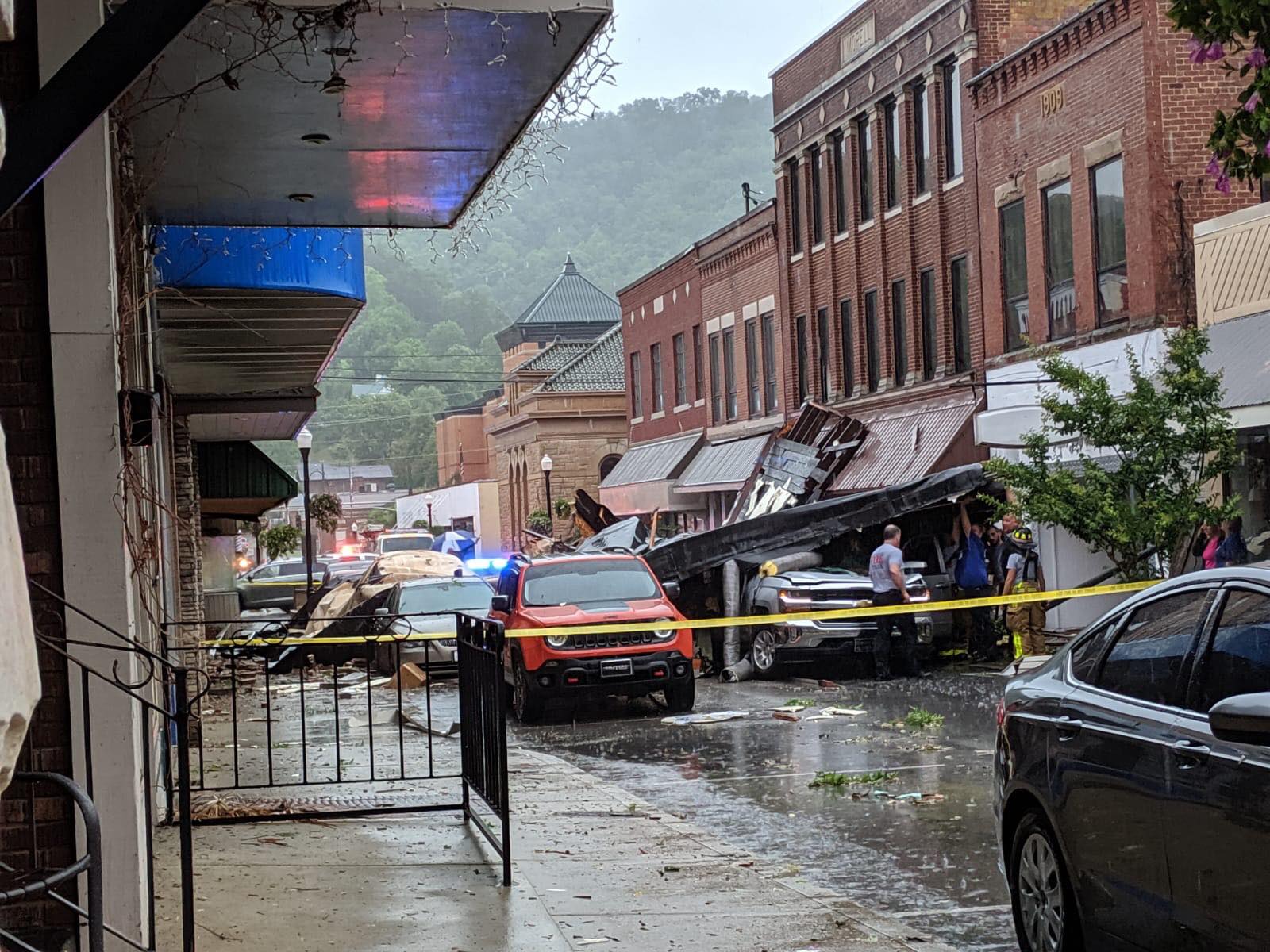
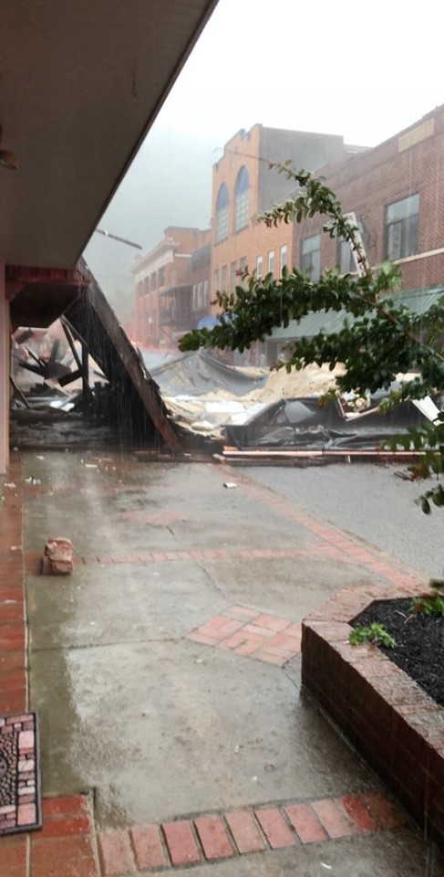
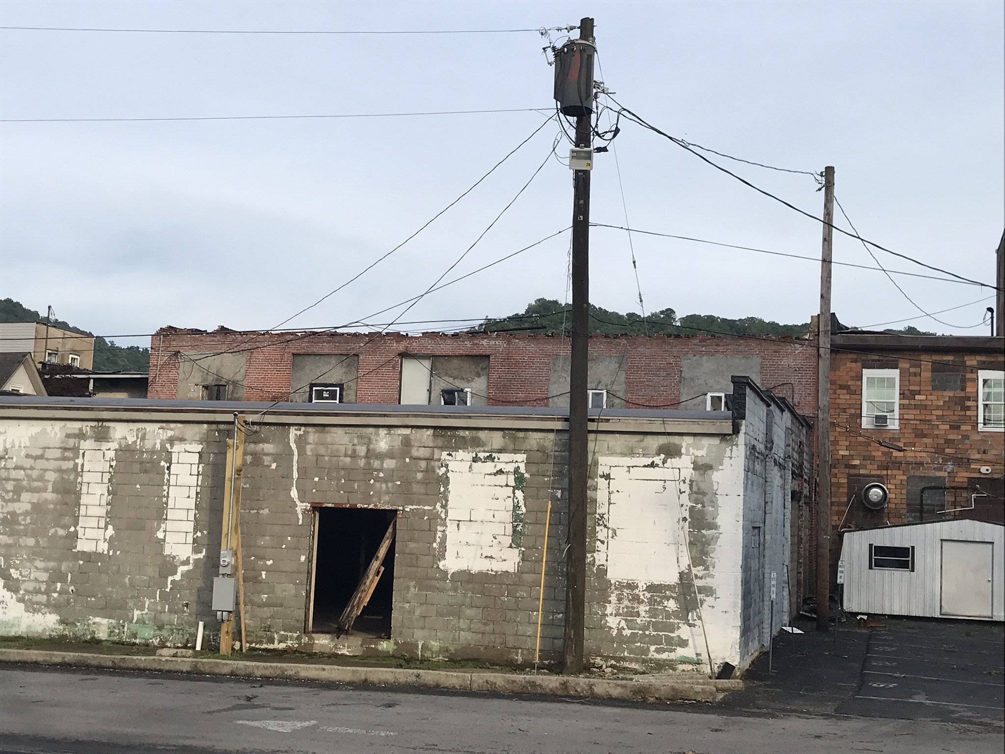
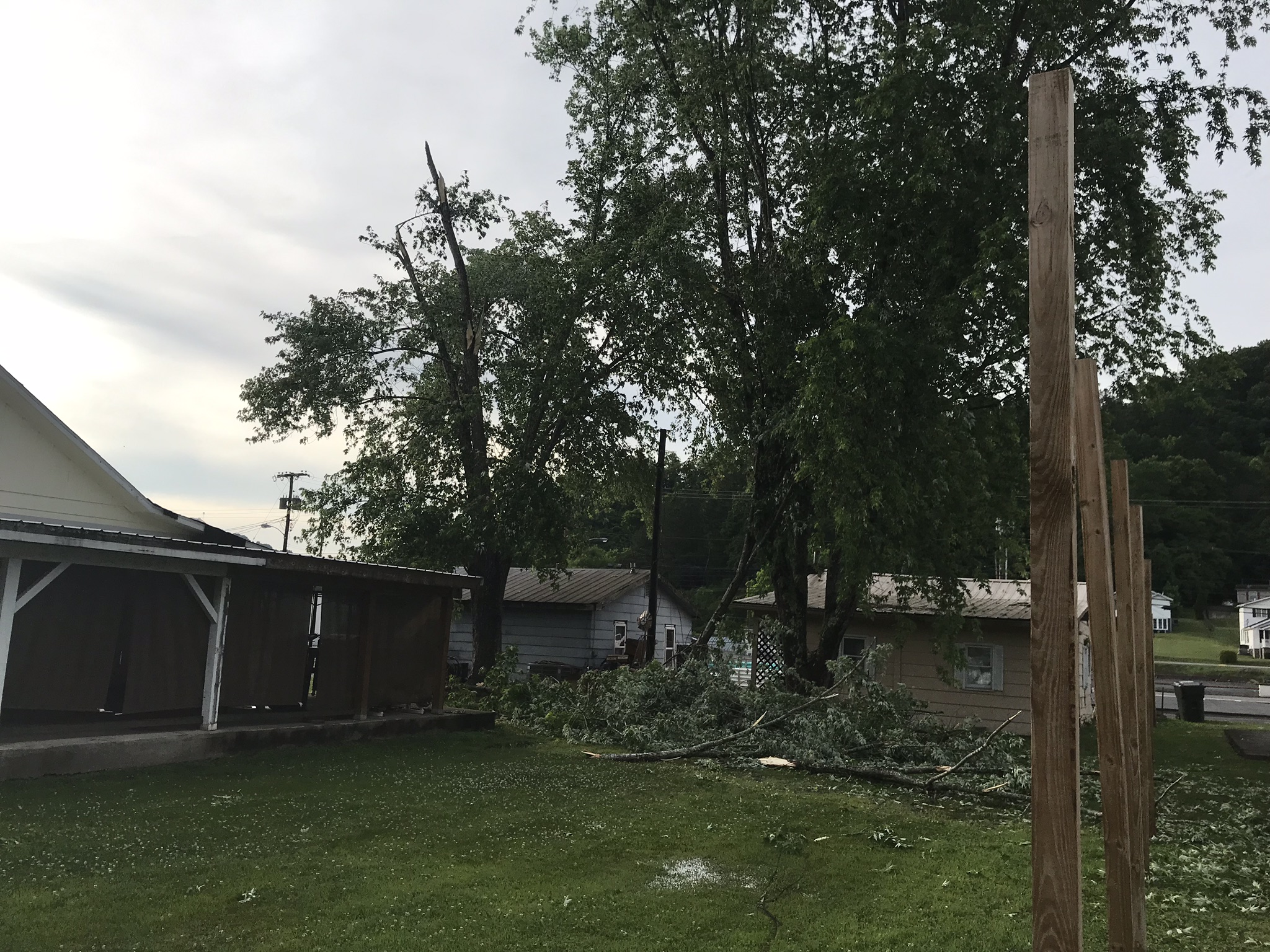
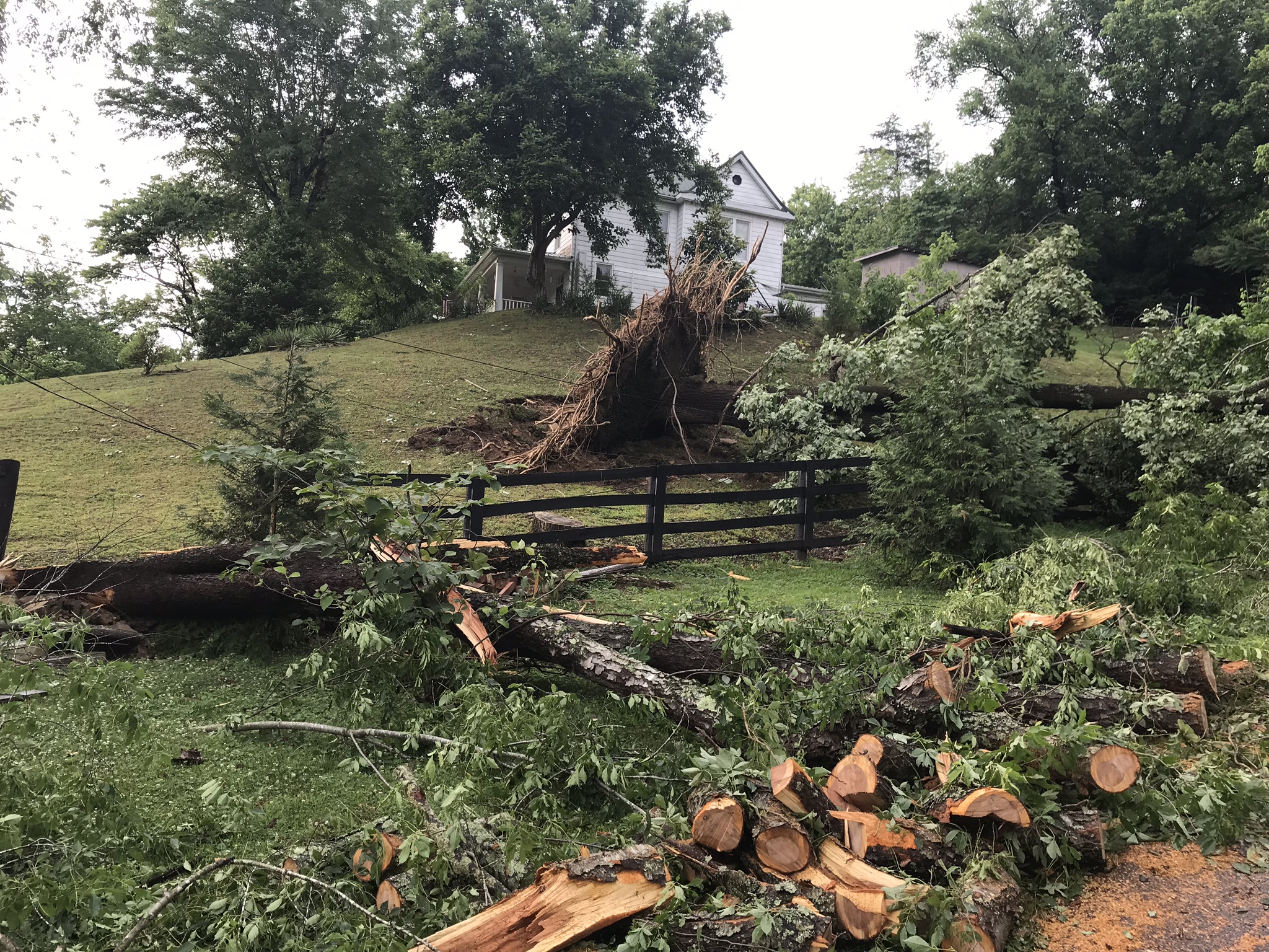
The combination of an upper level impulse and southward sagging frontal boundary out of the Ohio Valley brought a line of strong to severe thunderstorms across eastern Kentucky during the late morning and afternoon of May 29, 2019. The most intense of these storms moved through far eastern Kentucky, including Prestonsburg where a 70-80 mph downburst blew half the roof off of a hock shop building. A man driving on West Court Street was crushed by this roof, resulting in his death. Damage stretched for about 1 mile through the city. Severe winds blew out a few of the windows of a 2 story building on West Court Street, while a large healthy poplar tree was uprooted. Elsewhere, from West Liberty and Jackson eastward through Pike County, mainly tree damage was sustained. In Letcher County, a rotating supercell produced quarter to golf ball sized hail near Jenkins, while Somerset experienced isolated damage from a thunderstorm wind gust on the southwest flank of the line of storms. |
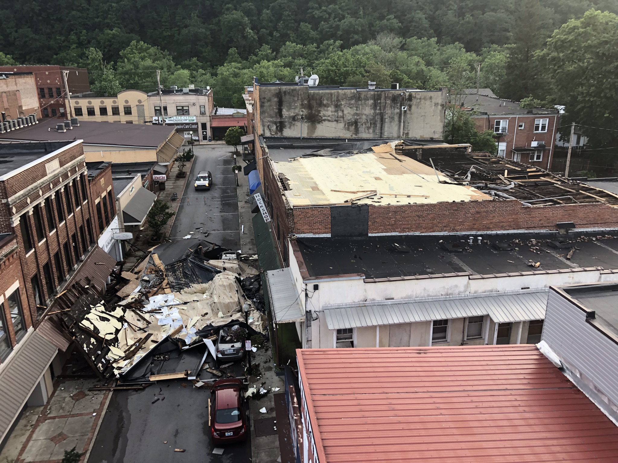 One half of the roof of a hock shop building blown onto West Court Street in Prestonsburg. Courtesy of the Prestonsburg Police Department. |
Prestonsburg Downburst
 |
 |
 |
| A portion of the roof of the hock shop on West Court Street. | Hock shop roof damage. Courtesy WYMT. | Windows blown out of the 2nd story of a building on West Court Street. |
 |
 |
 |
| Shingle damage at Court Street & Arnold Avenue. | Tree damage on South Lake Drive. | Poplar tree damage on South Highland Avenue. |
 |
| Map showing wind damage points across the city (green dots). |
PNSJKL
KYZ044-050>052-058>060-068-069-079-080-083>088-104-106>120-310330-
Public Information Statement...UPDATED
National Weather Service Jackson KY
1124 AM EDT Thu May 30 2019
...NWS DAMAGE SURVEY FOR 05/29/19 THUNDERSTORM WIND EVENT...
.THUNDERSTORM WIND PRESTONSBURG...
Peak wind /E/: 70-80 mph
Path length /Statute/: 1 mile
Path width /Maximum/: 440 yards
Fatalities: 1
Injuries: 0
Start date: May 29 2019
Start time: 2:11 PM EDT
Start location: Prestonsburg / Floyd County / KY
Start Lat/Lon: 37.6748/-82.7783
End date: May 29 2019
End time: 2:13 PM EDT
End location: Prestonsburg / Floyd County / KY
End lat/lon: 37.6656/-82.7658
SURVEY SUMMARY: U.S. National Weather Service meteorologist
surveyed localized downburst winds in Prestonsburg, Kentucky. This
caused sporadic damage throughout the community. The highest wind
gust estimated was in downtown Prestonsburg on West Court Street
where one half of the roof of a building was lifted off. This
roof landed on West Court Street, including on multiple vehicles,
fatally wounding one person in a moving vehicle. Glass was also
broken on multiple windows on the north side of the building.
There were a number of other buildings and homes with minor roof
or gutter damage nearby, as well as a couple of uprooted trees
near the downtown area. Wind speeds that uprooted a tree at a
residence on South Highland Avenue were estimated to be in the
upper end of the 70 to 80 mph range.
NOTE:
The information in this statement is PRELIMINARY and subject to
change pending final review of the event and publication in
NWS Storm Data.
$$
Photos
 |
 |
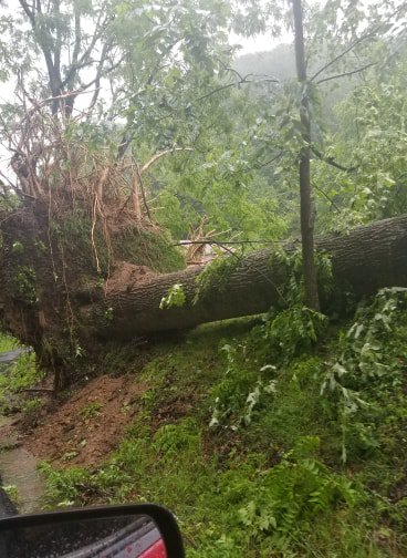 |
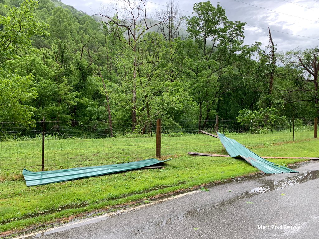
| Approximately golf ball sized hail in Jenkins. Courtesy of Rob Elkins. | Paneling/debris in Hatfield. Courtesy of Mary Reed Runyon. | Tree damage in the Mudlick Community of Pike County. Courtesy of WYMT. |
Radar
| 11 am - 5 pm, May 29th, 2019 Radar Loop. |
Storm Reports
| Local Storm Reports received from May 29, 2019 | ||
 |
||
Environment
 |
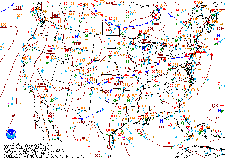 |
| Day 1 Convective Outlook Issued by Storm Prediction Center (SPC) in Norman, OK. | 8 pm Surface Analysis from Weather Prediction Center (WPC) in College Park, MD. |
 |
.gif) |
 |
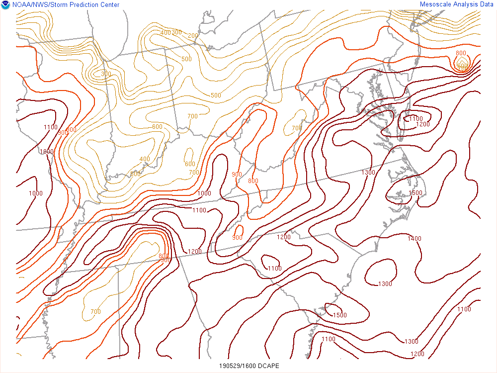
| The DCAPE (Downdraft CAPE) can be used to estimate the potential strength of rain-cooled downdrafts (damaging wind potential) within thunderstorms. Larger DCAPE values are associated with stronger downdrafts. Values around 1000 are generally considered favorable for strong winds. | Surface Based Convective Available Potential Energy, showning the magnitude of instability. | Effective Bulk Shear, higher values suggest a greater potential for organized/sustained storms. |
 |
Media use of NWS Web News Stories is encouraged! Please acknowledge the NWS as the source of any news information accessed from this site. |
|

