
Heat expands across the Desert Southwest, Plains, Mississippi Valley and Midwest into Monday. Fire weather concerns continue for portions of the Intermountain West. Active monsoonal moisture fuels thunderstorms over the Southwest with possible flash flooding. Tropical cyclone Fausto in the Pacific, should weaken as it approaches Hawaii; Dangerous surf, swells and rip currents are expected. Read More >
Jackson, KY
Weather Forecast Office
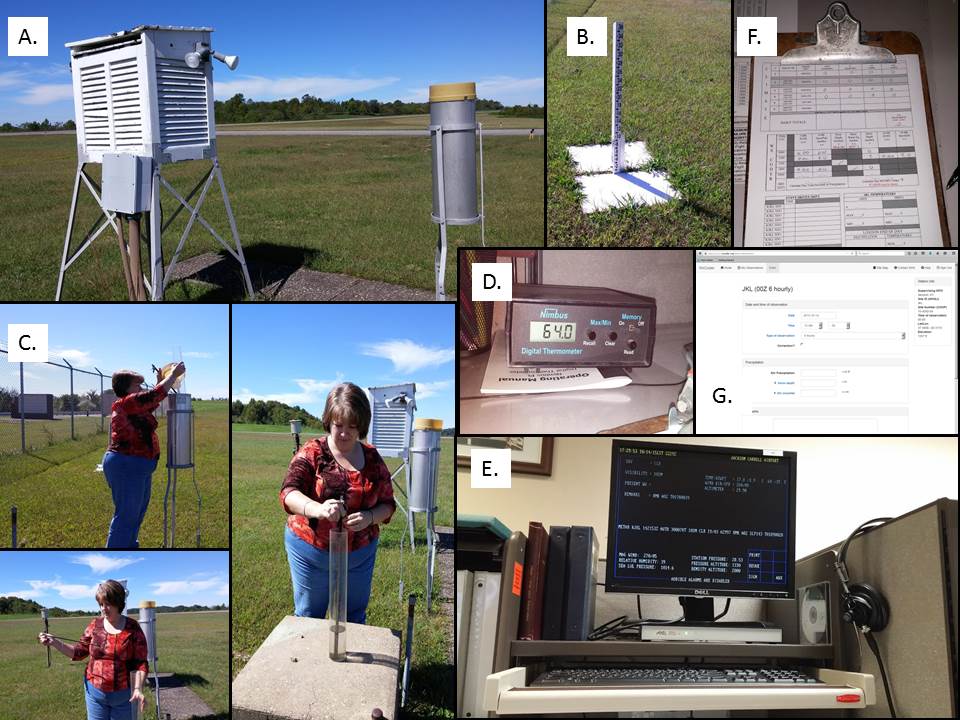
Weather observations are taken by forecasters and HMTs every six hours every day of the year. We will measure liquid precipitation, air temperature, and in the winter time we will also measure 6 hour snowfall and total snow depth. Shown here is our observation site (A and B), and our HMT Tabitha taking a rainfall measurement (C). After this is completed, we will review our temperatures using our Nimbus thermometer/display (D) as well as our automated weather station information (ASOS) (E). All measurements are then recorded (F) and sent to the web (G) for further use. If you would like to become part of a network of volunteer citizen observers, consider joining CoCoRaHs! https://www.cocorahs.org/application.aspx
Warnings/Hazards
Decision Support - Outlooks
Current Weather Hazards
Hazards Criteria
Weather Story Graphic
Recent Storm Reports
Submit a Report
Forecasts
Decision Support - Forecast
Aviation Forecasts
Fire Weather Forecasts
Hourly Weather Forecast
Activity Planner
River Forecasts
Forecast Discussion
Current Conditions
Regional Radar
Decision Support - Current
Rivers and Lakes
Hourly Airport Weather
Local Radar
Satellite
Kentucky Mesonet
Past Weather
Local Climate Info
Temp/Precip Summary
How Much Rain Fell?
How Much Snow Fell?
Past Weather Events
Drought Information
Local Coop Observers
US Dept of Commerce
National Oceanic and Atmospheric Administration
National Weather Service
Jackson, KY
1329 Airport Road
Jackson, KY 41339
606-666-8000
Comments? Questions? Please Contact Us.

