Jackson, KY
Weather Forecast Office
The National Weather Service (NWS) Jackson, #KYwx office will be conducting a required, scheduled update to the Advanced Weather Interactive Processing System (AWIPS) from Monday, June 23rd through Wednesday, June 25th. The NWS uses the AWIPS computer system to display and integrate weather and water information, and to send life-saving information, such as weather and water warnings, to the public.
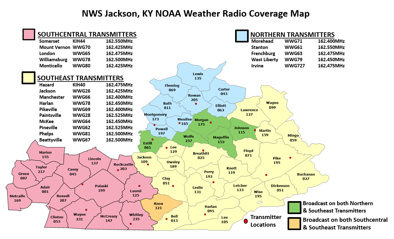
No impacts to our core services of forecast products and weather watches, warnings and advisories are expected during this period. The KJKL radar will remain operational and its products will continue to be distributed as normal. However, impacts will occur to the NOAA Weather Radio transmitters that are maintained by the NWS Jackson, KY office which serve southeast Kentucky. Beginning around 8 AM on Monday, June 23rd, all of the 20 NOAA Weather Radio broadcasts provided by the NWS Jackson, KY office will go offline for the duration of this update. A listing of NOAA Weather Radio transmitters that are broadcast from the NWS Jackson office can be found online at weather.gov/nwr/wfo_list?WFO=JKL Transmitters are expected to return to service sometime on Wednesday, June 25th. During periods of planned or unplanned outages it is important to have multiple ways to receive warning information. These alternative sources include: local television/radio, weather apps on your mobile device (such as the FEMA or Red Cross App), and the NWS website at weather.gov/jkl/.
Warnings/Hazards
Decision Support - Outlooks
Current Weather Hazards
Hazards Criteria
Weather Story Graphic
Recent Storm Reports
Submit a Report
Forecasts
Decision Support - Forecast
Aviation Forecasts
Fire Weather Forecasts
Hourly Weather Forecast
Activity Planner
River Forecasts
Forecast Discussion
Current Conditions
Regional Radar
Decision Support - Current
Rivers and Lakes
Hourly Airport Weather
Local Radar
Satellite
Kentucky Mesonet
Past Weather
Local Climate Info
Temp/Precip Summary
How Much Rain Fell?
How Much Snow Fell?
Past Weather Events
Drought Information
Local Coop Observers

US Dept of Commerce
National Oceanic and Atmospheric Administration
National Weather Service
Jackson, KY
1329 Airport Road
Jackson, KY 41339
606-666-8000
Comments? Questions? Please Contact Us.


 Follow us on X
 Follow us on Facebook
 Follow us on YouTube
 JKL RSS Feed