Jackson, KY
Weather Forecast Office
The stretch of above normal temperatures that began on January 10th should continue for about the next 2 Weeks. Precipitation should also be above normal during that period. Then, colder weather should return to end January and begin February. The latest Climate Predication Center 6 to 10 day and 8 to 14 day outlooks issued on Friday January 13th indicate very high probabilities of above normal temperatures and precipitation.
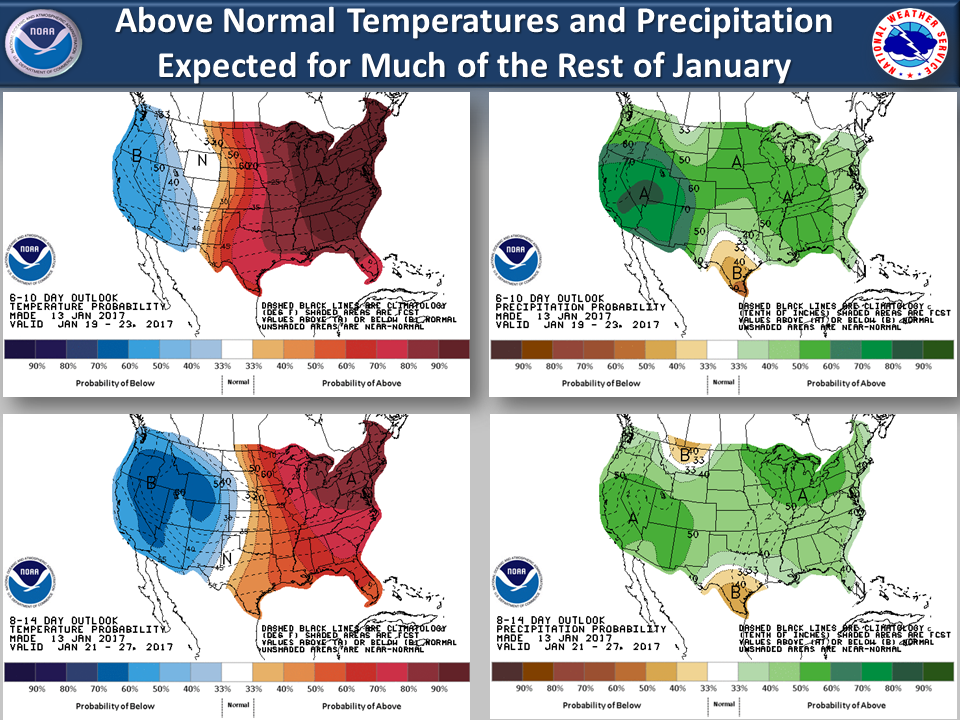
6 to 10 and 8 to 14 Day Temperature and Precipitation Outlooks Issued on Friday January 13, 2017
The latest Climate Predication Center Experimental Week 3-4 Outlooks also issued on Friday January 13th indicate high probabilities of below normal temperatures and precipitation to end January and begin February.
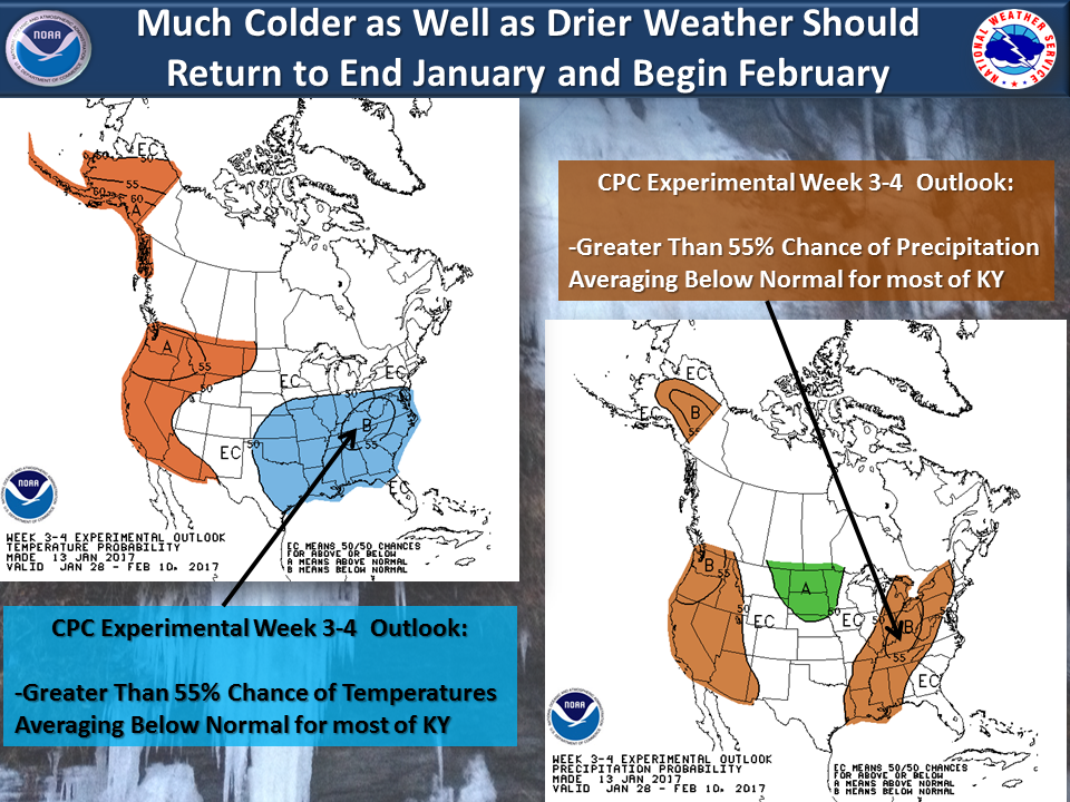
Experimental Week 3-4 Temperature and Precipitation Outlooks Issued on Friday January 13, 2017
Warnings/Hazards
Decision Support - Outlooks
Current Weather Hazards
Hazards Criteria
Weather Story Graphic
Recent Storm Reports
Submit a Report
Forecasts
Decision Support - Forecast
Aviation Forecasts
Fire Weather Forecasts
Hourly Weather Forecast
Activity Planner
River Forecasts
Forecast Discussion
Current Conditions
Regional Radar
Decision Support - Current
Rivers and Lakes
Hourly Airport Weather
Local Radar
Satellite
Kentucky Mesonet
Past Weather
Local Climate Info
Temp/Precip Summary
How Much Rain Fell?
How Much Snow Fell?
Past Weather Events
Drought Information
Local Coop Observers
US Dept of Commerce
National Oceanic and Atmospheric Administration
National Weather Service
Jackson, KY
1329 Airport Road
Jackson, KY 41339
606-666-8000
Comments? Questions? Please Contact Us.

