Jackson, KY
Weather Forecast Office
|
|
 |
 |
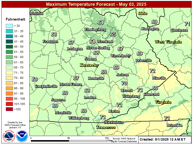 |
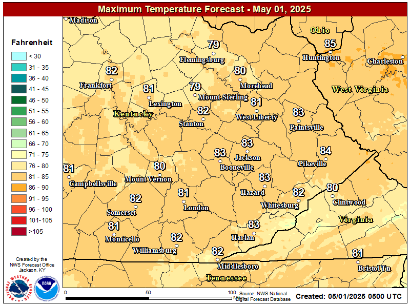
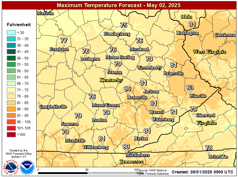
| Day 1 Max Temp | Day 2 Max Temp | Day 3 Max Temp |
784
WWUS83 KJKL 080045 AAA
SPSJKL

Special Weather Statement...UPDATED
National Weather Service Jackson KY
845 PM EDT Thu May 7 2026

KYZ044-050>052-058>060-104-081200-
Fleming-Montgomery-Bath-Rowan-Estill-Powell-Menifee-Elliott-
Including the cities of Flemingsburg, Camargo, Jeffersonville,
Mount Sterling, Owingsville, Morehead, Irvine, Ravenna,
Clay City, Stanton, Frenchburg, and Sandy Hook
845 PM EDT Thu May 7 2026

...Patchy Frost Possible...

With temperatures falling into the mid to upper 30s, light winds,
dry air, and clear skies, patchy frost could develop overnight
into Friday morning. Frost is most likely in rural valleys and
sheltered hollows. Those with sensitive plants outdoors may want
to consider taking action to protect them.

$$

GINNICK/GREIF


Warnings/Hazards
Decision Support - Outlooks
Current Weather Hazards
Hazards Criteria
Weather Story Graphic
Recent Storm Reports
Submit a Report
Forecasts
Decision Support - Forecast
Aviation Forecasts
Fire Weather Forecasts
Hourly Weather Forecast
Activity Planner
River Forecasts
Forecast Discussion
Current Conditions
Regional Radar
Decision Support - Current
Rivers and Lakes
Hourly Airport Weather
Local Radar
Satellite
Kentucky Mesonet
Past Weather
Local Climate Info
Temp/Precip Summary
How Much Rain Fell?
How Much Snow Fell?
Past Weather Events
Drought Information
Local Coop Observers
US Dept of Commerce
National Oceanic and Atmospheric Administration
National Weather Service
Jackson, KY
1329 Airport Road
Jackson, KY 41339
606-666-8000
Comments? Questions? Please Contact Us.

