Jackson, KY
Weather Forecast Office
 |
 |
 |
 |
 |
 |
888
WWUS73 KJKL 132350
NPWJKL
URGENT - WEATHER MESSAGE
National Weather Service Jackson KY
750 PM EDT Fri Mar 13 2026
KYZ044-050>052-058>060-068-069-104-106>112-114-119-120-140100-
/O.EXP.KJKL.WI.Y.0002.000000T0000Z-260314T0000Z/
Fleming-Montgomery-Bath-Rowan-Estill-Powell-Menifee-Rockcastle-
Jackson-Elliott-Morgan-Johnson-Wolfe-Magoffin-Floyd-Lee-Breathitt-
Owsley-Martin-Pike-
Including the cities of Salyersville, Morehead, Paintsville,
Irvine, Sandy Hook, Wheelwright, Inez, Mount Sterling, Clay City,
Pikeville, Ravenna, Flemingsburg, Beattyville, Frenchburg, McKee,
West Liberty, Owingsville, Elkhorn City, Booneville, South
Williamson, Jeffersonville, Brodhead, Camargo, Mount Vernon,
Jackson, Coal Run, Annville, Stanton, Prestonsburg, and Campton
750 PM EDT Fri Mar 13 2026
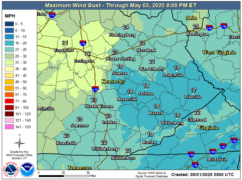
...WIND ADVISORY WILL EXPIRE AT 8 PM EDT THIS EVENING...
Winds are settling.
$$
GREIF
Warnings/Hazards
Decision Support - Outlooks
Current Weather Hazards
Hazards Criteria
Weather Story Graphic
Recent Storm Reports
Submit a Report
Forecasts
Decision Support - Forecast
Aviation Forecasts
Fire Weather Forecasts
Hourly Weather Forecast
Activity Planner
River Forecasts
Forecast Discussion
Current Conditions
Regional Radar
Decision Support - Current
Rivers and Lakes
Hourly Airport Weather
Local Radar
Satellite
Kentucky Mesonet
Past Weather
Local Climate Info
Temp/Precip Summary
How Much Rain Fell?
How Much Snow Fell?
Past Weather Events
Drought Information
Local Coop Observers
US Dept of Commerce
National Oceanic and Atmospheric Administration
National Weather Service
Jackson, KY
1329 Airport Road
Jackson, KY 41339
606-666-8000
Comments? Questions? Please Contact Us.

