
Dangerous and extreme heat will remain across portions of the southern U.S. this week. Heavy rainfall may bring significant flash flooding across portions of the Mid-Atlantic and Northeast through the night, and additional flash flooding concerns across New England on Wednesday. Monsoonal thunderstorms will bring a flash flood risk to the Four Corners region, especially in burn scar areas Read More >
Valentine New Year's Day Climatology
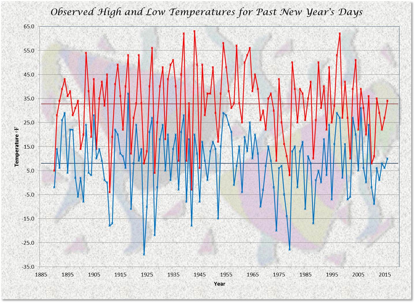
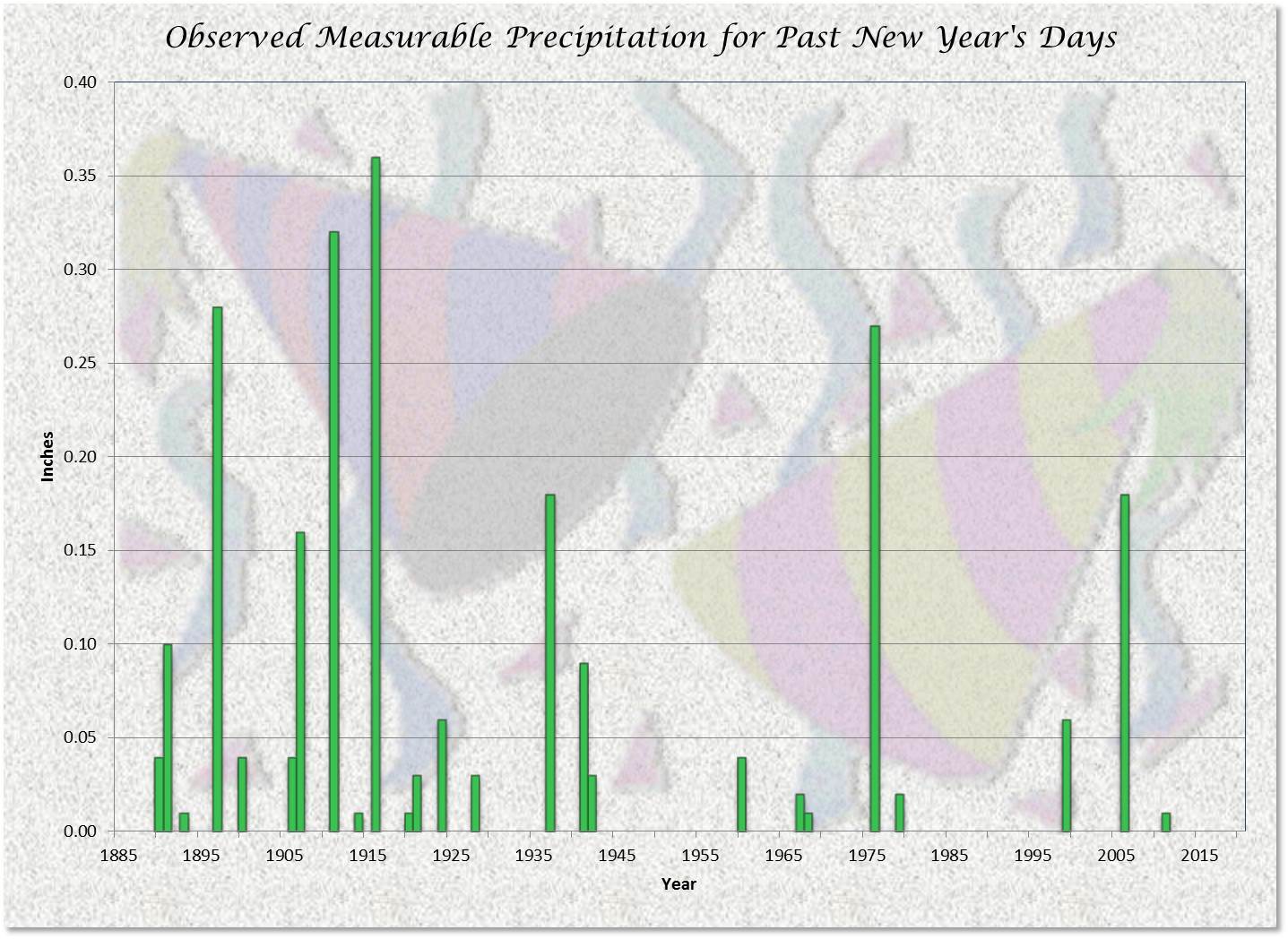
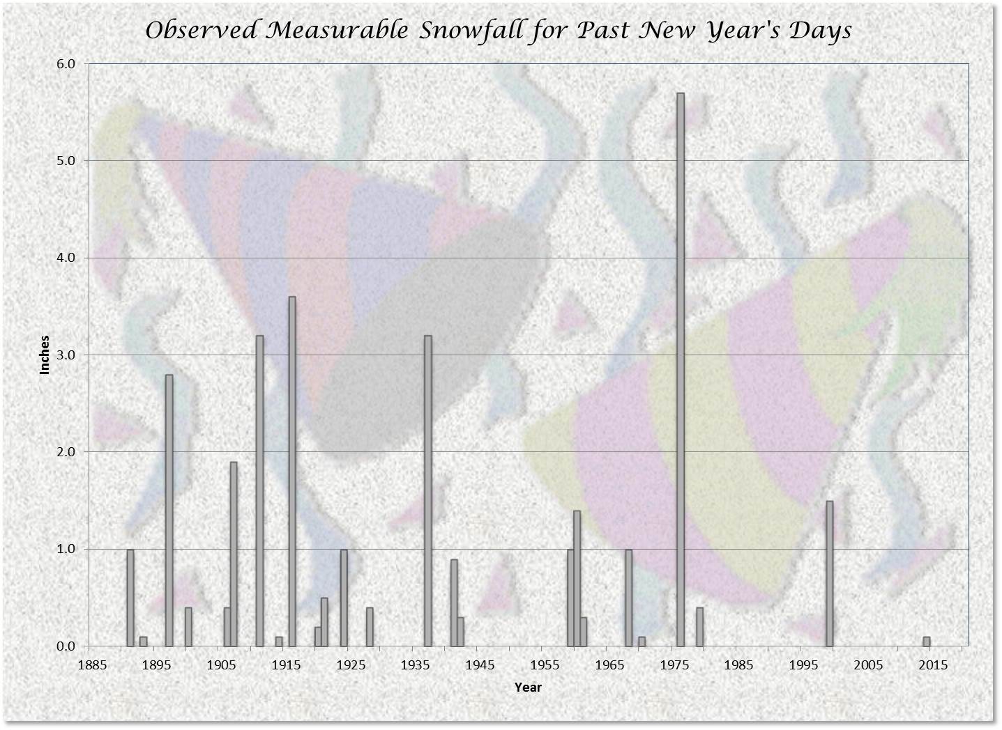
| As we enter a new year, the National Weather Service in North Platte will move into another year of collecting and providing weather information to the public and media. Records have been kept at Valentine since June 1889. A wide range of weather has been experienced for the first day of the new year. Below is a summary of New Year's Days of the past. (snow depth information not available prior to 1901) |
NEW YEAR'S DAY IN VALENTINE
PERIOD OF RECORD 127 YEARS: 1890-2016
TEMPERATURE DATA
|
High Temperature by 10 Degree Ranges
|
Low Temperature by 10 Degree Ranges
|
PRECIPITATION DATA
|
WHITE NEW YEAR'S DAY IN VALENTINE
PERIOD OF RECORD 116 YEARS: 1901-2016
White New Year's Day = 1 inch or more of snow on ground
at observation time on January 1
(snow depth rounded to nearest whole inch or trace if 0.4 inches or less)
|
White New Year's Day Occurences by Decade
* incomplete decade
|
DAILY WEATHER SUMMARIES PAST 5 NEW YEAR'S DAYS
|
YEAR BY YEAR WEATHER FOR PAST NEW YEAR'S DAYS
CLICK ON GRAPH FOR LARGER IMAGE

ALSO VISIT NORTH PLATTE NEW YEAR'S DAY CLIMATOLOGY
For more holiday climate studies see the main menu
Holiday Climate Studies for North Platte and Valentine
 |
Page composition by Matthew Masek Update includes 2016 |
 |

