
Flash flooding threatens areas from the Tennessee Valley to the Carolinas as storms repeat along a stalled front. Monsoonal storms may trigger flooding in the Southwest. Dangerous heat expands across the Desert Southwest, Plains, mid-Mississippi Valley and Southern Tier. Critical fire weather for interior Pacific Northwest. Cooler, drier air brings brief relief to the Great Lakes and Northeast. Read More >
Overview
|
Fast Facts:
|
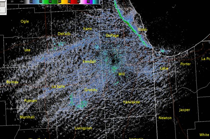 NWS Chicago Doppler Radar Reflectivity Loop: June 10, 2015 from 3:30 pm - 8:30 pm |
Hail Record:
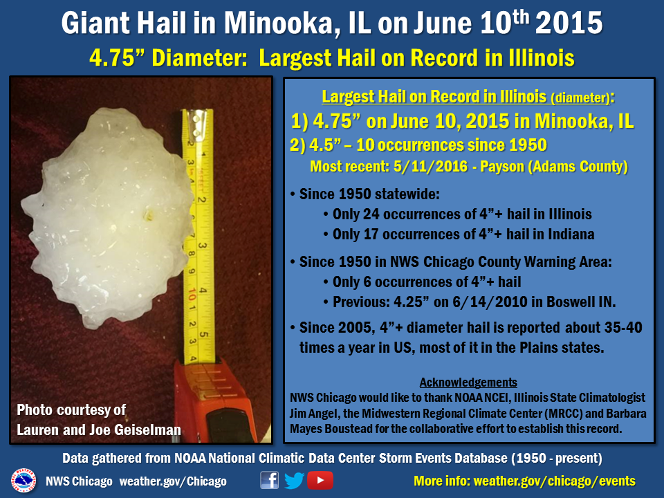 |
The Illinois state record for hail was set on June 10, 2015 as determined by the State Climate Extremes Committee (SCEC). Members included from NCEI, the Midwestern Regional Climate Center, Illinois State Climatologist, NWS Central Region Headquarters, and NWS Chicago.
State Record Hail Final Report
Hail Safety Reminders
The National Weather Service received many photos of the large hail on June 10 and these visual reports assisted us with warning messages to better stress the dangerous nature of the storms, as well as verification efforts after. Thank you!
It is important to remember that severe storms are dangerous, and hail to the size of this day can easily injure and even be deadly. While photos may be beneficial to us, ensure safety first and foremost. It is absolutely fine if the hail pictures have to wait to after the storm has ended, because after all, hail of this size will take quite a while to melt!
A reminder that the best place to be in severe storms is inside and central in a sturdy structure, away from windows, and putting as many walls between you and the severe storm as possible.
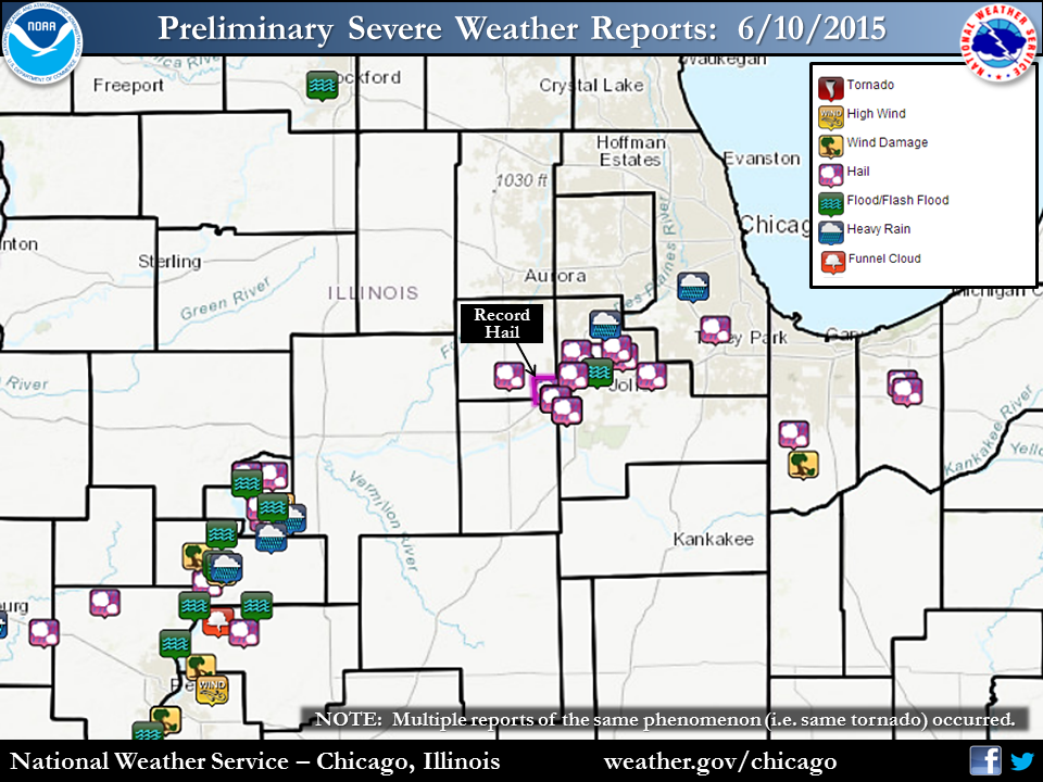
Storm Reports
 |
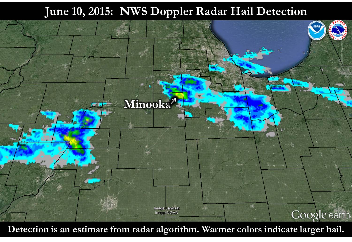 |
| Storm Reports from June 10, 2015 | NWS Doppler Radar hail detection from June 10, 2015 |
Text listing of storm reports from June 10, 2015
U.S. storm reports from June 10, 2015
Meteorology
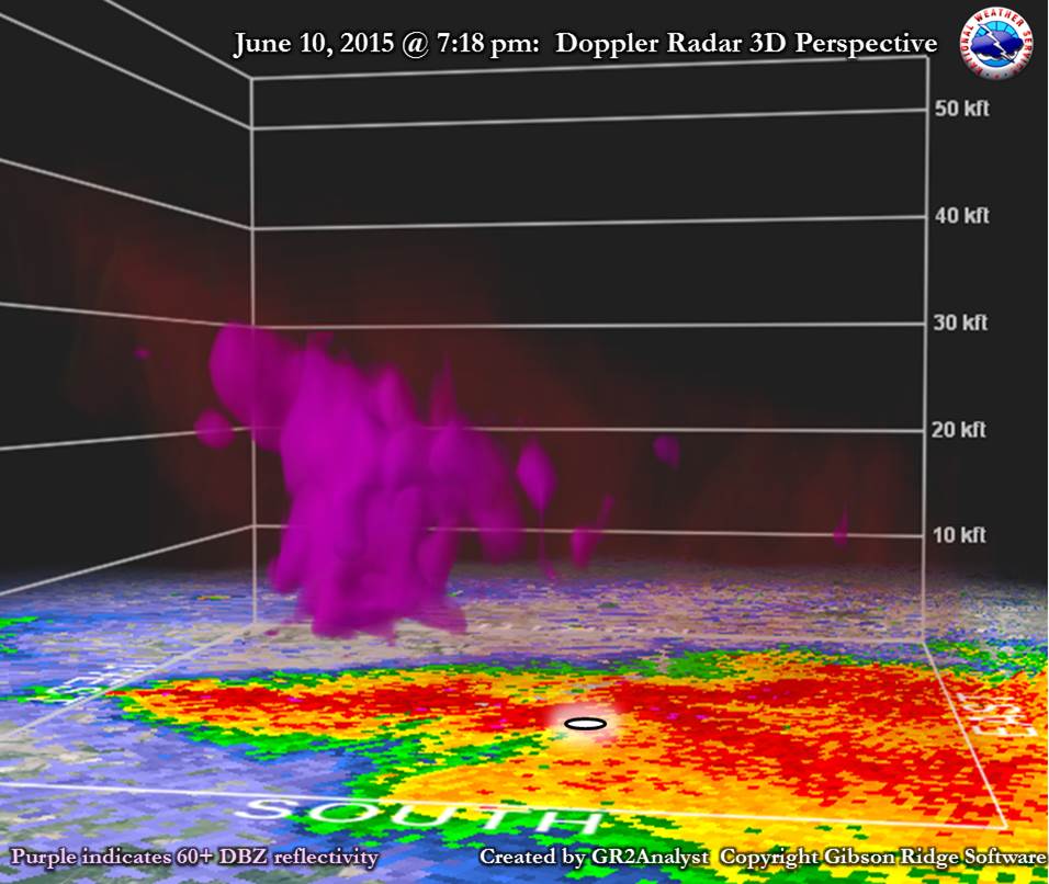 |
| 3D perspective of record hail storm, with white circle indicating location of record hail (2NNW of Minooka, IL). |
 |
 |
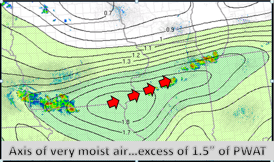 |
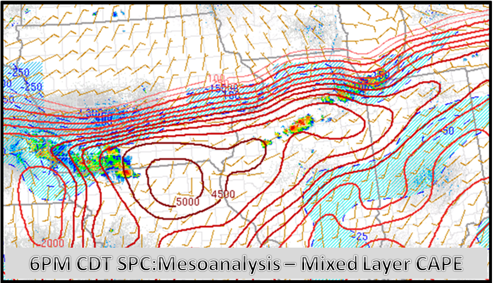
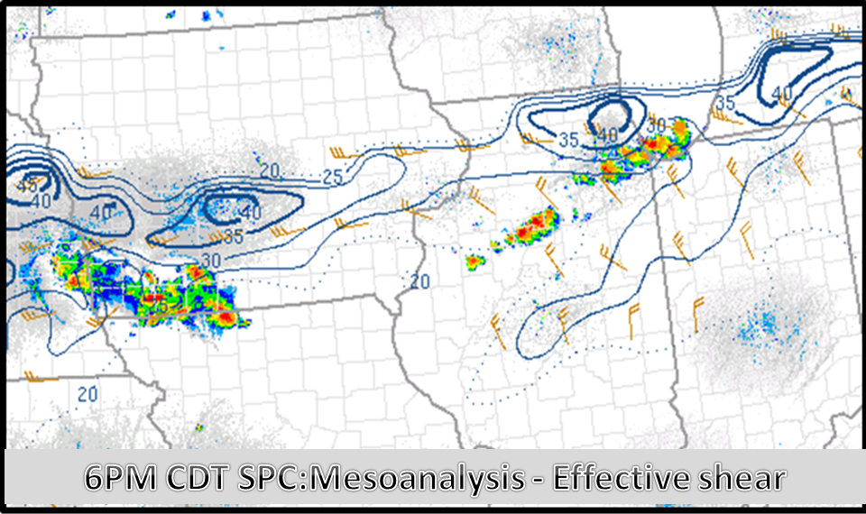
| MLCAPE at 6 pm on June 10, 2015 | Effective deep layer shear at 6 pm on June 10, 2015 | Precipitable water at 6 pm on June 10, 2015 |
 |
Media use of NWS Web News Stories is encouraged! Please acknowledge the NWS as the source of any news information accessed from this site. Additional recaps can be found on the NWS Chicago Past Events Page |
|

